


Greensboro Ridge Hike – Full PDF
 Driving Directions
- From the traffic light at Route 120 and Greensboro Road, turn east on Greensboro Road.
- After 0.4 miles, turn left onto Velvet Rocks Drive.
- Proceed up the hill to the parking area at the road’s end.
What You Should Know
- Foot travel only, except on the Silent Brook Trail where bikes are allowed. Dogs are welcome but must be under close control; please pick up after your pet. Be aware that this Natural Area is prime porcupine habitat!
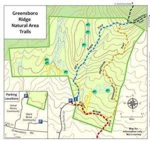
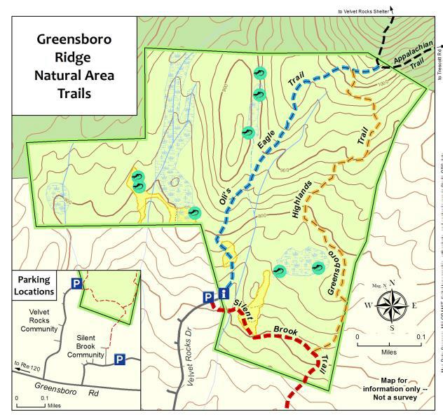
- The trails are blazed in colors matching the trail map: blue for Oli’s Eagle Trail, white for the Appalachian Trail, and light orange for the Greensboro Highlands Trail. The wider Silent Brook Trail is not blazed but is easy to follow.
- The Hanover Conservancy owns and manages the Greensboro Ridge Natural Area. The Town of Hanover holds a conservation easement on the land. After a housing development was proposed for this entire forested hillside, the Hanover Conservancy and Town worked with the developer to cluster homes close to the road and conserve the remaining acreage. The Conservancy acquired the land in 2008, protecting valuable wildlife habitat, a scenic backdrop, and a wonderful natural area with trails for the new Velvet Rocks and Silent Brook neighborhoods and the greater community to enjoy.
Brief Directions
- Take Oli’s Eagle Trail north from the trailhead kiosk to the junction with the Appalachian Trail.
- Retrace your steps a short distance to turn L onto the Greensboro Highlands Trail.
- Follow this down to a T with the Silent Brook Trail.
- Turn R to return to your car.
Full Hiking Directions
- Take a moment to check the trailhead kiosk display and map. We are grateful to Trumbull-Nelson for the gift of this beautifully hand-crafted kiosk.
- Oli’s Eagle Trail begins just to the L of the kiosk, heading up through a narrow rocky cleft. The contrast between this rough terrain and that tamed for the Velvet Rocks development is dramatic.
- This trail was built in 2008 by Oliver Simpson for his Eagle Scout project with help from the Hanover Conservation Commission’s Trails Committee.
- In early June, the foliage of purple trillium is still apparent near the trail entrance, although here at the warmer, lower end of the trail, the wildflowers may have gone by.
- You’ll soon reach an open expanse of unfurling ferns, primarily the sweetly fragrant Hay-Scented Fern. Watch your footing here. This opening was cleared from the forest as a demonstration house site before the land was protected. It will be kept open to provide habitat variety for wildlife.
- Heading back into the woods, you can hear the gurgle of a small stream as the trail curves gently to the right. Fisher and mink inhabit this area. The Natural Area is located in the Mink Brook watershed; protecting this land helps keep the waters of Mink Brook cool, clear, and comfortable for wild brook trout.
- Eight minutes from your car, you’ll begin climbing the ridge. Follow the blazed trail as it crosses a tiny drainage and winds up through a narrow cleft in the rocky ledges.
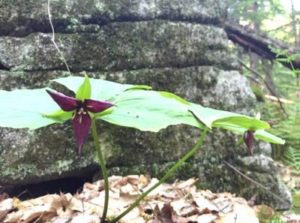
- By 18 minutes’ hike from your car, you’ll notice the rise in elevation and cooler forest conditions. The trillium has noticed it too, and may be still in bloom along the trail (photo L).
- A few minutes later, you might notice the work of pileated woodpeckers on an old tree on the L side of the trail.
- At 22 minutes from your car, you’ll reach the junction with the Greensboro Highlands Trail, marked with a wooden sign. You’ll soon return to this junction but now continue straight on Oli’s Trail for a minute or two to reach the white-blazed Appalachian Trail. The AT actually dips off federal land and onto Hanover Conservancy property for a short distance. At that junction, you could turn R to head to Etna or Mt. Katahdin in Maine or L for Velvet Rocks, downtown Hanover, or if you’re really ambitious, Springer Mountain in Georgia.
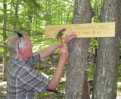
- Instead, turn around and retrace your steps for a short distance on Oli’s Trail, turning L onto the Greensboro Highlands Trail to continue your hike. The Hanover Conservancy, with help from the Upper Valley Trails Alliance and a team from Hypertherm, built the Greensboro Highlands Trail in 2012 to create this loop.
- 25 minutes from your car, you’ll note a fragment of stone wall at L, a reminder that this heavily forested land was once an open sheep pasture.
 In 2 more minutes, a fun photo opportunity appears on the right, where an old branch collar on a dead snag forms the perfect frame (R). Friends can take a photo of faces looking through it to post on our Facebook page!
- Black bear make their home here, and it’s easy to find bear claw marks on the smooth bark of beech trees, evidence of a bear seeking tasty beechnuts.
- 32 minutes into your hike, the trail winds to the R around a ledge featuring a huge and handsome vein of white quartz.

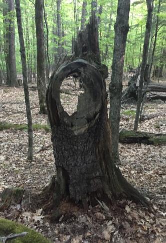
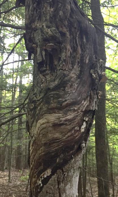
- In another 2 minutes, see if you can spot the guardian of this forest. This “face” on a tree (photo L) appears on the L side of the trail.
- 38 minutes into your hike, the trail splits around a large boulder, then a few yards later turns somewhat sharply L. There are a lot of well- worn game trails here and it would be easy to follow one if you were looking at the ground- be sure to look for the orange blazes!
- Look carefully for signs of one of the Natural Area’s hidden gems –its 8 vernal pools. These usually ephemeral wetlands are essential breeding habitat for salamanders and frogs, as they are free of fishy predators. (Please keep your dog from cooling off here.)
- At 45 minutes, another stone wall appears at L, marking the HC boundary. A wetland is visible just behind it as you near the trail junction for Silent Brook.
- 48 minutes into your hike, you’ll reach the Silent Brook Trail. This trail, designed to link the Silent Brook and Velvet Rocks neighborhoods, is open to bicycles. If you turn L, you’ll reach the Silent Brook neighborhood in less than 5 minutes. To return to your car in just a few more, turn R onto the Silent Brook Trail.
 Cross a small drainage on a footbridge and enter another ferny opening. Here, white pines are doing what they do naturally – reclaiming old openings – and volunteers are working to keep this area, another demonstration house site, open for wildlife.
- The trail drops steeply and crosses another small wooden bridge before returning to your car and the parking lot at the end of Velvet Rocks Drive.

Note: The Hanover Conservancy is seeking volunteers to advise us on managing the Natural Area, monitor trails, and help out with very occasional work parties. We also warmly welcome donations to our Land Stewardship Fund to help maintain the Natural Area. More info about the Natural Area can be found here.
June 2016, revised September 2020
