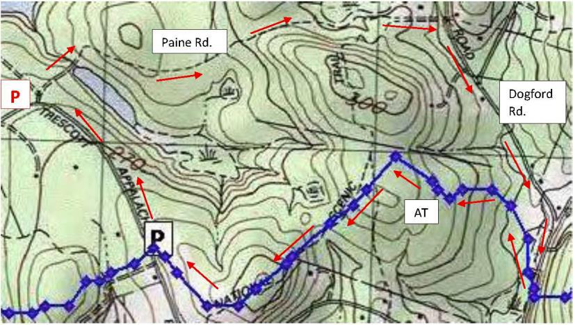
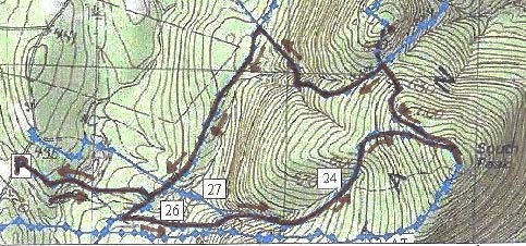
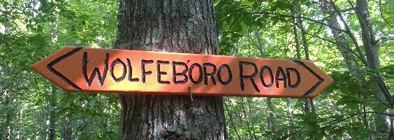
HIKE DIRECTIONS & MAP – Full PDF
 Driving Directions

- From Etna village, turn R onto Ruddsboro Road
- Follow Mink Brook as the road curves up its narrow valley for 1.5 mi.
- Turn L onto Three Mile Road
- After 1.2 miles, arrive at the AT parking area on L, opposite telephone pole 31-50
What You Should Know
- Foot travel only.
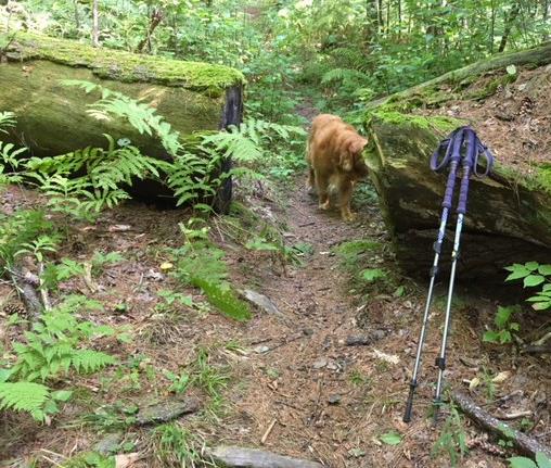
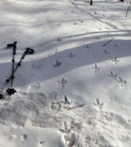
- Dogs are welcome but must be under close control.
- Wear blaze orange Sept. 15-Dec. 15 (your four-legged hiking buddy, too!)
- Hunting is permitted on the AT and other lands you cross at the beginning and end of this hike, but not on the private land crossed by the southern half of the General’s Trail loop.
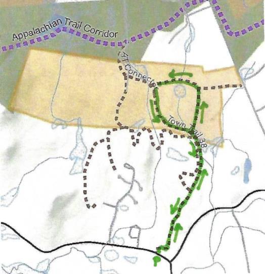
- You’ll visit lands owned by the federal government, Dartmouth College, and private owners including the Shumway Forest, protected by the Hanover Conservancy (outlined in yellow above).
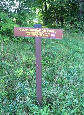
- As of 2021, some trail names are being updated.
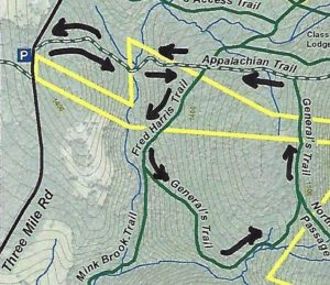
Brief Directions
- Take the AT east from Three Mile Road
- Turn R onto the Fred Harris Trail
- Bear L onto the General’s Trail, following uphill
- Bear L where Northwest Passage comes in at R
- Turn L onto AT going west
- Continue straight back to your car at Three Mile Road
Full Hiking Directions
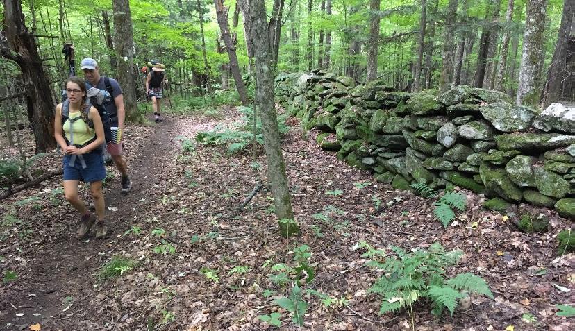
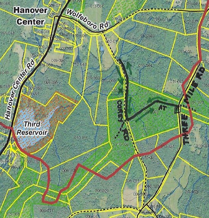
 Begin your hike on the Appalachian Trail on the E side of Three Mile Road. The federal government bought this 21-acre parcel from the Mascoma Beagle Association in the 1980s. It must have been a lively place with the beagles in charge.
- The white-blazed AT passes over a rise and then gently down into the valley of Mink Brook.
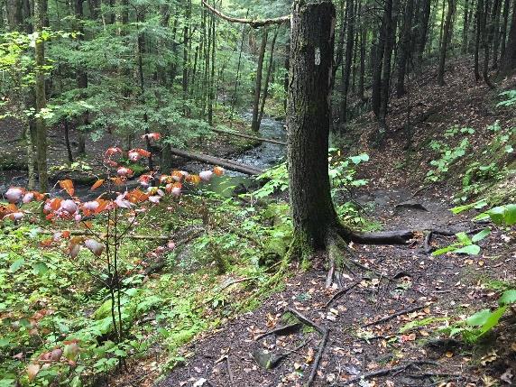
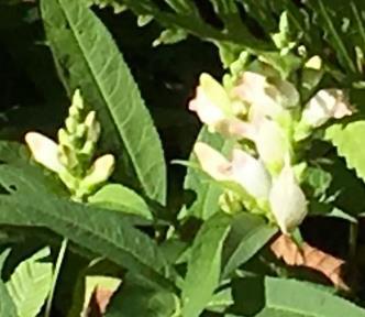
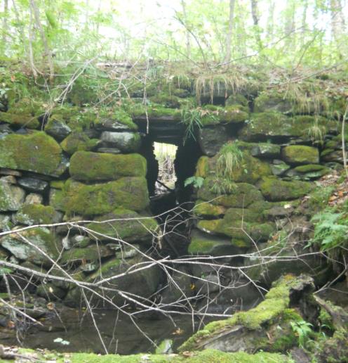
- Seven minutes into your hike, cross the brook on a log bridge. Nearby, deep purple infuses the fall foliage of a hobblebush, decorating the scene at this time of year.
- Cross the brook and follow the AT as it climbs back out of the stream valley.
- Six minutes’ walk from the brook, step over a rotting log and cross onto Dartmouth College land. On this part, the federal government holds a permanent easement to protect the AT.
- Just after a log crossing at a small wetland, arrive at a 4-way junction. The Harris Trail, former route of the AT, honors the Dartmouth Outing Club’s founder (1909). It offers wonderful skiing when conditions are right. The AT was re-routed off this path onto the ridge of Moose Mountain in the 1980s.
- At this junction, the AT continues straight ahead – you’ll return down that path to this point. At L, the Harris Trail looks well-traveled. Today, you’re up for the path less taken – turn R. A few yards ahead, a wooden sign reads, “Old Harris Cabin Access.” [new trail name: North Cabin Trail]
- The wide and grassy trail soon begins to descend gently through northern hardwoods. For the next 5 minutes, you’re traveling through a part of the 313-acre Shumway Forest that was protected by an AT trail easement in the 1980s and in 2017 by the Hanover Conservancy’s more comprehensive conservation easement. Both easements guarantee public access to the trails.
- Soon a wood sign with arrow directs you L. You have arrived at another parcel of private property. Say a silent thanks to this generous landowner who gamely goes along with the network of hiking trails on Moose Mountain, and take care to leave no trace of your visit.
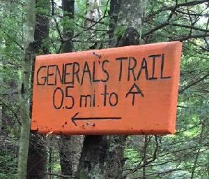
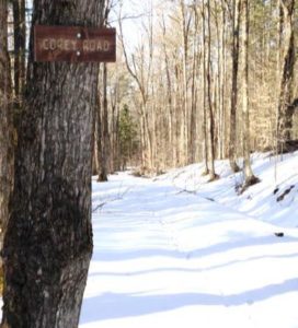
 Shortly after the arrow sign, an orange sign at L marks the W end of the orange-blazed General’s Trail, a pine-needle-strewn path that makes a wide loop back to the AT.
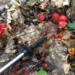
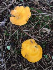
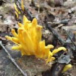
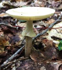
- In autumn, it seems the whole trail is decked out in orange – from the trail signs and blazes to the brightly colored red eft salamander you might spot at your feet, to the brilliant mushrooms that spangle the forest floor and the fallen leaves of red and sugar maples.
 The trail initially has the look of an old woods road but soon narrows, offering gentle and comfortable hiking, unlike the often rooty and rocky AT. This trail was built in the early 1990s by a former owner of this property with the help of his boy scout troop. Why the “General’s Trail?” For a quarter century, it’s been the favorite daily hike of a neighbor who retired from the Air Force Reserve as a two-star general. When his friends and neighbors Peter and Kay Shumway met him often on the trail, they decided to name it for him on their Moose Mountain Lodge trail map. Recently, his daughter asked the Dartmouth Outing Club to make the orange signs as a special birthday gift.
- Ten minutes from the orange sign, you arrive at an open grove of hemlocks – a good place for a snack. The trail swings L here to follow the rim of a steep valley, but before taking that turn, look over the escarpment to the brook far below.
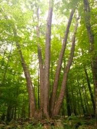
 The trail turns L past an “elbow tree” at R, a leaning yellow birch that lost its top and headed for the sun.
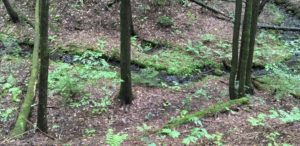
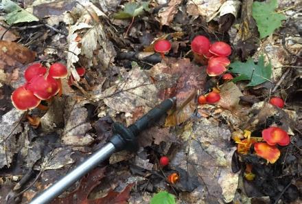
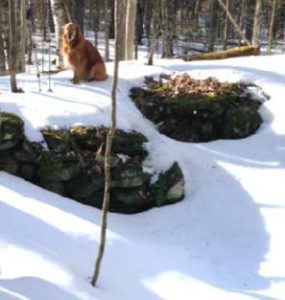
- Climbing gently up along the stream, the trail soon brings you to an up close and personal look at the tiny Mink Brook tributary. Cross it on impossibly green, luxuriantly mossy logs. You’ll soon encounter a few more “corduroy” log crossings. These places don’t look like much, but they are ecologically valuable. Headwater seeps, kept shaded and forested, serve as an important “sponge” in a downpour and start a stream off on its downhill tumble in the right fashion, cool and clean. Abundant moisture in the forest floor and a rich layer of duff support a fun and fantastic array of fungi.

- The trail reaches the head of the little stream valley and follows the land’s contour as it heads north toward its junction with the AT. As the trail is less distinct here, it’s important to keep an eye out for the orange blazes; stay left at a fork. It’s hard to miss a jumble of pure white boulders of quartz.
 20 minutes from the hemlock grove, a vertical white “US AT Boundary” sign appears on a white birch at L, and you know you’re getting close.
- Three minutes later, arrive at the AT; note the orange “General’s Trail” sign.
- Turn L and follow the famous path as it heads gently and pleasantly downhill.
- What a difference thousands of feet per year can make! The AT treadway is well-worn but also well-loved, evidenced by some clever bits of trail work that carry the path over small drainages.
- Five minutes after bidding the General goodbye, you return to the familiar four-way intersection with the Harris Trail. Cross it and continue straight on the AT.
- Seven minutes from the intersection, the brook and bridge come into view. If you didn’t stop for a picnic at the hemlock grove, this is a great picnic spot too.
- These waters and the rest of the Mink Brook watershed were part of a statewide study by Trout Unlimited and NH Fish and Game biologists in 2011. They found that “Hanover’s little Mink Brook and its tributaries showed a surprisingly healthy population of native Eastern Brook Trout.” They counted 213 brookies in 16 study sites and noted how important cold clean water is for this species. Almost 70% of the trout were found in five sites (including this one) with an average water temperature of 59.8 degrees. If you have such a stream on your property, what can you do to help brook trout? Keep a lush buffer of trees and shrubs to shield it from the summer sun.
- Cross the bridge with its handrail and head back up and out the seven minutes’ hike to your car.


Please respect the generosity of these landowners by leaving no trace of your visit and enjoy the memories and photographs you take home.
9/2018, revised 1/2021

 Driving Directions
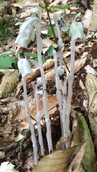

 Driving Directions
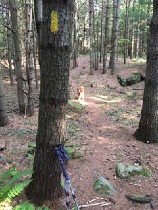 Don’t be dismayed by the steep path that suddenly appears– the rest of the hike is gentle and rolling. Follow the yellow blazes into the woods.
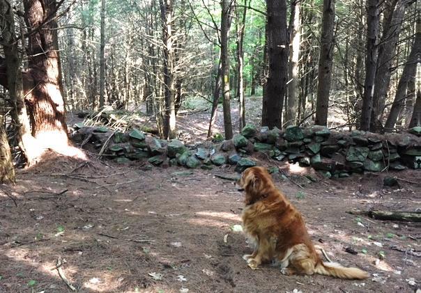

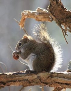 The trail continues gently back up to a matching plateau on the east side. Deer trails cross and you may find leftovers from a red squirrel’s dinner in a pile of pine cone scales or acorn tops. The forest is different here – less pine, more hardwood – belying a different history. Could this have been Luther’s woodlot?