Hanover Conservancy

Facebook logo   Instagram   YouTube          
Donate button
  • Home
  • About Us
    • Celebrating 60 Years
    • What We Do
      • Advocacy
      • Conservation
      • Education
      • Stewardship
    • Board & Staff
    • Membership Benefits
    • Contact Us
  • Get Outdoors
    • Hanover Lands
      • Balch Hill Natural Area
      • Mink Brook Nature Preserve
      • Other Properties
    • Hanover Hikes
    • Hanover Trails Challenge
    • Upper Valley Hikes
    • Exploring Nature at Home
    • Hunting
  • Events
    • Calendar
    • Spring Wildflower Scavenger Hunt
    • Private Events
  • Get Involved
    • Donate
    • Volunteer
    • Adopt a Trail
    • Corporate Conservators
    • Planned Giving
  • Education
    • School Programs
      • KAST
      • Connecticut River Studies
      • Hanover High School Scholarship
    • Request a Field Trip or Speaker
    • Research on Our Lands
    • Hanover History
    • Resources
  • News
    • Remembering Bob Norman
    • Reports & e-News
  • Conserve Your Land

Moose Mountain Ridge Loop

August 1, 2019

Complete PDF


Moose Mountain loop mapDriving Directions

  • From Etna village, turn R onto Ruddsboro Rd
  • Follow Mink Brook as the road curves up its narrow valley for 1.5 miles
  • Turn L onto Three Mile Rd
  • After 1.4 miles, arrive at a big dip in the road with parking on both sides.

What You Should Know

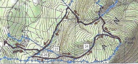
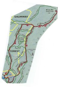
  • Today’s hike, shown on the map above, takes you on a loop that visits the South Peak on a lesser known trail, cruises the mountain ridge on the Appalachian Trail (with optional 15-minute, 0.2 mi. visit to the Moose Mtn. Shelter) and returns on the historic Wolfeboro Road and the old route of the AT, the Harris Trail.
  • You’re about to visit lands owned by the federal government (permanently protected) and Dartmouth College (partially protected for the AT corridor) and the privately owned Shumway Forest, protected by the Hanover Conservancy in 2017.
  • Dogs are welcome if under your control; please pick up after your pet.

Hiking Directions

  • Begin your hike on Dartmouth land at the orange Dartmouth Outing Club sign that reads, “Parking/No Camping.”
  • Known as the New Fred Harris Cabin Access Trail, this blue-blazed, ½ mile trail was built by the DOC as a direct route to the college’s Class of ’66 Lodge (built on the site of the Fred Harris Cabin).
  • The trail is easy and rises gently to a plateau, passing through a long-abandoned sheep pasture. Here, saplings are creeping into the understory sheltered by towering pines above. Years ago, all these lands between the road and the mountain ridge were owned by Luther Brown.
  • Seven minutes’ walk from your car, the sound of water signals the approach to a main tributary of Mink Brook. At L, a rough stone wall marks the plateau’s edge and boundary of the old pasture.
  • The trail drops to a bridge over the brook. Look L upstream; the brook drains a rich beaver-influenced wetland just out of sight on the Shumway Forest.
  • The trail continues gently back up to a matching plateau on the E side. The forest is different here – less pine, more hardwood – belying a different history. Was this Luther’s woodlot?
  • 10 minutes’ hike from your car, reach the Harris Trail. An orange DOC sign hangs on a tree at R, facing the other direction and reading “To AT” and “To 3 Mile Rd & Parking,” indicating the path you just took. Across the trail junction is a wooden sign reading, “<- Harris Trail ->” placed by the Hanover Conservation Commission’s Trails Committee.
  • The Fred Harris Trail, former route of the Appalachian Trail, honors the Dartmouth Outing Club’s founder (1909). It offers wonderful skiing when conditions are right. The trail once ran from Moose Mountain Lodge Road N into Lyme, and can still be followed by an alert hiker. The AT was re-routed onto the Moose Mountain ridge in the 1980s.
  • Turn R onto the wide Harris Trail and head down to another brook. While there is no bridge, it’s easy to cross on stepping stones. Slow-growing hemlocks and yellow birch shelter the stream and hold the banks in place. At L, beyond the brook, a yellow blaze and white boundary sign signal the edge of the federal easement over Dartmouth land that protects the Appalachian Trail.
  • The Harris Trail continues on its gentle grade and an unmarked trail soon joins at L. This is the Ski Loop, a challenging ski trail built before the AT. Turn L here and head uphill for about 15 minutes. The trail is not blazed and because it is not used as heavily as the AT that parallels it nearby to the S, it is not as worn, but is not hard to follow.
  • The Ski Loop takes you gently but steadily up on an old cart path. Shortly past a fallen beech, the trail levels out and slabs L along the hillside.
  • 15 minutes from the Harris Trail, the sounds of falling water accompany your arrival at another trail junction. Signs on trees at L indicate the trail down to Dartmouth’s Class of ’66 Lodge. The stream you hear, which is the one you recently crossed below, provides the lodge’s water supply. At this point, you cross onto the Shumway Forest. More about that later.
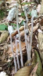
  • Indian Pipe flowersContinue straight onto the Nat Thompson Trail which leads 1.1 miles from this junction up to the AT on the ridge. This begins as a wide, pleasant trail, re-opened a few years ago by the Dartmouth Outing Club. In midsummer, look for the ghostly white stems and downturned flowers of Indian Pipe (R), a saprophyte that relies on decomposing plants for its food as it has no chlorophyll. Shining clubmoss blankets the hillside at R.
  • 8 minutes from the Ski Loop junction, the Nat Thompson Trail approaches the stream at L; be sure to stay straight without crossing the stream and continue gradually uphill. The trail is irregularly blazed but easy to follow. Six minutes later, a log crossing carries the trail over a small drainage as you leave the Shumway Forest for federal land surrounding the AT. The trail swings NNE to make a wide easy sweep up to the ridge.
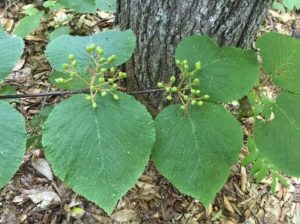
  • Hobblebush
  • Spring wildflowers have long since gone by, but sharp eyes will find the deep blue berries of blue-bead lily and the seed clusters setting on hobblebush viburnum. Some paired hobblebush leaves achieve lunch plate size; they will turn deep purple in autumn. The three-lobed leaves of goosefoot or striped maple, a small understory tree, can get even bigger.
  • 10 minutes from the log crossing, the trail swings R and becomes steeper as it climbs toward the South Peak. 5 minutes later, reach a fork and a sign directing you R toward the South Peak. 5 more minutes’ climb brings you out onto the open ledges of the 2293’ South Peak of Moose Mountain.
  • Time for a break! Enjoy the view out over Goose Pond below and, if it’s not hazy, across Canaan and far beyond. At this time of year, the rosy flower clusters of shrubby meadowsweet attract pollinators and dragonflies patrol the skies.
  • Beyond the summit sign, the path S of the clearing is the AT southbound, which would take you straight back to Three Mile Road about ¼ mile S of your car (and downtown Hanover, if you keep going). If a thunderstorm threatens, this is your best bet. But we’ve got much more to see today, so retrace your steps and strike N (path at L of ledges). In a few yards bear R on the AT northbound at a pair of orange signs, past the Nat Thompson Trail.
  • The white-blazed AT soon heads down into the saddle between the N and S peaks. The wind rising up both the E and W slopes plays in the trees overhead, keeping the bugs too entertained to bother you.
  • 13 minutes from the S Peak, a sign announces you’ve reached the Moose Mountain Shelter “FPA” (government-speak for Forest Protection Area). 5 minutes further, an orange sign indicates the shelter is 0.1 miles beyond Wolfeboro Rd. Just beyond is the historic road itself, rising up from the Tunis District to the E and quickly disappearing down toward Hanover to the W.
  • SHELTER STOP – You can visit this shelter with an easy out-and-back 0.2 mile, 15 minute hike, or if time is short, simply turn L and head down Wolfeboro Rd. To find the shelter, cross the Wolfeboro Rd and follow the AT northbound as it winds gently uphill for 5 minutes to a cheerfully illustrated orange sign at the shelter access path. Turn R here and within moments, the shelter comes into view at L. A bench of Aldo Leopold’s design rests on a nearby ledge, and must offer great views when leaves are off. Be sure to sign the ledger tucked by the shelter’s N wall. A lot of work by volunteers goes into maintaining places like this. Return to the Wolfeboro Rd the way you came.
  • Stand for a moment at the four-way junction of two of the most historic routes in New Hampshire. The 2,190 mile-long Appalachian Trail, proposed nearly a century ago, threads through a national park that spans the eastern seaboard from Maine to Georgia. Conservation efforts along its route have also protected valuable wildlife habitat and cool forests. The Wolfeboro Road, built 250 years ago when New Hampshire was still a colony of Great Britain, reached from the colonial governor’s home in Wolfeborough up and over this mountain to Hanover, a distance of 55 miles as the crow flies. Governor John Wentworth ordered its construction so that he could attend commencement at Dartmouth College, having assisted its founder, Rev. Eleazar Wheelock, in securing its charter from the King. Wentworth was an eager outdoorsman, relishing camping out with his road survey crew in the NH woods and leaving his wife at home to worry about decorating her new ballroom in the governor’s mansion.
  • This spot also marks an important watershed divide. All rain and snow falling E of where you stand on the AT flows into Tunis Brook, Pressey Brook, Goose Pond, and then to the Mascoma River. All that falls on the W side ends up in Mink Brook. Waters from each reach the Connecticut River, but by much different paths.
  • Wolfeboro road signIt’s time to head down. Take the Wolfeboro Rd W and down the mountainside for about 15 minutes. Adventure-seeking jeep drivers have created ruts in places, and the footing is wet for the first 5 minutes until you encounter rough gravel laid down by the Hanover Dept. of Public Works so emergency vehicles could reach the AT to assist injured hikers.
  • Along the way, imagine Governor Wentworth riding this rugged route to the Dartmouth Green. For more hiking on this historic road, see our Hike of the Month for June, Wolfeboro Road West.
  • 15 minutes from the AT, an old stone wall appears at L and you reach an open area at the bottom of the slope. You’re back in former sheep country! Continue straight, passing a chained-off drive at R. A few paces further, a metal gate comes into view at L and an orange sign just beyond indicates the Harris Trail. Walk around the gate and back onto Dartmouth land, following a woods road past a log landing and bearing R to re-enter the woods.
  • Here, the Harris Trail follows a gravel-surfaced woods road used to deliver supplies to the college’s Class of ’66 Lodge. After crossing a new wooden bridge, there’s a more natural surface underfoot.
  • Peter and Kay Shumway at table
    Peter and Kay Shumway after signing the Shumway Forest conservation easement, June 2017
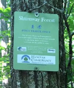
  • Shumway Forest sign10 minutes from the gate, spot the green Shumway Forest sign at R. Peter and Kay Shumway (L), owners of the historic Moose Mountain Lodge from 1975 to 2018, purchased 313 acres on the mountain from a lumber company in 1986 to keep the land from being developed. In 2017, to permanently protect public access to its foot trails, they conveyed a conservation easement to the Hanover Conservancy.
  • A short distance past the sign, follow the Harris Trail as it bears R off the woods road. While the red and black DOC blazes have long since faded, the former route of the AT is easy to see. The forest is younger here than on the mountain ridge, punctuated with occasional massive white pines.
  • 5 minutes past the fork arrive at a junction where a trail at L heads over a footbridge to the Class of ’66 Lodge. Continue straight and soon the orange sign appears at R directing you back to Three Mile Road. You’ve now closed today’s loop. Bear R for the 10-minute return on the now-familiar path, over the wooden bridge, and back to your car.


Filed Under: August, Hike of the Month, Moose Mountain Tagged With: Appalachian Trail, goosefoot, hobblebush, Indian Pipe, meadowsweet, Wentworth, Wolfeboro Road

Slade Brook and Huntington Hill

August 1, 2018

Hike information and map – full PDF


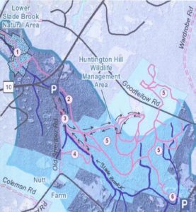
Slade Brook trail mapDriving Directions

  • From downtown, head N on Rt. 10 past Hanover Conservancy offices
  • Continue on Route 10, 3.3 miles past the N rotary
  • Turn R on Old Lyme Rd. and drive 0.2 miles to a sharp bend.
  • Park on R on gravel shoulder at sign for Upper Slade Brook.

What You Should Know

  • Foot travel only, except for Old Spencer Road.
  • Dogs are welcome but must be under close control.
  • This loop hike passes through the Barnes Estate, owned and managed by Dartmouth Hitchcock Medical Center, before reaching the Huntington Hill Wildlife Management Area, a major privately owned parcel protected by a conservation easement held by the NH Fish and Game Department.
  • Trails are marked in some places; plans are being developed for a new trail map.

Hiking Directions

  • A sign bearing a white arrow with yellow lettering directs you to Upper Slade Brook on a path leading in to the woods. Begin your hike here.
  • In a few yards you’ll pass over a narrow wooden footbridge, built by the Hanover Conservation Council (now Conservancy) and town volunteers in 2000. This crossing replaces an earlier one – below at L is the old stone abutment for the bridge that once carried Old Spencer Road over this stream. This road, built in 1816 to link Old Lyme Road with Dogford Road, was discontinued subject to gates and bars in 1932.
  • Follow Old Spencer Road through the woods and up the hill. This is part of the former Barnes Estate, now owned by DHMC. In 2017 this area was logged significantly.
  • About 7-8 minutes from the bridge, you’ll reach a junction marked with a yellow-lettered sign. Old Spencer Road continues straight uphill. Bear L onto the Bridle Path. It has been used recently as a skid trail, but quickly narrows and you’ll soon hear the music of Slade Brook at L.
  • After 5 minutes’ walk from Old Spencer Road, a sturdy wooden bridge comes into view as you cross onto the Huntington Hill Wildlife Management Area.
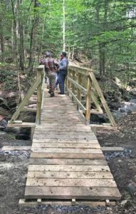
  • Slade Brook bridgePause on the bridge to admire both the workmanship and the partnership that built it in May-July, 2017. A determined team of 20 volunteers, led by Hugh Mellert and the Hanover Conservation Commission’s Trails Committee, built the bridge with permission of the private landowners and help from the Upper Valley Trails Alliance, Hanover Public Works, Hanover Conservancy, Cardigan Mountain Highlanders, DHMC, neighbors, and hikers who happened by and jumped in. Funds for materials were donated and the 250 person hours of labor were free. This new bridge replaces one that’s been gone for 50 years, and provides a safe and valuable connection to the network of trails on Huntington Hill.
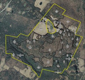
  • Huntington Hill map
  • Huntington Hill Wildlife Management Area (outlined in yellow on this forest stand map) is managed for recreation, timber, and wildlife habitat. The NH Fish and Game Department holds a permanent conservation easement on 464 acres of privately owned land here, and also on a 31-acre piece connecting it to Hanover Center Road, where the Hanover Conservancy holds a secondary easement. Forests and vegetation cover are highly variable, with deciduous, mixed, and coniferous forest types. Hemlocks dominate the brook valley (lower L). Much timber stand improvement has been done over the last 40 years under the guidance of professional foresters.
  • Now turn your attention to the brook itself, and the fascinating variety of rocks composing its bed. Water-worn granite alternates with leaves of uplifted, slanted sedimentary rock that speak volumes about the deep geological history of this place.
  • Two trails meet at the far end of the bridge. Bear L onto the wider of the two (you’ll come back on the other one) and head steadily uphill through a pine/hemlock forest. Faded pink flagging marks the route.
  • About 10 minutes’ walk from the bridge, you reach the top of a rise where the Barnes Trail comes in at L by two large white pines. Another wooden sign with yellow lettering confirms your location. Continue straight for Goodfellow Meadows. Just ahead, another trail junction is visible. You’ll take that path on your way back.
  • 15 minutes’ gentle steady walk uphill from the bridge, a trail comes in at R. Continue straight toward the opening that appears ahead. An orange diamond with arrow is posted at L, guiding your way forward.
  • Pass briefly into a brushy wildlife opening of berry bushes and popple. Think like a bear and keep an eye out for ripe fruit before reentering the woods. Places like this are also excellent habitat for hares.
  • In 6 more minutes’ walk, arrive at an open meadow bounded on the far side by a stately line of trees. A minor trail comes in at R – you’ll be returning on that trail to this point later.
  • song sparrow
  • Walk straight through the meadow, a stark contrast to the piney woods below. The meadow is filled at this season with golden black-eyed Susans and goldenrod, white yarrow and Queen Anne’s lace, and deep blue cow vetch among the grasses. Wildlife appreciate openings like this, vestiges of the much more open agricultural landscape that once existed here in New Hampshire. Listen for the conversational trill of the song sparrow.
  • Nearing a small red maple at L, note the barely perceptible shift in the tilt of the land beneath your feet. You are crossing the watershed boundary from Slade Brook behind you to the watershed of Pingree Brook, ahead.
  • horse drawn tedderAs you approach the wall of tall trees at the far end of the meadow, a break in the trees appears and you arrive at an opening in the stone wall. Beyond stretch a grand, wide, rolling hayfield and wonderful views to the west and northwest. On the day we visited, newly mown hay was being turned to dry and the air was full of its sweet scent. While a woman driving a tractor was managing this task today, we could easily imagine a horse drawn tedder (R) doing the job a century ago.
  • While it’s hard to keep your eyes off the distant horizon, wrest them away to the stone wall close by. Among the larger stones are many smaller fist-sized ones, clues that the land growing grass today was once cultivated, prompting the farmer to remove and dump here any small stones that might damage his equipment or discourage seedlings.
  • Turn R and head up along the edge of the hayfield close to the tree line.
  • You’ll pass another break in the stone wall, but continue until the 19th century barn comes into view and you reach a sturdy post carrying a bluebird house and the familiar orange diamond with arrow. Views are even broader here. Imagine a time when these hills were 85% open sheep pasture and cropland, rather than 85% forested. In 1840, when Hanover’s human population was about 2,600, its sheep population was 11,024!
  • A low yellow-painted iron post by the stone wall marks your turn back into the woods here. Turn R again onto a well-worn path that follows the wall back in the direction you just came. From this vantage, it’s easy to read the former farming use in the strands of barbed wire laying over wider sheep fencing. A line of fine old maples punctuates the wall, testifying to the passage of time on this farm.
  • As the trail swings gently up to the L, sharp eyes will find the hood of a 1930s-era truck, another remnant of farm days past. The trail moves away from the field and wall and back into the Slade Brook watershed. Continue straight and head WSW and eventually S, gently up. Occasional flagging appears at R.
  • 15 minutes from the field, an opening appears through the trees; just before reaching it, turn R onto a narrower trail just past a handsome straight-boled red oak at R.
  • A few yards later, this link ends at a T; turn R.
  • 3 minutes later, you arrive back at the first open meadow. Look for the small red maple dead ahead. Stop and admire the views you couldn’t see when you first traversed a lower part of this field.
  • Paths diverge here following the forest edges; you bear L, noting blueberry bushes at your feet, and pass along the edge of the meadow before quickly regaining the shelter of the woods.
  • 5 minutes later, rejoin the trail at the end of the meadow. Turn L and retrace your steps downhill, bringing you in 10 minutes back to the yellow painted sign for the Barnes Trail. If you’re in a very big hurry, you can take this trail to return directly to your car (about 12 minutes), but you’ll miss a nice treat (20 minutes, not including time lingering by the brook).
  • To continue your hike, turn to face uphill and after 15-20 paces, turn R onto a new trail that largely follows the contour after a short log crossing of a small drainage. The trail soon takes on the look of a very old woods road, with a sunken bed just wide enough for a cart. The old road starts down into Slade Brook’s hemlock-shaded valley.
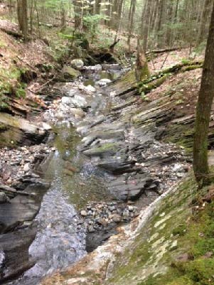
  • Slade Brook5 minutes from the last junction, you reach the brook at a footbridge constructed in September, 2018 by Hanover Trails Committee volunteers and the public-spirited landowner. Today, our route keeps us on this side of the brook.
  • Turn R and follow the brook down through its steep-sided valley, noting how tree roots hold the streambank in place. In some places, you can see where the brook makes several channels during high water, and then recedes to the lowest of them as waters subside, rearranging its bed every time. A thrush’s song plays a duet with the water’s music.
  • Watch closely for a shift in the trail up to the R under a tipped hemlock as the trail leaves the brookside to avoid a section of uplifted ledges. Occasional orange arrow signs point the way, but you need only to keep the brook on your L. It seems a privilege to be accompanying this little brook on its trip to the Connecticut River, spilling over tiny waterfalls and enlivening occasional pools as it tumbles on its wood-strewn way. If you brought a snack with you, find a likely looking rock perch to enjoy it now.
  • 6 minutes from the old crossing, return to the new bridge. The trail you took on the way out comes in at R.
  • Past the bridge, you’ll know when you’ve returned to DHMC land when logging slash appears by the trail. Limbs and branches are left behind to return nutrients to the soil and feed the next generation of trees.
  • 3 minutes from the bridge, arrive again at Old Spencer Road. Turn R and head down 4 minutes to the lower bridge and your car.

Please respect the generosity of these landowners by leaving no trace of your visit and enjoy the memories and photographs you take home.

In 2004, Northern Woodlands magazine carried this feature story about Huntington Hill.


Filed Under: August, Hike of the Month, Slade Brook Tagged With: Queen Anne’s lace, white yarrow

Shumway Forest and Tom Linnell Ridge Trail

August 1, 2017

Hike Information and map – full PDF


Moose Mountain trail mapDriving Directions

  • From Etna Village, head N on Hanover Center Road
  • Turn R on Ruddsboro Road and drive 1.8 miles
  • Turn L on Old Dana Road
  • Turn R just past large red barn on R, onto Moose Mountain Lodge Road (not marked)
  • Drive 0.8 miles to top of road. Park in marked trailhead parking area just past the beaver dam.

What You Should Know

  • Foot travel only. Dogs are welcome but must be under close control.
  • Consider bringing binoculars and a bird book for viewing waterfowl on Mill Pond.
  • This hike passes through six major conservation parcels on Moose Mountain that are part of a 3,800-acre block of protected, un-fragmented wildlife habitat. The newest and largest is the 313-acre Shumway Forest, conserved by the Hanover Conservancy in June 2017.

Hiking Directions

  • Begin your hike at the green Mill Pond Forest/Huggins Trail Access sign. The Huggins and Shumway families donated a conservation easement on this area in 2015 to ensure that the public would always be welcome on their trails and have a dedicated place to park.
  • The trail heads E along a beaver-managed section of Mink Brook – look for evidence of beaver chews, slides, and an impressive series of dams.
  • You’ll soon reach a fork; a big pine at R bears a sign for Pasture Road. Bear L on the other trail. You have arrived at the 130-acre Dana Pasture Natural Area, a wonderful piece of land that holds an important place in the Dana Family history. Today, the Town of Hanover and a Dana heir own undivided half shares.
  • 15 paces from the fork, look for a cellar hole at L. This was the home of miller David Woodward, who built the dam on Mill Pond and an impressive sawmill and gristmill on the steep falls of Mink Brook below where you left your car (a visit for another day).
  • Continue 75 yards to the pond’s edge and a bench that beckons you to admire the view across the 10-acre pond. This is the highest water body in the town of Hanover and the primary source of Mink Brook, the town’s largest stream. Set in a saddle on the mountain ridge, it may have originally been a small pond or perhaps a marsh. In the late 1700s, Woodward built a drylaid stone dam (just out of view at L, beyond the spruces) to raise the water level some 6-8 feet (it has since partly silted in). Then beavers took over and have been managing the pond ever since. Today, the entire shoreline remains undisturbed: Hanover Conservancy easements protect the N side with the Dana Pasture Natural Area on the S.
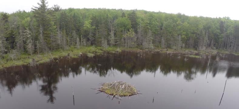
  • beavers in pondDirectly across from the bench is an impressive beaver lodge. Scan the pond’s surface for waterfowl and other birds. You might be welcomed by the slap of a beaver’s tail.
  • Retrace your steps for a short distance to the Pond Loop (unmarked) at L, and begin your trip around the pond. In 3 minutes, come to a Y with the Baboon Bypass at R and an arrow pointing L.
  • Turn L here, keeping the pond at L. You’ll encounter some wet places, an old corduroy (log) crossing, and lush growths of sphagnum moss, goldthread, and club moss.
  • About 10 minutes’ walk from the bench, you meet a massive old white birch and side trails to the water. Continue straight to another big birch and a large maple snag, an apartment house for a variety of creatures. The trail continues around them.
  • Just a few minutes later you’ll arrive at a trail junction, and you have a decision to make.
  • The arrow points L to the tower road. If you just remembered you left something on the stove, this is the first of two bail-out points. To return to your car, bear L on the Pond Loop, heading N. The trail is easy to follow if you keep the pond in view at L and bear R at an arrow. You’ll leave the Dana Pasture Natural Area for the Shumway Forest before you reach the tower road 10 minutes from your decision point. Turn L to return to your car in another 4 minutes.

  • If you’re game for more adventure, bear R toward the sign reading “To the O.D. Ridge Trail.” The Orange Diamond Trail was built by a local snowmobile club in the 1970s but hasn’t been used that way for years. The trail, deemed by the club as unsuitable for today’s snow machines, is now restricted to foot travel.
  • Thank the Hanover Conservation Commission’s Trails Committee for restoring this and the Tom Linnell Ridge Trail, which it joins in 4/10 mile. The trail sees heavier use in winter than summer, so follow it with care.
  • Continue on the Orange Diamond Trail as it heads northeast through mixed northern hardwoods for 20-25 minutes. Bear L at forks in the path. Soon you leave the Dana Pasture Natural Area, briefly visit the Shumway Forest, and enter two lots fully owned by the Town of Hanover. The Conservancy helped the Town acquire the N one in 2002. Didn’t notice a break in the forest, did you? Wildlife doesn’t either! That’s the point of keeping habitat un-fragmented here on the mountain.
  • This is prime habitat for the kinds of wildlife that need large blocks of cold mountain habitat, including the snowshoe hare. We’ve seen not only the tracks but the creature itself, a white blur whizzing across a whitened winter landscape, with a bobcat in pursuit. Sheltered rocky crevices provide fine bobcat dens.
  • As the Orange Diamond Trail joins the Tom Linnell Ridge Trail, bear L to head due N. The Hanover Conservancy is assisting the Upper Valley Trails Alliance and Hanover Trails Committee with their project to formalize and protect public access to the Ridge Trail for its entire route from Enfield to the South Peak, under a grant from the Quabbin to Cardigan Partnership.
  • 20-25 minutes from the Pond Loop, arrive at the tower “road,” which was visible at L for the last few minutes. Here’s your second bail-out point: you can walk down the road to the gate and turn L to your car.
  • The tower road was built in the 1960s for construction and maintenance of the nearby communications tower. Despite what a surprising number of maps say, it is NOT a public Class VI road that goes over the ridge to Goss Road, nor is it part of Moose Mountain Lodge Road. A private right of way, it is blocked by a locked gate just above the entry from the Lodge Road. Hanover Conservancy easements on its lower half prevent use by vehicles except for forestry, wildlife habitat management, and of course, by the tower folk.

  • We hope you’re up for more adventure – if so, cross the road at its hairpin turn and re-enter the woods at the sign of the moose. The Orange Diamond / Tom Linnell Ridge Trail is wide and easy to follow here.
  • In 3 minutes, the O’Brien Trail (named for the Shumways’ forester, John O’Brien) leaves at L. John has an endearing habit of arranging skid trails so they make good hiking and XC ski trails.
  • Stay straight; you’ll soon encounter evidence of federal boundary blazes as the trail begins to snake the line between the Shumway Forest and federal land acquired in the 1980s for the Appalachian Trail.
  • In 2 minutes, bear R at a fork and sign reading “To the A.T.” The trail becomes a narrow footpath again, easy to follow as it begins to climb along the boundary. Look for some old sugar maples whose nearness to the line may have spared them the woodman’s axe.
  • Soon you’ll get hints of views to the E (R) as the trail swings L and continues up, not blazed but easy to see.
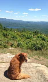
  • dog at Moose Mountain view20 minutes from the tower road, arrive at the Appalachian Trail. An orange Dartmouth Outing Club sign rests on the ground by a tree, pointing the way to the South Peak. Here, you can turn R to head to Mt. Katahdin in Maine. Turn left for Velvet Rocks, downtown Hanover, and if you’re really ambitious, Springer Mountain in Georgia. Today, we’ll turn R and take the AT for about 15 minutes to the S summit along the well-worn, gently but steadily climbing path.
  • Relish your reward at the South Peak: glorious views E, with Goose Pond at your feet and Mt. Cardigan, Sunapee, Kearsarge, and more visible on the SE horizon. At one point, the Presidentials are visible in the distance to the NE. Bedrock ledges offer comfortable seating. Search the raspberry thicket for ripe berries. You can bet the bears do.
  • steeplebush
  • At this season, native steeplebush is in full bloom (L), its rosy spires of tiny flowers alive with native pollinators. Dragonflies cruise the peaceful scene today, but in 1968, Northeast Airlines flight 946 crashed near this area. The rescue effort required bulldozers to clear a path to the wreckage.
  • The orange DOC sign indicates that the South Peak’s elevation is 2222’ above sea level. More refined measurements indicate it’s actually 73’ higher.
  • When you’re done drinking in the view, head back down the AT the way you came. The junction for the O.D. Ridge Trail appears just after a raised log/stone section of trail. Enter the Shumway Forest once again and continue down the AT past this trail. Volunteer AT trail maintainers have been here – step over rock water bars that keep water from sluicing down the trail and creating gullies.
  • About 8 minutes from the O.D. Ridge Trail junction, the trail flattens out – your cue to look for the Logging Road entering at L. Find the trail sign mounted on a large paper birch a short way in.
  • Turn L here, off the AT (if you continued, you’d arrive at Three Mile Road). You’re passing through a “sandwich” of easements placed by the National Park Service in 1983. A 200’ Trail Right of Way Easement follows the AT itself with a pair of protective easements 200-461’ wide, one on each side of the Trail ROW.
  • The Logging Road heads briefly uphill and then follows the contour S. You will follow it for half an hour through the Shumway Forest. This is your best chance at seeing moose that use this trail as a highway. Watch for their dinner plate-sized tracks in a few wet areas that appear here and there.
  • About 9 minutes from the AT, the Picnic Trail comes in at L. Ferny openings indicate the Logging Road’s path SSW. A few minutes further at a small opening, bear L and the trail, now more clearly a former skid trail, leads on.
  • Note the carefully constructed water bars on the route, built for past years’ logging operations to control water flow. Brush piles were laid to help return nutrients to the soil and provide small mammal habitat. The Shumway Forest has been under the supervision of a professional forester ever since the current owners, Kay and Peter Shumway, purchased what was then a heavily logged property in 1986 from a timber company to prevent construction of a mountaintop vacation home by another would-be buyer.
  • The Shumways manage the land primarily for public recreation and also to steer the forest back to a healthy and ecologically intact system with a variety of habitats for wildlife while protecting streams and wetlands. The new conservation easement ensures that this management will continue, adding a 100’ protective buffer for those waters.
  • About 20 minutes from the AT, the Bear Cub Trail comes in at L and soon you arrive at a grassy log landing. Bear L, away from the large open area, and continue up into the woods. Wildlife feed in such openings surrounded by forest cover. The Logging Road becomes stony here, hardened to take the weight of forestry vehicles. You’re starting to think this might be a wonderful ski route in winter, and you’re right!
  • In 4 minutes the Middle Mountain Trail and Mountainside Trail leave at R, and in a few more, you arrive at a second log landing. Just beyond is the tower road. Signs on a tree at L include a trail map. Turn R on the tower road.
  • Now it’s time to explore the north shore of Mill Pond. Two minutes from the Logging Road, the pond comes into view as you leave the Shumway Forest and enter the Mill Pond Forest, where the Shumways and Hugginses donated a conservation easement to the Hanover Conservancy in 2015.
  • Mill Pond with beaver lodgeTurn L opposite a telephone pole and take the short trail to the water’s edge. The beaver lodge is close by, and the bench you visited earlier is visible on the far shore at 2 o’clock. Lush northern shoreline vegetation is underfoot: sphagnum moss, ferns, and lichens. This thick carpet captures sediment running off the mountainside and helps keep Mink Brook crystal clear.
  • Turn R to follow the path along the shore, crossing a few beaver slides, noting the reeds with their tousled “bad hair day” seedheads. At a fork in the path, stay L on the pine-needle carpeted trail to where a small cove indicates the old dam overflow. The dam is just beyond, obscured by beaver engineering and shrubs.
  • Bear R and head for the green gate at the entrance to the tower road. Turn downhill past the gate and L to return to your car.

The Hanover Conservancy holds permanent conservation easements on the Shumway Forest, Mill Pond Forest, and Huggins Trail Access, which remain privately owned. Please respect the generosity of these landowners by leaving no trace of your visit and enjoy the memories and photographs you take home.

Filed Under: August, Hike of the Month, Moose Mountain, Shumway Forest Tagged With: Appalachian Trail, beaver, snowshoe hare, steeplebush

South Esker

August 1, 2016

South Esker Hike – Full PDF


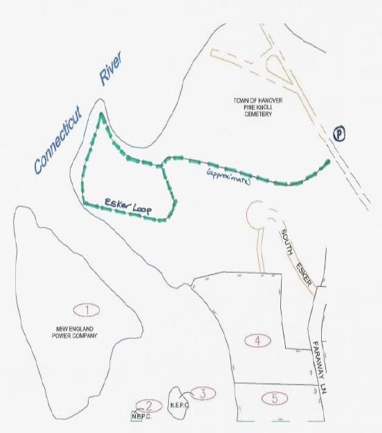
South Esker trail mapDriving Directions

  • From downtown Hanover, drive south on Main Street for 0.5 miles
  • Just after crossing the bridge over Mink Brook, turn right at 121 South Main Street, for the Pine Knoll Cemetery and Water Reclamation Facility
  • Drive through the gate and continue 0.3 miles through the cemetery, staying left at a fork in the lane.
  • The trailhead appears on the left, marked with a blue sign. Park your car just a few yards beyond on the right (not in the maintenance area on the left).

What You Should Know

  • Foot travel only. Dogs are welcome but must be under close control; please pick up after your pet.
  • The trails are well-blazed in town colors: two white patches on either side of a blue patch.
  • Pack a picnic to enjoy by the water, but remember that camping and fires are not permitted.
  • The Town of Hanover owns and manages the South Esker. When an 8-lot housing development was proposed for this entire forested hillside, a couple purchased the 17-acre property, built their home on four acres, and sold the remainder to the Town in 1971. The Hanover Conservancy (then known as the Hanover Conservation Council) had acquired an option on the land the previous year and raised the funds for the purchase.

Hiking Directions

  • Step onto the trail from the paved lane and watch your feet – almost the first step is, disconcertingly, onto a sewer manhole cover. Disconcerting, that is, until you remember that the nearby water reclamation facility works round the clock to clean Hanover’s wastewater before it is released into the Connecticut River. In the dirty old days before the Clean Water Act, before this facility was built, Mink Brook carried raw sewage from many hundreds of homes right past this spot. Enough of that – let’s get into the clean, cool woods!
  • Shortly after entering the woods, note the distinctive blue and white blaze at a fork in the trail. Stay right to follow the blazes as the trail begins to gently climb and then slabs along the side of the hill heading west.
  • At about 6 minutes from your car, arrive at a double blaze on a big hemlock tree and a new trail sign indicating the Esker Loop. This is your destination.
  • Continue straight to follow the loop counter-clockwise.
  • The reliable blazes make the path easy to follow despite the lack of understory plants and a defined treadway. Soft needles fallen from the pines and hemlocks overhead blanket the forest floor and muffle your steps while imparting a sweetly woodsy scent to the air.
  • After three or four minutes, an arrow directs you to turn left. But if you’re curious, continue on a few paces to a screened view over the round settling ponds of the water reclamation facility below.
  • Retrace your steps to the arrow.
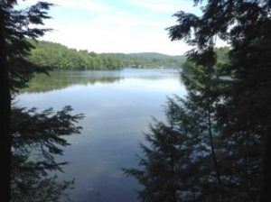
  • river view from South Esker trailHead down the hill toward a quiet cove on the river shore. The small but delightful viewpoint here, where soil conditions hint that many others have stopped here before you, is a peaceful spot to glimpse the Ledyard Bridge in the distance. Ducks and other waterfowl linger in the quiet water below. If you have a dog or small children with you, be sure they don’t stray too close to the edge of the steep, high bank.
  • A side trail comes in from the left as you proceed gradually bearing right following the white/blue blazes and the curving riverbank.
  • 20 minutes from your car, the trail reaches a sharp point jutting out into the river that offers another view of both Ledyard Bridge, screened by the branches of some brave young hemlocks, and on the right, the wastewater treatment plant. Stop for a moment to take in the scene. We’ve already imagined what the brook and river might have been like on a warm summer day before 1970 and the Clean Water Act (when a riverfront home was not desirable). Now imagine how this area might have appeared before 1950, when Wilder Dam, less than two miles downstream, inundated this area. Mink Brook would have met a much narrower Connecticut River mainstem and would be a small stream itself here. Many years before that, Abenaki dwellings and other landmarks of Native life would have stood here at the confluence of such a significant stream. Today, these places are submerged.
  • Now follow the trail as it turns south and follows some quiet water that separates the land from Gilman Island. Keep an eye out for an odd hardwood tree that reminds you of sinewy muscles – this is American hornbeam, also called musclewood, ironwood, blue beech, or water beech. It is often found in the understory of forests along rivers and streams where it can withstand periodic flooding. Its hard wood was used to make tool handles and mallet heads.
  • 25 minutes from your car, arrive at your picnic spot next to the river. On a hot day, a swim might be fun. Indeed, water quality has improved so much over the last 45 years that the river is clean enough for swimming, although it’s always wise to avoid the river after a very heavy storm.
  • Gilman Island beachGilman Island, a bedrock outcropping in the river, stands just across this short stretch of water. Owned by Great River Hydro and the westernmost point in Hanover, the island is a great camping destination for river trippers. Two campsites on the south side each have room for 10 campers. In 2015, a mouldering privy was installed in a partnership project between the Vermont River Conservancy, Dartmouth College, and LL Bean, with support from the previous hydro company, TransCanada, and the Silvio Conte Fish and Wildlife Refuge. On the island’s north end stands Dartmouth’s Titcomb Cabin. Originally built in 1953, it burned down in 2009. Dartmouth students took on the challenge of rebuilding the log cabin on the old site, and it is available for rent.
  • There’s more to see on the way back to your car. Follow the white/blue blazes as they lead southeast and away from the water. You enter a pine and hemlock forest that, while younger and denser than what you walked through earlier, still retains that quiet and dignified “cathedral” feel. Forest studies by the Hanover Conservancy indicate that the area was open at some point, likely for pasture of cattle or other livestock. Increment borings of the largest hemlock go back to the year 1904.
  • Soon, the esker itself looms up before you as the trail bears left at its foot. This steep-sided deposit of sand and gravel marks the path of a river that once flowed under the glacier. This esker follows the current path of the Connecticut River for many miles.
  • On your left, the forest floor is suddenly green with a carpet of ferns and other growth, where water flowing down the slope pools before sinking into the soil.
  • 10 minutes from the picnic spot, the river appears again through the trees and you reach a trail junction. Turn right up hill. At the top, turn right again.
  • 15 minutes from the picnic spot, you’ll return to the brown sign and know you’ve completed the Esker Loop. Continue straight, still following blazes.
  • Soon you’ll encounter a trail junction you may not have noticed on the way in – a short path to the right leads to a driveway off Spencer Road. Bear left instead and take the now-familiar trail as it slabs across and down the hill, delivering you back to your car.

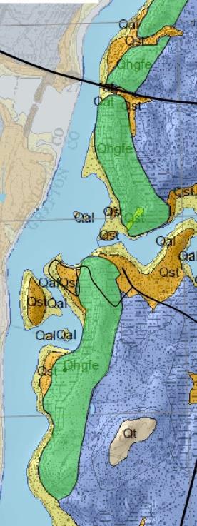
South Esker geologic map


Left: green indicates the esker along the river; blue indicates sediments deposited later by glacial Lake Hitchcock. The yellow arrow indicates the South Esker Natural Area.

Esker map modified from the Surface Geologic Map of the Hanover Quadrangle Grafton County, NH by Carol T. Hildreth, NH Geological Survey Surficial Geologic Map Series GEO-091-024000-SMAP. Thanks to Carl Renshaw, formerly of the Hanover Conservancy Board of Directors.

Filed Under: August, Hike of the Month, South Esker Tagged With: hornbeam

71 Lyme Road
Hanover, NH 03755
(603) 643-3433

info@hanoverconservancy.org

Facebook logo   Instagram   YouTube

Get Involved

Become a Member

Volunteer

Business Sponsors

Conserve Your Land

Employment

Our Mission

Advocacy

Conservation

Education

Stewardship

Explore Hanover

Hanover Hikes

Upcoming Events

Upper Valley Hikes

Trails Challenge

Copyright © 2025 Hanover Conservancy | Design by Chase Brook Software