Hanover Conservancy

Facebook logo   Instagram   YouTube          
Donate button
  • Home
  • About Us
    • Celebrating 60 Years
    • What We Do
      • Advocacy
      • Conservation
      • Education
      • Stewardship
    • Board & Staff
    • Membership Benefits
    • Contact Us
  • Get Outdoors
    • Hanover Lands
      • Balch Hill Natural Area
      • Mink Brook Nature Preserve
      • Other Properties
    • Hanover Hikes
    • Hanover Trails Challenge
    • Upper Valley Hikes
    • Exploring Nature at Home
    • Hunting
  • Events
    • Calendar
    • Spring Wildflower Scavenger Hunt
    • Private Events
  • Get Involved
    • Donate
    • Volunteer
    • Adopt a Trail
    • Corporate Conservators
    • Planned Giving
  • Education
    • School Programs
      • KAST
      • Connecticut River Studies
      • Hanover High School Scholarship
    • Request a Field Trip or Speaker
    • Research on Our Lands
    • Hanover History
    • Resources
  • News
    • Remembering Bob Norman
    • Reports & e-News
  • Conserve Your Land

Childs Farm Loop at Trescott Lands

February 1, 2020

Childs Farm Loop full PDF


Childs Farm Loop trail mapDriving directions

  • From Downtown Hanover and the Green, drive E on East Wheelock St. and up the hill 1.7 miles to the junction of E. Wheelock, Grasse, and Trescott Roads. Continue straight on Trescott Rd. and
    drive 2.4 more miles to Etna Rd. Turn L and head N on Etna Rd. 1.3 miles to Dogford Rd. Turn L; follow 1.2 miles to parking on L after sharp bend and pond.
  • Park at the marked trailhead parking area near the kiosk.

What you should know

  • Today’s hike is a loop on lands owned by the Trescott Water Company (Town/Dartmouth).
  • This is a great route for confident backcountry skiers.
  • The route follows two 18th century roads, visits two cellar holes, and returns on a new trail (2019).
  • As of 2019, all trails described here are blazed with yellow and marked with brown and yellow signs, thanks to the Trescott Recreation and Hanover Trails Committees.
  • Dogs must be leashed while on the Trescott Water Supply Lands and waste must be picked up and
    carried out in order to protect drinking water.
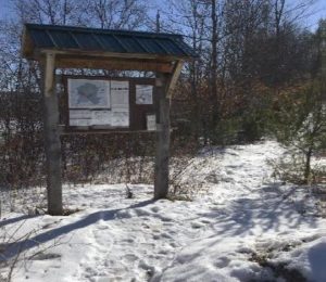
Trescott trail kiosk in winterBrief Hiking Directions

  • Start on the Poor Farm Trail that begins at R of the trailhead kiosk.
  • The trail soon reaches an historic road; turn R and continue.
  • Follow the Poor Farm Trail E as it turns R off the old road.
  • Continue to Knapp Road and turn R.
  • Turn R on the Child’s Farm Trail for 0.6 miles and return to your car.

Trescott Water Supply Lands logoThe Full Story

  • Welcome to your water source! Drinking water for much of Hanover and Dartmouth College comes from these lands, so special rules apply for recreational use. Take a moment to check the kiosk display to acquaint yourself with these rules and pick up a trail guide.
  • Start at the path to the R of the kiosk; a few steps in, a sign at L identifies it as the Poor Farm Trail East, 0.6 miles to Knapp Road. The easy trail parallels Dogford Road before swinging R at a distinctly raised, flat spot that is the site of the old Wright place. Snow may obscure it today; the photo below gives you an idea of what you’re missing. Wright was raising sheep on this land in 1855; by 1892, J.W. and W.D. Chandler had taken over his farm.
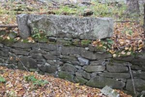
  • stone wall in fieldAs the trail swings L again, note blue tubes on both sides of the trail. These protect young tree seedlings from deer browse. The foresters managing this land are working hard to re-establish native trees in a place with a dense deer population – the water supply lands had essentially been a deer sanctuary for half a century while people (and hunters) were fenced out. Deer prefer to browse the northern hardwoods like maple, birch, beech, and oak that make a healthy natural forest and therefore a pure drinking water supply. This is one reason why deer hunting is strongly encouraged on these lands.
  • Soon the path joins the wide old Wolfeboro Road, with its graceful stone walls and venerable sugar maples. Today, the Hanover emergency services folks insist on a different name to avoid confusion when attempting a rescue, so this section is now called Poor Farm Trail East.
  • Governor Wentworth portrait
    Governor John Wentworth

    Royal Governor John Wentworth ordered the cutting of this road in 1770 in hopes of traveling over it from his home in Wolfeborough, NH, to attend Dartmouth College’s first commencement in 1771. A committee of Hanover citizens was appointed to “…run a line from near the southwest corner of Hanover to the Great Pond, or Governor’s seat, at Wolfeborough, and view the situation of the land and convenience for a highway, and make return the first Monday in October next.” Members were paid four shillings and sixpence per day and spent ten days surveying the route. Hanover landowners were assessed a penny and a half per acre to raise the 120£ needed to complete the road. The road wasn’t finished in time, however, and the Governor had to travel by way of Haverhill to attend the first commencement, but by 1772 it was ready for the second ceremony.

  • Wentworth, appointed in 1766 by King George III to take over management of the colony of New Hampshire from his infamous uncle Benning, helped Eleazar Wheelock secure the charter for Dartmouth College. Here he appears as quite the dandy, but indeed he was an eager outdoorsman and leapt at any chance to go camping and rusticating in his colony’s abundant wilderness. While he was on the trail happily getting dirty and sleeping on the ground, his wife was planning her fancy ballroom at their estate in the Lakes Region.
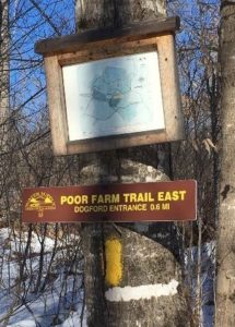
  • Poor Farm Trail East signThe Wolfeboro Road was probably only the second road in Hanover to be properly laid out, mapped, and recorded. Like many early roads, over the years its location has shifted. The entire road remained in use through the 19th century until construction of the Fletcher Reservoir in 1893 interrupted its path. Today many sections, including this one and the stretch that goes bravely up and over Moose Mountain, are Class VI roads. No wonder Emergency Services gets confused.
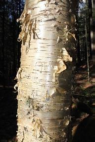
  • Follow the wide old road gently down the slope. A bit over 10 minutes from your car, your route swings R as the old road plunges toward what is now the Parker Reservoir, an area now off-limits to the public. Note the map posted on a tree at R. As you near the bottom of the hollow, birch tree trunknote the gleaming golden bark of yellow birch at R, a most handsome tree.
  • 20 minutes from your car, cross a stream headed for the Parker Reservoir. Pause to look upstream – at this season, with leaves off the trees, you get a good view of a well-laid stone wall running along the hillside above. One of Mr. Wright’s creations?
  • Climb up and out of the little valley. At the top, the trail bears L and flattens out.
  • At R note a plantation of small red pines, thigh-high at this writing. The Trescott lands experienced major blowdowns during the 2007 Patriot’s Day Windstorm, and two million board feet of logs and 3,100 cords of pulp were salvaged. This storm hit heaviest in the plantations, leaving natural stands largely unaffected. While the forest management plan for the Trescott lands calls for creating more natural, uneven-aged stands rather than even-aged plantations, this area is an exception to keep the slopes from becoming overrun by invasive buckthorn and other non-natives.
  • Proceed along the level trail, catching glimpses of Parker Reservoir below at L through the trees.
  • 30 minutes from your car, arrive at Knapp Road, identified by a sign just across the way and a map posted at R. Turn R and follow this historic road up the hill. Knapp Road was laid out Nov. 13, 1793, named for Lt. Peter Knapp of Hanover’s Revolutionary War-era militia. The cellar hole of his homestead is just below where this road meets another part of the Wolfeboro Road. In the late 1700s, that was a busy intersection!
  • A minute’s walk up the hill brings you to a sign at L interpreting the history of the Town Poor Farm, which once stood in the field beyond the road. That’s a great place to explore in spring.
  • middle school student group clearing brush
    Ms. Hadden’s 7th Grade group “Power of We”

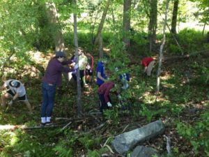
    Continue to the top of a small rise and look for a small cellar hole at R in a circle of pines. Here is what seems like the remains of a very small house. Actually, most early homes had cellars under only a part, as a cellar was not easy to dig and was needed just for storage of apples and other supplies, not for the many purposes to which we put basements today. This was the home of P. W. Durkee in 1855, and by the 1880 census, government workers recorded the four Hewitts here – Elbert, 36 years old, a farmer; his 34-year-old wife Augusta, keeping house; their 12-year-old daughter Mary and 10-year-old son Charles, who both attended the District #4 one-room schoolhouse at the bottom of the hill. (Thanks to Ms. Hadden’s 7th grade group at the Richmond School, who researched this site and helped clear it of brush for their “Power of We” project in 2019.) In 1903, it was owned by Newton Frost until the Water Company bought his place and demolished it along with nine other farms.

  • Continue up Knapp Rd another 100 paces to a sign at R for the Childs Farm Trail. From here, it’s an easy 0.5 miles back to your car. Before turning onto the trail, look back down the road, noting the pines ringing the cellar hole at the edge of your view. This must have been a beautiful place to live.
  • Back to the mundane – is your dog still on its leash? There are porcupines nearby. Indeed, the next trail up the hill is named the Porcupine Trail for a good reason.
  • Childs Farm on old map
    1892 map showing Childs farm

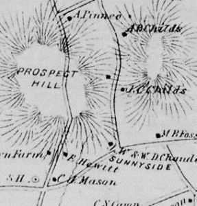
    In the 1880s and 90s, the northeastern part of the Trescott lands were part of the home farm of Joseph Childs, his wife Christiane, and their children Arthur, Mabel, Myrtle, and Marcellus. Joseph was a major landowner with 500 acres, including a sugar orchard of 800 trees and an apple orchard of 200 trees, plus 10 cows, 12 horses, and 200 Merino sheep. The 1892 map at right shows Joseph’s location; he had set his son Arthur up in the next place north.

  • Strike out through the meadow on the Childs Farm Trail. The yellow-blazed trail is mostly flat and follows the contour, except where it dips when crossing a few small drainages. You’re now passing above the most recent plantation you saw from below, and have a better view of earlier plantings and a pine-backed ridge.
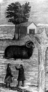
  • two men in tophats below a ram
  • 15 minutes after leaving Knapp Road, cross a second small stream and then climb gently to a small height of land. A low stone wall angles in at L; it may be barely visible in the snow. This is one of over a quarter million miles of stone walls built in New England and New York in the early-mid 19th century, largely in response to the rise of the Merino sheep industry (left). When the landscape-altering wool textile industry eventually went south, much of the human population went west, and the forest returned to cloak the hillsides where hundreds of sheep once grazed. In the mixed-age, mixed species forest surrounding you today, larger stumps are evidence of a previous harvest of trees that got their start a century ago.
  • 5 minutes later, you emerge into an open meadow that has been partly planted with young pines. At your appearance, finches erupt from feeding on seed heads in the scrub.
  • As your car comes into sight, a trail joins at R – a glance over your shoulder confirms it’s the Coyote Connector, an alternative route to Knapp Road.
  • As you approach the parking area, enjoy the view of Muscle In Your Arm Farm on the slope across Dogford Road, another part of the former Childs Farm. Its open sheep pastures, laced with stone walls lined with sugar maples, echo the view that you would have encountered a century ago on the lands you have just explored.

This Hanover Hike of the Month
has been generously sponsored byChase Brook Software logo


Filed Under: February, Hike of the Month, Trescott Tagged With: cellar hole, Wentworth, Wolfeboro Road

Camp Brook Valley Loop

October 1, 2019

Trail Information and Hike Map – Full PDF


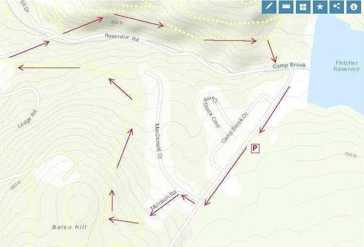
Camp Brook loop mapDriving Directions

  • From Downtown Hanover and the Green, drive E on E. Wheelock St. and up the hill 1.7 miles to Grasse Road. Turn L onto Grasse Road.
  • Park at the public ballfield parking area at 41 Grasse Road, outside the fence at the water treatment facility.

What You Should Know

  • Today’s hike takes you on a loop that tours the east and north slopes of the Balch Hill Natural
  • Area from neighborhood lanes and returns on the historic Wolfeboro Road, on lands owned by Dartmouth College and the Town of Hanover.
  • Dogs are welcome if under your control. Please pick up after your pet.
  • Archery season begins Sept. 15 and it is wise to wear blaze orange until Dec. 15.

Brief Hiking Directions

  • Turn L onto Grasse Rd to MacDonald Dr.
  • Turn R onto MacDonald Dr. and L onto Morrison Rd.
  • At far end of cul-de-sac, take steps up to trail
  • Turn R on the Garipay Trail
  • Take sharp R onto the Maple Trail
  • Turn L on Dot Strong Trail; at private drive, turn R
  • Turn R onto Reservoir Rd; cross to Wolfeboro Rd.
  • Take Wolfeboro Rd for 15 min
  • Turn R onto smaller path; cross brook
  • Turn L onto Reservoir Rd and Grasse Rd and return to your car.

The Full Story

  • Turn L onto Grasse Rd and walk along the shoulder past Camp Brook Dr. to MacDonald Dr. At this season, asters, goldenrod, and white-flowering turtlehead decorate the drainage ditch by the road. You might hear Canada geese announcing their flight south (let’s hope they didn’t linger on nearby Fletcher Reservoir).
  • Turn R at MacDonald Dr into a neighborhood developed for Dartmouth faculty and staff housing in the early 1990s. In fall, old apple trees hint at the history of this land, an orchard on the Garipay Farm.
  • 5 minutes’ walk from your car, turn L onto Morrison Rd and walk up the short lane to the cul-de-sac and trailhead sign.
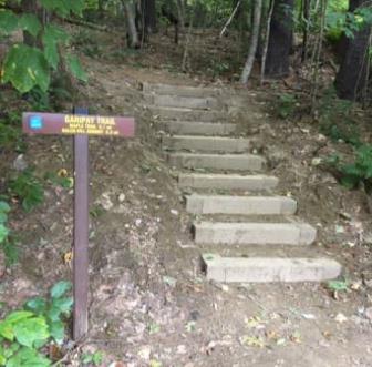
  • Garipay Trail stepsYou can thank the Upper Valley Trails Alliance’s High School Trail Corps and the Hanover Conservation Commission for the friendly steps at the trail entrance. Built in 2019 on Grasse Rd Homeowners’ Assoc. land, they lend easy access to the Balch Hill Natural Area trail system.
  • It’s just a few paces to the junction of the Hunter East (L) and Garipay Trails. Turn R onto the blue-blazed Garipay Trail, named for the farm family that most recently owned this land. At this season, the many small drainages off Balch Hill are dry, but at wetter times of year, the wooden crossings are most welcome. The split log one was built by Hypertherm volunteers in 2019 and the lumber one by a Conservancy volunteer a few years earlier.
  • A low stone wall follows the trail at R; could this be a relic of the sheep days in the mid-1800s, when the entire hill was open pasture and orchard?
  • 5 minutes’ hike from Morrison, the Garipay Trail rises to meet the Maple Trail. Turning L would bring you to the summit with its beautiful views – if you have 10 minutes to spare, it’s worth the detour. For this trip, take the sharp R turn, cross the stone wall, and follow the yellow-blazed Maple Trail. You’re now on town land, bought from the Garipays in 1978 with help from the federal Land and Water Conservation Fund.
  • 2 minutes later, look for deer research plots at R. A small sign explains their purpose.
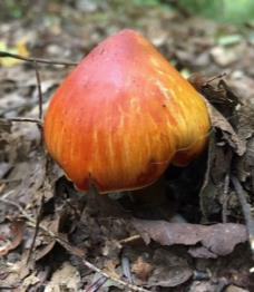
  • colored mushroom
  • Watch for color underfoot, not just among the maples overhead. It’s mushroom time!
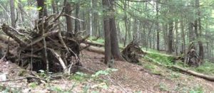
  • 5 downed treesThe entire E side of Balch Hill suffered blowdowns from the Patriot’s Day Windstorm in 2007. At one point on the Maple Trail, you’ll see the “undersides” of 5 downed trees in a row, with their boles all pointing W away from the source of that wind. Eventually, the root masses will melt back into the landscape, leaving the “mound and pit” (sometimes called “pillow and cradle”) micro-topography typical of wind-influenced forests.
  • 10 minutes’ hike from the Garipay Trail, the Maple Trail enters more open coniferous forest and onto another piece of Dartmouth land, where the college kindly granted a trail license to move the trail onto a more sustainable path. By now you’ve gathered that the Hanover Conservancy, Hanover Conservation Commission, Upper Valley Trails Alliance, and Dartmouth are closely cooperating partners on Balch Hill.
  • A few minutes farther, look for a yellow Wildlife Safety Zone sign as the trail swings L and then out to the wide Dot Strong Trail. A glance to the R confirms this is a sewer line connecting two neighborhoods. Bicycles are allowed on the flat, comfortable path. Dot Strong was an ardent conservationist who lived nearby on Reservoir Road.
  • Turn L on the Dot Strong Trail and enjoy the easy 0.3 mile walk to Reservoir Rd. In 5 minutes, reach the metal gate posts at the edge of town property. Continue a few paces to the private drive at 29 Reservoir Rd (you’re allowed!), turn R down the drive, and note the trailhead sign at R – in case you’d like to try the loop counter-clockwise sometime.
  • Turn R onto Reservoir Rd. As you walk along the shoulder, look down into the forested ravine at L, listening for Camp Brook as it falls from the Fletcher Reservoir down to Storrs Pond. The brook has only this short distance to cool off in the shade of the hemlocks on its banks before reaching the pond. While smaller brooks run dry at this season, controlled releases from the reservoir keep water in the channel.
  • Cross the brook; look for the brown/yellow Wolfeboro Rd trailhead sign, just R of the Storrs Pond sign.
  • Take the Wolfeboro Rd trail up and around the metal gate. Five steps in, and you’re on the clearly discernable, original route of the Wolfeboro Rd. Our forebears chose a good path – it is safely out of the way of Camp Brook, which washed out Reservoir Rd a few years back.
  • Walk up through the hemlocks that shade the valley of this brook. You can imagine the relief of Royal Governor John Wentworth, after several days’ ride on the new road in 1772, as he made his final descent toward his destination, Dartmouth College’s second commencement. He had ordered the cutting of this road, linking his home in Wolfeborough with Hanover, two years earlier. At a public meeting on July 30, 1770, a committee of Hanover citizens was appointed to “…run a line from near the southwest corner of Hanover to the Great Pond, or Governor’s seat, at Wolfeborough, and view the situation of the land and convenience for a highway, and make return the first Monday in October next.” Members were paid four shillings and sixpence per day and spent ten days surveying the route. In October, they gained approval to lay it out from the College to the Canaan line. Hanover landowners were assessed a penny and a half per acre to raise the 120£ needed to complete the road.
  • The old road moves steadily up the side of the valley, past some large old pines that are still too young to have been here when the Governor passed through. Two Oak Hill trails join at L; continue straight.
  • At this season you can hear birds flitting in the branches overhead, preparing to join their migrating brethren following the nearby Connecticut River south.
  • 10 minutes’ hike from Reservoir Rd, the canopy opens up and the trail is crowded by young white pines eager to fill the space. This is your cue to watch for a less worn trail at R. (The Wolfeboro Rd continues with two detours through the Trescott Water Supply Lands, over Moose Mountain, and on to the Lakes Region.)
  • Turn R on this smaller path and head downhill for 5 minutes among the brash and brushy white pines. As you approach Reservoir Rd., note the barbed wire and sign on a big pine at L, marking the boundary of the restricted area around the Fletcher Reservoir and its dam. Just beyond at R are two study plots helping the Hanover Biodiversity Committee measure deer browse pressure on Trillium, a native wildflower. One plot is fenced from deer and the other, marked with blue flagging, is not.
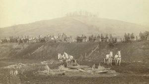
  • Fletcher Dam construction in 1893A small footbridge leads over the natural channel of Camp Brook, nearly dry at this season, and soon you pop out on Reservoir Rd just as it curves into Grasse Rd. The Fletcher Dam looms above at L. Constructed in 1893, this is the first of two dams built on Camp Brook to provide safe drinking (and fire-fighting!) water to downtown Hanover and Dartmouth College. This image shows the many teams of horses and men employed in building the dam. We aren’t certain, but we believe that the white horses in the foreground are standing on what would eventually be flooded land behind the dam, and that the hill in the background topped by the tuft of trees is Balch Hill.
  • Follow Grasse Rd to return to your car at the public parking area just beyond the ball field and swings.

This Hanover Hike of the Month has been generously sponsored byJMH Wealth Management logo

October 2019 


Filed Under: Balch Hill, Hike of the Month, October Tagged With: aster, Oak Hill, turtlehead, Wentworth, Wolfeboro Road

Moose Mountain Ridge Loop

August 1, 2019

Complete PDF


Moose Mountain loop mapDriving Directions

  • From Etna village, turn R onto Ruddsboro Rd
  • Follow Mink Brook as the road curves up its narrow valley for 1.5 miles
  • Turn L onto Three Mile Rd
  • After 1.4 miles, arrive at a big dip in the road with parking on both sides.

What You Should Know

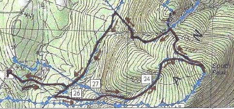
  • Today’s hike, shown on the map above, takes you on a loop that visits the South Peak on a lesser known trail, cruises the mountain ridge on the Appalachian Trail (with optional 15-minute, 0.2 mi. visit to the Moose Mtn. Shelter) and returns on the historic Wolfeboro Road and the old route of the AT, the Harris Trail.
  • You’re about to visit lands owned by the federal government (permanently protected) and Dartmouth College (partially protected for the AT corridor) and the privately owned Shumway Forest, protected by the Hanover Conservancy in 2017.
  • Dogs are welcome if under your control; please pick up after your pet.

Hiking Directions

  • Begin your hike on Dartmouth land at the orange Dartmouth Outing Club sign that reads, “Parking/No Camping.”
  • Known as the New Fred Harris Cabin Access Trail, this blue-blazed, ½ mile trail was built by the DOC as a direct route to the college’s Class of ’66 Lodge (built on the site of the Fred Harris Cabin).
  • The trail is easy and rises gently to a plateau, passing through a long-abandoned sheep pasture. Here, saplings are creeping into the understory sheltered by towering pines above. Years ago, all these lands between the road and the mountain ridge were owned by Luther Brown.
  • Seven minutes’ walk from your car, the sound of water signals the approach to a main tributary of Mink Brook. At L, a rough stone wall marks the plateau’s edge and boundary of the old pasture.
  • The trail drops to a bridge over the brook. Look L upstream; the brook drains a rich beaver-influenced wetland just out of sight on the Shumway Forest.
  • The trail continues gently back up to a matching plateau on the E side. The forest is different here – less pine, more hardwood – belying a different history. Was this Luther’s woodlot?
  • 10 minutes’ hike from your car, reach the Harris Trail. An orange DOC sign hangs on a tree at R, facing the other direction and reading “To AT” and “To 3 Mile Rd & Parking,” indicating the path you just took. Across the trail junction is a wooden sign reading, “<- Harris Trail ->” placed by the Hanover Conservation Commission’s Trails Committee.
  • The Fred Harris Trail, former route of the Appalachian Trail, honors the Dartmouth Outing Club’s founder (1909). It offers wonderful skiing when conditions are right. The trail once ran from Moose Mountain Lodge Road N into Lyme, and can still be followed by an alert hiker. The AT was re-routed onto the Moose Mountain ridge in the 1980s.
  • Turn R onto the wide Harris Trail and head down to another brook. While there is no bridge, it’s easy to cross on stepping stones. Slow-growing hemlocks and yellow birch shelter the stream and hold the banks in place. At L, beyond the brook, a yellow blaze and white boundary sign signal the edge of the federal easement over Dartmouth land that protects the Appalachian Trail.
  • The Harris Trail continues on its gentle grade and an unmarked trail soon joins at L. This is the Ski Loop, a challenging ski trail built before the AT. Turn L here and head uphill for about 15 minutes. The trail is not blazed and because it is not used as heavily as the AT that parallels it nearby to the S, it is not as worn, but is not hard to follow.
  • The Ski Loop takes you gently but steadily up on an old cart path. Shortly past a fallen beech, the trail levels out and slabs L along the hillside.
  • 15 minutes from the Harris Trail, the sounds of falling water accompany your arrival at another trail junction. Signs on trees at L indicate the trail down to Dartmouth’s Class of ’66 Lodge. The stream you hear, which is the one you recently crossed below, provides the lodge’s water supply. At this point, you cross onto the Shumway Forest. More about that later.
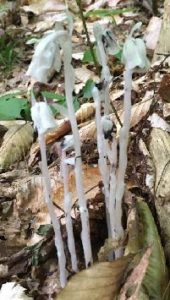
  • Indian Pipe flowersContinue straight onto the Nat Thompson Trail which leads 1.1 miles from this junction up to the AT on the ridge. This begins as a wide, pleasant trail, re-opened a few years ago by the Dartmouth Outing Club. In midsummer, look for the ghostly white stems and downturned flowers of Indian Pipe (R), a saprophyte that relies on decomposing plants for its food as it has no chlorophyll. Shining clubmoss blankets the hillside at R.
  • 8 minutes from the Ski Loop junction, the Nat Thompson Trail approaches the stream at L; be sure to stay straight without crossing the stream and continue gradually uphill. The trail is irregularly blazed but easy to follow. Six minutes later, a log crossing carries the trail over a small drainage as you leave the Shumway Forest for federal land surrounding the AT. The trail swings NNE to make a wide easy sweep up to the ridge.
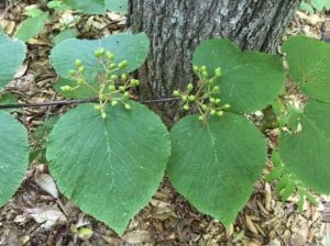
  • Hobblebush
  • Spring wildflowers have long since gone by, but sharp eyes will find the deep blue berries of blue-bead lily and the seed clusters setting on hobblebush viburnum. Some paired hobblebush leaves achieve lunch plate size; they will turn deep purple in autumn. The three-lobed leaves of goosefoot or striped maple, a small understory tree, can get even bigger.
  • 10 minutes from the log crossing, the trail swings R and becomes steeper as it climbs toward the South Peak. 5 minutes later, reach a fork and a sign directing you R toward the South Peak. 5 more minutes’ climb brings you out onto the open ledges of the 2293’ South Peak of Moose Mountain.
  • Time for a break! Enjoy the view out over Goose Pond below and, if it’s not hazy, across Canaan and far beyond. At this time of year, the rosy flower clusters of shrubby meadowsweet attract pollinators and dragonflies patrol the skies.
  • Beyond the summit sign, the path S of the clearing is the AT southbound, which would take you straight back to Three Mile Road about ¼ mile S of your car (and downtown Hanover, if you keep going). If a thunderstorm threatens, this is your best bet. But we’ve got much more to see today, so retrace your steps and strike N (path at L of ledges). In a few yards bear R on the AT northbound at a pair of orange signs, past the Nat Thompson Trail.
  • The white-blazed AT soon heads down into the saddle between the N and S peaks. The wind rising up both the E and W slopes plays in the trees overhead, keeping the bugs too entertained to bother you.
  • 13 minutes from the S Peak, a sign announces you’ve reached the Moose Mountain Shelter “FPA” (government-speak for Forest Protection Area). 5 minutes further, an orange sign indicates the shelter is 0.1 miles beyond Wolfeboro Rd. Just beyond is the historic road itself, rising up from the Tunis District to the E and quickly disappearing down toward Hanover to the W.
  • SHELTER STOP – You can visit this shelter with an easy out-and-back 0.2 mile, 15 minute hike, or if time is short, simply turn L and head down Wolfeboro Rd. To find the shelter, cross the Wolfeboro Rd and follow the AT northbound as it winds gently uphill for 5 minutes to a cheerfully illustrated orange sign at the shelter access path. Turn R here and within moments, the shelter comes into view at L. A bench of Aldo Leopold’s design rests on a nearby ledge, and must offer great views when leaves are off. Be sure to sign the ledger tucked by the shelter’s N wall. A lot of work by volunteers goes into maintaining places like this. Return to the Wolfeboro Rd the way you came.
  • Stand for a moment at the four-way junction of two of the most historic routes in New Hampshire. The 2,190 mile-long Appalachian Trail, proposed nearly a century ago, threads through a national park that spans the eastern seaboard from Maine to Georgia. Conservation efforts along its route have also protected valuable wildlife habitat and cool forests. The Wolfeboro Road, built 250 years ago when New Hampshire was still a colony of Great Britain, reached from the colonial governor’s home in Wolfeborough up and over this mountain to Hanover, a distance of 55 miles as the crow flies. Governor John Wentworth ordered its construction so that he could attend commencement at Dartmouth College, having assisted its founder, Rev. Eleazar Wheelock, in securing its charter from the King. Wentworth was an eager outdoorsman, relishing camping out with his road survey crew in the NH woods and leaving his wife at home to worry about decorating her new ballroom in the governor’s mansion.
  • This spot also marks an important watershed divide. All rain and snow falling E of where you stand on the AT flows into Tunis Brook, Pressey Brook, Goose Pond, and then to the Mascoma River. All that falls on the W side ends up in Mink Brook. Waters from each reach the Connecticut River, but by much different paths.
  • Wolfeboro road signIt’s time to head down. Take the Wolfeboro Rd W and down the mountainside for about 15 minutes. Adventure-seeking jeep drivers have created ruts in places, and the footing is wet for the first 5 minutes until you encounter rough gravel laid down by the Hanover Dept. of Public Works so emergency vehicles could reach the AT to assist injured hikers.
  • Along the way, imagine Governor Wentworth riding this rugged route to the Dartmouth Green. For more hiking on this historic road, see our Hike of the Month for June, Wolfeboro Road West.
  • 15 minutes from the AT, an old stone wall appears at L and you reach an open area at the bottom of the slope. You’re back in former sheep country! Continue straight, passing a chained-off drive at R. A few paces further, a metal gate comes into view at L and an orange sign just beyond indicates the Harris Trail. Walk around the gate and back onto Dartmouth land, following a woods road past a log landing and bearing R to re-enter the woods.
  • Here, the Harris Trail follows a gravel-surfaced woods road used to deliver supplies to the college’s Class of ’66 Lodge. After crossing a new wooden bridge, there’s a more natural surface underfoot.
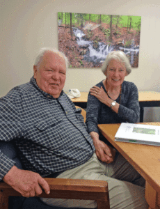
  • Peter and Kay Shumway at table
    Peter and Kay Shumway after signing the Shumway Forest conservation easement, June 2017
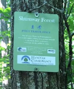
  • Shumway Forest sign10 minutes from the gate, spot the green Shumway Forest sign at R. Peter and Kay Shumway (L), owners of the historic Moose Mountain Lodge from 1975 to 2018, purchased 313 acres on the mountain from a lumber company in 1986 to keep the land from being developed. In 2017, to permanently protect public access to its foot trails, they conveyed a conservation easement to the Hanover Conservancy.
  • A short distance past the sign, follow the Harris Trail as it bears R off the woods road. While the red and black DOC blazes have long since faded, the former route of the AT is easy to see. The forest is younger here than on the mountain ridge, punctuated with occasional massive white pines.
  • 5 minutes past the fork arrive at a junction where a trail at L heads over a footbridge to the Class of ’66 Lodge. Continue straight and soon the orange sign appears at R directing you back to Three Mile Road. You’ve now closed today’s loop. Bear R for the 10-minute return on the now-familiar path, over the wooden bridge, and back to your car.


Filed Under: August, Hike of the Month, Moose Mountain Tagged With: Appalachian Trail, goosefoot, hobblebush, Indian Pipe, meadowsweet, Wentworth, Wolfeboro Road

Historic Wolfeboro Road West

June 1, 2017

Wolfeboro Road West – Full Hike PDF


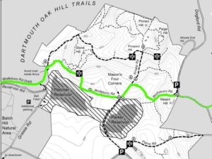
Wolfeboro Road trail map
Route is outlined in green

Driving Directions

  • Arrange with a friend to leave a car at the hike’s end OR give yourself time to hike back to your car.
  • Car drop: from downtown Hanover and the Green, take E. Wheelock Street east up the hill; continue as it becomes Trescott Road. Turn L onto Etna Road. Drive through Etna village, pass a cemetery on L, and turn L onto Dogford Road. Follow as it turns sharply R past a farm pond; turn L into the Trescott parking area. To reach the start point, return to Trescott Road and turn R onto Grasse Road. Follow as it turns L and heads down the hill. Stay R for Storrs Pond and Oak Hill. Park at the Oak Hill parking area at R.
  • Starting point for a round trip hike: from downtown Hanover and the Green, take the Wolfeboro Road (known today as College Street) north through campus past the medical school. At the Dewey Field light, stay straight to join Lyme Road. Drive past the golf course to the rotary and bear R onto Reservoir Road (still on the old Wolfeboro Road route). Turn sharply L toward Storrs Pond and Oak Hill as the road enters the woods. Park at the Oak Hill parking area at R.

What You Should Know

  • Trescott Water Supply Lands logoWelcome to your water source! Most of this hike crosses the Trescott Water Supply Lands. Drinking water for much of Hanover and for Dartmouth College comes from this area, so special rules apply for visitors.
  • Dogs are welcome but must always be leashed; please pick up after your pet.
  • You may encounter forestry vehicles; they have the right of way.
  • Hiking times are approximate. Plan on 2 hours; longer if you plan to spend time enjoying the views.

Hiking Directions

  • Begin your hike by walking back up the lane to a path entrance between the white Storrs Pond sign and the green street sign for Reservoir Road. Five steps in, and you’re on the clearly discernable, original route of the Wolfeboro Road. Our forebears chose a good path – it is safely out of the way of Camp Brook, which washed out Reservoir Road a few years back.
  • Walk up through the hemlocks that shade the valley of this brook. You can imagine the relief of Royal Governor Wentworth, after several days’ ride on the new road, making his final descent toward his destination, Dartmouth College’s second commencement in 1772. In hopes of making it to the first one, Governor Wentworth ordered the cutting of the Wolfeboro Road, from his home in Wolfeborough across to Hanover, in 1770. At a public meeting on July 30 of that year, a committee of Hanover citizens was appointed to “…run a line from near the southwest corner of Hanover to the Great Pond, or Governor’s seat, at Wolfeborough, and view the situation of the land and convenience for a highway, and make return the first Monday in October next.” Members were paid four shillings and sixpence per day (Hanover Center’s Jonathan Freeman earned six shillings and sixpence/day as surveyor) and spent ten days surveying the route. In October, they gained approval to lay it out from the College to the Canaan line. Hanover landowners were assessed a penny and a half per acre to raise the 120£ needed to complete the road.
  • portrait of John Wentworth
    John Wentworth
    Royal Governor John Wentworth, appointed in 1766 by King George III to take over management of the colony of New Hampshire from his infamous uncle Benning, helped Eleazar Wheelock secure the charter for Dartmouth College. Here he appears as quite the dandy, but indeed he was an eager outdoorsman and leapt at any chance to go camping and rusticating in his colony’s abundant wilderness. While he was on the trail happily getting dirty and sleeping on the ground, his wife was fixated on having a fancy ballroom at their country estate in Wolfeborough.
  • In about a half mile, just as the road starts gently downhill, look R for a trail coming in from Reservoir Road where it joins Grasse Road. If you want to return to this side of the Trescott lands, you can park at the ball field near the water filtration plant and take this path over a foot bridge.
  • You are near the foot of Fletcher Reservoir, first of two impoundments built on Camp Brook to provide water to downtown Hanover and Dartmouth College. This reservoir flooded a section of the Wolfeboro Road, so we will bear L and head uphill to avoid this section and the protected area around it. Because the public is not permitted within 250 feet of the waters, we’ll have to take a few side trails, but these are not without their delights!
  • After six minutes’ walk from the trail junction, a mowed ski trail comes in from the L. A few yards further, look closely for the turn to the R as the ski trail veers off to the L – your goal is a sign, posted a short way into the woods at the Trescott Lands boundary. Time to leash your dog, if your pup is along for the hike.
  • This trail takes you over an old woods road and soon, a newly built bridge over an intermittent stream. The trail is marked in most places with flagging and is well trodden, following the contour of Stone Hill (more about Stone – a person, not a geological feature – in a moment). Side trails built by mountain bikers come in at L in several places; avoid these and stay on the generally straight path.
  • Soon, you’ll see a stone wall ahead. Head for the break in the wall and emerge from the forest to a vantage point. This unusual view of Velvet Rocks, with the waters of Fletcher Reservoir at R, is your reward for the detour off the old road.
  • Head downhill, following stakes in the open field, to rejoin the Wolfeboro Road at a well-marked opening in the trees. Look R to see where the old road went west, and turn L to resume your pilgrimage. Red boundary signs on the R and orange blazes on trees indicate the reservoir buffer, not open to the public (or dogs hoping for a swim).
  • Walking on the old road is easy and grades are gentle. Keep your eyes out for the cellar hole at L of the old Stone Farm, on a small rise (double circle on the map). Plans to dam Camp Brook meant that farmers in its watershed would be displaced. In 1893, Dartmouth College simply swapped farms with Charles Stone. It’s said that he milked his cows here in the morning of the move, then herded his cows down the Wolfeboro Road and through downtown Hanover, and installed them in their new barn near Mink Brook just south of town, where he milked them that evening.
  • Continue east on the Wolfeboro Road to Mason’s Four Corners. Now a log landing, the Four Corners was once a major intersection where the Wolfeboro Road crosses the more recent Knapp Road. Look for a sign posted on a tree opposite, confirming your location.
  • Knapp Road was laid out Nov. 13, 1793, named for Lt. Peter Knapp of Hanover’s Revolutionary War-era militia. The cellar hole of his homestead is on the northeast corner of this intersection. By 1855, J. J. Mason lived here, followed by Charles Mason by 1892. The 160-acre Mason Farm had a 100-tree apple orchard and 200-tree sugarbush. Mason also kept 12 dairy cows and 70 Merino sheep. In the days before the Civil War, Hanover was one of the four top sheep towns in New Hampshire (after Walpole, Lyme, and Lebanon). The water company purchased Mason’s farm by 1903 for $4000.
  • At the NW corner of this intersection stood the one-room District #4 schoolhouse (1807). Look for an interpretive sign here for more about these historic sites.
  • The Wolfeboro Road was probably only the second road in Hanover not only to be properly laid out but also to be mapped and recorded. Like many early roads, over the years its location has shifted, with and without the benefit of surveys and deeds. The entire road remained in use through the 19th century until construction of Fletcher Reservoir in 1893 interrupted its path.
  • As a member of Dartmouth’s new Board of Trustees, Wentworth hoped to cross it for the first commencement of four students in 1771, but not all the communities in its path felt obliged to cooperate in its construction (except Hanover, of course!). It wasn’t ready for another year, and was still just a rough trace, not a “road” as we imagine it. In 1771 the governor ended up going by way of Haverhill.
  • The Wolfeboro Road continues E, still marked by old sugar maples but obscured by brush. Here again, we must take a detour to avoid the reservoir buffer, this time for the Parker Reservoir. After imagining the busy neighborhood that once existed here, continue up Knapp Road, itself lined with stately old maples and stone walls. In a few minutes you’ll notice another sign at R for the trail to Dogford Road. Turn R here.
  • The hillsides beyond are partly open and are being replanted. These lands experienced major blowdowns during the 2007 Patriot’s Day Windstorm. Two million board feet of logs and 3,100 cords of pulp were salvaged. This storm hit heaviest in the plantations, leaving natural stands largely unaffected. The forest management plan calls for creating more natural, uneven-aged stands rather than even-aged plantations.
  • Catch glimpses of Parker Reservoir as the trail turns SE to rejoin the old Wolfeboro Road after a short dip.
  • Back to Royal Governor John Wentworth – he visited Hanover for the third and last time in 1773, once again for the College’s commencement exercises, presumably traveling over his new highway. He was not able to attend in 1774, and by the summer of 1775 he had fled New Hampshire after war broke out with Great Britain.
  • Back to the mundane – is your dog still on its leash? Give yourself a gold star and know that there are porcupines nearby.
  • stone wall in fieldTurn L, uphill, returning to the old road. It climbs gently but steadily, and stone walls become more impressive. You’re seeing the handiwork of one Wright, who owned the farm at the final cellar hole we will visit today. He was there in 1855; by 1892, J.W. and W.D. Chandler had taken over his farm. As the gate and Dogford Road come into view, look for the cellar hole at L – it’s the largest yet. Find the threshold stone and admire the drylaid stonework, all done without benefit of power machinery.
  • From here, you have a choice. If you dropped your car at the Dogford Road parking lot, head N on the light trail that leads from the cellar hole and parallels the road for the short distance to the lot. You can also continue by foot, or in your car, along the route of the Wolfeboro Road by following Dogford Road straight E to where it turns just past an historic farmhouse at L.
  • If you are feeling adventurous, have 15 minutes, and seek the very best Wolfeboro Road experience of all, park on the shoulder of Dogford Road at the turn (there is room for one carefully parked car) and proceed on foot up the old road as it continues as a Class VI road through a pasture.
  • Note the cattle fence, which is electrified. Grasp the gray plastic handle to cross the fence – carefully – and immediately replace the handle behind you. This is the home of Scottish Highlander cattle, but the public is still allowed on the old road, which is easily distinguished by the early stone walls and towering maples that line it. You’ll pass pieces of antique farming equipment and sap buckets along the way. Step carefully (for obvious reasons) and do not approach the long-horned cattle if you encounter them.
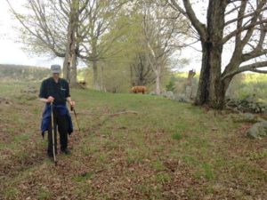
  • Wolfeboro Road with walker and cattle in backgroundProceed, if cattle and other conditions allow, to the crest of the hill. From here, you can see the path of the old Wolfeboro Road as it continues down into a little valley and then up the other side.
  • Stop here – this is the one section of the Wolfeboro Road that is no longer a public way, due to town meeting action in the 1980s, when a single vote sealed the road’s fate. The road is closed from a small bridge at the end of Elm Road until it joins Hanover Center Road. Yet the Wolfeboro Road, a beautiful scenic and recreational asset for Hanover, remains an important historical reminder of the early regional vision and political leadership that was to benefit the entire region.
  • Turn back toward Dogford Road and enjoy the most beautiful view of all – Velvet Rocks and the lush farm landscapes that seem not to have changed since the early 19th century.

Learn more about the Trescott Water Company Lands.

Filed Under: Hike of the Month, June, Trescott Tagged With: cellar hole, Wentworth, Wolfeboro Road

71 Lyme Road
Hanover, NH 03755
(603) 643-3433

info@hanoverconservancy.org

Facebook logo   Instagram   YouTube

Get Involved

Become a Member

Volunteer

Business Sponsors

Conserve Your Land

Employment

Our Mission

Advocacy

Conservation

Education

Stewardship

Explore Hanover

Hanover Hikes

Upcoming Events

Upper Valley Hikes

Trails Challenge

Copyright © 2025 Hanover Conservancy | Design by Chase Brook Software