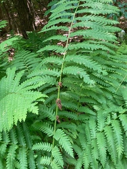
Hanover Conservancy

Facebook logo   Instagram   YouTube          
Donate button
  • Home
  • About Us
    • Celebrating 60 Years
    • What We Do
      • Advocacy
      • Conservation
      • Education
      • Stewardship
    • Board & Staff
    • Membership Benefits
    • Contact Us
  • Get Outdoors
    • Hanover Lands
      • Balch Hill Natural Area
      • Mink Brook Nature Preserve
      • Other Properties
    • Hanover Hikes
    • Upper Valley Hikes
    • Exploring Nature at Home
    • Trails Challenge
    • Hunting
  • Events
    • Calendar
    • Celebrating 60 Years
    • Hanover Trails Challenge
    • Hike of the Month
    • Private Events
  • Get Involved
    • Donate
    • Volunteer
    • Adopt a Trail
    • Corporate Conservators
    • Planned Giving
  • Education
    • School Programs
      • KAST
      • Connecticut River Studies
      • Hanover High School Scholarship
    • Request a Field Trip or Speaker
    • Research on Our Lands
    • Hanover History
    • Resources
  • News
    • Remembering Bob Norman
    • Reports & e-News
  • Conserve Your Land

Pasture Road Peregrinations

June 30, 2022

DOWNLOAD FULL PDF OF DIRECTIONS -Pasture Road Peregrinations

Driving directions:

  • From Etna Village, head N on Hanover Center Road
  • Turn R on Ruddsboro Road and drive 1.8 miles
  • Turn L on Old Dana Road
  • Turn R onto Moose Mtn. Lodge Rd just past an old barn
  • Drive 0.8 miles to top of steep road. Park at the marked trailhead parking area.

What you should know:

  • Foot travel only.
  • Dogs welcome if under close control.
  • Bring binoculars for viewing waterfowl on Mill Pond.
  • This hike explores a trail newly built and blazed in spring, 2022 and visits the Dana Forest and Pasture Natural Area, co-owned by the Town of Hanover and a Dana family heir, and the privately owned Baum Conservation Area. These lands are part of a 3,800-acre contiguous block of protected higher-elevation wildlife habitat on Moose Mountain.

BRIEF HIKING DIRECTIONS

  • Begin at the sign reading “Mill Pond Forest & Huggins Trail Access.”
  • Bear L at first trail junction to visit Mill Pond
  • Return to trail junction and turn L onto Pasture Road
  • Follow signs for Pasture Road Trail.
  • Turn R onto Stone Wall Trail at gap in stone wall
  • Turn L onto Blue Loop Trail, heading downhill
  • Turn L onto Pasture Road Trail
  • Continue straight after junction with Stone Wall Trail
  • Bear L at junction with Pond Trail
  • Retrace your steps to return to your car

FULL DIRECTIONS

  • Begin your hike at the sign reading, “Mill Pond Forest & Huggins Trail Access.” To forever ensure public access to the network of trails you’ll be exploring, the Shumway and Huggins families donated conservation easements on this area to the Hanover Conservancy in 2016.
  • Cross a small drainage and note the grassy area beyond the trees at L. By 2017, the beavers left when their preferred food supply ran out, after years of entertaining their neighbors with tail slaps on the water plus plugged culverts and “free-range forestry.” The thread of infant Mink Brook has reappeared in the absence of management by these aquatic engineers, and the series of pools is growing up to grass.
  • 3 minutes’ walk from your car, bear L at the first trail junction. In 15 paces look for a cellar hole at L, difficult to see amid the lush growth at this time of year. Here stood the home of David Woodward, who built the dam on Mill Pond and a sawmill and gristmill on the small, steep falls of Mink Brook below where you left your car.
  • Continue on the path a few minutes further to Mill Pond, the highest water body in Hanover and the primary source of the town’s largest stream. Set in a saddle on the mountain ridge, it originally may have been a smaller pond or perhaps a marsh. Around 1800, Woodward built a drylaid stone dam (out of view at L, beyond the spruces) to raise the water level some 6-8 feet (since partly silted in). Beavers later took over managing water levels but since they departed, the pond has shrunk to half its size. Directly across the water is the remains of their impressive lodge. Today, the entire shoreline remains undisturbed as Hanover Conservancy easements protect the N side and the S side is the Dana Pasture Natural Area. It is this 132-acre parcel straddling the mountain ridge that we’ll traverse now
  • Scan the pond for waterfowl and other birds. On the day we visited, elegant black and white dragonflies, looking as if they were dressed for a formal affair, darted over the surface. Punctuating the green bristly growth of sedges (left) are the paired reddish (when emerging) leaves of St. John’s Wort.
  • Retrace your steps to the trail junction, marked with a sign for Pasture Road and a green moose. Turn L onto this historic Class VI road. Where it once met Moose Mountain Lodge Road is anybody’s guess – we bet it’s now under an old beaver dam.
  • Pasture Road follows an old stone wall through mixed woods. You’ll soon arrive at a pair of hefty bog bridges, built in 2022 by the Upper Valley Trail Alliance’s High School Trail Corps to provide dry footing across a wet part of the old road. The road climbs gently and in a few more minutes, cross another wet area. These seeps may seem pesky to hikers but are an important part of the mountain’s water retention system, holding moisture in the soil rather than letting it run quickly downhill. This is especially important with the sudden, heavy downpours that are accompanying climate change
  • Note two of the “junior” members of the forest community that both feature paired leaves: striped maple, with its goose-foot shaped leaf, and hobblebush (left), a viburnum just setting fruit at this time of year. As fall approaches, it will turn a deep purple and its fruits, beloved by birds, will turn bright red
  • Four minutes’ walk from the last wetland crossing, pass the Orange Diamond Ridge Trail at L. Ahead at R is a sign for Pasture Road. Continue straight.
  • 8 minutes later, bear L at a set of signs posted to help you navigate the uncertain route of historic Pasture Road toward the Baum Conservation Area and Stone Wall Trail.
  • You’ve been passing through true northern hardwoods forest, with some of its most handsome members on display. We’re fond of the glistening golden bark of yellow birch like the one on your L (photo), a northern species that is more shade-tolerant and long lived than its familiar, iconic cousin known as canoe, paper, or white birch. The forest here looks to be about 75 years old, with beech, northern red oak, red and sugar maple, and hemlock.
  • The forest is in recovery from its years as the Dana Farm’s summering grazing grounds. The Dana family farmed this area since the late 1800s. Into the 1960s, the family drove their cattle up the mountainside to graze on the remaining open pastures in summer.
  • From the signs, continue for 7 minutes on the yellow-blazed trail, keeping an eye out for the colorful mushrooms and fungi that begin to appear at this time of year. Spring wildflowers have mostly wound down, but you may spot the delicate pink-striped white blossoms of mountain woodsorrel, Oxalis montana, shown at R mixed with the similar but glossier leaves of goldthread.
  • Suddenly, Pasture Road delivers you to a large and dramatic stone wall, built of huge, angular, coarsely laid blocks. A yellow-blazed pin indicates that the wall marks a property boundary – to the S is the Baum Conservation Area, owned by a local Dartmouth alumnus with a keen interest in trails and the public benefits of protected land. Bear L along the wall for a few minutes to a gap at the junction of the Pasture Road Trail and the new Stone Wall Trail. Take a moment to check the signage here, as you’ll be returning to this spot in a little under an hour. If your time is limited, you can just explore the Stone Wall Trail (11 minutes one way) and retrace your steps.
  • Turn R and down the hill on the Stone Wall Trail, built in 2021 to replace 2 trails retired to reduce impact on wildlife habitat. Volunteers led by the Hanover Trails Committee spent 34 person-hours in one week in 2022, blazing 10-12 miles of trails here and elsewhere. It takes lots of work, time, and bug-swatting, all powered by a spirit of good will, to provide such trails for you to enjoy.
  • On the R, the massive stone wall is in view upslope; soon you’ll notice a parallel wall at L. The forest is younger here, and wild sarsaparilla is common in the understory.
  • The Stone Wall Trail ends at a connector trail not long after the wall itself ends. Note a closed trail at R and a sign ahead on the opposite side of a tree. Continue your hike by bearing L and gently downhill, crossing a small drainage to the extensive trail system on the Baum Conservation Area.
  • 4 minutes from the Stone Wall Trail, turn L on the Blue Loop Trail and head down through a fern-covered former skid trail. In 3 minutes the trail briefly levels out. Look L for a sign reading “Blue Loop to Pasture Road” and head downhill again.
  • Enjoy this old logging road with a few short steep sections and some low ledges. Now’s a good time to admire the variety of ferns growing here – wood fern, cinnamon fern, interrupted fern (photo) and the delicate, dual-tapered New York fern. Sturdy three-part bracken fern and the coarser fronds of sensitive fern enjoy damp spots.
  • The trail bears L at the bottom of a hill. A short section of blocky stone wall is visible at L. Cross a small drainage that may be dry at this season. On the other side, back on the town’s Dana Forest and Pasture Natural Area, pick up the yellow blazes again. The trail moves gently downhill.
  • 10 minutes from your last turn, cross another drainage and look L for another Pasture Road sign. Turn L here; the Blue Loop Trail you’ve been following continues downhill. Natural stone steps lead up and the trail bends L and slabs across the slope. Keep your eye out for yellow blazes to guide you on this less-beaten path that curves up and around a ledge.
  • Here, forest patches are composed of pole-sized saplings of young beech and goose-foot (striped) maple, belying a recent forest disturbance. Arrive at an opening filled with blueberries and bracken fern and then move more steeply up into hemlocks, whose dense shade discourages understory growth. As the trail becomes less steep, note a scarred beech at L that appears to be a favorite for bucks to rub velvet off their antlers. Pine and oak join the hemlocks. The flute-like calls of the wood thrush provide orchestration for your hike. The wind in the trees overhead reminds that you’re climbing on a mountain ridge.
  • The trail reaches the top of a gentle ascent and bears L. Mossy flat stones decorate the treadway. In 2 minutes another stone wall appears ahead. Bear R to keep it on your L. The angular flat rock at L bears evidence of many squirrel picnics.
  • The wall follows the Baum/Dana boundary, and the trail takes a sharp R where the wall meets a ledge.
  • 4 minutes from your meeting with the wall, you’re back at the signed junction with the Stone Wall Trail, closing the loop. Continue straight on the Pasture Road Trail, keeping that impressive wall on your L; bear R to follow the yellow blazes.
  • What are such massive stone walls doing in the forests of Moose Mountain? When they were built, likely during the Sheep Craze of 1820-1850, the forests were largely gone, cut to provide building materials, heat, and especially open pastures for merino sheep. In 1840, there were over 11,000 sheep grazing Hanover’s hillsides, tended by a human population of only 2,800. As the region’s wool market and textile industry succumbed to competition from the Midwest and South in the Civil War era, the departure of nibbling sheep allowed the forest to return, yet the timeless walls remained.
  • Continue straight (N) on the Pasture Road Trail, passing several signs for the Orange Diamond Ridge Trail. As you go, note signs of forest succession – dead snags of white birch, blowdowns, and more. All these are signs of rejuvenation and provide habitat for various birds and small mammals.
  • 10 minutes from the Stone Wall Trail stay L on the Pasture Road trail. The opening visible through the trees off to the R is the S end of Mill Pond, filling in with grasses now that beavers are no longer maintaining their improvements on David Woodard’s dam. If the beavers do not return, you’ll soon find alders and other wet-tolerant woody plants here. Eventually, the forest will reclaim this space.
  • Pasture Road’s more formal walls accompany you until you arrive at the path at R leading to the water. Turn L at this fork to return to your car.

July, 2022

Thanks to the Coop Food Stores’

program for supporting this hike of the month 

Filed Under: Bears, Birds, Conservation, Deer, Hike of the Month, History, July, Lands, Moose Mountain, Trails, Wildlife

Trail improvements underway on Moose Mountain

December 28, 2021

We are working with the landowners and the Town’s Trails Committee to focus use and maintenance on the best connections and close some lesser-used, duplicate trails. Volunteer-led trail work made great strides in Fall, 2021 and will resume in Spring, 2022. We’ve updated our map to show new routes and those no longer open on the central and southern part of the mountain.  We hope this helps while you’re out on the trails this winter!

Download the Winter 2022 interim trail map here

Please note that these trails are maintained by volunteers. While some trails traverse lands managed by the Hanover Conservation Commission or protected by the Hanover Conservancy, many paths cross privately-owned lands that are not conserved. Please do your part to keep these trails open by respecting these generous landowners and treating their property as you would your own. 

Filed Under: Mill Pond Forest/Huggins Trail Access, Moose Mountain, Shumway Forest, Stewardship, Trails, Volunteers

General’s Trail

July 15, 2020

HIKE DIRECTIONS & MAP – Full PDF


General's Trail route mapDriving Directions

  • From Etna village, turn R onto Ruddsboro Road
  • Follow Mink Brook as the road curves up its narrow valley for 1.5 mi.
  • Turn L onto Three Mile Road
  • After 1.2 miles, arrive at the AT parking area on L, opposite telephone pole 31-50

What You Should Know

  • Foot travel only.
  • Dogs are welcome but must be under close control.
  • Wear blaze orange Sept. 15-Dec. 15 (your four-legged hiking buddy, too!)
  • Hunting is permitted on the AT and other lands you cross at the beginning and end of this hike, but not on the private land crossed by the southern half of the General’s Trail loop.
  • You’ll visit lands owned by the federal government, Dartmouth College, and private owners including the Shumway Forest, protected by the Hanover Conservancy (outlined in yellow above).
  • As of 2021, some trail names are being updated.

Brief Directions

  • Take the AT east from Three Mile Road
  • Turn R onto the Fred Harris Trail
  • Bear L onto the General’s Trail, following uphill
  • Bear L where Northwest Passage comes in at R
  • Turn L onto AT going west
  • Continue straight back to your car at Three Mile Road

Full Hiking Directions

  • tree with white blazeBegin your hike on the Appalachian Trail on the E side of Three Mile Road.  The federal government bought this 21-acre parcel from the Mascoma Beagle Association in the 1980s. It must have been a lively place with the beagles in charge.
  • The white-blazed AT passes over a rise and then gently down into the valley of Mink Brook.
  • Seven minutes into your hike, cross the brook on a log bridge. Nearby, deep purple infuses the fall foliage of a hobblebush, decorating the scene at this time of year.
  • Cross the brook and follow the AT as it climbs back out of the stream valley.
  • Six minutes’ walk from the brook, step over a rotting log and cross onto Dartmouth College land. On this part, the federal government holds a permanent easement to protect the AT.
  • Just after a log crossing at a small wetland, arrive at a 4-way junction. The Harris Trail, former route of the AT, honors the Dartmouth Outing Club’s founder (1909). It offers wonderful skiing when conditions are right. The AT was re-routed off this path onto the ridge of Moose Mountain in the 1980s.
  • At this junction, the AT continues straight ahead – you’ll return down that path to this point. At L, the Harris Trail looks well-traveled. Today, you’re up for the path less taken – turn R. A few yards ahead, a wooden sign reads, “Old Harris Cabin Access.” [new trail name: North Cabin Trail]
  • The wide and grassy trail soon begins to descend gently through northern hardwoods. For the next 5 minutes, you’re traveling through a part of the 313-acre Shumway Forest that was protected by an AT trail easement in the 1980s and in 2017 by the Hanover Conservancy’s more comprehensive conservation easement. Both easements guarantee public access to the trails.
  • Soon a wood sign with arrow directs you L. You have arrived at another parcel of private property. Say a silent thanks to this generous landowner who gamely goes along with the network of hiking trails on Moose Mountain, and take care to leave no trace of your visit.
  • General's Trail sign
  • red berries by walking poleShortly after the arrow sign, an orange sign at L marks the W end of the orange-blazed General’s Trail, a pine-needle-strewn path that makes a wide loop back to the AT.
  • In autumn, it seems the whole trail is decked out in orange – from the trail signs and blazes to the brightly colored red eft salamander you might spot at your feet, to the brilliant mushrooms that spangle the forest floor and the fallen leaves of red and sugar maples.
  • red leaf
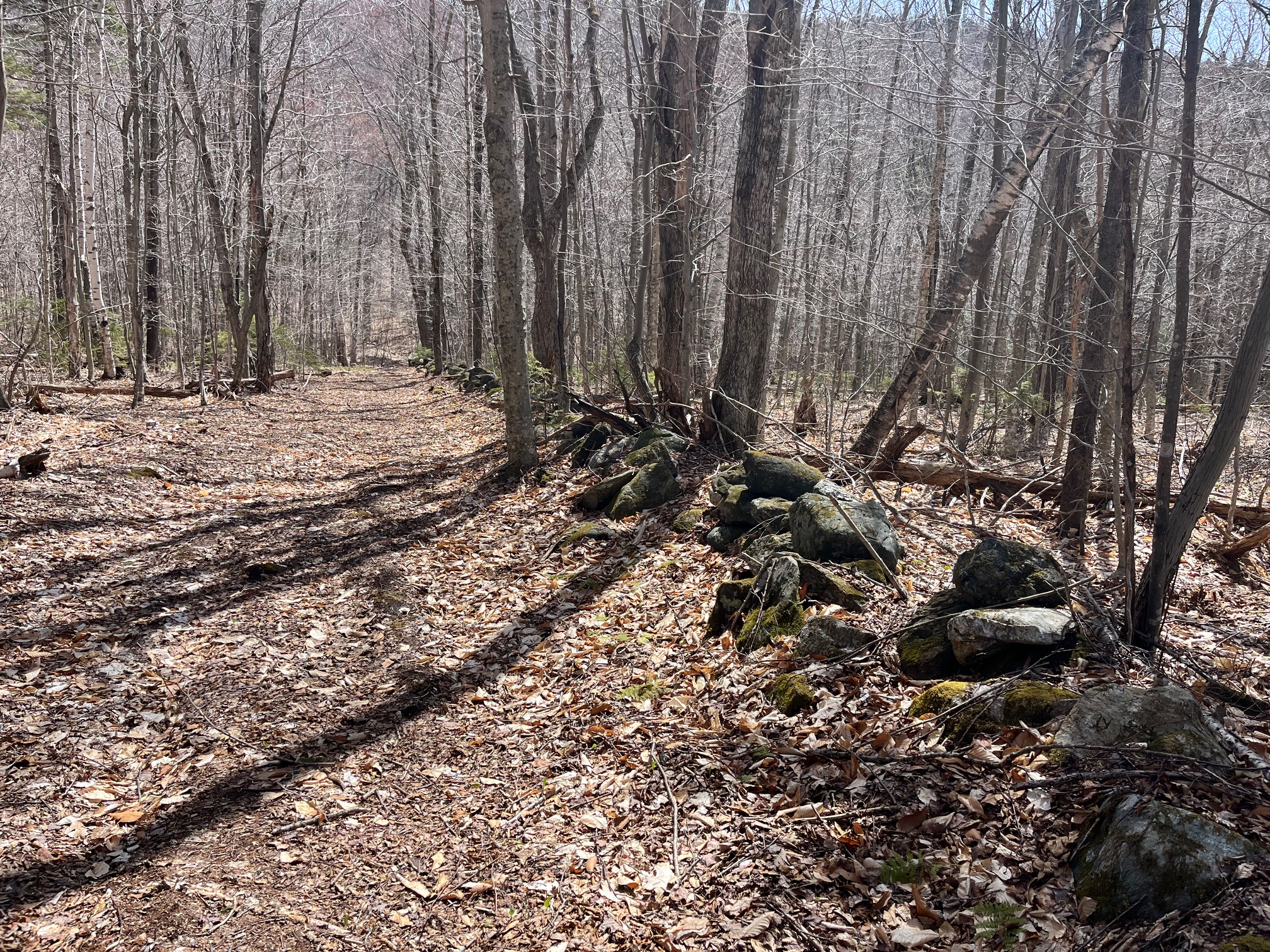
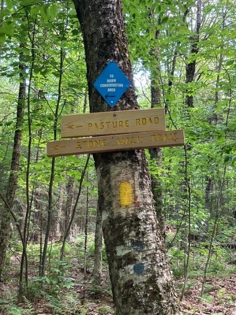
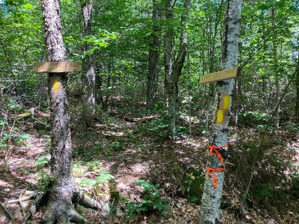
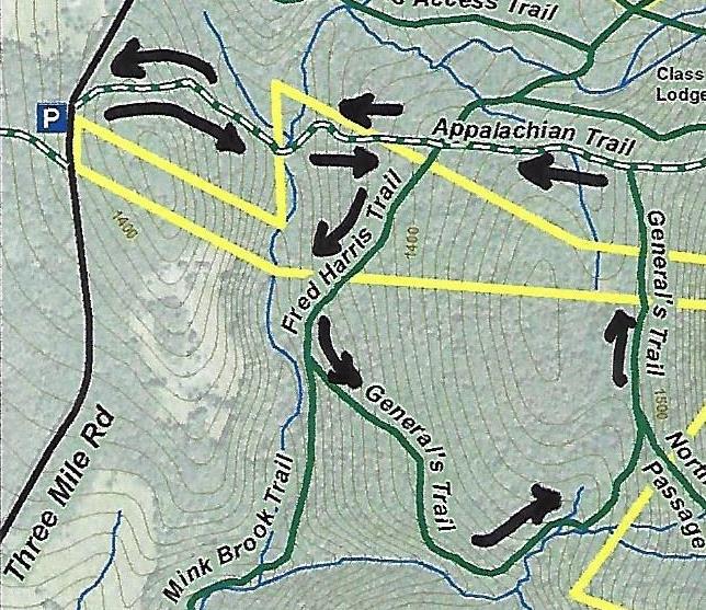
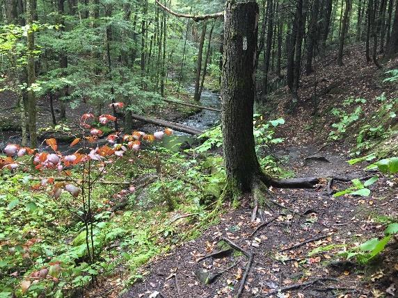
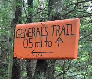
The trail initially has the look of an old woods road but soon narrows, offering gentle and comfortable hiking, unlike the often rooty and rocky AT. This trail was built in the early 1990s by a former owner of this property with the help of his boy scout troop. Why the “General’s Trail?” For a quarter century, it’s been the favorite daily hike of a neighbor who retired from the Air Force Reserve as a two-star general. When his friends and neighbors Peter and Kay Shumway met him often on the trail, they decided to name it for him on their Moose Mountain Lodge trail map. Recently, his daughter asked the Dartmouth Outing Club to make the orange signs as a special birthday gift.
  • Ten minutes from the orange sign, you arrive at an open grove of hemlocks – a good place for a snack. The trail swings L here to follow the rim of a steep valley, but before taking that turn, look over the escarpment to the brook far below.
  • "elbow" birchThe trail turns L past an “elbow tree” at R, a leaning yellow birch that lost its top and headed for the sun.
  • white fungi on log
  • Climbing gently up along the stream, the trail soon brings you to an up close and personal look at the tiny Mink Brook tributary. Cross it on impossibly green, luxuriantly mossy logs. You’ll soon encounter a few more “corduroy” log crossings. These places don’t look like much, but they are ecologically valuable. Headwater seeps, kept shaded and forested, serve as an important “sponge” in a downpour and start a stream off on its downhill tumble in the right fashion, cool and clean. Abundant moisture in the forest floor and a rich layer of duff support a fun and fantastic array of fungi.yellow fungi
  • white mushroom
  • The trail reaches the head of the little stream valley and follows the land’s contour as it heads north toward its junction with the AT. As the trail is less distinct here, it’s important to keep an eye out for the orange blazes; stay left at a fork. It’s hard to miss a jumble of pure white boulders of quartz.
  • yellow fungi by leaves20 minutes from the hemlock grove, a vertical white “US AT Boundary” sign appears on a white birch at L, and you know you’re getting close.
  • Three minutes later, arrive at the AT; note the orange “General’s Trail” sign.
  • Turn L and follow the famous path as it heads gently and pleasantly downhill.
  • What a difference thousands of feet per year can make! The AT treadway is well-worn but also well-loved, evidenced by some clever bits of trail work that carry the path over small drainages.
  • Five minutes after bidding the General goodbye, you return to the familiar four-way intersection with the Harris Trail. Cross it and continue straight on the AT.
  • Seven minutes from the intersection, the brook and bridge come into view. If you didn’t stop for a picnic at the hemlock grove, this is a great picnic spot too.
  • These waters and the rest of the Mink Brook watershed were part of a statewide study by Trout Unlimited and NH Fish and Game biologists in 2011. They found that “Hanover’s little Mink Brook and its tributaries showed a surprisingly healthy population of native Eastern Brook Trout.” They counted 213 brookies in 16 study sites and noted how important cold clean water is for this species. Almost 70% of the trout were found in five sites (including this one) with an average water temperature of 59.8 degrees. If you have such a stream on your property, what can you do to help brook trout? Keep a lush buffer of trees and shrubs to shield it from the summer sun.
  • Cross the bridge with its handrail and head back up and out the seven minutes’ hike to your car.

Please respect the generosity of these landowners by leaving no trace of your visit and enjoy the memories and photographs you take home.

9/2018, revised 1/2021


Filed Under: Hike of the Month, Moose Mountain, October, Shumway Forest Tagged With: Appalachian Trail

Moose Mountain Ridge Loop

August 1, 2019

Complete PDF


Moose Mountain loop mapDriving Directions

  • From Etna village, turn R onto Ruddsboro Rd
  • Follow Mink Brook as the road curves up its narrow valley for 1.5 miles
  • Turn L onto Three Mile Rd
  • After 1.4 miles, arrive at a big dip in the road with parking on both sides.

What You Should Know

  • Today’s hike, shown on the map above, takes you on a loop that visits the South Peak on a lesser known trail, cruises the mountain ridge on the Appalachian Trail (with optional 15-minute, 0.2 mi. visit to the Moose Mtn. Shelter) and returns on the historic Wolfeboro Road and the old route of the AT, the Harris Trail.
  • You’re about to visit lands owned by the federal government (permanently protected) and Dartmouth College (partially protected for the AT corridor) and the privately owned Shumway Forest, protected by the Hanover Conservancy in 2017.
  • Dogs are welcome if under your control; please pick up after your pet.

Hiking Directions

  • Begin your hike on Dartmouth land at the orange Dartmouth Outing Club sign that reads, “Parking/No Camping.”
  • Known as the New Fred Harris Cabin Access Trail, this blue-blazed, ½ mile trail was built by the DOC as a direct route to the college’s Class of ’66 Lodge (built on the site of the Fred Harris Cabin).
  • The trail is easy and rises gently to a plateau, passing through a long-abandoned sheep pasture. Here, saplings are creeping into the understory sheltered by towering pines above. Years ago, all these lands between the road and the mountain ridge were owned by Luther Brown.
  • Seven minutes’ walk from your car, the sound of water signals the approach to a main tributary of Mink Brook. At L, a rough stone wall marks the plateau’s edge and boundary of the old pasture.
  • The trail drops to a bridge over the brook. Look L upstream; the brook drains a rich beaver-influenced wetland just out of sight on the Shumway Forest.
  • The trail continues gently back up to a matching plateau on the E side. The forest is different here – less pine, more hardwood – belying a different history. Was this Luther’s woodlot?
  • 10 minutes’ hike from your car, reach the Harris Trail. An orange DOC sign hangs on a tree at R, facing the other direction and reading “To AT” and “To 3 Mile Rd & Parking,” indicating the path you just took. Across the trail junction is a wooden sign reading, “<- Harris Trail ->” placed by the Hanover Conservation Commission’s Trails Committee.
  • The Fred Harris Trail, former route of the Appalachian Trail, honors the Dartmouth Outing Club’s founder (1909). It offers wonderful skiing when conditions are right. The trail once ran from Moose Mountain Lodge Road N into Lyme, and can still be followed by an alert hiker. The AT was re-routed onto the Moose Mountain ridge in the 1980s.
  • Turn R onto the wide Harris Trail and head down to another brook. While there is no bridge, it’s easy to cross on stepping stones. Slow-growing hemlocks and yellow birch shelter the stream and hold the banks in place. At L, beyond the brook, a yellow blaze and white boundary sign signal the edge of the federal easement over Dartmouth land that protects the Appalachian Trail.
  • The Harris Trail continues on its gentle grade and an unmarked trail soon joins at L. This is the Ski Loop, a challenging ski trail built before the AT. Turn L here and head uphill for about 15 minutes. The trail is not blazed and because it is not used as heavily as the AT that parallels it nearby to the S, it is not as worn, but is not hard to follow.
  • The Ski Loop takes you gently but steadily up on an old cart path. Shortly past a fallen beech, the trail levels out and slabs L along the hillside.
  • 15 minutes from the Harris Trail, the sounds of falling water accompany your arrival at another trail junction. Signs on trees at L indicate the trail down to Dartmouth’s Class of ’66 Lodge. The stream you hear, which is the one you recently crossed below, provides the lodge’s water supply. At this point, you cross onto the Shumway Forest. More about that later.
  • Indian Pipe flowersContinue straight onto the Nat Thompson Trail which leads 1.1 miles from this junction up to the AT on the ridge. This begins as a wide, pleasant trail, re-opened a few years ago by the Dartmouth Outing Club. In midsummer, look for the ghostly white stems and downturned flowers of Indian Pipe (R), a saprophyte that relies on decomposing plants for its food as it has no chlorophyll. Shining clubmoss blankets the hillside at R.
  • 8 minutes from the Ski Loop junction, the Nat Thompson Trail approaches the stream at L; be sure to stay straight without crossing the stream and continue gradually uphill. The trail is irregularly blazed but easy to follow. Six minutes later, a log crossing carries the trail over a small drainage as you leave the Shumway Forest for federal land surrounding the AT. The trail swings NNE to make a wide easy sweep up to the ridge.
  • Hobblebush
  • Spring wildflowers have long since gone by, but sharp eyes will find the deep blue berries of blue-bead lily and the seed clusters setting on hobblebush viburnum. Some paired hobblebush leaves achieve lunch plate size; they will turn deep purple in autumn. The three-lobed leaves of goosefoot or striped maple, a small understory tree, can get even bigger.
  • 10 minutes from the log crossing, the trail swings R and becomes steeper as it climbs toward the South Peak. 5 minutes later, reach a fork and a sign directing you R toward the South Peak. 5 more minutes’ climb brings you out onto the open ledges of the 2293’ South Peak of Moose Mountain.
  • Time for a break! Enjoy the view out over Goose Pond below and, if it’s not hazy, across Canaan and far beyond. At this time of year, the rosy flower clusters of shrubby meadowsweet attract pollinators and dragonflies patrol the skies.
  • Beyond the summit sign, the path S of the clearing is the AT southbound, which would take you straight back to Three Mile Road about ¼ mile S of your car (and downtown Hanover, if you keep going). If a thunderstorm threatens, this is your best bet. But we’ve got much more to see today, so retrace your steps and strike N (path at L of ledges). In a few yards bear R on the AT northbound at a pair of orange signs, past the Nat Thompson Trail.
  • The white-blazed AT soon heads down into the saddle between the N and S peaks. The wind rising up both the E and W slopes plays in the trees overhead, keeping the bugs too entertained to bother you.
  • 13 minutes from the S Peak, a sign announces you’ve reached the Moose Mountain Shelter “FPA” (government-speak for Forest Protection Area). 5 minutes further, an orange sign indicates the shelter is 0.1 miles beyond Wolfeboro Rd. Just beyond is the historic road itself, rising up from the Tunis District to the E and quickly disappearing down toward Hanover to the W.
  • SHELTER STOP – You can visit this shelter with an easy out-and-back 0.2 mile, 15 minute hike, or if time is short, simply turn L and head down Wolfeboro Rd. To find the shelter, cross the Wolfeboro Rd and follow the AT northbound as it winds gently uphill for 5 minutes to a cheerfully illustrated orange sign at the shelter access path. Turn R here and within moments, the shelter comes into view at L. A bench of Aldo Leopold’s design rests on a nearby ledge, and must offer great views when leaves are off. Be sure to sign the ledger tucked by the shelter’s N wall. A lot of work by volunteers goes into maintaining places like this. Return to the Wolfeboro Rd the way you came.
  • Stand for a moment at the four-way junction of two of the most historic routes in New Hampshire. The 2,190 mile-long Appalachian Trail, proposed nearly a century ago, threads through a national park that spans the eastern seaboard from Maine to Georgia. Conservation efforts along its route have also protected valuable wildlife habitat and cool forests. The Wolfeboro Road, built 250 years ago when New Hampshire was still a colony of Great Britain, reached from the colonial governor’s home in Wolfeborough up and over this mountain to Hanover, a distance of 55 miles as the crow flies. Governor John Wentworth ordered its construction so that he could attend commencement at Dartmouth College, having assisted its founder, Rev. Eleazar Wheelock, in securing its charter from the King. Wentworth was an eager outdoorsman, relishing camping out with his road survey crew in the NH woods and leaving his wife at home to worry about decorating her new ballroom in the governor’s mansion.
  • This spot also marks an important watershed divide. All rain and snow falling E of where you stand on the AT flows into Tunis Brook, Pressey Brook, Goose Pond, and then to the Mascoma River. All that falls on the W side ends up in Mink Brook. Waters from each reach the Connecticut River, but by much different paths.
  • Wolfeboro road signIt’s time to head down. Take the Wolfeboro Rd W and down the mountainside for about 15 minutes. Adventure-seeking jeep drivers have created ruts in places, and the footing is wet for the first 5 minutes until you encounter rough gravel laid down by the Hanover Dept. of Public Works so emergency vehicles could reach the AT to assist injured hikers.
  • Along the way, imagine Governor Wentworth riding this rugged route to the Dartmouth Green. For more hiking on this historic road, see our Hike of the Month for June, Wolfeboro Road West.
  • 15 minutes from the AT, an old stone wall appears at L and you reach an open area at the bottom of the slope. You’re back in former sheep country! Continue straight, passing a chained-off drive at R. A few paces further, a metal gate comes into view at L and an orange sign just beyond indicates the Harris Trail. Walk around the gate and back onto Dartmouth land, following a woods road past a log landing and bearing R to re-enter the woods.
  • Here, the Harris Trail follows a gravel-surfaced woods road used to deliver supplies to the college’s Class of ’66 Lodge. After crossing a new wooden bridge, there’s a more natural surface underfoot.
  • Peter and Kay Shumway at table
    Peter and Kay Shumway after signing the Shumway Forest conservation easement, June 2017
  • Shumway Forest sign10 minutes from the gate, spot the green Shumway Forest sign at R. Peter and Kay Shumway (L), owners of the historic Moose Mountain Lodge from 1975 to 2018, purchased 313 acres on the mountain from a lumber company in 1986 to keep the land from being developed. In 2017, to permanently protect public access to its foot trails, they conveyed a conservation easement to the Hanover Conservancy.
  • A short distance past the sign, follow the Harris Trail as it bears R off the woods road. While the red and black DOC blazes have long since faded, the former route of the AT is easy to see. The forest is younger here than on the mountain ridge, punctuated with occasional massive white pines.
  • 5 minutes past the fork arrive at a junction where a trail at L heads over a footbridge to the Class of ’66 Lodge. Continue straight and soon the orange sign appears at R directing you back to Three Mile Road. You’ve now closed today’s loop. Bear R for the 10-minute return on the now-familiar path, over the wooden bridge, and back to your car.


Filed Under: August, Hike of the Month, Moose Mountain Tagged With: Appalachian Trail, goosefoot, hobblebush, Indian Pipe, meadowsweet, Wentworth, Wolfeboro Road

Baum Conservation Area and Moose Mountain

July 1, 2018

Baum Conservation Area – Full PDF


Baum area trail mapDriving Directions

  • From Etna Village, head N on Hanover Center Road
  • Turn R on Ruddsboro Road and continue to end on Route 4
  • Turn L on Route 4, drive 1.6 miles to Enfield Village
  • Turn L onto Maple Street; bear L at junction with May Street.
  • Drive 3.1 miles to the well-marked Baum Conservation Area entrance (1.7 mi. past Hanover-Enfield line).

What You Should Know

  • This is a hike for confident hikers with good trail skills. The trails are not the well-beaten paths you find at Balch Hill or the Appalachian Trail, which is part of the adventure. Bring a compass.
  • Some of the route follows grassy former skid trails; anticipate insect hitchhikers and do a tick check.
  • Foot travel only. Dogs welcome if under close control. You’ll pass prime porcupine habitat – we know from experience.
  • The route visits the Baum Conservation Area and the Dana Forest and Pasture Natural Area, parts of a 3,800-acre block of protected high-elevation wildlife habitat on Moose Mountain.

Baum area signHiking Directions

  • Begin your hike at the large triangular flat rock at the SW edge of the dirt parking area, after familiarizing yourself with the trails depicted on the posted entrance sign. You’ll be touring most of the 1.6 mile Blue Loop today, with a couple of additions.
  • To protect mountain wildlife habitat next to the Dana Forest and Pasture Natural Area and to offer public access to the trails you’ll be exploring, Dartmouth alumnus and outdoorsman Jim Baum and his wife Carol purchased this 239-acre area and gave the Town a conservation easement on the land. Jim worked with the Upper Valley Trails Alliance to improve the trails.
  • Start up through the trackless meadow, aiming for a point at 10 o’clock on the surrounding tree line. Soon a bare bit of smooth ledge appears with a small cairn to reassure you. Look for a yellow diamond sign with an arrow at the edge of the woods. Here, you bear R (not L) onto a mowed path.
  • An old skid trail turned hiking trail, the path soon begins to ascend gently but steadily, with mosses and herbaceous plants underfoot. Continue past a wide trail leading back down to the meadow. Shrubs such as a native honeysuckle and spiraea line the way. You can tell the soils here are moist, receiving subsurface water from upslope, as the path is carpeted with water-loving sedges. The curious fruiting body of the most common one looks like a pudgy green porcupine or blowfish. It looks prickly, but it’s not.
  • bracken fernAbout 18 minutes from your car, the trail bears R and levels out. A blue arrow confirms you’re on the Blue Loop. Waist-high bracken fern grows exuberantly. If a deerfly has discovered you, thwart it by joining the Order of the Bracken – pick a frond and wear it upside down on top of your head! Deerflies are programmed to swarm around the highest point of their prey – and will hover at the top of the fern stem.
  • 4 minutes from the blue diamond, look for yellow and blue diamonds on a tree at L. The trail swings L and moves through a thick young forest of pole-sized trees 1-3” in diameter. Grouse enjoy this habitat and you may suddenly flush one, startling both of you. Listen for the liquid notes of a wood thrush.
  • Another 4 minutes’ walk brings you to a clearing where a yellow arrow points L. You bear straight toward an opening filled with sun-loving, fragrant, hay-scented fern. Foresters don’t like this fern (or bracken) because it tends to quickly colonize forest openings, shading out any tree regeneration they encourage.
  • The trail moves gently up and curves L and R, ducking in and out of fern openings. As you ascend, now heading N, note the change in the woods. Here, older yellow birch and beech dominate the bony land. A few dips in the trail remind you that it was built as a logging trail with water bars to prevent erosion.
  • In 10 minutes, pass a pool teeming with tiny life. Just past it, the trail heads downhill.
  • Watch for a blue arrow on a small gnarled maple at L, directing you R as the trail gently curves.
  • The trail becomes narrower, with a few twists and turns, but if you trust your feet, it’s easy to follow.
  • 5 minutes past the pool, look for a junction with blue arrows pointing L and R. The Blue Loop heads R, straight downhill and back to the meadow and your car. We have more to discover, so look ahead for two orange diamonds at 11 o’clock. Head this way and cross a tiny drainage. This is a good place to look for wildlife tracks. Moose, bear, fisher, bobcat, fox, coyote, deer, porcupine, and squirrel are possibilities!
  • The trail has now transitioned to a more familiar woodland path. Follow the irregularly spaced orange diamonds, interspersed with blue flagging. In some places, blue diamonds are posted for viewing from the other direction. The trail moves gently and steadily up through mature northern hardwood forest.
  • 9 minutes from the last junction, a large bark-less, sun-bleached tree trunk has fallen across the trail. Pause to cross it and note an orange diamond on the L and just ahead, a constellation of signs. You have arrived at the Dana Forest and Pasture Natural Area, a 132-acre parcel owned by both the Town of Hanover and a member of the Dana family.
  • At this major junction, you have a choice –a 20-minute detour to check out two ledges (10 minutes if you just bag the first one) and soak in some views, or continue in the woods.

Optional Visit to Moose Mountain Ledges (1/3 mile each way)

  • view from the ledge just off the ridgeTurn L at the wooden sign and up a short steep section to a mossy ledge. This is part of the Orange Diamond Ridge Trail, built by a daring snowmobile club in the 1970s. The trail runs along the spine of Moose Mountain from Enfield to the South Peak, where it meets the AT. The Hanover Trails Committee has decided to rename it the Tom Linell Ridge Trail, after a dedicated long-time trail maintainer. The snowmobiles never returned.
  • Arrive at the first of two open ledges where views open up to the E. At 1 o’clock is the bony knob of Mt. Cardigan. Keep an eye on kids and dogs. A small cairn on the far side marks the trail’s return to the woods. Pass a nice colony of the small but stoic rock polypody fern.
  • Here, the Ridge Trail follows the boundary of two privately owned parcels – to the E is the Baum Conservation Area – you’re now following a trail that is parallel to but high above the one you just walked.
  • 5 minutes from the first ledge, arrive at the second, larger ledge, with even broader views. From the highest part of the open rock, you can see distant Mount Washington at 11 o’clock. At 10 o’clock, the ridge of Moose Mountain stretches N beyond the communications tower.
  • To return, look for pink tape on a tree to locate the trail back. It becomes clear you’re hiking the very spine of this mountain, a watershed divide, with the Mascoma River valley off at R and Mink Brook valley at L.
  • Return to the first ledge and follow a blue arrow to return to the trail junction.

Hike Continued

  • Back at the trail junction, retrace your steps to the fallen bare tree across the trail. Continue another 10 paces to a yellow sign at R for the Baum Conservation Area. At L, an orange sign with an arrow directs you to turn L onto the Ridge Trail, which appears as a smaller side trail.
  • Soon the Ridge Trail swings L and slabs along the contour before heading gently downhill. Note the bristly white pine at R that has received the attentions of pileated woodpeckers. The forest floor undulates with
  • the mounds and pits that betray long-ago blowdowns.
  • Pasture Road sign5 minutes after turning onto this trail, arrive at a junction. Bear R to follow orange flags, about 20 yards to a small hollow. Here an orange sign at L reads “Orange Ridge Trail” and at R, a white sign indicates “Pasture Road Trail.” Note the town’s blue and white trail blazes on a birch at L. This doesn’t look much like a road, but it follows, more or less, the route of a long-abandoned early “highway.”
  • Turn R to take the Pasture Road Trail, which is marked with blue-white blazes and occasional blue flagging. Here, the trail is uneven and narrow but well-marked.
  • stone wall corner
  • 6 minutes from the junction, you come upon a startling sight – the imposing corner of a stone wall with a yellow pin protruding from its base – boundary markers from the 19th and 21st centuries colliding. The wall is big and blocky and encrusted with lichen. It marks the northernmost corner of the Baum Conservation Area. After the terrain you’ve just been over, it’s hard to imagine building a wall to keep sheep here – especially a wall like this!
  • The trail continues L of the wall’s corner. Keep the wall on your R and a sharp eye out for painted blazes and blue flagging. The wall oddly ends, then after the trail twists near an outcrop, a section of wall appears again. There’s a nice growth of bunchberry and lowbush blueberry on the forest floor.
  • 8 minutes from the pinned wall corner, the trail parts company with the wall, which heads downslope. You continue straight, following blazes carefully. A short section of wall shows up again (what was the wall builder thinking?). Keep following the blue flagging and trust your feet.
  • 3 minutes later, bear R downhill onto a clearer path, down to a flat in a hemlock grove. Here, the trail bears R and is marked with simple blue painted blazes. Arrive at an opening with a dramatic view up to the ridge you may have just visited.
  • dog on trailThe trail continues on a narrow, rocky path for another 5-7 minutes arriving abruptly back at the Baum Conservation Area’s Blue Loop Trail, the now-familiar wide grassy path.
  • Turn L onto the easily followed trail and soon cross a streambed. Depending on recent weather, it may be dry, but it still has a watershed address! It’s an unnamed tributary of Lovejoy Brook, a tributary of the Mascoma River. We think it should be Baum Brook.
  • 10 minutes after joining the Blue Loop, cross another tiny stream. A path comes in at L – this leads to the Baum Cabin. Continue straight, head slightly uphill, and 2 minutes later you’re back at the meadow with your car in sight. As you head down to it, don’t forget to look for wild strawberries in the grass!

Note – Baum Cabin, 1/3 mile north of the parking area, is open to all by reservation with the Dartmouth Outing Club. Jim and Carol Baum gave the cabin to the DOC in 2008, thoughtfully including funds for its upkeep. The two-room cabin sleeps 6.

Learn More

  • Shumway Forest on Moose Mountain
  • Hanover Trails Committee maps
  • Baum Cabin


Filed Under: Hike of the Month, July, Moose Mountain Tagged With: bracken fern, polypody fern, sedge, views

Moose Mountain Lodge and Ledges

June 1, 2018

Hike information & map – full PDF

Driving Directionstrail map

  • From Etna Village, head N on Hanover Center Road
  • Turn R on Ruddsboro Road and drive 1.8 miles
  • Turn L on Old Dana Road
  • Turn R just past large red barn on R, onto Moose Mountain Lodge Road (not marked)
  • Drive 0.8 miles to top of road. Park at the marked trailhead parking area just past the beaver dam.

What You Should Know

  • Foot travel only. Dogs welcome if under close control.
  • Bring binoculars and bird book for viewing waterfowl on Mill Pond and exploring distant views.
  • This hike celebrates the  history of Moose Mountain Lodge and explores the wild ridge of the mountain. We will view the former Lodge site from an overlook; please note that the site is privately owned.
  • The route visits part of a 3,800-acre block of protected higher-elevation wildlife habitat on Moose Mountain.
  • The hike ends with an optional visit to protected 18th century mill ruins on the steep mountainside.

BRIEF DIRECTIONS

  • Begin at the sign reading “Mill Pond Forest & Huggins Trail Access.”
  • Bear L at first trail junction to visit Mill Pond
  • Return to trail junction and turn L onto Pasture Road
  • Turn R onto Baboon Bypass, cross drainage, and reach first views
  • Continue on trail to second pasture and third pastures and cross stone wall
  • Bear R at arrow, head downhill, and shortly after, turn L at arrow
  • Bear R at sign parallel to the trail indicating the Orange Diamond Ridge Trail. Head up a short steep section to a mossy ledge.
  • Continue to second open ledge.
  • Retrace your steps to return to your car.

Hiking Directions

  • Begin your hike at the sign reading, “Mill Pond Forest & Huggins Trail Access.” To forever ensure public access to the network of trails you’ll be exploring, the Shumway and Huggins families donated conservation easements on this area to the Hanover Conservancy in 2016.
  • Cross a small drainage and note the series of small beaver ponds at L. By late 2017, the beavers left after many years of entertaining their neighbors with sightings of cruising kits and evening tail slaps on the water, as well as plugged culverts and “free-range forestry.”
  • The thread of infant Mink Brook has reappeared with the lack of diligent management by these aquatic engineers.
  • Arrive at the first trail junction and bear L. Within 15 paces look for a cellar hole at L. This was the high-elevation c. 1800 home of miller David Woodward, who built the dam on Mill Pond and an impressive sawmill and gristmill on the steep falls of Mink Brook below where you left your car (optional visit at end of this hike). Woodward’s house was probably larger than the modest cellar hole, which, in the days of hand digging, must have presented a challenge to build.
  • 2 beavers in Mill Pond
    Mill Pond beavers; photo by Kay Shumway

    Continue on the path a few minutes further to a bench at the pond shore. It’s time for a picnic, or at least to pull out the binoculars! Ten-acre Mill Pond is the highest water body in Hanover and the primary source of Mink Brook, the town’s largest stream. Set in a saddle on the mountain ridge, it may have originally been a small pond or perhaps a marsh. Around 1800, Woodward built a drylaid stone dam (just out of view at L, beyond the spruces) to raise the water level some 6-8 feet (it has since partly silted in). Beavers later took over and have been managing the pond off and on, ever since. Today, the entire shoreline remains undisturbed: Hanover Conservancy easements protect the N side with the Dana Pasture Natural Area on the S (co-owned by the Town of Hanover and a Dana heir).

  • Directly across the water is an impressive beaver lodge. Scan the pond’s surface for waterfowl and other birds. On the day we visited, three male mallards were holding a bachelor party at the pond.
  • Retrace your steps to the cellar hole and trail junction. At this time of year, violets are in bloom on the forest floor and you may spot the cheerful red of partridgeberries.
  • A sign for Pasture Road and a green moose mark the trail junction. Turn L; soon you’ll see the old stone wall marking this Class VI road. Where Pasture Road once met Moose Mountain Lodge Road is anybody’s guess – our bet is the area under the beaver dam.
  • Pass by the first gap in the wall, which leads to a private home, and look for a second gap marked with a sign for “Baboon Bypass” a few yards beyond the wall. Turn R here. This short and somewhat indistinct trail leads W toward your next destination, across a small drainage. Blue sky appears ahead and an arrow on a barbed-wire-garbed tree directs you to swing L into an opening.
  • Arriving in an old pasture (first of three), leave the path and head through low brambles and blueberry bushes toward a big pine and two old fence posts. It seems all of central and southern Vermont is spread before you, with sharp-peaked Killington presiding.
  • It seems all of central and southern Vermont is spread before you, with sharp-peaked Killington presiding. For 80 years, just below the brow of this field, stood Moose Mountain Lodge, an icon in the Upper Valley and legend in the ski world. The Lodge is now history, having been removed in the last few years, but we’re going to tell you all about it!
  • overhead view of lodge in 1949
    Lodge, pastures, and ski slopes, 1949

    Let’s start with long-time owner Kay Shumway’s recollections: “The Lodge is a big old comfortable log building perched high on the western side of Moose Mountain. It has survived 80 years of snow, sleet, ice, wind, and lightning. The weather comes across the Connecticut River Valley and sweeps up the mountain, wearing away at the log surfaces like sandpaper. Sometimes the wind gets unbearable with its relentless buffeting. We often remark that it’s almost like living on a ship at sea.”

  • The Leslie brothers built the lodge in 1937-38. They were identical, inseparable twins – when one came to Dartmouth, the other had to come too! Bill Robes was teaching skiing then and the boys were hooked. Robes, who married into the Dana family, he said he knew of a place where they could build a ski lodge, and the rest is history.
  • The Lodge opened in 1938 for downhill skiing complete with rope tows and skiing on cleared slopes below. There was even night skiing on a lighted slope, which according to Kay was not too successful. The Lodge primarily served Dartmouth, housing college guests and students’ dates. Back then skiers careened down the mountain’s sunny west slopes on wooden skis. The road up to the Lodge was part of the adventure. Most who arrived by car parked at the base of the mountain and used a crank telephone to summon the Lodge’s Ford woody station wagon for a ride up the hill.
  • From 1943-45, the Lodge closed as gas rationing during WWII curtailed driving for pleasure and cut off fuel for the tows. It reopened from 1946-49 but was soon empty and vandalized. In 1955, Bob Jones bought the abandoned Lodge and nearby cottage as a boys’ summer camp. Camp Moose Hi ran for three years until Agnar and Anah Pytte bought the Lodge and Elisha and Anne Huggins the nearby cottage. John and Mary Clarke acquired the Lodge in 1972, turning it back into an inn for cross-country skiers and cutting some of trails we still enjoy today.
  • view of lodge in winter
    The Lodge in 1975

    Three years later, Peter and Kay Shumway visited in a snowstorm. At the time, Peter was in the lumber business in New York and Kay taught in a Head Start program. Peter’s father had been a ski jumper at Dartmouth (Class of 1913) and when he and some friends skied the 25 miles to Mt. Moosilauke, people would stop them and ask what they had on their feet. The Shumways happily bought the Lodge and it continued to host in the back country skiing tradition.

  • The Shumways welcomed guests for the next 35 years, retiring in 2011. Kay recalls, “Inn-keeping on our beautiful mountain allowed us to live in this peaceful place in isolation while still meeting interesting people.”
  • In 1985, the Shumways purchased a 313-acre mountain tract just N of the Lodge to keep it from being developed. Their forester, John O’Brien, helped them return its forest to health after prior heavy logging, always with an eye to ski trail potential. In 2017, these public-spirited landowners conveyed a permanent conservation easement on the Shumway Forest to the Hanover Conservancy, protecting public trail access and high elevation wildlife habitat forever. We celebrated with the entire Moose Mountain Lodge family and many friends on a sunny Saturday in July.
  • Peter and Kay Shumway at table
    Peter and Kay Shumway after signing the Shumway Forest conservation easement, June 2017

    The lodge interior was even more wonderful than you imagine. Log ceiling beams, a sunny comfortable living room filled with rustic handmade log furniture, Kay’s baby grand piano, and drifts of hand-dyed wool for her spinning projects surrounded a huge cobblestone fireplace that featured a granite millstone above the hearth (more on that later). The dining room spanned the NW side, with another fireplace and a handmade dining table so long you can just imagine hungry guests gathering around it after a great day on skis. Behind was an efficient yet delightfully old-fashioned kitchen with everything close at hand, including Kay’s own Moose Mountain Lodge recipe book. On the N side was the ski shop with rows of skis hanging from a rack, ready for waxing.  A welcoming porch spanned the entire W side, with log settees beckoning you to relax and take in the breathtaking view and spectacular sunsets.

  • Up the stairs under the watchful eyes of a mounted moose head you’d find a warren of cozy guest rooms with log beds, some made by Kay and Peter themselves. Down the hill were a large fenced vegetable garden, goat shed (Kay kept Angora goats for their fleece), and small sugarhouse.
  • Now it’s time to enjoy some of the trails the Shumways and their former neighbor, Elisha Huggins, long maintained. Return to the path and continue uphill to a second, smaller clearing adorned by white birches. Follow the path back into the woods, guided by small wooden arrows. Soon you’ll arrive at a third pasture, the largest of all. Head uphill toward a moose sign with orange highlights posted on a birch.
  • These pastures, occasional clumps of juniper, and the fragments of barbed wire on fence posts recall the land’s history as the Dana Farm’s summering grazing grounds. The Dana family farmed this area since the late 1800s. Today, the red barn still stands on the E side of Old Dana Road and the early white farmhouse migrated from its original site across the way to the hilltop above. Into the 1960s, the family drove their cattle up the mountainside to graze here during the summer. After grazing stopped, Elisha Huggins kept the pastures open for skiing and views, using a hand scythe!
  • A low stone wall among the birches marks the boundary with private land. Continue S toward a large ash bearing an arrow pointing R. After a short downhill, another arrow + moose sign directs you to turn L. Take the path through the woods a short distance to a trail junction.
  • A sign at R, parallel to the trail, indicates the Orange Diamond Ridge Trail. Bear R and up a short steep section to a mossy ledge.
  • Ten minutes’ walk from the last pasture, you arrive at the first of two open ledges and views open up to the E. Keep an eye on kids and dogs. A small cairn on the far side marks the trail’s return to the woods.
  • Here, the Ridge Trail follows the boundary of two privately owned parcels – to the E is the Baum Conservation Area, owned by a local Dartmouth alumnus with a keen interest in trails and conservation. Pass a nice colony of the small but stoic rock polypody fern.
  • view of people on ledgeFive minutes from the first ledge, arrive at the second, larger ledge, today’s turn-around point. Time to corral kids and dogs and pull up a stony seat among the lowbush blueberries to drink in the view (and some water). At 1 o’clock is the bony knob of Mt. Cardigan. If you stand on the highest part of the ledge, you can see distant Mount Washington at 11 o’clock.
  • At 10 o’clock, the ridge of Moose Mountain stretches N beyond the communications tower. From here, you get a fine view of the mountain’s E profile and realize that, like Holt’s Ledge and so many others in New England, it is a roche moutonnee or sheepback, shaped by the passing of the glacier. The glacier abraded the NW side and plucked rocks from the opposite slope as it ground its way from NW to SE. In this view, dark patches of evergreens to the R of the tower mark the steep SE side.
  • To return, pink tape on a tree helps you locate the trail back. It becomes clear you’re hiking the very spine of this mountain, with the Mascoma River valley off at R and Mink Brook valley at L.
  • Returning to the first ledge, admire the view of Cardigan before continuing on, following a blue arrow.
  • At the trail junction, yellow signs point R to the Baum Conservation Area (to explore another day). You turn L to retrace your steps toward the pastures.
  • At a bent yellow birch, a sign at L directs you to turn R; shortly after you’ll turn L at another arrow. Soon you’re back to the birches and the upper Dana pasture. In June, white five-petaled strawberry flowers decorate the ground under your feet.
  • Continue gently downhill to the last pasture, above the site of the Lodge. See if you can spot the white hamlet of Hanover Center in the distance, to the R. You can see why this village never fulfilled its intended destiny as the hub of Hanover – it’s on a hilltop and there’s no running water!
  • Take the path back into the woods – avoid the trail that comes in at L from a private home – and return to Pasture Road. Turn L past the stone wall and then L again at the junction by the cellar hole. Ten minutes from the last overlook, you’re back at your car.

Optional Mill Site Visit (10 minutes)

  • mill ruins by streamHidden in the woods are remains of a late 1700s saw and grist mill. They are very close by but invisible unless you make the short scramble through the woods to see them.
  • Walk back down Moose Mountain Lodge Road to a telephone pole opposite the gated entrance to the tower right of way. Turn L and bushwhack back the short way to the stream. You’ll soon pick up an old cart path on the near side. Take this down along the brook, admiring the cascades, to a series of angular piles of rock. Towers rise on either side of the brook. More can be seen farther downstream.
  • We marvel at how David Woodward managed to build these structures in such a steep ravine around 1800, his only tools likely being a pair of sturdy oxen, ropes, a chisel, and a native understanding of physics. In his 1982 anthropology paper, Dartmouth student Tom Slocum suggests that Woodward used the cubic
  • blocks of native schist to build an undershot-type mill that most likely functioned to saw wood and grind grain. Water stored in the pond above could be released to provide enough flow to operate the mill. At some point in its history, the mill operated only during the spring freshet and only as a sawmill.
  • The 1930s builders of Moose Mountain Lodge found their fireplace ornament here amid the ruins of Woodward’s mills. These historic sites are now specifically protected from further disturbance by the Hanover Conservancy’s Mill Pond Forest conservation easement.
  • Continue down the brook-side cart path to the last set of ruins. The path appears to end here; retrace your steps to return to your car.

Revised 10/2020

Filed Under: Dana Pasture Lot, Easements, Hike of the Month, History, June, Mill Pond Forest/Huggins Trail Access, Moose Mountain, Views Tagged With: beaver, grist mill, wild strawberry

  • 1
  • 2
  • Next Page »

Thank you for your support!

Our generous members and Corporate Conservators help make all of this possible. If you’re a customer of  our local business supporters, please let them know their contributions are appreciated!

71 Lyme Road
Hanover, NH 03755
(603) 643-3433

info@hanoverconservancy.org

Facebook logo   Instagram   YouTube

Get Involved

Become a Member

Volunteer

Business Sponsors

Conserve Your Land

Employment

Our Mission

Advocacy

Conservation

Education

Stewardship

Explore Hanover

Hanover Hikes

Upcoming Events

Upper Valley Hikes

Trails Challenge

Copyright © 2023 Hanover Conservancy | Design by Chase Brook Software