Hanover Conservancy

Facebook logo   Instagram   YouTube          
Donate button
  • Home
  • About Us
    • Celebrating 60 Years
    • What We Do
      • Advocacy
      • Conservation
      • Education
      • Stewardship
    • Board & Staff
    • Membership Benefits
    • Contact Us
  • Get Outdoors
    • Hanover Lands
      • Balch Hill Natural Area
      • Mink Brook Nature Preserve
      • Other Properties
    • Hanover Hikes
    • Hanover Trails Challenge
    • Upper Valley Hikes
    • Exploring Nature at Home
    • Hunting
  • Events
    • Calendar
    • Spring Wildflower Scavenger Hunt
    • Private Events
  • Get Involved
    • Donate
    • Volunteer
    • Adopt a Trail
    • Corporate Conservators
    • Planned Giving
  • Education
    • School Programs
      • KAST
      • Connecticut River Studies
      • Hanover High School Scholarship
    • Request a Field Trip or Speaker
    • Research on Our Lands
    • Hanover History
    • Resources
  • News
    • Remembering Bob Norman
    • Reports & e-News
  • Conserve Your Land

Trescott Trails: Knapp Road & Ascutney View

March 1, 2016

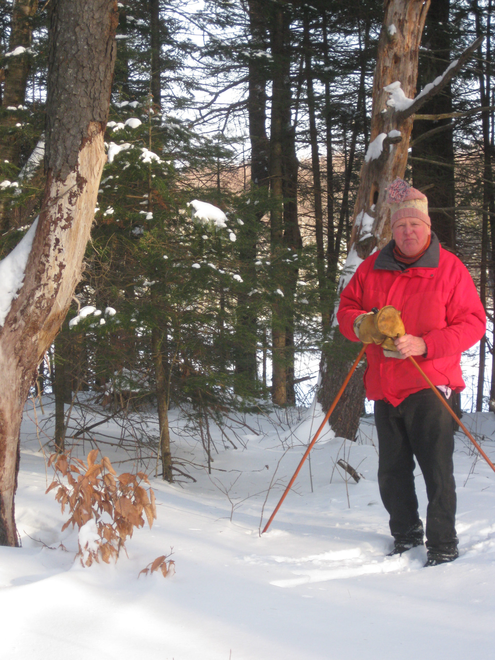
HIKE DIRECTIONS – full PDF

Driving Directions

  • From Downtown Hanover and the Green, drive east onto East Wheelock St. and up the hill 1.7 miles to the junction of E. Wheelock, Grasse, and Trescott Rds. The Balch Hill trailhead will be at L.   Bear R to continue on Trescott Rd and drive 1.2 more miles to a sharp bend and the Trescott gate.
  • From Etna village, turn W onto Trescott Rd and drive 1.3 miles to the Trescott gate at bend in road.
  • Park at the marked trailhead parking area. Please do not block the gate.

What You Should Know

  • Trescott Water Supply Lands logoThis is the perfect hike for Mud Season, when most trails can be too soft and vulnerable as frost leaves the ground.
  • Welcome to your water source! Drinking water for much of Hanover and for Dartmouth College comes from these lands, so special rules apply for recreational use.
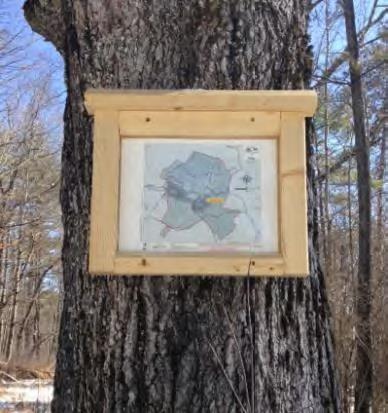
  • Check the kiosk display to acquaint yourself with these rules and pick up a trail guide.
  • Dogs are welcome but must be leashed at all times; please pick up after your pet.
  • You may encounter forestry vehicles; they have the right of way.
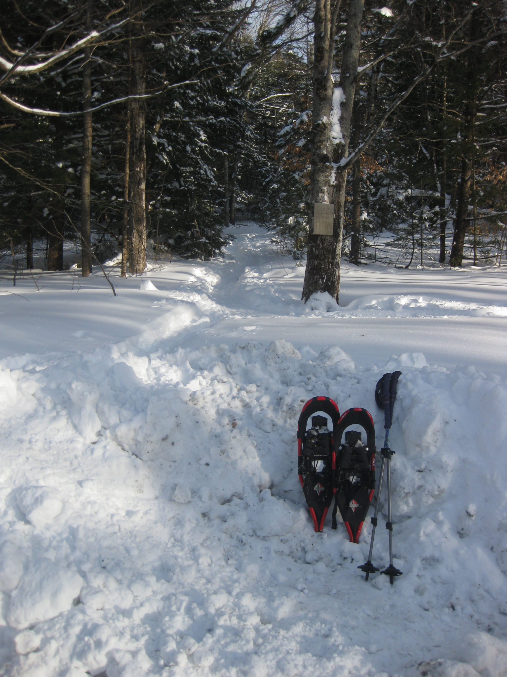
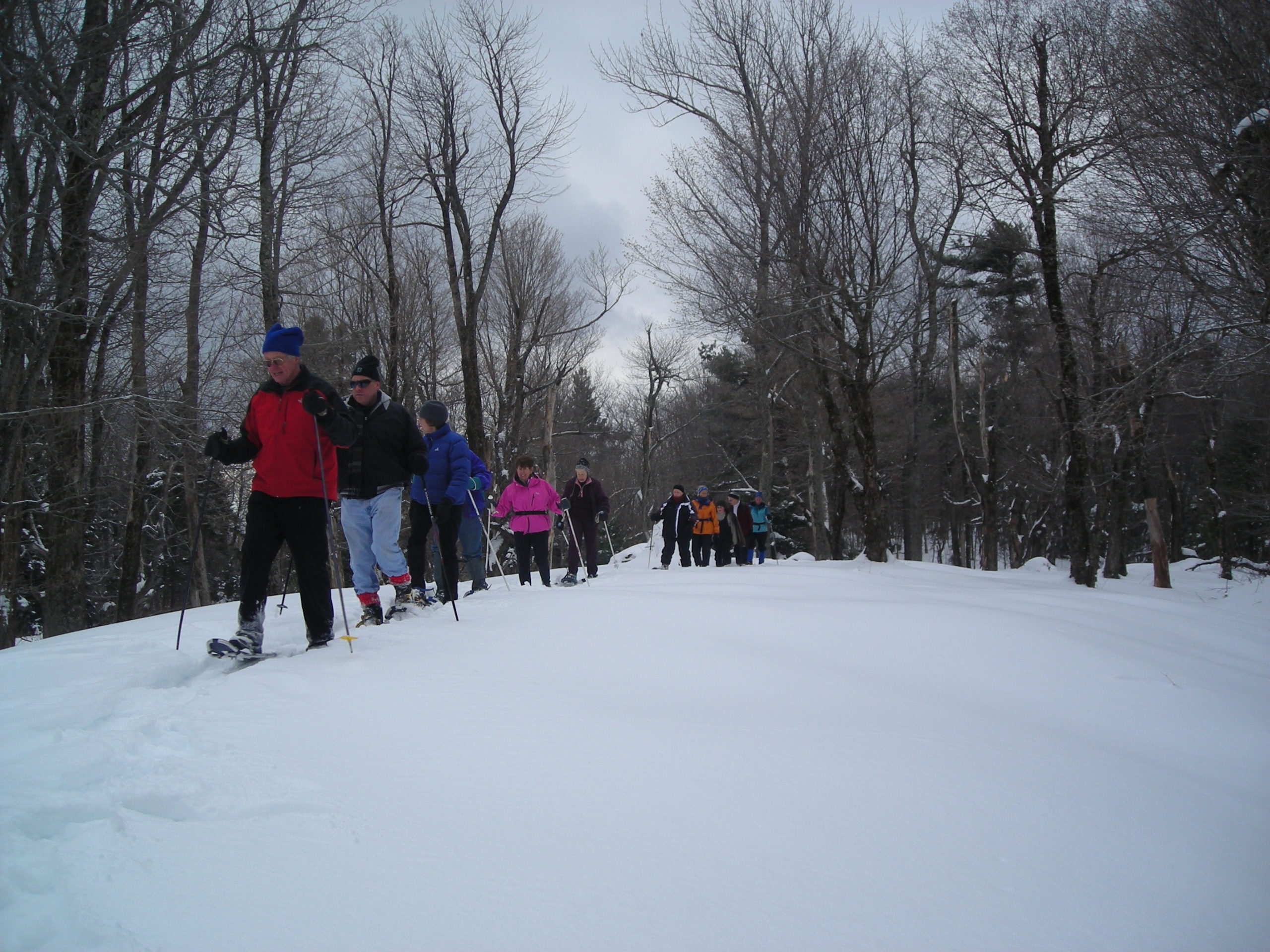
  • Plan on 1 ¼- 1 ½ hours; longer if you spend time enjoying the views.
  • Many hiking routes in the Trescott lands make use of historic and/or logging roads.

Knapp Road map

Brief Hiking Directions

  • Take the short path at R of the kiosk to reach Knapp Road
  • Turn L on Knapp Rd and walk past Parker Reservoir, the Four Corners, and up hill to a junction where the road flattens out.
  • Turn L and soon L again on a path through a pine plantation to the viewpoint.
  • Return the way you came.

Full Hiking Directions

  • After visiting the kiosk, take the short path to the R that leads around the fence. This takes you to Knapp Road, where you turn L to begin your walk. Laid out on Nov. 13, 1793, the road named for Lt. Peter Knapp of Hanover’s Revolutionary War-era militia. You will pass the site of his homestead.
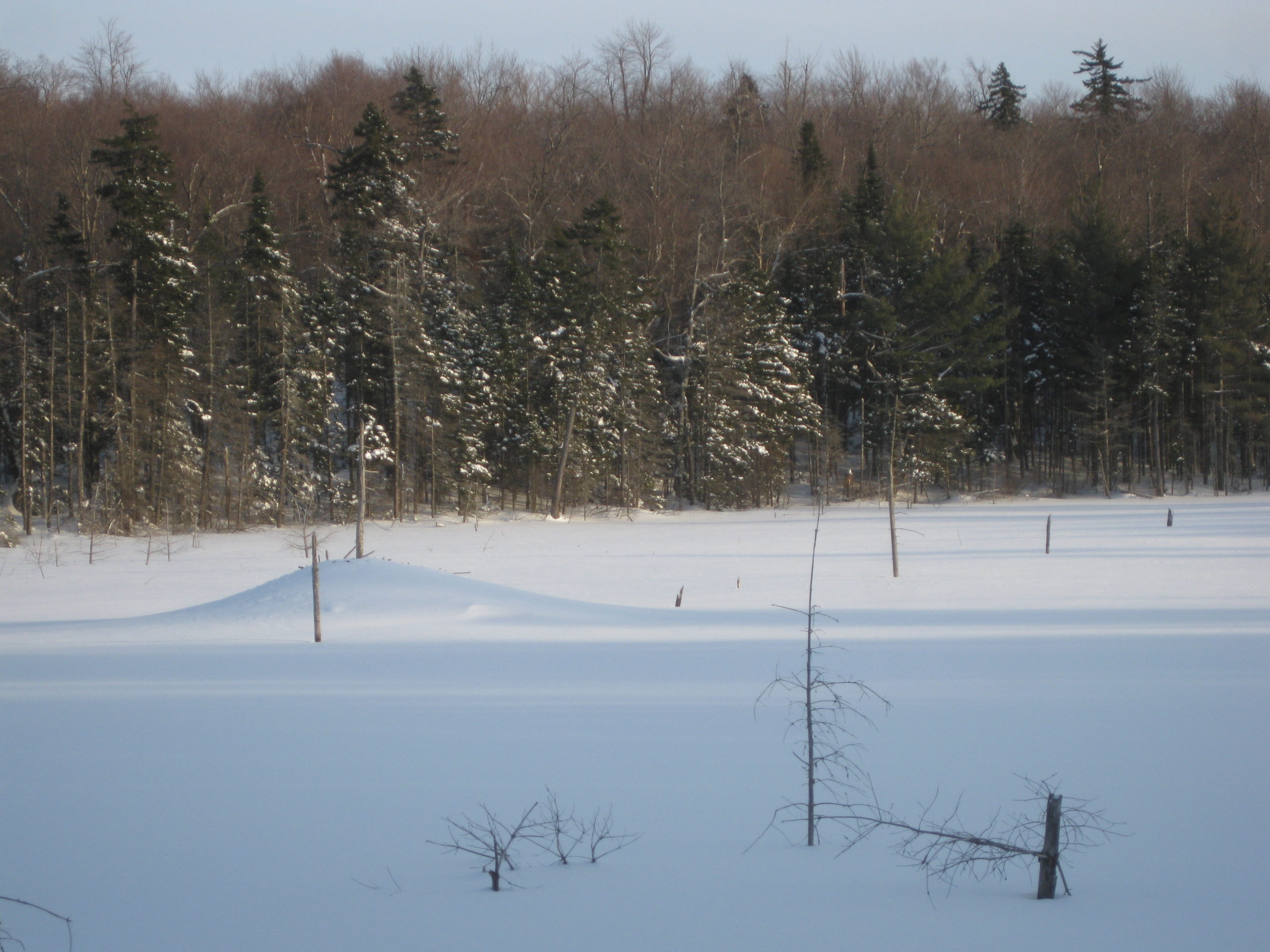
  • After 5 minutes’ gentle downhill walk, Parker Reservoir comes into view. A sign at the road’s edge asks you to remain on the road as you walk through the reservoir’s 250’ protective buffer zone. To safeguard the water supply, the public (dogs included) is not permitted within 250’ of the water (or ice) except on Knapp Road. State law protects these waters.
  • Built in 1924 by damming Camp Brook, Parker Reservoir is the second in a string of three reservoirs that collect water to send to Hanover homes. The oldest and lowest is Fletcher Reservoir, near Reservoir and Grasse Roads. Together, they hold 425 million gallons of water. The third is the Hanover Center Reservoir, in the Mink Brook watershed. Its water is diverted to flow into the Parker Reservoir.
  • From this point, look ahead for an open area on the hillside above. This is your destination.
  • Continue on Knapp Rd below the earthen dam and cross Camp Brook. Note the semi-circular stone structure on the R, part of the early earthworks. An interpretive sign nearby illustrates the dam’s construction and explains forest management to protect water quality.
  • Camp Brook flows out of a concrete spillway in the earthen dam near some venerable maples. One wonders if these might once have been dooryard trees for a farmhouse that once stood nearby. All structures of the ten farms that once existed on this land were removed by 1912.
  • Continue on Knapp Rd; 15-20 minutes from your car, you’ll reach Mason’s Four Corners. Look for a sign posted on a tree at R indicating your location (photo at R)
  • Occasionally serving as a log landing, the Four Corners was once a major intersection. Here, the historic Wolfeboro Road crosses Knapp Road. Colonial Governor John Wentworth proposed this road in 1770 so he could attend commencement exercises at Dartmouth College. He and his party supposedly traveled it from his home in Wolfeboro in 1772. The historic road is easily viewed looking W; to the E, it is obscured by brush.
  • #4 Schoolhouse building
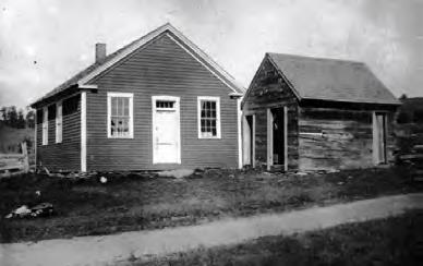
    #4 Schoolhouse; Knapp Road in foreground

    At the NW corner of this intersection stood the one-room District #4 schoolhouse (1807). Lt. Knapp’s home (c. 1793) stood across the way on the NE corner. Knapp was one of three school district commissioners for District 4. You can find the remains of his house’s cellar hole by looking (carefully!) through the brush.  By 1855, J. J. Mason lived here, followed by Charles Mason by 1892. The 160-acre Mason Farm had a 100-tree apple orchard and 200-tree sugarbush. Mason also kept 12 dairy cows and 70 Merino sheep. The water company purchased his farm by 1903 for $4000.

  • After imagining the busy neighborhood that once existed here, continue up Knapp Rd. In a few minutes another sign at R marks the Poor Farm East Trail to Dogford Rd.
  • Continue up Knapp Rd and reach the top of a small rise. Look for a cellar hole at R among a clump of trees near a large maple. Views are beginning to open up.
  • The Town Poor Farm stood not far from this spot, on the W side of Knapp Road. Several large foundations, a well, and a curious piece of farm equipment can still be seen. In 1840, the Town of Hanover purchased the James Tisdale Farm for $4250 to provide a place where the community’s orphans and other unfortunates could live and work to help support themselves. Unlike other towns, Hanover did not send its poor to the Grafton County farm when it opened in 1864, keeping this farm operating until 1903, when it was sold to the water company for $4000. Interpretive signage provides more insights into the farm.
  • Is your dog still on its leash? Give yourself a gold star and know that there are porcupines nearby.
  • Having caught your breath, continue your march up Knapp Rd. The road is lined with stately old maples, but the hillsides beyond are partly open and are being replanted. These lands experienced major blowdowns during the 2007 Patriot’s Day Windstorm. Two million board feet of logs and 3,100 cords of pulp were salvaged. This storm hit heaviest in the plantations, leaving natural stands largely unaffected.  The forest management plan calls for moving toward more natural, uneven-aged stands rather than even-aged plantations, although some spruce plantations have recently been planted nearby on the hillside.
  • Knapp Rd now climbs more steeply. Pass over two sets of grates covering water diversion channels to protect the steep road from erosion and protect the reservoirs below from sediment. The grates were paid for with a grant from the USDA Natural Resources Conservation Service.
  • Note the stone walls that follow the road in this area. The small size of the stones used to build them is a clue that the nearby land was cultivated at one time. One imagines the Poor Farm’s residents picking stones from among their potatoes and adding them to the walls.
  • At a little over half an hour from your car, Knapp Rd levels out. Look for a sign on a tree at 11 o’clock. Before heading to the hike’s big reward (the view!) take a moment to visit another historic site.
  • Continue straight on Knapp Rd for 90-100 paces toward a log landing. About 20 paces off the road at R in the woods is another cellar hole. This one is L-shaped.
  • Return to the intersection and turn R (west), taking care to stay on the road, not the skid trail at R.
  • After about 100 paces, turn L toward a gap in the pines.
  • Walk a short distance through a pine plantation, being thinned. The path brings you to an open hillside with dramatic views. We suggest taking a few steps to the left into the field for the best view, taking care not to trample young red pines.
  • The panorama before you is among the most beautiful in Hanover. Far below is Parker Reservoir; you can pick out Knapp Rd curving around on the SW side (your route back to your car).
  • Mt. Ascutney dominates the scene, of course.  At R in the near distance is Velvet Rocks. Ski areas in Vermont are also visible farther west.
  • Resolve right now to return in mid-October! The many sugar and red maples in this scene put on their own spectacular show at that time of year.
  • After you’ve inhaled the view, return the way you came.
  • Walk back up through the plantation and turn R on the far side of the pines
  • Turn R again onto Knapp Rd. As you walk down the hill, enjoy views of some of Etna’s surviving high fields and pastures, visible at L. These are remnants of the much more open landscape of the 19th and early 20th centuries, when the native northern hardwood/white pine forests had been cleared for agriculture and thousands of sheep, later cattle, grazed on these hills. In the days before the Civil War, Hanover was one of the four top sheep towns in NH (with Walpole, Lyme, and Lebanon).
  • Knapp Road takes you past Parker Reservoir and back to your car.

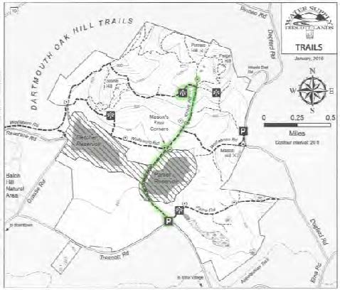
Learn more about the Trescott Water Company Lands  and download the most up to date trail map.

March 2016, revised July 2020


Filed Under: Hike of the Month, March, Trescott Tagged With: cellar hole, Wolfeboro Road

Mill Pond Forest & Dana Pastures

February 1, 2016

HIKE DESCRIPTION & MAP – Full PDF


Driving Directions

  •  From Etna village, turn R onto Ruddsboro Road
  •  Follow Mink Brook as the road curves up its narrow valley
  •  Pass Three Mile Road
  •  At 2.0 miles from Etna, turn L onto Old Dana Road
  •  At 2.4 miles from Etna, turn R onto Moose Mountain Lodge Road just past the historic Dana Barn
  •  Head up Moose Mtn. Lodge Road 0.9 miles to its end
  •  Bear R at a fork and park at the marked trailhead parking area. Please do not block driveways to the two neighboring homes.

Two Options

  •  ½ hour easy visit to the pond, pastures, and views, retracing your steps
  •  1-hour relatively easy loop, with visit to the three Dana pastures, exceptional views, and tour around the pond

What You Should Know

  • Hiking times are approximate.
  • Foot travel only. If there are ski tracks in the path, please walk beside rather than in them.
  • Dogs are welcome if under your close control; please pick up after your pet and do not allow it to chase wildlife. Porcupines are active.
  • Hunting is permitted in season.
  • You will visit both the 18-acre Mill Pond Forest and 313-acre Shumway Forest, privately owned and protected with conservation easements held by the Hanover Conservancy, and the 66-acre Dana Forest and Pasture Natural Area, owned jointly by the Town of Hanover and a private citizen and managed for conservation purposes.

Hiking Directions

For both options: Begin at the trailhead sign for Mill Pond Forest and Huggins Trail Access. You are standing on privately owned property that was conserved in November, 2015 with the Hanover Conservancy.

  • In 2015, the Shumway and Huggins families generously donated a conservation easement on this area to the Hanover Conservancy, to ensure that the public would always have access to the trails you are about to visit and to protect water quality and an early mill site on Mink Brook.
  • The trail moves past a series of pools in Mink Brook. Depending on whether beavers are active, this area can be some of the best evidence in town of a beaver’s construction skills. Cross a small drainage to reach the Dana Pasture Natural Area, jointly owned by the Town of Hanover and a private heir of the Dana family.
  • After two minutes’ walk, you’ll arrive at a fork. Bear L for a quick visit to the pond shore.
  • Just past the fork, you’ll see the c. 1800 cellar hole of the Woodward home at L. David Woodward was a miller who built a stone dam at Mill Pond and a saw and gristmill on Mink Brook as it tumbles down the mountainside beyond where you parked.
  • Continue on this short path to the shore, where you’ll find a bench at the water’s edge. At this season, little seems to move, but it’s a great place to look for waterfowl when the pond is clear of ice. Woodward’s stone
    Kay Shumway visits Mill Pond

    dam is just out of sight at L. Across the pond, a low mound indicates a large beaver lodge that was occupied until 2018.

  • Return to the cellar hole and trail junction, turning L onto Pasture Road, a very old Class VI road, marked with  a wooden sign posted on a pine, with another green moose sign nailed below.
  • Follow Pasture Road for about 2 minutes, following a handsome stone wall.
  • Two minutes from the trail junction, look for a break in the wall and trail at R, marked just beyond the break with wooden signs reading “Baboon Bypass” and a green moose. Watch for real moose sign as you venture out today –there’s a reason for Moose Mountain’s name! You may also see tracks of wild turkey, grouse, bobcat, porcupine, fisher, fox, coyote, and of course, deer.
  • Turn R, head up the path; cross a small drainage, and bear L as the trail swings toward an opening. Here, the promise of views lures you off the path. Walk about 35 paces to the edge of a drop-off and an old fence post silhouetted against the sky.

    Moose Mountain Lodge
  • Suddenly the world opens up to a stunning vista that stretches to the spine of the Green Mountains of Vermont. Killington and Pico peaks dominate the horizon. At your feet once stood Moose Mountain Lodge. Built in 1937-8 for skiers, the Lodge had a long and colorful history until it was demolished in 2019 by new owners. Learn more at hanoverconservancy.org/lands/easements/mill-pond-forest/ 
  • Please do not go beyond the fence posts and remnants of barbed wire on the property boundary; they remind you that this was one of the Dana family’s summer pastures for young cattle.
  • After you’ve inhaled the view, return to the trail and continue gently up the hill along the tree line toward a second pasture, following occasional orange flagging.
  • Continue uphill toward the third and highest pasture.
  • Note barbed wire fencing and clumps of juniper on L, more signs of the land’s grazing history.
  • Elisha Huggins leads a Conservancy snowshoe trip down through the third pasture

    Head up the gentle slope to a line of white birches that marks the southern boundary of the Dana Pasture Natural Area. After cattle were no longer pastured here, these meadows were kept open for years by neighbor Elisha Huggins, who mowed them with a hand scythe. Today, these openings offer fine wildlife habitat, especially in early summer when lowbush blueberries offer food for bears and many kinds of birds.

  • At the top of this pasture, you can extend your hike by continuing south on the orange-blazed Ridge Trail to ledges that offer remarkable eastern views. Today, we’ll return to Mill Pond.
  • Retrace your steps for 10 minutes through the three pastures and back to Pasture Road, all the way to the stone wall. (A path to the L after the last pasture, well before you reach the wall lining the road, leads to a private home).
  • At Pasture Road, turn L to return to your car (5 minutes) or take the ½ hour loop around Mill Pond.

For the pond loop:

  • Turn R on Pasture Road and immediately L.
  • Follow this path as it meanders among the spruce a short distance from the pond, keeping the pond on your left. You’ll cross small drainages that feed the pond; step carefully.
  • In about 10 minutes, a short spur to the left leads to the shore; bear R up the hill to a junction marked “Orange Diamond Trail” just visible ahead. A short distance above the pond, northern hardwoods take over for the red spruce and hemlock that cling to the water’s edge where cold air settles.
  • Turn L to continue on the Pond Loop. In a few yards you’ll step off the Dana Pasture Natural Area and onto the privately-owned Shumway Forest.  In 2017, the Shumway family conveyed a conservation easement to the Hanover Conservancy on 313 acres to protect wildlife habitat and public access to the network of trails on Moose Mountain, many of which they maintained for the public and for guests at their Moose Mountain Lodge. The Forest is now under new ownership, but the conservation protections will remain in place forever.

    snow-covered beaver lodge
  • Follow the Pond Loop Trail N for about 7 minutes to the gravel road that serves a nearby communications tower. The trail is not frequently blazed in this area. Keep the pond on your left.
  • Turn L on the tower road and walk down it along the north shore of the pond. Other than vehicles servicing the tower or those involved in forestry, no vehicles are permitted on this road.
  • After 5 minutes, reach a gate and turn L onto Moose Mtn. Lodge Road to return to your car.
  • Peter Shumway pauses by the pond

    Send a silent message of thanks to the generous landowners who made your visit possible!

February 2016, revised January 2021

Filed Under: Dana Pasture Lot, February, Hike of the Month, Moose Mountain Tagged With: cellar hole, mill, pond, views

  • « Previous Page
  • 1
  • …
  • 6
  • 7
  • 8

71 Lyme Road
Hanover, NH 03755
(603) 643-3433

info@hanoverconservancy.org

Facebook logo   Instagram   YouTube

Get Involved

Become a Member

Volunteer

Business Sponsors

Conserve Your Land

Employment

Our Mission

Advocacy

Conservation

Education

Stewardship

Explore Hanover

Hanover Hikes

Upcoming Events

Upper Valley Hikes

Trails Challenge

Copyright © 2025 Hanover Conservancy | Design by Chase Brook Software