Childs Farm Loop full PDF
 Driving directions
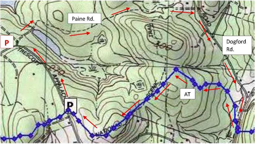
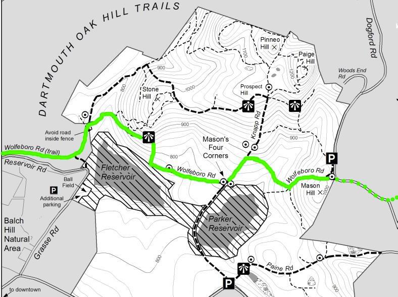
- From Downtown Hanover and the Green, drive E on East Wheelock St. and up the hill 1.7 miles to the junction of E. Wheelock, Grasse, and Trescott Roads. Continue straight on Trescott Rd. and
drive 2.4 more miles to Etna Rd. Turn L and head N on Etna Rd. 1.3 miles to Dogford Rd. Turn L; follow 1.2 miles to parking on L after sharp bend and pond. - Park at the marked trailhead parking area near the kiosk.
What you should know
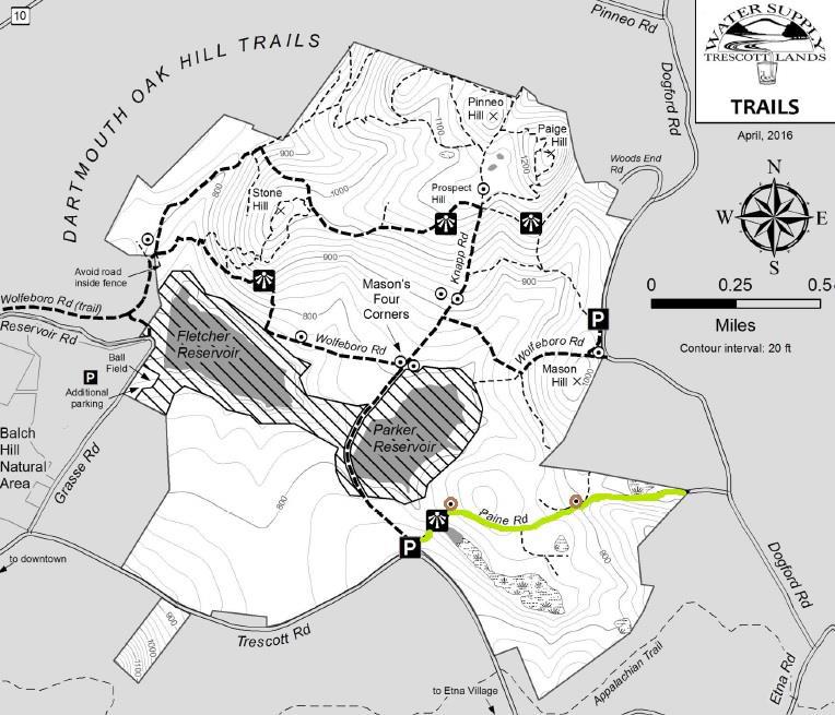
- Today’s hike is a loop on lands owned by the Trescott Water Company (Town/Dartmouth).
- This is a great route for confident backcountry skiers.
- The route follows two 18th century roads, visits two cellar holes, and returns on a new trail (2019).
- As of 2019, all trails described here are blazed with yellow and marked with brown and yellow signs, thanks to the Trescott Recreation and Hanover Trails Committees.
- Dogs must be leashed while on the Trescott Water Supply Lands and waste must be picked up and
carried out in order to protect drinking water.
 Brief Hiking Directions
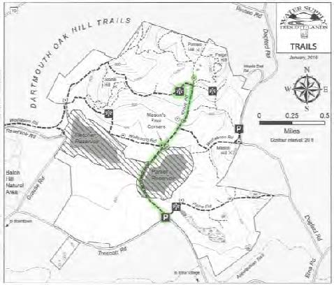
- Start on the Poor Farm Trail that begins at R of the trailhead kiosk.
- The trail soon reaches an historic road; turn R and continue.
- Follow the Poor Farm Trail E as it turns R off the old road.
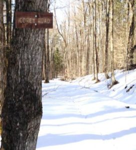
- Continue to Knapp Road and turn R.
- Turn R on the Child’s Farm Trail for 0.6 miles and return to your car.
 The Full Story
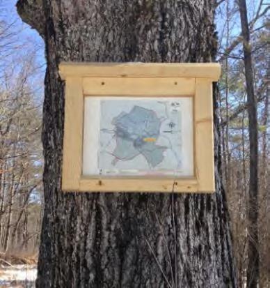
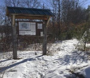
- Welcome to your water source! Drinking water for much of Hanover and Dartmouth College comes from these lands, so special rules apply for recreational use. Take a moment to check the kiosk display to acquaint yourself with these rules and pick up a trail guide.
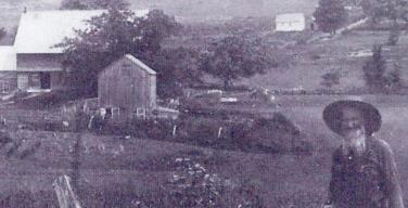
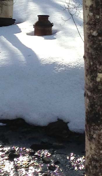
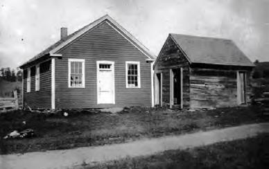
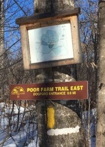
- Start at the path to the R of the kiosk; a few steps in, a sign at L identifies it as the Poor Farm Trail East, 0.6 miles to Knapp Road. The easy trail parallels Dogford Road before swinging R at a distinctly raised, flat spot that is the site of the old Wright place. Snow may obscure it today; the photo below gives you an idea of what you’re missing. Wright was raising sheep on this land in 1855; by 1892, J.W. and W.D. Chandler had taken over his farm.
 As the trail swings L again, note blue tubes on both sides of the trail. These protect young tree seedlings from deer browse. The foresters managing this land are working hard to re-establish native trees in a place with a dense deer population – the water supply lands had essentially been a deer sanctuary for half a century while people (and hunters) were fenced out. Deer prefer to browse the northern hardwoods like maple, birch, beech, and oak that make a healthy natural forest and therefore a pure drinking water supply. This is one reason why deer hunting is strongly encouraged on these lands.
- Soon the path joins the wide old Wolfeboro Road, with its graceful stone walls and venerable sugar maples. Today, the Hanover emergency services folks insist on a different name to avoid confusion when attempting a rescue, so this section is now called Poor Farm Trail East.
-

Governor John Wentworth Royal Governor John Wentworth ordered the cutting of this road in 1770 in hopes of traveling over it from his home in Wolfeborough, NH, to attend Dartmouth College’s first commencement in 1771. A committee of Hanover citizens was appointed to “…run a line from near the southwest corner of Hanover to the Great Pond, or Governor’s seat, at Wolfeborough, and view the situation of the land and convenience for a highway, and make return the first Monday in October next.” Members were paid four shillings and sixpence per day and spent ten days surveying the route. Hanover landowners were assessed a penny and a half per acre to raise the 120£ needed to complete the road. The road wasn’t finished in time, however, and the Governor had to travel by way of Haverhill to attend the first commencement, but by 1772 it was ready for the second ceremony.
- Wentworth, appointed in 1766 by King George III to take over management of the colony of New Hampshire from his infamous uncle Benning, helped Eleazar Wheelock secure the charter for Dartmouth College. Here he appears as quite the dandy, but indeed he was an eager outdoorsman and leapt at any chance to go camping and rusticating in his colony’s abundant wilderness. While he was on the trail happily getting dirty and sleeping on the ground, his wife was planning her fancy ballroom at their estate in the Lakes Region.
 The Wolfeboro Road was probably only the second road in Hanover to be properly laid out, mapped, and recorded. Like many early roads, over the years its location has shifted. The entire road remained in use through the 19th century until construction of the Fletcher Reservoir in 1893 interrupted its path. Today many sections, including this one and the stretch that goes bravely up and over Moose Mountain, are Class VI roads. No wonder Emergency Services gets confused.
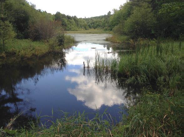
- Follow the wide old road gently down the slope. A bit over 10 minutes from your car, your route swings R as the old road plunges toward what is now the Parker Reservoir, an area now off-limits to the public. Note the map posted on a tree at R. As you near the bottom of the hollow,
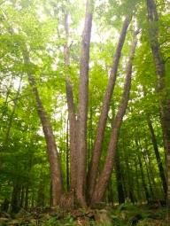
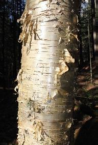 note the gleaming golden bark of yellow birch at R, a most handsome tree.
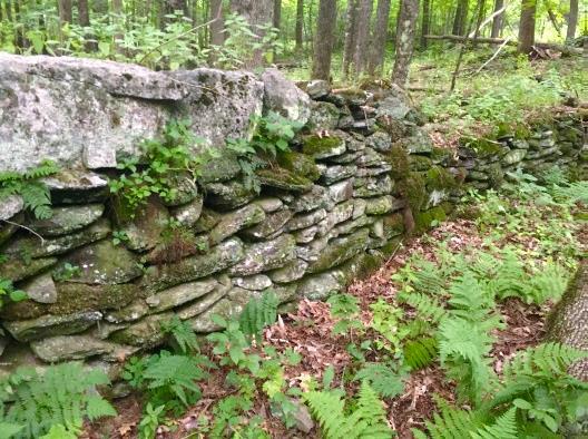
 - 20 minutes from your car, cross a stream headed for the Parker Reservoir. Pause to look upstream – at this season, with leaves off the trees, you get a good view of a well-laid stone wall running along the hillside above. One of Mr. Wright’s creations?
- Climb up and out of the little valley. At the top, the trail bears L and flattens out.
- At R note a plantation of small red pines, thigh-high at this writing. The Trescott lands experienced major blowdowns during the 2007 Patriot’s Day Windstorm, and two million board feet of logs and 3,100 cords of pulp were salvaged. This storm hit heaviest in the plantations, leaving natural stands largely unaffected. While the forest management plan for the Trescott lands calls for creating more natural, uneven-aged stands rather than even-aged plantations, this area is an exception to keep the slopes from becoming overrun by invasive buckthorn and other non-natives.
- Proceed along the level trail, catching glimpses of Parker Reservoir below at L through the trees.
- 30 minutes from your car, arrive at Knapp Road, identified by a sign just across the way and a map posted at R. Turn R and follow this historic road up the hill. Knapp Road was laid out Nov. 13, 1793, named for Lt. Peter Knapp of Hanover’s Revolutionary War-era militia. The cellar hole of his homestead is just below where this road meets another part of the Wolfeboro Road. In the late 1700s, that was a busy intersection!
- A minute’s walk up the hill brings you to a sign at L interpreting the history of the Town Poor Farm, which once stood in the field beyond the road. That’s a great place to explore in spring.
-
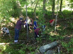
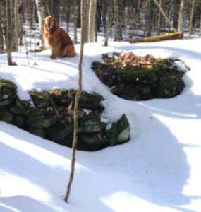
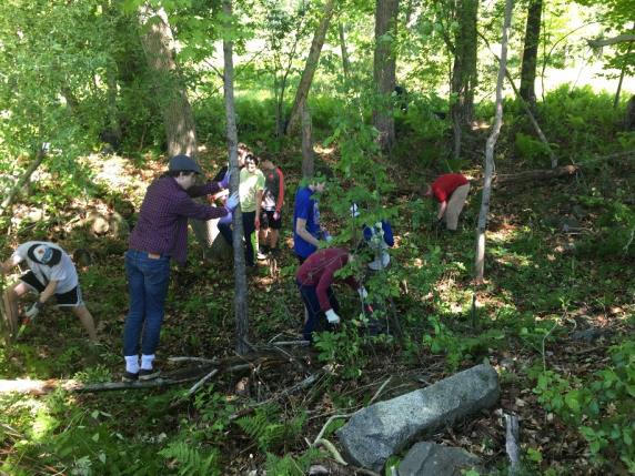
Ms. Hadden’s 7th Grade group “Power of We” Continue to the top of a small rise and look for a small cellar hole at R in a circle of pines. Here is what seems like the remains of a very small house. Actually, most early homes had cellars under only a part, as a cellar was not easy to dig and was needed just for storage of apples and other supplies, not for the many purposes to which we put basements today. This was the home of P. W. Durkee in 1855, and by the 1880 census, government workers recorded the four Hewitts here – Elbert, 36 years old, a farmer; his 34-year-old wife Augusta, keeping house; their 12-year-old daughter Mary and 10-year-old son Charles, who both attended the District #4 one-room schoolhouse at the bottom of the hill. (Thanks to Ms. Hadden’s 7th grade group at the Richmond School, who researched this site and helped clear it of brush for their “Power of We” project in 2019.) In 1903, it was owned by Newton Frost until the Water Company bought his place and demolished it along with nine other farms.
- Continue up Knapp Rd another 100 paces to a sign at R for the Childs Farm Trail. From here, it’s an easy 0.5 miles back to your car. Before turning onto the trail, look back down the road, noting the pines ringing the cellar hole at the edge of your view. This must have been a beautiful place to live.
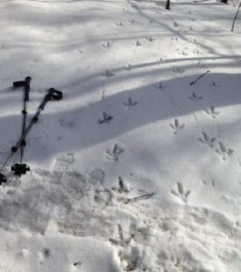
- Back to the mundane – is your dog still on its leash? There are porcupines nearby. Indeed, the next trail up the hill is named the Porcupine Trail for a good reason.
-

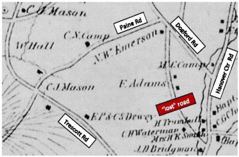
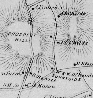
1892 map showing Childs farm In the 1880s and 90s, the northeastern part of the Trescott lands were part of the home farm of Joseph Childs, his wife Christiane, and their children Arthur, Mabel, Myrtle, and Marcellus. Joseph was a major landowner with 500 acres, including a sugar orchard of 800 trees and an apple orchard of 200 trees, plus 10 cows, 12 horses, and 200 Merino sheep. The 1892 map at right shows Joseph’s location; he had set his son Arthur up in the next place north.
- Strike out through the meadow on the Childs Farm Trail. The yellow-blazed trail is mostly flat and follows the contour, except where it dips when crossing a few small drainages. You’re now passing above the most recent plantation you saw from below, and have a better view of earlier plantings and a pine-backed ridge.
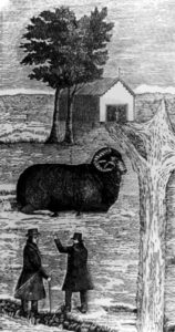
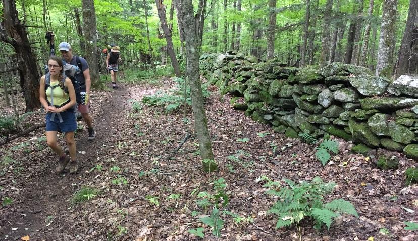
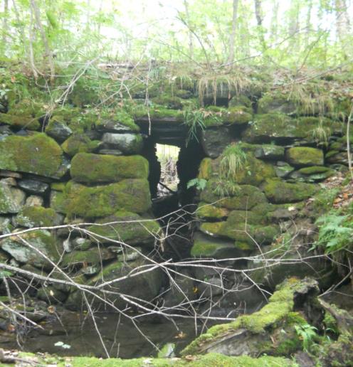
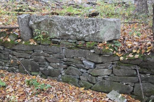
- 15 minutes after leaving Knapp Road, cross a second small stream and then climb gently to a small height of land. A low stone wall angles in at L; it may be barely visible in the snow. This is one of over a quarter million miles of stone walls built in New England and New York in the early-mid 19th century, largely in response to the rise of the Merino sheep industry (left). When the landscape-altering wool textile industry eventually went south, much of the human population went west, and the forest returned to cloak the hillsides where hundreds of sheep once grazed. In the mixed-age, mixed species forest surrounding you today, larger stumps are evidence of a previous harvest of trees that got their start a century ago.
- 5 minutes later, you emerge into an open meadow that has been partly planted with young pines. At your appearance, finches erupt from feeding on seed heads in the scrub.
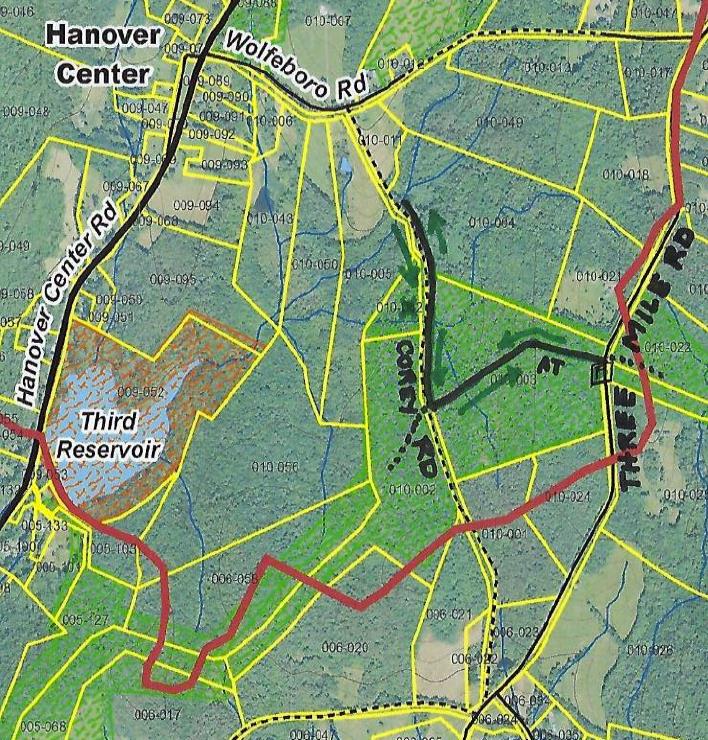
- As your car comes into sight, a trail joins at R – a glance over your shoulder confirms it’s the Coyote Connector, an alternative route to Knapp Road.
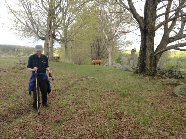
- As you approach the parking area, enjoy the view of Muscle In Your Arm Farm on the slope across Dogford Road, another part of the former Childs Farm. Its open sheep pastures, laced with stone walls lined with sugar maples, echo the view that you would have encountered a century ago on the lands you have just explored.
This Hanover Hike of the Month
has been generously sponsored by