Hanover Conservancy

Facebook logo   Instagram   YouTube          
Donate button
  • Home
  • About Us
    • Employment
    • What We Do
      • Advocacy
      • Conservation
      • Education
      • Stewardship
    • Celebrating 60 Years
    • Board & Staff
    • Membership Benefits
    • Contact Us
  • Get Outdoors
    • Hanover Lands
      • Balch Hill Natural Area
      • Mink Brook Nature Preserve
      • Other Properties
    • Hanover Hikes
    • Hanover Trails Challenge
    • Upper Valley Hikes
    • Exploring Nature at Home
    • Hunting
  • Events
    • Calendar
    • Spring Wildflower Scavenger Hunt
    • Private Events
  • Get Involved
    • Donate
    • Volunteer
    • Adopt a Trail
    • Corporate Conservators
    • Planned Giving
  • Education
    • School Programs
      • KAST
      • Connecticut River Studies
      • Hanover High School Scholarship
    • Request a Field Trip or Speaker
    • Research on Our Lands
    • Hanover History
    • Resources
  • News
    • Remembering Bob Norman
    • Reports & e-News
  • Conserve Your Land

Rinker-Steele Natural Area

November 1, 2016

Trail Description and Hike – Full PDF
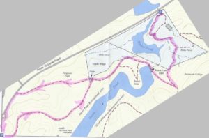
 

Rinker-Steele trail mapDriving Directions

  • From Downtown Hanover, drive N on N. Park Street and turn right onto Route 10N. Continue past the golf course, through the first rotary, and past the Richmond School and Dartmouth Printing. Turn right for 71 Lyme Road at sign for the Hanover Conservancy.
  • Park in the office parking lot. If it’s a weekday, stop in at the Conservancy’s offices on the lower level to say hello!

What You Should Know

  • Today’s loop hike takes you through the Storrs Pond Recreation Area to the Rinker-Steele Natural Area, through Ferguson Field, and back along a short section of Route 10.
  • You’ll be walking on lands owned by the Town of Hanover and the Hanover Improvement Society. Conservation easements protect some but not all of this land.
  • Trails have many short but steep up-and-down grades – you’ll get a good workout! Clay soils can make for slippery footing on a wet day.
  • In winter, some of these trails are groomed for skiing – and should not be used by hikers.
  • We suggest bringing a hand lens – you’ll find out why.
  • Dogs are welcome but must be under your control; please pick up after your pet.

Hiking Directions

  • Begin your hike at the south end of the parking lot, at a gate across the lane that heads down to Storrs Pond. Take this lane and in 100 yards, turn L and up a slight hill. You’ll begin an up and down saunter on a wide ski trail, among white pines that invaded old farmland about 60 years ago. The route is easy to follow.
  • At this time of year you may notice that most understory trees have lost their leaves but one kind still seems healthy and green –glossy buckthorn, an invasive tree that gets its edge from photosynthesizing far into the fall after native trees have given up for the year.
  • The view into steep, wooded ravines changes constantly as the path turns this way and that. We’ll explain the reason for this dramatic landscape farther into the hike.
  • Six minutes from your car, you reach the bottom of the hill. At R is the covered pavilion at Area 5 of the Storrs Pond Recreation Area. Turn L and head straight uphill past the sign for the Storrs Pond Trail and Scout Area. Soon you’ll have a view of an arm of Storrs Pond on the R.

  • fishing on Storrs PondStorrs Pond is part of what must be Hanover’s hardest working watershed – Camp Brook. This brook begins on lands owned in the 1800s by the Camp family that are now held by the Trescott Company (50% Town of Hanover, 50% Dartmouth College). The Hanover Water Works bought those lands in 1893-1912 to create the public water supply. Camp Brook was dammed in 1893 to form the Fletcher Reservoir (where Grasse and Reservoir Roads meet) and again in 1924 to form the Parker Reservoir upstream. After filtering, much of its water ends up on downtown restaurant tables, in college dorms, and domestic faucets. What’s left continues downhill along upper Reservoir Road and into another artificial pond created by a third earthen dam. We know this one as Storrs Pond, and thanks to the Hanover Improvement Society, there’s a lot of fun to be had here!
  • Eleven minutes from your car, you’ll reach a junction. At L is the gate to Ferguson Field; you’ll return to this spot later. Turn R along the southern boundary of the former Steele property.
  • Look for a pockmarked old pine on the R that is providing quite the chickadee condominium. You notice greater tree diversity here – instead of young pine and buckthorn, you’ve moved into a proper hemlock-northern hardwoods forest with maples, oaks, and birches, an older forest that’s seen less interference.
  • At a fork, take the main trail up to the L. The trail then curves to the R, affording a sudden view straight down into Rinker Pond. Yet another dam, you ask? Wait and see.
  • You’ll soon come to a hemlock cut into sections after it fell across the trail. While it may not strike you as a particularly large tree, pull out that hand lens to look at its growth rings. See how tightly packed they are – indicating hemlock’s naturally slow growth in the shade of its companions. We counted over 140 rings on one section –the tree was likely already growing during the Civil War.
  • Two minutes’ walk later, you cross the dam that creates Storrs Pond. In October, 2016, after a droughty summer and fall, the water was down four feet from the top of the outlet pipe.
  • Continue up the hill and look for a trail on the L just past the overhead ladder on the R. Here, the wider trail winds up to the R toward Oak Hill and you turn L onto the narrower path to the 24-acre Rinker-Steele Natural Area. You’re about 25 minutes from your car.
  • The Hanover Conservancy purchased the 17.62 acre Rinker Tract in 1973 from Mr. and Mrs. Jack Rinker, who lived across Route 10 just north of the former Chieftain Inn. The Conservancy held this parcel until the town’s Conservation Commission could buy it with a grant from the Land and Water Conservation Fund.
  • This narrower path threads its way through a wild, dramatic landscape, following the heights of knolls between steep ravines. The Conservation Commission’s blue/white blazes mark the route.
  • It seems incredible, but part of this land was once grazed by sheep, or at least they were contained here. A fragment of wide-grid sheep fencing remains next to the trail, nailed to a dead yellow birch and flagged with orange. Most of this land was just too steep for farming, and some trees here are therefore quite old.
  • Half an hour from your car, cross a small wooden bridge spanning the drainage from a lush little valley that is moist even in the driest times of year. A brown and yellow sign indicates the junction of the Rinker Bike Loop. Turn L on a trail closed to bikes.
  • The trail approaches Rinker Pond and soon hugs the slope directly above the water. It’s a pretty dramatic landscape! What’s going on here? You are actually hiking at what was once the bottom of glacial Lake Hitchcock. This frigid lake covered the Connecticut River valley from Middletown, CT to Littleton, NH after the river’s waters trapped by a dam of debris dropped by the glacier as it melted. Thousands of years later, of course, that dam broke, leaving us with the beautiful winding river we see today. While the lake was in place, however, soil washing in from the uplands settled on the lake bottom. In still water, such as that quieted by a glaze of ice, the finest particles of clay sink to the bottom. When the lake drained, Camp Brook flowed down through the newly exposed sediments, slicing deep channels through them on its way to meet the river. These old channels are now the steep ravines that surround you.
  • You arrive at a large uprooted hemlock. The blazes on its prostrate trunk indicate it served as a trail marker until quite recently. Walk around its root ball to see the pale, lake-bottom clay revealed among its roots and in the pit where it once grew.
  • Continue on the path toward the Brook Trail.
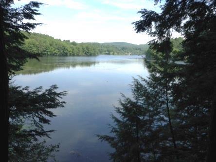
  • calm pond with trees
    Rinker Pond

    You hear traffic on Route 10 before you see it –the sound seems out of place next to this still reflecting pond surrounded by the soft needles of old hemlocks. Soon, the path reaches the water’s edge and Route 10 appears. Just beyond, through a culvert too deeply submerged to be seen, is Camp Brook’s confluence with the Connecticut. So – is Rinker Pond just another one in the brook’s chain? No – it’s actually a blend of brook and river water backed up behind Wilder Dam, miles downstream on the Connecticut!

  • The path ahead may be flooded, depending on whether Wilder Dam is generating power or storing water – an unnatural sight in a time of drought and another sign that the water table is affected by operations at Wilder Dam.
  • Stop here and look on the steep hillside ahead and to the R – you’re at the old quarry, said to be the source of stone for the White Church in Hanover.
  • If the path is dry, continue a short ways to the road, where there is parking for two cars (legal, despite the “No Parking” signs nearby). In any case, you’ll turn around and go back up the trail toward Storrs Pond. Take a moment to look for the bright red berries of wintergreen at your feet.
  • Return around the fallen hemlock and across the small bridge. Keep an eye out for maidenhair fern at R and then a “giraffe” tree you might not have noticed on the way down. Here, a yellow birch took root on an old stump that later rotted away, leaving the birch’s roots as props holding it off the ground.
  • 50 minutes after leaving your car, return to the wide ski trail and turn R. Note the lush growth of evergreen Christmas fern on the R. Continue across the dam.
  • Just as the trail bears L and downhill, look straight ahead. This is the six-acre Steele Tract, added to the Rinker Tract in 2010 with contributions from many generous donors, including $25,000 from the Hanover Conservancy. Nine years in the making, this project gathered wide community support and eliminated the possibility of a driveway across Ferguson Field. The Conservancy now holds a conservation easement on the combined property.
  • At a fork, instead of continuing back the way you came, bear R through the gate to the foot of Ferguson Field.
  • One of the glories of the northern gateway to Hanover, Ferguson Field is owned by the Hanover Improvement Society and is protected by a conservation easement. The Hanover Conservancy acquired the field from Mrs. Ferguson in 1989, holding it until it could be conveyed to H.I.S.
  • Follow the mown path up through the field to the far corner toward the historic Ferguson farmhouse, visible on the far side of Route 10.
  • The path passes through former farmland, a much-softened version of the steep hillocks below.
  • From the top of the field, look N behind you to the new Steele trail, built across the field to a wooded knoll in early November, 2016.
  • Turn L to walk the remaining 4-5 minutes around the small rotary and back to your car at 71 Lyme Road.

Learn more about the Rinker-Steele Natural Area
Filed Under: Hike of the Month, November, Rinker-Steele Tagged With: Hanover Improvement Society, maidenhair fern

Paine Road in the Trescott Lands

September 1, 2016

Route Description and Map – Full PDF


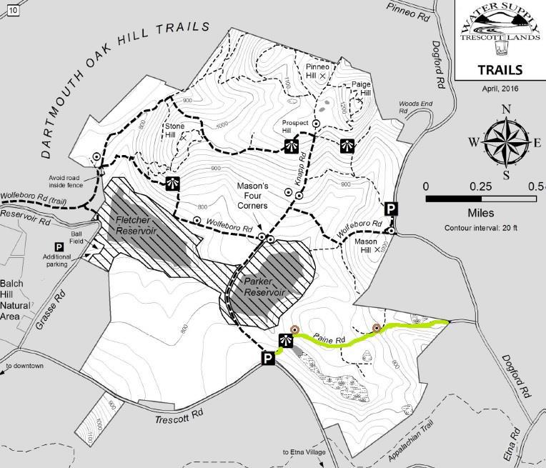
Paine Road mapDriving Directions

  • From Downtown Hanover and the Green, drive E on East Wheelock Street and up the hill 1.7 miles to the junction of E. Wheelock, Grasse, and Trescott Roads. Bear R to continue on Trescott Road and drive 1.2 more miles to the Trescott gate at a sharp bend.
  • From Etna village, turn W onto Trescott Road and drive 1.3 miles to the Trescott gate at a sharp bend.
  • Park at the marked trailhead parking area near the kiosk. Please do not block the gate.
  • Today’s hike is highlighted in green on the map at R, with cellar holes indicated in brown.

What You Should Know

  • Welcome to your water source! Drinking water for much of Hanover and Dartmouth College comes from these lands, so special rules apply for recreational use.
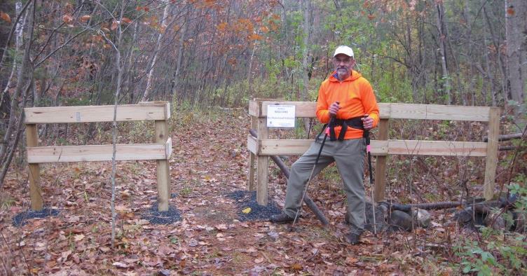
  • Take a moment to check the kiosk display to acquaint yourself with these rules and pick up a trail guide. Note dates for various deer hunting seasons. Deer hunting is encouraged here to improve the forest, and it is wise to wear blaze orange Sept. 15-Dec. 15.
  • Dogs are welcome but must be leashed at all times; please pick up after your pet. In fall, many hitch-hiking plants would love to send their seeds home with your dog. After picking many small burrs off a golden retriever (on a short leash for the entire trip) we wished we had left her at home.
  • You may encounter forestry vehicles; they have the right of way.
  • Most current hiking routes in the Trescott lands make use of historic roads, including this one.

Hiking Directions

  • view from Paine RoadTake the short path to the R of the kiosk that leads around the fence. This takes you to Knapp Road. Turn R back toward the gate and after 25 yards, turn L onto Paine Road. For well over a century, this was a four-way intersection.
  • The route now called Paine Road was laid out in 1782 from Jeremiah Trescott’s place to Dogford Road, “to accommodate him for Meeting.” He’d been asking for an easier route from his house to Hanover Center since 1775. Who Paine was and why the road now bears that name remain a mystery.
  • Paine Road leads invitingly down a gentle hill for several minutes’ walk. Approach the dip in the old road softly; if you’re lucky, you’ll get a glimpse of a great blue heron or other wildlife in the beautiful flowage on the R.
  • This valley is not as small as it first appears – it extends well over a half mile; off to the L, it feeds an arm of Parker Reservoir. The wetland captures sediment washing off higher ground before it can enter the drinking water reservoir, where clear water is an important concern.
  • The old road continues up out of the hollow. Just as it swings R, stop and look for the remains of an old stone wall at L. You have found the site of the Wright-Mason Farm.
  • old cellar hole wall
    Cellar hole of the Wright-Mason farm

    To find the farmhouse’s cellar hole, follow the line of this wall into the woods with your eyes to a pile of large, flat stones, about 35 paces from the road. Leave the road and walk to this point and then continue straight, another 25 paces, to a small grassy rise. The cellar hole will be invisible until you’re nearly upon it, so keep a sharp lookout!

  • Here is what seems like a very small house foundation, with ash trees growing in and around it. One has made such close friends with a foundation stone that it appears the stone is growing into the tree instead of the other way around.
  • Was this really such a tiny house? Actually, most 18th and early 19th century homes had cellars under only a portion of the house, as cellars were not easy to dig and were needed just for storage of apples and other foodstuffs, not for the many purposes to which we put basements today. On the N side of the cellar hole you may discern other foundations, perhaps indicating a house with an ell. More research is needed.
  • In 1855, one H. Wright occupied this farm. Little is known about this family. By 1885, Charles J. Mason, Jr. owned it. He grew up at Mason’s Four Corners and his family owned much land in the neighborhood. This house and other farm buildings were removed when the Parker Reservoir was built.
  • Return to the road and continue E (away from the wetland).
  • 5 ash treesYou begin to notice old sugar maples lining the road, and ahead on the L at the top of a rise is an impressive “fairy ring” of trees. Five large ash trees seem to spring from a single place. Look closely and you’ll see the cut stump of a sixth. All of these are sprouts from the stump of a single earlier ash. What’s the story? Did Mason cut the parent ash for firewood and leave his farm before he could come back for the sprouts once they grew to size?

  • Continue your walk along Paine Road, which now levels out. A nice low stone wall follows on the L, and handsome sugar maples 20” in diameter line the lane. They were probably set out along the road by the Wrights and their mid-19th century neighbors, the Johnsons, when the rest of the surrounding land was open pasture or cropland. Now, the forest has returned but the maples still reign.
  • A close look at some of these walls reveals small stones among larger ones, indicating that the land nearby was cultivated and therefore it was worth the trouble of moving rocks of that size.
  • Pass a small pocket of red pine plantation on the R; it looks oddly out of place here in the hemlock-white pine-northern hardwoods forest that surrounds it. The plantation is a leftover from earlier watershed management efforts. Nowadays, the foresters tending the Trescott Water Supply Lands are guiding the woods back to a more natural, uneven-aged, multi-species forest like that surrounding this plantation.
  • As you walk along, the stone walls grow more prominent and you have the odd but peaceful feeling that they’re keeping you company.
  • Twenty minutes from your car, you arrive at a log landing – a sunny opening with small piles of cut logs hidden in the growth at its edges. Timber pulled through the woods is delivered here by a skidder and cut to length before transfer to a lumber truck. When not humming with logging equipment, a landing like this can be busy with wildlife enjoying the opening in the forest and the berry bushes that often grow on its edges.
  • Just past the log landing is a big white pine snag that turns out to be one of four. These big “wolf pines” may have been left behind because their uneven form diminished their value as cut lumber. The wildlife doesn’t mind, and the old pines make great apartment dwellings for woodpeckers and other creatures.
  • As you continue on Paine Road, stone walls seem to be everywhere, following the road and heading off into the woods at right angles, separating fields and pastures of another time. They were likely built by A.D. Johnson, whose home site you will soon visit, during the “Sheep Craze” of the early-mid 1800s.
  • As you head up a small rise, a woods road comes in from the L. Continue straight.
  • Walk over a pronounced lump in the road – this is a water bar, built by the foresters to keep water from running down the road and creating gullies. Good forest management in a public water supply watershed is all about managing water!
  • About five minutes’ walk past the log landing, you’ll reach a flat spot on the L, site of the Johnson-Camp Farm. This cellar hole is easily visible from Paine Road, just 18 paces away. While this one is nearly square, the farmhouse that stood over it was probably rectangular and extended to the W.
  • The 1855 map of Hanover shows A. D. Johnson at this site. By 1885, Carlton N. Camp lived here, a descendant of the family that gave the Camp Brook watershed its name. The 1885 Grafton County Gazetteer records him farming 75 acres with a sugar orchard of 150 trees and leasing 40 more acres from a William Doten. Camp’s Civil War service was also noted: he served in Company B of the 18th NH Volunteers. What a nice view the Camps must have had in the days when this land was clear and abundantly decorated with their stone walls. We suspect he was glad to get back to his farm in New Hampshire when the war ended.
  • After exploring the cellar hole, continue E on Paine Road. You’ll soon come to a sign and barbed wire marking an old water company property line; walk around the large pine on the R to pass through a gap in the fencing, taking care to avoid a brush with the wire.
  • Paine Road heads gently downhill and, on a sunny day, a flush of light through the trees catches your attention. You’ve reached another wetland, which you recognize as the large swamp that is visible from Dogford Road. Cattails and other marsh plants grow amid the standing skeletons of dead white pines. A big wetland in a bowl like this helps hold heavy rains like a sponge, protecting people downstream in Etna from sudden flooding.
  • Climbing up out of the bowl you soon reach the spot where Paine Road once again becomes a traveled way (restored to active use in 1971). Here, private land comes close to the road and is posted in some places. Please take care to respect these neighbors.
  • Turn around and return W on Paine Road, retracing your steps. As you pass the Johnson-Camp Farm’s impressive stone walls, resolve to return when the leaves are off the trees for a better look.
  • Linger a moment at the valley wetland before ascending to Trescott Road. It’s a beautiful and quiet spot, yet so close to a road busy with cars hurrying between Etna and downtown Hanover.

Learn more about the Trescott Water Supply Lands

Hypertherm Hope logoThanks to the Hypertherm HOPE Foundation for support in creating this Hanover Hike of the Month.

Filed Under: Hike of the Month, September, Trescott Tagged With: cellar hole

South Esker

August 1, 2016

South Esker Hike – Full PDF


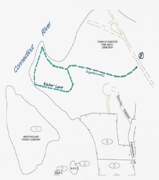
South Esker trail mapDriving Directions

  • From downtown Hanover, drive south on Main Street for 0.5 miles
  • Just after crossing the bridge over Mink Brook, turn right at 121 South Main Street, for the Pine Knoll Cemetery and Water Reclamation Facility
  • Drive through the gate and continue 0.3 miles through the cemetery, staying left at a fork in the lane.
  • The trailhead appears on the left, marked with a blue sign. Park your car just a few yards beyond on the right (not in the maintenance area on the left).

What You Should Know

  • Foot travel only. Dogs are welcome but must be under close control; please pick up after your pet.
  • The trails are well-blazed in town colors: two white patches on either side of a blue patch.
  • Pack a picnic to enjoy by the water, but remember that camping and fires are not permitted.
  • The Town of Hanover owns and manages the South Esker. When an 8-lot housing development was proposed for this entire forested hillside, a couple purchased the 17-acre property, built their home on four acres, and sold the remainder to the Town in 1971. The Hanover Conservancy (then known as the Hanover Conservation Council) had acquired an option on the land the previous year and raised the funds for the purchase.

Hiking Directions

  • Step onto the trail from the paved lane and watch your feet – almost the first step is, disconcertingly, onto a sewer manhole cover. Disconcerting, that is, until you remember that the nearby water reclamation facility works round the clock to clean Hanover’s wastewater before it is released into the Connecticut River. In the dirty old days before the Clean Water Act, before this facility was built, Mink Brook carried raw sewage from many hundreds of homes right past this spot. Enough of that – let’s get into the clean, cool woods!
  • Shortly after entering the woods, note the distinctive blue and white blaze at a fork in the trail. Stay right to follow the blazes as the trail begins to gently climb and then slabs along the side of the hill heading west.
  • At about 6 minutes from your car, arrive at a double blaze on a big hemlock tree and a new trail sign indicating the Esker Loop. This is your destination.
  • Continue straight to follow the loop counter-clockwise.
  • The reliable blazes make the path easy to follow despite the lack of understory plants and a defined treadway. Soft needles fallen from the pines and hemlocks overhead blanket the forest floor and muffle your steps while imparting a sweetly woodsy scent to the air.
  • After three or four minutes, an arrow directs you to turn left. But if you’re curious, continue on a few paces to a screened view over the round settling ponds of the water reclamation facility below.
  • Retrace your steps to the arrow.
  • river view from South Esker trailHead down the hill toward a quiet cove on the river shore. The small but delightful viewpoint here, where soil conditions hint that many others have stopped here before you, is a peaceful spot to glimpse the Ledyard Bridge in the distance. Ducks and other waterfowl linger in the quiet water below. If you have a dog or small children with you, be sure they don’t stray too close to the edge of the steep, high bank.
  • A side trail comes in from the left as you proceed gradually bearing right following the white/blue blazes and the curving riverbank.
  • 20 minutes from your car, the trail reaches a sharp point jutting out into the river that offers another view of both Ledyard Bridge, screened by the branches of some brave young hemlocks, and on the right, the wastewater treatment plant. Stop for a moment to take in the scene. We’ve already imagined what the brook and river might have been like on a warm summer day before 1970 and the Clean Water Act (when a riverfront home was not desirable). Now imagine how this area might have appeared before 1950, when Wilder Dam, less than two miles downstream, inundated this area. Mink Brook would have met a much narrower Connecticut River mainstem and would be a small stream itself here. Many years before that, Abenaki dwellings and other landmarks of Native life would have stood here at the confluence of such a significant stream. Today, these places are submerged.
  • Now follow the trail as it turns south and follows some quiet water that separates the land from Gilman Island. Keep an eye out for an odd hardwood tree that reminds you of sinewy muscles – this is American hornbeam, also called musclewood, ironwood, blue beech, or water beech. It is often found in the understory of forests along rivers and streams where it can withstand periodic flooding. Its hard wood was used to make tool handles and mallet heads.
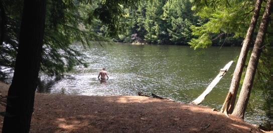
  • 25 minutes from your car, arrive at your picnic spot next to the river. On a hot day, a swim might be fun. Indeed, water quality has improved so much over the last 45 years that the river is clean enough for swimming, although it’s always wise to avoid the river after a very heavy storm.
  • Gilman Island beachGilman Island, a bedrock outcropping in the river, stands just across this short stretch of water. Owned by Great River Hydro and the westernmost point in Hanover, the island is a great camping destination for river trippers. Two campsites on the south side each have room for 10 campers. In 2015, a mouldering privy was installed in a partnership project between the Vermont River Conservancy, Dartmouth College, and LL Bean, with support from the previous hydro company, TransCanada, and the Silvio Conte Fish and Wildlife Refuge. On the island’s north end stands Dartmouth’s Titcomb Cabin. Originally built in 1953, it burned down in 2009. Dartmouth students took on the challenge of rebuilding the log cabin on the old site, and it is available for rent.
  • There’s more to see on the way back to your car. Follow the white/blue blazes as they lead southeast and away from the water. You enter a pine and hemlock forest that, while younger and denser than what you walked through earlier, still retains that quiet and dignified “cathedral” feel. Forest studies by the Hanover Conservancy indicate that the area was open at some point, likely for pasture of cattle or other livestock. Increment borings of the largest hemlock go back to the year 1904.
  • Soon, the esker itself looms up before you as the trail bears left at its foot. This steep-sided deposit of sand and gravel marks the path of a river that once flowed under the glacier. This esker follows the current path of the Connecticut River for many miles.
  • On your left, the forest floor is suddenly green with a carpet of ferns and other growth, where water flowing down the slope pools before sinking into the soil.
  • 10 minutes from the picnic spot, the river appears again through the trees and you reach a trail junction. Turn right up hill. At the top, turn right again.
  • 15 minutes from the picnic spot, you’ll return to the brown sign and know you’ve completed the Esker Loop. Continue straight, still following blazes.
  • Soon you’ll encounter a trail junction you may not have noticed on the way in – a short path to the right leads to a driveway off Spencer Road. Bear left instead and take the now-familiar trail as it slabs across and down the hill, delivering you back to your car.

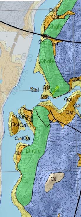
South Esker geologic map


Left: green indicates the esker along the river; blue indicates sediments deposited later by glacial Lake Hitchcock. The yellow arrow indicates the South Esker Natural Area.

Esker map modified from the Surface Geologic Map of the Hanover Quadrangle Grafton County, NH by Carol T. Hildreth, NH Geological Survey Surficial Geologic Map Series GEO-091-024000-SMAP. Thanks to Carl Renshaw, formerly of the Hanover Conservancy Board of Directors.

Filed Under: August, Hike of the Month, South Esker Tagged With: hornbeam

The White Ledges of the Mayor-Niles Forest

July 1, 2016

Full loop in PDF format


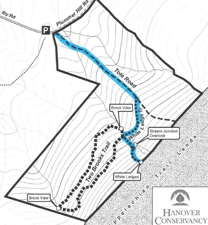
Mayor-Niles trail map
Trail map

Driving Directions

  • From the Hanover Center green, head north on Hanover Center Road.
  • Shortly before the intersection of Rennie Road, turn east on Ferson Road.
  • Turn left at the T onto Three Mile Road.
  • Turn right at the T onto Ibey (Iby) Road.
  • Proceed up the hill 0.1 mile to the small parking area at the road’s end.

What You Should Know

  • Foot travel only. Dogs are welcome but must be under close control; please pick up after your pet.
  • Be aware that this is prime porcupine and bear habitat!
  • The trails are well-signed and marked. The wide Tote Road is not blazed but easy to follow. The White Ledge Trail is blazed in red.
  • The 92-acre Mayor-Niles Forest was the generous gift of Michael and Elizabeth Mayor and John Niles, who had owned the land for some 20 years. The Conservancy accepted the land in 2013 to protect valuable high elevation wildlife habitat, the headwaters of Hewes Brook, flood security for downstream neighbors, and a scenic backdrop, all the while adding to the block of contiguous protected habitat on Moose Mountain surrounding the Appalachian Trail.
  • The trails were created in 2016 by carefully laying out routes to avoid creating erosion on sensitive soils and disrupting rare plant habitats.

Hiking Directions

  • Park your car on the left, opposite a gray cape house. This house stands on the site of the former Smith farmhouse, which was standing here by 1799. By 1892, it was owned by H. L. Barnes. The lower parts of this land were once open sheep pasture. Note the stone wall separating the house and drive from the protected Forest.
  • Ibey Road becomes Plummer Hill Road, a Class VI road, just beyond the parking area and house. The road dead-ends at Plummer Hill, but the Harris Trail, which follows it, continues to Goose Pond Road in Lyme.
  • Start up Plummer Hill Road; in 20 yards turn right at the Conservancy sign posted on a large white pine.
  • Pass through a simple but elegantly designed gate – your first clue that someone really loves and cares for this property.
  • The trail initially passes through an area that was open until fairly recently. It soon moves into the woods after crossing a year-round stream on a narrow foot bridge built by the same volunteer.
  • Standing on the little bridge, you can see woody debris in the channel that captures sediment and keeps waters clear. The Forest is located in the Hewes Brook watershed; protecting this land keeps the waters of this brook shaded and therefore cool, clean, and comfortable for wild brook trout. Keeping the tiny headwater streams well forested with a spongy forest floor also helps soak up heavy rains and release water slowly, contributing to flood security in downstream neighborhoods.
  • Begin a steady climb up the old tote road. This road was used years ago by International Paper Company to haul timber off Moose Mountain. Occasional water bars have been installed to divert runoff to cope with the slope, preventing gullies in this steep, direct path.
  • As you move upslope, you’ll notice many small red spruce trees coming up along the path, marking the shift to cooler growing conditions. This higher elevation habitat will become an increasingly important refuge as the effects of climate change become more pronounced. Feel the branches to distinguish prickly red spruce from the soft branchlets of hemlock.
  • On the forest floor near the path, you may see ground cedar, ground pine, wild oats, and starflower.
  • After ten minutes’ steady climb, you’ll arrive at a well-marked turn onto the White Ledge Trail. If you stayed on the Tote Road, you’d come to the yellow-blazed boundary with the federal Appalachian Trail corridor land. While we’d love to create a trail connection with the AT here, such connections are carefully limited.
  • Turn right onto the red-blazed White Ledge Trail. Why not blaze it white, you ask? Only the AT is blazed white in Hanover!
  • The trail follows the mountainside contour as it heads south, a pleasant (but temporary!) relief from the steeper Tote Road. It passes through multi-aged northern hardwood forest that was last harvested about 20-25 years ago. Look for three kinds of birch (white, yellow, and gray), oak, beech, and four species of maple (sugar, red, goosefoot or striped, and mountain).
  • About 5 minutes from the Tote Road, you’ll come to another even more delightfully crafted brook crossing, this one with a white birch handrail. While the steep brook channel is dry in summer, the amount of woody and leafy debris in its channel testifies to the power of heavy rain and gravity.
  • A few yards beyond the little bridge, you arrive at a four-way trail intersection. The Two Brooks Trail leads straight ahead and loops around, returning to the right. To best appreciate it, save this trail for a day after rain or in late spring.
  • Joe Danna, Jr. by trail gateTurn left to continue on the White Ledge Trail, again heading uphill. White ash, black cherry, and other hardwoods join the birches and some impressive maples. The trail is steep in places but steps and careful trail benching create a safe pathway. By now, you’re curious about the person who lavished such attention on this tricky part of the path! We are fortunate to have Joe Danna, Jr. (right) to thank for all this work. A tireless Hanover Conservancy volunteer and nearby resident, Joe laid out, cleared, stabilized, and blazed these trails with the help of our Stewardship Committee and John Taylor of the Upper Valley Trails Alliance.
  • The trail continues to climb, sometimes steeply. Take care to turn right at a stake with red paint. As you wend your way to your goal, the White Ledges will come into view, their cool white forms almost glowing in the dark forest.
  • About 30 minutes’ hike from your car, a routed sign just past the ledges indicates you’ve reached the trail’s end. Just beyond you’ll see a bold yellow boundary blaze and vertical white sign reading, “U.S. Boundary” marking the protected lands surrounding the Appalachian Trail. YOU (and a couple hundred million other Americans) own that land. Moose, bear, and bobcat thank you for it.
  • White ledges at Mayor-NilesLinger at the White Ledges for a bit to marvel at the color and shape of this quartzite outcropping. Did you bring a picnic? One of those strikes us as a good picnic rock; our favorite is the smoothly angled one that looks like the prow of an ice cutting ship. Dartmouth Earth Science professor and former Hanover Conservancy Board member Carl Renshaw explains,

“Moose Mountain is composed of a core of Clough quartzite that is highly resistant to weathering. Outcrops of this quartzite, often called the ‘white ledges,’ are visible on the Mayor-Niles Forest, especially in one area close to the AT corridor boundary, where one may observe large, angular slabs of quartzite colored with small amounts of iron and lines composed of later quartzite intrusions.

“At one time, this place would have resembled a white, sandy beach composed of the material eroded from the high mountains that once ringed the area. When the continent was in a more southern position on the globe, the climate would have been warmer. The shape of the inland sea would have resulted in good-sized waves – creating conditions for a great surfing beach on the side of Moose Mountain. Heat and pressure later solidified these solid sand grains into the quartzite we observe today.

“The collisions of England, the Bronson island chain, and later Africa into North America were a major event that created the Appalachian Mountains some 400 million years ago – once the largest mountains in the world, at least two miles high. The Mayor-Niles Forest and the rest of the region are overlain by the Littleton Formation. On lower elevations on the property, this rock is exposed and contains small red crystals of garnet, indicating high temperature and pressure in the formation of this metamorphosed rock, and confirming that the mountains that existed here were relatively high. Fool’s gold, lead, and arsenic are other components of this dark gray rock.”

  • Take a moment to look for wildflowers here, too. Trillium, starflower, and violets have past blooming but their foliage remains. Among the clubmosses, you may see ground cedar, shining clubmoss, and ground pine. Some young hobblebush nearby will glow with purple foliage in fall.
  • When you’re ready to leave, follow the red blazes back to the four-way trail intersection and turn right toward the Tote Road, crossing Joe’s birch bridge.
  • Stop at the Tote Road junction to search the bark of nearby trees for clues to two different kinds of visitors. A few larger maples on the far side of the road show scarring near their bases received when loads of felled trees, hauled down the tote road, bumped into them. On your left, look high on the uphill side of some nearby beech trees to see claw marks from bears climbing the beeches in search of tasty, nutritious beechnuts.
  • Continue down the Tote Road, noting the diversity of ferns you’ve seen growing at the Mayor-Niles Forest: ostrich fern, woodfern, sensitive fern, the leathery evergreen Christmas fern, and, near Joe’s lower bridge, a nice gathering of New York fern.
  • Reach Plummer Hill Road and turn left toward your car.

The Hanover Conservancy owns and manages the Mayor-Niles Forest. We warmly welcome donations to our Land Stewardship Fund to help maintain the property. Contact info@hanoverconservancy.org. Learn more about the Forest.

Filed Under: Hike of the Month, July, Mayor-Niles Forest Tagged With: bear, hobblebush, quartzite, starflower, trillium

The Velvet Ledges of Greensboro Ridge

June 1, 2016

Greensboro Ridge Hike – Full PDF

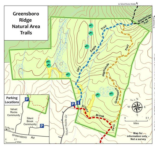
Map of Greensboro Ridge trailsDriving Directions

  • From the traffic light at Route 120 and Greensboro Road, turn east on Greensboro Road.
  • After 0.4 miles, turn left onto Velvet Rocks Drive.
  • Proceed up the hill to the parking area at the road’s end.

What You Should Know

  • Foot travel only, except on the Silent Brook Trail where bikes are allowed. Dogs are welcome but must be under close control; please pick up after your pet. Be aware that this Natural Area is prime porcupine habitat!
  • The trails are blazed in colors matching the trail map: blue for Oli’s Eagle Trail, white for the Appalachian Trail, and light orange for the Greensboro Highlands Trail. The wider Silent Brook Trail is not blazed but is easy to follow.
  • The Hanover Conservancy owns and manages the Greensboro Ridge Natural Area. The Town of Hanover holds a conservation easement on the land. After a housing development was proposed for this entire forested hillside, the Hanover Conservancy and Town worked with the developer to cluster homes close to the road and conserve the remaining acreage. The Conservancy acquired the land in 2008, protecting valuable wildlife habitat, a scenic backdrop, and a wonderful natural area with trails for the new Velvet Rocks and Silent Brook neighborhoods and the greater community to enjoy.

Brief Directions

  • Take Oli’s Eagle Trail north from the trailhead kiosk to the junction with the Appalachian Trail.
  • Retrace your steps a short distance to turn L onto the Greensboro Highlands Trail.
  • Follow this down to a T with the Silent Brook Trail.
  • Turn R to return to your car.

Full Hiking Directions

  • Take a moment to check the trailhead kiosk display and map. We are grateful to Trumbull-Nelson for the gift of this beautifully hand-crafted kiosk.
  • Oli’s Eagle Trail begins just to the L of the kiosk, heading up through a narrow rocky cleft. The contrast between this rough terrain and that tamed for the Velvet Rocks development is dramatic.
  • This trail was built in 2008 by Oliver Simpson for his Eagle Scout project with help from the Hanover Conservation Commission’s Trails Committee.
  • In early June, the foliage of purple trillium is still apparent near the trail entrance, although here at the warmer, lower end of the trail, the wildflowers may have gone by.
  • You’ll soon reach an open expanse of unfurling ferns, primarily the sweetly fragrant Hay-Scented Fern. Watch your footing here. This opening was cleared from the forest as a demonstration house site before the land was protected. It will be kept open to provide habitat variety for wildlife.
  • Heading back into the woods, you can hear the gurgle of a small stream as the trail curves gently to the right. Fisher and mink inhabit this area. The Natural Area is located in the Mink Brook watershed; protecting this land helps keep the waters of Mink Brook cool, clear, and comfortable for wild brook trout.
  • Eight minutes from your car, you’ll begin climbing the ridge. Follow the blazed trail as it crosses a tiny drainage and winds up through a narrow cleft in the rocky ledges.
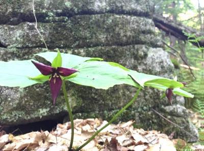
  • trillium
  • By 18 minutes’ hike from your car, you’ll notice the rise in elevation and cooler forest conditions. The trillium has noticed it too, and may be still in bloom along the trail (photo L).
  • A few minutes later, you might notice the work of pileated woodpeckers on an old tree on the L side of the trail.
  • At 22 minutes from your car, you’ll reach the junction with the Greensboro Highlands Trail, marked with a wooden sign. You’ll soon return to this junction but now continue straight on Oli’s Trail for a minute or two to reach the white-blazed Appalachian Trail. The AT actually dips off federal land and onto Hanover Conservancy property for a short distance. At that junction, you could turn R to head to Etna or Mt. Katahdin in Maine or L for Velvet Rocks, downtown Hanover, or if you’re really ambitious, Springer Mountain in Georgia.
  • Instead, turn around and retrace your steps for a short distance on Oli’s Trail, turning L onto the Greensboro Highlands Trail to continue your hike. The Hanover Conservancy, with help from the Upper Valley Trails Alliance and a team from Hypertherm, built the Greensboro Highlands Trail in 2012 to create this loop.
  • 25 minutes from your car, you’ll note a fragment of stone wall at L, a reminder that this heavily forested land was once an open sheep pasture.
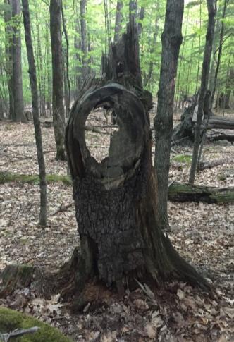
  • old branch collar in treeIn 2 more minutes, a fun photo opportunity appears on the right, where an old branch collar on a dead snag forms the perfect frame (R). Friends can take a photo of faces looking through it to post on our Facebook page!
  • Black bear make their home here, and it’s easy to find bear claw marks on the smooth bark of beech trees, evidence of a bear seeking tasty beechnuts.
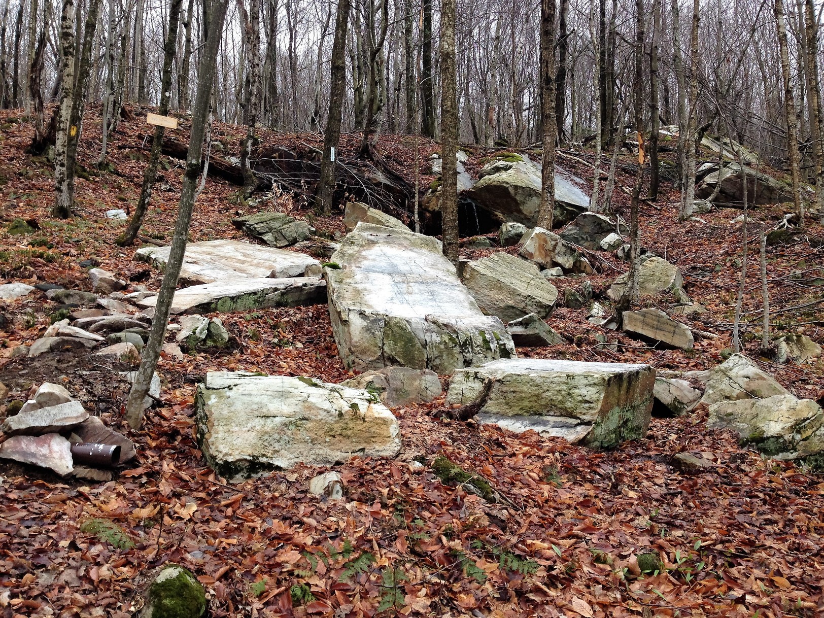
  • 32 minutes into your hike, the trail winds to the R around a ledge featuring a huge and handsome vein of white quartz.
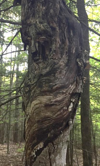
  • "face" in old tree
  • In another 2 minutes, see if you can spot the guardian of this forest. This “face” on a tree (photo L) appears on the L side of the trail.
  • 38 minutes into your hike, the trail splits around a large boulder, then a few yards later turns somewhat sharply L. There are a lot of well- worn game trails here and it would be easy to follow one if you were looking at the ground- be sure to look for the orange blazes!
  • Look carefully for signs of one of the Natural Area’s hidden gems –its 8 vernal pools. These usually ephemeral wetlands are essential breeding habitat for salamanders and frogs, as they are free of fishy predators. (Please keep your dog from cooling off here.)
  • At 45 minutes, another stone wall appears at L, marking the HC boundary. A wetland is visible just behind it as you near the trail junction for Silent Brook.
  • 48 minutes into your hike, you’ll reach the Silent Brook Trail. This trail, designed to link the Silent Brook and Velvet Rocks neighborhoods, is open to bicycles. If you turn L, you’ll reach the Silent Brook neighborhood in less than 5 minutes. To return to your car in just a few more, turn R onto the Silent Brook Trail.
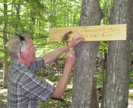
  • volunteer mounting a trail signCross a small drainage on a footbridge and enter another ferny opening. Here, white pines are doing what they do naturally – reclaiming old openings – and volunteers are working to keep this area, another demonstration house site, open for wildlife.
  • The trail drops steeply and crosses another small wooden bridge before returning to your car and the parking lot at the end of Velvet Rocks Drive.

Note: The Hanover Conservancy is seeking volunteers to advise us on managing the Natural Area, monitor trails, and help out with very occasional work parties. We also warmly welcome donations to our Land Stewardship Fund to help maintain the Natural Area. More info about the Natural Area can be found here.

June 2016, revised September 2020

Filed Under: Greensboro Ridge, Hike of the Month, June Tagged With: Appalachian Trail, hay-scented fern, porcupine, purple trillium

Waterfalls of Slade Brook

May 1, 2016

Slade Brook Hike – full PDF


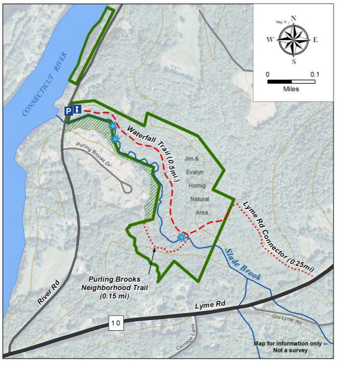
Slade Brook hike mapDriving Directions

  • From downtown Hanover and the Green, follow Route 10 north for 4.2 miles to River Road and turn left.
  • Follow River Road for 0.5 mile.
  • Just past Purling Brooks Drive, cross Slade Brook near its confluence with the Connecticut River.
  • Turn immediately right into the small parking area.

What You Should Know

  • Foot travel only. Dogs are welcome but must be under close control; please pick up after your pet.
  • The trail is not blazed but is easy to follow. Wooden arrows mark important turns.

Hiking Directions

  • Take a moment to check the kiosk display and map before embarking on the trail beyond the rocks.
  • Slade Brook flows 4.0 miles from a wetland near Three Mile Road west to the Connecticut River, draining a largely forested 2.55 square mile watershed. Nearly a third of this watershed is permanently protected, including the 38-acre Lower Slade Brook Natural Area, Huntington Hill Wildlife Management Area, Moister Meadow, and several other parcels.
  • At this time of year, the dark green of stiff-stemmed horsetail, or scouring rush, is prominent. Our forebears used this primitive native plant, its tissues naturally fortified with silica, to scrub dishes.
  • The brook takes its name from Capt. Samuel Slade (1747-1826), described as a “leading citizen” of Hanover who came to town around 1774 and eventually served as tithing man, selectman, and representative. A Revolutionary War soldier, Slade was part of a committee to raise soldiers for the Continental Army and was stationed at Fort Ticonderoga. He, his wife Sarah, and their 13 children lived one mile north of Hanover Center (house later burned) and were prominent members of the Hanover Center church. His grandson, Samuel Thompson Slade (b. 1810) married a Huntington girl, so the family was clearly frequenting the neighborhood. Generations of Slades are buried at Hanover Center.
  • Shortly after leaving your car, note a dramatic ravine on the left. This steep, narrow cut was carved out thousands of years ago by Slade Brook as it scoured through lake-bottom sediments left behind by glacial Lake Hitchcock.
  • Louisiana waterthrushListen as you walk for the Louisiana waterthrush. The male’s song is a musical, distinctive series of descending notes followed by a warble. One of the earlier neotropical migrants to return to its breeding grounds in the spring, this bird often arrives a month or more before other warblers. The hilly forest surrounding Slade Brook offers prime habitat for the waterthrush, as its name indicates.
  • On a terrace above the brook, the trail follows a very gently rising path that may once have been an old tote road. Evergreen Christmas fern decorates the banks at left.
  • As the trail bears to the right, the first flume comes into view and the trail heads up a short rise. A second flume appears above the first.
  • The trail soon levels again and offers a view down onto the floodplain of the brook. The wet, mossy expanse hints at its important function of storing water during heavy rains and snowmelt.
  • As you continue, the trail moves a short distance from the brook into a grove of hemlock, yellow birch, and white pine. Admire the birches’ glowing papery bark. Some, growing on the rotting remains of old fallen trees, are working on a giraffe imitation as their roots stretch down to the soil. The forest promises a cool retreat when you return on a hot summer day.
  • About 12 minutes’ walk from your car, you catch the sound of water again, drawing you off the trail a few feet to the right to view the uppermost waterfall. Here, the brook takes two paths down mossy stepped ledges, and then sluices away to the southwest through a short, narrow gorge. The entire flow from the brook’s 1,630 acre watershed passes through this point.
  • After admiring the falls, continue up the path.
  • Just beyond the falls, stepping stones lead across the brook to a short (0.15 mile) side trail to the Purling Brooks neighborhood. The public is welcome to use this trail as far as the Natural Area boundary, but may not continue across private land.
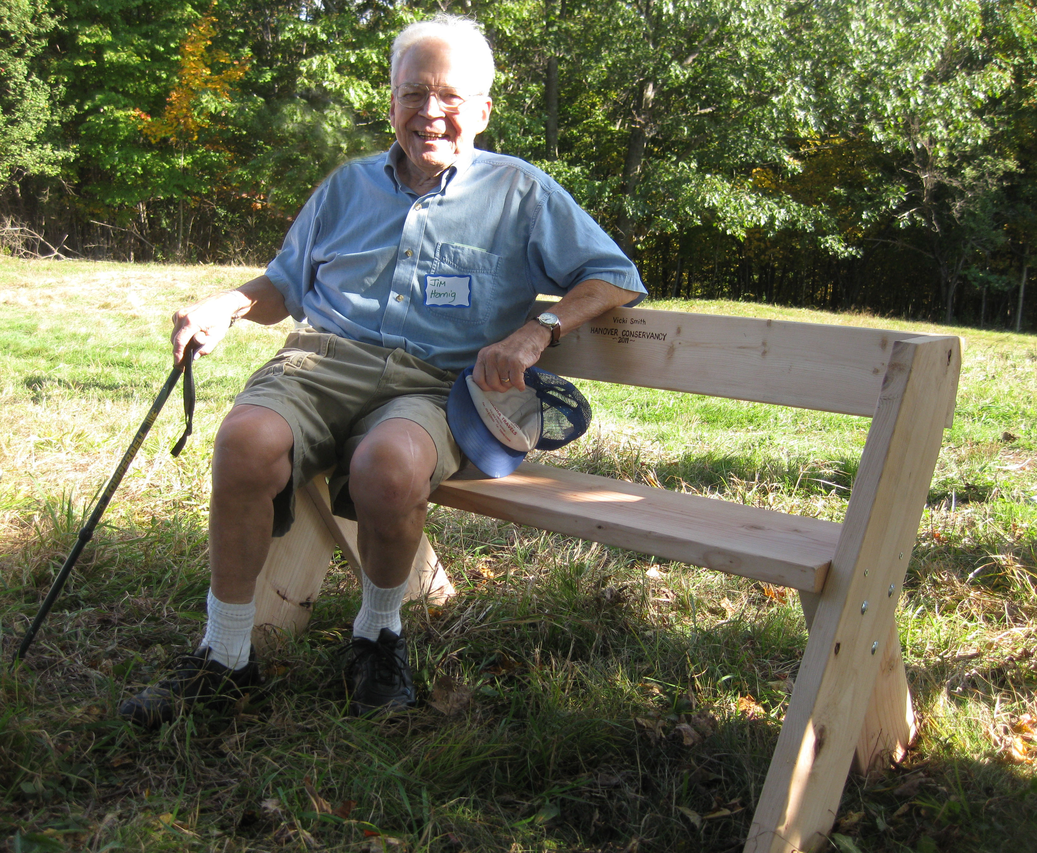
  • Board Member Emeritus member Jim Hornig sits on a bench in 2011That brings us to the story behind the Natural Area’s protection in 2005. When a developer presented a plan for 17 houses in this area, the Conservancy (then the Hanover Conservation Council) proposed an alternative that resulted in 10 homes clustered on 20 acres on the south side of the brook, on the site of a former gravel pit, with the rest of the property left intact. This solution protected the brook and its undisturbed valley, while providing recreational trails for homeowners in the Purling Brooks neighborhood and the wider community. Jim Hornig, former president of the Council, was the inspiring force behind this idea, and the Council gratefully named the Natural Area in honor of Jim (right) and his wife, Evalyn.
  • Watch for the sharp left turn as the trail heads away from the brook and somewhat steeply up to a plateau. About 5 minutes past the falls, you’ll come to a remnant of barbed wire on the right, marked with flagging, a reminder of the grazing history of this area. This land was once part of the Piper Farm.
  • The trail continues past the Conservancy boundary to a trail junction. To the right, an old logging road heads 0.25 miles to Route 10. To the left, it leads to private land.
  • Turn around and head back toward Slade Brook, enjoying the chance to see what’s growing at the top of the steep knolls you saw earlier from below.
  • Turn right at the arrow and head toward the waterfall. In the afternoon, the sun filters through the hemlocks, illuminating the falls. If you hear voices off to the left, it’s probably children playing near the houses across the brook. Consider how lucky they are to grow up with such a beautiful brook in their back yard, thanks to the foresight of those who protected it.
  • Slade Brook follows you down to your car before it joins the Connecticut River on its journey to Long Island Sound, hundreds of miles away.

The Hanover Conservancy owns and manages the Jim and Evalyn Natural Area at Lower Slade Brook. The Upper Valley Land Trust holds a conservation easement on the land. To protect the south bank of Slade Brook, the Conservancy holds a conservation easement on parts of eight properties at Purling Brooks Drive.

Note: The Hanover Conservancy is seeking volunteers to advise us on managing the Natural Area, monitor trails, and help out with very occasional work parties. We also warmly welcome donations to our Land Stewardship Fund to help maintain the Natural Area. Learn more about the Lower Slade Brook Natural Area.


Filed Under: Hike of the Month, May, Slade Brook Tagged With: Hornig, horsetail, Louisiana waterthrush

  • « Previous Page
  • 1
  • …
  • 5
  • 6
  • 7
  • 8
  • Next Page »

71 Lyme Road
Hanover, NH 03755
(603) 643-3433

info@hanoverconservancy.org

Facebook logo   Instagram   YouTube

Get Involved

Become a Member

Volunteer

Business Sponsors

Conserve Your Land

Employment

Our Mission

Advocacy

Conservation

Education

Stewardship

Explore Hanover

Hanover Hikes

Upcoming Events

Upper Valley Hikes

Trails Challenge

Copyright © 2026 Hanover Conservancy | Design by Chase Brook Software