Hanover Conservancy

Facebook logo   Instagram   YouTube          
Donate button
  • Home
  • About Us
    • Celebrating 60 Years
    • What We Do
      • Advocacy
      • Conservation
      • Education
      • Stewardship
    • Board & Staff
    • Membership Benefits
    • Contact Us
  • Get Outdoors
    • Hanover Lands
      • Balch Hill Natural Area
      • Mink Brook Nature Preserve
      • Other Properties
    • Hanover Hikes
    • Upper Valley Hikes
    • Exploring Nature at Home
    • Trails Challenge
    • Hunting
  • Events
    • Calendar
    • Celebrating 60 Years
    • Hanover Trails Challenge
    • Hike of the Month
    • Private Events
  • Get Involved
    • Donate
    • Volunteer
    • Adopt a Trail
    • Corporate Conservators
    • Planned Giving
  • Education
    • School Programs
      • KAST
      • Connecticut River Studies
      • Hanover High School Scholarship
    • Request a Field Trip or Speaker
    • Research on Our Lands
    • Hanover History
    • Resources
  • News
    • Remembering Bob Norman
    • Reports & e-News
  • Conserve Your Land

Greensboro Ridge 10th Anniversary today!

October 3, 2018

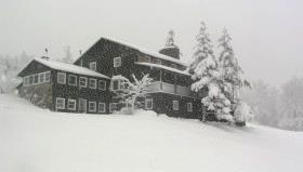
We’re putting a lot of faith in the forecast today- this space will be updated if we’re forced to postpone until tomorrow. See you at 4:30!

AT family hiking day 2018

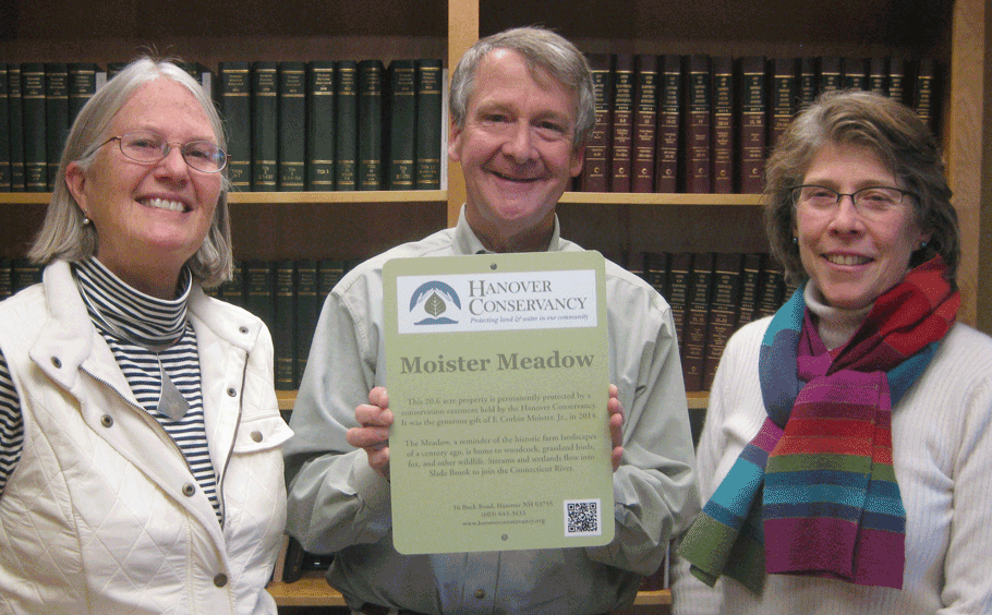
Join us at the main trailhead parking at the top of Velvet Rocks Dr. on Thursday, October 4th for live music, refreshments and a brief history of this conservation success. (RAIN DATE: Friday, Oct. 5th)

Filed Under: Conservation, Easements, Events, Greensboro Ridge, History, Lands, Outdoor Trips, Partnerships, Uncategorized Tagged With: anniversary, celebration, event, Greensboro Ridge, Town of Hanover

Moose Mountain Lodge and Ledges

June 1, 2018

Hike information & map – full PDF

Driving Directionstrail map

  • From Etna Village, head N on Hanover Center Road
  • Turn R on Ruddsboro Road and drive 1.8 miles
  • Turn L on Old Dana Road
  • Turn R just past large red barn on R, onto Moose Mountain Lodge Road (not marked)
  • Drive 0.8 miles to top of road. Park at the marked trailhead parking area just past the beaver dam.

What You Should Know

  • Foot travel only. Dogs welcome if under close control.
  • Bring binoculars and bird book for viewing waterfowl on Mill Pond and exploring distant views.
  • This hike celebrates the  history of Moose Mountain Lodge and explores the wild ridge of the mountain. We will view the former Lodge site from an overlook; please note that the site is privately owned.
  • The route visits part of a 3,800-acre block of protected higher-elevation wildlife habitat on Moose Mountain.
  • The hike ends with an optional visit to protected 18th century mill ruins on the steep mountainside.

BRIEF DIRECTIONS

  • Begin at the sign reading “Mill Pond Forest & Huggins Trail Access.”
  • Bear L at first trail junction to visit Mill Pond
  • Return to trail junction and turn L onto Pasture Road
  • Turn R onto Baboon Bypass, cross drainage, and reach first views
  • Continue on trail to second pasture and third pastures and cross stone wall
  • Bear R at arrow, head downhill, and shortly after, turn L at arrow
  • Bear R at sign parallel to the trail indicating the Orange Diamond Ridge Trail. Head up a short steep section to a mossy ledge.
  • Continue to second open ledge.
  • Retrace your steps to return to your car.

Hiking Directions

  • Begin your hike at the sign reading, “Mill Pond Forest & Huggins Trail Access.” To forever ensure public access to the network of trails you’ll be exploring, the Shumway and Huggins families donated conservation easements on this area to the Hanover Conservancy in 2016.
  • Cross a small drainage and note the series of small beaver ponds at L. By late 2017, the beavers left after many years of entertaining their neighbors with sightings of cruising kits and evening tail slaps on the water, as well as plugged culverts and “free-range forestry.”
  • The thread of infant Mink Brook has reappeared with the lack of diligent management by these aquatic engineers.
  • Arrive at the first trail junction and bear L. Within 15 paces look for a cellar hole at L. This was the high-elevation c. 1800 home of miller David Woodward, who built the dam on Mill Pond and an impressive sawmill and gristmill on the steep falls of Mink Brook below where you left your car (optional visit at end of this hike). Woodward’s house was probably larger than the modest cellar hole, which, in the days of hand digging, must have presented a challenge to build.
  • 2 beavers in Mill Pond
    Mill Pond beavers; photo by Kay Shumway

    Continue on the path a few minutes further to a bench at the pond shore. It’s time for a picnic, or at least to pull out the binoculars! Ten-acre Mill Pond is the highest water body in Hanover and the primary source of Mink Brook, the town’s largest stream. Set in a saddle on the mountain ridge, it may have originally been a small pond or perhaps a marsh. Around 1800, Woodward built a drylaid stone dam (just out of view at L, beyond the spruces) to raise the water level some 6-8 feet (it has since partly silted in). Beavers later took over and have been managing the pond off and on, ever since. Today, the entire shoreline remains undisturbed: Hanover Conservancy easements protect the N side with the Dana Pasture Natural Area on the S (co-owned by the Town of Hanover and a Dana heir).

  • Directly across the water is an impressive beaver lodge. Scan the pond’s surface for waterfowl and other birds. On the day we visited, three male mallards were holding a bachelor party at the pond.
  • Retrace your steps to the cellar hole and trail junction. At this time of year, violets are in bloom on the forest floor and you may spot the cheerful red of partridgeberries.
  • A sign for Pasture Road and a green moose mark the trail junction. Turn L; soon you’ll see the old stone wall marking this Class VI road. Where Pasture Road once met Moose Mountain Lodge Road is anybody’s guess – our bet is the area under the beaver dam.
  • Pass by the first gap in the wall, which leads to a private home, and look for a second gap marked with a sign for “Baboon Bypass” a few yards beyond the wall. Turn R here. This short and somewhat indistinct trail leads W toward your next destination, across a small drainage. Blue sky appears ahead and an arrow on a barbed-wire-garbed tree directs you to swing L into an opening.
  • Arriving in an old pasture (first of three), leave the path and head through low brambles and blueberry bushes toward a big pine and two old fence posts. It seems all of central and southern Vermont is spread before you, with sharp-peaked Killington presiding.
  • It seems all of central and southern Vermont is spread before you, with sharp-peaked Killington presiding. For 80 years, just below the brow of this field, stood Moose Mountain Lodge, an icon in the Upper Valley and legend in the ski world. The Lodge is now history, having been removed in the last few years, but we’re going to tell you all about it!
  • overhead view of lodge in 1949
    Lodge, pastures, and ski slopes, 1949

    Let’s start with long-time owner Kay Shumway’s recollections: “The Lodge is a big old comfortable log building perched high on the western side of Moose Mountain. It has survived 80 years of snow, sleet, ice, wind, and lightning. The weather comes across the Connecticut River Valley and sweeps up the mountain, wearing away at the log surfaces like sandpaper. Sometimes the wind gets unbearable with its relentless buffeting. We often remark that it’s almost like living on a ship at sea.”

  • The Leslie brothers built the lodge in 1937-38. They were identical, inseparable twins – when one came to Dartmouth, the other had to come too! Bill Robes was teaching skiing then and the boys were hooked. Robes, who married into the Dana family, he said he knew of a place where they could build a ski lodge, and the rest is history.
  • The Lodge opened in 1938 for downhill skiing complete with rope tows and skiing on cleared slopes below. There was even night skiing on a lighted slope, which according to Kay was not too successful. The Lodge primarily served Dartmouth, housing college guests and students’ dates. Back then skiers careened down the mountain’s sunny west slopes on wooden skis. The road up to the Lodge was part of the adventure. Most who arrived by car parked at the base of the mountain and used a crank telephone to summon the Lodge’s Ford woody station wagon for a ride up the hill.
  • From 1943-45, the Lodge closed as gas rationing during WWII curtailed driving for pleasure and cut off fuel for the tows. It reopened from 1946-49 but was soon empty and vandalized. In 1955, Bob Jones bought the abandoned Lodge and nearby cottage as a boys’ summer camp. Camp Moose Hi ran for three years until Agnar and Anah Pytte bought the Lodge and Elisha and Anne Huggins the nearby cottage. John and Mary Clarke acquired the Lodge in 1972, turning it back into an inn for cross-country skiers and cutting some of trails we still enjoy today.
  • view of lodge in winter
    The Lodge in 1975

    Three years later, Peter and Kay Shumway visited in a snowstorm. At the time, Peter was in the lumber business in New York and Kay taught in a Head Start program. Peter’s father had been a ski jumper at Dartmouth (Class of 1913) and when he and some friends skied the 25 miles to Mt. Moosilauke, people would stop them and ask what they had on their feet. The Shumways happily bought the Lodge and it continued to host in the back country skiing tradition.

  • The Shumways welcomed guests for the next 35 years, retiring in 2011. Kay recalls, “Inn-keeping on our beautiful mountain allowed us to live in this peaceful place in isolation while still meeting interesting people.”
  • In 1985, the Shumways purchased a 313-acre mountain tract just N of the Lodge to keep it from being developed. Their forester, John O’Brien, helped them return its forest to health after prior heavy logging, always with an eye to ski trail potential. In 2017, these public-spirited landowners conveyed a permanent conservation easement on the Shumway Forest to the Hanover Conservancy, protecting public trail access and high elevation wildlife habitat forever. We celebrated with the entire Moose Mountain Lodge family and many friends on a sunny Saturday in July.
  • Peter and Kay Shumway at table
    Peter and Kay Shumway after signing the Shumway Forest conservation easement, June 2017

    The lodge interior was even more wonderful than you imagine. Log ceiling beams, a sunny comfortable living room filled with rustic handmade log furniture, Kay’s baby grand piano, and drifts of hand-dyed wool for her spinning projects surrounded a huge cobblestone fireplace that featured a granite millstone above the hearth (more on that later). The dining room spanned the NW side, with another fireplace and a handmade dining table so long you can just imagine hungry guests gathering around it after a great day on skis. Behind was an efficient yet delightfully old-fashioned kitchen with everything close at hand, including Kay’s own Moose Mountain Lodge recipe book. On the N side was the ski shop with rows of skis hanging from a rack, ready for waxing.  A welcoming porch spanned the entire W side, with log settees beckoning you to relax and take in the breathtaking view and spectacular sunsets.

  • Up the stairs under the watchful eyes of a mounted moose head you’d find a warren of cozy guest rooms with log beds, some made by Kay and Peter themselves. Down the hill were a large fenced vegetable garden, goat shed (Kay kept Angora goats for their fleece), and small sugarhouse.
  • Now it’s time to enjoy some of the trails the Shumways and their former neighbor, Elisha Huggins, long maintained. Return to the path and continue uphill to a second, smaller clearing adorned by white birches. Follow the path back into the woods, guided by small wooden arrows. Soon you’ll arrive at a third pasture, the largest of all. Head uphill toward a moose sign with orange highlights posted on a birch.
  • These pastures, occasional clumps of juniper, and the fragments of barbed wire on fence posts recall the land’s history as the Dana Farm’s summering grazing grounds. The Dana family farmed this area since the late 1800s. Today, the red barn still stands on the E side of Old Dana Road and the early white farmhouse migrated from its original site across the way to the hilltop above. Into the 1960s, the family drove their cattle up the mountainside to graze here during the summer. After grazing stopped, Elisha Huggins kept the pastures open for skiing and views, using a hand scythe!
  • A low stone wall among the birches marks the boundary with private land. Continue S toward a large ash bearing an arrow pointing R. After a short downhill, another arrow + moose sign directs you to turn L. Take the path through the woods a short distance to a trail junction.
  • A sign at R, parallel to the trail, indicates the Orange Diamond Ridge Trail. Bear R and up a short steep section to a mossy ledge.
  • Ten minutes’ walk from the last pasture, you arrive at the first of two open ledges and views open up to the E. Keep an eye on kids and dogs. A small cairn on the far side marks the trail’s return to the woods.
  • Here, the Ridge Trail follows the boundary of two privately owned parcels – to the E is the Baum Conservation Area, owned by a local Dartmouth alumnus with a keen interest in trails and conservation. Pass a nice colony of the small but stoic rock polypody fern.
  • view of people on ledgeFive minutes from the first ledge, arrive at the second, larger ledge, today’s turn-around point. Time to corral kids and dogs and pull up a stony seat among the lowbush blueberries to drink in the view (and some water). At 1 o’clock is the bony knob of Mt. Cardigan. If you stand on the highest part of the ledge, you can see distant Mount Washington at 11 o’clock.
  • At 10 o’clock, the ridge of Moose Mountain stretches N beyond the communications tower. From here, you get a fine view of the mountain’s E profile and realize that, like Holt’s Ledge and so many others in New England, it is a roche moutonnee or sheepback, shaped by the passing of the glacier. The glacier abraded the NW side and plucked rocks from the opposite slope as it ground its way from NW to SE. In this view, dark patches of evergreens to the R of the tower mark the steep SE side.
  • To return, pink tape on a tree helps you locate the trail back. It becomes clear you’re hiking the very spine of this mountain, with the Mascoma River valley off at R and Mink Brook valley at L.
  • Returning to the first ledge, admire the view of Cardigan before continuing on, following a blue arrow.
  • At the trail junction, yellow signs point R to the Baum Conservation Area (to explore another day). You turn L to retrace your steps toward the pastures.
  • At a bent yellow birch, a sign at L directs you to turn R; shortly after you’ll turn L at another arrow. Soon you’re back to the birches and the upper Dana pasture. In June, white five-petaled strawberry flowers decorate the ground under your feet.
  • Continue gently downhill to the last pasture, above the site of the Lodge. See if you can spot the white hamlet of Hanover Center in the distance, to the R. You can see why this village never fulfilled its intended destiny as the hub of Hanover – it’s on a hilltop and there’s no running water!
  • Take the path back into the woods – avoid the trail that comes in at L from a private home – and return to Pasture Road. Turn L past the stone wall and then L again at the junction by the cellar hole. Ten minutes from the last overlook, you’re back at your car.

Optional Mill Site Visit (10 minutes)

  • mill ruins by stream
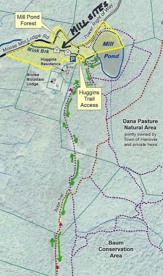
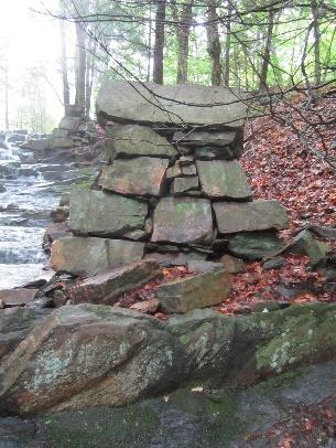
Hidden in the woods are remains of a late 1700s saw and grist mill. They are very close by but invisible unless you make the short scramble through the woods to see them.
  • Walk back down Moose Mountain Lodge Road to a telephone pole opposite the gated entrance to the tower right of way. Turn L and bushwhack back the short way to the stream. You’ll soon pick up an old cart path on the near side. Take this down along the brook, admiring the cascades, to a series of angular piles of rock. Towers rise on either side of the brook. More can be seen farther downstream.
  • We marvel at how David Woodward managed to build these structures in such a steep ravine around 1800, his only tools likely being a pair of sturdy oxen, ropes, a chisel, and a native understanding of physics. In his 1982 anthropology paper, Dartmouth student Tom Slocum suggests that Woodward used the cubic
  • blocks of native schist to build an undershot-type mill that most likely functioned to saw wood and grind grain. Water stored in the pond above could be released to provide enough flow to operate the mill. At some point in its history, the mill operated only during the spring freshet and only as a sawmill.
  • The 1930s builders of Moose Mountain Lodge found their fireplace ornament here amid the ruins of Woodward’s mills. These historic sites are now specifically protected from further disturbance by the Hanover Conservancy’s Mill Pond Forest conservation easement.
  • Continue down the brook-side cart path to the last set of ruins. The path appears to end here; retrace your steps to return to your car.

Revised 10/2020

Filed Under: Dana Pasture Lot, Easements, Hike of the Month, History, June, Mill Pond Forest/Huggins Trail Access, Moose Mountain, Views Tagged With: beaver, grist mill, wild strawberry

Shumway Forest on Moose Mountain Conserved!

July 12, 2017

Download a newly updated trail map HERE.

Our conservation work continues on Hanover’s highest ridge with the permanent protection of the 313-acre Shumway Forest – the largest project in our half-century history!  The parcel stretches from Three Mile Road to the crest of Moose Mountain and creates a link both to other conservation lands – federal Appalachian Trail lands, town-owned parcels, and the Mill Pond Forest – and to a vast network of foot trails including the AT.  This connected high elevation habitat assures room for wildlife – and hikers – to roam.  The parcel includes headwater tributaries of Mink img_2207Brook and a variety of other types of wetlands, including a fen (left), vernal pool, and black ash and red spruce swamps.

The Shumway Forest is the center of a mountainside trail network that includes not only the Appalachian Trail as it travels from Three Mile Road to the South Peak of Moose Mountain, but a dozen other foot trails totaling 3.4 miles, linking the AT with others on the mountain and beyond. Many are trails that Kay and Peter built and/or maintained for skiing as the owners of Moose Mountain Lodge.  Coincidentally, they signed the conservation easement on the 40th anniversary of their acquisition of the Lodge.

The Shumways and their neighbors, Elisha and Anne Huggins, previously donated a conservation easement on the abutting Mill Pond Forest and Huggins Trail Access, protecting a key public access point as well as the primary headwaters of  Mink Brook.

Two grants allowed us to purchase a permanent conservation easshumway-forest-topo-for-app-2016-11-21ement on this prominent property.  New Hampshire’s Aquatic Resource Mitigation Fund provided a major contribution, the largest single grant in the Conservancy’s history.  A second grant from the Quabbin to Cardigan Partnership helps with transaction costs. Owners Kay and Peter Shumway have generously made a bargain sale of this easement, far below market value.  Learning of the awards, the Shumways replied, “We are thrilled with your news and the idea that our land will be forever open for people to enjoy and not covered with no trespassing signs (and houses…)!”  We  look forward to a mountain-side celebration on July 17.


Filed Under: Conservation, Easements, Moose Mountain, Shumway Forest

Moister Meadow protected

October 3, 2015

The Hanover Conservancy is pleased to announce a new addition to its portfolio of protected lands, the Moister Meadow.  The conservation easement on the 21-acre property, set in the rolling hills of Hanover Center, is the gift of F. Corbin Moister, Jr., whose family has owned the land for over 40 years.

Views into Vermont from the Moister Meadow off Dogford Road

The open meadow, fringed by forest, represents an iconic historic farming landscape, ringed with stone walls dating from the early 19th century. The property is located in the headwaters of the Slade Brook watershed and abuts over 700 acres of other protected land, including the Huntington Hill Wildlife Management Area and the historic Nutt Farm.

“Protecting this property accomplishes a number of the Conservancy’s strategic conservation goals,” observes Adair Mulligan, Executive Director. “The meadow provides an increasingly uncommon type of habitat for woodcock, bobolink, and other grassland birds and wildlife, and also has valuable agricultural soils.  As the forest reclaims many old fields like this, such habitat is becoming scarcer. The open views and rolling landscape are moving reminders of Hanover’s past.”

Just as important, the wetlands and rivulets on the property protect the waters of Slade Brook and supports flood security for neighborhoods below. Such headwaters help control stream flow and are the first line of defense against microbursts and washouts. The Conservancy’s Jim and Evalyn Hornig Natural Area at Lower Slade Brook, just off River Road, guards another 35 acres around this stream.  The Moister Meadow provides a link in the wildlife corridor that connects the Connecticut with Hanover’s uplands and Moose Mountain.

“My father and step mother chose to build their home in this meadow at least in part to allow their English Setter dogs a safe place to run,” Corb Moister says. “I am very pleased to be able to preserve a portion of this property exactly as they found it 50 years ago. I hope that future owners and neighbors will enjoy tMoister-2014-12-27-locushis beautiful place as my family has.”

Donor Corb Moister with Exec. Director Adair Mulligan (L) and President Nancy Collier

The land will continue in private ownership and is currently listed for sale. Public access will be a decision of the future landowner. One need not step onto the property to enjoy it – beautiful views across the meadow from stone wall-lined Upper Dogford Road make for an enjoyable walk or drive.

Filed Under: Conservation, Easements, Moister Meadow

Thank you for your support!

Our generous members and Corporate Conservators help make all of this possible. If you’re a customer of  our local business supporters, please let them know their contributions are appreciated!

71 Lyme Road
Hanover, NH 03755
(603) 643-3433

info@hanoverconservancy.org

Facebook logo   Instagram   YouTube

Get Involved

Become a Member

Volunteer

Business Sponsors

Conserve Your Land

Employment

Our Mission

Advocacy

Conservation

Education

Stewardship

Explore Hanover

Hanover Hikes

Upcoming Events

Upper Valley Hikes

Trails Challenge

Copyright © 2023 Hanover Conservancy | Design by Chase Brook Software