Hanover Conservancy

Facebook logo   Instagram   YouTube          
Donate button
  • Home
  • About Us
    • Celebrating 60 Years
    • What We Do
      • Advocacy
      • Conservation
      • Education
      • Stewardship
    • Board & Staff
    • Membership Benefits
    • Contact Us
  • Get Outdoors
    • Hanover Lands
      • Balch Hill Natural Area
      • Mink Brook Nature Preserve
      • Other Properties
    • Hanover Hikes
    • Upper Valley Hikes
    • Exploring Nature at Home
    • Trails Challenge
    • Hunting
  • Events
    • Calendar
    • Celebrating 60 Years
    • Hanover Trails Challenge
    • Hike of the Month
    • Private Events
  • Get Involved
    • Donate
    • Volunteer
    • Adopt a Trail
    • Corporate Conservators
    • Planned Giving
  • Education
    • School Programs
      • KAST
      • Connecticut River Studies
      • Hanover High School Scholarship
    • Request a Field Trip or Speaker
    • Research on Our Lands
    • Hanover History
    • Resources
  • News
    • Remembering Bob Norman
    • Reports & e-News
  • Conserve Your Land

Osher participants are raving about the Hanover Conservancy’s classes

November 21, 2022

Adair Mulligan and Gail McPeek have finished up another successful Osher session and the participants can’t stop raving about it! See what they had to say below:

“Gail and Adair are both talented teachers. It is a pleasure to listen to them; they are wonderful at answering all questions.”

“So knowledgeable!!!!!!! Learning by seeing!”

“Gail went above and beyond providing make-up hikes, due to the heavy rain on the day of our final hike.”

Keep an eye out for future Hanover Conservancy Classes through the Osher Lifelong Learning Institute

Filed Under: Events, History, Indoor Programs, Lands, Outdoor Trips Tagged With: Dartmouth, History of Lands, Osher, Osher Classes, Outdoor event, Outdoor trips

A Trip Through Tunis History

September 12, 2022

Sun, Sept. 25, 10am-noon

Remote northeast Hanover is the Tunis District, a once-busy 19th c. settlement with its own one-room schoolhouse built in 1822. Celebrate its 200th anniversary with a peek at the beautifully restored school and easy/moderate hike to an historic mill site. Location: 88 Wolfeboro Road. Leaders: Barbara Fildes, Keith Quinton, and Adair Mulligan. Co-sponsored with the Hanover Historical Society.

Head over to Event Page for more information and registration!

Filed Under: Education, Events, History, Lands, Outdoor Trips, Partnerships, Tunis Mill Lot, Uncategorized Tagged With: Fall Trips, Hanover Historical Society, Outdoor event, Outdoor trips, Town of Hanover, Tunis, Tunis School house

Pasture Road Peregrinations

June 30, 2022

DOWNLOAD FULL PDF OF DIRECTIONS -Pasture Road Peregrinations

Driving directions:

  • From Etna Village, head N on Hanover Center Road
  • Turn R on Ruddsboro Road and drive 1.8 miles
  • Turn L on Old Dana Road
  • Turn R onto Moose Mtn. Lodge Rd just past an old barn
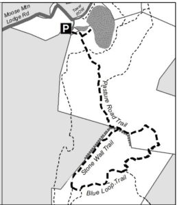
  • Drive 0.8 miles to top of steep road. Park at the marked trailhead parking area.

What you should know:

  • Foot travel only.
  • Dogs welcome if under close control.
  • Bring binoculars for viewing waterfowl on Mill Pond.
  • This hike explores a trail newly built and blazed in spring, 2022 and visits the Dana Forest and Pasture Natural Area, co-owned by the Town of Hanover and a Dana family heir, and the privately owned Baum Conservation Area. These lands are part of a 3,800-acre contiguous block of protected higher-elevation wildlife habitat on Moose Mountain.

BRIEF HIKING DIRECTIONS

  • Begin at the sign reading “Mill Pond Forest & Huggins Trail Access.”
  • Bear L at first trail junction to visit Mill Pond
  • Return to trail junction and turn L onto Pasture Road
  • Follow signs for Pasture Road Trail.
  • Turn R onto Stone Wall Trail at gap in stone wall
  • Turn L onto Blue Loop Trail, heading downhill
  • Turn L onto Pasture Road Trail
  • Continue straight after junction with Stone Wall Trail
  • Bear L at junction with Pond Trail
  • Retrace your steps to return to your car

FULL DIRECTIONS

  • Begin your hike at the sign reading, “Mill Pond Forest & Huggins Trail Access.” To forever ensure public access to the network of trails you’ll be exploring, the Shumway and Huggins families donated conservation easements on this area to the Hanover Conservancy in 2016.
  • Cross a small drainage and note the grassy area beyond the trees at L. By 2017, the beavers left when their preferred food supply ran out, after years of entertaining their neighbors with tail slaps on the water plus plugged culverts and “free-range forestry.” The thread of infant Mink Brook has reappeared in the absence of management by these aquatic engineers, and the series of pools is growing up to grass.
  • 3 minutes’ walk from your car, bear L at the first trail junction. In 15 paces look for a cellar hole at L, difficult to see amid the lush growth at this time of year. Here stood the home of David Woodward, who built the dam on Mill Pond and a sawmill and gristmill on the small, steep falls of Mink Brook below where you left your car.
  • Continue on the path a few minutes further to Mill Pond, the highest water body in Hanover and the primary source of the town’s largest stream. Set in a saddle on the mountain ridge, it originally may have been a smaller pond or perhaps a marsh. Around 1800, Woodward built a drylaid stone dam (out of view at L, beyond the spruces) to raise the water level some 6-8 feet (since partly silted in). Beavers later took over managing water levels but since they departed, the pond has shrunk to half its size. Directly across the water is the remains of their impressive lodge. Today, the entire shoreline remains undisturbed as Hanover Conservancy easements protect the N side and the S side is the Dana Pasture Natural Area. It is this 132-acre parcel straddling the mountain ridge that we’ll traverse now
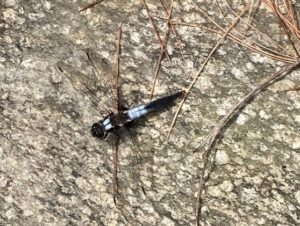
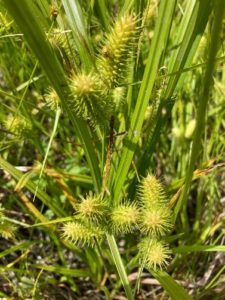
  • Scan the pond for waterfowl and other birds. On the day we visited, elegant black and white dragonflies, looking as if they were dressed for a formal affair, darted over the surface. Punctuating the green bristly growth of sedges (left) are the paired reddish (when emerging) leaves of St. John’s Wort.
  • Retrace your steps to the trail junction, marked with a sign for Pasture Road and a green moose. Turn L onto this historic Class VI road. Where it once met Moose Mountain Lodge Road is anybody’s guess – we bet it’s now under an old beaver dam.
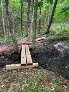
  • Pasture Road follows an old stone wall through mixed woods. You’ll soon arrive at a pair of hefty bog bridges, built in 2022 by the Upper Valley Trail Alliance’s High School Trail Corps to provide dry footing across a wet part of the old road. The road climbs gently and in a few more minutes, cross another wet area. These seeps may seem pesky to hikers but are an important part of the mountain’s water retention system, holding moisture in the soil rather than letting it run quickly downhill. This is especially important with the sudden, heavy downpours that are accompanying climate change
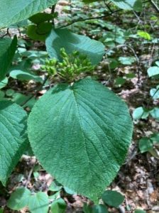
  • Note two of the “junior” members of the forest community that both feature paired leaves: striped maple, with its goose-foot shaped leaf, and hobblebush (left), a viburnum just setting fruit at this time of year. As fall approaches, it will turn a deep purple and its fruits, beloved by birds, will turn bright red
  • Four minutes’ walk from the last wetland crossing, pass the Orange Diamond Ridge Trail at L. Ahead at R is a sign for Pasture Road. Continue straight.
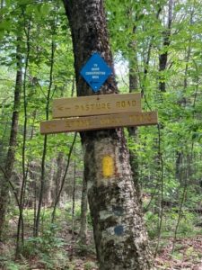
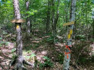
  • 8 minutes later, bear L at a set of signs posted to help you navigate the uncertain route of historic Pasture Road toward the Baum Conservation Area and Stone Wall Trail.
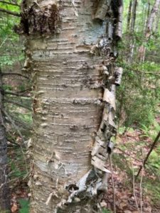
  • You’ve been passing through true northern hardwoods forest, with some of its most handsome members on display. We’re fond of the glistening golden bark of yellow birch like the one on your L (photo), a northern species that is more shade-tolerant and long lived than its familiar, iconic cousin known as canoe, paper, or white birch. The forest here looks to be about 75 years old, with beech, northern red oak, red and sugar maple, and hemlock.
  • The forest is in recovery from its years as the Dana Farm’s summering grazing grounds. The Dana family farmed this area since the late 1800s. Into the 1960s, the family drove their cattle up the mountainside to graze on the remaining open pastures in summer.
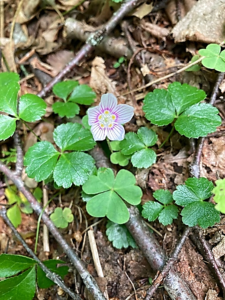
  • From the signs, continue for 7 minutes on the yellow-blazed trail, keeping an eye out for the colorful mushrooms and fungi that begin to appear at this time of year. Spring wildflowers have mostly wound down, but you may spot the delicate pink-striped white blossoms of mountain woodsorrel, Oxalis montana, shown at R mixed with the similar but glossier leaves of goldthread.
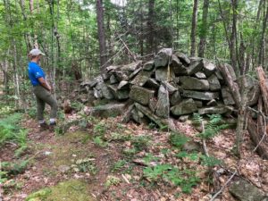
  • Suddenly, Pasture Road delivers you to a large and dramatic stone wall, built of huge, angular, coarsely laid blocks. A yellow-blazed pin indicates that the wall marks a property boundary – to the S is the Baum Conservation Area, owned by a local Dartmouth alumnus with a keen interest in trails and the public benefits of protected land. Bear L along the wall for a few minutes to a gap at the junction of the Pasture Road Trail and the new Stone Wall Trail. Take a moment to check the signage here, as you’ll be returning to this spot in a little under an hour. If your time is limited, you can just explore the Stone Wall Trail (11 minutes one way) and retrace your steps.
  • Turn R and down the hill on the Stone Wall Trail, built in 2021 to replace 2 trails retired to reduce impact on wildlife habitat. Volunteers led by the Hanover Trails Committee spent 34 person-hours in one week in 2022, blazing 10-12 miles of trails here and elsewhere. It takes lots of work, time, and bug-swatting, all powered by a spirit of good will, to provide such trails for you to enjoy.
  • On the R, the massive stone wall is in view upslope; soon you’ll notice a parallel wall at L. The forest is younger here, and wild sarsaparilla is common in the understory.
  • The Stone Wall Trail ends at a connector trail not long after the wall itself ends. Note a closed trail at R and a sign ahead on the opposite side of a tree. Continue your hike by bearing L and gently downhill, crossing a small drainage to the extensive trail system on the Baum Conservation Area.
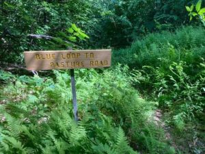
  • 4 minutes from the Stone Wall Trail, turn L on the Blue Loop Trail and head down through a fern-covered former skid trail. In 3 minutes the trail briefly levels out. Look L for a sign reading “Blue Loop to Pasture Road” and head downhill again.
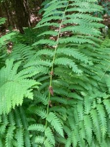
  • Enjoy this old logging road with a few short steep sections and some low ledges. Now’s a good time to admire the variety of ferns growing here – wood fern, cinnamon fern, interrupted fern (photo) and the delicate, dual-tapered New York fern. Sturdy three-part bracken fern and the coarser fronds of sensitive fern enjoy damp spots.
  • The trail bears L at the bottom of a hill. A short section of blocky stone wall is visible at L. Cross a small drainage that may be dry at this season. On the other side, back on the town’s Dana Forest and Pasture Natural Area, pick up the yellow blazes again. The trail moves gently downhill.
  • 10 minutes from your last turn, cross another drainage and look L for another Pasture Road sign. Turn L here; the Blue Loop Trail you’ve been following continues downhill. Natural stone steps lead up and the trail bends L and slabs across the slope. Keep your eye out for yellow blazes to guide you on this less-beaten path that curves up and around a ledge.
  • Here, forest patches are composed of pole-sized saplings of young beech and goose-foot (striped) maple, belying a recent forest disturbance. Arrive at an opening filled with blueberries and bracken fern and then move more steeply up into hemlocks, whose dense shade discourages understory growth. As the trail becomes less steep, note a scarred beech at L that appears to be a favorite for bucks to rub velvet off their antlers. Pine and oak join the hemlocks. The flute-like calls of the wood thrush provide orchestration for your hike. The wind in the trees overhead reminds that you’re climbing on a mountain ridge.
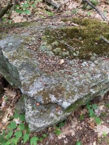
  • The trail reaches the top of a gentle ascent and bears L. Mossy flat stones decorate the treadway. In 2 minutes another stone wall appears ahead. Bear R to keep it on your L. The angular flat rock at L bears evidence of many squirrel picnics.
  • The wall follows the Baum/Dana boundary, and the trail takes a sharp R where the wall meets a ledge.
  • 4 minutes from your meeting with the wall, you’re back at the signed junction with the Stone Wall Trail, closing the loop. Continue straight on the Pasture Road Trail, keeping that impressive wall on your L; bear R to follow the yellow blazes.
  • What are such massive stone walls doing in the forests of Moose Mountain? When they were built, likely during the Sheep Craze of 1820-1850, the forests were largely gone, cut to provide building materials, heat, and especially open pastures for merino sheep. In 1840, there were over 11,000 sheep grazing Hanover’s hillsides, tended by a human population of only 2,800. As the region’s wool market and textile industry succumbed to competition from the Midwest and South in the Civil War era, the departure of nibbling sheep allowed the forest to return, yet the timeless walls remained.
  • Continue straight (N) on the Pasture Road Trail, passing several signs for the Orange Diamond Ridge Trail. As you go, note signs of forest succession – dead snags of white birch, blowdowns, and more. All these are signs of rejuvenation and provide habitat for various birds and small mammals.
  • 10 minutes from the Stone Wall Trail stay L on the Pasture Road trail. The opening visible through the trees off to the R is the S end of Mill Pond, filling in with grasses now that beavers are no longer maintaining their improvements on David Woodard’s dam. If the beavers do not return, you’ll soon find alders and other wet-tolerant woody plants here. Eventually, the forest will reclaim this space.
  • Pasture Road’s more formal walls accompany you until you arrive at the path at R leading to the water. Turn L at this fork to return to your car.

July, 2022

Thanks to the Coop Food Stores’

program for supporting this hike of the month 

Filed Under: Bears, Birds, Conservation, Deer, Hike of the Month, History, July, Lands, Moose Mountain, Trails, Wildlife

60 years of Hanover Conservancy

January 3, 2022

The Hanover Conservancy is pleased and proud to share with you our new video honoring our 60th anniversary milestone. During 2021, we worked with videographer and Hanover High School student Ezra McGinley-Smith to capture Hanover’s most meaningful conservation places, partners, and progress. Check out our Celebrating 60 years for more info about HC and Ezra

Filed Under: Conservation, Featured, History, Lands, Media, Uncategorized

Watch the 2021 Annual Meeting on our YouTube Channel!

November 17, 2021

Yesterday’s Annual Meeting was recorded! View the full video on our YouTube channel. The first 15 minutes are the business portion, followed by Executive Director, Adair Mulligan presentation of the History of HC protected lands and Q&A. Enjoy!

Filed Under: Board of Directors, Education, Events, History, Lands, Media

Hanover Conservancy’s 60th Anniversary Celebration

October 5, 2021

This past Saturday we held our 60th anniversary celebration at the Dartmouth Rivercrest field across from our office at 71 Lyme Rd in Hanover. 76 people came out to help celebrate 60 years of community conservation with Hanover Conservancy and we had a chance to hear stories from fellow community members. It was very heartwarming to be able to capture a photo with past and present board members from 1961 till now. We also had the opportunity to recognized our key partners.

  • Russell Hirschler- Upper Valley Trails Alliance
  • Julia Griffin & Rob Houseman- Town of Hanover
  • J.T. Horn- Trust for Public Land
  • Betsy McGean- Trust for Public Land & former president 

A huge thank you to our event sponsors!

Fisher Financial Advisors

Revision Energy

LindeMac Real Estate

E.C. Brown’s

Coop Food Stores

Mascoma Savings Bank

My Brigadeirio

Poverty Lane Orchards


Special Thanks to

Dartmouth College

Lars Blackmore- Ameridane Press

Lyme Road Dental, Neal Wallace Dental

Sheridan Printing

Red Clover

Hanover Parks & Recreation 

Those Guys of Lyme

Filed Under: Conservation, Events, History, Media, Outdoor Trips, Uncategorized

  • 1
  • 2
  • 3
  • …
  • 5
  • Next Page »

Thank you for your support!

Our generous members and Corporate Conservators help make all of this possible. If you’re a customer of  our local business supporters, please let them know their contributions are appreciated!

71 Lyme Road
Hanover, NH 03755
(603) 643-3433

info@hanoverconservancy.org

Facebook logo   Instagram   YouTube

Get Involved

Become a Member

Volunteer

Business Sponsors

Conserve Your Land

Employment

Our Mission

Advocacy

Conservation

Education

Stewardship

Explore Hanover

Hanover Hikes

Upcoming Events

Upper Valley Hikes

Trails Challenge

Copyright © 2023 Hanover Conservancy | Design by Chase Brook Software