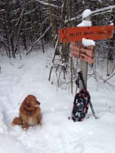
Driving directions:
- From the Hanover Center green, head north on Hanover Center Rd.
- Shortly before Rennie Rd, turn R (E) on Ferson Rd.
- Turn L at T onto Three Mile Rd.
- Turn right at T onto Ibey (sometimes spelled Iby) Rd.
- Proceed up the hill 0.1 mile to the small parking area at the road’s maintained end opposite a cape house.
What you should know:
- This is a mostly easy hike with a few short steeper sections.
- The route is well marked with flagging and blue diamonds.
- Foot travel only.
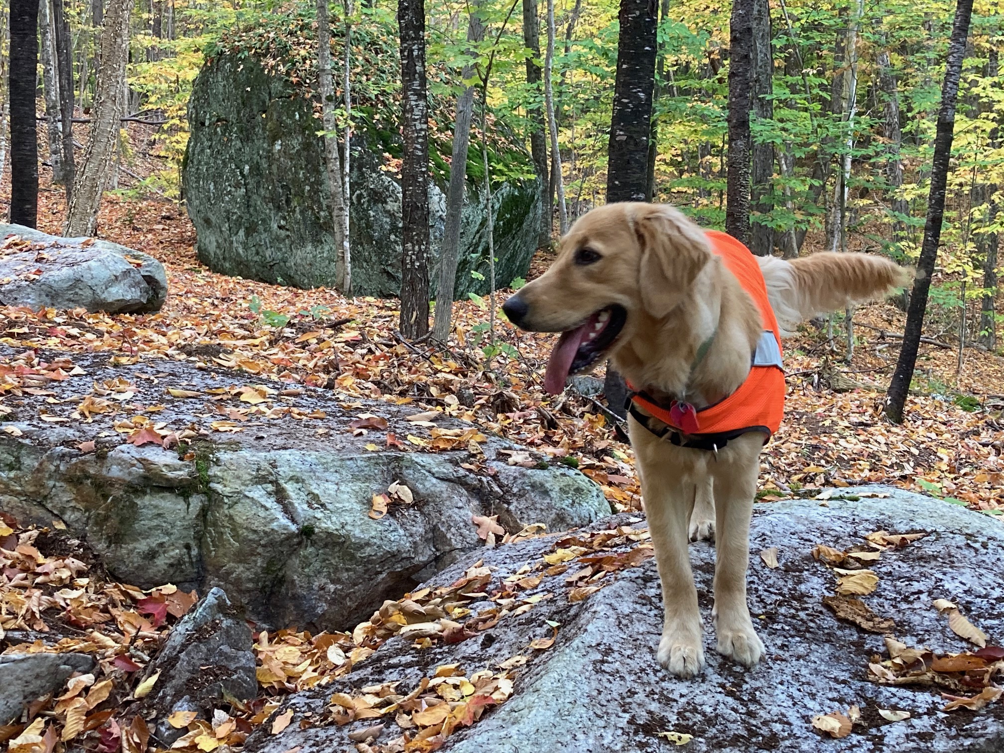
- Dogs are welcome but must be under your control; please pick up after your pet.
- Deer hunting is permitted in season; dress appropriately.
- The Black Bear Loop trail was built in 2020 on the Conservancy’s Britton Forest.
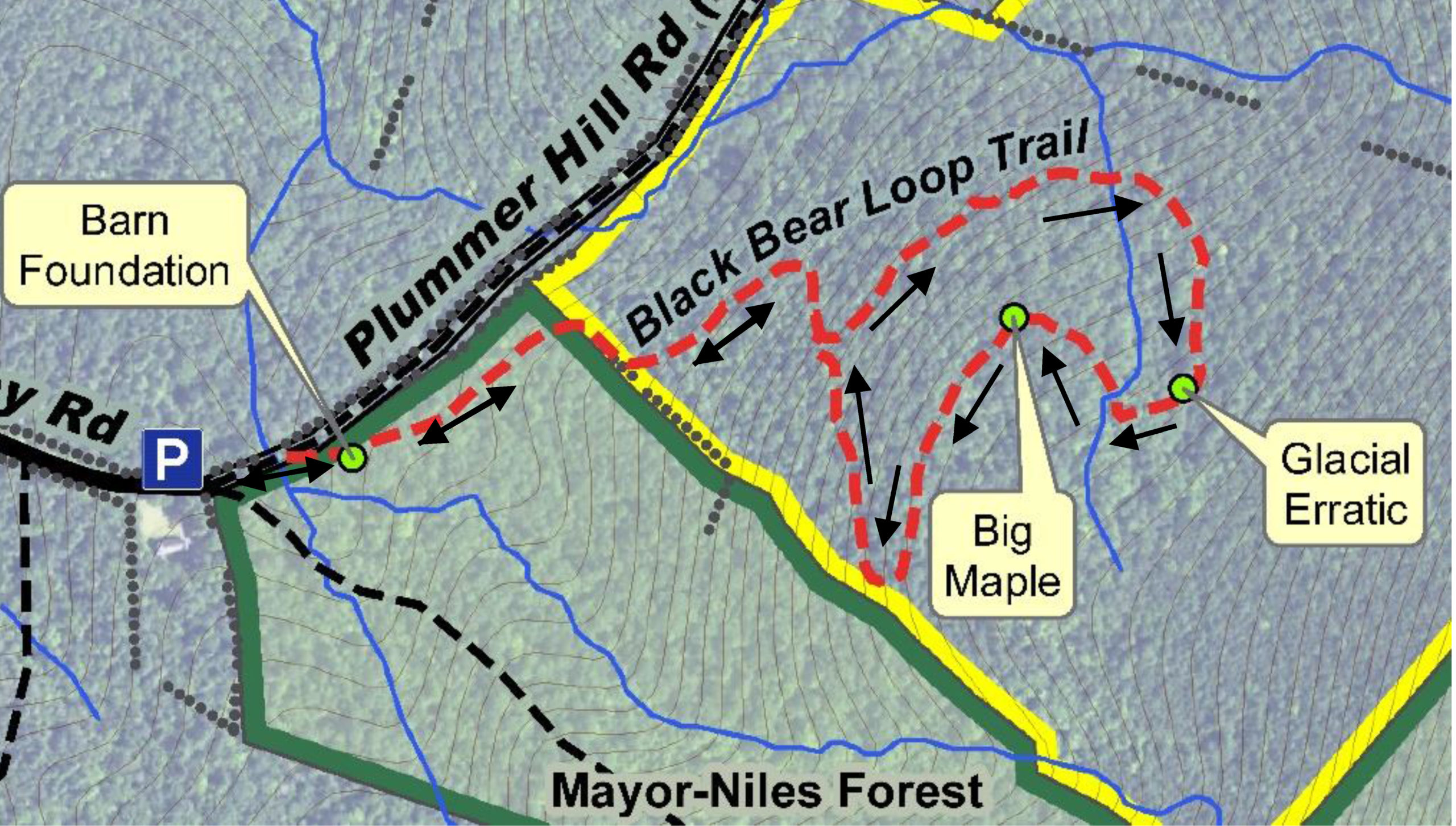
BRIEF HIKING DIRECTIONS
- From the trailhead parking area, take the Class VI Plummer Hill Road, the continuation of Ibey Road.
- Cross a small stream and turn R off the old road at a large old maple and a barn foundation.
- Follow the trail over and then along a stone wall.
- Bear L at a trail junction up and across a small stream on a log bridge.
- The trail visits a large glacial erratic and an old maple tree, unusual survivor of an insect infestation here.
- The trail returns to the junction; stay straight to return to the stone wall and eventually the barn foundation.
- Bear R at the foundation and immediately L onto Plummer Hill Road to return to your car.
FULL DIRECTIONS
- At the trailhead parking area, take a moment to look around. The house stands on the site of the former Smith farmhouse, which was standing here by 1799. By 1892, it was owned by Henry L. Barnes. The stone wall just L of the house marks a boundary of the Mayor-Niles Forest, a 92-acre mountainside property given to the Hanover Conservancy in 2013 by Michael and Lili Mayor and John Niles. This land, and the 79-acre Britton Forest just beyond, were once part of Barnes’ 220 acre family farm –by the mid-19th century, likely treeless sheep pasture! More about that as we proceed.
- Begin your hike by heading up the Class VI Plummer Hill Road, the unmaintained continuation of Ibey Road. At R is the trailhead for the Mayor-Niles Forest, where you can pick up a trail map and guide. Today we’ll continue N for a brief time on Plummer Hill Road, crossing a small stream on logs placed at R.
- This road dates back to the 18th century, when it apparently dead-ended farther up around Plummer Hill and did not continue on to nearby Lyme. However, the old road, discontinued in 1979, now serves as a section of the Harris Trail, offering some of the best back-country skiing in Hanover. The Harris Trail begins 3.2 miles S at Moose Mountain Lodge Road and runs nearly the entire length of Moose Mountain, following a major tributary of Mink Brook, passing Dartmouth’s Class of ’66 Lodge, and crossing the old Wolfeboro Road before arriving at Ibey Road just below where you parked. The Harris Trail continues 1.5 miles up Plummer Hill Road and has recently been re-opened all the way to Goose Pond Road thanks to cooperative landowners and a dedicated volunteer.
- But back to today’s hike. Just past the crossing, look ahead at R for an old maple snag that marks your turn – and Farmer Barnes’ former route – to the remains of his bank barn. New Hampshire is not blessed with much level land, and any sensible hill farmer would use sloped land to his advantage, building his barn back into the hillside. This avoided taking up precious level space and provided handy access to multiple levels of the building. While a century’s leafy detritus makes it a little hard to see, a close look at the drylaid stone foundation shows how the barn was built into the hill so one could enter either from where you are standing or reach an upper level by walking up and around to the back.
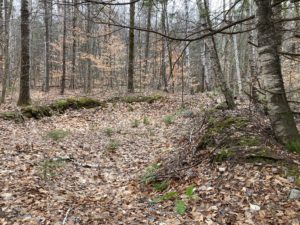
Barnes barn foundation - Find your trail heading NE past the lower L side of the foundation. The trail is marked with various colors of flagging being replaced with more durable blue diamond markers.
- Cross a small drainage on stepping stones and continue as the easy path takes you through mixed woods.
- 10 minutes’ walk from your car, cross a stone wall and immediately turn R as the path follows the wall. One is tempted to wonder why anyone would build a stone wall in the forest –to keep the trees from wandering off? Indeed, over a quarter million miles of stone walls just like this were built in New England and New York before 1870, most of them in the first 20 years of that century, and mostly to contain sheep. Imagine this space as an open grassy pasture when the wall was built, except for the upper slopes of Moose Mountain.
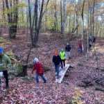
- The stone wall marks the boundary between the Conservancy’s Mayor-Niles Forest and Britton Forest, the generous gift of Doug and Katharine Britton in 2017. This now wooded parcel had been in the Britton family for many years. When Doug decided to donate the property to the Conservancy, he asked that a trail be built here for the public to enjoy – and here you are. With a grant from the Quabbin to Cardigan Partnership and gifts from friends and neighbors, the Conservancy confirmed the W boundary of the parcel and engaged the Upper Valley Trails Alliance’s high school trail corps to build the trail during the summer of 2020, following a full year’s observations of soil conditions and wildlife movements to determine the best route. The trail explores the S part of the property, not far from trails on the Mayor-Niles Forest, to avoid disturbing a high-use bear area on the N side.
- The trail follows the old wall for a short while and then turns L, winding pleasantly up the slope. The trail builders benched the path here for a more level treadway.
- The trail bears R and up more steadily through mixed woods.
- 10 minutes from the stone wall crossing, arrive at a fork where markings on a large hardwood straight ahead catch your eye. A cut stump at your feet bears an arrow pointing L to begin the loop.
- The trail rises gently and, when leaves are off the trees, offers views at L into the valley below.
 9 minutes from the junction, cross a log bridge built by Hypertherm volunteers. Listen for the music of a small waterfall just below. This stream, like its sisters on the Mayor-Niles Forest, is part of the headwater network for Hewes Brook, which flows down off the NW slope of Moose Mountain in to Lyme, past Crossroads Academy, and on to the Connecticut River. By protecting these headwater streams, keeping them naturally forested and shaded, the Conservancy protects cool and clean water for brook trout while providing security against downstream flooding during the heavy storms that come with climate change.
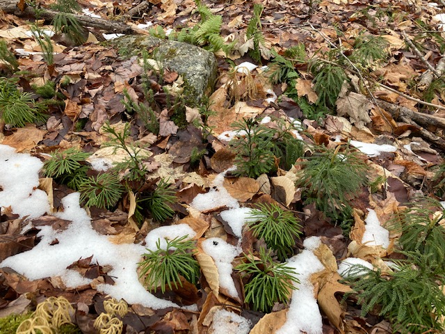
 Once across the log bridge, keep your eyes out for a tiny forest of Lycopodium, or clubmoss. There are at least 3 species here – ground pine, ground cedar, and shining club moss, miniature ancient cousins of the huge forests that once offered shade to dinosaurs.
- As you continue, look for deer scrapes and antler rubs on smaller trees near the trail. These are message boards for deer looking to see who has been by and their breeding status. They also serve as handy scratching posts for ridding maturing antlers of their nourishing velvet.
- Don’t miss a pretty view down at R into the valley of the stream you recently crossed.
- 10 minutes’ hike past the bridge, arrive at curious slabs of stone that look as if a giant had just lost a game of dominoes. One of them offers the perfect seat for a snack, with a great view of one of this trail’s highlights – a grand glacial erratic.
 This rock had some help getting here from nearby Holt’s Ledge in Lyme, but the icy conveyor belt melted and disappeared 14,000 years ago. Spend a few moments admiring the growth of rich moss on its downslope side encouraged by moisture rising from the stream below. Topping the huge rock is a toupee of rock polypody, a tiny evergreen fern that seems to like such perches.
- The trail descends to pass on the L side of the erratic. As you go by, look up to admire the ambition of a small shrub that has claimed a foothold on top of the rock.
- The trail continues toward a small stream, bearing R as you approach it. Nearly 10 minutes after leaving the erratic, cross the stream on a double log bridge – built by Hypertherm volunteers like the one you crossed lower down on this same brook. As you do, look upstream to see where several braided channels come together. It’s places like this that allow this little brook to play its part in capturing and holding stormwater before sending it gently downhill.
- The trail turns L and up after crossing the stream. Note the finely corrugated bark of the ash trees here. Ash enjoys damp soils and is a good partner for the stream. A fallen ash at the far side of the brook’s little valley guides you on your way.
- 5 minutes after crossing the stream, a big old sugar maple comes into view. It shouldn’t be much of a landmark, but indeed it is. You can’t recall seeing other maples of this size here, except near the barn foundation. Shouldn’t this mixed northern hardwoods-hemlock-red spruce forest have lots of them? Yes – but they were mostly cut in the 1980s during a salvage operation following an infestation of the saddled prominent moth. Apparently this one missed the logger’s saw, or maybe it was left as a seed source for the once and future forest.
- The trail turns L near the maple and heads gradually down through the fallen brush of dying birches. Paper, or white birch, is an early successional tree that comes in to the sunny openings created by fires, logging, or windthrow, but doesn’t do as well once its longer-lived companions shade it out.
 About 15 minutes’ walk from the big maple, the trail turns L twice before arriving at the end of the loop. Pause here to consider a red spruce at R. It was this species of tree that alerted the country to the scourge of acid rain in the 1980s, when scientists from the University of Vermont noticed waves of dying red spruce on the W slopes of Camel’s Hump…the slopes that caught polluted winds blowing in from industrialized parts of Ohio, Michigan, and SW Ontario. Efforts to control air-borne pollution were successful enough that acid rain is largely a thing of the past and the spruces are recovering, but they face a new threat – climate change. Barely tolerant of warm temperatures, red spruce survives on “sky islands” around the summits of the southern Appalachian Mountains, along the Maine coast, and in higher elevation parts of New England such as this. These populations will surely shrink as the climate warms. Their presence here contributes to wildlife habitat value – offering food and shelter for ruffed grouse, snowshoe hare, and small mammals in times of snow, and is among the many reasons the Conservancy was pleased to protect this land.
 You’ve just spent an hour roaming an unbroken forest – another key reason the Britton Forest is important. The property is surrounded on three sides by other forested, protected and/or public lands: the Mayor-Niles Forest to the S, the Appalachian Trail corridor owned by the National Park Service to the E along the mountain’s spine, and the Plummer Tract to the N, owned by the Town of Hanover. Keeping all of these higher elevation forests intact means continuous, cooler room for wildlife to roam, especially as the climate warms.
- It’s time to retrace your steps – bear L at the trail junction and down the hill.
- Soon you arrive at the stone wall, turning R to follow it briefly before turning L to cross it and continue down to the barn foundation guarded by its ancient maple.
- Turn L onto Plummer Hill Road, and return to your car 10 minutes after crossing the wall. Resolve to return another day to explore the trails on the nearby Mayor-Niles Forest.

This Hanover Hike of the Month is generously sponsored by ![]()

 The Appalachian Trail Conservancy manages care of the land. Trails on the property are maintained by Berrill Farm neighbors and Hanover Trails Committee volunteers. The beautiful meadows will be kept open for their spectacular views and grassland bird habitat.
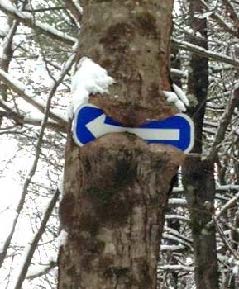 errill Farms. Above to the L, a tree seems to be gnawing on a blue arrow. Ahead at R, another tree has made less progress consuming its arrow sign. Bear R here and follow the arrow and blue-blazed trail downhill past a large old wolf pine at R.