Hanover Conservancy

Facebook logo   Instagram   YouTube          
Donate button
  • Home
  • About Us
    • Celebrating 60 Years
    • What We Do
      • Advocacy
      • Conservation
      • Education
      • Stewardship
    • Board & Staff
    • Membership Benefits
    • Contact Us
  • Get Outdoors
    • Hanover Lands
      • Balch Hill Natural Area
      • Mink Brook Nature Preserve
      • Other Properties
    • Hanover Hikes
    • Upper Valley Hikes
    • Exploring Nature at Home
    • Trails Challenge
    • Hunting
  • Events
    • Calendar
    • Celebrating 60 Years
    • Hanover Trails Challenge
    • Hike of the Month
    • Private Events
  • Get Involved
    • Donate
    • Volunteer
    • Adopt a Trail
    • Corporate Conservators
    • Planned Giving
  • Education
    • School Programs
      • KAST
      • Connecticut River Studies
      • Hanover High School Scholarship
    • Request a Field Trip or Speaker
    • Research on Our Lands
    • Hanover History
    • Resources
  • News
    • Remembering Bob Norman
    • Reports & e-News
  • Conserve Your Land

Mink Brook Log Crossing Update

August 1, 2022

Mink Brook Log Crossing status as of August 1st, 2022

You may recall that we were planning for its replacement well before advancing rot forced us to close it last summer, starting with research into what kind of structure would conform to the restrictions in our deed. The above-mentioned erosion meant we needed longer, stronger logs than the trees growing there could provide, so we can’t just replace the log. Our terrific team of Thayer engineering students developed a well-considered plan for a new crossing in the same place, and we’ve been working since March to secure approvals from key stakeholders.

To that end, our volunteers are wandering around the Preserve interviewing visitors (again) to learn more about how and where they enjoy the land, so we can share that information with those decision-makers. We hope to have good news soon!

Filed Under: Lands, Media, Mink Brook, Stewardship, Trails Tagged With: bridge, log crossing, Mink Brook, stewardship

Mink Brook & Tanzi Tract

September 10, 2021

DOWNLOAD FULL PDF OF DIRECTIONS – Mink Brook & Tanzi Tract

Driving directions:

  • From downtown Hanover, drive S on Main St. (Rte 10) 0.5 miles to Brook Rd.
  • Turn L just before Route 10 crosses Mink Brook.
  • Follow Brook Road for 0.1 mile to a sharp bend.
  • Park here near the trailhead gate.

What you should know:

  • Dogs are welcome but must be under close control (better yet, leashed); please pick up after your pet.
  • Foot travel only. Bicycles are not permitted in the Mink Brook Nature Preserve.
  • Trail maps are available at the trailhead kiosk near the Brook Road gate.
  • The Preserve is home to bears who may emerge from hibernation as early as March (another reason to leash your dog). If you encounter a bear, do not run but speak softly to it and move away slowly. Mother bears are as protective of their young as we are.
  • You will visit the 112-acre Mink Brook Nature Preserve, owned and managed by the Hanover Conservancy since 1999, and the 15.8 acre Angelo Tanzi Natural Area, owned by the Town of Hanover.

BRIEF HIKING DIRECTIONS

  • Take the Quinn Trail through the gate and visit the kiosk.
  • Continue on the Quinn Trail along the N side of Mink Brook, past the Norman Overlook.
  • Bear R to view the brook, then bear L to return to the Quinn Trail. Turn R and up the hill.
  • Enter the Tanzi Tract at a stone wall and turn R onto the Brook Loop. Follow back to Quinn Trail.
  • Cross the Quinn Trail onto the Forest Loop and return along the stone wall.
  • Turn R onto the Quinn Trail to return to your car.

FULL DIRECTIONS

  • Pass through the gate onto the Quinn Trail. Take a moment to check the kiosk display just ahead and pick up a trail guide. Note the map outlining Mink Brook’s 18.5 square mile watershed.
  • Hanover’s largest stream begins high on Moose Mountain at Mill Pond, gathering waters from other headwater streams and flowing through Etna, where it once powered so many mills that the village was first known as Mill Village. Below Etna, the brook turns and runs S of Greensboro Road through the Mink Brook Community Forest, protected in 2021. Crossing under Route 120 and past the remains of a mill built for Eleazar Wheelock, the brook rushes W past the Tanzi Tract and through the Mink Brook Nature Preserve toward the Connecticut River.
  • You are walking the easy, flat Quinn Trail, named for a Hanover family we’ll hear about later. This part of the trail follows a buried sewer line marked by covers labeled “Hanover Sewer 1976.” While they seem out of place on a woodland walk, we can forgive the intrusion since the building of this sewer line to collect waste from hundreds of Hanover homes meant the transformation of Mink Brook and the Connecticut River from noxious open sewers back to the safe, clean waters they are today.
  • Note the nature of the water in the brook. If ice-free, does it appear to be lazy and slow-moving, or is it locked silent under a cover of snow and ice? In this area, both the Connecticut and Mink Brook are pond-like, backed up behind Wilder Dam just downstream in Lebanon. Farther along the trail, stay alert for a change in character to the naturally free-flowing, musical stream that flows off the uplands.
  • 5 minutes’ walk from the gate, the trail takes a sharp L by a crabapple tree. Pause here to note the thick, ropy stems of river grape (Vitis riparia) growing up the trees at L. This native vine is common along streams and offers a rich food source for birds and other wildlife.
  • Now look R for a path heading towards the brook through young pines, and take a short trip down to the water where stepping stones offer a way to cross the brook at certain seasons. In the 1990s, a 30+ lot subdivision was laid out for the 112 acres of today’s Preserve. A road to serve the subdivision was to cross the brook here. Give a cheer for the 500 donors, the Quinn Family, and Dartmouth College for recognizing the natural value of this place and stepping up to help the Conservancy and Upper Valley Land Trust protect it. The Hanover Conservancy now owns and manages the land, with conservation deed restrictions from UVLT.
  • Return to the Quinn Trail and note the exposed roots of a large tree on the steep bank opposite. This clay bank was mined at one time for clay that was used to build Dartmouth’s tennis courts!
  • Turn R to continue on the Quinn Trail; you’ll soon arrive at the Norman Overlook at R, marked by slabs of granite offering a pleasant perch for observing the brook. Bob Norman, a founder of the Hanover Conservancy in 1961, was its President in 1999 when the Preserve was protected. A demonstration planting of native shrubs includes red osier (Cornus sericea), whose brilliant red stems are especially ornamental in late winter. This handsome shrub is a great choice for wet areas, as it tolerates wet feet and its white berries offer high quality food for wildlife in fall. You may see it growing naturally nearby.
  • At this point, the brook is clearly more lively, with patches of open water roiled by its flow. Wilder Dam may be far out of sight, but it controls the character and movement of Mink Brook here in the Preserve and of other tributaries as far north as Haverhill NH and Newbury VT, 45 miles upstream. The Hanover Conservancy is closely following re-licensing of this dam and studies of how it affects erosion and sedimentation, fish, wildlife, invasive species, and even archeological sites. As this hike is published, a welcome new proposal from the hydropower company suggests altering dam management to more of a natural, run-of-river flow than an up-and-down “peaking” flow, meaning that more of Mink Brook would be allowed to behave like a proper stream instead of a pond.
  • Note the stone riprap on the streambank near the tree line. Tropical Storm Irene sent so much water down Mink Brook that the brook changed course and began to erode this bank. Because the sewer line runs close by, the Town of Hanover is intervening to protect it from erosion.
  • Just past this site, bear R off the Quinn Trail toward the old log crossing. The beautiful log bridge, crafted in 2009 from a nearby tree, served for over a decade to connect trails on the north and south sides of the Preserve. Mother Nature began to reclaim it and the crossing was closed in August, 2021 for public safety. From this point you can still enjoy views of the brook and a distinctive square-topped stone.
  • Follow the path, bearing L at a fork to return up a short narrow path to rejoin the Quinn Trail. Turn R and take care on the stony slope as you approach the pine and hemlock forest on the hill above.
  • Note the plaque at R honoring the Quinn Family, who helped protect this land in 1999. Both Brian and Allie Quinn were members of the Conservancy’s board of directors, with Allie leading environmental education efforts in Hanover schools in the 1970s and 80s.
  • 5 minutes’ walk from the brook, arrive at a mossy stone wall marking the boundary with the Tanzi Tract. In 1966-67, working with the newly formed Conservation Commission, the Conservancy took an option on this 15.8 acre parcel and provided half the funding for its purchase for the Town. Angelo Tanzi (1899-1969) was a beloved local figure who managed a grocery market on Main Street (R), and whose family once owned this land.
  • Turn R to follow the Brook Loop for a few minutes along the stone wall to a lookout over a particularly pretty section of Mink Brook.
  • The Brook Loop bends left past a private inholding and returns in a few minutes’ walk to the Quinn Trail. Cross it to explore the 10-minute Forest Loop, marked “Foot Trail Only.”
  • Soon, a wooded slope looms up ahead – one of the strangely steep sides of ancient channels of Mink Brook. This region was once inundated by the frigid waters of glacial Lake Hitchcock. Its fine sediments were easily sliced by the rushing waters of such brooks after the lake receded, leaving these ravines. The Storrs Road neighborhood, up out of sight on the terrace above, is set on part of the old lake bottom.
  • The Forest Loop follows the base of the slope, bending L and passing over two boardwalks through great bear territory. In the hollow is a beautiful forested wetland that begins to hum with life in early spring. Note evergreen Christmas ferns and tipped-up trees in the wet soils.
  • High quality habitat abounds here, for bears, wood frogs, and many other creatures and plants. In fact, the NH Fish and Game Department’s Wildlife Action Plan identifies this area as some of the highest quality habitat in the state, shown in pink on this map.
  • The stone wall soon reappears at R. Keep a lookout for an old pine snag that gives an up-close-and-personal view of pine anatomy, branch collars and all.
  • Return to the Quinn Trail and the Mink Brook Nature Preserve boundary sign on a large pine. Turn R and follow the trail down the hill, watching your footing and taking no turns.
  • At the foot of the hill, the path may be damp with drainage from a wetland that is an extension of the one you skirted on the Forest Loop. This space is lively in spring with wood frogs and other amphibians courting and laying eggs.
  • Continue W on the Quinn Trail past the Norman Overlook and kiosk to return to your car. As you do, note the change in character of the brook as it shifts from a free-flowing stream to one whose flow is captured by Wilder Dam.
  • Be sure to come back as spring unfurls at the Preserve. This is a great walk at any time of year.

  September 2021

  This Hanover Hike of the Month is generously sponsored by

Filed Under: April, Bears, Conservation, History, Mink Brook, Trails, Wildlife

Storied Stones of the South Side

September 10, 2021

DOWNLOAD FULL PDF-Mink Brook South Side Storied Stones

Driving directions:

  • From downtown Hanover, drive south on Main Street (Route 10) 0.5 miles
  • Cross the bridge over Mink Brook
  • Turn R into Pine Grove Cemetery and park.
  • Walk across Route 10 to begin your hike.

What you should know:

  • Dogs are welcome but must be under close control (better yet, leashed); please pick up after your pet.
  • Foot travel only. Bicycles are not permitted in the Mink Brook Nature Preserve.
  • Trail maps are posted at trail junctions and are available at the trailhead kiosk near the Brook Road gate.
  • The Preserve is home to bears who may emerge from hibernation as early as March (another reason to leash your dog). If you encounter a bear, do not run but speak softly to it and move away slowly. Mother bears are as protective of their young as we are.
  • After crossing a small town-owned space next to Route 10, you will visit the 112-acre Mink Brook Nature Preserve, owned and managed by the Hanover Conservancy since 1999.

BRIEF HIKING DIRECTIONS

  • Take the Wheelock Trail along the S side of Mink Brook.
  • Continue past the old log crossing to a group of large boulders.
  • Return past the log crossing on the Wheelock Trail.
  • After the Wheelock Trail turns L, bear L onto the Trout Brook Trail.
  • Bear R onto the Mink Link across a set of bog bridges.
  • The Mink Link meets the Sachem Connector at Trout Brook.
  • Turn R onto the Sachem Connector and L onto the Wheelock Trail.
  • Stay on the Wheelock Trail to return to your car.

FULL DIRECTIONS

  • Begin your hike by walking through the open area toward a telephone pole visible ahead on the easy, flat Wheelock Trail, named for Dartmouth’s founder. This land and a mill privilege just upstream on Mink Brook were offered to Eleazar Wheelock as an incentive to locate his new college in Hanover.
  • You’ll soon encounter a Hanover Conservancy sign as the trail heads into the woods. A smaller sign reminds that bicycles are not permitted on the Preserve, a condition of the generous gifts that made purchase of the land possible.
  • The trail enters the woods and 5 minutes from the road, passes through a natural gate of two impressively large (for them) musclewood trees (R). A look at their limbs hints at the reason for this odd name – they look like they’ve been to the gym!
  • The blue-blazed trail passes briefly under a power line and then through a richly mixed hardwood forest.
  • 4 minutes from the musclewood gate, look for a large multi-stemmed cherry tree at L. Bear L at a Y here, where a private trail enters at R. The Wheelock Trail traverses Mink Brook’s flat floodplain.
  • 2 minutes later, a pair of logs takes you across Trout Brook. This stream rises in Lebanon and flows north to meet Mink Brook. It might not look like much here, but in its upper reaches on the Preserve it provides very high quality habitat for (albeit small) wild brook trout, here almost within sight of downtown Hanover.
  • 4 minutes later, the trail rises to a junction with the Sachem Connector, a red-blazed trail at R. You’ll return on that path. For now, stay L among the big pines.
  • You’ll soon cross a small drainage on a series of stepping stones. Just beyond is the junction of the orange-blazed Trout Brook Trail. You bear L to stay on the blue-blazed Wheelock Trail.
  • A few steps further, at a big double pine, the Wheelock Trail turns R. A spur trail at L leads to stepping stones across Mink Brook to the N side of the Preserve. This is where a bridge was planned to serve a proposed 32-lot residential subdivision in the area you’ve been exploring. Give a cheer for the 500 donors, the Quinn Family, and Dartmouth College for recognizing the natural value of this place and stepping up to help the Conservancy and Upper Valley Land Trust protect it. The Hanover Conservancy now owns and manages the land, with conservation deed restrictions from UVLT.
  • Continue E on the Wheelock Trail for a few minutes to the former log crossing. Crafted in 2009 from a nearby tree, it served as a temporary trail link until the fall of 2021. A replacement crossing is planned. A sign on a tree opposite the log crossing directs you to continue E on the Wheelock Trail toward Buck Road. We’ll turn around well before that, but recommend that route for a summer’s day. Note an island in the brook on your L; until Tropical Storm Irene came through in 2011, Mink Brook flowed mostly between the path you’re on and this island. High water caused the brook to change course to the far side of the island, and this area is wet only a few times each year. Brooks are dynamic!
  • Continue to follow the brook upstream through deepening hemlock and pine forest.
  • 3 minutes’ walk from the log crossing, note a large, flat-faced stone ahead at R. Stop and look more closely – a jumble of large stones nearby appear to have been placed a very long time ago – but by whom?
  • Watch your footing as the trail bears L among boulders, ledges, and roots, past an ambitious hemlock growing over a low stone wall.
  • The most massive stone of all rears up at L. Follow the trail up a few yards to a nearby lookout above a small waterfall on Mink Brook. You have reached your destination.
  • These silent stones clearly have stories to tell. We don’t know what the stones might say, but in our imaginations, they must be eloquent – they are the original and timeless inhabitants of this beautiful stream valley.
  • Through the millennia Mink Brook, or Mosbasak Zibosiz in the Abenaki language, has been a key part of local Abenaki village and subsistence grounds. From the time of Dartmouth’s founding, Abenaki and other Native families lived in this area to support their children who were enrolled in Moor’s Charity School and the College. Abenaki families have lived nearby to this day.  What is known today as the Mink Brook Nature Preserve has long been known as a “woman’s place,” and when Eleazar Wheelock arrived to raise his college, Abenaki grandmothers met with his people to lay out their expectations for how the land would be used.
  • It’s hard to imagine this place as a residential subdivision and yourself standing amid driveways, garages, mailboxes, landscaped yards, and houses with dogs and cats. Turn your thoughts instead to the public-spirited vision of those who worked to protect this place so the stones could continue to speak to all.
  • After visiting with the stream and the stones, retrace your steps past a glistening yellow birch and head W on the Wheelock Trail. Pass the old log crossing and bear L at the forked pine, leaving the brook behind.
  • In a few paces, reach the junction with the orange-blazed Trout Brook Trail. Bear L here, following the little rivulet upstream.
  • In 2 minutes’ walk, pass a big rock at R and arrive at another trail fork marked with a “no bikes” sign. Bear R onto the Mink Link. Cross the wetland here on a new bog bridge.
  • This crossing and another you’ll soon encounter were built in 2019 by Andrew Chen of Troop 45 for his Eagle Scout Project. The task was to create a dry crossing of split and peeled hemlock logs through a wetland that had been trampled by hikers making an informal shortcut. With the bog bridge in place, the wetland has recovered well. An incredible 176 hours went into this project. The Hanover Lions Club and the Rankin family contributed to the cost of materials. Thanks to all!
  • The Mink Link Trail moseys up and among the hemlocks and pines, soon reaching another of Andrew’s log crossings. Note a posted map at L marking the junction of the Mink Link and Sachem Connector. Hop up on the bridge, which crosses Trout Brook.
  • Andrew’s bridge replaces another one that previously washed away in high water. Does the tame little stream you’re viewing today seem capable of such a feat? Had this land not been protected and the area altered with construction of roofs, driveways, and other surfaces that would prevent rain from soaking into the ground, this brook could have become downright dangerous during the heavy storms now associated with climate change. Now, a thick forest canopy and a blanket of natural duff over the soil act as a sponge to let the water flow more slowly and with less force when the hard rains come.
  • Return to the trail sign and bear L to take the Sachem Connector Trail up and around a small knoll. The trail is blazed red, but you won’t see the next blaze until you’ve gone around the bend.
  • 10 minutes from the Trout Brook Trail, you return to the Wheelock Trail amid some impressively tall pines. Bear L at a Y around two of them.
  • You’ve just passed most of the way around one of many oddly steep ridges that mark the sides of ancient channels of Mink Brook. This region was once inundated by the frigid waters of glacial Lake Hitchcock, and the clay/silt lake-bottom sediments were easily sliced by the rushing waters of the brook after the lake receded, leaving steep-sided ravines.
  • 3 minutes later, cross Trout Brook again. Just a few yards beyond, note two large “basket ash” trees, one on either side of the trail. These are a species of ash with pale, finely flaked bark that are favored for the making of baskets by Native American craftspeople.
  • Bear R at the many-stemmed cherry tree to avoid the neighborhood trail at L.
  • 9 minutes from your last crossing of Trout Brook, arrive back at your car. Resolve to return as spring unfurls at Mink Brook. This is a great walk at any time of year.

 Note: The Hanover Conservancy seeks volunteers to monitor trails and help out with occasional work parties. We also warmly welcome donations to our Mink Brook Stewardship Fund to help maintain the Preserve.  Get in touch at info@hanoverconservancy.org. For more about the Mink Brook Nature Preserve, visit www.hanoverconservancy.org/lands/mink-brook/.

 This Hanover Hike of the Month is generously sponsored by Snyder Donegan Real Estate Group

September, 2021

Filed Under: Conservation, History, March, Mink Brook, Trails

Mink Brook Featured in Here in Hanover’s List of Local Hikes

May 15, 2020

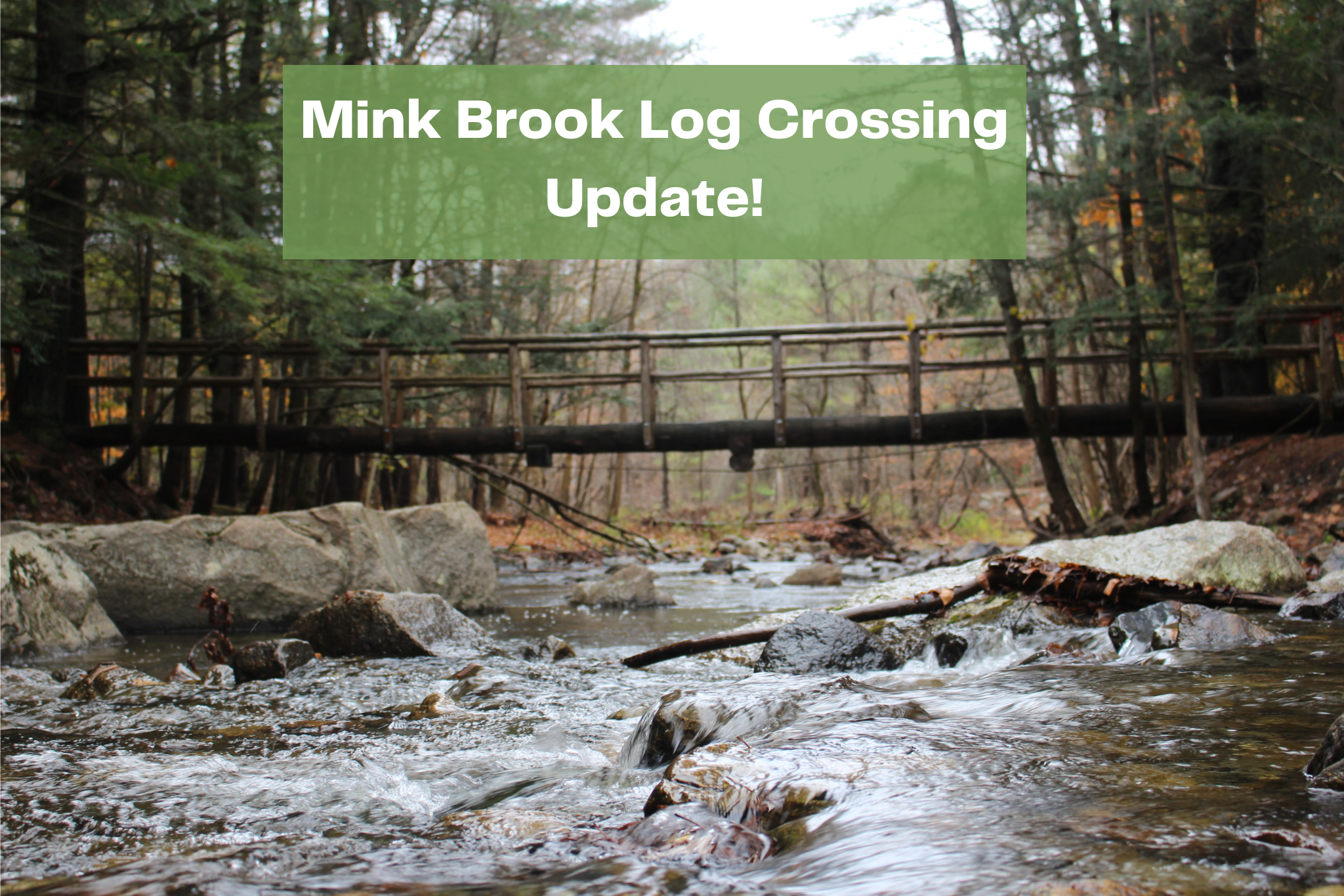
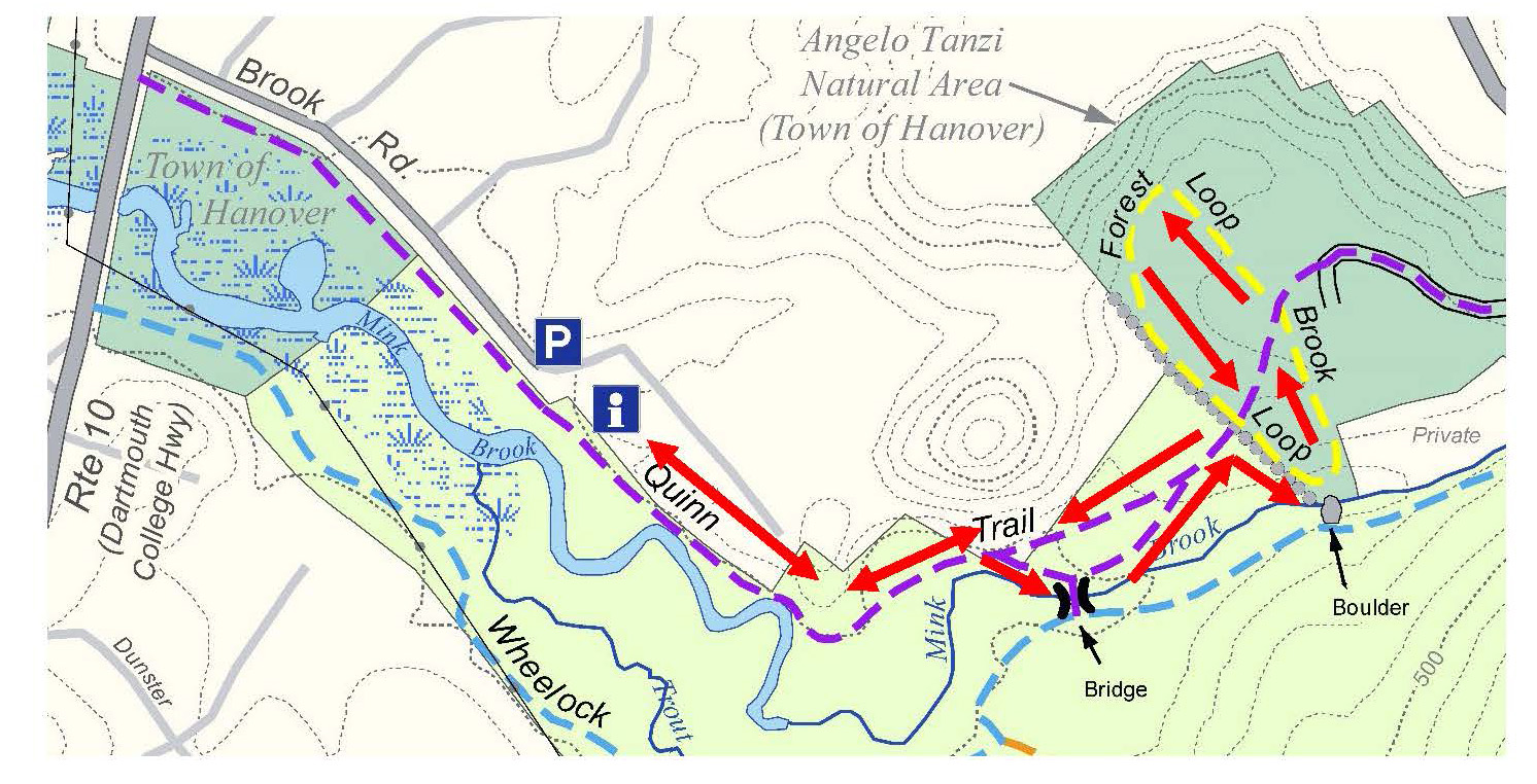
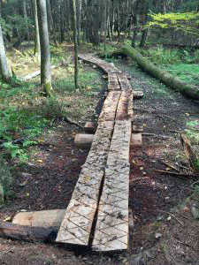
As a reminder, the Quinn Trail will be closed for repairs May 18-21, but all other trails are open and can be accessed from Buck Road, Sachem/DHMC/Boston Lot network, or Route 10 (park on grass just across from Pine Knoll Cemetery).
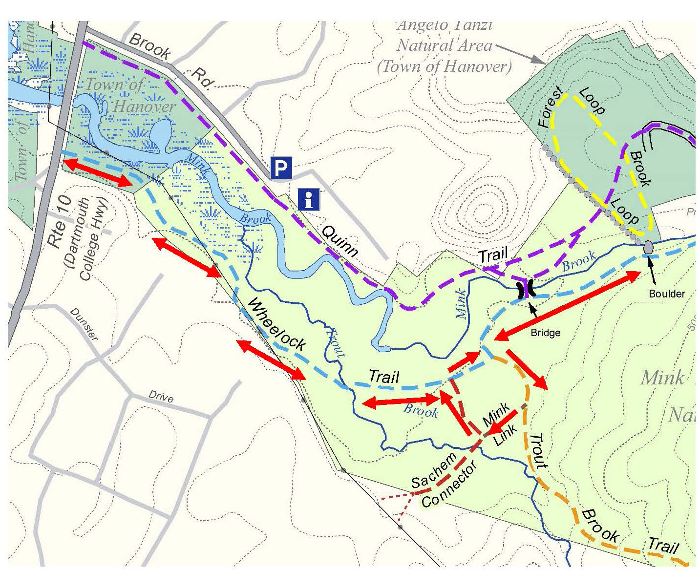
 Read the full list of recommended hikes here. 

Filed Under: Media, Mink Brook, Trails

Quinn Trail at Mink Brook CLOSED May 18th-21st

May 12, 2020

The Quinn Trail at Mink Brook will be closed approximately 1300 feet East of Brook Road for emergency repairs between May 18th and 21st. The trail runs along a Town sewer right-of-way, and erosion from recent flooding requires a significant amount of work. After repairs are finished, we will coordinate with the Town on ways to prevent future erosion, including planting riparian plants along the bank. Wherever possible, the Hanover Conservancy strongly believes streams and rivers should be allowed freely, and we work to include the entire floodplain of a conserved area when feasible. We are very grateful to Hanover DPW for managing the situation at Mink Brook so that the sewer line isn’t impacted!

Regular visitors to the preserve have watched the brook working to shift its course just below the log crossing, ever since Tropical Storm Irene rearranged things upstream back in 2011. What the brook doesn’t know is that the sewer line is buried here, right under the Quinn Trail, and needs to stay that way! Felling and cabling a large nearby pine in hopes of capturing sediment and diverting the flow were a great idea but apparently not up to the task. Therefore, the town DPW will perform temporary, emergency repairs next week that will involve stone at the base of the eroded bank. Next year, a fuller treatment will take place, hopefully restoring the vegetative buffer in the process to improve habitat. We’ll keep you posted.

Please give the Quinn Trail a break May 18-21, but feel free to observe the work from the safety of the Wheelock Trail on the opposite bank. You can reach this spot from Route 10 just south of the bridge, or from Buck Road. We know the town will take all precautions to be sure the project affects water quality as little as possible.

Filed Under: Mink Brook, Partnerships, Trails

Brook/River/Garden Loop

November 1, 2019

Hike Direction and Map – Full PDF


trail mapDriving Directions

  • From Downtown Hanover, drive S on S. Main St. for 0.3 miles
  • Parking area is on R just before electric substation and bridge over Mink Brook.

What You Should Know

  • Start your hike AFTER 11AM if you’d like to do the loop and visit the garden. Bring binoculars and a bird book!
  • Today’s hike takes you along lower Mink Brook on a flat, ADA accessible path with benches. You can retrace your steps OR
  • For a more challenging hike, continue on the banks of the CT River on a narrow, sometimes steep path and climb to the neighborhood tucked behind downtown. Return on quiet streets, visiting a small meditation garden that glows in fall.
  • Dogs are welcome if under your control. Please pick up after your pet.
  • Foot travel only.

Brief Hiking Directions

  • Take the gravel path down through the gate and bear R along Mink Brook.
  • The gravel path ends across from the Water Reclamation Facility. Turn around here OR
  • Stay straight on a woods path; turn R at river’s edge
  • Follow path along river to wood steps
  • Climb wood steps to gate at Maple St./Downing St.
  • Walk down Maple St.; turn R on Pleasant St. and R on School St.
  • Follow School St. to sharp curve; visit Li Graben Meditation Garden
  • Continue on School St. (becomes Huntley Ave.)
  • Turn R onto S. Main St. and return to your car.

The Full Story

  • Walk toward the electric station, bearing R before its parking lot, and go through the gate (better ADA access is from this lower lot). Bear R onto the packed gravel path along the water. You’ll notice that the trees are alive with birds at this season, stocking up on seeds and berries before launching themselves into the great migratory stream of wings that flows south along the Connecticut River flyway in fall.
  • ADA section of River TrailThe Town of Hanover undertook an ambitious project in the summer/fall of 2019 to create a 3,700 foot fully ADA compliant, accessible path along this beautiful stream (marked in red on aerial photo). Benches beckon visitors to stop and enjoy the views, reflections, and especially the waterfowl that frequent this area.
  • Note the blue and white tags identifying this as Town Conservation land. Working with the Town, the Hanover Conservancy (then the Hanover Conservation Council) contributed half the purchase price for the 15.7 acre former Edgerton property on Mink
  • Brook and the river in 1973. With protection of the Conservancy’s Mink Brook Nature Preserve just upstream in 1999, nearly 2 miles of the stream are now protected and open to the public.
  • Fall is the perfect time to enjoy the foliage and feathered things here. The flame of maples may be winding down, but the oaks are golden bronze and we can (if grudgingly) enjoy the brilliant foliage of burning bush, an invasive garden escape. Note the sewer covers along the path – you and the wastewater piped under your feet are both traveling in the same direction – toward renewal! Thankfully, the Water Reclamation Facility (once known as a wastewater treatment plant) to which it is headed has restored Mink Brook and the Connecticut River from the ugly open sewers of the 1960s back to the beautiful waterways they are today.
  • merganserLower Mink Brook, so close to the Connecticut River flyway, is known for its waterfowl. On the day we scouted this route (Oct. 30), two male hooded mergansers (R ) were bobbing their bright white mops of head feathers and croaking in attempts to impress the less gaudy females with them. Further downstream, a dozen Canada geese rested on a fallen log (below). Occasional broad stone slabs and more formal benches invite you to stop to watch.
  • virginia waterleaf
  • At the first bend you’ll see pink flagging marking a patch of Virginia waterleaf (L), a plant of moist woods and floodplains, considered threatened in NH. It is protected here.
  • As you proceed, note the steep slopes at R, decorated with evergreen Christmas fern.
  • Like similar slopes at the Rinker-Steele Natural Area and Kendal Riverfront Park, these are remnants of Lake Hitchcock, which flooded this area as the glacier receded.
  • The brook bends, its original channel filled with river water backed up behind Wilder Dam just a short distance downstream on the Connecticut. Before the dam was built in 1950, this would have been a narrow but obviously flowing stream, probably small and shallow enough to wade through at this time of year.
  • Soon the Water Reclamation Facility comes into view. 20 minutes’ walk from your car, and opposite the plant, the ADA path ends. Here you can choose to turn around and see what new birds might have alighted in your wake, or continue on.
    Canada geese on log
  • To continue, proceed straight ahead on an un-blazed woods path across a wet area and up a knob. At the top, turn L for a short way to where the path ends at the mouth of Mink Brook. Take care on the hemlock-clad point – the clay soils are slippery when wet. The brook may be narrow here, but it is the largest in Hanover, draining an 18 sq.mi. watershed from the ridge of Moose Mtn. through Etna and along Greensboro Road.
  • Return to the intersection and stay straight down a short hill, following the river for <15 minutes to another viewpoint. The path narrows as it passes another inlet. Stay L along the water as several paths join at R. The trail is narrow and benched, and passes a small island that was part of the shore before Wilder Dam flooded the area. Sinewy stems of ironwood or musclewood trees lean toward the water. Across the river a short section of railroad bed is visible, but beyond the sounds of I-91 and yard work in the neighborhood above, you might as well be 100 miles from civilization.
  • The trail, unmarked but easy to follow, skirts another backwater and rises to another point of land. Watch for bald eagles – on our scouting day, an immature and an adult were perching overhead. Eagles have made a substantial comeback in the last 10 years, with dozens of nests along the Connecticut where there was only one in 1995. Some overwinter in this area, where they fish in the open water around Wilder Dam.
  • The view S from the point includes the pine and hemlock-clad South Esker, another natural area purchased by the Conservancy and Town in 1971. See our Hikes of the Month to visit those trails. Across the river appear benches and trails at the Montshire Museum in VT.
  • The trail passes over a steep-sided ridge with water on both sides. A few minutes later, take the R fork through a cut in a large log and head up a set of wooden steps. The trail swings R, edged with sections of cut log, and then curves up more steeply among the homes on the ridge above. Wood steps are your guide.
  • gate at end of Maple Street
  • 7 minutes’ hike up from the eagles’ point, arrive at the top of the ridge and a gate (walk around) at the junction of Maple and Downing Streets. A handsome new kiosk displays a useful map and signs remind that the trail is open from dawn to dusk only. Parking for this part of the trail is at the other end of Maple Street.
  • Nathan's GardenStart down Maple St.; opposite the junction with River Ridge Rd,, look for the entrance to Nathan’s Garden at L. This beautiful secluded natural area (R ) is open to the public (dawn to dusk) through the kindness of the landowner. Make a note to come back in spring and summer.
  • Continue on Maple St. Can you spot the bear family on a weathervane? For all the civilized look of this neighborhood, it’s prime bear territory, or at least it was until the neighbors took in their birdfeeders and covered up their compost piles, and the bears went elsewhere.
  • This part of the hike (<½ hour) makes you wish you’d brought a field guide to historic architecture along with your bird guide. Turrets, porches, eave decorations, fanciful shingles, and even stained glass panels evoke the 1860s-1920s when this neighborhood grew up. It’s a pleasant mix of Italianate, Second Empire, Stick, Queen Anne, Shingle, and Colonial Revival styles. Bright-leaved barberry and burning bush decorate front yards, more appropriate habitat than streambanks.
  • Turn R on Pleasant St. and enjoy the view out over the Mink Brook valley as it curves to the L.
  • Turn R on School St. If you are pressed for time, turn L on Ripley and R onto S. Main St. to return to your car.
  • You’ll be glad you continued on School St., passing the pretty forested section at L, and over the brook at R.
  • garden sign
  • Just before the street curves L, watch for a small sign at R welcoming you to the Li Graben Meditation Garden, open noon to sunset. Follow the short stone path and turn R onto a wooden deck path that leads to a tiny covered seating area. Here, you can contemplate the brook below and a peaceful scene created by stones arranged in a gravel bed. Azaleas will be bouncing with color in spring, but at this time of year, you’re treated to the brilliant yellow feathery blossoms of witchhazelwitchhazel (L)! Sit for a bit to enjoy the silent company of a public-spirited landowner who provides this space. In the shelter, discover a journal of poems left by visitors, including one who declared, “the river is Byootyefl!”
  • Return to School St. and follow it down as it becomes Huntley Rd., marveling at this neighborhood arranged on the challenging terrain left by glacial Lake Hitchcock.
  • Turn R onto S. Main Street. Your car is close, but the fun is not over. Just as the small parking area comes into view, note the Greek Revival style brick cape that sits across the road on your L. This house was built in 1840 by Ruben Benton, a Hanover selectman at the time, when his earlier home burned. In 1852, Ruben’s son Charles added a massive barn (131’ x 45’, four stories high) that was a landmark in town for a century. In 1885, the Benton Farm included 150 acres of land in Hanover and 174 in abutting Lebanon, 140 Merino sheep, and a sawmill. That land included the brook side area you’ve just explored plus the Mink Brook Nature Preserve and much more.
  • old view of farm and gullies
    The Benton Farm – view N to Hanover village across Mink Brook c. 1865
  • After Charles Benton’s death, his family sold the farm to Dartmouth College for $4,500. Five years later in 1903, the college traded this farm for Charles Stone’s farm on the Wolfeboro Road in the future Trescott Water Supply lands to make room for the new Fletcher Reservoir. Stone milked his dairy herd at the Trescott lands in the morning, herded them down Reservoir and Lyme Roads into town and down Main Street, and milked them in their new barn that evening.
  • The Stones later sold off pieces of their farm to the electric company (1928), to the town to re-route S. Main Street, to the hydro power company to allow Wilder Dam to flood the lower brook, and for residential development on parts of Buell St., Mourlyn, and S. Main, among other things. Finally, in 1949, the Stones sold the remaining 169 acres to three families who developed the residential area around Brook Road, and the landmark barn came down.
  • Time to return to your car at R.

This Hanover Hike of the Month has been generously sponsored by

Lyme Timber Company logo

November 2019

Filed Under: Hike of the Month, Mink Brook, November Tagged With: ADA, evergreen Christmas fern, merganser, Virginia waterleaf

  • 1
  • 2
  • 3
  • …
  • 8
  • Next Page »

Thank you for your support!

Our generous members and Corporate Conservators help make all of this possible. If you’re a customer of  our local business supporters, please let them know their contributions are appreciated!

71 Lyme Road
Hanover, NH 03755
(603) 643-3433

info@hanoverconservancy.org

Facebook logo   Instagram   YouTube

Get Involved

Become a Member

Volunteer

Business Sponsors

Conserve Your Land

Employment

Our Mission

Advocacy

Conservation

Education

Stewardship

Explore Hanover

Hanover Hikes

Upcoming Events

Upper Valley Hikes

Trails Challenge

Copyright © 2023 Hanover Conservancy | Design by Chase Brook Software