Hanover Conservancy

Facebook logo   Instagram   YouTube          
Donate button
  • Home
  • About Us
    • Employment
    • What We Do
      • Advocacy
      • Conservation
      • Education
      • Stewardship
    • Celebrating 60 Years
    • Board & Staff
    • Membership Benefits
    • Contact Us
  • Get Outdoors
    • Hanover Lands
      • Balch Hill Natural Area
      • Mink Brook Nature Preserve
      • Other Properties
    • Hanover Hikes
    • Hanover Trails Challenge
    • Upper Valley Hikes
    • Exploring Nature at Home
    • Hunting
  • Events
    • Calendar
    • Spring Wildflower Scavenger Hunt
    • Private Events
  • Get Involved
    • Donate
    • Volunteer
    • Adopt a Trail
    • Corporate Conservators
    • Planned Giving
  • Education
    • School Programs
      • KAST
      • Connecticut River Studies
      • Hanover High School Scholarship
    • Request a Field Trip or Speaker
    • Research on Our Lands
    • Hanover History
    • Resources
  • News
    • Remembering Bob Norman
    • Reports & e-News
  • Conserve Your Land

Quinn Trail at Mink Brook CLOSED May 18th-21st

May 12, 2020

The Quinn Trail at Mink Brook will be closed approximately 1300 feet East of Brook Road for emergency repairs between May 18th and 21st. The trail runs along a Town sewer right-of-way, and erosion from recent flooding requires a significant amount of work. After repairs are finished, we will coordinate with the Town on ways to prevent future erosion, including planting riparian plants along the bank. Wherever possible, the Hanover Conservancy strongly believes streams and rivers should be allowed freely, and we work to include the entire floodplain of a conserved area when feasible. We are very grateful to Hanover DPW for managing the situation at Mink Brook so that the sewer line isn’t impacted!

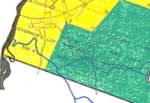
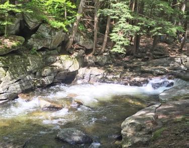
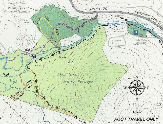
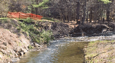
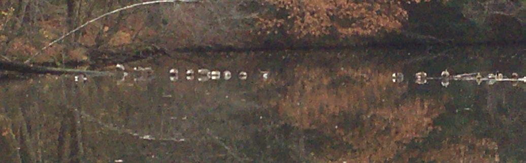
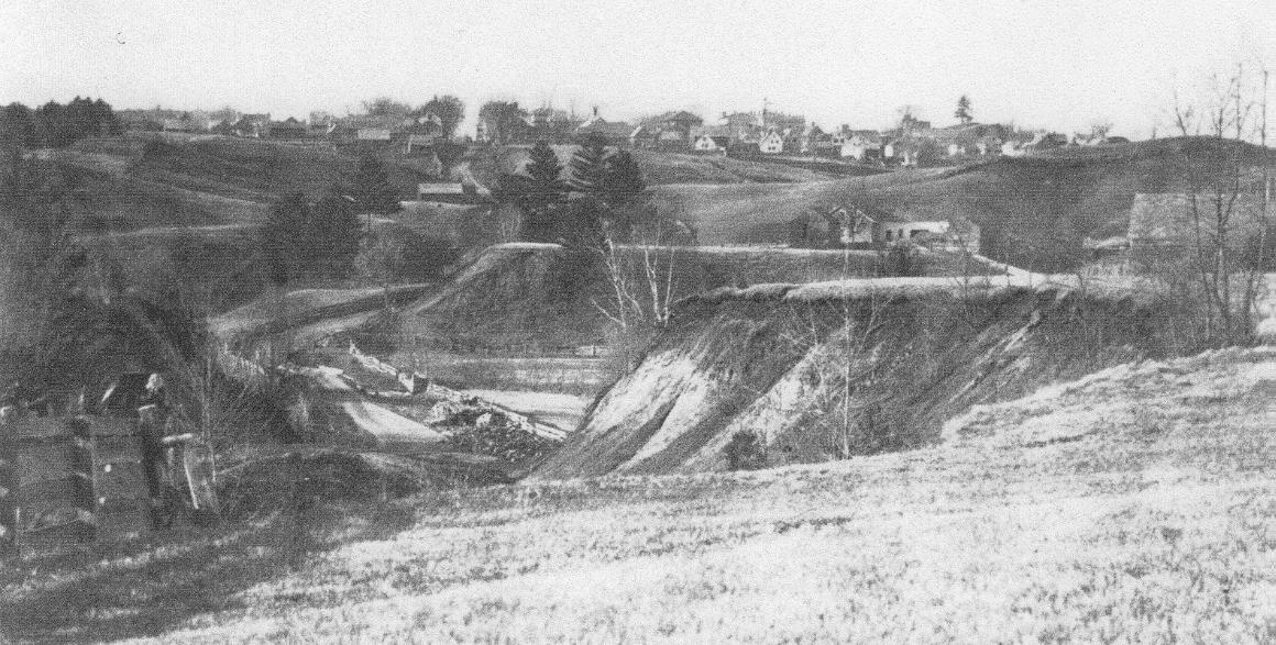
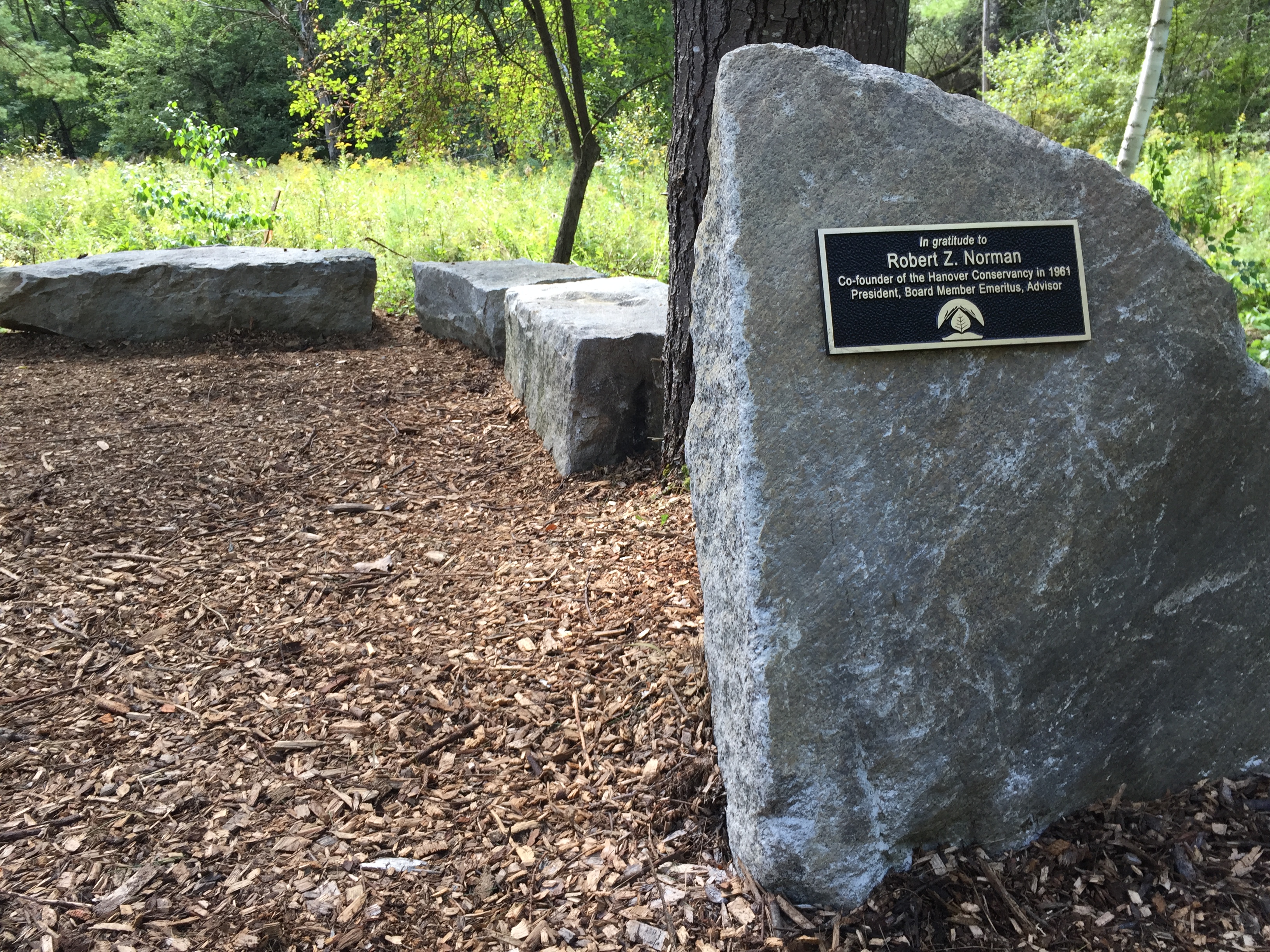
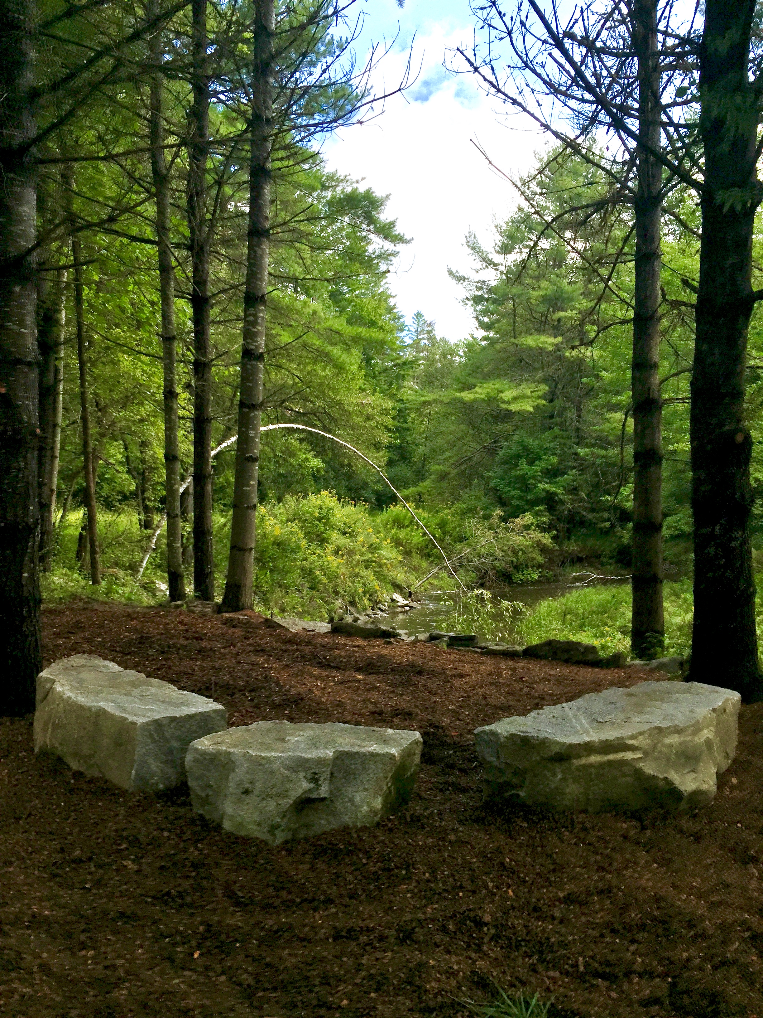
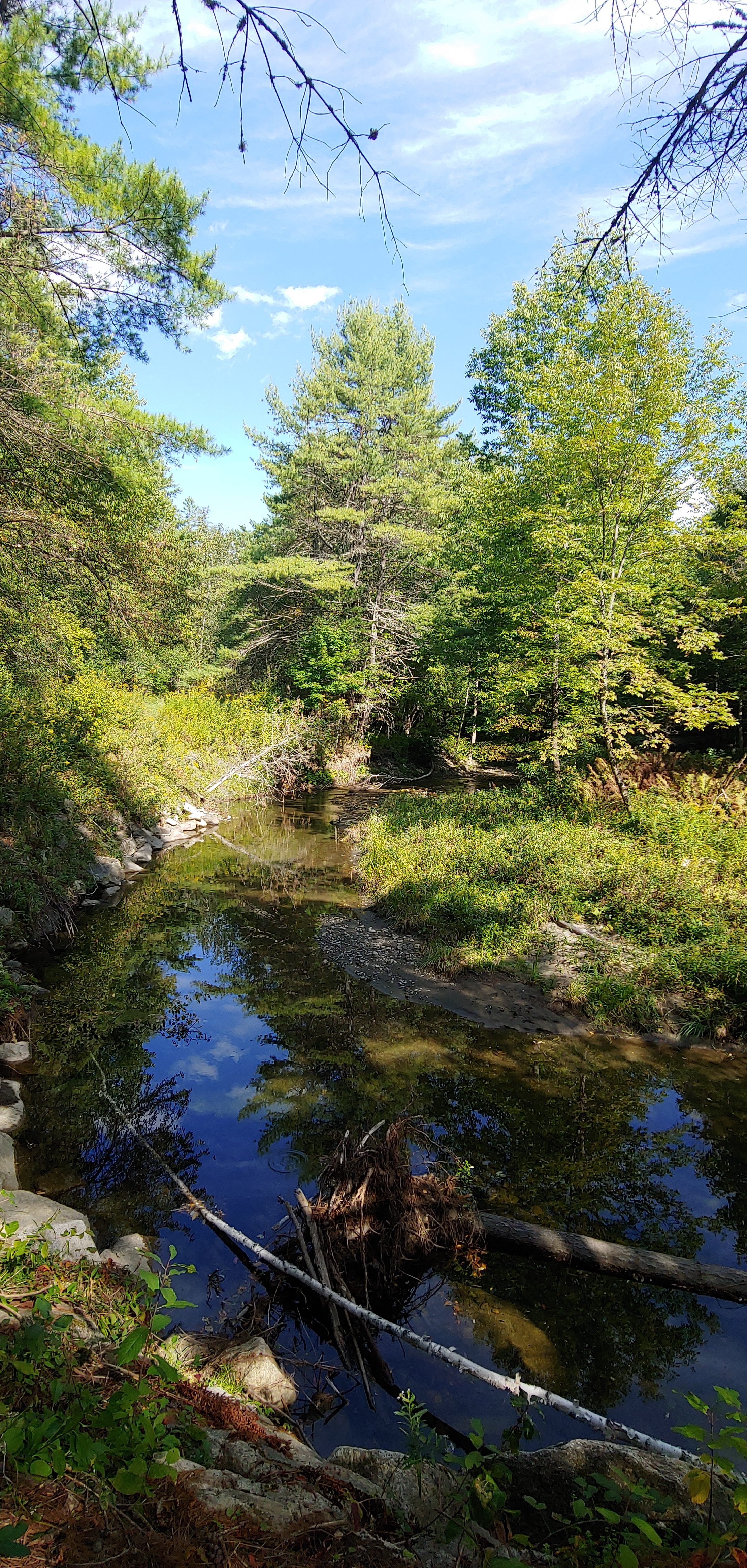
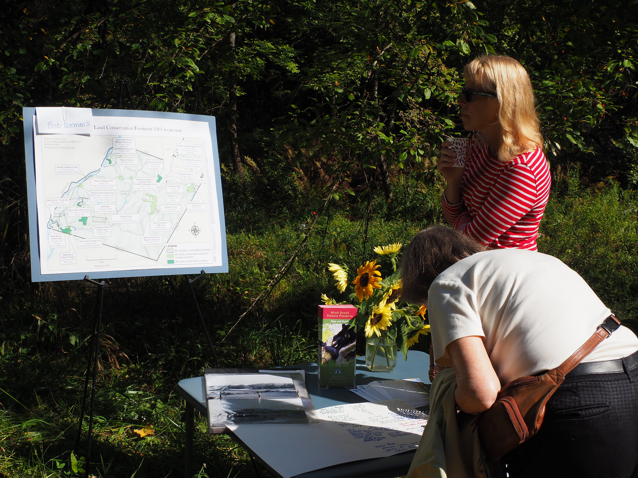
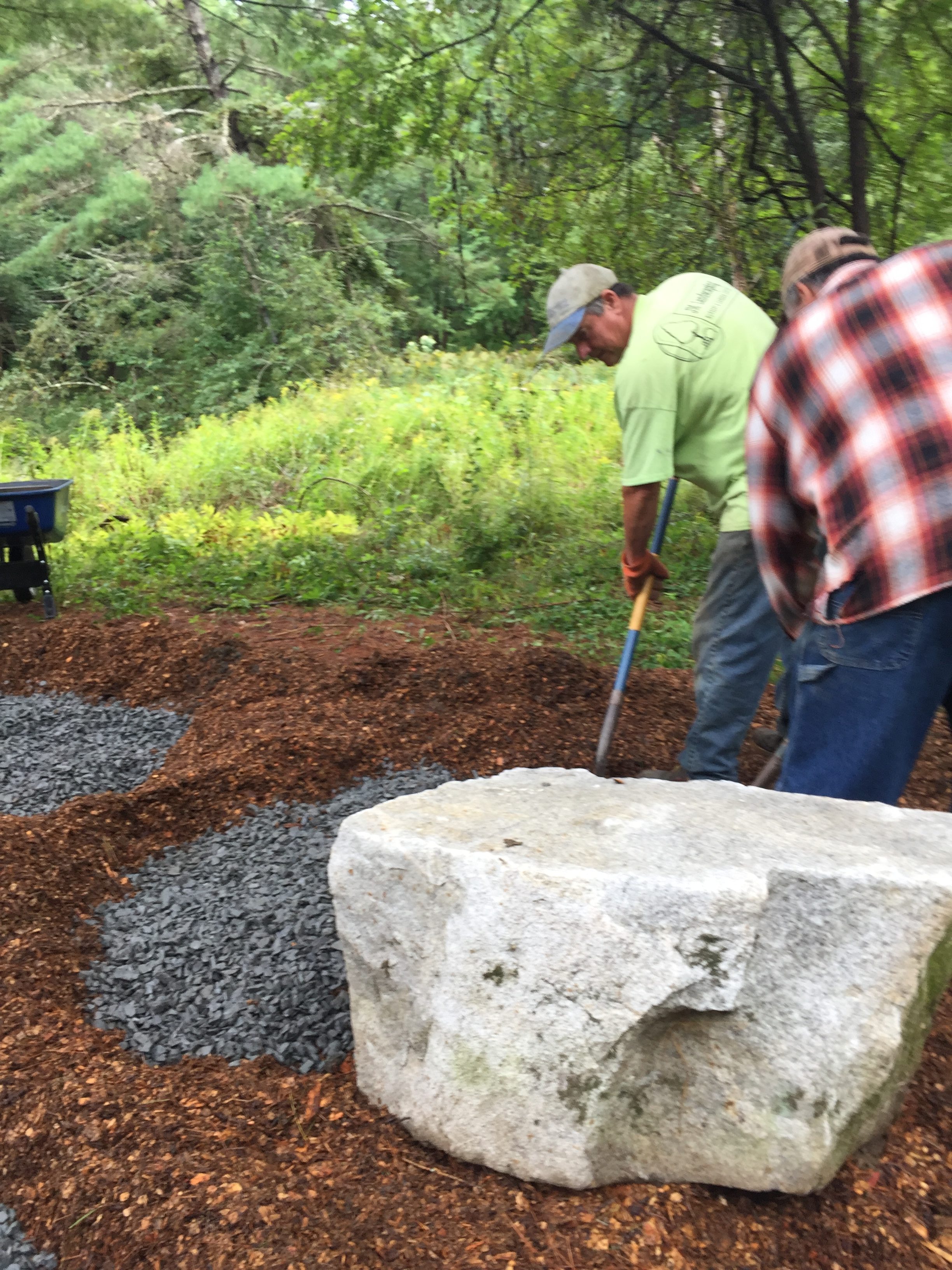
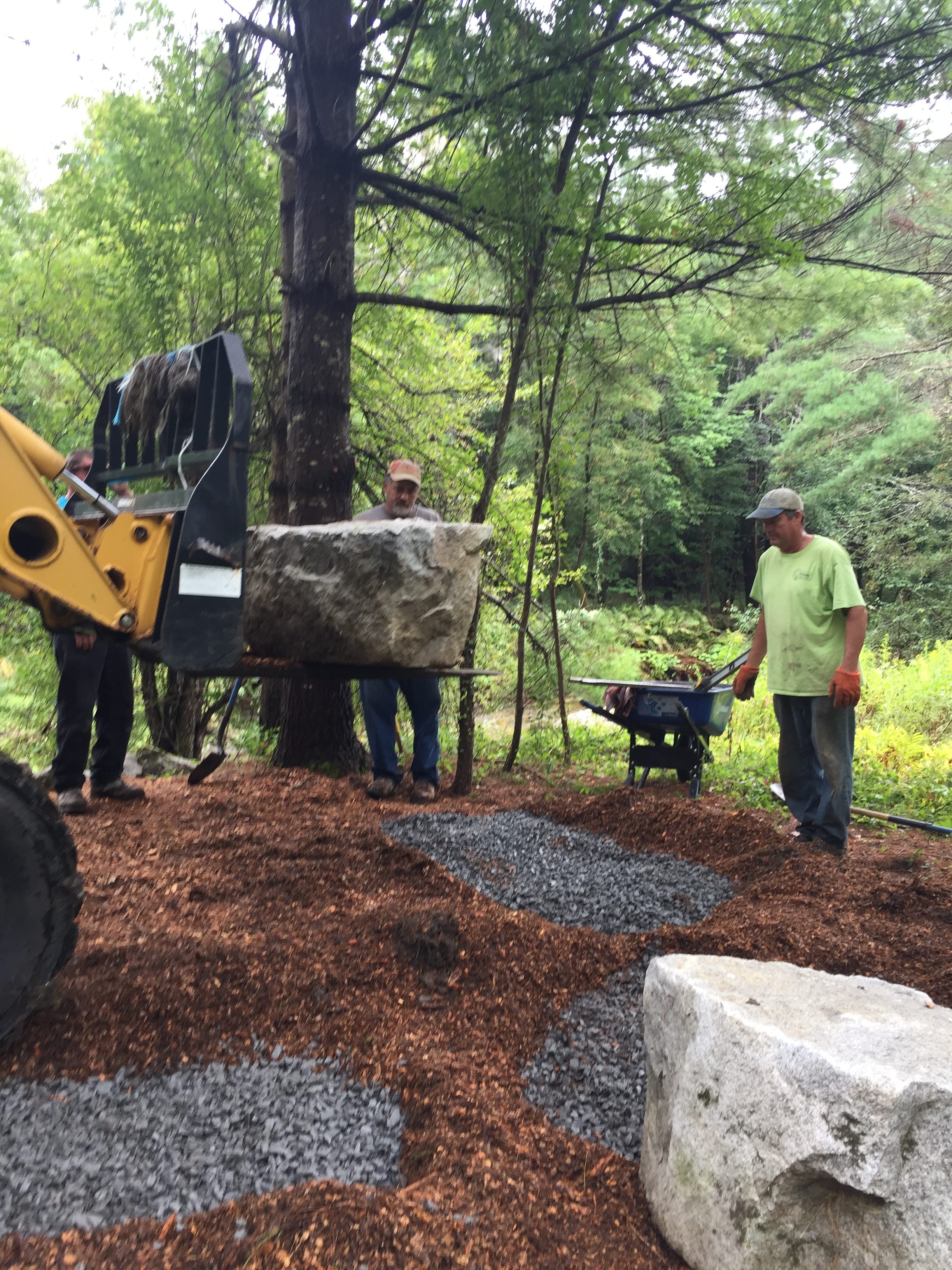
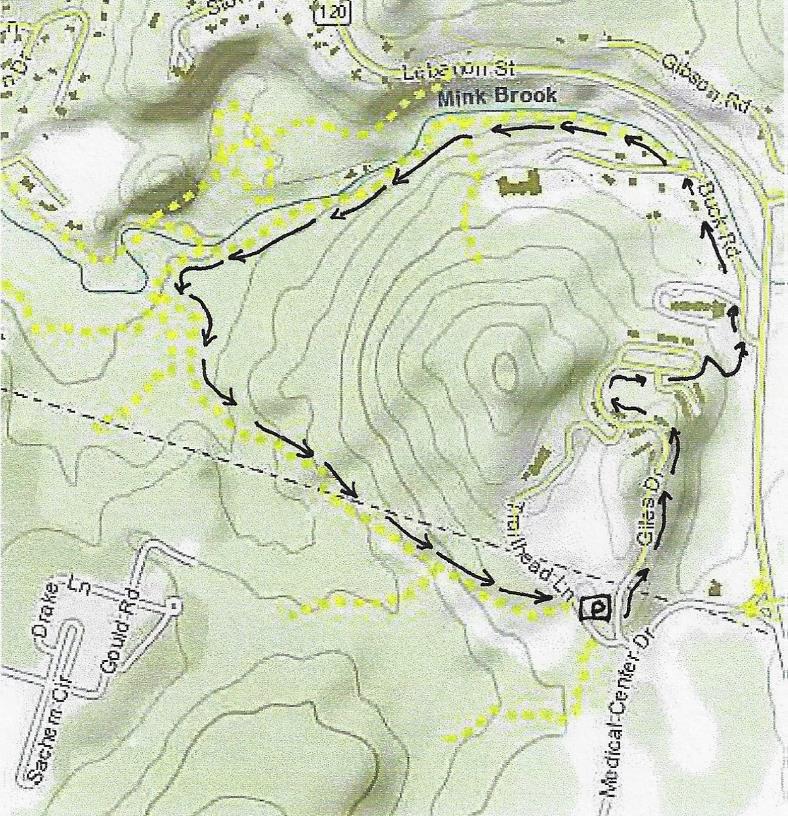
Regular visitors to the preserve have watched the brook working to shift its course just below the log crossing, ever since Tropical Storm Irene rearranged things upstream back in 2011. What the brook doesn’t know is that the sewer line is buried here, right under the Quinn Trail, and needs to stay that way! Felling and cabling a large nearby pine in hopes of capturing sediment and diverting the flow were a great idea but apparently not up to the task. Therefore, the town DPW will perform temporary, emergency repairs next week that will involve stone at the base of the eroded bank. Next year, a fuller treatment will take place, hopefully restoring the vegetative buffer in the process to improve habitat. We’ll keep you posted.

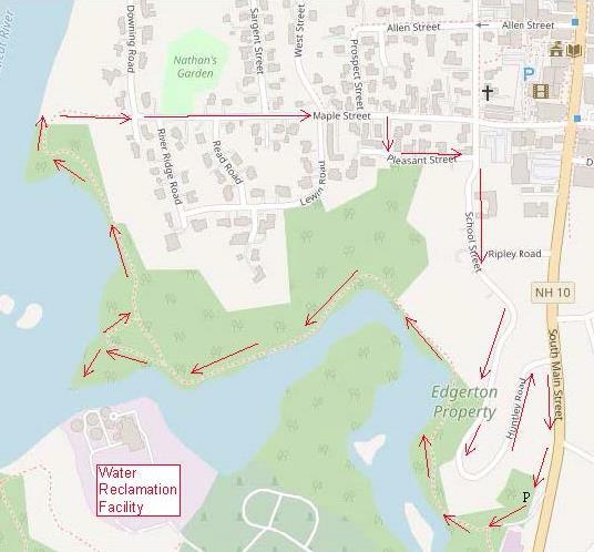
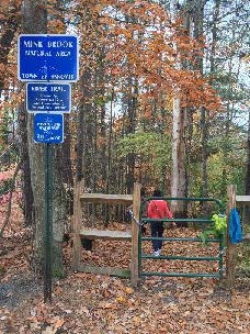
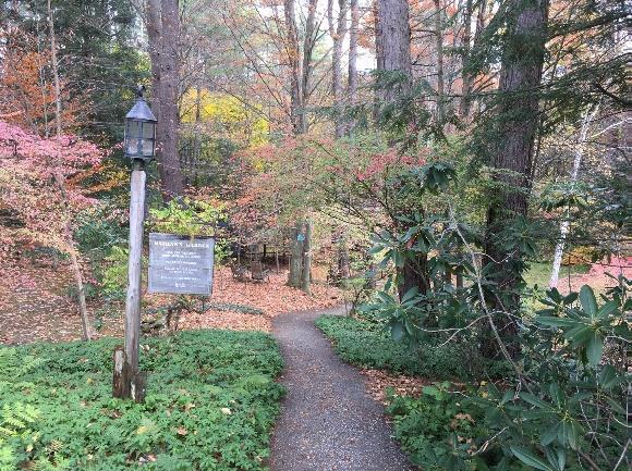
Please give the Quinn Trail a break May 18-21, but feel free to observe the work from the safety of the Wheelock Trail on the opposite bank. You can reach this spot from Route 10 just south of the bridge, or from Buck Road. We know the town will take all precautions to be sure the project affects water quality as little as possible.

Filed Under: Mink Brook, Partnerships, Trails

Brook/River/Garden Loop

November 1, 2019

Hike Direction and Map – Full PDF


trail mapDriving Directions

  • From Downtown Hanover, drive S on S. Main St. for 0.3 miles
  • Parking area is on R just before electric substation and bridge over Mink Brook.

What You Should Know

  • Start your hike AFTER 11AM if you’d like to do the loop and visit the garden. Bring binoculars and a bird book!
  • Today’s hike takes you along lower Mink Brook on a flat, ADA accessible path with benches. You can retrace your steps OR
  • For a more challenging hike, continue on the banks of the CT River on a narrow, sometimes steep path and climb to the neighborhood tucked behind downtown. Return on quiet streets, visiting a small meditation garden that glows in fall.
  • Dogs are welcome if under your control. Please pick up after your pet.
  • Foot travel only.

Brief Hiking Directions

  • Take the gravel path down through the gate and bear R along Mink Brook.
  • The gravel path ends across from the Water Reclamation Facility. Turn around here OR
  • Stay straight on a woods path; turn R at river’s edge
  • Follow path along river to wood steps
  • Climb wood steps to gate at Maple St./Downing St.
  • Walk down Maple St.; turn R on Pleasant St. and R on School St.
  • Follow School St. to sharp curve; visit Li Graben Meditation Garden
  • Continue on School St. (becomes Huntley Ave.)
  • Turn R onto S. Main St. and return to your car.

The Full Story

  • Walk toward the electric station, bearing R before its parking lot, and go through the gate (better ADA access is from this lower lot). Bear R onto the packed gravel path along the water. You’ll notice that the trees are alive with birds at this season, stocking up on seeds and berries before launching themselves into the great migratory stream of wings that flows south along the Connecticut River flyway in fall.
  • ADA section of River TrailThe Town of Hanover undertook an ambitious project in the summer/fall of 2019 to create a 3,700 foot fully ADA compliant, accessible path along this beautiful stream (marked in red on aerial photo). Benches beckon visitors to stop and enjoy the views, reflections, and especially the waterfowl that frequent this area.
  • Note the blue and white tags identifying this as Town Conservation land. Working with the Town, the Hanover Conservancy (then the Hanover Conservation Council) contributed half the purchase price for the 15.7 acre former Edgerton property on Mink
  • Brook and the river in 1973. With protection of the Conservancy’s Mink Brook Nature Preserve just upstream in 1999, nearly 2 miles of the stream are now protected and open to the public.
  • Fall is the perfect time to enjoy the foliage and feathered things here. The flame of maples may be winding down, but the oaks are golden bronze and we can (if grudgingly) enjoy the brilliant foliage of burning bush, an invasive garden escape. Note the sewer covers along the path – you and the wastewater piped under your feet are both traveling in the same direction – toward renewal! Thankfully, the Water Reclamation Facility (once known as a wastewater treatment plant) to which it is headed has restored Mink Brook and the Connecticut River from the ugly open sewers of the 1960s back to the beautiful waterways they are today.
  • merganserLower Mink Brook, so close to the Connecticut River flyway, is known for its waterfowl. On the day we scouted this route (Oct. 30), two male hooded mergansers (R ) were bobbing their bright white mops of head feathers and croaking in attempts to impress the less gaudy females with them. Further downstream, a dozen Canada geese rested on a fallen log (below). Occasional broad stone slabs and more formal benches invite you to stop to watch.
  • virginia waterleaf
  • At the first bend you’ll see pink flagging marking a patch of Virginia waterleaf (L), a plant of moist woods and floodplains, considered threatened in NH. It is protected here.
  • As you proceed, note the steep slopes at R, decorated with evergreen Christmas fern.
  • Like similar slopes at the Rinker-Steele Natural Area and Kendal Riverfront Park, these are remnants of Lake Hitchcock, which flooded this area as the glacier receded.
  • The brook bends, its original channel filled with river water backed up behind Wilder Dam just a short distance downstream on the Connecticut. Before the dam was built in 1950, this would have been a narrow but obviously flowing stream, probably small and shallow enough to wade through at this time of year.
  • Soon the Water Reclamation Facility comes into view. 20 minutes’ walk from your car, and opposite the plant, the ADA path ends. Here you can choose to turn around and see what new birds might have alighted in your wake, or continue on.
    Canada geese on log
  • To continue, proceed straight ahead on an un-blazed woods path across a wet area and up a knob. At the top, turn L for a short way to where the path ends at the mouth of Mink Brook. Take care on the hemlock-clad point – the clay soils are slippery when wet. The brook may be narrow here, but it is the largest in Hanover, draining an 18 sq.mi. watershed from the ridge of Moose Mtn. through Etna and along Greensboro Road.
  • Return to the intersection and stay straight down a short hill, following the river for <15 minutes to another viewpoint. The path narrows as it passes another inlet. Stay L along the water as several paths join at R. The trail is narrow and benched, and passes a small island that was part of the shore before Wilder Dam flooded the area. Sinewy stems of ironwood or musclewood trees lean toward the water. Across the river a short section of railroad bed is visible, but beyond the sounds of I-91 and yard work in the neighborhood above, you might as well be 100 miles from civilization.
  • The trail, unmarked but easy to follow, skirts another backwater and rises to another point of land. Watch for bald eagles – on our scouting day, an immature and an adult were perching overhead. Eagles have made a substantial comeback in the last 10 years, with dozens of nests along the Connecticut where there was only one in 1995. Some overwinter in this area, where they fish in the open water around Wilder Dam.
  • The view S from the point includes the pine and hemlock-clad South Esker, another natural area purchased by the Conservancy and Town in 1971. See our Hikes of the Month to visit those trails. Across the river appear benches and trails at the Montshire Museum in VT.
  • The trail passes over a steep-sided ridge with water on both sides. A few minutes later, take the R fork through a cut in a large log and head up a set of wooden steps. The trail swings R, edged with sections of cut log, and then curves up more steeply among the homes on the ridge above. Wood steps are your guide.
  • gate at end of Maple Street
  • 7 minutes’ hike up from the eagles’ point, arrive at the top of the ridge and a gate (walk around) at the junction of Maple and Downing Streets. A handsome new kiosk displays a useful map and signs remind that the trail is open from dawn to dusk only. Parking for this part of the trail is at the other end of Maple Street.
  • Nathan's GardenStart down Maple St.; opposite the junction with River Ridge Rd,, look for the entrance to Nathan’s Garden at L. This beautiful secluded natural area (R ) is open to the public (dawn to dusk) through the kindness of the landowner. Make a note to come back in spring and summer.
  • Continue on Maple St. Can you spot the bear family on a weathervane? For all the civilized look of this neighborhood, it’s prime bear territory, or at least it was until the neighbors took in their birdfeeders and covered up their compost piles, and the bears went elsewhere.
  • This part of the hike (<½ hour) makes you wish you’d brought a field guide to historic architecture along with your bird guide. Turrets, porches, eave decorations, fanciful shingles, and even stained glass panels evoke the 1860s-1920s when this neighborhood grew up. It’s a pleasant mix of Italianate, Second Empire, Stick, Queen Anne, Shingle, and Colonial Revival styles. Bright-leaved barberry and burning bush decorate front yards, more appropriate habitat than streambanks.
  • Turn R on Pleasant St. and enjoy the view out over the Mink Brook valley as it curves to the L.
  • Turn R on School St. If you are pressed for time, turn L on Ripley and R onto S. Main St. to return to your car.
  • You’ll be glad you continued on School St., passing the pretty forested section at L, and over the brook at R.
  • garden sign
  • Just before the street curves L, watch for a small sign at R welcoming you to the Li Graben Meditation Garden, open noon to sunset. Follow the short stone path and turn R onto a wooden deck path that leads to a tiny covered seating area. Here, you can contemplate the brook below and a peaceful scene created by stones arranged in a gravel bed. Azaleas will be bouncing with color in spring, but at this time of year, you’re treated to the brilliant yellow feathery blossoms of witchhazelwitchhazel (L)! Sit for a bit to enjoy the silent company of a public-spirited landowner who provides this space. In the shelter, discover a journal of poems left by visitors, including one who declared, “the river is Byootyefl!”
  • Return to School St. and follow it down as it becomes Huntley Rd., marveling at this neighborhood arranged on the challenging terrain left by glacial Lake Hitchcock.
  • Turn R onto S. Main Street. Your car is close, but the fun is not over. Just as the small parking area comes into view, note the Greek Revival style brick cape that sits across the road on your L. This house was built in 1840 by Ruben Benton, a Hanover selectman at the time, when his earlier home burned. In 1852, Ruben’s son Charles added a massive barn (131’ x 45’, four stories high) that was a landmark in town for a century. In 1885, the Benton Farm included 150 acres of land in Hanover and 174 in abutting Lebanon, 140 Merino sheep, and a sawmill. That land included the brook side area you’ve just explored plus the Mink Brook Nature Preserve and much more.
  • old view of farm and gullies
    The Benton Farm – view N to Hanover village across Mink Brook c. 1865
  • After Charles Benton’s death, his family sold the farm to Dartmouth College for $4,500. Five years later in 1903, the college traded this farm for Charles Stone’s farm on the Wolfeboro Road in the future Trescott Water Supply lands to make room for the new Fletcher Reservoir. Stone milked his dairy herd at the Trescott lands in the morning, herded them down Reservoir and Lyme Roads into town and down Main Street, and milked them in their new barn that evening.
  • The Stones later sold off pieces of their farm to the electric company (1928), to the town to re-route S. Main Street, to the hydro power company to allow Wilder Dam to flood the lower brook, and for residential development on parts of Buell St., Mourlyn, and S. Main, among other things. Finally, in 1949, the Stones sold the remaining 169 acres to three families who developed the residential area around Brook Road, and the landmark barn came down.
  • Time to return to your car at R.

This Hanover Hike of the Month has been generously sponsored by

Lyme Timber Company logo

November 2019

Filed Under: Hike of the Month, Mink Brook, November Tagged With: ADA, evergreen Christmas fern, merganser, Virginia waterleaf

Norman Overlook at Mink Brook

September 25, 2019

In 1999, Bob led the Council’s effort to protect the 112-acre Mink Brook Nature Preserve, then slated to become a 32-lot subdivision. In 2019, the 20th anniversary of that daunting and ultimately successful project, the Conservancy dedicated the Norman Overlook to Bob and his vision for our community.

The Bob Norman Overlook
Celebrating the Norman Overlook’s dedication
Unveiling the “sentry stone”
The view from the Norman Overlook
Bob greets a guest
Former Dartmouth President Jim Wright
Signing a card for Bob
Jeanie McIntyre, President of UVLT
Preparing the site with JM Landscaping
HC Board members finish final prep on the Overlook site
Native dogwoods, serviceberry and other shrubs were planted to restore the floodplain.
Hugh Mellert works to place the dedication plaque on a granite boulder
The final step was planting native shrubs and preparing the site for the dedication ceremony

Filed Under: Events, History, Lands, Mink Brook, Outdoor Trips, Trails, Volunteers Tagged With: accessible, benches, Bob Norman, founder, history, Mink Brook, Norman Overlook, seating, trails, volunteers

Mink Brook and Gile Hill

July 1, 2019

Complete PDF


Gile Hill mapDriving Directions

  • You can drive to the take-off point at Gile Hill OR walk from DHMC on medical center campus trails.
  • From downtown Hanover, take Lebanon St./Route 120 south to the first light after Greensboro Road, at Medical Center Drive. Turn R at the light, pass the gas station, cross the bridge, and take the first R to Gile Drive.
  • Turn immediately L into the gravel parking area encircled by large stones, and park. This is your starting point.
  • Today’s hike is a loop through the Mink Brook Nature Preserve and adjoining Gile Hill area, encircling the 800’ rocky knob highlighted on the map at R.

What You Should Know

  • This is a moderately challenging hike, if only because it uses every sort of path you can imagine – from wide and paved to narrow and rocky, flat to steep – and everything in between. Wear sturdy shoes!
  • You’ll pass through surroundings that vary from a deep hemlock forest to sculpted grassy slopes between apartment buildings. It’s good to know such wild places are so close at hand.
  • Dogs are welcome but must be leashed while walking through Gile Hill and must always be under your close control. Please pick up after your pet.
  • Bicycles are not permitted in the Mink Brook Nature Preserve.

Hiking Directions

  • To begin your hike, walk to the paved road to the Gile Hill development and turn L onto the paved sidewalk just beyond. Follow the sidewalk as it crosses the access road several times and continues down past the apartment buildings. When the sidewalk ends, continue a short distance to White Pine Oval. Take the nearer end of the oval – your destination is a crosswalk at the far end that leads you to a paved path. Along the way, notice a “wall” of stones inside a gabion cage, a stark contrast to the native boulders visible just beyond and the early stone walls you’ll observe later on this trip.
  • Walk past the wooden rail fence to a crosswalk where you’ll take the wide paved path to Buck Road. Just as it curves L, note a steep sided trench at R, built to capture stormwater runoff from the paved areas and roofs. Before 2006, when the Gile Hill development was built, this entire hillside was a steep, forested jumble of boulders. It presented such an engineering challenge that it was the field site focus of a regional conference on stormwater management techniques.
  • The paved path ends at Buck Road near Route 120. Turn L and head down the hill on Buck Road, which was once the main road linking Lebanon and Hanover before 120 was built. In a few minutes, Buck Road swings L just before the narrow bridge that once carried it over Mink Brook.
  • Wheelock trail sign
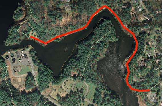
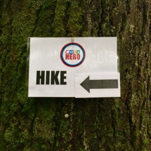
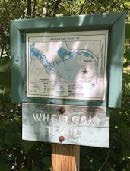
A few paces beyond the turn, look for the Wheelock Trail just before a fire hydrant.
  • Named for Eleazar Wheelock, founder of Dartmouth College (more about him in a minute), the blue-blazed trail begins as a narrow, rocky path threading among rocks and roots close to Mink Brook. You’re greeted by the sound of the tumbling brook and the cool sweet air of the protective forest, a stark change from Buck Road and Gile Hill. The Upper Valley Land Trust owns this land on the south side of the brook; you’ll pass beneath UVLT’s office perched at the top of the bank. UVLT was instrumental in protecting this parcel and the larger Mink Brook Nature Preserve in 1999, working hand in hand with the Hanover Conservancy (then known as the Hanover Conservation Council).
  • Five minutes from Buck Road, look for a rocky ledge on the far side of the brook where the water spills over a small falls. Amid the foliage above, you can make out the stone wall of an old mill structure. Watch your step among the tangle of roots across the trail. There’s a better view of the falls from below. You’re looking at the reason why Dartmouth College is in Hanover and not somewhere else!
  • 1778 map
    1778 map of SW Hanover showing Mink Brook and college and Wheelock holdings
    In the late 1760s, when Rev. Wheelock was searching for a town to locate his college, colonial governor John Wentworth and the proprietors of newly-founded Hanover and Lebanon joined together to offer him 2,000 acres surrounding this brook. This, the largest stream in Hanover, has an 18 square mile watershed, thus guaranteeing a good flow, and this falls offered a promising spot for a grist mill. This was essential gear for grinding grain to make flour to bake bread to feed hungry young men. The deal was sealed, and in 2019, Dartmouth celebrated its 250th anniversary, all thanks to Mink Brook. (After a first mill failed, Israel Woodward built this mill for Wheelock in 1771-1772).
  • But we digress. The Wheelock Trail continues into a cool glen shaded by hemlocks and becomes a wider path. Soon it heads up to a break in the canopy and bears R across land owned by Wheelock Terrace. Here, the sewer line passes under your feet on its way to the wastewater treatment plant at the mouth of Mink Brook.
  • Enter the woods once again at a small sign (TRAIL ->). In a few moments you’ll encounter a low stone wall marking an early boundary; today it announces that you have arrived at the Hanover Conservancy’s Mink Brook Nature Preserve. A remnant of barbed wire clings to a tree at L, and HC’s even more contemporary boundary marker, a 4’ plastic square, hangs on a tree at R. This stone wall marks the ancient property line between the 300 acre Wheelock parcel and the 1000 acre Dartmouth College parcel of land. That easterly property line makes a series of erratic westerly jogs as it runs north over the top of the hill and descends the northerly side. This reflects the fact that in 1771, after Wheelock had established his first mill on Mink Brook, it was found to be located not on Dartmouth property as the College Trustees had intended, but rather on Wheelock’s private property. Therefore, to appease the Trustees, the original property line was adjusted westerly, giving more land to the College.
  • Continue as the path becomes level and wide among the hemlocks. The brook’s floodplain may be flat, but you’re aware of steep, high slopes both across the brook and to your L. Soon they begin to crowd the path as steep ravines appear at L. What’s going on here? You are actually hiking along what was once the bottom of glacial Lake Hitchcock. This frigid lake covered the Connecticut River valley from Middletown, CT to Littleton, NH after the river’s waters were trapped by a dam of debris dropped by the glacier as it melted. Thousands of years later that dam broke, leaving us with the beautiful winding Connecticut River of today. While the lake was in place, however, soil washing in from the uplands settled on the lake bottom. In still water, such as that quieted by a veneer of ice, the finest particles of clay sink to the bottom. When the lake drained, Mink Brook’s braided waters flowed down through the newly exposed sediments, slicing deep channels through them on their way to meet the river. These old channels are now the steep ravines that surround you.
  • rocky gorgeAbout 15 minutes’ walk from Buck Road, you reach a beautiful rocky gorge. The trail briefly becomes indistinct on the slope but picks up later. Take a moment to visit the water’s edge and discover a lovely pool behind a low dam. This dam was built in the 1920s to create a swimming hole for a seasonal cottage once owned by the Tanzi family. The cottage is now gone, but a nearby private residence remains on the opposite bank. Continue west on the Wheelock Trail.
  • Four minutes’ walk past the gorge a flat terrace appears at L; this is part of the old glacial lake bed, formed when the lake had partially dropped.
  • Two minutes later, you arrive at a dramatic spot where an enormous boulder guards the brook. The footing is tricky here. Climb below the boulder to admire its sheer face, but please resist the temptation to climb it. A look toward the brook may reveal woody debris tossed here by high water. A nearby tree shows the scars of two strands of barbed wire, two and three feet off the ground, presumably set 150 years ago to protect grazing sheep from falling into the water.
  • Just beyond the huge boulder is a very old stone wall with hemlocks growing from it. Scan the hillside at L to marvel at another partial wall of larger boulders. This land has clearly been used for many, many years.
  • Mink Brook area mapFive minutes’ walk past the boulder brings you to a recently abandoned stream channel. Before Tropical Storm Irene, Mink Brook ran through this now nearly dry sandy area, but the August 2011 surge tore a new channel slightly north, where it now flows except in times of very high water. The trail heads toward the log crossing built in 2009. Just before the bridge are signs of erosion that began with Irene and continues today – a hemlock hangs out over the water, its roots exposed, and on the far side, the brook is scouring the north bank. Nearby at L, ferns occupy the swale of yet an earlier abandoned channel. This is a pretty busy place!
  • At the log crossing, you have a choice of exploring trails on the north side of the brook. If you do, please cross the log one at a time. A sign at L indicates that you have come from Buck Road and are headed toward Lebanon. Continue straight on the Wheelock Trail; it soon begins to swing away from the brook.
  • Just past a dead tree at R, look L for bright pink “whiskers” marking a study plot of Trillium. This study, conducted by the Biodiversity Committee of the Hanover Conservation Commission, is following survival of this native wildflower under heavy deer browse pressure.
  • A few steps further, a trail comes in at R. Take this for a few yards back to the streambank. Plans for a 32-lot housing development on this land included a road and bridge across the brook at this point. In 1999, to save this land as a refuge for the community – both human and wild – the Hanover Conservancy and Upper Valley Land Trust worked together to purchase the property. Over 500 households contributed, with Dartmouth College providing the major gift that ultimately made it possible to protect this land. Today, the 112-acre preserve is owned and managed by the Hanover Conservancy with help from volunteers. Conservation restrictions held by UVLT guide the preserve’s management.
  • Return to the Wheelock Trail, trying to visualize this place as a residential subdivision and yourself standing on a paved road leading to driveways, garages, mailboxes, landscaped yards, and houses with dogs and cats.
  • A few steps bring you to another junction, where the Wheelock Trail turns R and crosses a drainage over stones placed to allow both feet and water to pass. Here, you stay straight and continue on the orange-blazed Trout Brook Trail, a flat and gently winding pine-needle strewn path.
  • fernsAt R, pockets of ferny wetlands adorn the forest floor. It is easy to imagine how useful they are as sponges during heavy rains, holding back stormwater and protecting the brook from flooding and erosion.
  • Five minutes’ walk from the would-be subdivision bridge, arrive at another junction where a trail at R leads to Sachem Village. A small sign reminds that bicycles are not permitted at the Mink Brook Nature Preserve due to a condition placed on the College’s major gift that protected the land. The trail begins to climb as the mild music of falling water is heard.
  • Two minutes further, arrive at a small but picturesque waterfall on Trout Brook. At its foot are twin boulders, each wearing a rakish wig of moss and ferns. During a study of wild brook trout habitat by the NH Fish and Game Department and Trout Unlimited in 2012, biologists agreed that the protected forest in this area provides extremely high quality habitat for wild brook trout. (The trout are small, and deserve to live and grow another day.)
  • Keep the brook company for a short while, but watch for orange blazes as the trail swings L and heads up and away. Through the trees at L above is a flattish area where millet was grown by the Stone family when this land was part of their farm in the 1960s.
  • The Trout Brook Trail now heads steadily up, with Trout Brook singing away below to the R.
  • Seven minutes’ walk from the waterfall, you reach the height of land on the trail and emerge, blinking in the sudden change of light, into the clearing for a huge powerline. Needless to say, you’ve found the southern boundary of the nature preserve, which is also the boundary between Hanover and Lebanon.
  • Take a moment to adjust to the sharp contrast and then continue on the path, which bears L and down toward the power line. Coarse rock and gravel mark the route, which soon plunges up again, sometimes quite steeply, through clover, daisies, briars, coltsfoot, and 5’ white pines. It’s difficult to imagine that this area once looked exactly like what you just hiked. Replacing towering hemlocks with towering metal poles makes a big difference to everything beneath them!
  • About 10 minutes from the woodland’s edge, you arrive at another height of land affording a view of an electric transformer station below at R. Continue on the path, heading slightly L toward a gap in the trees and a yellow gate. Just beyond the gate is Trailhead Lane; turn R to reach the parking area where you left your car. If you walked from DHMC, turn R again at Medical Center Drive.

Filed Under: Hike of the Month, July, Mink Brook Tagged With: coltsfoot, trout

CHaD HERO Hike this Sunday

October 9, 2018

Hikers and hunters, please note that the woods will be busier than normal this Sunday, October 14th.

Hike sign

Both the 5- and 7-mile hiking routes for the Children’s Hospital at Dartmouth (CHaD) HERO event wind their way through the Mink Brook Nature Preserve. Volunteers will be directing HERO hikers at major junctions from approximately 10-2.


Filed Under: Events, Mink Brook, Outdoor Trips, Partnerships, Trails, Volunteers Tagged With: CHaD HERO, events, HERO, hike, Mink Brook, volunteer

Bear Update

June 29, 2018

We’re sad to report that the family of black bears at the Mink Brook NP have been trapped and relocated after more than a year of concentrated efforts by town and state officials to educate our human residents. With another large bear family only a few miles away, our efforts to become better neighbors to these beautiful, typically shy animals will certainly continue! Read more here…

Version 2

Filed Under: Bears, Conservation, Mink Brook, Partnerships, Wildlife Tagged With: bear, black bear, cubs, Fish & Game, Mink, relocated

  • « Previous Page
  • 1
  • 2
  • 3
  • 4
  • …
  • 8
  • Next Page »

71 Lyme Road
Hanover, NH 03755
(603) 643-3433

info@hanoverconservancy.org

Facebook logo   Instagram   YouTube

Get Involved

Become a Member

Volunteer

Business Sponsors

Conserve Your Land

Employment

Our Mission

Advocacy

Conservation

Education

Stewardship

Explore Hanover

Hanover Hikes

Upcoming Events

Upper Valley Hikes

Trails Challenge

Copyright © 2026 Hanover Conservancy | Design by Chase Brook Software