Hanover Conservancy

Facebook logo   Instagram   YouTube          
Donate button
  • Home
  • About Us
    • Celebrating 60 Years
    • What We Do
      • Advocacy
      • Conservation
      • Education
      • Stewardship
    • Board & Staff
    • Membership Benefits
    • Contact Us
  • Get Outdoors
    • Hanover Lands
      • Balch Hill Natural Area
      • Mink Brook Nature Preserve
      • Other Properties
    • Hanover Hikes
    • Upper Valley Hikes
    • Exploring Nature at Home
    • Trails Challenge
    • Hunting
  • Events
    • Calendar
    • Celebrating 60 Years
    • Hanover Trails Challenge
    • Hike of the Month
    • Private Events
  • Get Involved
    • Donate
    • Volunteer
    • Adopt a Trail
    • Corporate Conservators
    • Planned Giving
  • Education
    • School Programs
      • KAST
      • Connecticut River Studies
      • Hanover High School Scholarship
    • Request a Field Trip or Speaker
    • Research on Our Lands
    • Hanover History
    • Resources
  • News
    • Remembering Bob Norman
    • Reports & e-News
  • Conserve Your Land

Pasture Road Peregrinations

June 30, 2022

DOWNLOAD FULL PDF OF DIRECTIONS -Pasture Road Peregrinations
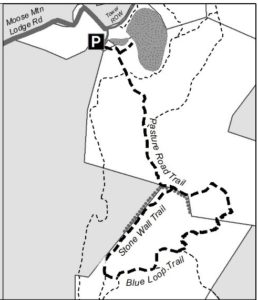
Driving directions:

  • From Etna Village, head N on Hanover Center Road
  • Turn R on Ruddsboro Road and drive 1.8 miles
  • Turn L on Old Dana Road
  • Turn R onto Moose Mtn. Lodge Rd just past an old barn
  • Drive 0.8 miles to top of steep road. Park at the marked trailhead parking area.

What you should know:

  • Foot travel only.
  • Dogs welcome if under close control.
  • Bring binoculars for viewing waterfowl on Mill Pond.
  • This hike explores a trail newly built and blazed in spring, 2022 and visits the Dana Forest and Pasture Natural Area, co-owned by the Town of Hanover and a Dana family heir, and the privately owned Baum Conservation Area. These lands are part of a 3,800-acre contiguous block of protected higher-elevation wildlife habitat on Moose Mountain.

BRIEF HIKING DIRECTIONS

  • Begin at the sign reading “Mill Pond Forest & Huggins Trail Access.”
  • Bear L at first trail junction to visit Mill Pond
  • Return to trail junction and turn L onto Pasture Road
  • Follow signs for Pasture Road Trail.
  • Turn R onto Stone Wall Trail at gap in stone wall
  • Turn L onto Blue Loop Trail, heading downhill
  • Turn L onto Pasture Road Trail
  • Continue straight after junction with Stone Wall Trail
  • Bear L at junction with Pond Trail
  • Retrace your steps to return to your car

FULL DIRECTIONS

  • Begin your hike at the sign reading, “Mill Pond Forest & Huggins Trail Access.” To forever ensure public access to the network of trails you’ll be exploring, the Shumway and Huggins families donated conservation easements on this area to the Hanover Conservancy in 2016.
  • Cross a small drainage and note the grassy area beyond the trees at L. By 2017, the beavers left when their preferred food supply ran out, after years of entertaining their neighbors with tail slaps on the water plus plugged culverts and “free-range forestry.” The thread of infant Mink Brook has reappeared in the absence of management by these aquatic engineers, and the series of pools is growing up to grass.
  • 3 minutes’ walk from your car, bear L at the first trail junction. In 15 paces look for a cellar hole at L, difficult to see amid the lush growth at this time of year. Here stood the home of David Woodward, who built the dam on Mill Pond and a sawmill and gristmill on the small, steep falls of Mink Brook below where you left your car.
  • Continue on the path a few minutes further to Mill Pond, the highest water body in Hanover and the primary source of the town’s largest stream. Set in a saddle on the mountain ridge, it originally may have been a smaller pond or perhaps a marsh. Around 1800, Woodward built a drylaid stone dam (out of view at L, beyond the spruces) to raise the water level some 6-8 feet (since partly silted in). Beavers later took over managing water levels but since they departed, the pond has shrunk to half its size. Directly across the water is the remains of their impressive lodge. Today, the entire shoreline remains undisturbed as Hanover Conservancy easements protect the N side and the S side is the Dana Pasture Natural Area. It is this 132-acre parcel straddling the mountain ridge that we’ll traverse now
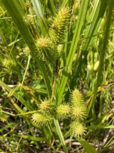
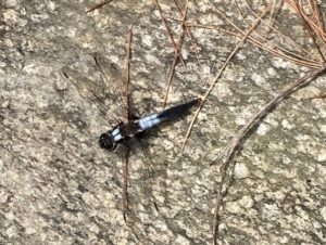
  • Scan the pond for waterfowl and other birds. On the day we visited, elegant black and white dragonflies, looking as if they were dressed for a formal affair, darted over the surface. Punctuating the green bristly growth of sedges (left) are the paired reddish (when emerging) leaves of St. John’s Wort.
  • Retrace your steps to the trail junction, marked with a sign for Pasture Road and a green moose. Turn L onto this historic Class VI road. Where it once met Moose Mountain Lodge Road is anybody’s guess – we bet it’s now under an old beaver dam.
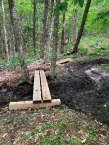
  • Pasture Road follows an old stone wall through mixed woods. You’ll soon arrive at a pair of hefty bog bridges, built in 2022 by the Upper Valley Trail Alliance’s High School Trail Corps to provide dry footing across a wet part of the old road. The road climbs gently and in a few more minutes, cross another wet area. These seeps may seem pesky to hikers but are an important part of the mountain’s water retention system, holding moisture in the soil rather than letting it run quickly downhill. This is especially important with the sudden, heavy downpours that are accompanying climate change
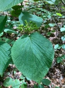
  • Note two of the “junior” members of the forest community that both feature paired leaves: striped maple, with its goose-foot shaped leaf, and hobblebush (left), a viburnum just setting fruit at this time of year. As fall approaches, it will turn a deep purple and its fruits, beloved by birds, will turn bright red
  • Four minutes’ walk from the last wetland crossing, pass the Orange Diamond Ridge Trail at L. Ahead at R is a sign for Pasture Road. Continue straight.
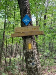
  • 8 minutes later, bear L at a set of signs posted to help you navigate the uncertain route of historic Pasture Road toward the Baum Conservation Area and Stone Wall Trail.
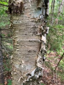
  • You’ve been passing through true northern hardwoods forest, with some of its most handsome members on display. We’re fond of the glistening golden bark of yellow birch like the one on your L (photo), a northern species that is more shade-tolerant and long lived than its familiar, iconic cousin known as canoe, paper, or white birch. The forest here looks to be about 75 years old, with beech, northern red oak, red and sugar maple, and hemlock.
  • The forest is in recovery from its years as the Dana Farm’s summering grazing grounds. The Dana family farmed this area since the late 1800s. Into the 1960s, the family drove their cattle up the mountainside to graze on the remaining open pastures in summer.
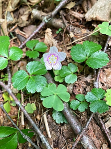
  • From the signs, continue for 7 minutes on the yellow-blazed trail, keeping an eye out for the colorful mushrooms and fungi that begin to appear at this time of year. Spring wildflowers have mostly wound down, but you may spot the delicate pink-striped white blossoms of mountain woodsorrel, Oxalis montana, shown at R mixed with the similar but glossier leaves of goldthread.
  • Suddenly, Pasture Road delivers you to a large and dramatic stone wall, built of huge, angular, coarsely laid blocks. A yellow-blazed pin indicates that the wall marks a property boundary – to the S is the Baum Conservation Area, owned by a local Dartmouth alumnus with a keen interest in trails and the public benefits of protected land. Bear L along the wall for a few minutes to a gap at the junction of the Pasture Road Trail and the new Stone Wall Trail. Take a moment to check the signage here, as you’ll be returning to this spot in a little under an hour. If your time is limited, you can just explore the Stone Wall Trail (11 minutes one way) and retrace your steps.
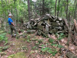
  • Turn R and down the hill on the Stone Wall Trail, built in 2021 to replace 2 trails retired to reduce impact on wildlife habitat. Volunteers led by the Hanover Trails Committee spent 34 person-hours in one week in 2022, blazing 10-12 miles of trails here and elsewhere. It takes lots of work, time, and bug-swatting, all powered by a spirit of good will, to provide such trails for you to enjoy.
  • On the R, the massive stone wall is in view upslope; soon you’ll notice a parallel wall at L. The forest is younger here, and wild sarsaparilla is common in the understory.
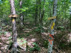
  • The Stone Wall Trail ends at a connector trail not long after the wall itself ends. Note a closed trail at R and a sign ahead on the opposite side of a tree. Continue your hike by bearing L and gently downhill, crossing a small drainage to the extensive trail system on the Baum Conservation Area.
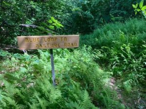
  • 4 minutes from the Stone Wall Trail, turn L on the Blue Loop Trail and head down through a fern-covered former skid trail. In 3 minutes the trail briefly levels out. Look L for a sign reading “Blue Loop to Pasture Road” and head downhill again.
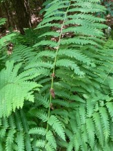
  • Enjoy this old logging road with a few short steep sections and some low ledges. Now’s a good time to admire the variety of ferns growing here – wood fern, cinnamon fern, interrupted fern (photo) and the delicate, dual-tapered New York fern. Sturdy three-part bracken fern and the coarser fronds of sensitive fern enjoy damp spots.
  • The trail bears L at the bottom of a hill. A short section of blocky stone wall is visible at L. Cross a small drainage that may be dry at this season. On the other side, back on the town’s Dana Forest and Pasture Natural Area, pick up the yellow blazes again. The trail moves gently downhill.
  • 10 minutes from your last turn, cross another drainage and look L for another Pasture Road sign. Turn L here; the Blue Loop Trail you’ve been following continues downhill. Natural stone steps lead up and the trail bends L and slabs across the slope. Keep your eye out for yellow blazes to guide you on this less-beaten path that curves up and around a ledge.
  • Here, forest patches are composed of pole-sized saplings of young beech and goose-foot (striped) maple, belying a recent forest disturbance. Arrive at an opening filled with blueberries and bracken fern and then move more steeply up into hemlocks, whose dense shade discourages understory growth. As the trail becomes less steep, note a scarred beech at L that appears to be a favorite for bucks to rub velvet off their antlers. Pine and oak join the hemlocks. The flute-like calls of the wood thrush provide orchestration for your hike. The wind in the trees overhead reminds that you’re climbing on a mountain ridge.
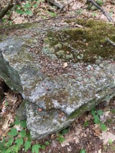
  • The trail reaches the top of a gentle ascent and bears L. Mossy flat stones decorate the treadway. In 2 minutes another stone wall appears ahead. Bear R to keep it on your L. The angular flat rock at L bears evidence of many squirrel picnics.
  • The wall follows the Baum/Dana boundary, and the trail takes a sharp R where the wall meets a ledge.
  • 4 minutes from your meeting with the wall, you’re back at the signed junction with the Stone Wall Trail, closing the loop. Continue straight on the Pasture Road Trail, keeping that impressive wall on your L; bear R to follow the yellow blazes.
  • What are such massive stone walls doing in the forests of Moose Mountain? When they were built, likely during the Sheep Craze of 1820-1850, the forests were largely gone, cut to provide building materials, heat, and especially open pastures for merino sheep. In 1840, there were over 11,000 sheep grazing Hanover’s hillsides, tended by a human population of only 2,800. As the region’s wool market and textile industry succumbed to competition from the Midwest and South in the Civil War era, the departure of nibbling sheep allowed the forest to return, yet the timeless walls remained.
  • Continue straight (N) on the Pasture Road Trail, passing several signs for the Orange Diamond Ridge Trail. As you go, note signs of forest succession – dead snags of white birch, blowdowns, and more. All these are signs of rejuvenation and provide habitat for various birds and small mammals.
  • 10 minutes from the Stone Wall Trail stay L on the Pasture Road trail. The opening visible through the trees off to the R is the S end of Mill Pond, filling in with grasses now that beavers are no longer maintaining their improvements on David Woodard’s dam. If the beavers do not return, you’ll soon find alders and other wet-tolerant woody plants here. Eventually, the forest will reclaim this space.
  • Pasture Road’s more formal walls accompany you until you arrive at the path at R leading to the water. Turn L at this fork to return to your car.

July, 2022

Thanks to the Coop Food Stores’

program for supporting this hike of the month 

Filed Under: Bears, Birds, Conservation, Deer, Hike of the Month, History, July, Lands, Moose Mountain, Trails, Wildlife

Mink Brook & Tanzi Tract

September 10, 2021

DOWNLOAD FULL PDF OF DIRECTIONS – Mink Brook & Tanzi Tract

Driving directions:

  • From downtown Hanover, drive S on Main St. (Rte 10) 0.5 miles to Brook Rd.
  • Turn L just before Route 10 crosses Mink Brook.
  • Follow Brook Road for 0.1 mile to a sharp bend.
  • Park here near the trailhead gate.

What you should know:

  • Dogs are welcome but must be under close control (better yet, leashed); please pick up after your pet.
  • Foot travel only. Bicycles are not permitted in the Mink Brook Nature Preserve.
  • Trail maps are available at the trailhead kiosk near the Brook Road gate.
  • The Preserve is home to bears who may emerge from hibernation as early as March (another reason to leash your dog). If you encounter a bear, do not run but speak softly to it and move away slowly. Mother bears are as protective of their young as we are.
  • You will visit the 112-acre Mink Brook Nature Preserve, owned and managed by the Hanover Conservancy since 1999, and the 15.8 acre Angelo Tanzi Natural Area, owned by the Town of Hanover.

BRIEF HIKING DIRECTIONS

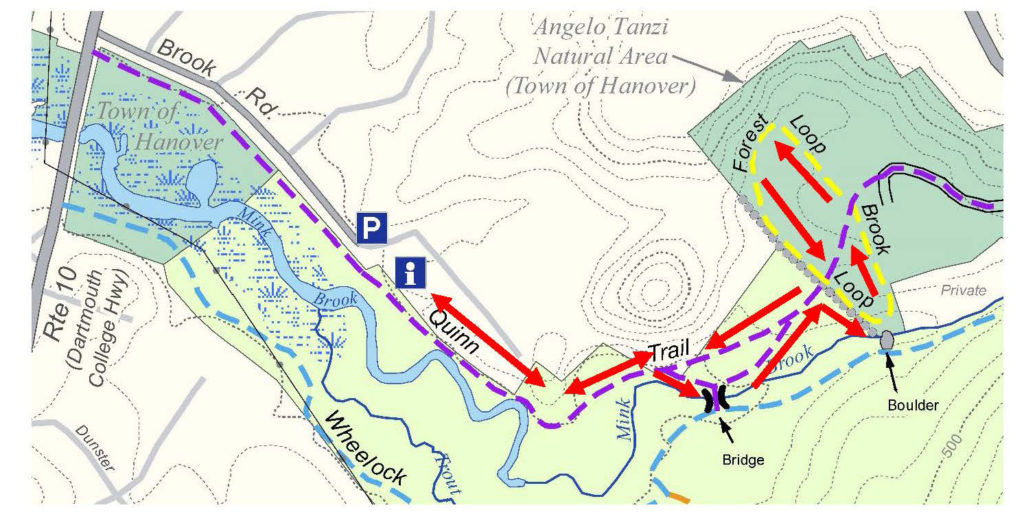
  • Take the Quinn Trail through the gate and visit the kiosk.
  • Continue on the Quinn Trail along the N side of Mink Brook, past the Norman Overlook.
  • Bear R to view the brook, then bear L to return to the Quinn Trail. Turn R and up the hill.
  • Enter the Tanzi Tract at a stone wall and turn R onto the Brook Loop. Follow back to Quinn Trail.
  • Cross the Quinn Trail onto the Forest Loop and return along the stone wall.
  • Turn R onto the Quinn Trail to return to your car.

FULL DIRECTIONS

  • Pass through the gate onto the Quinn Trail. Take a moment to check the kiosk display just ahead and pick up a trail guide. Note the map outlining Mink Brook’s 18.5 square mile watershed.
  • Hanover’s largest stream begins high on Moose Mountain at Mill Pond, gathering waters from other headwater streams and flowing through Etna, where it once powered so many mills that the village was first known as Mill Village. Below Etna, the brook turns and runs S of Greensboro Road through the Mink Brook Community Forest, protected in 2021. Crossing under Route 120 and past the remains of a mill built for Eleazar Wheelock, the brook rushes W past the Tanzi Tract and through the Mink Brook Nature Preserve toward the Connecticut River.
  • You are walking the easy, flat Quinn Trail, named for a Hanover family we’ll hear about later. This part of the trail follows a buried sewer line marked by covers labeled “Hanover Sewer 1976.” While they seem out of place on a woodland walk, we can forgive the intrusion since the building of this sewer line to collect waste from hundreds of Hanover homes meant the transformation of Mink Brook and the Connecticut River from noxious open sewers back to the safe, clean waters they are today.
  • Note the nature of the water in the brook. If ice-free, does it appear to be lazy and slow-moving, or is it locked silent under a cover of snow and ice? In this area, both the Connecticut and Mink Brook are pond-like, backed up behind Wilder Dam just downstream in Lebanon. Farther along the trail, stay alert for a change in character to the naturally free-flowing, musical stream that flows off the uplands.
  • 5 minutes’ walk from the gate, the trail takes a sharp L by a crabapple tree. Pause here to note the thick, ropy stems of river grape (Vitis riparia) growing up the trees at L. This native vine is common along streams and offers a rich food source for birds and other wildlife.
  • Now look R for a path heading towards the brook through young pines, and take a short trip down to the water where stepping stones offer a way to cross the brook at certain seasons. In the 1990s, a 30+ lot subdivision was laid out for the 112 acres of today’s Preserve. A road to serve the subdivision was to cross the brook here. Give a cheer for the 500 donors, the Quinn Family, and Dartmouth College for recognizing the natural value of this place and stepping up to help the Conservancy and Upper Valley Land Trust protect it. The Hanover Conservancy now owns and manages the land, with conservation deed restrictions from UVLT.
  • Return to the Quinn Trail and note the exposed roots of a large tree on the steep bank opposite. This clay bank was mined at one time for clay that was used to build Dartmouth’s tennis courts!
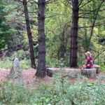
  • Turn R to continue on the Quinn Trail; you’ll soon arrive at the Norman Overlook at R, marked by slabs of granite offering a pleasant perch for observing the brook. Bob Norman, a founder of the Hanover Conservancy in 1961, was its President in 1999 when the Preserve was protected. A demonstration planting of native shrubs includes red osier (Cornus sericea), whose brilliant red stems are especially ornamental in late winter. This handsome shrub is a great choice for wet areas, as it tolerates wet feet and its white berries offer high quality food for wildlife in fall. You may see it growing naturally nearby.
  • At this point, the brook is clearly more lively, with patches of open water roiled by its flow. Wilder Dam may be far out of sight, but it controls the character and movement of Mink Brook here in the Preserve and of other tributaries as far north as Haverhill NH and Newbury VT, 45 miles upstream. The Hanover Conservancy is closely following re-licensing of this dam and studies of how it affects erosion and sedimentation, fish, wildlife, invasive species, and even archeological sites. As this hike is published, a welcome new proposal from the hydropower company suggests altering dam management to more of a natural, run-of-river flow than an up-and-down “peaking” flow, meaning that more of Mink Brook would be allowed to behave like a proper stream instead of a pond.
  • Note the stone riprap on the streambank near the tree line. Tropical Storm Irene sent so much water down Mink Brook that the brook changed course and began to erode this bank. Because the sewer line runs close by, the Town of Hanover is intervening to protect it from erosion.
  • Just past this site, bear R off the Quinn Trail toward the old log crossing. The beautiful log bridge, crafted in 2009 from a nearby tree, served for over a decade to connect trails on the north and south sides of the Preserve. Mother Nature began to reclaim it and the crossing was closed in August, 2021 for public safety. From this point you can still enjoy views of the brook and a distinctive square-topped stone.
  • Follow the path, bearing L at a fork to return up a short narrow path to rejoin the Quinn Trail. Turn R and take care on the stony slope as you approach the pine and hemlock forest on the hill above.
  • Note the plaque at R honoring the Quinn Family, who helped protect this land in 1999. Both Brian and Allie Quinn were members of the Conservancy’s board of directors, with Allie leading environmental education efforts in Hanover schools in the 1970s and 80s.
  • 5 minutes’ walk from the brook, arrive at a mossy stone wall marking the boundary with the Tanzi Tract. In 1966-67, working with the newly formed Conservation Commission, the Conservancy took an option on this 15.8 acre parcel and provided half the funding for its purchase for the Town. Angelo Tanzi (1899-1969) was a beloved local figure who managed a grocery market on Main Street (R), and whose family once owned this land.
  • Turn R to follow the Brook Loop for a few minutes along the stone wall to a lookout over a particularly pretty section of Mink Brook.
  • The Brook Loop bends left past a private inholding and returns in a few minutes’ walk to the Quinn Trail. Cross it to explore the 10-minute Forest Loop, marked “Foot Trail Only.”
  • Soon, a wooded slope looms up ahead – one of the strangely steep sides of ancient channels of Mink Brook. This region was once inundated by the frigid waters of glacial Lake Hitchcock. Its fine sediments were easily sliced by the rushing waters of such brooks after the lake receded, leaving these ravines. The Storrs Road neighborhood, up out of sight on the terrace above, is set on part of the old lake bottom.
  • The Forest Loop follows the base of the slope, bending L and passing over two boardwalks through great bear territory. In the hollow is a beautiful forested wetland that begins to hum with life in early spring. Note evergreen Christmas ferns and tipped-up trees in the wet soils.
  • High quality habitat abounds here, for bears, wood frogs, and many other creatures and plants. In fact, the NH Fish and Game Department’s Wildlife Action Plan identifies this area as some of the highest quality habitat in the state, shown in pink on this map.
  • The stone wall soon reappears at R. Keep a lookout for an old pine snag that gives an up-close-and-personal view of pine anatomy, branch collars and all.
  • Return to the Quinn Trail and the Mink Brook Nature Preserve boundary sign on a large pine. Turn R and follow the trail down the hill, watching your footing and taking no turns.
  • At the foot of the hill, the path may be damp with drainage from a wetland that is an extension of the one you skirted on the Forest Loop. This space is lively in spring with wood frogs and other amphibians courting and laying eggs.
  • Continue W on the Quinn Trail past the Norman Overlook and kiosk to return to your car. As you do, note the change in character of the brook as it shifts from a free-flowing stream to one whose flow is captured by Wilder Dam.
  • Be sure to come back as spring unfurls at the Preserve. This is a great walk at any time of year.

  September 2021

  This Hanover Hike of the Month is generously sponsored by

Filed Under: April, Bears, Conservation, History, Mink Brook, Trails, Wildlife

Living With Bears- Ben Kilham’s Talk Now Online!

May 15, 2020

The bears are back! Bring in your birdfeeders, secure garbage and compost, and keep your grills clean to prevent negative bear-human interactions. 

Watch Ben Kilham’s full presentation on living with bears, thanks to our local Community Access TV crew. Find out more about Ben’s work at kilhambearcenter.org.

Filed Under: Bears, Events, Indoor Programs

Bear Update

June 29, 2018

We’re sad to report that the family of black bears at the Mink Brook NP have been trapped and relocated after more than a year of concentrated efforts by town and state officials to educate our human residents. With another large bear family only a few miles away, our efforts to become better neighbors to these beautiful, typically shy animals will certainly continue! Read more here…

Version 2

Filed Under: Bears, Conservation, Mink Brook, Partnerships, Wildlife Tagged With: bear, black bear, cubs, Fish & Game, Mink, relocated

About those bears…

May 25, 2017

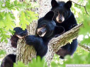
photo by Nicki Felicetti

The Hanover Conservancy has worked hard for many, many years to educate the Hanover community about how to co-exist with native wildlife, including the bears that, for generations, have occupied a home range near downtown and Mink Brook. We’ve sponsored programs by a variety of bear experts, blanketed inboxes with repeated pleas to take in birdfeeders, stuffed flyers in doors, posted signs, and sought help from the town and state. We organized a meeting with these experts and, most recently, sought volunteers to help with “bear hazing” to try to deter the bears from approaching homes in a last-ditch effort to stave off the inevitable.

Despite these efforts and those of many concerned neighbors, a bounty of birdfeeders, unsecured trash, and other inappropriate food sources remained available, leading the mother bear to teach her cubs to seek these rather than wild foods. The result is cubs that are twice the size they should be for their age, with no fear of humans or concept of bear/human boundaries. Much as we’d like to imagine that a different future could await bears that think it’s okay to help themselves to brownies on a kitchen counter, there is, unfortunately, no “Bear-Anon” to rehabilitate a bear that has strayed from its wild roots. And it is not the bears’ fault.

The bears will ultimately pay the price for human mistakes that are forcing state biologists to trap and euthanize the mother and her cubs. Nobody wants that fate for them, but with such unnatural habits, the bears cannot be released elsewhere. They would either continue their dangerous ways in their new home or would find their way back to Hanover after being driven out by bears already living there.  There is no other place a bear gone bad can go.

When one Hanover neighborhood decided to clean up its bear attractants and got serious about it, the bears stopped visiting, according to deputy fire chief Mike Hinsley, who has diligently scouted the situation. Bear-proof trash containers, taking in birdfeeders when bears emerge in spring, and confining access to compost are all sensible solutions.  We strongly support a town-wide ordinance requiring responsible management of trash and other bear attractants.

In the meantime, we recognize that there is excellent bear habitat in our area – Indian Ridge, Velvet Rocks, and stream corridors – and that it’s only a matter of time before a new bear discovers the recently-vacated territory in Hanover. We hope this time the bear receives a different welcome, from a community that has united to help it remain wild and free.

Filed Under: Bears, Mink Brook

Thank you for your support!

Our generous members and Corporate Conservators help make all of this possible. If you’re a customer of  our local business supporters, please let them know their contributions are appreciated!

71 Lyme Road
Hanover, NH 03755
(603) 643-3433

info@hanoverconservancy.org

Facebook logo   Instagram   YouTube

Get Involved

Become a Member

Volunteer

Business Sponsors

Conserve Your Land

Employment

Our Mission

Advocacy

Conservation

Education

Stewardship

Explore Hanover

Hanover Hikes

Upcoming Events

Upper Valley Hikes

Trails Challenge

Copyright © 2023 Hanover Conservancy | Design by Chase Brook Software