Hanover Conservancy

Facebook logo   Instagram   YouTube          
Donate button
  • Home
  • About Us
    • Celebrating 60 Years
    • What We Do
      • Advocacy
      • Conservation
      • Education
      • Stewardship
    • Board & Staff
    • Membership Benefits
    • Contact Us
  • Get Outdoors
    • Hanover Lands
      • Balch Hill Natural Area
      • Mink Brook Nature Preserve
      • Other Properties
    • Hanover Hikes
    • Upper Valley Hikes
    • Exploring Nature at Home
    • Trails Challenge
    • Hunting
  • Events
    • Calendar
    • Celebrating 60 Years
    • Hanover Trails Challenge
    • Hike of the Month
    • Private Events
  • Get Involved
    • Donate
    • Volunteer
    • Adopt a Trail
    • Corporate Conservators
    • Planned Giving
  • Education
    • School Programs
      • KAST
      • Connecticut River Studies
      • Hanover High School Scholarship
    • Request a Field Trip or Speaker
    • Research on Our Lands
    • Hanover History
    • Resources
  • News
    • Remembering Bob Norman
    • Reports & e-News
  • Conserve Your Land

Pasture Road Peregrinations

June 30, 2022

DOWNLOAD FULL PDF OF DIRECTIONS -Pasture Road Peregrinations
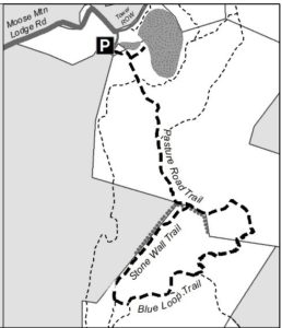
Driving directions:

  • From Etna Village, head N on Hanover Center Road
  • Turn R on Ruddsboro Road and drive 1.8 miles
  • Turn L on Old Dana Road
  • Turn R onto Moose Mtn. Lodge Rd just past an old barn
  • Drive 0.8 miles to top of steep road. Park at the marked trailhead parking area.

What you should know:

  • Foot travel only.
  • Dogs welcome if under close control.
  • Bring binoculars for viewing waterfowl on Mill Pond.
  • This hike explores a trail newly built and blazed in spring, 2022 and visits the Dana Forest and Pasture Natural Area, co-owned by the Town of Hanover and a Dana family heir, and the privately owned Baum Conservation Area. These lands are part of a 3,800-acre contiguous block of protected higher-elevation wildlife habitat on Moose Mountain.

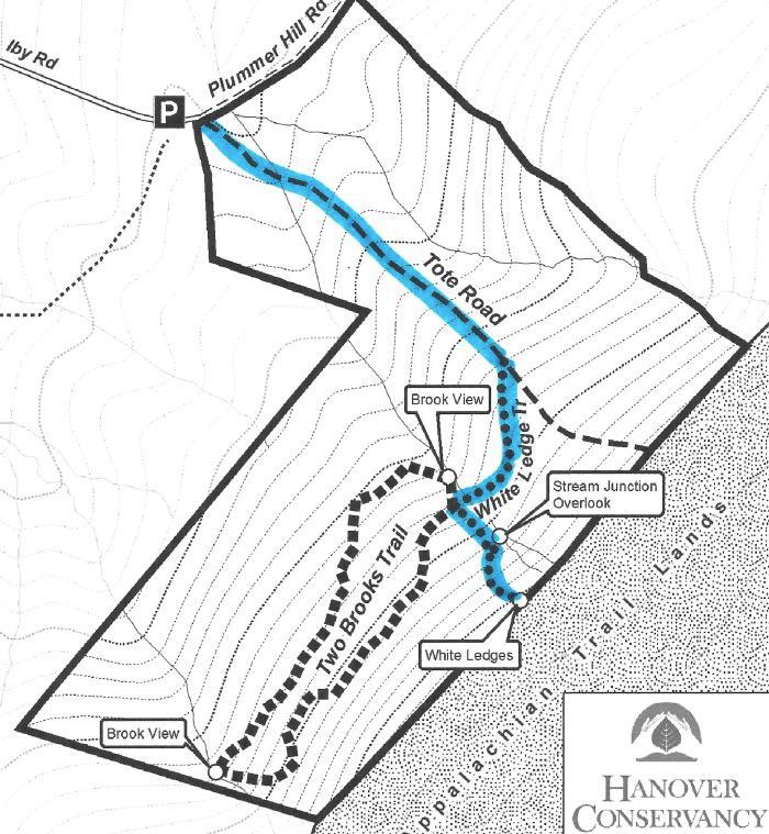
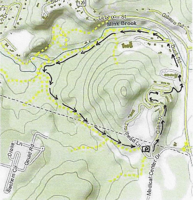
BRIEF HIKING DIRECTIONS

  • Begin at the sign reading “Mill Pond Forest & Huggins Trail Access.”
  • Bear L at first trail junction to visit Mill Pond
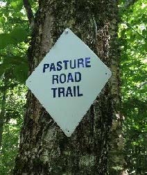
  • Return to trail junction and turn L onto Pasture Road
  • Follow signs for Pasture Road Trail.
  • Turn R onto Stone Wall Trail at gap in stone wall
  • Turn L onto Blue Loop Trail, heading downhill
  • Turn L onto Pasture Road Trail
  • Continue straight after junction with Stone Wall Trail
  • Bear L at junction with Pond Trail
  • Retrace your steps to return to your car

FULL DIRECTIONS

  • Begin your hike at the sign reading, “Mill Pond Forest & Huggins Trail Access.” To forever ensure public access to the network of trails you’ll be exploring, the Shumway and Huggins families donated conservation easements on this area to the Hanover Conservancy in 2016.
  • Cross a small drainage and note the grassy area beyond the trees at L. By 2017, the beavers left when their preferred food supply ran out, after years of entertaining their neighbors with tail slaps on the water plus plugged culverts and “free-range forestry.” The thread of infant Mink Brook has reappeared in the absence of management by these aquatic engineers, and the series of pools is growing up to grass.
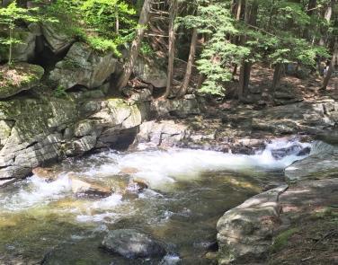
  • 3 minutes’ walk from your car, bear L at the first trail junction. In 15 paces look for a cellar hole at L, difficult to see amid the lush growth at this time of year. Here stood the home of David Woodward, who built the dam on Mill Pond and a sawmill and gristmill on the small, steep falls of Mink Brook below where you left your car.
  • Continue on the path a few minutes further to Mill Pond, the highest water body in Hanover and the primary source of the town’s largest stream. Set in a saddle on the mountain ridge, it originally may have been a smaller pond or perhaps a marsh. Around 1800, Woodward built a drylaid stone dam (out of view at L, beyond the spruces) to raise the water level some 6-8 feet 
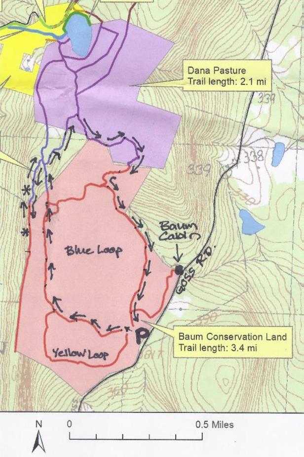
(since partly silted in). Beavers later took over managing water levels but since they departed, the pond has shrunk to half its size. Directly across the water is the remains of their impressive lodge. Today, the entire shoreline remains undisturbed as Hanover Conservancy easements protect the N side and the S side is the Dana Pasture Natural Area. It is this 132-acre parcel straddling the mountain ridge that we’ll traverse now
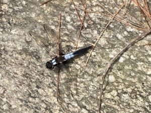
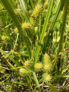
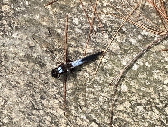
  • Scan the pond for waterfowl and other birds. On the day we visited, elegant black and white dragonflies, looking as if they were dressed for a formal affair, darted over the surface. Punctuating the green bristly growth of sedges (left) are the paired reddish (when emerging) leaves of St. John’s Wort.
  • Retrace your steps to the trail junction, marked with a sign for Pasture Road and a green moose. Turn L onto this historic Class VI road. Where it once met Moose Mountain Lodge Road is anybody’s guess – we bet it’s now under an old beaver dam.
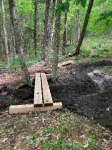
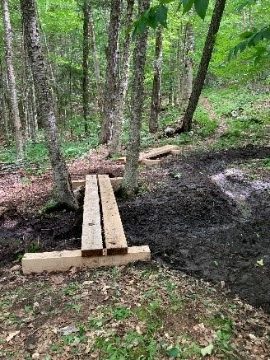
  • Pasture Road follows an old stone wall through mixed woods. You’ll soon arrive at a pair of hefty bog bridges, built in 2022 by the Upper Valley Trail Alliance’s High School Trail Corps to provide dry footing across a wet part of the old road. The road climbs gently and in a few more minutes, cross another wet area. These seeps may seem pesky to hikers but are an important part of the mountain’s water retention system, holding moisture in the soil rather than letting it run quickly downhill. This is especially important with the sudden, heavy downpours that are accompanying climate change
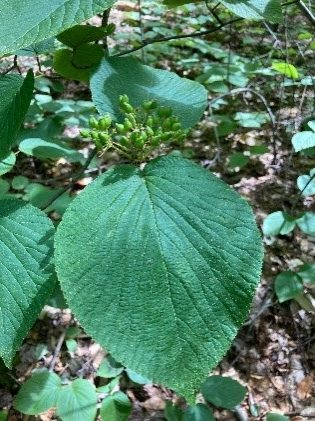
  • Note two of the “junior” members of the forest community that both feature paired leaves: striped maple, with its goose-foot shaped leaf, and hobblebush (left), a viburnum just setting fruit at this time of year. As fall approaches, it will turn a deep purple and its fruits, beloved by birds, will turn bright red
  • Four minutes’ walk from the last wetland crossing, pass the Orange Diamond Ridge Trail at L. Ahead at R is a sign for Pasture Road. Continue straight.
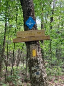
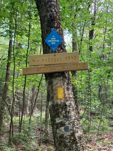
  • 8 minutes later, bear L at a set of signs posted to help you navigate the uncertain route of historic Pasture Road toward the Baum Conservation Area and Stone Wall Trail.
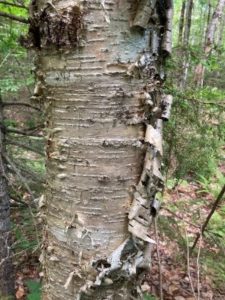
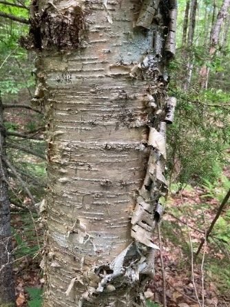
  • You’ve been passing through true northern hardwoods forest, with some of its most handsome members on display. We’re fond of the glistening golden bark of yellow birch like the one on your L (photo), a northern species that is more shade-tolerant and long lived than its familiar, iconic cousin known as canoe, paper, or white birch. The forest here looks to be about 75 years old, with beech, northern red oak, red and sugar maple, and hemlock.
  • The forest is in recovery from its years as the Dana Farm’s summering grazing grounds. The Dana family farmed this area since the late 1800s. Into the 1960s, the family drove their cattle up the mountainside to graze on the remaining open pastures in summer.
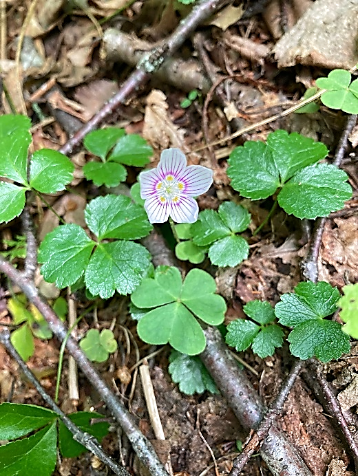
  • From the signs, continue for 7 minutes on the yellow-blazed trail, keeping an eye out for the colorful mushrooms and fungi that begin to appear at this time of year. Spring wildflowers have mostly wound down, but you may spot the delicate pink-striped white blossoms of mountain woodsorrel, Oxalis montana, shown at R mixed with the similar but glossier leaves of goldthread.
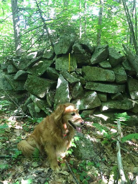
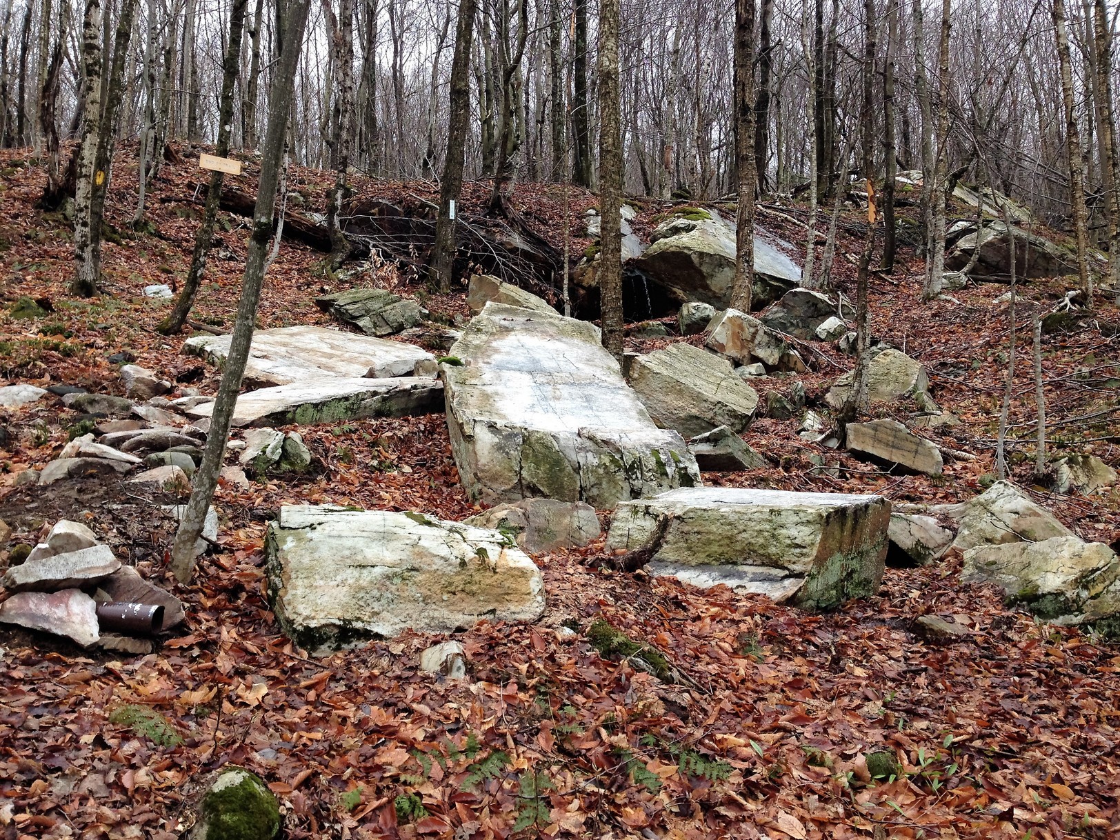
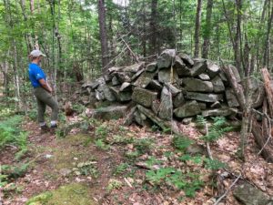
  • Suddenly, Pasture Road delivers you to a large and dramatic stone wall, built of huge, angular, coarsely laid blocks. A yellow-blazed pin indicates that the wall marks a property boundary – to the S is the Baum Conservation Area, owned by a local Dartmouth alumnus with a keen interest in trails and the public benefits of protected land. Bear L along the wall for a few minutes to a gap at the junction of the Pasture Road Trail and the new Stone Wall Trail. Take a moment to check the signage here, as you’ll be returning to this spot in a little under an hour. If your time is limited, you can just explore the Stone Wall Trail (11 minutes one way) and retrace your steps.
  • Turn R and down the hill on the Stone Wall Trail, built in 2021 to replace 2 trails retired to reduce impact on wildlife habitat. Volunteers led by the Hanover Trails Committee spent 34 person-hours in one week in 2022, blazing 10-12 miles of trails here and elsewhere. It takes lots of work, time, and bug-swatting, all powered by a spirit of good will, to provide such trails for you to enjoy.
  • On the R, the massive stone wall is in view upslope; soon you’ll notice a parallel wall at L. The forest is younger here, and wild sarsaparilla is common in the understory.
  • The Stone Wall Trail ends at a connector trail not long after the wall itself ends. Note a closed trail at R and a sign ahead on the opposite side of a tree. Continue your hike by bearing L and gently downhill, crossing a small drainage to the extensive trail system on the Baum Conservation Area.
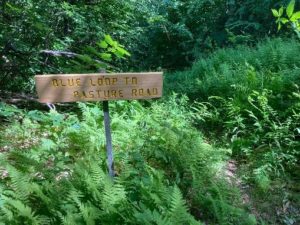
  • 4 minutes from the Stone Wall Trail, turn L on the Blue Loop Trail and head down through a fern-covered former skid trail. In 3 minutes the trail briefly levels out. Look L for a sign reading “Blue Loop to Pasture Road” and head downhill again.
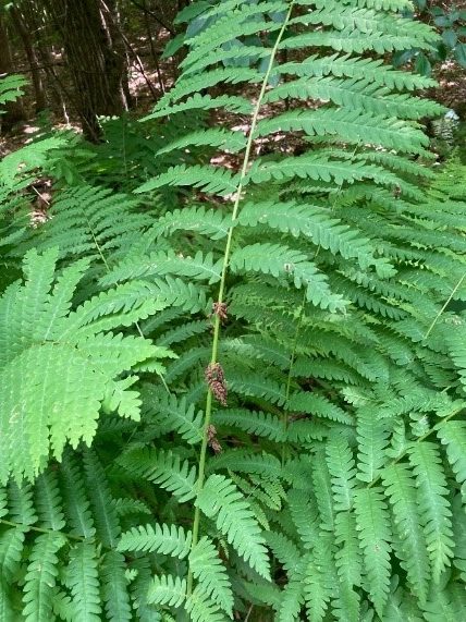
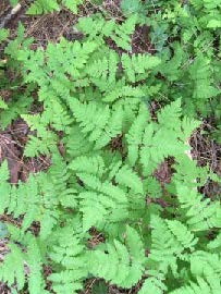
  • Enjoy this old logging road with a few short steep sections and some low ledges. Now’s a good time to admire the variety of ferns growing here – wood fern, cinnamon fern, interrupted fern (photo) and the delicate, dual-tapered New York fern. Sturdy three-part bracken fern and the coarser fronds of sensitive fern enjoy damp spots.
  • The trail bears L at the bottom of a hill. A short section of blocky stone wall is visible at L. Cross a small drainage that may be dry at this season. On the other side, back on the town’s Dana Forest and Pasture Natural Area, pick up the yellow blazes again. The trail moves gently downhill.
  • 10 minutes from your last turn, cross another drainage and look L for another Pasture Road sign. Turn L here; the Blue Loop Trail you’ve been following continues downhill. Natural stone steps lead up and the trail bends L and slabs across the slope. Keep your eye out for yellow blazes to guide you on this less-beaten path that curves up and around a ledge.
  • Here, forest patches are composed of pole-sized saplings of young beech and goose-foot (striped) maple, belying a recent forest disturbance. Arrive at an opening filled with blueberries and bracken fern and then move more steeply up into hemlocks, whose dense shade discourages understory growth. As the trail becomes less steep, note a scarred beech at L that appears to be a favorite for bucks to rub velvet off their antlers. Pine and oak join the hemlocks. The flute-like calls of the wood thrush provide orchestration for your hike. The wind in the trees overhead reminds that you’re climbing on a mountain ridge.
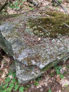
  • The trail reaches the top of a gentle ascent and bears L. Mossy flat stones decorate the treadway. In 2 minutes another stone wall appears ahead. Bear R to keep it on your L. The angular flat rock at L bears evidence of many squirrel picnics.
  • The wall follows the Baum/Dana boundary, and the trail takes a sharp R where the wall meets a ledge.
  • 4 minutes from your meeting with the wall, you’re back at the signed junction with the Stone Wall Trail, closing the loop. Continue straight on the Pasture Road Trail, keeping that impressive wall on your L; bear R to follow the yellow blazes.
  • What are such massive stone walls doing in the forests of Moose Mountain? When they were built, likely during the Sheep Craze of 1820-1850, the forests were largely gone, cut to provide building materials, heat, and especially open pastures for merino sheep. In 1840, there were over 11,000 sheep grazing Hanover’s hillsides, tended by a human population of only 2,800. As the region’s wool market and textile industry succumbed to competition from the Midwest and South in the Civil War era, the departure of nibbling sheep allowed the forest to return, yet the timeless walls remained.
  • Continue straight (N) on the Pasture Road Trail, passing several signs for the Orange Diamond Ridge Trail. As you go, note signs of forest succession – dead snags of white birch, blowdowns, and more. All these are signs of rejuvenation and provide habitat for various birds and small mammals.
  • 10 minutes from the Stone Wall Trail stay L on the Pasture Road trail. The opening visible through the trees off to the R is the S end of Mill Pond, filling in with grasses now that beavers are no longer maintaining their improvements on David Woodard’s dam. If the beavers do not return, you’ll soon find alders and other wet-tolerant woody plants here. Eventually, the forest will reclaim this space.
  • Pasture Road’s more formal walls accompany you until you arrive at the path at R leading to the water. Turn L at this fork to return to your car.

July, 2022

Thanks to the Coop Food Stores’

program for supporting this hike of the month 

Filed Under: Bears, Birds, Conservation, Deer, Hike of the Month, History, July, Lands, Moose Mountain, Trails, Wildlife

Mink Brook and Gile Hill

July 1, 2019

Complete PDF


Gile Hill mapDriving Directions

  • You can drive to the take-off point at Gile Hill OR walk from DHMC on medical center campus trails.
  • From downtown Hanover, take Lebanon St./Route 120 south to the first light after Greensboro Road, at Medical Center Drive. Turn R at the light, pass the gas station, cross the bridge, and take the first R to Gile Drive.
  • Turn immediately L into the gravel parking area encircled by large stones, and park. This is your starting point.
  • Today’s hike is a loop through the Mink Brook Nature Preserve and adjoining Gile Hill area, encircling the 800’ rocky knob highlighted on the map at R.

What You Should Know

  • This is a moderately challenging hike, if only because it uses every sort of path you can imagine – from wide and paved to narrow and rocky, flat to steep – and everything in between. Wear sturdy shoes!
  • You’ll pass through surroundings that vary from a deep hemlock forest to sculpted grassy slopes between apartment buildings. It’s good to know such wild places are so close at hand.
  • Dogs are welcome but must be leashed while walking through Gile Hill and must always be under your close control. Please pick up after your pet.
  • Bicycles are not permitted in the Mink Brook Nature Preserve.

Hiking Directions

  • To begin your hike, walk to the paved road to the Gile Hill development and turn L onto the paved sidewalk just beyond. Follow the sidewalk as it crosses the access road several times and continues down past the apartment buildings. When the sidewalk ends, continue a short distance to White Pine Oval. Take the nearer end of the oval – your destination is a crosswalk at the far end that leads you to a paved path. Along the way, notice a “wall” of stones inside a gabion cage, a stark contrast to the native boulders visible just beyond and the early stone walls you’ll observe later on this trip.
  • Walk past the wooden rail fence to a crosswalk where you’ll take the wide paved path to Buck Road. Just as it curves L, note a steep sided trench at R, built to capture stormwater runoff from the paved areas and roofs. Before 2006, when the Gile Hill development was built, this entire hillside was a steep, forested jumble of boulders. It presented such an engineering challenge that it was the field site focus of a regional conference on stormwater management techniques.
  • The paved path ends at Buck Road near Route 120. Turn L and head down the hill on Buck Road, which was once the main road linking Lebanon and Hanover before 120 was built. In a few minutes, Buck Road swings L just before the narrow bridge that once carried it over Mink Brook.
  • Wheelock trail sign
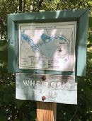
A few paces beyond the turn, look for the Wheelock Trail just before a fire hydrant.
  • Named for Eleazar Wheelock, founder of Dartmouth College (more about him in a minute), the blue-blazed trail begins as a narrow, rocky path threading among rocks and roots close to Mink Brook. You’re greeted by the sound of the tumbling brook and the cool sweet air of the protective forest, a stark change from Buck Road and Gile Hill. The Upper Valley Land Trust owns this land on the south side of the brook; you’ll pass beneath UVLT’s office perched at the top of the bank. UVLT was instrumental in protecting this parcel and the larger Mink Brook Nature Preserve in 1999, working hand in hand with the Hanover Conservancy (then known as the Hanover Conservation Council).
  • Five minutes from Buck Road, look for a rocky ledge on the far side of the brook where the water spills over a small falls. Amid the foliage above, you can make out the stone wall of an old mill structure. Watch your step among the tangle of roots across the trail. There’s a better view of the falls from below. You’re looking at the reason why Dartmouth College is in Hanover and not somewhere else!
  • 1778 map
    1778 map of SW Hanover showing Mink Brook and college and Wheelock holdings
    In the late 1760s, when Rev. Wheelock was searching for a town to locate his college, colonial governor John Wentworth and the proprietors of newly-founded Hanover and Lebanon joined together to offer him 2,000 acres surrounding this brook. This, the largest stream in Hanover, has an 18 square mile watershed, thus guaranteeing a good flow, and this falls offered a promising spot for a grist mill. This was essential gear for grinding grain to make flour to bake bread to feed hungry young men. The deal was sealed, and in 2019, Dartmouth celebrated its 250th anniversary, all thanks to Mink Brook. (After a first mill failed, Israel Woodward built this mill for Wheelock in 1771-1772).
  • But we digress. The Wheelock Trail continues into a cool glen shaded by hemlocks and becomes a wider path. Soon it heads up to a break in the canopy and bears R across land owned by Wheelock Terrace. Here, the sewer line passes under your feet on its way to the wastewater treatment plant at the mouth of Mink Brook.
  • Enter the woods once again at a small sign (TRAIL ->). In a few moments you’ll encounter a low stone wall marking an early boundary; today it announces that you have arrived at the Hanover Conservancy’s Mink Brook Nature Preserve. A remnant of barbed wire clings to a tree at L, and HC’s even more contemporary boundary marker, a 4’ plastic square, hangs on a tree at R. This stone wall marks the ancient property line between the 300 acre Wheelock parcel and the 1000 acre Dartmouth College parcel of land. That easterly property line makes a series of erratic westerly jogs as it runs north over the top of the hill and descends the northerly side. This reflects the fact that in 1771, after Wheelock had established his first mill on Mink Brook, it was found to be located not on Dartmouth property as the College Trustees had intended, but rather on Wheelock’s private property. Therefore, to appease the Trustees, the original property line was adjusted westerly, giving more land to the College.
  • Continue as the path becomes level and wide among the hemlocks. The brook’s floodplain may be flat, but you’re aware of steep, high slopes both across the brook and to your L. Soon they begin to crowd the path as steep ravines appear at L. What’s going on here? You are actually hiking along what was once the bottom of glacial Lake Hitchcock. This frigid lake covered the Connecticut River valley from Middletown, CT to Littleton, NH after the river’s waters were trapped by a dam of debris dropped by the glacier as it melted. Thousands of years later that dam broke, leaving us with the beautiful winding Connecticut River of today. While the lake was in place, however, soil washing in from the uplands settled on the lake bottom. In still water, such as that quieted by a veneer of ice, the finest particles of clay sink to the bottom. When the lake drained, Mink Brook’s braided waters flowed down through the newly exposed sediments, slicing deep channels through them on their way to meet the river. These old channels are now the steep ravines that surround you.
  • rocky gorgeAbout 15 minutes’ walk from Buck Road, you reach a beautiful rocky gorge. The trail briefly becomes indistinct on the slope but picks up later. Take a moment to visit the water’s edge and discover a lovely pool behind a low dam. This dam was built in the 1920s to create a swimming hole for a seasonal cottage once owned by the Tanzi family. The cottage is now gone, but a nearby private residence remains on the opposite bank. Continue west on the Wheelock Trail.
  • Four minutes’ walk past the gorge a flat terrace appears at L; this is part of the old glacial lake bed, formed when the lake had partially dropped.
  • Two minutes later, you arrive at a dramatic spot where an enormous boulder guards the brook. The footing is tricky here. Climb below the boulder to admire its sheer face, but please resist the temptation to climb it. A look toward the brook may reveal woody debris tossed here by high water. A nearby tree shows the scars of two strands of barbed wire, two and three feet off the ground, presumably set 150 years ago to protect grazing sheep from falling into the water.
  • Just beyond the huge boulder is a very old stone wall with hemlocks growing from it. Scan the hillside at L to marvel at another partial wall of larger boulders. This land has clearly been used for many, many years.
  • Mink Brook area mapFive minutes’ walk past the boulder brings you to a recently abandoned stream channel. Before Tropical Storm Irene, Mink Brook ran through this now nearly dry sandy area, but the August 2011 surge tore a new channel slightly north, where it now flows except in times of very high water. The trail heads toward the log crossing built in 2009. Just before the bridge are signs of erosion that began with Irene and continues today – a hemlock hangs out over the water, its roots exposed, and on the far side, the brook is scouring the north bank. Nearby at L, ferns occupy the swale of yet an earlier abandoned channel. This is a pretty busy place!
  • At the log crossing, you have a choice of exploring trails on the north side of the brook. If you do, please cross the log one at a time. A sign at L indicates that you have come from Buck Road and are headed toward Lebanon. Continue straight on the Wheelock Trail; it soon begins to swing away from the brook.
  • Just past a dead tree at R, look L for bright pink “whiskers” marking a study plot of Trillium. This study, conducted by the Biodiversity Committee of the Hanover Conservation Commission, is following survival of this native wildflower under heavy deer browse pressure.
  • A few steps further, a trail comes in at R. Take this for a few yards back to the streambank. Plans for a 32-lot housing development on this land included a road and bridge across the brook at this point. In 1999, to save this land as a refuge for the community – both human and wild – the Hanover Conservancy and Upper Valley Land Trust worked together to purchase the property. Over 500 households contributed, with Dartmouth College providing the major gift that ultimately made it possible to protect this land. Today, the 112-acre preserve is owned and managed by the Hanover Conservancy with help from volunteers. Conservation restrictions held by UVLT guide the preserve’s management.
  • Return to the Wheelock Trail, trying to visualize this place as a residential subdivision and yourself standing on a paved road leading to driveways, garages, mailboxes, landscaped yards, and houses with dogs and cats.
  • A few steps bring you to another junction, where the Wheelock Trail turns R and crosses a drainage over stones placed to allow both feet and water to pass. Here, you stay straight and continue on the orange-blazed Trout Brook Trail, a flat and gently winding pine-needle strewn path.
  • fernsAt R, pockets of ferny wetlands adorn the forest floor. It is easy to imagine how useful they are as sponges during heavy rains, holding back stormwater and protecting the brook from flooding and erosion.
  • Five minutes’ walk from the would-be subdivision bridge, arrive at another junction where a trail at R leads to Sachem Village. A small sign reminds that bicycles are not permitted at the Mink Brook Nature Preserve due to a condition placed on the College’s major gift that protected the land. The trail begins to climb as the mild music of falling water is heard.
  • Two minutes further, arrive at a small but picturesque waterfall on Trout Brook. At its foot are twin boulders, each wearing a rakish wig of moss and ferns. During a study of wild brook trout habitat by the NH Fish and Game Department and Trout Unlimited in 2012, biologists agreed that the protected forest in this area provides extremely high quality habitat for wild brook trout. (The trout are small, and deserve to live and grow another day.)
  • Keep the brook company for a short while, but watch for orange blazes as the trail swings L and heads up and away. Through the trees at L above is a flattish area where millet was grown by the Stone family when this land was part of their farm in the 1960s.
  • The Trout Brook Trail now heads steadily up, with Trout Brook singing away below to the R.
  • Seven minutes’ walk from the waterfall, you reach the height of land on the trail and emerge, blinking in the sudden change of light, into the clearing for a huge powerline. Needless to say, you’ve found the southern boundary of the nature preserve, which is also the boundary between Hanover and Lebanon.
  • Take a moment to adjust to the sharp contrast and then continue on the path, which bears L and down toward the power line. Coarse rock and gravel mark the route, which soon plunges up again, sometimes quite steeply, through clover, daisies, briars, coltsfoot, and 5’ white pines. It’s difficult to imagine that this area once looked exactly like what you just hiked. Replacing towering hemlocks with towering metal poles makes a big difference to everything beneath them!
  • About 10 minutes from the woodland’s edge, you arrive at another height of land affording a view of an electric transformer station below at R. Continue on the path, heading slightly L toward a gap in the trees and a yellow gate. Just beyond the gate is Trailhead Lane; turn R to reach the parking area where you left your car. If you walked from DHMC, turn R again at Medical Center Drive.

Filed Under: Hike of the Month, July, Mink Brook Tagged With: coltsfoot, trout

Baum Conservation Area and Moose Mountain

July 1, 2018

Baum Conservation Area – Full PDF


Baum area trail mapDriving Directions

  • From Etna Village, head N on Hanover Center Road
  • Turn R on Ruddsboro Road and continue to end on Route 4
  • Turn L on Route 4, drive 1.6 miles to Enfield Village
  • Turn L onto Maple Street; bear L at junction with May Street.
  • Drive 3.1 miles to the well-marked Baum Conservation Area entrance (1.7 mi. past Hanover-Enfield line).

What You Should Know

  • This is a hike for confident hikers with good trail skills. The trails are not the well-beaten paths you find at Balch Hill or the Appalachian Trail, which is part of the adventure. Bring a compass.
  • Some of the route follows grassy former skid trails; anticipate insect hitchhikers and do a tick check.
  • Foot travel only. Dogs welcome if under close control. You’ll pass prime porcupine habitat – we know from experience.
  • The route visits the Baum Conservation Area and the Dana Forest and Pasture Natural Area, parts of a 3,800-acre block of protected high-elevation wildlife habitat on Moose Mountain.

Baum area signHiking Directions

  • Begin your hike at the large triangular flat rock at the SW edge of the dirt parking area, after familiarizing yourself with the trails depicted on the posted entrance sign. You’ll be touring most of the 1.6 mile Blue Loop today, with a couple of additions.
  • To protect mountain wildlife habitat next to the Dana Forest and Pasture Natural Area and to offer public access to the trails you’ll be exploring, Dartmouth alumnus and outdoorsman Jim Baum and his wife Carol purchased this 239-acre area and gave the Town a conservation easement on the land. Jim worked with the Upper Valley Trails Alliance to improve the trails.
  • Start up through the trackless meadow, aiming for a point at 10 o’clock on the surrounding tree line. Soon a bare bit of smooth ledge appears with a small cairn to reassure you. Look for a yellow diamond sign with an arrow at the edge of the woods. Here, you bear R (not L) onto a mowed path.
  • An old skid trail turned hiking trail, the path soon begins to ascend gently but steadily, with mosses and herbaceous plants underfoot. Continue past a wide trail leading back down to the meadow. Shrubs such as a native honeysuckle and spiraea line the way. You can tell the soils here are moist, receiving subsurface water from upslope, as the path is carpeted with water-loving sedges. The curious fruiting body of the most common one looks like a pudgy green porcupine or blowfish. It looks prickly, but it’s not.
  • bracken fernAbout 18 minutes from your car, the trail bears R and levels out. A blue arrow confirms you’re on the Blue Loop. Waist-high bracken fern grows exuberantly. If a deerfly has discovered you, thwart it by joining the Order of the Bracken – pick a frond and wear it upside down on top of your head! Deerflies are programmed to swarm around the highest point of their prey – and will hover at the top of the fern stem.
  • 4 minutes from the blue diamond, look for yellow and blue diamonds on a tree at L. The trail swings L and moves through a thick young forest of pole-sized trees 1-3” in diameter. Grouse enjoy this habitat and you may suddenly flush one, startling both of you. Listen for the liquid notes of a wood thrush.
  • Another 4 minutes’ walk brings you to a clearing where a yellow arrow points L. You bear straight toward an opening filled with sun-loving, fragrant, hay-scented fern. Foresters don’t like this fern (or bracken) because it tends to quickly colonize forest openings, shading out any tree regeneration they encourage.
  • The trail moves gently up and curves L and R, ducking in and out of fern openings. As you ascend, now heading N, note the change in the woods. Here, older yellow birch and beech dominate the bony land. A few dips in the trail remind you that it was built as a logging trail with water bars to prevent erosion.
  • In 10 minutes, pass a pool teeming with tiny life. Just past it, the trail heads downhill.
  • Watch for a blue arrow on a small gnarled maple at L, directing you R as the trail gently curves.
  • The trail becomes narrower, with a few twists and turns, but if you trust your feet, it’s easy to follow.
  • 5 minutes past the pool, look for a junction with blue arrows pointing L and R. The Blue Loop heads R, straight downhill and back to the meadow and your car. We have more to discover, so look ahead for two orange diamonds at 11 o’clock. Head this way and cross a tiny drainage. This is a good place to look for wildlife tracks. Moose, bear, fisher, bobcat, fox, coyote, deer, porcupine, and squirrel are possibilities!
  • The trail has now transitioned to a more familiar woodland path. Follow the irregularly spaced orange diamonds, interspersed with blue flagging. In some places, blue diamonds are posted for viewing from the other direction. The trail moves gently and steadily up through mature northern hardwood forest.
  • 9 minutes from the last junction, a large bark-less, sun-bleached tree trunk has fallen across the trail. Pause to cross it and note an orange diamond on the L and just ahead, a constellation of signs. You have arrived at the Dana Forest and Pasture Natural Area, a 132-acre parcel owned by both the Town of Hanover and a member of the Dana family.
  • At this major junction, you have a choice –a 20-minute detour to check out two ledges (10 minutes if you just bag the first one) and soak in some views, or continue in the woods.

Optional Visit to Moose Mountain Ledges (1/3 mile each way)

  • view from the ledge just off the ridgeTurn L at the wooden sign and up a short steep section to a mossy ledge. This is part of the Orange Diamond Ridge Trail, built by a daring snowmobile club in the 1970s. The trail runs along the spine of Moose Mountain from Enfield to the South Peak, where it meets the AT. The Hanover Trails Committee has decided to rename it the Tom Linell Ridge Trail, after a dedicated long-time trail maintainer. The snowmobiles never returned.
  • Arrive at the first of two open ledges where views open up to the E. At 1 o’clock is the bony knob of Mt. Cardigan. Keep an eye on kids and dogs. A small cairn on the far side marks the trail’s return to the woods. Pass a nice colony of the small but stoic rock polypody fern.
  • Here, the Ridge Trail follows the boundary of two privately owned parcels – to the E is the Baum Conservation Area – you’re now following a trail that is parallel to but high above the one you just walked.
  • 5 minutes from the first ledge, arrive at the second, larger ledge, with even broader views. From the highest part of the open rock, you can see distant Mount Washington at 11 o’clock. At 10 o’clock, the ridge of Moose Mountain stretches N beyond the communications tower.
  • To return, look for pink tape on a tree to locate the trail back. It becomes clear you’re hiking the very spine of this mountain, a watershed divide, with the Mascoma River valley off at R and Mink Brook valley at L.
  • Return to the first ledge and follow a blue arrow to return to the trail junction.

Hike Continued

  • Back at the trail junction, retrace your steps to the fallen bare tree across the trail. Continue another 10 paces to a yellow sign at R for the Baum Conservation Area. At L, an orange sign with an arrow directs you to turn L onto the Ridge Trail, which appears as a smaller side trail.
  • Soon the Ridge Trail swings L and slabs along the contour before heading gently downhill. Note the bristly white pine at R that has received the attentions of pileated woodpeckers. The forest floor undulates with
  • the mounds and pits that betray long-ago blowdowns.
  • Pasture Road sign
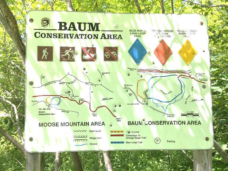
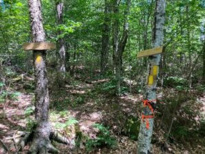
5 minutes after turning onto this trail, arrive at a junction. Bear R to follow orange flags, about 20 yards to a small hollow. Here an orange sign at L reads “Orange Ridge Trail” and at R, a white sign indicates “Pasture Road Trail.” Note the town’s blue and white trail blazes on a birch at L. This doesn’t look much like a road, but it follows, more or less, the route of a long-abandoned early “highway.”
  • Turn R to take the Pasture Road Trail, which is marked with blue-white blazes and occasional blue flagging. Here, the trail is uneven and narrow but well-marked.
  • stone wall corner
  • 6 minutes from the junction, you come upon a startling sight – the imposing corner of a stone wall with a yellow pin protruding from its base – boundary markers from the 19th and 21st centuries colliding. The wall is big and blocky and encrusted with lichen. It marks the northernmost corner of the Baum Conservation Area. After the terrain you’ve just been over, it’s hard to imagine building a wall to keep sheep here – especially a wall like this!
  • The trail continues L of the wall’s corner. Keep the wall on your R and a sharp eye out for painted blazes and blue flagging. The wall oddly ends, then after the trail twists near an outcrop, a section of wall appears again. There’s a nice growth of bunchberry and lowbush blueberry on the forest floor.
  • 8 minutes from the pinned wall corner, the trail parts company with the wall, which heads downslope. You continue straight, following blazes carefully. A short section of wall shows up again (what was the wall builder thinking?). Keep following the blue flagging and trust your feet.
  • 3 minutes later, bear R downhill onto a clearer path, down to a flat in a hemlock grove. Here, the trail bears R and is marked with simple blue painted blazes. Arrive at an opening with a dramatic view up to the ridge you may have just visited.
  • dog on trailThe trail continues on a narrow, rocky path for another 5-7 minutes arriving abruptly back at the Baum Conservation Area’s Blue Loop Trail, the now-familiar wide grassy path.
  • Turn L onto the easily followed trail and soon cross a streambed. Depending on recent weather, it may be dry, but it still has a watershed address! It’s an unnamed tributary of Lovejoy Brook, a tributary of the Mascoma River. We think it should be Baum Brook.
  • 10 minutes after joining the Blue Loop, cross another tiny stream. A path comes in at L – this leads to the Baum Cabin. Continue straight, head slightly uphill, and 2 minutes later you’re back at the meadow with your car in sight. As you head down to it, don’t forget to look for wild strawberries in the grass!

Note – Baum Cabin, 1/3 mile north of the parking area, is open to all by reservation with the Dartmouth Outing Club. Jim and Carol Baum gave the cabin to the DOC in 2008, thoughtfully including funds for its upkeep. The two-room cabin sleeps 6.

Learn More

  • Shumway Forest on Moose Mountain
  • Hanover Trails Committee maps
  • Baum Cabin


Filed Under: Hike of the Month, July, Moose Mountain Tagged With: bracken fern, polypody fern, sedge, views

The White Ledges of the Mayor-Niles Forest

July 1, 2016

Full loop in PDF format


Mayor-Niles trail map
Trail map

Driving Directions

  • From the Hanover Center green, head north on Hanover Center Road.
  • Shortly before the intersection of Rennie Road, turn east on Ferson Road.
  • Turn left at the T onto Three Mile Road.
  • Turn right at the T onto Ibey (Iby) Road.
  • Proceed up the hill 0.1 mile to the small parking area at the road’s end.

What You Should Know

  • Foot travel only. Dogs are welcome but must be under close control; please pick up after your pet.
  • Be aware that this is prime porcupine and bear habitat!
  • The trails are well-signed and marked. The wide Tote Road is not blazed but easy to follow. The White Ledge Trail is blazed in red.
  • The 92-acre Mayor-Niles Forest was the generous gift of Michael and Elizabeth Mayor and John Niles, who had owned the land for some 20 years. The Conservancy accepted the land in 2013 to protect valuable high elevation wildlife habitat, the headwaters of Hewes Brook, flood security for downstream neighbors, and a scenic backdrop, all the while adding to the block of contiguous protected habitat on Moose Mountain surrounding the Appalachian Trail.
  • The trails were created in 2016 by carefully laying out routes to avoid creating erosion on sensitive soils and disrupting rare plant habitats.

Hiking Directions

  • Park your car on the left, opposite a gray cape house. This house stands on the site of the former Smith farmhouse, which was standing here by 1799. By 1892, it was owned by H. L. Barnes. The lower parts of this land were once open sheep pasture. Note the stone wall separating the house and drive from the protected Forest.
  • Ibey Road becomes Plummer Hill Road, a Class VI road, just beyond the parking area and house. The road dead-ends at Plummer Hill, but the Harris Trail, which follows it, continues to Goose Pond Road in Lyme.
  • Start up Plummer Hill Road; in 20 yards turn right at the Conservancy sign posted on a large white pine.
  • Pass through a simple but elegantly designed gate – your first clue that someone really loves and cares for this property.
  • The trail initially passes through an area that was open until fairly recently. It soon moves into the woods after crossing a year-round stream on a narrow foot bridge built by the same volunteer.
  • Standing on the little bridge, you can see woody debris in the channel that captures sediment and keeps waters clear. The Forest is located in the Hewes Brook watershed; protecting this land keeps the waters of this brook shaded and therefore cool, clean, and comfortable for wild brook trout. Keeping the tiny headwater streams well forested with a spongy forest floor also helps soak up heavy rains and release water slowly, contributing to flood security in downstream neighborhoods.
  • Begin a steady climb up the old tote road. This road was used years ago by International Paper Company to haul timber off Moose Mountain. Occasional water bars have been installed to divert runoff to cope with the slope, preventing gullies in this steep, direct path.
  • As you move upslope, you’ll notice many small red spruce trees coming up along the path, marking the shift to cooler growing conditions. This higher elevation habitat will become an increasingly important refuge as the effects of climate change become more pronounced. Feel the branches to distinguish prickly red spruce from the soft branchlets of hemlock.
  • On the forest floor near the path, you may see ground cedar, ground pine, wild oats, and starflower.
  • After ten minutes’ steady climb, you’ll arrive at a well-marked turn onto the White Ledge Trail. If you stayed on the Tote Road, you’d come to the yellow-blazed boundary with the federal Appalachian Trail corridor land. While we’d love to create a trail connection with the AT here, such connections are carefully limited.
  • Turn right onto the red-blazed White Ledge Trail. Why not blaze it white, you ask? Only the AT is blazed white in Hanover!
  • The trail follows the mountainside contour as it heads south, a pleasant (but temporary!) relief from the steeper Tote Road. It passes through multi-aged northern hardwood forest that was last harvested about 20-25 years ago. Look for three kinds of birch (white, yellow, and gray), oak, beech, and four species of maple (sugar, red, goosefoot or striped, and mountain).
  • About 5 minutes from the Tote Road, you’ll come to another even more delightfully crafted brook crossing, this one with a white birch handrail. While the steep brook channel is dry in summer, the amount of woody and leafy debris in its channel testifies to the power of heavy rain and gravity.
  • A few yards beyond the little bridge, you arrive at a four-way trail intersection. The Two Brooks Trail leads straight ahead and loops around, returning to the right. To best appreciate it, save this trail for a day after rain or in late spring.
  • Joe Danna, Jr. by trail gateTurn left to continue on the White Ledge Trail, again heading uphill. White ash, black cherry, and other hardwoods join the birches and some impressive maples. The trail is steep in places but steps and careful trail benching create a safe pathway. By now, you’re curious about the person who lavished such attention on this tricky part of the path! We are fortunate to have Joe Danna, Jr. (right) to thank for all this work. A tireless Hanover Conservancy volunteer and nearby resident, Joe laid out, cleared, stabilized, and blazed these trails with the help of our Stewardship Committee and John Taylor of the Upper Valley Trails Alliance.
  • The trail continues to climb, sometimes steeply. Take care to turn right at a stake with red paint. As you wend your way to your goal, the White Ledges will come into view, their cool white forms almost glowing in the dark forest.
  • About 30 minutes’ hike from your car, a routed sign just past the ledges indicates you’ve reached the trail’s end. Just beyond you’ll see a bold yellow boundary blaze and vertical white sign reading, “U.S. Boundary” marking the protected lands surrounding the Appalachian Trail. YOU (and a couple hundred million other Americans) own that land. Moose, bear, and bobcat thank you for it.
  • White ledges at Mayor-NilesLinger at the White Ledges for a bit to marvel at the color and shape of this quartzite outcropping. Did you bring a picnic? One of those strikes us as a good picnic rock; our favorite is the smoothly angled one that looks like the prow of an ice cutting ship. Dartmouth Earth Science professor and former Hanover Conservancy Board member Carl Renshaw explains,

“Moose Mountain is composed of a core of Clough quartzite that is highly resistant to weathering. Outcrops of this quartzite, often called the ‘white ledges,’ are visible on the Mayor-Niles Forest, especially in one area close to the AT corridor boundary, where one may observe large, angular slabs of quartzite colored with small amounts of iron and lines composed of later quartzite intrusions.

“At one time, this place would have resembled a white, sandy beach composed of the material eroded from the high mountains that once ringed the area. When the continent was in a more southern position on the globe, the climate would have been warmer. The shape of the inland sea would have resulted in good-sized waves – creating conditions for a great surfing beach on the side of Moose Mountain. Heat and pressure later solidified these solid sand grains into the quartzite we observe today.

“The collisions of England, the Bronson island chain, and later Africa into North America were a major event that created the Appalachian Mountains some 400 million years ago – once the largest mountains in the world, at least two miles high. The Mayor-Niles Forest and the rest of the region are overlain by the Littleton Formation. On lower elevations on the property, this rock is exposed and contains small red crystals of garnet, indicating high temperature and pressure in the formation of this metamorphosed rock, and confirming that the mountains that existed here were relatively high. Fool’s gold, lead, and arsenic are other components of this dark gray rock.”

  • Take a moment to look for wildflowers here, too. Trillium, starflower, and violets have past blooming but their foliage remains. Among the clubmosses, you may see ground cedar, shining clubmoss, and ground pine. Some young hobblebush nearby will glow with purple foliage in fall.
  • When you’re ready to leave, follow the red blazes back to the four-way trail intersection and turn right toward the Tote Road, crossing Joe’s birch bridge.
  • Stop at the Tote Road junction to search the bark of nearby trees for clues to two different kinds of visitors. A few larger maples on the far side of the road show scarring near their bases received when loads of felled trees, hauled down the tote road, bumped into them. On your left, look high on the uphill side of some nearby beech trees to see claw marks from bears climbing the beeches in search of tasty, nutritious beechnuts.
  • Continue down the Tote Road, noting the diversity of ferns you’ve seen growing at the Mayor-Niles Forest: ostrich fern, woodfern, sensitive fern, the leathery evergreen Christmas fern, and, near Joe’s lower bridge, a nice gathering of New York fern.
  • Reach Plummer Hill Road and turn left toward your car.

The Hanover Conservancy owns and manages the Mayor-Niles Forest. We warmly welcome donations to our Land Stewardship Fund to help maintain the property. Contact info@hanoverconservancy.org. Learn more about the Forest.

Filed Under: Hike of the Month, July, Mayor-Niles Forest Tagged With: bear, hobblebush, quartzite, starflower, trillium

Thank you for your support!

Our generous members and Corporate Conservators help make all of this possible. If you’re a customer of  our local business supporters, please let them know their contributions are appreciated!

71 Lyme Road
Hanover, NH 03755
(603) 643-3433

info@hanoverconservancy.org

Facebook logo   Instagram   YouTube

Get Involved

Become a Member

Volunteer

Business Sponsors

Conserve Your Land

Employment

Our Mission

Advocacy

Conservation

Education

Stewardship

Explore Hanover

Hanover Hikes

Upcoming Events

Upper Valley Hikes

Trails Challenge

Copyright © 2023 Hanover Conservancy | Design by Chase Brook Software