Hanover Conservancy

Facebook logo   Instagram   YouTube          
Donate button
  • Home
  • About Us
    • Celebrating 60 Years
    • What We Do
      • Advocacy
      • Conservation
      • Education
      • Stewardship
    • Board & Staff
    • Membership Benefits
    • Contact Us
  • Get Outdoors
    • Hanover Lands
      • Balch Hill Natural Area
      • Mink Brook Nature Preserve
      • Other Properties
    • Hanover Hikes
    • Upper Valley Hikes
    • Exploring Nature at Home
    • Trails Challenge
    • Hunting
  • Events
    • Calendar
    • Celebrating 60 Years
    • Hanover Trails Challenge
    • Hike of the Month
    • Private Events
  • Get Involved
    • Donate
    • Volunteer
    • Adopt a Trail
    • Corporate Conservators
    • Planned Giving
  • Education
    • School Programs
      • KAST
      • Connecticut River Studies
      • Hanover High School Scholarship
    • Request a Field Trip or Speaker
    • Research on Our Lands
    • Hanover History
    • Resources
  • News
    • Remembering Bob Norman
    • Reports & e-News
  • Conserve Your Land

Application for 2022 Balch Hill Deer Hunting is open!

August 1, 2022

Our deer permit application for the 2022 hunting season at Balch Hill is now open! Please follow the link below to our deer permit application, thank you!

Balch Hill Deer Hunting Application

Filed Under: Balch Hill, Deer, Hunting, Lands, Wildlife Tagged With: Balch Hill, Deer permit, hunting

We’ve got mail!

August 19, 2020

Wooden mailbox on the summit of Balch Hill 
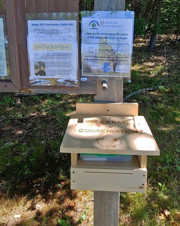
This fun mailbox on the summit of Balch Hill is filled with pens and postcards so visitors can write a note with their favorite memories of this natural area, whose summit we protected 50 years ago.

Some notes so far: “I am 7 1/2 years old and my Dad brought me here today for the first time! Thank you for keeping this place open. I love the butterflies.”

“This hike is magical. I do it weekly. We are privileged to life in such a beautiful place as this.”

“In honor of Dr. Susan Harper; a mentor and beautiful spirit whose legacy will flourish in the Upper Valley forever.” For more about Susan, visit the News page of our website.

Filed Under: Balch Hill, Conservation Tagged With: Susan Harper

Behemoths of Balch Hill

August 12, 2020

Hike Directions & Map – Full PDF

Driving directions:

  • From Downtown Hanover, drive east for 1.6Route map on Balch Hillmiles on East Wheelock Street, up a long hill to the junction of Grasse and Trescott Roads.
  • Park in the unpaved informal parking area on the northeast side of this intersection.

What you should know:

  • This loop hike takes you through the Balch Hill Natural Area to the summit with its beautiful views. Along the way you’ll visit grandfather trees that may have witnessed our town’s founding – including the Grafton County Champion Northern Red Oak.
  • You’ll be walking on lands owned by Dartmouth College, the Hanover Conservancy, and the Town of Hanover. Conservation easements and other restrictions protect some but not all of this land.
  • Trails have occasional short up-and-down grades but are easy for the entire family.
  • Foot travel only; no bicycles please.
  • Archery hunting for deer is permitted Sept 15 through Dec. 15; blaze orange is a good wardrobe choice.
  • Dogs are welcome but must be under your control; please pick up after your pet.

BRIEF HIKING DIRECTIONS

  • Take the red-blazed Grasse Road Trail from the trailhead kiosk to the summit, crossing a small footbridge.
  • From the summit kiosk, take the Fire Trail down to the junction with the Maple Trail.
  • Return to the summit and take the Hemlock Trail down to a large fallen tree.
  • Return to the summit and head for a group of apple trees and a stone bench. Look for the Piane Trail sign and turn L onto the red-blazed Grasse Road Loop.
  • Take this trail to the Champion Red Oak; continue to the small footbridge and turn R to return to your car.

FULL DIRECTIONS

  • Begin your hike at the trailhead kiosk, across Grasse Road from the parking area. The Hanover Lions Club generously donated this timber frame kiosk in 2011. Here, you can read a bit about the history of this land and pick up a trail guide if you wish.
  • The Grasse Road Trail heads across the slope on Dartmouth College land. This section was re-routed in 2015 by an Upper Valley Trails crew to follow a gentler, more sustainable path than the original.
  • The path soon turns to avoid a series of downed trees. What happened here? A short but violent windstorm on Patriot’s Day in April, 2007 blew down many trees on this part of the hill, and it will be years before they degrade back into the earth.
  • For several years near this spot stood a deer “exclosure” where Dartmouth ecology students conducted a study  to determine the effect of deer browse on the vegetation. Two identical plots, one fenced against deer and the other unfenced, were compared each year. Here are the results for the plot in this area. The blue bars indicate total number of plants in the fenced plots where deer cannot enter to browse, while red bars indicate the number of plants in the unfenced plots. In 2012, before the fencing went up, both plots had nearly the same number of plants. Contrast that to 2015! The largest change is in the number of wildflowers, especially Canada mayflower.
  • You’ve reached the low stone wall marking the southern boundary. Look for fragments of sheep fencing (large rectangles of wire fence) that date from the pre-Civil War “sheep craze” in the Upper Valley. In 1840, Hanover had over 10,000 sheep grazing on its hillsides, including this one, while the human population was around 2,000.
  • Follow the Grasse Road Trail as it makes a right turn away from the wall and heads north among tall, cool hemlocks.
  • At the junction with the Hunter East Trail (route to the Morrison Road neighborhood), turn left and cross a small log bridge over a wet area and onto Hanover Conservancy land.

Balch Hill sunset in winter. Photo by Rob Chapman

  • The trail bears right then immediately left and heads up the slope past some dramatic pine snags. In ten minutes’ walk from your car, you’ll reach the 920’ summit.
  • Enjoy the sweeping views from this, the only open summit in town where the public is welcome. Twenty-one miles to the south is grand Mount Ascutney. The spire of Baker Tower marks downtown Hanover in the near view to the west, while on the western horizon, 29 miles across Vermont, the sharp peak of Killington appears. To the northwest, our volunteers have been restoring the view toward Gile Mountain in Norwich.
  • Historically, the summit of Balch Hill was used as a pasture for grazing sheep and cattle. Records indicate that it was cleared of most trees for more than a century. In our experience, those trees badly want to return! We’ve been working to restore the orchard on the hill and keep the views open by mowing the meadow.

View of Hanover from Balch Hill in winter; undated photo

  • Once known as Corey Hill after an early owner, Balch Hill takes its name from former owner Adna P. Balch (1817-1889). Balch, a prominent citizen who served in the legislature in 1876-1877, promoted the development of the railroad in the Connecticut River Valley and was a director of the Hanover Gas Company. In the early to mid-twentieth century, the summit was known as Dewey Hill Pasture, after owners in those later days.
  • You can imagine what demand there might be to develop this hillside with its astounding views, so close to town. That’s why the Hanover Conservancy, then known as the Hanover Conservation Council, set out to purchase the summit when a New York developer proposed first 126 condominiums and then 49 luxury homes for this place. The community came together to protect the land, with the Council and Town later adding to it with a second purchase from the Garipay family. Make a note to come back for the annual Balch Hill Kite Day in May or the Hawk Watch in September, to see how much the community enjoys this natural area today. It was worth the effort!
  • After visiting the summit kiosk, erected by the Council in memory of Alice Jackson in 2009, begin your tour of Balch Hill’s biggest trees. Take the wide Fire Trail behind the kiosk for a short distance to its junction with the Maple Trail.
  • Take this right turn and in just a few steps you meet some venerable old sugar maples that may once have marked the path of an early road. These ancients stand out against their much younger brethren.
  • A person stands underneath a huge oak tree with one fallen limbHead back up the Maple and Fire Trails to the summit. Pass the kiosk and nearby bench, and head down to the right toward the Hemlock Trail sign. You’ll soon come to the remains of an enormous old oak tree, its split trunk and massive limbs now draped across the landscape, having lost their battle with gravity and time. The trail actually passes under the fallen trunk. Here’s what it looked like in 2014 (right).
  • Return to the summit for your last view before visiting the largest resident of Balch Hill. From the low bench near the summit maple, walk west and downhill toward the view of downtown, to another stone bench near a group of crabapple trees. Just beyond, you’ll see a sign for the Piane and Grasse Rd Loop Trails on the left, nailed to a white birch. Head down this trail only a few steps and make a sharp left onto the red-blazed Grasse Rd Loop.
  • The Grasse Rd Loop trail follows the contour, leading you in a couple of minutes to the County Champion Northern Red Oak, marked with a small sign. Despite its size, it can be easy to miss as its bulk is so far overhead. Look for it opposite the cut trunk of a tree.
  • Neighbors are sometimes reluctant to cut trees along boundaries, and we think it was this instinct that protected this massive tree, the largest survivor of its kind in Grafton County. When measured by the state’s Big Tree Steward in 2014, it had a circumference of 196 inches, a height of 114 feet, and an average crown spread of 80 feet. Had its cousin on the Hemlock Trail not lost its limbs, that tree would have been even larger.
  • After admiring this giant and imagining the history it must have witnessed, continue on the trail that soon bears left to head up a small valley to the small footbridge you crossed earlier. You’re now five minutes from your car.
  • Cross the bridge, bear right at the junction with the Hunter East Trail, and return down the hill to your car.

The volunteer Balch Hill Stewardship Committee cares for thisVolunteers tend a fire to remove cut brush on the summit of Balch Hill in winter. place and always welcomes help. Contact us if you’d like to get involved! We welcome contributions to the Balch Hill Stewardship Fund to help with the costs of annual mowing, vegetation management, and trail improvements.

December 2016, updated September 2020

Filed Under: Balch Hill, December, Forest Ecology, Hike of the Month Tagged With: Dartmouth College, history, maple, oak, summit, Town of Hanover, view

Remembering Susan Harper

April 22, 2020

Earth Day reminds us to be grateful for Susan Harper, a dedicated volunteer and Secretary of our Board of Directors from 2003-2008, who recently passed away.  She really made things happen in Hanover, especially at the Balch Hill Natural Area, where she started the wonderful tradition of Kite Day, when families enjoy the views and spring breezes on the open summit.  Susan’s family has asked that gifts in her memory be made to the Conservancy; we are dedicating them to the Balch Hill Stewardship Fund in her name.

Filed Under: Balch Hill, Events, History, Volunteers Tagged With: Balch Hill, Kite Day, memorial gifts, Susan Harper

Camp Brook Valley Loop

October 1, 2019

Trail Information and Hike Map – Full PDF


Camp Brook loop mapDriving Directions

  • From Downtown Hanover and the Green, drive E on E. Wheelock St. and up the hill 1.7 miles to Grasse Road. Turn L onto Grasse Road.
  • Park at the public ballfield parking area at 41 Grasse Road, outside the fence at the water treatment facility.

What You Should Know

  • Today’s hike takes you on a loop that tours the east and north slopes of the Balch Hill Natural
  • Area from neighborhood lanes and returns on the historic Wolfeboro Road, on lands owned by Dartmouth College and the Town of Hanover.
  • Dogs are welcome if under your control. Please pick up after your pet.
  • Archery season begins Sept. 15 and it is wise to wear blaze orange until Dec. 15.

Brief Hiking Directions

  • Turn L onto Grasse Rd to MacDonald Dr.
  • Turn R onto MacDonald Dr. and L onto Morrison Rd.
  • At far end of cul-de-sac, take steps up to trail
  • Turn R on the Garipay Trail
  • Take sharp R onto the Maple Trail
  • Turn L on Dot Strong Trail; at private drive, turn R
  • Turn R onto Reservoir Rd; cross to Wolfeboro Rd.
  • Take Wolfeboro Rd for 15 min
  • Turn R onto smaller path; cross brook
  • Turn L onto Reservoir Rd and Grasse Rd and return to your car.

The Full Story

  • Turn L onto Grasse Rd and walk along the shoulder past Camp Brook Dr. to MacDonald Dr. At this season, asters, goldenrod, and white-flowering turtlehead decorate the drainage ditch by the road. You might hear Canada geese announcing their flight south (let’s hope they didn’t linger on nearby Fletcher Reservoir).
  • Turn R at MacDonald Dr into a neighborhood developed for Dartmouth faculty and staff housing in the early 1990s. In fall, old apple trees hint at the history of this land, an orchard on the Garipay Farm.
  • 5 minutes’ walk from your car, turn L onto Morrison Rd and walk up the short lane to the cul-de-sac and trailhead sign.
  • Garipay Trail stepsYou can thank the Upper Valley Trails Alliance’s High School Trail Corps and the Hanover Conservation Commission for the friendly steps at the trail entrance. Built in 2019 on Grasse Rd Homeowners’ Assoc. land, they lend easy access to the Balch Hill Natural Area trail system.
  • It’s just a few paces to the junction of the Hunter East (L) and Garipay Trails. Turn R onto the blue-blazed Garipay Trail, named for the farm family that most recently owned this land. At this season, the many small drainages off Balch Hill are dry, but at wetter times of year, the wooden crossings are most welcome. The split log one was built by Hypertherm volunteers in 2019 and the lumber one by a Conservancy volunteer a few years earlier.
  • A low stone wall follows the trail at R; could this be a relic of the sheep days in the mid-1800s, when the entire hill was open pasture and orchard?
  • 5 minutes’ hike from Morrison, the Garipay Trail rises to meet the Maple Trail. Turning L would bring you to the summit with its beautiful views – if you have 10 minutes to spare, it’s worth the detour. For this trip, take the sharp R turn, cross the stone wall, and follow the yellow-blazed Maple Trail. You’re now on town land, bought from the Garipays in 1978 with help from the federal Land and Water Conservation Fund.
  • 2 minutes later, look for deer research plots at R. A small sign explains their purpose.
  • colored mushroom
  • Watch for color underfoot, not just among the maples overhead. It’s mushroom time!
  • 5 downed treesThe entire E side of Balch Hill suffered blowdowns from the Patriot’s Day Windstorm in 2007. At one point on the Maple Trail, you’ll see the “undersides” of 5 downed trees in a row, with their boles all pointing W away from the source of that wind. Eventually, the root masses will melt back into the landscape, leaving the “mound and pit” (sometimes called “pillow and cradle”) micro-topography typical of wind-influenced forests.
  • 10 minutes’ hike from the Garipay Trail, the Maple Trail enters more open coniferous forest and onto another piece of Dartmouth land, where the college kindly granted a trail license to move the trail onto a more sustainable path. By now you’ve gathered that the Hanover Conservancy, Hanover Conservation Commission, Upper Valley Trails Alliance, and Dartmouth are closely cooperating partners on Balch Hill.
  • A few minutes farther, look for a yellow Wildlife Safety Zone sign as the trail swings L and then out to the wide Dot Strong Trail. A glance to the R confirms this is a sewer line connecting two neighborhoods. Bicycles are allowed on the flat, comfortable path. Dot Strong was an ardent conservationist who lived nearby on Reservoir Road.
  • Turn L on the Dot Strong Trail and enjoy the easy 0.3 mile walk to Reservoir Rd. In 5 minutes, reach the metal gate posts at the edge of town property. Continue a few paces to the private drive at 29 Reservoir Rd (you’re allowed!), turn R down the drive, and note the trailhead sign at R – in case you’d like to try the loop counter-clockwise sometime.
  • Turn R onto Reservoir Rd. As you walk along the shoulder, look down into the forested ravine at L, listening for Camp Brook as it falls from the Fletcher Reservoir down to Storrs Pond. The brook has only this short distance to cool off in the shade of the hemlocks on its banks before reaching the pond. While smaller brooks run dry at this season, controlled releases from the reservoir keep water in the channel.
  • Cross the brook; look for the brown/yellow Wolfeboro Rd trailhead sign, just R of the Storrs Pond sign.
  • Take the Wolfeboro Rd trail up and around the metal gate. Five steps in, and you’re on the clearly discernable, original route of the Wolfeboro Rd. Our forebears chose a good path – it is safely out of the way of Camp Brook, which washed out Reservoir Rd a few years back.
  • Walk up through the hemlocks that shade the valley of this brook. You can imagine the relief of Royal Governor John Wentworth, after several days’ ride on the new road in 1772, as he made his final descent toward his destination, Dartmouth College’s second commencement. He had ordered the cutting of this road, linking his home in Wolfeborough with Hanover, two years earlier. At a public meeting on July 30, 1770, a committee of Hanover citizens was appointed to “…run a line from near the southwest corner of Hanover to the Great Pond, or Governor’s seat, at Wolfeborough, and view the situation of the land and convenience for a highway, and make return the first Monday in October next.” Members were paid four shillings and sixpence per day and spent ten days surveying the route. In October, they gained approval to lay it out from the College to the Canaan line. Hanover landowners were assessed a penny and a half per acre to raise the 120£ needed to complete the road.
  • The old road moves steadily up the side of the valley, past some large old pines that are still too young to have been here when the Governor passed through. Two Oak Hill trails join at L; continue straight.
  • At this season you can hear birds flitting in the branches overhead, preparing to join their migrating brethren following the nearby Connecticut River south.
  • 10 minutes’ hike from Reservoir Rd, the canopy opens up and the trail is crowded by young white pines eager to fill the space. This is your cue to watch for a less worn trail at R. (The Wolfeboro Rd continues with two detours through the Trescott Water Supply Lands, over Moose Mountain, and on to the Lakes Region.)
  • Turn R on this smaller path and head downhill for 5 minutes among the brash and brushy white pines. As you approach Reservoir Rd., note the barbed wire and sign on a big pine at L, marking the boundary of the restricted area around the Fletcher Reservoir and its dam. Just beyond at R are two study plots helping the Hanover Biodiversity Committee measure deer browse pressure on Trillium, a native wildflower. One plot is fenced from deer and the other, marked with blue flagging, is not.
  • Fletcher Dam construction in 1893A small footbridge leads over the natural channel of Camp Brook, nearly dry at this season, and soon you pop out on Reservoir Rd just as it curves into Grasse Rd. The Fletcher Dam looms above at L. Constructed in 1893, this is the first of two dams built on Camp Brook to provide safe drinking (and fire-fighting!) water to downtown Hanover and Dartmouth College. This image shows the many teams of horses and men employed in building the dam. We aren’t certain, but we believe that the white horses in the foreground are standing on what would eventually be flooded land behind the dam, and that the hill in the background topped by the tuft of trees is Balch Hill.
  • Follow Grasse Rd to return to your car at the public parking area just beyond the ball field and swings.

This Hanover Hike of the Month has been generously sponsored byJMH Wealth Management logo

October 2019 


Filed Under: Balch Hill, Hike of the Month, October Tagged With: aster, Oak Hill, turtlehead, Wentworth, Wolfeboro Road

Balch Hill Hawk Watch this Saturday 11-1

September 20, 2018

Join David Merker and Gail McPeek on the summit of Balch Hill this Saturday at 11 to see cruising hawks on their fall migration route.

BYO binoculars; great for kids!

Hot off the press!

We’re excited to be featured in the fall issue of Here in Hanover magazine! Pick up your copy around town or share the article with friends online.
hih

Filed Under: Balch Hill, Birds, Events, Outdoor Trips, Wildlife Tagged With: Balch Hill, birding, hawk watch

  • 1
  • 2
  • 3
  • …
  • 6
  • Next Page »

Thank you for your support!

Our generous members and Corporate Conservators help make all of this possible. If you’re a customer of  our local business supporters, please let them know their contributions are appreciated!

71 Lyme Road
Hanover, NH 03755
(603) 643-3433

info@hanoverconservancy.org

Facebook logo   Instagram   YouTube

Get Involved

Become a Member

Volunteer

Business Sponsors

Conserve Your Land

Employment

Our Mission

Advocacy

Conservation

Education

Stewardship

Explore Hanover

Hanover Hikes

Upcoming Events

Upper Valley Hikes

Trails Challenge

Copyright © 2023 Hanover Conservancy | Design by Chase Brook Software