Complete PDF
 Driving Directions
- From Etna village, turn R onto Ruddsboro Rd
- Follow Mink Brook as the road curves up its narrow valley for 1.5 miles
- Turn L onto Three Mile Rd
- After 1.4 miles, arrive at a big dip in the road with parking on both sides.
What You Should Know
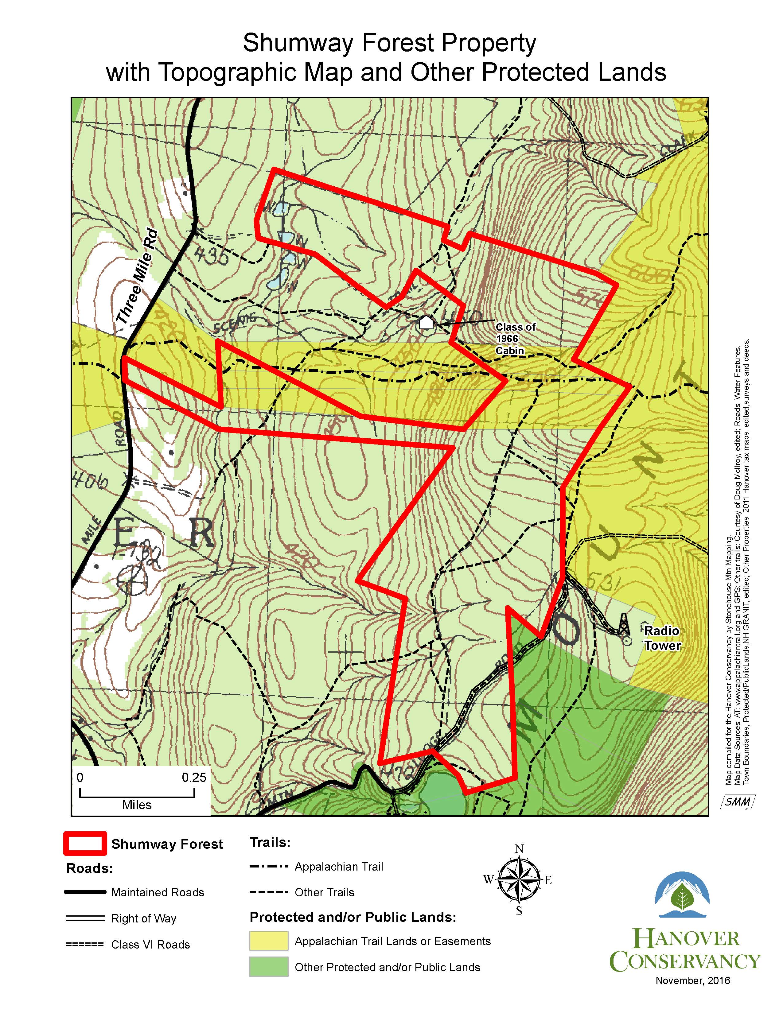
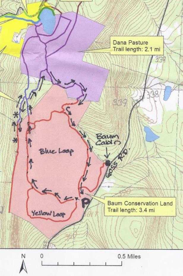
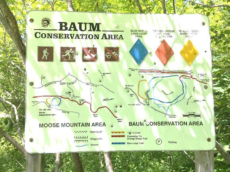
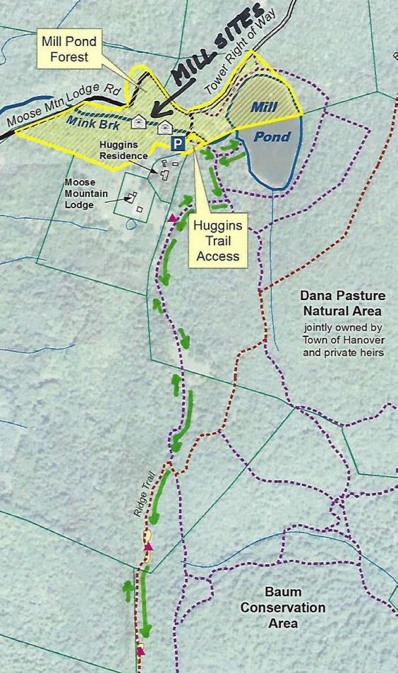
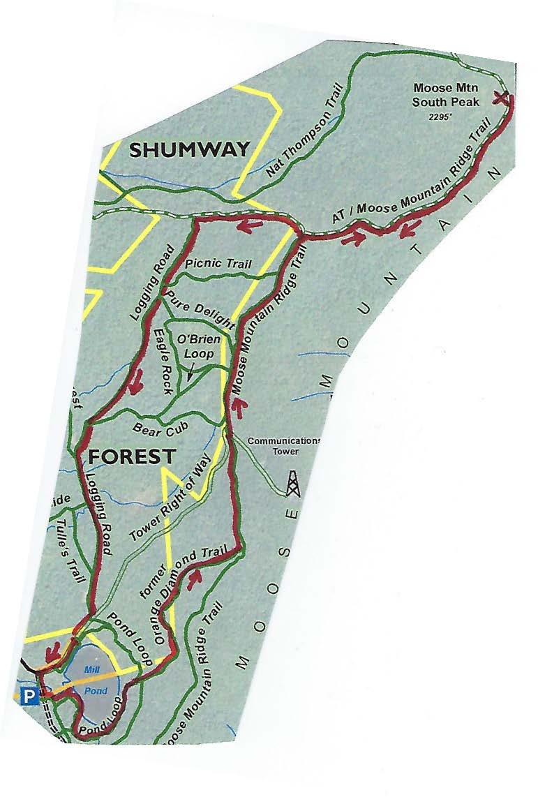
- Today’s hike, shown on the map above, takes you on a loop that visits the South Peak on a lesser known trail, cruises the mountain ridge on the Appalachian Trail (with optional 15-minute, 0.2 mi. visit to the Moose Mtn. Shelter) and returns on the historic Wolfeboro Road and the old route of the AT, the Harris Trail.
- You’re about to visit lands owned by the federal government (permanently protected) and Dartmouth College (partially protected for the AT corridor) and the privately owned Shumway Forest, protected by the Hanover Conservancy in 2017.
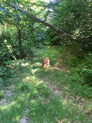
- Dogs are welcome if under your control; please pick up after your pet.
Hiking Directions
- Begin your hike on Dartmouth land at the orange Dartmouth Outing Club sign that reads, “Parking/No Camping.”
- Known as the New Fred Harris Cabin Access Trail, this blue-blazed, ½ mile trail was built by the DOC as a direct route to the college’s Class of ’66 Lodge (built on the site of the Fred Harris Cabin).
- The trail is easy and rises gently to a plateau, passing through a long-abandoned sheep pasture. Here, saplings are creeping into the understory sheltered by towering pines above. Years ago, all these lands between the road and the mountain ridge were owned by Luther Brown.
- Seven minutes’ walk from your car, the sound of water signals the approach to a main tributary of Mink Brook. At L, a rough stone wall marks the plateau’s edge and boundary of the old pasture.
- The trail drops to a bridge over the brook. Look L upstream; the brook drains a rich beaver-influenced wetland just out of sight on the Shumway Forest.
- The trail continues gently back up to a matching plateau on the E side. The forest is different here – less pine, more hardwood – belying a different history. Was this Luther’s woodlot?
- 10 minutes’ hike from your car, reach the Harris Trail. An orange DOC sign hangs on a tree at R, facing the other direction and reading “To AT” and “To 3 Mile Rd & Parking,” indicating the path you just took. Across the trail junction is a wooden sign reading, “<- Harris Trail ->” placed by the Hanover Conservation Commission’s Trails Committee.
- The Fred Harris Trail, former route of the Appalachian Trail, honors the Dartmouth Outing Club’s founder (1909). It offers wonderful skiing when conditions are right. The trail once ran from Moose Mountain Lodge Road N into Lyme, and can still be followed by an alert hiker. The AT was re-routed onto the Moose Mountain ridge in the 1980s.
- Turn R onto the wide Harris Trail and head down to another brook. While there is no bridge, it’s easy to cross on stepping stones. Slow-growing hemlocks and yellow birch shelter the stream and hold the banks in place. At L, beyond the brook, a yellow blaze and white boundary sign signal the edge of the federal easement over Dartmouth land that protects the Appalachian Trail.
- The Harris Trail continues on its gentle grade and an unmarked trail soon joins at L. This is the Ski Loop, a challenging ski trail built before the AT. Turn L here and head uphill for about 15 minutes. The trail is not blazed and because it is not used as heavily as the AT that parallels it nearby to the S, it is not as worn, but is not hard to follow.
- The Ski Loop takes you gently but steadily up on an old cart path. Shortly past a fallen beech, the trail levels out and slabs L along the hillside.
- 15 minutes from the Harris Trail, the sounds of falling water accompany your arrival at another trail junction. Signs on trees at L indicate the trail down to Dartmouth’s Class of ’66 Lodge. The stream you hear, which is the one you recently crossed below, provides the lodge’s water supply. At this point, you cross onto the Shumway Forest. More about that later.
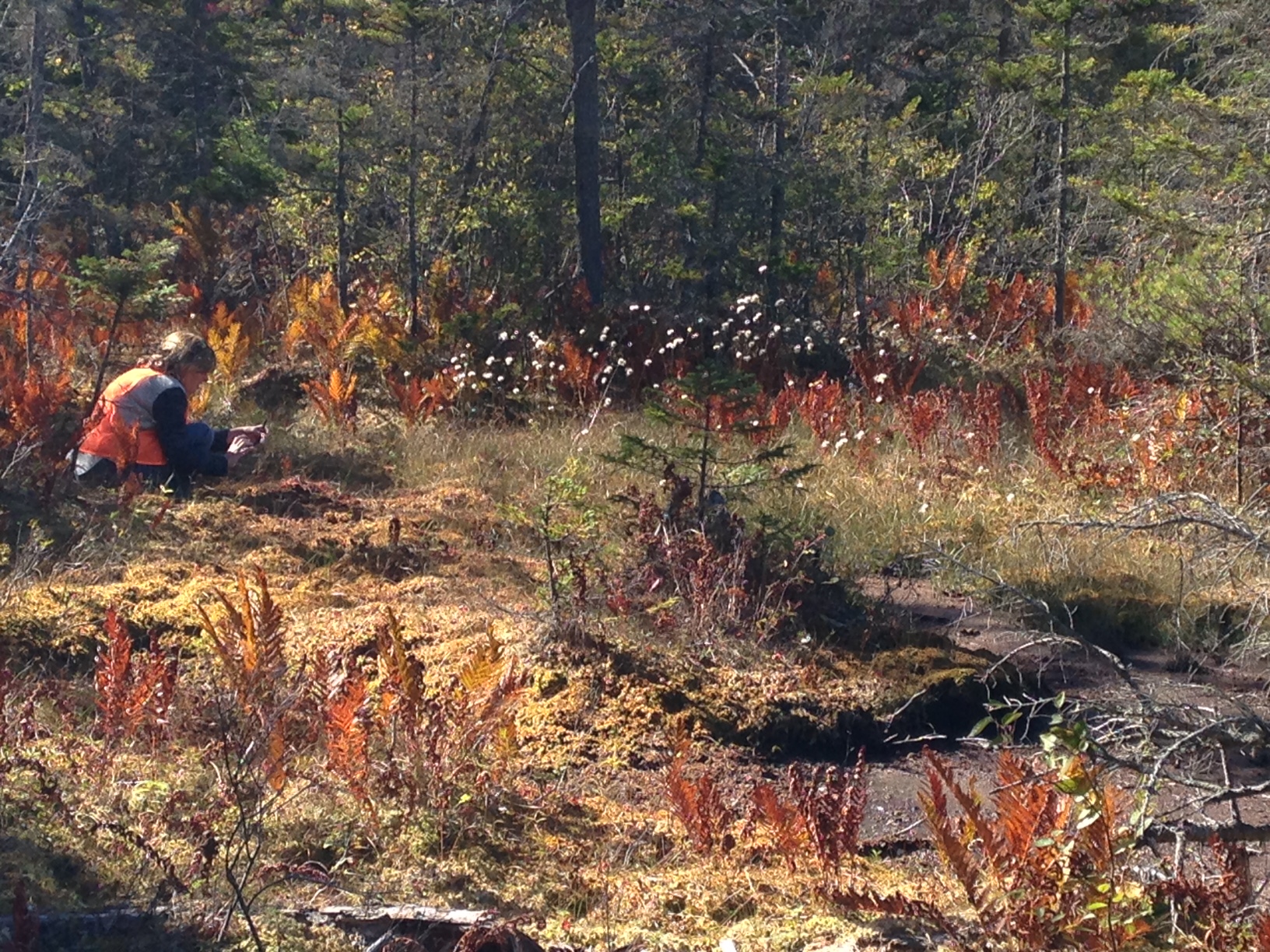
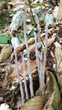
 Continue straight onto the Nat Thompson Trail which leads 1.1 miles from this junction up to the AT on the ridge. This begins as a wide, pleasant trail, re-opened a few years ago by the Dartmouth Outing Club. In midsummer, look for the ghostly white stems and downturned flowers of Indian Pipe (R), a saprophyte that relies on decomposing plants for its food as it has no chlorophyll. Shining clubmoss blankets the hillside at R.
- 8 minutes from the Ski Loop junction, the Nat Thompson Trail approaches the stream at L; be sure to stay straight without crossing the stream and continue gradually uphill. The trail is irregularly blazed but easy to follow. Six minutes later, a log crossing carries the trail over a small drainage as you leave the Shumway Forest for federal land surrounding the AT. The trail swings NNE to make a wide easy sweep up to the ridge.
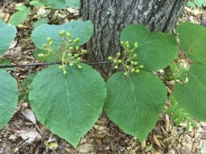
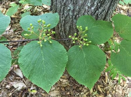
- Spring wildflowers have long since gone by, but sharp eyes will find the deep blue berries of blue-bead lily and the seed clusters setting on hobblebush viburnum. Some paired hobblebush leaves achieve lunch plate size; they will turn deep purple in autumn. The three-lobed leaves of goosefoot or striped maple, a small understory tree, can get even bigger.
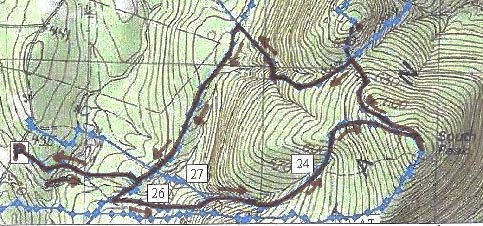
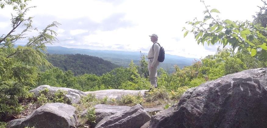
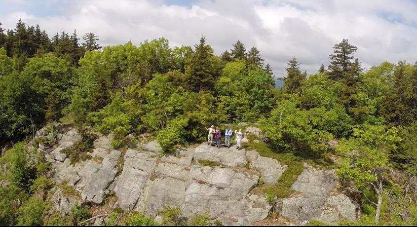
- 10 minutes from the log crossing, the trail swings R and becomes steeper as it climbs toward the South Peak. 5 minutes later, reach a fork and a sign directing you R toward the South Peak. 5 more minutes’ climb brings you out onto the open ledges of the 2293’ South Peak of Moose Mountain.
- Time for a break! Enjoy the view out over Goose Pond below and, if it’s not hazy, across Canaan and far beyond. At this time of year, the rosy flower clusters of shrubby meadowsweet attract pollinators and dragonflies patrol the skies.
- Beyond the summit sign, the path S of the clearing is the AT southbound, which would take you straight back to Three Mile Road about ¼ mile S of your car (and downtown Hanover, if you keep going). If a thunderstorm threatens, this is your best bet. But we’ve got much more to see today, so retrace your steps and strike N (path at L of ledges). In a few yards bear R on the AT northbound at a pair of orange signs, past the Nat Thompson Trail.
- The white-blazed AT soon heads down into the saddle between the N and S peaks. The wind rising up both the E and W slopes plays in the trees overhead, keeping the bugs too entertained to bother you.
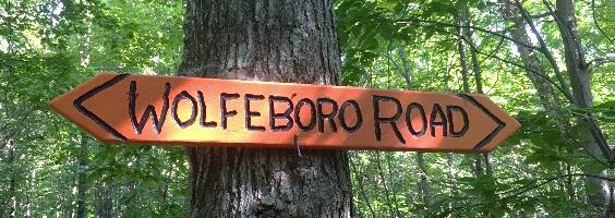
- 13 minutes from the S Peak, a sign announces you’ve reached the Moose Mountain Shelter “FPA” (government-speak for Forest Protection Area). 5 minutes further, an orange sign indicates the shelter is 0.1 miles beyond Wolfeboro Rd. Just beyond is the historic road itself, rising up from the Tunis District to the E and quickly disappearing down toward Hanover to the W.
- SHELTER STOP – You can visit this shelter with an easy out-and-back 0.2 mile, 15 minute hike, or if time is short, simply turn L and head down Wolfeboro Rd. To find the shelter, cross the Wolfeboro Rd and follow the AT northbound as it winds gently uphill for 5 minutes to a cheerfully illustrated orange sign at the shelter access path. Turn R here and within moments, the shelter comes into view at L. A bench of Aldo Leopold’s design rests on a nearby ledge, and must offer great views when leaves are off. Be sure to sign the ledger tucked by the shelter’s N wall. A lot of work by volunteers goes into maintaining places like this. Return to the Wolfeboro Rd the way you came.
- Stand for a moment at the four-way junction of two of the most historic routes in New Hampshire. The 2,190 mile-long Appalachian Trail, proposed nearly a century ago, threads through a national park that spans the eastern seaboard from Maine to Georgia. Conservation efforts along its route have also protected valuable wildlife habitat and cool forests. The Wolfeboro Road, built 250 years ago when New Hampshire was still a colony of Great Britain, reached from the colonial governor’s home in Wolfeborough up and over this mountain to Hanover, a distance of 55 miles as the crow flies. Governor John Wentworth ordered its construction so that he could attend commencement at Dartmouth College, having assisted its founder, Rev. Eleazar Wheelock, in securing its charter from the King. Wentworth was an eager outdoorsman, relishing camping out with his road survey crew in the NH woods and leaving his wife at home to worry about decorating her new ballroom in the governor’s mansion.
- This spot also marks an important watershed divide. All rain and snow falling E of where you stand on the AT flows into Tunis Brook, Pressey Brook, Goose Pond, and then to the Mascoma River. All that falls on the W side ends up in Mink Brook. Waters from each reach the Connecticut River, but by much different paths.
 It’s time to head down. Take the Wolfeboro Rd W and down the mountainside for about 15 minutes. Adventure-seeking jeep drivers have created ruts in places, and the footing is wet for the first 5 minutes until you encounter rough gravel laid down by the Hanover Dept. of Public Works so emergency vehicles could reach the AT to assist injured hikers.
- Along the way, imagine Governor Wentworth riding this rugged route to the Dartmouth Green. For more hiking on this historic road, see our Hike of the Month for June, Wolfeboro Road West.
- 15 minutes from the AT, an old stone wall appears at L and you reach an open area at the bottom of the slope. You’re back in former sheep country! Continue straight, passing a chained-off drive at R. A few paces further, a metal gate comes into view at L and an orange sign just beyond indicates the Harris Trail. Walk around the gate and back onto Dartmouth land, following a woods road past a log landing and bearing R to re-enter the woods.
- Here, the Harris Trail follows a gravel-surfaced woods road used to deliver supplies to the college’s Class of ’66 Lodge. After crossing a new wooden bridge, there’s a more natural surface underfoot.
-
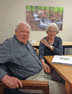
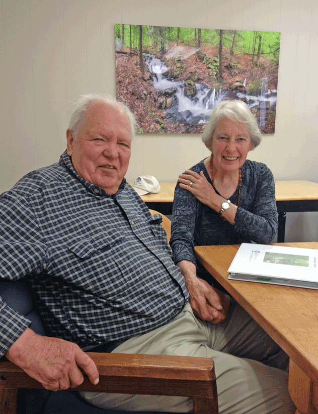
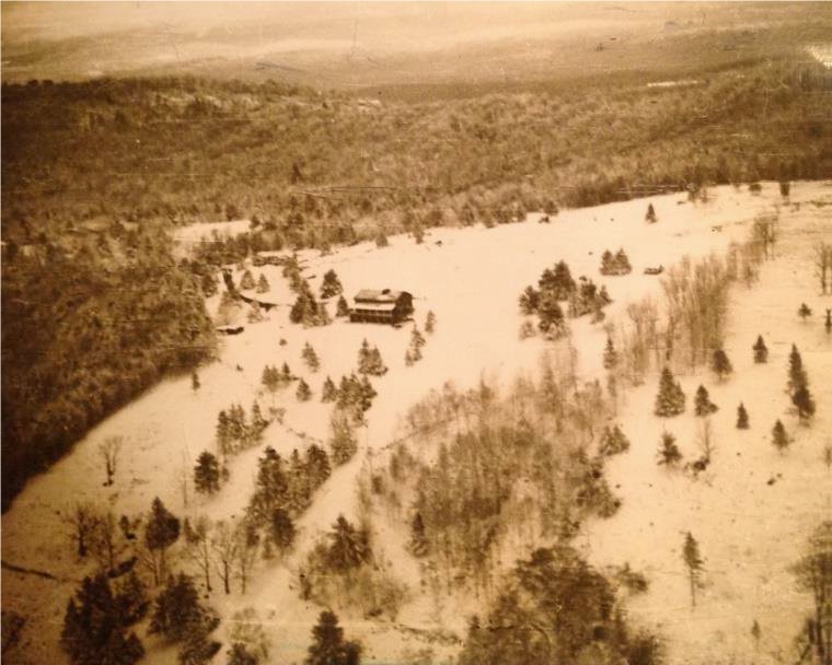
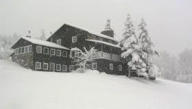
Peter and Kay Shumway after signing the Shumway Forest conservation easement, June 2017 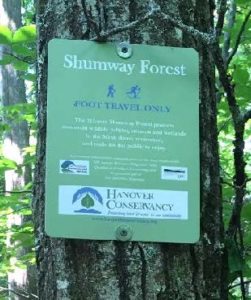 10 minutes from the gate, spot the green Shumway Forest sign at R. Peter and Kay Shumway (L), owners of the historic Moose Mountain Lodge from 1975 to 2018, purchased 313 acres on the mountain from a lumber company in 1986 to keep the land from being developed. In 2017, to permanently protect public access to its foot trails, they conveyed a conservation easement to the Hanover Conservancy.
- A short distance past the sign, follow the Harris Trail as it bears R off the woods road. While the red and black DOC blazes have long since faded, the former route of the AT is easy to see. The forest is younger here than on the mountain ridge, punctuated with occasional massive white pines.
- 5 minutes past the fork arrive at a junction where a trail at L heads over a footbridge to the Class of ’66 Lodge. Continue straight and soon the orange sign appears at R directing you back to Three Mile Road. You’ve now closed today’s loop. Bear R for the 10-minute return on the now-familiar path, over the wooden bridge, and back to your car.


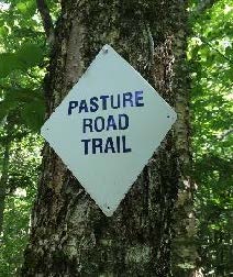 5 minutes after turning onto this trail, arrive at a junction. Bear R to follow orange flags, about 20 yards to a small hollow. Here an orange sign at L reads “Orange Ridge Trail” and at R, a white sign indicates “Pasture Road Trail.” Note the town’s blue and white trail blazes on a birch at L. This doesn’t look much like a road, but it follows, more or less, the route of a long-abandoned early “highway.”
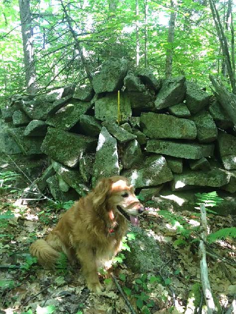

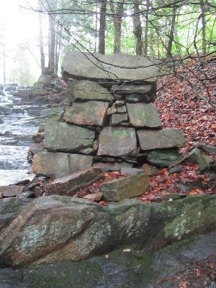 Hidden in the woods are remains of a late 1700s saw and grist mill. They are very close by but invisible unless you make the short scramble through the woods to see them.
 The trail continues gently back up to a matching plateau on the east side. Deer trails cross and you may find leftovers from a red squirrel’s dinner in a pile of pine cone scales or acorn tops. The forest is different here – less pine, more hardwood – belying a different history. Could this have been Luther’s woodlot?
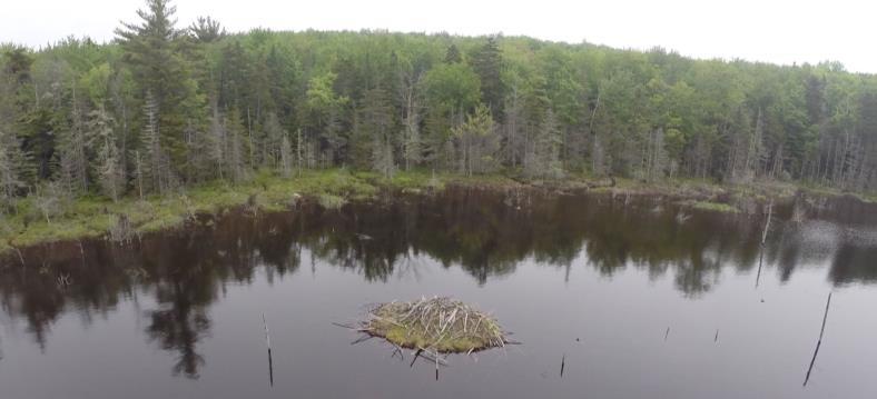
 Directly across from the bench is an impressive beaver lodge. Scan the pond’s surface for waterfowl and other birds. You might be welcomed by the slap of a beaver’s tail.
 20 minutes from the tower road, arrive at the Appalachian Trail. An orange Dartmouth Outing Club sign rests on the ground by a tree, pointing the way to the South Peak. Here, you can turn R to head to Mt. Katahdin in Maine. Turn left for Velvet Rocks, downtown Hanover, and if you’re really ambitious, Springer Mountain in Georgia. Today, we’ll turn R and take the AT for about 15 minutes to the S summit along the well-worn, gently but steadily climbing path.