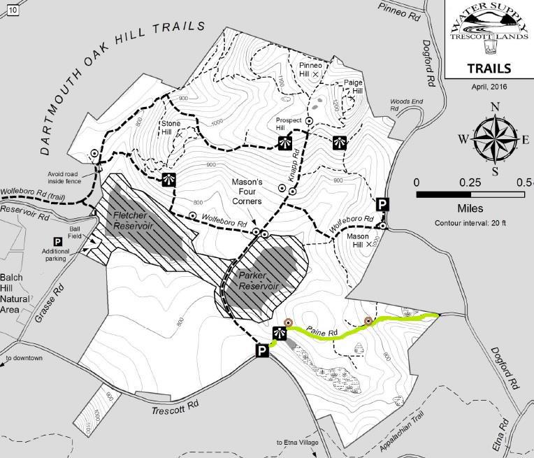
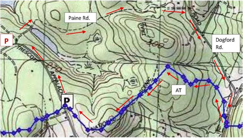
Hanover Conservancy

Facebook logo   Instagram   YouTube          
Donate button
  • Home
  • About Us
    • Celebrating 60 Years
    • What We Do
      • Advocacy
      • Conservation
      • Education
      • Stewardship
    • Board & Staff
    • Membership Benefits
    • Contact Us
  • Get Outdoors
    • Hanover Lands
      • Balch Hill Natural Area
      • Mink Brook Nature Preserve
      • Other Properties
    • Hanover Hikes
    • Hanover Trails Challenge
    • Upper Valley Hikes
    • Exploring Nature at Home
    • Hunting
  • Events
    • Calendar
    • Spring Wildflower Scavenger Hunt
    • Private Events
  • Get Involved
    • Donate
    • Volunteer
    • Adopt a Trail
    • Corporate Conservators
    • Planned Giving
  • Education
    • School Programs
      • KAST
      • Connecticut River Studies
      • Hanover High School Scholarship
    • Request a Field Trip or Speaker
    • Research on Our Lands
    • Hanover History
    • Resources
  • News
    • Remembering Bob Norman
    • Reports & e-News
  • Conserve Your Land

Huntington Hill North Loop

August 25, 2020

Driving Directions

  • From downtown Hanover, head N on Lyme Road (Route 10)
  • 6 miles after passing Kendal, turn R on Goodfellow Road
  • Head uphill for 0.7 mile; pavement ends near historic white farmhouse on R
  • Park in pull-off on L (north) side of road near gate. A sign reads “foot travel welcome.”huntington hill north map

What You Should Know

  • Today’s hike is a pair of loops on permanently protected, privately owned land. Please respect the generosity of landowners who provide public access, and pack out your trash.
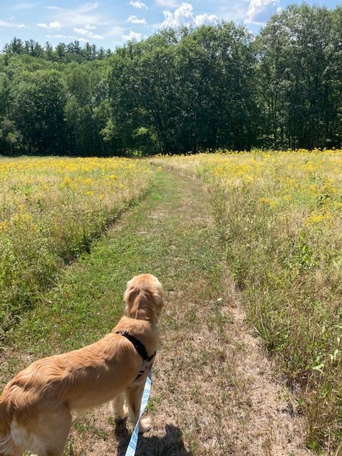
  • Much of this route travels over wide and less-used trails – old farm lanes and mowed meadow paths – allowing for ample physical distancing while enjoying the outdoors.
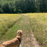
  • Dogs must be under your close control. Please pick up after your pet.

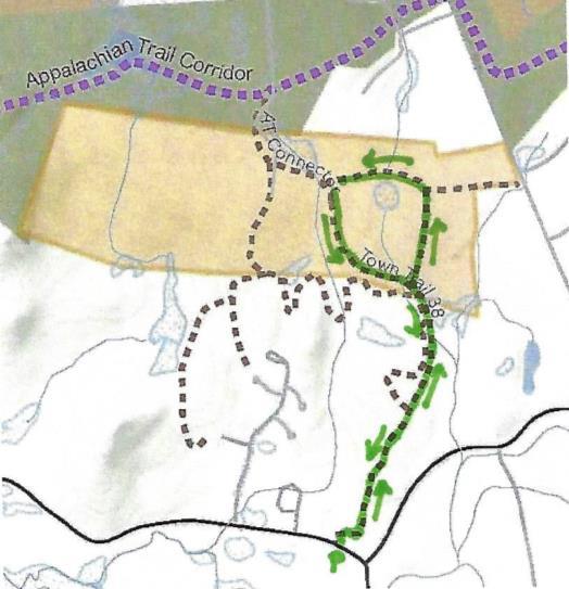
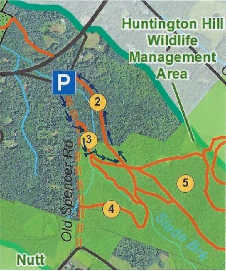
Brief Hiking Directions

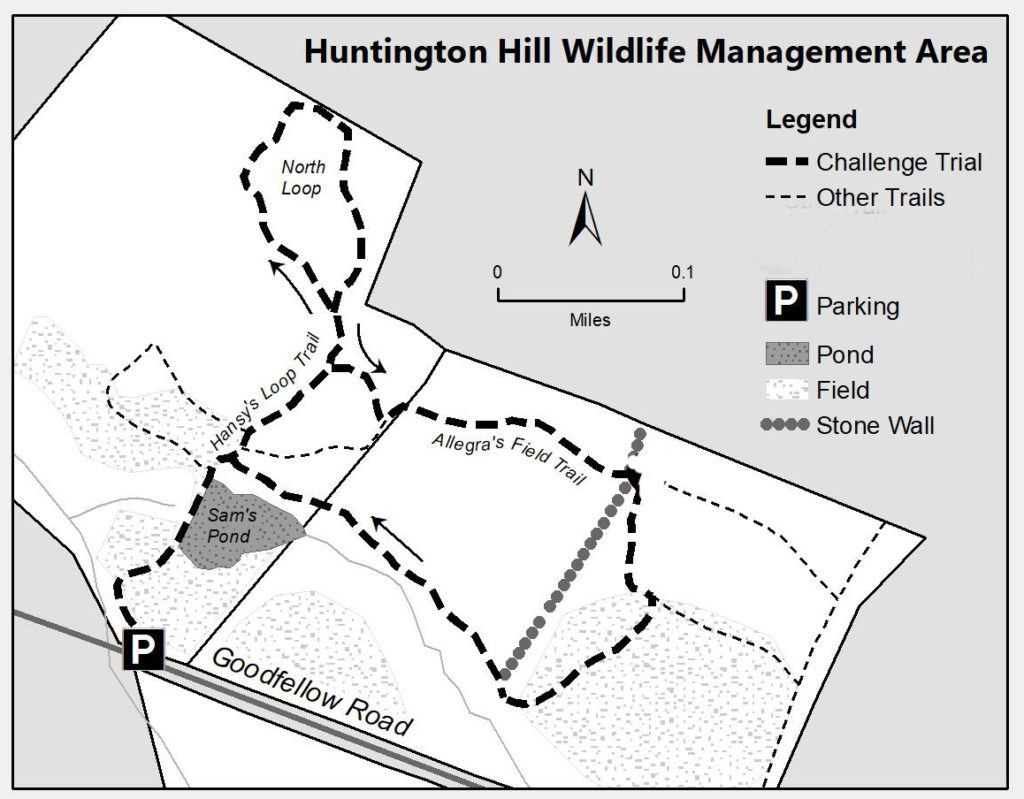
  • Walk around the gate and follow the mowed path to Sam’s Pond.
  • Beyond the pond, bear L at a fork
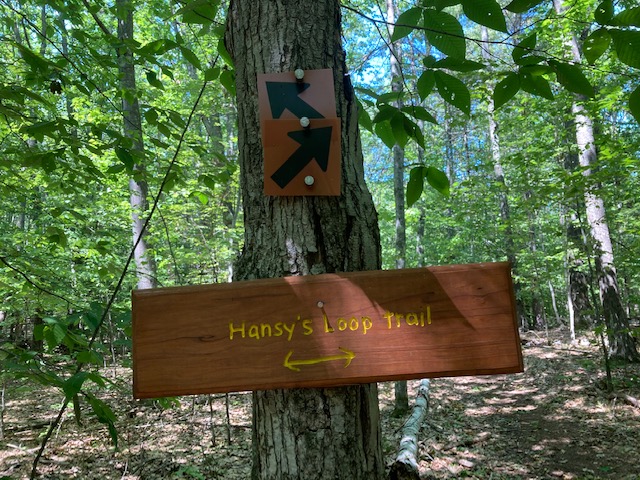
  • Bear L at another fork labeled “Hansy’s Loop”
  • Bear L at another fork with arrows pointing both ways and sign reading “Hansy’s Loop”
  • Returning to this point, return on the trail traveled earlier but turn L just past a large fallen tree on R
  • Turn L at T at a stone wall to follow Allegra’s Field Trail
  • Cross a second stone wall and bear R
  • After reaching a second meadow, bear R and down to the pond
  • Turn L to cross the pond’s dam and return to your car.Pond on Huntington Hill

The Full Story

  • Begin by walking around the gate and following the mowed path as it winds through a pleasant meadow.
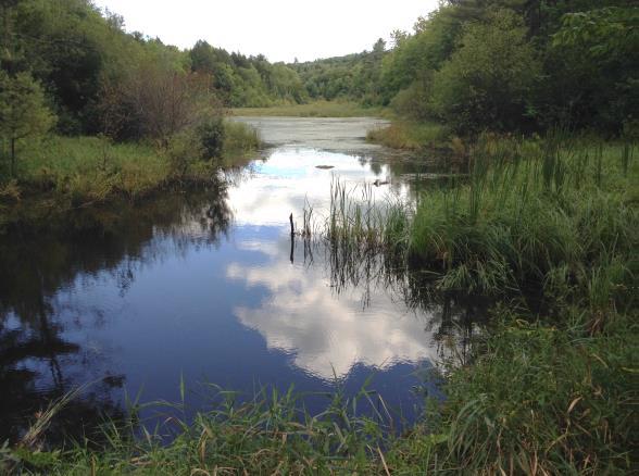
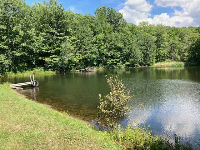
  • An expanse of water appears ahead – you’ve found Sam’s Pond.
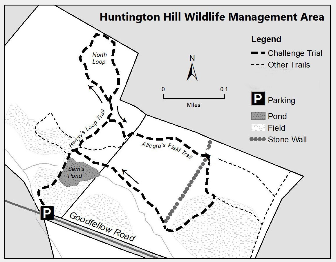
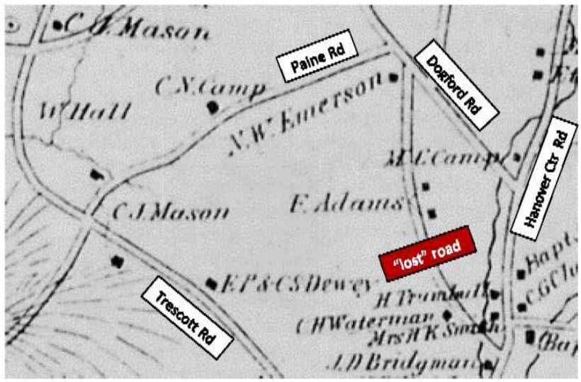
  • Pause by the small dock for a moment to contemplate the major conservation success that allows you to visit today. You’re walking through 83 beautiful acres that are part of the permanently protected Huntington Hill property. Dr. Sam Doyle purchased this land in 1991 and conveyed a conservation easement on six parcels, including this one, to the NH Fish and Game Department. On the S side of Goodfellow Road, the property spans another 417 acres. Other adjacent conservation lands, including the Moister Meadow (20 acres, easement held by the Hanover Conservancy), the Mudge land (8 acres, easement held by Fish & Game) and the Nutt Farm (207 acres, easements held by Society for Protection of NH Forests) bring the total of protected, connected wildlife habitat to a stunning 735 acres. (See map on next page, where these areas appear in dark green). Today, Huntington Hill continues under a new family, with the original protections intact (see p.4).
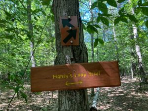
  • Continue across the earthen dam to the far side, and bear L through another meadow. The coarse fronds of sensitive fern at L tell you that area is damp without the need to feel the soil. Drier parts of the upland meadow are studded at this season with the nodding white flowers of Queen Anne’s Lace. Continue straight as a second mown path comes in at L. Your trail soon swings to the R and up into the woods, returning to the N edge of the meadow, where the pond comes back into view. At the far edge, look L for a yellow-highlighted sign reading “Hansy’s Loop.”
  • Bear L here, walking up and away from the pond. After a few minutes, an orange arrow guides you to bear L.
  • A large blowdown at L gives an intimate view of the fallen tree’s root system and the light soil in which it grew.
  • 5 minutes from the last junction, arrive at another fork with arrows pointing both ways, and bear L.
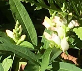
  • Travel gently down through a mixed age forest of pine, northern red oak, and other hardwoods. These are taking the place of an earlier stand of white birch, whose fallen members litter the forest floor, returning nutrients to the soil. Look for a variety of club mosses thriving here – ground cedar, shining clubmoss, and others. The strange and ghostly white stems and flowers are Indian Pipe, a wildflower – not a fungus – that takes food from tree roots rather than making its own with green chlorophyll.
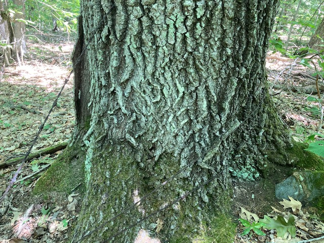
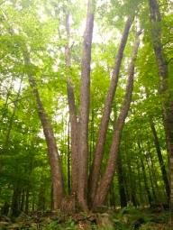
  • As the trail swings R and to the SE, you’ll encounter some much larger trees. Sharp eyes will spot fragments of old barbed wire caught in their trunks and realize these are boundary trees – allowed to grow to such size because neither neighbor dared cut them, and they were serving as useful fence posts at a time when the landscape was more open. One oak looks to be at least 30” in diameter at breast height. 7 minutes from the last fork, the trail swings R again at a huge double-stemmed red oak marked with a red boundary blaze.
  • 3 minutes later, you’re back at the start of Hansy’s Loop. Retrace your steps back down the hill for about 45 paces; just past the fallen tree at R seen earlier, turn L onto a less distinct, unmarked trail.
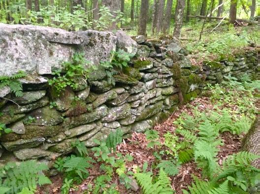
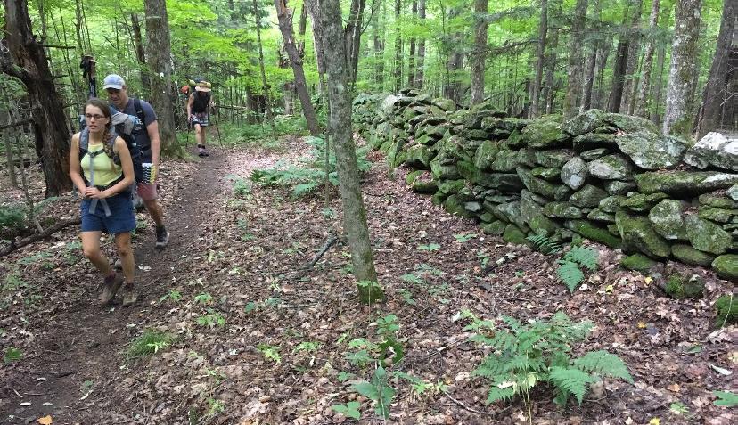
  • This trail soon reaches a low stone wall, where you turn L and walk gently uphill for a short distance past the end of the wall. This is the first reminder that this wooded land – and most of Hanover – was once open sheep pasture. After all, nobody builds stone walls in the woods! In 1840, Hanover had 2,613 human residents and a startling 11,024 sheep.
  • The trail narrows and rises more steeply to another impressive oak, then flattens out. Soon, arrive at a larger stone wall. Just beyond, a sign announces “Allegra’s Field Trail.”
  • 3 minutes’ hike from the last stone wall, reach another sunny meadow. In your view at about 2 o’clock is Huntington Hill, at 1247’ a perfect twin of the hill you just hiked around.
  • The meadow’s mown path forms a T: turn R, noting the lowbush blueberries carpeting the area. This must be a very happy place for bush-surfing bears in July.
  • Head down through the field amid the sunny heads of goldenrod. There are many species of this yellow aster-type flower in northern New England, but did you know that there is also one called silverrod? Its white flowers are reminiscent of moonbeams.
  • Huntington Hill’s variety of habitats – shady diverse forest, sunny meadows, open water, and the edges where they meet – are more important than you might think in keeping Hanover’s landscape resilient to the effects of climate change. Why? Connectivity. Strategically located between the migratory pathway that is the Connecticut River and the uplands of Moose Mountain, Huntington Hill connects these 
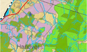
areas. It provides an important travel corridor for birds and other wildlife that need to move around, either seasonally to summer breeding grounds, or more long-term as the climate changes. If wildlife can move freely, their genes can too, meaning that their populations don’t become isolated, inbred, and therefore less healthy. In this map, dark green shows conserved and public lands; light green shows core areas for conservation focus, and purple indicates important connectivity corridors stretching from the river to the core (the star indicates today’s hike location.)
  • As you re-enter the cool woods at the foot of the same stone wall you recently crossed, note the heap of many small stones. These tell you that the land nearby was once tilled, and the farmer went to the effort to pick the stones and transport them here to spare his plow and give his root crops a fighting chance.
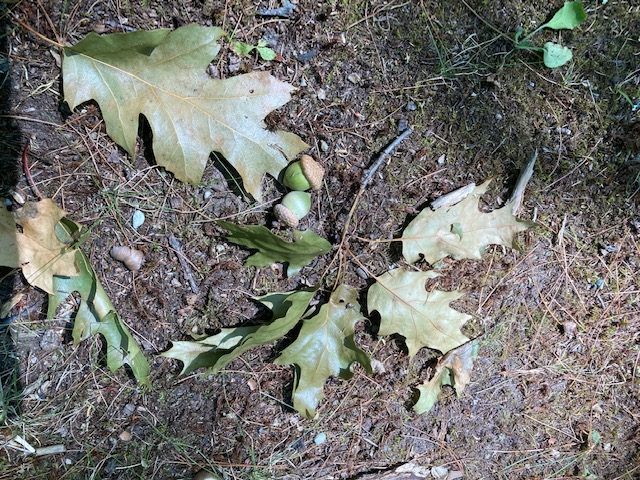
  • Walk along the contour on a wide old farm lane. Watch for acorns on the trail – they make wonderful food for wildlife but can act like ball bearings underfoot!
  • 15 minutes from the top of the last meadow, arrive at the lower end of the first wall you crossed, and Sam’s Pond appears through the trees ahead at L. As you close your second trail loop of the day, note a large rhododendron, oddly out of place near the trail junction. It must have been planted – but by whom, and why?
  • Watch the area carefully before stepping out of the woods. On the day we visited, a male Northern Harrier (formerly called a marsh hawk) sailed out over the meadow from the pond.
  • At the lower field’s edge, turn L to the pond. Pause a moment to watch for wildlife – maybe the darting gymnasts of the air, dragonflies on the hunt above the water’s surface or resting on a blade of grass. Check the sediments at the water’s edge for tracks. Goldfinches chatter in the trees.
  • Continue to the far side of the pond. At this season, your reward may include ripe blackberries on the briars that frame parts of the trail. This is one of many kinds of mast on which wildlife thrives here – blueberries, acorns, naturalized crabapples, and more.
  • Follow the mown path to your car on Goodfellow Road.

Historical Notes

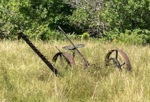
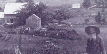
Goodfellow Road, linking Lyme Road with Hanover Center Road since at least 1855, takes its name from the Goodfellow family, from whom Dr. Doyle purchased the land in 1991. The Goodfellows arrived between 1893 and 1925.

In the 1850s-80s several generations of the Runnels family lived on and farmed on the land you visited today. By 1885, John Runnels was listed as a “wool grower” with 125 sheep on 196 acres. He had served three years in the Civil War with the 9th New Hampshire Volunteers.

In the 1880s-90s the Ingalls brothers, A.H. and Charles, occupied the big white farmhouse, barn, and 250 acres across the road. Also sheep farmers, they had an apple orchard of 100 trees, a maple sugar orchard of 200 trees, and 130 head of sheep. Back in 1855, the family of Andrew Huntington – he who gave his name to the property –farmed that land. Andrew, who probably built the 1780 farmhouse, served in the Revolutionary War with his brothers Christopher and Samuel.

Today’s owners feel viscerally attached to their property on Goodfellow Road and were excited to purchase conserved land from Sam Doyle with the promise to Sam that they would continue his focus and dedication to the land – maintaining and expanding the network of trails, promoting the property as a wildlife habitat, keeping fields mowed, and sustainably harvesting timber according to the Forest Management plan maintained by Jeff Smith of Butternut Hollow Forestry.

September, 2020

This Hanover Hike of the Month has been generously sponsored by

Filed Under: Hike of the Month, History, Huntington Hill, September, Trails Tagged With: farming, Goodfellow Road, history, huntington hill, Sotheby's

Trescott/Paine/AT Loop

September 1, 2019

Hike map and directions – full PDF


Paine Road trail mapDriving Directions

  • From Downtown Hanover and the Green, drive E on E. Wheelock St. and up the hill 1.7 miles to the junction of E. Wheelock, Grasse, and Trescott Roads. Bear R to continue on Trescott Road and drive 1.2 more miles to the Trescott gate at a sharp bend.
  • From Etna village, turn W onto Trescott Road and drive 1.3 miles to the Trescott gate at a sharp bend.
  • Park at the marked trailhead parking area near the kiosk. Please do not block the gate.

What You Should Know

  • Today’s hike takes you on a loop that begins on the Trescott Water Supply Lands, follows an historic road past two cellar holes, visits a 19th century cemetery, and returns on the Appalachian Trail. The two forested legs of the hike are linked by short walks on the public portions of Paine, Dogford, and Trescott Roads.
  • You’re about to visit lands owned by the Trescott Water Company (Town/Dartmouth) and the permanently protected corridor of the Appalachian Trail as it skirts Etna village.
  • Dogs must be leashed while on the Trescott Water Supply Lands and waste must be picked up and carried out in order to protect drinking water. Elsewhere, dogs are welcome if under your control.
  • Archery season begins Sept. 15. Deer hunting is encouraged on the Trescott lands to improve the forest, and it is wise to wear blaze orange Sept. 15-Dec. 15. Hunting is also permitted on AT lands.

Hiking Directions

  • Trescott Water Supply Lands logoWelcome to your water source! Drinking water for much of Hanover and Dartmouth College comes from these lands, so special rules apply for recreational use. Take a moment to check the kiosk display to acquaint yourself with these rules and pick up a trail guide.
  • Take the short path R of the kiosk that leads around the fence to Knapp Rd., avoiding a logging road at L. At Knapp Rd., turn R back toward the gate and after 25 yards, turn L onto Paine Road. For over a century, this was a four-way intersection.
  • The route now called Paine Road was laid out in 1782 from Jeremiah Trescott’s place to Dogford Road, “to accommodate him for Meeting.” He’d been asking for an easier route from his house to Hanover Center since 1775. Who Paine was and why the road now bears that name remain a mystery.
  • Paine Road leads invitingly down a gentle hill for several minutes’ walk. Approach the dip in the old road softly; if you’re lucky, you’ll get a glimpse of a great blue heron or other wildlife in the wetland at R. This valley is not as small as it first appears – it extends over a half mile and feeds Parker Reservoir. The wetland captures sediment washing off higher ground before it can enter the drinking water reservoir.
  • The old road continues up out of the hollow. Just as it swings R, stop and look for the remains of an old stone wall at L. You have found the site of the Wright-Mason Farm.
  • old cellar hole wall
    Cellar hole of the Wright-Mason farm
    To find the farmhouse’s cellar hole, follow the line of this wall into the woods to a pile of large, flat stones, about 35 paces from the road. From this point continue straight, another 25 paces, to a small grassy rise. The cellar hole may be invisible until you’re nearly upon it.
  • Here is what seems like the remains of a very small house. Actually, most early homes had cellars under only a part, as a cellar was not easy to dig and was needed just for storage of apples and other supplies, not for the many purposes to which we put basements today. Other foundations on the N side suggest the house had an ell.
  • In 1855, one H. Wright occupied this farm. Little is known about this family. By 1885, Charles Mason, Jr. owned the place. It was removed when the Parker Reservoir was built.
  • 5 ash trees
  • Return to the road and continue E (away from the wetland). Ahead on a rise at L is an impressive “fairy ring” where five large ash trees spring from a single place. All are sprouts from the stump of a single earlier tree.
  • Paine Road levels out, lined by a nice low stone wall at L and handsome sugar maples 20” in diameter. They were probably set out along the road by the Wrights and their mid-19th century neighbors, the Johnsons, when the surrounding land was open pasture or cropland. Now, the forest has returned but the maples still reign.
  • 0.3 miles and 15 minutes from your car, look for the Mason Trail at L. Continue straight on Paine Road.
  • 20 minutes from your car, arrive at a log landing – a sunny opening where timber pulled through the woods by a skidder is cut to length before transfer to a lumber truck.
  • As you proceed, stone walls follow the road and head off into the woods at right angles, separating fields and pastures of another time. They were likely built by A.D. Johnson, whose home site you will soon visit, during the “Sheep Craze” of the mid-1800s. A close look reveals small stones among larger ones, indicating the land nearby was cultivated, making it worth the trouble to move minor rocks.
  • About 5 minutes’ walk past the log landing is a flat spot at L, site of the Johnson-Camp Farm. This cellar hole is easily visible from the road. While it is nearly square, the farmhouse that stood over it was probably rectangular. The 1855 map shows A. D. Johnson here. By 1885, Carlton Camp lived here, of the family that gave Camp Brook its name and a veteran of the Civil War (Company B of the 18th NH Volunteers). His farm consisted of 75 acres with a sugar orchard of 150 trees and 40 more acres leased from a William Doten.
  • After exploring the cellar hole, continue E on Paine Rd. At a sign and barbed wire marking an old water company boundary, walk around the large pine at R to pass through a gap in the fencing.
  • Paine Rd. heads gently downhill and, on a sunny day, light through the trees catches your attention. You’ve reached a major wetland in the headwaters of Mink Brook where cattails and other marsh plants grow amid the standing skeletons of dead white pines. A big wetland in a bowl like this helps hold heavy rains like a sponge, protecting people downstream in Etna from sudden flooding.
  • A mesh cage, oddly out of place in these woods, is part of a monitoring program by the Hanover Biodiversity Committee to measure deer browsing pressure on Trillium.
  • Climbing up out of the bowl, Paine Rd. once again becomes a traveled way (restored to active use in 1971). Here, private land is posted in some places. Please take care to respect these neighbors.
  • turtlehead
    Turtlehead
    1/2 hour from your car, reach Dogford Rd. Turn R and walk on its edge, following the drainage from the wetland. Just past Jones St. is a good patch of wetland wildflowers in joyous bloom at this season: orange jewelweed and white turtlehead (R). Its flowers are so sturdy that only bees are strong enough to pry them open for pollination. Walking allows you to enjoy the riot of roadside flowers blooming at this time of year – goldenrod, Queen Anne’s lace, yarrow, New England aster, and pink clover.
  • 10 minutes’ walk brings you to Hanover Center Road. Turn R and take a few moments to wander through the nearby cemetery, established in the early 1840s. Most of the families who farmed the Trescott Water Supply Lands now rest here, along with their Etna neighbors. Some of their names are being memorialized on trails in the water supply lands.
  • close-up of headstone
    Detail on the Mason grave marker
  • A tall obelisk near the gate marks the 1883 Chandler family plot, and just behind, an ornately carved obelisk (L) marks the burial place of Julius J. Mason and his successive wives Sarah Camp and Lydia Chandler. Other markers bear the names Bridgman, Childs, and Chase. William Hall (1825-1912), pictured below at his farm (site of today’s Parker Reservoir), is buried here. Heart-breaking are stones for “Little Baby” and other children.
  • farmer in field by farm houses
    William Hall, c. 1890
    After visiting the Trescott lands’ long-ago occupants, follow the roadside fence to the far opening, turn R on Hanover Center Rd. and R again onto the Appalachian Trail S at the US Forest Service sign. Trescott Rd is 1.3 miles and under an hour away.
  • The 2,190 mile-long Appalachian Trail threads through a national park that spans the eastern seaboard from Maine to Georgia. Conservation efforts along its route have protected valuable wildlife habitat and cool forests – and historic sites. The fern-lined, white-blazed trail heads between the cemetery and a forested wetland fed by Monahan Brook, a tributary of Mink Brook. Check tracks at wet spots – are all human and dog? We saw a bear track when scouting this route. Cross the brook on a sturdy log bridge and follow it up to an old field, where goldenrod reaches for the sky and apples ripen on trees planted 150 years ago. This is wonderful wildlife habitat.
  • 10 minutes’ hike from the road brings you over another log crossing as the trail begins to climb gently but steadily out of the little valley. Young woods are punctuated by big bull pines.
  • 9 minutes later, arrive at a trail junction marked by an orange Dartmouth Outing Club sign directing you to the L. A stone wall just beyond marks an old property line. A few minutes later, reach a Y junction with similar sign. You’ll bear R here; a service trail bears L.
  • 1855 map showing roadsAn odd metal object leaning against the sign is your cue to explore the large cellar hole just W of the trail (at R as you face the sign). Beyond the nearly intact cellar hole are three dressed granite foundation slabs. Metal objects of mysterious purpose are scattered about. Beyond is a complex set of foundations indicating that an elaborate barn stood here. What is such a thing doing out here in the woods? The 1855 map of Hanover shows a mysterious road linking Dogford and Hanover Center Rds with a single home near the N end. The 1892 map (R) shows two more places, owned by F. Adams, midway on the road. Today’s Partridge Road once linked Hanover Center Road with Jones Street, and it is the remains of the Adams farm you’ve discovered. The Adams family once owned all the land between Dogford and the east leg of Trescott Road. When the farm was sold and subdivided to create the Trescott Ridge subdivision in the 1960s, Partridge Road was re-routed and the Adams farmhouse (R) was bulldozed.
  • 2-story house with trees in front
    Adams House, c. 1960
    Return to the trail junction and take the R fork to continue on the white-blazed Appalachian Trail. The AT follows Adams’ handsome, well-made stone wall for quite a distance. Sharp eyes will note other walls joining it to separate former pastures where tree roots now graze. The AT is busy at this time of year – the day we were out, we met 8 hikers, hailing from Florida, Chicago, Massachusetts, and Vermont.
  • hikers by stone wall
  • The AT heads up around a knob and through gaps in other, older walls. 20 minutes from the cellar hole, you’re suddenly in a thick pine forest, likely a cattle pasture abandoned 80 years ago, and the trail swings R to skirt an old field. The sound of passing cars hints that Trescott Road is near.
  • The trail drops gently down the slope to another souvenir from Etna’s agricultural past – the circular foundation of a silo, now moss-covered. Nearby is a curious rectangular cement box and platform, possibly a milk cooling structure for a dairy farm.
  • Soon the trail approaches the back of a kiosk placed to inform AT hikers coming the other way. While the AT proceeds straight, turn R here to take the pine needle-strewn path that leads through the woods to a small AT parking area. Turn R onto Trescott Road and walk 10 minutes back to your car.

This Hanover Hike of the Month has been generously sponsored by
Chase Brook Software logo


Filed Under: Hike of the Month, September, Trescott Tagged With: Appalachian Trail, cellar hole, jewelweed, turtlehead

Old Highway 38 & Hudson Farm

September 1, 2018

Trail Directions and Map – Full Hike


Hudson Farm hike mapDriving Directions

  • From the traffic light at Route 120 and Greensboro Road, take Greensboro Road east for 1.8 miles to its junction with Etna and Great Hollow Roads.
  • Park at the roadside pull-off. If you prefer off-road parking, turn in at David Farr Memorial Park and bear R and downhill to a shaded gravel parking area.
  • Today’s hike on an historic highway includes a loop through the now-protected Hudson Farm’s fields and forest.

What You Should Know

  • This is a fun and easy hike with a few sections of tricky footing among roots or rocks. The route is well-blazed.
  • The route follows an early road and then travels a loop on one of Hanover’s newest conservation lands. In 2017, the National Park Service purchased the Hudson Farm (brown-shaded area on map) to permanently protect it as part of the Appalachian Trail corridor.
  • Trails are maintained by Hanover Trails Committee volunteers and Berrill Farm neighbors.
  • Dogs are welcome but must be under your control; please pick up after your pet.
  • Snowmobiles, ATVs, and bicycles are not permitted.

Hiking Directions

  • Begin your hike on Greensboro Road at the blue town sign marking the Old Highway 38 Trail, directly opposite the town’s Farr Memorial Park.
  • The old road leads between two contemporary houses and shortly turns R (marked with arrow), immediately diving back into time at a pair of old stone walls – the first of many you will encounter today.
  • tree with yellow blaze
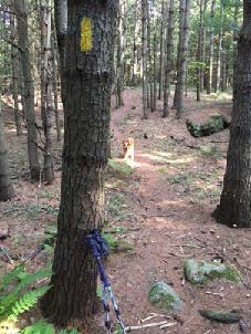
Don’t be dismayed by the steep path that suddenly appears– the rest of the hike is gentle and rolling. Follow the yellow blazes into the woods.
  • Town Highway 38 has a murky history. Laid out in 1795, it connected Greensboro and Trescott Roads. It was later discontinued, but its exact route was so hard to trace that when planning began for Berrill Farms in 1979, the town agreed with the developer on a route to be called the “Old Highway 38 Trail.”
  • The trail passes through a knobby landscape covered with ferns and a young forest of white pine. The stubs of lower branches encircling each tree are clues that these pines grew up together in an abandoned field, self-pruning those branches as the canopy closed in and blocked out the sun. A few venerable, much older maples survive.
  • old stone wall
  • Eight minutes from the trailhead you cross a fine stone wall. Follow it with your eyes to another at R, running parallel to the trail.
  • A few minutes later, take care crossing a wet spot, where “tree cookies” placed as pavers can be slippery. A small wooden bridge takes the trail over a space that is wetter in other seasons.
  • Six minutes from the first wall crossing, a trail comes in at L at the top of a small rise. This trail is closed to all but Berrill Farms residents. Continue straight, toward a blaze on a large, triple-trunk white pine. The nature of the forest has shifted, with more deciduous hardwoods, belying a different history.
  • You soon encounter another stone wall, this one built with much smaller stones – a clue that it once bordered cultivated land. The builder wished to spare his plow and give his carrot seedlings a chance by stooping to move and stack smaller stones. Had he been grazing sheep here, he wouldn’t have bothered. Take a moment to peel the years off this scene in your imagination, to a time nearly 200 years ago when the only trees were a few young maples left as shade for sheep, when sunlight flooded the ground you’re walking, and the view stretched E to nearby Mill Village, now called Etna. Time, and the end of the sheep craze, brought back the trees.
  • path in fallen pineSeven minutes’ walk from the trail junction, you pass through a slot in the fallen bole of a big pine, nearly 3 feet through. That’s big – but trace it back to where it fell – it was once part of a massive ring of three trunks! These softwoods grow more quickly than hardwoods like maples and oaks, so despite its imposing size, it’s likely younger than most of the hardwoods.
  • The trail swings up and L and follows a stone wall that retains barbed wire from when cattle, not sheep grazed here. At R, a field appears.
  • Bear R at a fork in the trail, up onto a mown path into the E meadow of the former Hudson Farm, to begin a steady climb to a line of trees at the top. Monarchs and other butterflies join you at this time of year, alighting on milkweed, clover, and goldenrod among the grasses, and cicadas and grasshoppers contribute the music.
  • Five minutes from the woods trail, you arrive at the tree line, where a second field comes into view beyond. You are walking through one of Hanover’s iconic historical farm landscapes.
  • Stop for a moment to enjoy the expansive view. Straight ahead, the open slopes of Lebanon’s Storrs Hill stand out, even more so in winter when covered in snow. At R are the Rix Ledges, some of the most interesting terrain and wildlife habitat in Lebanon.
  • Approach the small white pine growing by itself in the field, 20 paces away. From this vantage point you can see Mount Ascutney rising in the distance, to the right of Rix Ledges. You won’t be the first to have “The Sound of Music” pop into your head – nobody’s watching, so twirl around and sing!
  • A group stands with honorary plaques during the June 2017Hudson Farm conservation celebrationIn June, 2017, this was the site of a grand celebration. A partnership between the Trust for Public Land and the Town of Hanover, assisted by the Hanover Conservancy, resulted in purchase of the 175-acre Hudson Farm by the National Park Service to permanently protect it as part of the Appalachian Trail corridor. In addition to major federal funding, many local contributions made this possible, including a major contribution from the Hanover Conservancy to help with caring for the land into the future.
  • Owned for many years by Dartmouth College, the property had been eyed as a site for everything from a cemetery and golf course to a housing development. Today, the AT Conservancy manages the land with help from the White Mountain National Forest (WMNF) and, for trails, the Hanover Conservation Commission’s Trails Committee.
  • The beautiful meadows are kept open by periodic controlled burning for their spectacular views, to keep invasives under control, and to rejuvenate valuable grassland bird habitat. Without such treatment, grassy thatch would build up to prevent ground nesting of bobolinks. WMNF crews conduct such burns every 3-4 years, after careful advance planning. Burns take place during the brief window of time in late April just before the fields burst into lush green and before birds arrive to begin nesting. Coordinating with local officials and consulting weather forecasts, trained crews stage fire-fighting equipment nearby before conducting a small test burn to confirm that conditions are right. If they are, the burn continues.
  • Returning to the tree line, cross a low stone wall to the other field and a brown and yellow trail sign where two mown paths meet. From here, you can see a 20th century home built as a country retreat by Archer Hudson, a retired architect. Dartmouth College later purchased the property and carved off the house for resale, keeping the land. While the College referred to it as the “Hudson Farm,” the property ceased to be a farm when Hudson arrived. In fact, he burned down the large barn that once stood here!Old Highway 38 sign
  • [NOTE: To return along Etna Road, bear R here and take the mown path down through the meadow to Trescott Road and the Hudson Farm trailhead. Turn R on Trescott Road and R on Etna Road to your car.]
  • To continue today’s hike, bear L toward the woods to the lowest point in the rolling field.
  • Two sets of boardwalks offer dry footing across drainages. The second, larger one was built in 2018 by Hanover Trails Committee volunteers (thank you!). Protecting such headwater wetlands and streams from heavy foot traffic benefits water quality and trout habitat in Mink Brook.
  • Soon you’ll see a stone wall at R, reminder that this was once grazing land. Continue as the trail heads gently downhill, with the slabby stone wall on your R until the wall neatly turns a corner of the old pasture.
  • Shortly after, a blue sign at R indicates you are heading toward the Appalachian Trail.
  • [NOTE: For a much longer adventure, continue straight here, turn L (southbound) on the AT to the Conservancy’s Greensboro Ridge Natural Area, L at Oli’s Trail, L at the Greensboro Highlands Trail, L at the Silent Brook Trail, and then L onto Greensboro Road and walk 1.6 miles back to your car.]
  • To continue today’s hike, turn L at the blue sign and follow the yellow blazes past impressive white pines. The trail slabs along the contour. It is discouraging to note the invasion of non-native barberry (a prickly shrub) and glossy buckthorn (find its black berries underfoot among the pine needles). Consider volunteering for organized work parties to remove these pests from conservation land. Or, volunteer to remove them from your own property, to help keep them from spreading. Learn more about these invasives from the Hanover Conservation Commission’s Biodiversity Committee.
  • Continue down the hill to a small drainage that may be nearly dry at this season. The trail crosses it in two places and bears R. About 15 minutes from the top of the fields, you return to the path you took into the first meadow. Continue on the woods path and stay L to avoid a R fork leading over a stone wall. It’s another 15 minutes back to your car from here.
  • The trail soon swings R and down toward Greensboro Road. Listen for the two-part whistle of a broad-wing hawk and keep an eye out for mushrooms. These fungi decorate the forest floor at this time of year, in colors ranging from purest white to bloody red.
  • The sound of traffic is a clue that you are nearing Greensboro Road. A pair of granite boulders serve as your gateway back from Hanover’s past to its present.

8/30/2018

Filed Under: Hike of the Month, Hudson Farm, September Tagged With: Appalachian Trail

Slade Brook Watershed Trails

September 1, 2017

Trail Description and Map – Full Hike


Slade Brook trail mapDriving Directions

  • From downtown, head N on Rt. 10 past Hanover Conservancy offices
  • Continue on Route 10, 3.3 miles past the N rotary
  • Turn R on Old Lyme Rd. and drive 0.2 miles to a sharp bend.
  • Park on R on gravel shoulder.

What You Should Know

  • Foot travel only, except for Old Spencer Road.
  • Dogs are welcome but must be under close control.
  • This loop hike passes through the Barnes Estate, owned and managed by Dartmouth Hitchcock Medical Center, before reaching the Huntington Hill Wildlife Management Area, a major privately owned parcel protected by a conservation easement held by the NH Fish and Game Department.

Hiking Directions

  • There’s a secret waiting for you right here, before you start into the woods. Walk a few dozen yards back down Old Lyme Road to the guard rail marking Slade Brook’s passage below. Look carefully on the left beyond the far end of the rail for a dramatic drylaid stone bridge abutment. This once carried the original road linking Hanover to Lyme and points north. Today, we whiz by this area at 50+mph on a much straightened, widened, and otherwise altered route. Imagine journeying to Lyme on the poky narrow road that existed before Dartmouth urged the state to “improve” travel to its new Skiway in Lyme Center.
  • Back at your car, look for two routes into the woods. At L, a woods road heads uphill, blocked with a cable. This is where you’ll return. At R, a clear, narrower level path leads in to the woods. Begin your hike here.
  • In a few yards you’ll pass over a narrow wooden footbridge, built by volunteers shortly before the Hanover Conservancy protected the Jim and Evalyn Hornig Natural Area at Lower Slade Brook, just downstream from Route 10. (2007) This crossing replaces an earlier one – look down to the left to see remains of the old stone abutment for the bridge that once carried Old Spencer Road over this stream.
  • Follow Old Spencer Road through the woods and up the hill to an upper river terrace that was once the shore of glacial Lake Hitchcock. This land is part of the former Barnes Estate, now owned by DHMC.
  • old stone wallOld Spencer Road links Old Lyme Road with Dogford Road, built in 1816 “from Benjamin Thatcher’s to the County Road.” Thatcher’s place (known today as the Nutt Farm on Dogford Road) was later owned by Captain Uel Spencer. Town Meeting voted to discontinue the road subject to gates and bars in Hanover is criss-crossed with dozens of early roads like this one, providing fine hiking, snowshoeing, horseback riding, biking, and skiing now that they are retired and no longer maintained for more intensive use.
  • About 7-8 minutes from the bridge, you’ll reach a tree down across the old road (which may be gone by the time you read this) and a junction. Old Spencer Road continues straight uphill. A logging skid trail is visible nearby at R. What appears to be another skid trail bears off Old Spencer Road at L. This is the Bridle Path, and your turn. Before taking it, continue another minute or two up the old road as it fully reveals its historic character. Partly buried stone walls mark each side and the roadbed appears sunken between them. Barbed wire follows the wall on the S side, a reminder that cattle once pastured here before the forest returned.
  • fisher
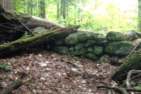
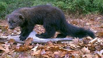
Watch for wildlife – on the day we visited, a fisher paused here on the wall to observe us. The largest member of the weasel family, the fisher is a lithe and talented predator that makes a specialty of dining on porcupine.
  • Return to the junction and take the Bridle Path that veers NE. It too has been used recently as a skid trail, but it quickly narrows and you’ll soon hear the music of Slade Brook at L.
  • After five minutes’ walk from Old Spencer Road, a new wooden bridge comes into view as you cross onto the Huntington Hill Wildlife Management Area.
  • Pause on the bridge to admire both the workmanship and the partnership that built it in May-July, 2017. A determined team of 20 volunteers, led by Hugh Mellert and the Hanover Conservation Commission’s Trails Committee, built the bridge with permission of the private landowners and help from the Upper Valley Trails Alliance, Hanover Public Works, Hanover Conservancy, Cardigan Mountain Highlanders, DHMC, neighbors, and hikers who happened by and jumped in. Funds for materials were donated and the 250 person hours of labor were free. This new bridge replaces one that’s been gone for 50 years, and provides a safe and valuable connection to the network of trails on Huntington Hill.
  • Slade BrookNow turn your attention to the brook itself, and the fascinating variety of rocks composing its bed. Water-worn granite alternates with leaves of uplifted, slanted sedimentary rock that speak volumes about the deep geological history of this place.
  • Two trails meet at the far end of the bridge. Bear L onto the wider of the two and head steadily uphill through a pine/hemlock forest. Faded pink flagging marks the route.
  • About 10 minutes’ walk from the bridge, you reach the top of a rise where the Barnes Trail comes in at L by two large white pines. Just ahead, another trail junction is visible.
  • Turn L onto the Barnes Trail and head down the narrower, pine needle- strewn path. The Barnes Trail is easy to follow as it meanders pleasantly down the slope. There’s a nice patch of foamflower (Tiarella cordifolia) on the R just before you cross a small drainage. Resolve to come back in May to see this native wildflower in bloom. The Barnes Trail begins to feel like an old woods road.
  • Cross another, larger drainage. Ten minutes’ walk from the last junction, reach a sunny opening filled with native wildflowers like Queen Anne’s Lace and various kinds of goldenrods, but with an ominous patch of Japanese knotweed. This log landing provides a valuable bit of open habitat nevertheless.
  • Continue across the clearing and re-enter the woods.
  • The trail, now an obvious logging road, passes through another small opening and then swings L and heads down to where your car awaits.

Please respect the generosity of these landowners by leaving no trace of your visit and enjoy the memories and photographs you take home.

8/30/2017

Filed Under: Hike of the Month, September, Slade Brook Tagged With: Class VI Road, fisher, foamflower

Paine Road in the Trescott Lands

September 1, 2016

Route Description and Map – Full PDF


Paine Road mapDriving Directions

  • From Downtown Hanover and the Green, drive E on East Wheelock Street and up the hill 1.7 miles to the junction of E. Wheelock, Grasse, and Trescott Roads. Bear R to continue on Trescott Road and drive 1.2 more miles to the Trescott gate at a sharp bend.
  • From Etna village, turn W onto Trescott Road and drive 1.3 miles to the Trescott gate at a sharp bend.
  • Park at the marked trailhead parking area near the kiosk. Please do not block the gate.
  • Today’s hike is highlighted in green on the map at R, with cellar holes indicated in brown.

What You Should Know

  • Welcome to your water source! Drinking water for much of Hanover and Dartmouth College comes from these lands, so special rules apply for recreational use.
  • Take a moment to check the kiosk display to acquaint yourself with these rules and pick up a trail guide. Note dates for various deer hunting seasons. Deer hunting is encouraged here to improve the forest, and it is wise to wear blaze orange Sept. 15-Dec. 15.
  • Dogs are welcome but must be leashed at all times; please pick up after your pet. In fall, many hitch-hiking plants would love to send their seeds home with your dog. After picking many small burrs off a golden retriever (on a short leash for the entire trip) we wished we had left her at home.
  • You may encounter forestry vehicles; they have the right of way.
  • Most current hiking routes in the Trescott lands make use of historic roads, including this one.

Hiking Directions

  • view from Paine RoadTake the short path to the R of the kiosk that leads around the fence. This takes you to Knapp Road. Turn R back toward the gate and after 25 yards, turn L onto Paine Road. For well over a century, this was a four-way intersection.
  • The route now called Paine Road was laid out in 1782 from Jeremiah Trescott’s place to Dogford Road, “to accommodate him for Meeting.” He’d been asking for an easier route from his house to Hanover Center since 1775. Who Paine was and why the road now bears that name remain a mystery.
  • Paine Road leads invitingly down a gentle hill for several minutes’ walk. Approach the dip in the old road softly; if you’re lucky, you’ll get a glimpse of a great blue heron or other wildlife in the beautiful flowage on the R.
  • This valley is not as small as it first appears – it extends well over a half mile; off to the L, it feeds an arm of Parker Reservoir. The wetland captures sediment washing off higher ground before it can enter the drinking water reservoir, where clear water is an important concern.
  • The old road continues up out of the hollow. Just as it swings R, stop and look for the remains of an old stone wall at L. You have found the site of the Wright-Mason Farm.
  • old cellar hole wall
    Cellar hole of the Wright-Mason farm

    To find the farmhouse’s cellar hole, follow the line of this wall into the woods with your eyes to a pile of large, flat stones, about 35 paces from the road. Leave the road and walk to this point and then continue straight, another 25 paces, to a small grassy rise. The cellar hole will be invisible until you’re nearly upon it, so keep a sharp lookout!

  • Here is what seems like a very small house foundation, with ash trees growing in and around it. One has made such close friends with a foundation stone that it appears the stone is growing into the tree instead of the other way around.
  • Was this really such a tiny house? Actually, most 18th and early 19th century homes had cellars under only a portion of the house, as cellars were not easy to dig and were needed just for storage of apples and other foodstuffs, not for the many purposes to which we put basements today. On the N side of the cellar hole you may discern other foundations, perhaps indicating a house with an ell. More research is needed.
  • In 1855, one H. Wright occupied this farm. Little is known about this family. By 1885, Charles J. Mason, Jr. owned it. He grew up at Mason’s Four Corners and his family owned much land in the neighborhood. This house and other farm buildings were removed when the Parker Reservoir was built.
  • Return to the road and continue E (away from the wetland).
  • 5 ash treesYou begin to notice old sugar maples lining the road, and ahead on the L at the top of a rise is an impressive “fairy ring” of trees. Five large ash trees seem to spring from a single place. Look closely and you’ll see the cut stump of a sixth. All of these are sprouts from the stump of a single earlier ash. What’s the story? Did Mason cut the parent ash for firewood and leave his farm before he could come back for the sprouts once they grew to size?
  • Continue your walk along Paine Road, which now levels out. A nice low stone wall follows on the L, and handsome sugar maples 20” in diameter line the lane. They were probably set out along the road by the Wrights and their mid-19th century neighbors, the Johnsons, when the rest of the surrounding land was open pasture or cropland. Now, the forest has returned but the maples still reign.
  • A close look at some of these walls reveals small stones among larger ones, indicating that the land nearby was cultivated and therefore it was worth the trouble of moving rocks of that size.
  • Pass a small pocket of red pine plantation on the R; it looks oddly out of place here in the hemlock-white pine-northern hardwoods forest that surrounds it. The plantation is a leftover from earlier watershed management efforts. Nowadays, the foresters tending the Trescott Water Supply Lands are guiding the woods back to a more natural, uneven-aged, multi-species forest like that surrounding this plantation.
  • As you walk along, the stone walls grow more prominent and you have the odd but peaceful feeling that they’re keeping you company.
  • Twenty minutes from your car, you arrive at a log landing – a sunny opening with small piles of cut logs hidden in the growth at its edges. Timber pulled through the woods is delivered here by a skidder and cut to length before transfer to a lumber truck. When not humming with logging equipment, a landing like this can be busy with wildlife enjoying the opening in the forest and the berry bushes that often grow on its edges.
  • Just past the log landing is a big white pine snag that turns out to be one of four. These big “wolf pines” may have been left behind because their uneven form diminished their value as cut lumber. The wildlife doesn’t mind, and the old pines make great apartment dwellings for woodpeckers and other creatures.
  • As you continue on Paine Road, stone walls seem to be everywhere, following the road and heading off into the woods at right angles, separating fields and pastures of another time. They were likely built by A.D. Johnson, whose home site you will soon visit, during the “Sheep Craze” of the early-mid 1800s.
  • As you head up a small rise, a woods road comes in from the L. Continue straight.
  • Walk over a pronounced lump in the road – this is a water bar, built by the foresters to keep water from running down the road and creating gullies. Good forest management in a public water supply watershed is all about managing water!
  • About five minutes’ walk past the log landing, you’ll reach a flat spot on the L, site of the Johnson-Camp Farm. This cellar hole is easily visible from Paine Road, just 18 paces away. While this one is nearly square, the farmhouse that stood over it was probably rectangular and extended to the W.
  • The 1855 map of Hanover shows A. D. Johnson at this site. By 1885, Carlton N. Camp lived here, a descendant of the family that gave the Camp Brook watershed its name. The 1885 Grafton County Gazetteer records him farming 75 acres with a sugar orchard of 150 trees and leasing 40 more acres from a William Doten. Camp’s Civil War service was also noted: he served in Company B of the 18th NH Volunteers. What a nice view the Camps must have had in the days when this land was clear and abundantly decorated with their stone walls. We suspect he was glad to get back to his farm in New Hampshire when the war ended.
  • After exploring the cellar hole, continue E on Paine Road. You’ll soon come to a sign and barbed wire marking an old water company property line; walk around the large pine on the R to pass through a gap in the fencing, taking care to avoid a brush with the wire.
  • Paine Road heads gently downhill and, on a sunny day, a flush of light through the trees catches your attention. You’ve reached another wetland, which you recognize as the large swamp that is visible from Dogford Road. Cattails and other marsh plants grow amid the standing skeletons of dead white pines. A big wetland in a bowl like this helps hold heavy rains like a sponge, protecting people downstream in Etna from sudden flooding.
  • Climbing up out of the bowl you soon reach the spot where Paine Road once again becomes a traveled way (restored to active use in 1971). Here, private land comes close to the road and is posted in some places. Please take care to respect these neighbors.
  • Turn around and return W on Paine Road, retracing your steps. As you pass the Johnson-Camp Farm’s impressive stone walls, resolve to return when the leaves are off the trees for a better look.
  • Linger a moment at the valley wetland before ascending to Trescott Road. It’s a beautiful and quiet spot, yet so close to a road busy with cars hurrying between Etna and downtown Hanover.

Learn more about the Trescott Water Supply Lands

Hypertherm Hope logoThanks to the Hypertherm HOPE Foundation for support in creating this Hanover Hike of the Month.

Filed Under: Hike of the Month, September, Trescott Tagged With: cellar hole

71 Lyme Road
Hanover, NH 03755
(603) 643-3433

info@hanoverconservancy.org

Facebook logo   Instagram   YouTube

Get Involved

Become a Member

Volunteer

Business Sponsors

Conserve Your Land

Employment

Our Mission

Advocacy

Conservation

Education

Stewardship

Explore Hanover

Hanover Hikes

Upcoming Events

Upper Valley Hikes

Trails Challenge

Copyright © 2025 Hanover Conservancy | Design by Chase Brook Software