Hanover Conservancy

Facebook logo   Instagram   YouTube          
Donate button
  • Home
  • About Us
    • Celebrating 60 Years
    • What We Do
      • Advocacy
      • Conservation
      • Education
      • Stewardship
    • Board & Staff
    • Membership Benefits
    • Contact Us
  • Get Outdoors
    • Hanover Lands
      • Balch Hill Natural Area
      • Mink Brook Nature Preserve
      • Other Properties
    • Hanover Hikes
    • Upper Valley Hikes
    • Exploring Nature at Home
    • Trails Challenge
    • Hunting
  • Events
    • Calendar
    • Celebrating 60 Years
    • Hanover Trails Challenge
    • Hike of the Month
    • Private Events
  • Get Involved
    • Donate
    • Volunteer
    • Adopt a Trail
    • Corporate Conservators
    • Planned Giving
  • Education
    • School Programs
      • KAST
      • Connecticut River Studies
      • Hanover High School Scholarship
    • Request a Field Trip or Speaker
    • Research on Our Lands
    • Hanover History
    • Resources
  • News
    • Remembering Bob Norman
    • Reports & e-News
  • Conserve Your Land

Hanover Conservancy Comment on North Campus Proposal

January 6, 2023

Sunset over the proposed building site
Eroding gully on the driving range. Drainage from the proposed development would be sent in this direction toward Girl Brook.

The Hanover Conservancy has been following the proposals by Dartmouth College to develop a new campus on Lyme Road, north of the traditional campus, on its former golf course land. Concerns about challenging soils and drainage conditions, along with the proximity of Pine Park and the already-impaired Girl Brook, have led our organization to offer this comment.

Read HC letter to The Town regarding Concerns with North Campus

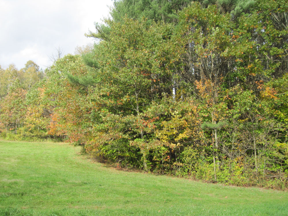
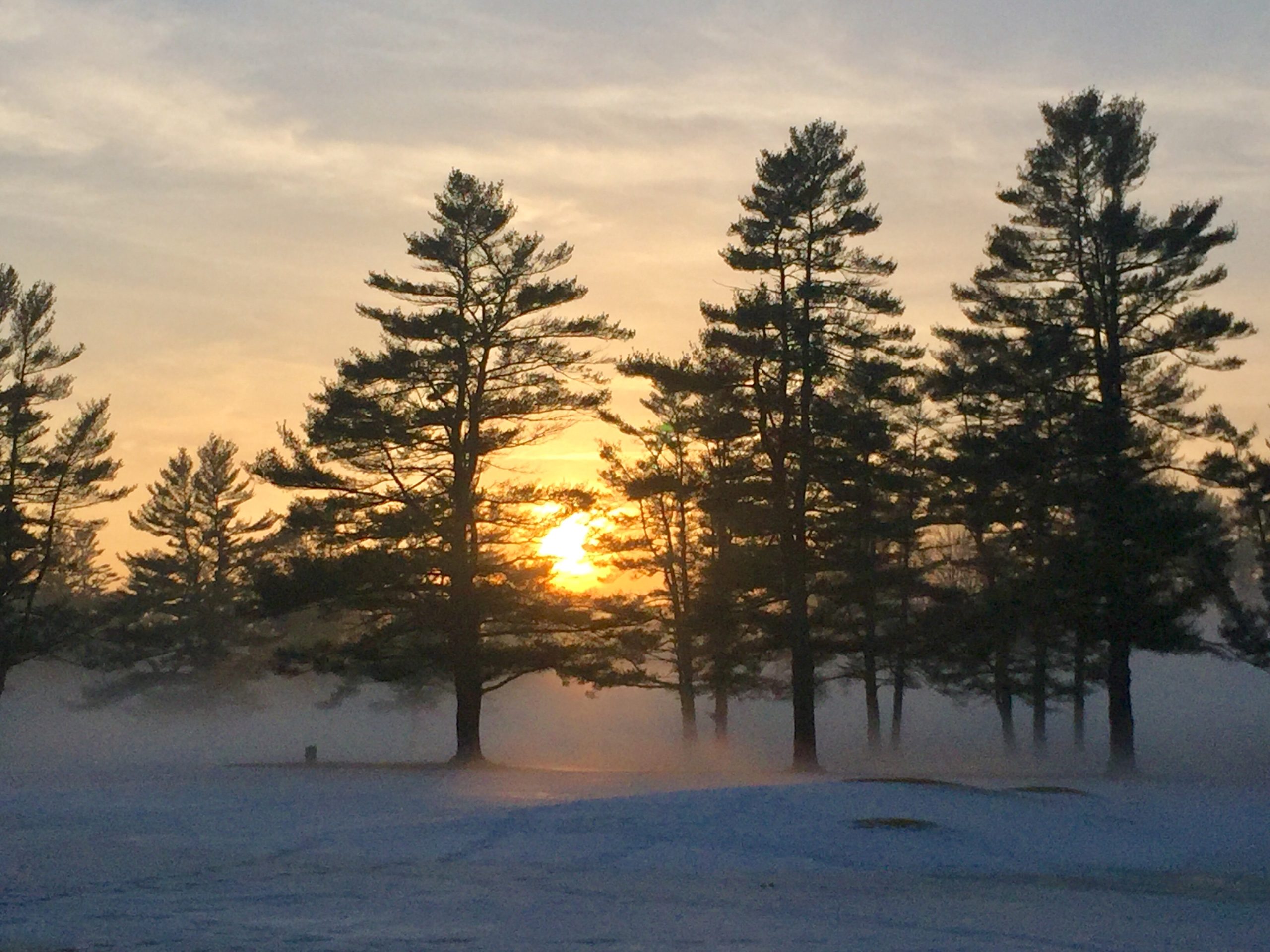
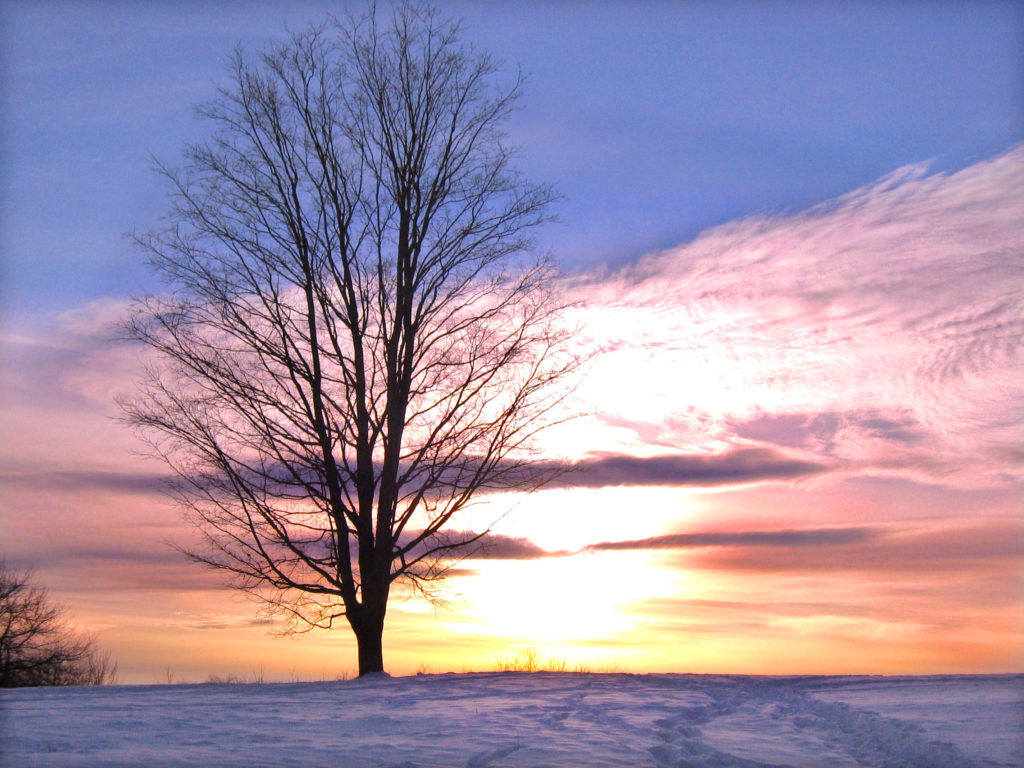
Photos (by Hanover Conservancy board and staff)

    Filed Under: Connecticut River, Conservation, Featured, Lands, Pine Park, Stewardship Tagged With: conservation, Dartmouth College, Girl Brook, North Campus, Pine Park, Town of Hanover 1 Comment

    Behemoths of Balch Hill

    August 12, 2020

    Hike Directions & Map – Full PDF

    Driving directions:

    • From Downtown Hanover, drive east for 1.6Route map on Balch Hillmiles on East Wheelock Street, up a long hill to the junction of Grasse and Trescott Roads.
    • Park in the unpaved informal parking area on the northeast side of this intersection.

    What you should know:

    • This loop hike takes you through the Balch Hill Natural Area to the summit with its beautiful views. Along the way you’ll visit grandfather trees that may have witnessed our town’s founding – including the Grafton County Champion Northern Red Oak.
    • You’ll be walking on lands owned by Dartmouth College, the Hanover Conservancy, and the Town of Hanover. Conservation easements and other restrictions protect some but not all of this land.
    • Trails have occasional short up-and-down grades but are easy for the entire family.
    • Foot travel only; no bicycles please.
    • Archery hunting for deer is permitted Sept 15 through Dec. 15; blaze orange is a good wardrobe choice.
    • Dogs are welcome but must be under your control; please pick up after your pet.

    BRIEF HIKING DIRECTIONS

    • Take the red-blazed Grasse Road Trail from the trailhead kiosk to the summit, crossing a small footbridge.
    • From the summit kiosk, take the Fire Trail down to the junction with the Maple Trail.
    • Return to the summit and take the Hemlock Trail down to a large fallen tree.
    • Return to the summit and head for a group of apple trees and a stone bench. Look for the Piane Trail sign and turn L onto the red-blazed Grasse Road Loop.
    • Take this trail to the Champion Red Oak; continue to the small footbridge and turn R to return to your car.

    FULL DIRECTIONS

    • Begin your hike at the trailhead kiosk, across Grasse Road from the parking area. The Hanover Lions Club generously donated this timber frame kiosk in 2011. Here, you can read a bit about the history of this land and pick up a trail guide if you wish.
    • The Grasse Road Trail heads across the slope on Dartmouth College land. This section was re-routed in 2015 by an Upper Valley Trails crew to follow a gentler, more sustainable path than the original.
    • The path soon turns to avoid a series of downed trees. What happened here? A short but violent windstorm on Patriot’s Day in April, 2007 blew down many trees on this part of the hill, and it will be years before they degrade back into the earth.
    • For several years near this spot stood a deer “exclosure” where Dartmouth ecology students conducted a study  to determine the effect of deer browse on the vegetation. Two identical plots, one fenced against deer and the other unfenced, were compared each year. Here are the results for the plot in this area. The blue bars indicate total number of plants in the fenced plots where deer cannot enter to browse, while red bars indicate the number of plants in the unfenced plots. In 2012, before the fencing went up, both plots had nearly the same number of plants. Contrast that to 2015! The largest change is in the number of wildflowers, especially Canada mayflower.
    • You’ve reached the low stone wall marking the southern boundary. Look for fragments of sheep fencing (large rectangles of wire fence) that date from the pre-Civil War “sheep craze” in the Upper Valley. In 1840, Hanover had over 10,000 sheep grazing on its hillsides, including this one, while the human population was around 2,000.
    • Follow the Grasse Road Trail as it makes a right turn away from the wall and heads north among tall, cool hemlocks.
    • At the junction with the Hunter East Trail (route to the Morrison Road neighborhood), turn left and cross a small log bridge over a wet area and onto Hanover Conservancy land.

    Balch Hill sunset in winter. Photo by Rob Chapman

    • The trail bears right then immediately left and heads up the slope past some dramatic pine snags. In ten minutes’ walk from your car, you’ll reach the 920’ summit.
    • Enjoy the sweeping views from this, the only open summit in town where the public is welcome. Twenty-one miles to the south is grand Mount Ascutney. The spire of Baker Tower marks downtown Hanover in the near view to the west, while on the western horizon, 29 miles across Vermont, the sharp peak of Killington appears. To the northwest, our volunteers have been restoring the view toward Gile Mountain in Norwich.
    • Historically, the summit of Balch Hill was used as a pasture for grazing sheep and cattle. Records indicate that it was cleared of most trees for more than a century. In our experience, those trees badly want to return! We’ve been working to restore the orchard on the hill and keep the views open by mowing the meadow.

    View of Hanover from Balch Hill in winter; undated photo
    View of Hanover from Balch Hill in winter; undated photo

    • Once known as Corey Hill after an early owner, Balch Hill takes its name from former owner Adna P. Balch (1817-1889). Balch, a prominent citizen who served in the legislature in 1876-1877, promoted the development of the railroad in the Connecticut River Valley and was a director of the Hanover Gas Company. In the early to mid-twentieth century, the summit was known as Dewey Hill Pasture, after owners in those later days.
    • You can imagine what demand there might be to develop this hillside with its astounding views, so close to town. That’s why the Hanover Conservancy, then known as the Hanover Conservation Council, set out to purchase the summit when a New York developer proposed first 126 condominiums and then 49 luxury homes for this place. The community came together to protect the land, with the Council and Town later adding to it with a second purchase from the Garipay family. Make a note to come back for the annual Balch Hill Kite Day in May or the Hawk Watch in September, to see how much the community enjoys this natural area today. It was worth the effort!
    • After visiting the summit kiosk, erected by the Council in memory of Alice Jackson in 2009, begin your tour of Balch Hill’s biggest trees. Take the wide Fire Trail behind the kiosk for a short distance to its junction with the Maple Trail.
    • Take this right turn and in just a few steps you meet some venerable old sugar maples that may once have marked the path of an early road. These ancients stand out against their much younger brethren.
    • A person stands underneath a huge oak tree with one fallen limb
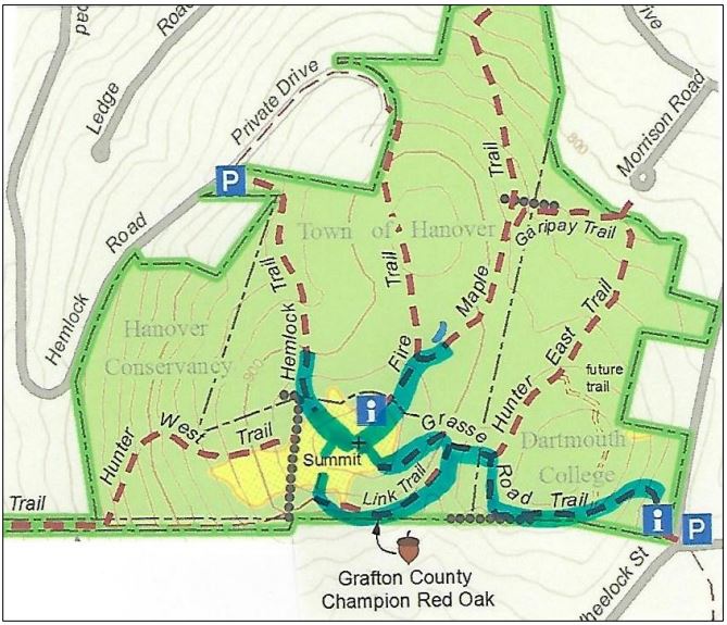
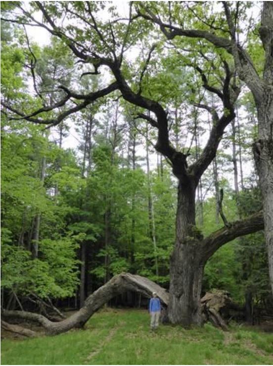
Head back up the Maple and Fire Trails to the summit. Pass the kiosk and nearby bench, and head down to the right toward the Hemlock Trail sign. You’ll soon come to the remains of an enormous old oak tree, its split trunk and massive limbs now draped across the landscape, having lost their battle with gravity and time. The trail actually passes under the fallen trunk. Here’s what it looked like in 2014 (right).
    • Return to the summit for your last view before visiting the largest resident of Balch Hill. From the low bench near the summit maple, walk west and downhill toward the view of downtown, to another stone bench near a group of crabapple trees. Just beyond, you’ll see a sign for the Piane and Grasse Rd Loop Trails on the left, nailed to a white birch. Head down this trail only a few steps and make a sharp left onto the red-blazed Grasse Rd Loop.
    • The Grasse Rd Loop trail follows the contour, leading you in a couple of minutes to the County Champion Northern Red Oak, marked with a small sign. Despite its size, it can be easy to miss as its bulk is so far overhead. Look for it opposite the cut trunk of a tree.
    • Neighbors are sometimes reluctant to cut trees along boundaries, and we think it was this instinct that protected this massive tree, the largest survivor of its kind in Grafton County. When measured by the state’s Big Tree Steward in 2014, it had a circumference of 196 inches, a height of 114 feet, and an average crown spread of 80 feet. Had its cousin on the Hemlock Trail not lost its limbs, that tree would have been even larger.
    • After admiring this giant and imagining the history it must have witnessed, continue on the trail that soon bears left to head up a small valley to the small footbridge you crossed earlier. You’re now five minutes from your car.
    • Cross the bridge, bear right at the junction with the Hunter East Trail, and return down the hill to your car.

    The volunteer Balch Hill Stewardship Committee cares for thisVolunteers tend a fire to remove cut brush on the summit of Balch Hill in winter. 
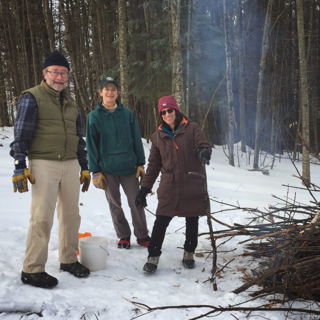
place and always welcomes help. Contact us if you’d like to get involved! We welcome contributions to the Balch Hill Stewardship Fund to help with the costs of annual mowing, vegetation management, and trail improvements.

    December 2016, updated September 2020

    Filed Under: Balch Hill, December, Forest Ecology, Hike of the Month Tagged With: Dartmouth College, history, maple, oak, summit, Town of Hanover, view

    Exploring history at Mink Brook Preserve

    November 4, 2011

    On Saturday, Nov. 5, we’ll explore the last 250 years of history at the Mink Brook Nature Preserve with historian Jay Barrett. Join us from 2-4pm, starting at the Brook Road gate. Families welcome (best to leave 4-footed members at home); no registration required. We’ll start with a gentle walk along the Quinn and Wheelock Trails. Those ready for an off-trail scramble can continue with us as we explore the higher terrain on the preserve’s south side.

    Filed Under: History, Mink Brook Tagged With: Dartmouth College, history, Mink Brook

    Rinker-Steele Walk

    October 16, 2011

    edge of the Steele tractA small group met at the Area 5 pavilion today to walk through the Rinker-Steele tract.  This area is made up of two parcels, the Steele tract, acquired by the town of Hanover in 2010, and the Rinker tract, which was acquired in the 70’s.  These two areas are between the Storrs Pond Recreation Area, Oak Hill and Dartmouth’s Organic Farm, and all together they make up a great set of resources and trails for the community. [Read more…]

    Filed Under: Rinker-Steele Tagged With: Dartmouth College, Hanover Improvement Society, Storrs Pond

    Good Plan for Hanover Water

    May 10, 2009

    Valley News – Sunday, May 10, 2009 – page E2
    Forum – Letters to the Editor

    To the Editor:

    The Hanover Conservation Council, a private non-profit organization incorporated in 1963, supports the current proposal before voters on May 12 to consider municipalization of the Hanover Water Works Company (HWWC).  The proposal includes a new Town of Hanover and Dartmouth College equal ownership structure (50:50) of a reconstituted land management company. Currently the Town holds a 47.2% owner interest in the HWWC and its land (the College has 52.8%).

    We believe that the proposal to municipalize the water company is a significant step forward in terms of equal ownership of the land resource. Focus on this proposal also offers an excellent opportunity to explore the permanent long-term protection of the watershed land. We are concerned that local ordinances and current zoning do not provide adequate long-term protection of the essential watersheds against future development. The Council strongly agrees with the Town of Hanover’s Master Plan (2003) and Open Space Priorities Plan that this land should be permanently protected.

    The 1440 acres of watershed land in question, which feed the surrounding drinking water reservoirs, comprise the largest undeveloped and ecologically-significant tract remaining in Hanover. Based on both size and location, the land supports well-managed forests, prime wildlife habitat, and excellent agricultural soils. It offers crucial connectivity between Lord’s Hill, Oak Hill and the Appalachian Trail.

    The community has also expressed keen interest in this land, its protection, and in potential public use. Now is the time to engage in an open dialogue to explore available conservation options. We propose that the Council, Town of Hanover, Dartmouth College and interested citizens work in partnership to plan for protection of this critical watershed land for everyone’s benefit far into the future. In the meantime, the proposal to municipalize the water company and equalize the ownership of the land resource is an advance toward longer-term conservation goals. Visit the Council website to learn more about this important resource in our community (www.hanoverconservation.org)

    Betsy McGean
    President, Hanover Conservation Council

    Molly Donovan
    Executive Director, Hanover Conservation Council

    Filed Under: Trescott Tagged With: Dartmouth College, Hanover, Valley News, Water Work

    Thank you for your support!

    Our generous members and Corporate Conservators help make all of this possible. If you’re a customer of  our local business supporters, please let them know their contributions are appreciated!

    71 Lyme Road
    Hanover, NH 03755
    (603) 643-3433

    info@hanoverconservancy.org

    Facebook logo   Instagram   YouTube

    Get Involved

    Become a Member

    Volunteer

    Business Sponsors

    Conserve Your Land

    Employment

    Our Mission

    Advocacy

    Conservation

    Education

    Stewardship

    Explore Hanover

    Hanover Hikes

    Upcoming Events

    Upper Valley Hikes

    Trails Challenge

    Copyright © 2023 Hanover Conservancy | Design by Chase Brook Software