Due to ongoing problems with recreation that compromise our public water supply, the Trescott Lands are closed for all purposes except hunting until further notice.
More details here…
Due to ongoing problems with recreation that compromise our public water supply, the Trescott Lands are closed for all purposes except hunting until further notice.
More details here…
 Driving Directions
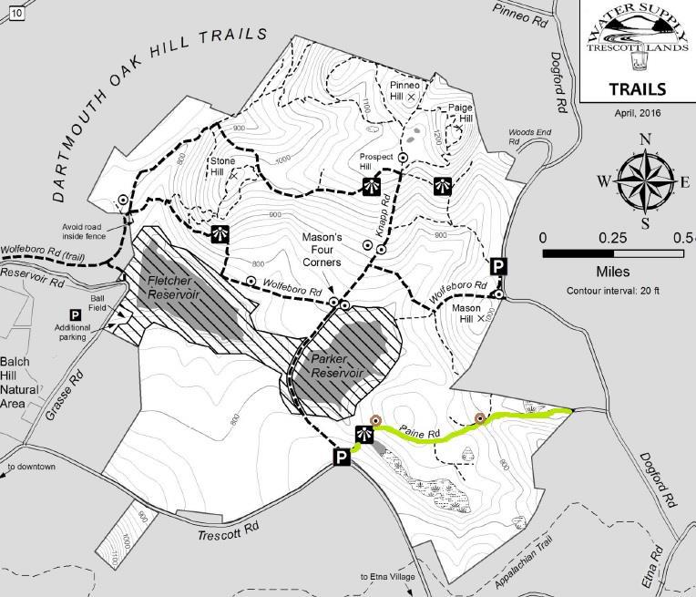
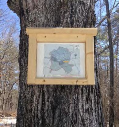
 Take the short path to the R of the kiosk that leads around the fence. This takes you to Knapp Road. Turn R back toward the gate and after 25 yards, turn L onto Paine Road. For well over a century, this was a four-way intersection.
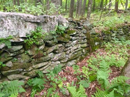
To find the farmhouse’s cellar hole, follow the line of this wall into the woods with your eyes to a pile of large, flat stones, about 35 paces from the road. Leave the road and walk to this point and then continue straight, another 25 paces, to a small grassy rise. The cellar hole will be invisible until you’re nearly upon it, so keep a sharp lookout!
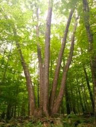 You begin to notice old sugar maples lining the road, and ahead on the L at the top of a rise is an impressive “fairy ring” of trees. Five large ash trees seem to spring from a single place. Look closely and you’ll see the cut stump of a sixth. All of these are sprouts from the stump of a single earlier ash. What’s the story? Did Mason cut the parent ash for firewood and leave his farm before he could come back for the sprouts once they grew to size?
Learn more about the Trescott Water Supply Lands
![]() Thanks to the Hypertherm HOPE Foundation for support in creating this Hanover Hike of the Month.
Thanks to the Hypertherm HOPE Foundation for support in creating this Hanover Hike of the Month.
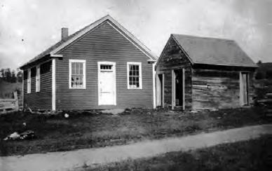
At the NW corner of this intersection stood the one-room District #4 schoolhouse (1807). Lt. Knapp’s home (c. 1793) stood across the way on the NE corner. Knapp was one of three school district commissioners for District 4. You can find the remains of his house’s cellar hole by looking (carefully!) through the brush. By 1855, J. J. Mason lived here, followed by Charles Mason by 1892. The 160-acre Mason Farm had a 100-tree apple orchard and 200-tree sugarbush. Mason also kept 12 dairy cows and 70 Merino sheep. The water company purchased his farm by 1903 for $4000.
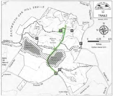
Learn more about the Trescott Water Company Lands and download the most up to date trail map.
March 2016, revised July 2020
Sunday 1/24 – join us to explore the Trescott Water Supply Lands with those who are working to open these long-closed 1,165 acres to public recreation. MORE.
Thanks to KLG Financial Solutions for sponsoring this season’s schedule of free Conservancy adventures.
We’ll keep you busy all day Saturday, April 25! Our next spring bird trip begins at 6:30 am. At 1:30, meet at the Howe Library for “A Walk Back in Time: The Secrets of Cellar Holes” followed by a field trip inside the gated Trescott Company lands. MORE
Our 2013 Winter Trip season is now complete. We visited the Trescott Water Company Lands, Tunis Brook watershed, the DOC Cabin on Moose Mountain, Morton Farm, Lord’s Hill, and Slade Brook. Spring trips are being planned – become a member to receive an announcement.
Other news: Mud Season has postponed the Hanover Select Board’s March 25 meeting on the Dana Pasture Lot to April 1.


