Hanover Conservancy

Facebook logo   Instagram   YouTube          
Donate button
  • Home
  • About Us
    • Employment
    • What We Do
      • Advocacy
      • Conservation
      • Education
      • Stewardship
    • Celebrating 60 Years
    • Board & Staff
    • Membership Benefits
    • Contact Us
  • Get Outdoors
    • Hanover Lands
      • Balch Hill Natural Area
      • Mink Brook Nature Preserve
      • Other Properties
    • Hanover Hikes
    • Hanover Trails Challenge
    • Upper Valley Hikes
    • Exploring Nature at Home
    • Hunting
  • Events
    • Calendar
    • Spring Wildflower Scavenger Hunt
    • Private Events
  • Get Involved
    • Donate
    • Volunteer
    • Adopt a Trail
    • Corporate Conservators
    • Planned Giving
  • Education
    • School Programs
      • KAST
      • Connecticut River Studies
      • Hanover High School Scholarship
    • Request a Field Trip or Speaker
    • Research on Our Lands
    • Hanover History
    • Resources
  • News
    • Remembering Bob Norman
    • Reports & e-News
  • Conserve Your Land

Moose Mountain Lodge and Ledges

June 1, 2018

Hike information & map – full PDF

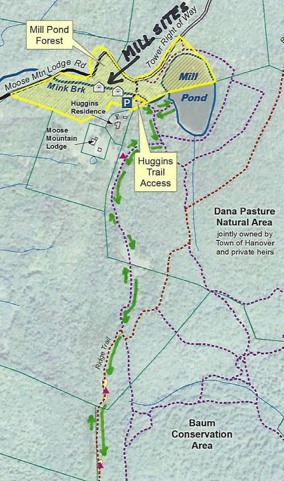
Driving Directionstrail map
  • From Etna Village, head N on Hanover Center Road
  • Turn R on Ruddsboro Road and drive 1.8 miles
  • Turn L on Old Dana Road
  • Turn R just past large red barn on R, onto Moose Mountain Lodge Road (not marked)
  • Drive 0.8 miles to top of road. Park at the marked trailhead parking area just past the beaver dam.

What You Should Know

  • Foot travel only. Dogs welcome if under close control.
  • Bring binoculars and bird book for viewing waterfowl on Mill Pond and exploring distant views.
  • This hike celebrates the  history of Moose Mountain Lodge and explores the wild ridge of the mountain. We will view the former Lodge site from an overlook; please note that the site is privately owned.
  • The route visits part of a 3,800-acre block of protected higher-elevation wildlife habitat on Moose Mountain.
  • The hike ends with an optional visit to protected 18th century mill ruins on the steep mountainside.

BRIEF DIRECTIONS

  • Begin at the sign reading “Mill Pond Forest & Huggins Trail Access.”
  • Bear L at first trail junction to visit Mill Pond
  • Return to trail junction and turn L onto Pasture Road
  • Turn R onto Baboon Bypass, cross drainage, and reach first views
  • Continue on trail to second pasture and third pastures and cross stone wall
  • Bear R at arrow, head downhill, and shortly after, turn L at arrow
  • Bear R at sign parallel to the trail indicating the Orange Diamond Ridge Trail. Head up a short steep section to a mossy ledge.
  • Continue to second open ledge.
  • Retrace your steps to return to your car.

Hiking Directions

  • Begin your hike at the sign reading, “Mill Pond Forest & Huggins Trail Access.” To forever ensure public access to the network of trails you’ll be exploring, the Shumway and Huggins families donated conservation easements on this area to the Hanover Conservancy in 2016.
  • Cross a small drainage and note the series of small beaver ponds at L. By late 2017, the beavers left after many years of entertaining their neighbors with sightings of cruising kits and evening tail slaps on the water, as well as plugged culverts and “free-range forestry.”
  • The thread of infant Mink Brook has reappeared with the lack of diligent management by these aquatic engineers.
  • Arrive at the first trail junction and bear L. Within 15 paces look for a cellar hole at L. This was the high-elevation c. 1800 home of miller David Woodward, who built the dam on Mill Pond and an impressive sawmill and gristmill on the steep falls of Mink Brook below where you left your car (optional visit at end of this hike). Woodward’s house was probably larger than the modest cellar hole, which, in the days of hand digging, must have presented a challenge to build.
  • 2 beavers in Mill Pond
    Mill Pond beavers; photo by Kay Shumway

    Continue on the path a few minutes further to a bench at the pond shore. It’s time for a picnic, or at least to pull out the binoculars! Ten-acre Mill Pond is the highest water body in Hanover and the primary source of Mink Brook, the town’s largest stream. Set in a saddle on the mountain ridge, it may have originally been a small pond or perhaps a marsh. Around 1800, Woodward built a drylaid stone dam (just out of view at L, beyond the spruces) to raise the water level some 6-8 feet (it has since partly silted in). Beavers later took over and have been managing the pond off and on, ever since. Today, the entire shoreline remains undisturbed: Hanover Conservancy easements protect the N side with the Dana Pasture Natural Area on the S (co-owned by the Town of Hanover and a Dana heir).

  • Directly across the water is an impressive beaver lodge. Scan the pond’s surface for waterfowl and other birds. On the day we visited, three male mallards were holding a bachelor party at the pond.
  • Retrace your steps to the cellar hole and trail junction. At this time of year, violets are in bloom on the forest floor and you may spot the cheerful red of partridgeberries.
  • A sign for Pasture Road and a green moose mark the trail junction. Turn L; soon you’ll see the old stone wall marking this Class VI road. Where Pasture Road once met Moose Mountain Lodge Road is anybody’s guess – our bet is the area under the beaver dam.
  • Pass by the first gap in the wall, which leads to a private home, and look for a second gap marked with a sign for “Baboon Bypass” a few yards beyond the wall. Turn R here. This short and somewhat indistinct trail leads W toward your next destination, across a small drainage. Blue sky appears ahead and an arrow on a barbed-wire-garbed tree directs you to swing L into an opening.
  • Arriving in an old pasture (first of three), leave the path and head through low brambles and blueberry bushes toward a big pine and two old fence posts. It seems all of central and southern Vermont is spread before you, with sharp-peaked Killington presiding.
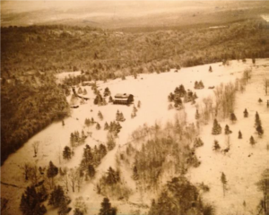
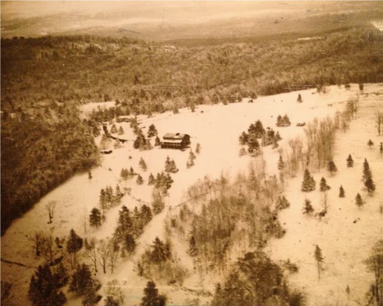
  • It seems all of central and southern Vermont is spread before you, with sharp-peaked Killington presiding. For 80 years, just below the brow of this field, stood Moose Mountain Lodge, an icon in the Upper Valley and legend in the ski world. The Lodge is now history, having been removed in the last few years, but we’re going to tell you all about it!
  • overhead view of lodge in 1949
    Lodge, pastures, and ski slopes, 1949

    Let’s start with long-time owner Kay Shumway’s recollections: “The Lodge is a big old comfortable log building perched high on the western side of Moose Mountain. It has survived 80 years of snow, sleet, ice, wind, and lightning. The weather comes across the Connecticut River Valley and sweeps up the mountain, wearing away at the log surfaces like sandpaper. Sometimes the wind gets unbearable with its relentless buffeting. We often remark that it’s almost like living on a ship at sea.”

  • The Leslie brothers built the lodge in 1937-38. They were identical, inseparable twins – when one came to Dartmouth, the other had to come too! Bill Robes was teaching skiing then and the boys were hooked. Robes, who married into the Dana family, he said he knew of a place where they could build a ski lodge, and the rest is history.
  • The Lodge opened in 1938 for downhill skiing complete with rope tows and skiing on cleared slopes below. There was even night skiing on a lighted slope, which according to Kay was not too successful. The Lodge primarily served Dartmouth, housing college guests and students’ dates. Back then skiers careened down the mountain’s sunny west slopes on wooden skis. The road up to the Lodge was part of the adventure. Most who arrived by car parked at the base of the mountain and used a crank telephone to summon the Lodge’s Ford woody station wagon for a ride up the hill.
  • From 1943-45, the Lodge closed as gas rationing during WWII curtailed driving for pleasure and cut off fuel for the tows. It reopened from 1946-49 but was soon empty and vandalized. In 1955, Bob Jones bought the abandoned Lodge and nearby cottage as a boys’ summer camp. Camp Moose Hi ran for three years until Agnar and Anah Pytte bought the Lodge and Elisha and Anne Huggins the nearby cottage. John and Mary Clarke acquired the Lodge in 1972, turning it back into an inn for cross-country skiers and cutting some of trails we still enjoy today.
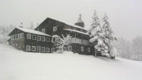
  • view of lodge in winter
    The Lodge in 1975

    Three years later, Peter and Kay Shumway visited in a snowstorm. At the time, Peter was in the lumber business in New York and Kay taught in a Head Start program. Peter’s father had been a ski jumper at Dartmouth (Class of 1913) and when he and some friends skied the 25 miles to Mt. Moosilauke, people would stop them and ask what they had on their feet. The Shumways happily bought the Lodge and it continued to host in the back country skiing tradition.

  • The Shumways welcomed guests for the next 35 years, retiring in 2011. Kay recalls, “Inn-keeping on our beautiful mountain allowed us to live in this peaceful place in isolation while still meeting interesting people.”
  • In 1985, the Shumways purchased a 313-acre mountain tract just N of the Lodge to keep it from being developed. Their forester, John O’Brien, helped them return its forest to health after prior heavy logging, always with an eye to ski trail potential. In 2017, these public-spirited landowners conveyed a permanent conservation easement on the Shumway Forest to the Hanover Conservancy, protecting public trail access and high elevation wildlife habitat forever. We celebrated with the entire Moose Mountain Lodge family and many friends on a sunny Saturday in July.
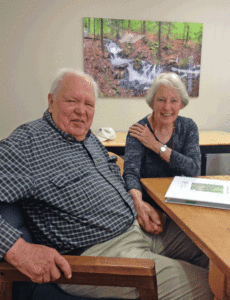
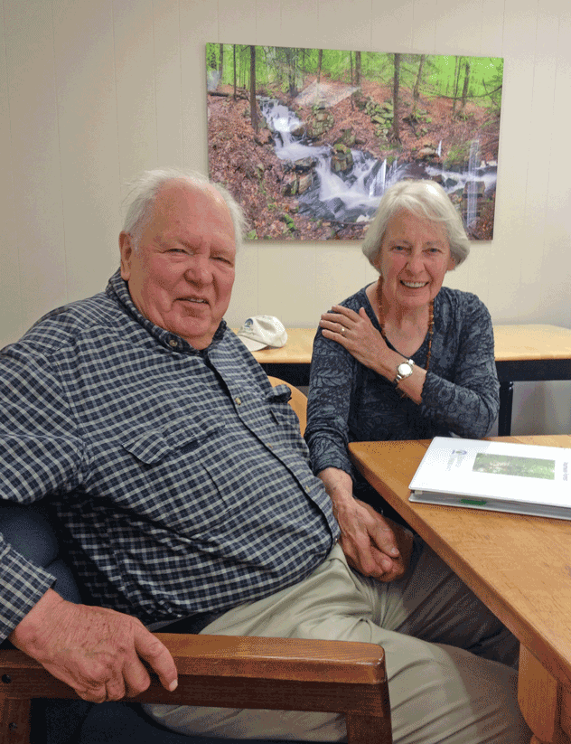
  • Peter and Kay Shumway at table
    Peter and Kay Shumway after signing the Shumway Forest conservation easement, June 2017

    The lodge interior was even more wonderful than you imagine. Log ceiling beams, a sunny comfortable living room filled with rustic handmade log furniture, Kay’s baby grand piano, and drifts of hand-dyed wool for her spinning projects surrounded a huge cobblestone fireplace that featured a granite millstone above the hearth (more on that later). The dining room spanned the NW side, with another fireplace and a handmade dining table so long you can just imagine hungry guests gathering around it after a great day on skis. Behind was an efficient yet delightfully old-fashioned kitchen with everything close at hand, including Kay’s own Moose Mountain Lodge recipe book. On the N side was the ski shop with rows of skis hanging from a rack, ready for waxing.  A welcoming porch spanned the entire W side, with log settees beckoning you to relax and take in the breathtaking view and spectacular sunsets.

  • Up the stairs under the watchful eyes of a mounted moose head you’d find a warren of cozy guest rooms with log beds, some made by Kay and Peter themselves. Down the hill were a large fenced vegetable garden, goat shed (Kay kept Angora goats for their fleece), and small sugarhouse.
  • Now it’s time to enjoy some of the trails the Shumways and their former neighbor, Elisha Huggins, long maintained. Return to the path and continue uphill to a second, smaller clearing adorned by white birches. Follow the path back into the woods, guided by small wooden arrows. Soon you’ll arrive at a third pasture, the largest of all. Head uphill toward a moose sign with orange highlights posted on a birch.
  • These pastures, occasional clumps of juniper, and the fragments of barbed wire on fence posts recall the land’s history as the Dana Farm’s summering grazing grounds. The Dana family farmed this area since the late 1800s. Today, the red barn still stands on the E side of Old Dana Road and the early white farmhouse migrated from its original site across the way to the hilltop above. Into the 1960s, the family drove their cattle up the mountainside to graze here during the summer. After grazing stopped, Elisha Huggins kept the pastures open for skiing and views, using a hand scythe!
  • A low stone wall among the birches marks the boundary with private land. Continue S toward a large ash bearing an arrow pointing R. After a short downhill, another arrow + moose sign directs you to turn L. Take the path through the woods a short distance to a trail junction.
  • A sign at R, parallel to the trail, indicates the Orange Diamond Ridge Trail. Bear R and up a short steep section to a mossy ledge.
  • Ten minutes’ walk from the last pasture, you arrive at the first of two open ledges and views open up to the E. Keep an eye on kids and dogs. A small cairn on the far side marks the trail’s return to the woods.
  • Here, the Ridge Trail follows the boundary of two privately owned parcels – to the E is the Baum Conservation Area, owned by a local Dartmouth alumnus with a keen interest in trails and conservation. Pass a nice colony of the small but stoic rock polypody fern.
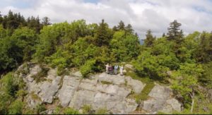
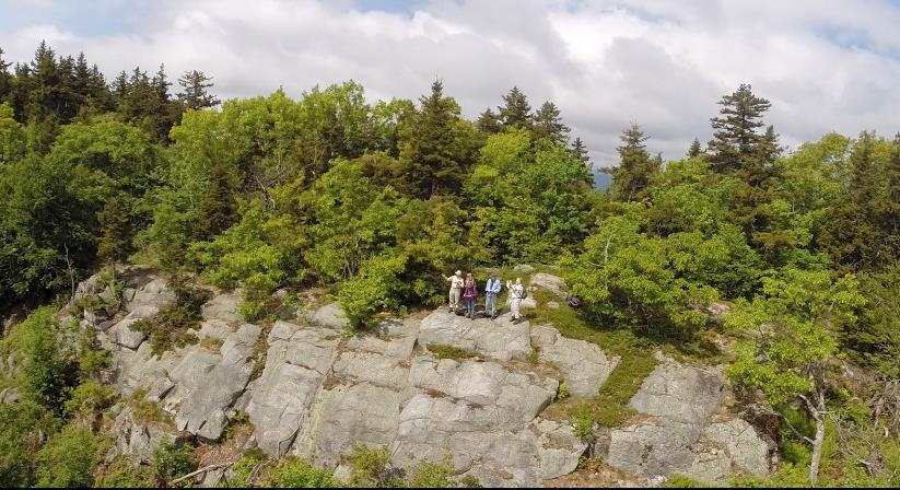
  • view of people on ledgeFive minutes from the first ledge, arrive at the second, larger ledge, today’s turn-around point. Time to corral kids and dogs and pull up a stony seat among the lowbush blueberries to drink in the view (and some water). At 1 o’clock is the bony knob of Mt. Cardigan. If you stand on the highest part of the ledge, you can see distant Mount Washington at 11 o’clock.
  • At 10 o’clock, the ridge of Moose Mountain stretches N beyond the communications tower. From here, you get a fine view of the mountain’s E profile and realize that, like Holt’s Ledge and so many others in New England, it is a roche moutonnee or sheepback, shaped by the passing of the glacier. The glacier abraded the NW side and plucked rocks from the opposite slope as it ground its way from NW to SE. In this view, dark patches of evergreens to the R of the tower mark the steep SE side.
  • To return, pink tape on a tree helps you locate the trail back. It becomes clear you’re hiking the very spine of this mountain, with the Mascoma River valley off at R and Mink Brook valley at L.
  • Returning to the first ledge, admire the view of Cardigan before continuing on, following a blue arrow.
  • At the trail junction, yellow signs point R to the Baum Conservation Area (to explore another day). You turn L to retrace your steps toward the pastures.
  • At a bent yellow birch, a sign at L directs you to turn R; shortly after you’ll turn L at another arrow. Soon you’re back to the birches and the upper Dana pasture. In June, white five-petaled strawberry flowers decorate the ground under your feet.
  • Continue gently downhill to the last pasture, above the site of the Lodge. See if you can spot the white hamlet of Hanover Center in the distance, to the R. You can see why this village never fulfilled its intended destiny as the hub of Hanover – it’s on a hilltop and there’s no running water!
  • Take the path back into the woods – avoid the trail that comes in at L from a private home – and return to Pasture Road. Turn L past the stone wall and then L again at the junction by the cellar hole. Ten minutes from the last overlook, you’re back at your car.

Optional Mill Site Visit (10 minutes)
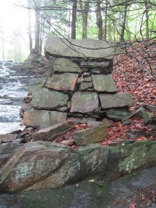
  • mill ruins by streamHidden in the woods are remains of a late 1700s saw and grist mill. They are very close by but invisible unless you make the short scramble through the woods to see them.
  • Walk back down Moose Mountain Lodge Road to a telephone pole opposite the gated entrance to the tower right of way. Turn L and bushwhack back the short way to the stream. You’ll soon pick up an old cart path on the near side. Take this down along the brook, admiring the cascades, to a series of angular piles of rock. Towers rise on either side of the brook. More can be seen farther downstream.
  • We marvel at how David Woodward managed to build these structures in such a steep ravine around 1800, his only tools likely being a pair of sturdy oxen, ropes, a chisel, and a native understanding of physics. In his 1982 anthropology paper, Dartmouth student Tom Slocum suggests that Woodward used the cubic
  • blocks of native schist to build an undershot-type mill that most likely functioned to saw wood and grind grain. Water stored in the pond above could be released to provide enough flow to operate the mill. At some point in its history, the mill operated only during the spring freshet and only as a sawmill.
  • The 1930s builders of Moose Mountain Lodge found their fireplace ornament here amid the ruins of Woodward’s mills. These historic sites are now specifically protected from further disturbance by the Hanover Conservancy’s Mill Pond Forest conservation easement.
  • Continue down the brook-side cart path to the last set of ruins. The path appears to end here; retrace your steps to return to your car.

Revised 10/2020
Filed Under: Dana Pasture Lot, Easements, Hike of the Month, History, June, Mill Pond Forest/Huggins Trail Access, Moose Mountain, Views Tagged With: beaver, grist mill, wild strawberry

Hayes Farm Park & Audrey McCollum Trail

May 1, 2018

Hayes Farm Hike – Full PDF


Hayes Farm Hike mapDriving Directions

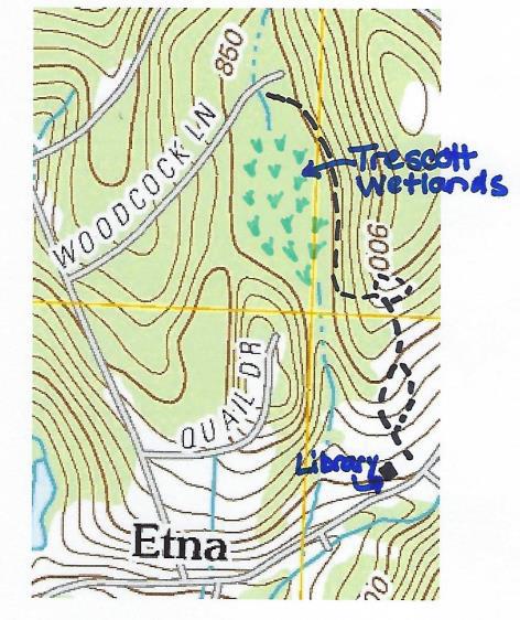
  • This hike begins at the Etna Library at 130 Etna Road.
  • From downtown Hanover, follow East Wheelock Street up to Grasse Road, where it becomes Trescott Road. Continue straight on Trescott Road to Etna Road.
  • Turn L onto Etna Road and head N
  • Opposite King Road, turn L into the Etna Library parking area.

What You Should Know

  • Foot travel only. Dogs are welcome but must be under close control; please pick up after your pet.
  • While this hike is not long, there are some short steep sections and some tricky footing.
  • We suggest bringing a picnic and binoculars, and allowing extra time to enjoy this spot.
  • You are exploring land acquired by the Town of Hanover in two phases – the 12.9 acre Trescott Ridge Wetlands, set aside when the “bird roads” (Woodcock, Partridge, and Quail Lanes) were laid out, and Hayes Farm Park, 9.4 acres acquired from the estate of Ethel Hayes in 2010. On the way, you’ll visit the King Bird Sanctuary, established in 2011 by the Hanover Conservancy and the Audrey McCollum Trail, built in 2017.

Hiking Directions

  • Begin your hike at the sign reading, “0.5 miles to Woodcock Lane/0.2 miles to King Bird Sanctuary.” Head up the mown path toward the trailhead kiosk visible above the meadow.
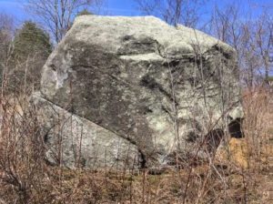
  • erratic boulder at Hayes Farm parkA massive boulder, looking quite out of place, looms ahead. This is a glacial erratic, plucked by the glacier from someplace northwest of here and unceremoniously dropped when the glacier receded, melting around it and leaving it behind. If you look closely, you can see that one H. L. Huntington spent quite a bit of time here on Sept. 14, 1872, carving the erratic’s first (and hopefully only) graffiti.
  • crabapple blooms
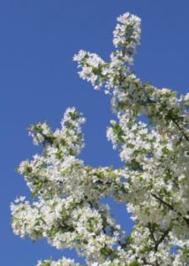
  • Pass L of the boulder and up into a small orchard of crabapples (L) that promise to be lovely at some point in May. Resolve right now to return to catch the show.
  • The trail is short and sometimes steep. Five minutes’ walk from your car, reach the top of a rise with the next of many fascinating features before you – a stone wall comes in at R. Close inspection reveals wide-mesh sheep fencing topped with a strand of barbed wire, clues that you are standing in what was sheep pasture (1820s-70s) and later pasture for cattle (to mid 20th century).
  • Continue down into the broad sheep lane with its fine stone walls on both sides. Halfway along, there’s a gap in the wall at R – your return route.
  • For a former sheep lane, this is a pretty interesting place ecologically. Here and there blue flags, set by the town’s Biodiversity Committee, indicate native plants to be tracked. Woodcock frequent the area, as do flocks of turkeys.
  • Follow the lane up the next knoll. A sign directs you R to the King Bird Sanctuary. The distinctive boulder seat, your next destination, appears up at L. It’s time for a picnic, or at least to pull out the binoculars!
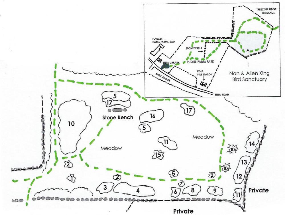
  • King Sanctuary mapThe Hanover Conservancy and Hanover Conservation Commission partnered to create this sanctuary to honor Nan and Allen King, prominent Hanover conservationists, and to benefit Etna Village. On the Upper Meadow of Hayes Farm Park, the sanctuary features a naturalized planting of hardy native trees and shrubs to benefit wildlife. It was dedicated on June 30, 2011, the Kings’ wedding anniversary. In addition to the Conservancy’s King Memorial Fund, many volunteers and donors helped make the project possible.
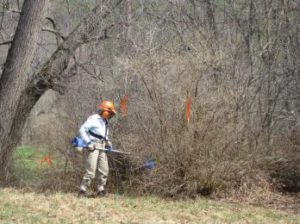
  • Worker clearing invasive plants
  • From your seat on the boulder, imagine this knoll as open pasture. A few such meadows can still be seen across the Mink Brook valley, but most have since grown up to pine. This piece was grazed longer and allowed to grow up more recently, with unforeseen and dire effects – what came in was not only white pine, but thick tangles of invasive non-native plants, including bristly Japanese barberry, honeysuckle, and glossy buckthorn. It took brave volunteers to cut the invaders and heavy equipment to pull them out by the roots.
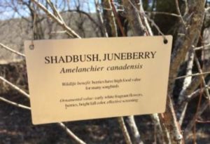
  • Replacing them are plantings of native northern New England trees and shrubs that are more reliable and less demanding than exotic varieties, and provide better food, cover, and nesting habitats for native birds and other creatures. All of the plants displayed here are excellent alternatives for the home landscape. Look for tags identifying the plants, their value to wildlife, and ornamental qualities. You’ll want to visit the Sanctuary throughout the seasons to see the changing palette of flowers, fruits, and foliage, and to enjoy a quiet view of the birds and mammals who make this their seasonal or permanent home.
  • shadbushFirst up in spring are the delicate, fragrant white flowers of shadbush, also called serviceberry and Juneberry. Old-timers associated the blooming of this plant with the spring migration of American shad and also the time for burial services for those who died in winter when the ground was frozen. You’ll find three specimens of this small tree at the King Sanctuary. In June, brightly colored berries follow the flowers, attracting birds. In fall, it sports brilliant foliage.

  • Take a few minutes to explore the King Sanctuary and its plantings. Follow the mown path a few yards back down to an adjoining path, and at the first of three shadbush, turn L to follow the path along a stone wall. These beautiful walls, built 200 years ago to enclose the sheep pasture, are still enjoyed by animals. At this time of year they hold the spring sun’s welcome heat through the chilly night. You might find chipmunks, garter snakes, and other creatures taking advantage of their warmth.
  • After one wall opening (private property beyond) and a group of witchhazel, the wall takes a curious jog. Past a second, smaller gate, a clump of bushy young pines are all that’s left of the many that had invaded the abandoned pasture.
  • Bear L and take the path over the saddle of the hill, keeping the stone seat at L. The path bends down and L past the remains of a huge brush pile left from the culling of invasives and dead trees. Now it’s a handy home for small mammals.
  • Audrey McCollum headshot
    Audrey McCollum
  • You’ve encircled the small hill and, with another stone wall ahead, arrive at a sign for the Audrey McCollum Trail. An ardent conservationist, Audrey (R) lived nearby for many years. Gifts to the Hanover Conservancy in her memory allowed the creation of this trail linking the library to the Woodcock Lane neighborhood.
  • Turn R and head downhill, following sunflower yellow blazes and entering a cool hemlock forest. At this time of year you can find such fleeting evidence of micro-climate as lingering patches of snow and ice in the hemlocks’ dense shade, when the sunny Sanctuary had long since given up such wintry garb.
  • Nearing the forested Trescott Ridge Wetlands, the trail bears R and a dramatic stone wall angles down the hill at R. Step over the wall and turn R. This is good porcupine habitat – keep an eye on your dog.
  • The yellow-blazed trail skirts the E edge of the wooded wetland. Note the spongy green sphagnum moss and erect beaded fertile fronds of sensitive fern. Indeed, this place IS one huge sponge – it collects and stores meltwater and rainwater, releasing it slowly into a tributary of Mink Brook. Those living as far away as Greensboro Road benefit from the flood-moderating work of this wetland.
  • bog bridges
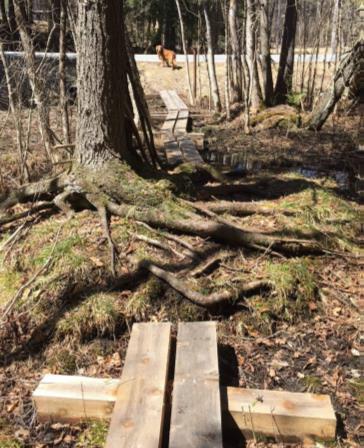
  • Approaching the north end of the wetland, you encounter a bog bridge of split logs to help you over a wet spot. A few yards further, cross an impressive string of carefully fitted planks bridging more wet areas and protecting wetland plants.
  • This is the work of the Upper Valley Trails Alliance with town and Conservancy volunteers who completed the Audrey McCollum Trail in 2017.
  • Follow the yellow blazes to avoid nearby private land. A final pair of bridges leads to the north end of Woodcock Lane. If you want to pick up the pace and cover more distance, you could walk down the lane, turn L onto Trescott Road (beware narrow shoulder), turn L onto Etna Road, and return to your car. We think it’s more fun to retrace your steps and see what you might have missed on the way out.
  • Turn around and follow the small stream feeding the wetland. It’s running well now, but slows to a trickle in summer. Signs of squirrel picnics might decorate a granite slab. Keep an eye on the blazes as you go.
  • stumps and logs along bog bridgeThis is a very untidy environment! Mossy stumps, lumps, shrubs, standing and fallen trees create visual havoc but are part of what makes this such a valuable wetland. Note the silence of this place.
  • Keep the wetland immediately on your R until you reach the stone wall. Here, wildlife like mink use such places as billboards, placing scat where it can’t be missed.
  • Past the wall, the trail swings up and away from the wetland and, 15 minutes from Woodcock Lane, you ascend from the woods. Stay on the path and round the corner of the stone wall (unless the King Sanctuary’s stone seat requires another visit). Head down the broad sheep lane, past an impressive quartz boulder at R.
  • Turn L through the break in the wall and enter the field. Ahead, the old farm well-head gives the impression that a giant has pounded a tiny house into the ground. A cluster of flagging and fence posts indicates a population of plants being tracked and protected.
  • Pass the end of the tree line and follow the path as it turns R to bring you to the library and your car. Enjoy a fine view of the historic Hayes Farm barn. This farm was owned by the Ingalls family as early as 1855; by 1892, the Stetsons farmed here. Hayes family members still live nearby.
  • Before leaving, pay a quick visit to the lilac garden behind the Etna Library. This outdoor reading garden is encircled by lilac varieties brought by the Conservancy from the famed Highland Park in Rochester, New York, where Nan and Allen King met.

The Conservancy has prepared a map and guide to the King Bird Sanctuary plantings to help visitors learn more about the wildlife benefits and year-round ornamental values of these native plants. Copies are available at the Etna Library and Hanover Town Office.

Filed Under: Hike of the Month, King Bird Preserve/Hayes Farm Park, Lands, May Tagged With: shadbush, sphagnum moss, woodcock

Corey Road and the AT

March 1, 2018

Corey Road & the AT – full PDF

Corey Road and AT hike mapDriving Directions

  • From Etna village, turn R onto Ruddsboro Road
  • Follow Mink Brook as the road curves up its narrow valley for 1.5 miles
  • Turn L onto Three Mile Road
  • After 1.2 miles, arrive at the AT parking area on L opposite telephone pole 31-50 (if parking area is not plowed, park on shoulder)
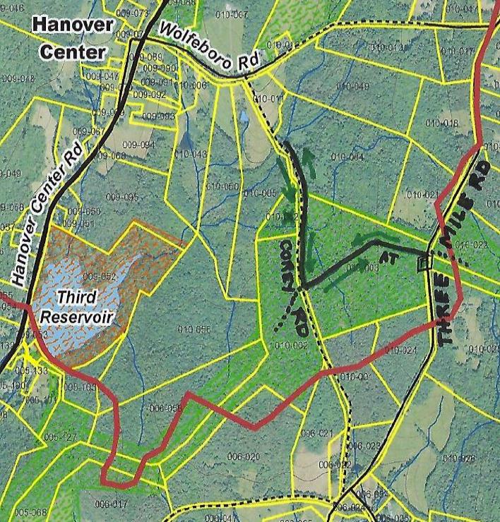
  • Today’s out-and-back hike, shown on the map at R, takes you to two fascinating historic sites.

What You Should Know

  • In winter, we suggest hiking poles and micro-spikes or snowshoes for traction, especially for the brook crossings. If rising temperatures threaten to melt snow/ice cover on the AT, we strongly advise taking your hike in the morning while surfaces are still frozen, to protect the treadway. Corey Road can be wet if snow cover has melted, and boots are advised.
  • You’re about to visit lands owned by the federal government (permanently protected) and a small portion of private land protected for AT corridor. Corey Road is a Class VI road open to the public subject to gates and bars.
  • The Corey Road portion of this hike makes for great skiing. If you’d rather do that, enter Corey Road at its south end, at the junction of Three Mile, Old Dana, and Chandler Roads. Park with respect for the private residence at the historic cape here; walk up the driveway and through the gate to continue on the Class VI portion of this road.
  • If you can’t bear to stop, you can combine this hike with a one-hour loop on the E side of Three Mile Road, posted as the February Hike of the Month: Mink Brook & the Harris Trail.
  • Dogs are welcome if under your control; please pick up after your pet.

Brief Directions

  • Take the AT westbound from Three Mile Road for about 15 minutes to Corey Road.
  • Turn R and follow Corey Road for about 20 minutes to an historic stone bridge.
  • Return the way you came.

Full Hiking Directions

  • Begin your hike at the wooden AT sign set back from Three Mile Road and proceed gently downhill through a young mixed forest of pine and northern hardwoods. Here and there, the gleaming bark of yellow birch catches the sun.
  • The 1855 and 1892 maps show no homes on this side of Three Mile Road between Chandler and the Wolfeboro Road, and so it was likely that most of this land served as sheep pasture then.
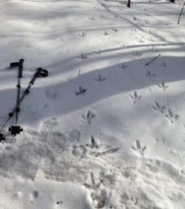
  • turkey prints on the snow
    We missed the turkey parade!

    If snow conditions are right, you can mark the passage of many creatures in these woods. Red squirrels, deer, and turkey are the most obvious.

  • Begin your hike at the wooden AT sign set back from Three Mile Rd and proceed gently downhill through a young mixed forest of pine and northern hardwoods. Here and there, the gleaming bark of yellow birch catches the sun.
  • The 1855 and 1892 maps show no homes on this side of Three Mile Rd between Chandler and the Wolfeboro Rd, and so it was likely that most of this land served as sheep pasture then.
  • If snow conditions are right, you can mark the passage of many creatures in these woods. Red squirrels, deer, and turkey are the most obvious.
  • 8 minutes’ walk from your car, you encounter the remains of an ancient tree that split like a giant lily at its base. Three large trunks fell at R, and another to the L was cleared away.
  • 5 minutes further, some kind soul has placed rough planks to help you cross a series of small rivulets. Send silent thanks to the dedicated trail maintainer of this section of the AT (we know who he is!) for keeping your feet dry.
  • The largest of these brooks marks a transition to larger pine, and you note five blowdowns at L. Their fallen boles all lie SW of their tipped up root systems, hinting that a nor’easter took them down. As the years pass their root masses will decay, leaving only the mounds and pits we find all over New England forests that speak softly but eloquently of such forest disturbances.
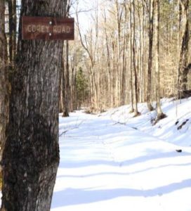
  • Corey Road wooden trail sign
    Corey Road

    Soon you reach a stone wall lined with large sugar maples, signaling your arrival at Corey Road. A close look at L reveals strands of barbed wire caught in the wood of one old tree, still on duty to keep the cows out of traffic.

  • From the center of the road, turn completely around to note two wooden signs placed (thank you, Hanover Trails Committee volunteers!) to identify the historic road. You’ll want to keep an eye out for them on your return trip.
  • Corey Road was laid out and surveyed on November 14, 1793 from the Wolfeboro Rd S to Chandler Rd, and was once an important link between Hanover Center and Enfield. One house stood on the road in 1855, but it was gone by 1892. By 1948, Corey Road was in disuse and Town Meeting voted to discontinue it subject to gates and bars. The AT was busier – Dr. Goldthwait noted a crossing of “the D.O.C. trail to Moose Mountain” when mapping the area in 1926.
  • Turn R and head N down Corey Rd. Stone walls line both sides. As you proceed, some sections of the R wall are composed of much smaller stones than elsewhere, hinting that the ground nearby may once have been tilled. This more intensive use would have motivated the landowner to remove smaller stones that could damage a plow, and dispose of them in the wall.
  • 6 minutes from the AT junction, you’ll head down a short, steeper pitch toward a brook – the same one you crossed on the AT. A formidable stone foundation appears at L on the other side. Stone walls and barbed wire mark boundaries.
  • Cross this small brook carefully. The size of woody debris caught just below indicates that this brook can punch above its apparent weight during a heavy rain.
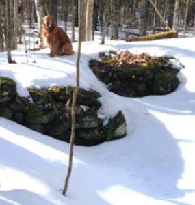
  • dog on cellar hole stones
    Corey-Woodard cellar hole

    Hike back up a few yards beyond the brook and past the stone foundation. Just as you reach more level ground, step off the road to discover a cellar hole, about 20 paces to the L. Likely the original Corey homestead, it was the home of one O. Woodard by 1855. The cellar hole is lined by a drylaid stone foundation. If it seems too small, consider that a cellar was needed under only a part of the home, and a glance to the N reveals a flat rectangular area where the rest of the house stood. Sited just above the road with SW exposure for solar gain and a good water source close by, this must have been a fine place to live. What happened to prompt its abandonment by the 1890s? We don’t know.

  • After exploring the cellar hole, return to Corey Road and continue N. Here, the stone wall at R is composed of coarse boulders topped with barbed wire – the edge of a pasture, not a garden.
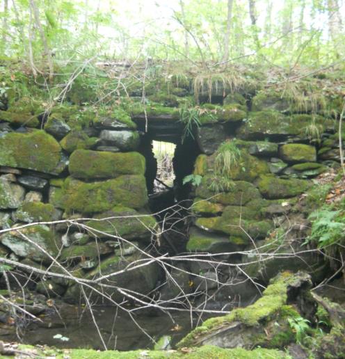
  • 7 minutes after leaving the cellar hole, you arrive at a second brook crossing, this time forded with the most impressive surviving drylaid stone culvert in Hanover.  Walk down to
    Corey Road culvert
    Corey Road stone culvert (fall 2012)

    the L on the S side to get a good view up to the moss-covered structure that has lasted here for 225 years. A close look reveals a flat stone lintel that carries Corey Road across the brook. The opening is tall enough to accommodate a short person. Imagine what it took to build this crossing!  Even more incredibly, the home-grown engineering created a stable bridge that has withstood not only the centuries but also – so far – the sudden, higher flows from microbursts and other heavy storms associated with climate change.

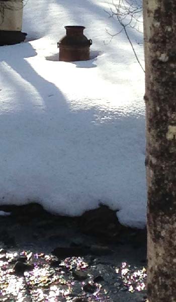
  • Bright sky appears across the brook and above to the L, indicating an open field. Below the slope and along the streambank is a collection of what can politely be called “cultural debris,” such as an old milk can. It was once common practice to toss unwanted items over a bank, often near a stream. This spot is a little open air museum thanks to that habit!
  • Like us, you’re probably tempted to linger by the bridge a bit longer, so we’ll tell you about the stream. This is Monahan Brook, the principal N tributary of Mink Brook. It rises N of Wolfeboro Road and flows SW to the Third Reservoir near Hanover Center Rd. From there, much of the water is diverted from Mink Brook and piped under the road and into the woods above the Parker Reservoir in the Trescott Water Supply Lands. Then it’s a short trip to downtown kitchens and drinking fountains. You’ve been hiking through more drinking water supply lands! However, the watershed of the Third Reservoir is only minimally protected – the Town owns only a narrow strip within 175-200 yards of the water’s edge. Federal land and AT easements protect a bit more, as do two privately conserved parcels at Monahan Brook’s headwaters, but otherwise this watershed is protected only by the good will of private landowners.
  • Monahan Brook and the rest of the Mink Brook watershed were part of a statewide study by Trout Unlimited and NH Fish and Game biologists in 2011, assisted by the Hanover Conservancy. They found that “Hanover’s little Mink Brook and its tributaries showed a surprisingly healthy population of native Eastern Brook Trout.” You are now standing at one of those study sites.
  • Corey Rd continues as a Class VI Road up to Wolfeboro Rd, but today we’ll retrace our steps and head S.
  • 9 minutes’ walk brings you back to the first brook, where several channels join upstream of your crossing. Make a note of the time.
  • Step over the brook and continue a gentle but steady uphill walk for about 8 minutes. Even under the snow, you can see the depression of the old road bed even though it has not been traveled for at least 70 years. Keep an eye out for the Corey Road sign at the AT crossing.
  • Reach the AT and stop to listen to the sighing pines overhead, imagining the open sunny pastures that once flanked the road on both sides, shaded only by the old maples lining the stone walls.
  • Turn L onto the AT and head E toward Three Mile Rd (and ultimately, N to Maine!).
  • 15 minutes’ hike on the gently rising trail will bring you back to your car.
  • A reminder – if you can’t bear to stop, you can combine this hike with a one-hour loop on the E side of Three Mile Road, the February Hike of the Month: Mink Brook and the Harris Trail.

sap buckets in snow

March  2018, revised July 2020

Filed Under: Hike of the Month, March Tagged With: Appalachian Trail, cellar hole, Class VI Road, Wolfeboro Road

Mink Brook & the Harris Trail

February 1, 2018

Harris Trail Loop full PDF

Harris trail mapDriving directions

  • From Etna village, turn R onto Ruddsboro Road
  • Follow Mink Brook as the road curves up its narrow valley for 1.5 miles
  • Turn L onto Three Mile Road
  • After 1.4 miles, arrive at a big dip in the road with space for parking on both sides. (The AT parking area just S of it is not plowed in winter).
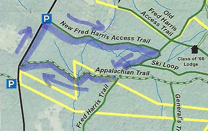
  • Today’s hike, shown on the map at R, takes you on a loop that crosses Mink Brook twice.

What you should know

  • In winter, we suggest hiking poles and micro-spikes or snowshoes for traction, especially for the brook crossings. The first part of this hike and the Harris Trail offer fine skiing, but the last part of the loop, on the AT, is narrow and often too steep for all but the bravest skiers.
  • You’re about to visit lands owned by the federal government (permanently protected) and Dartmouth College (partially protected for AT corridor). The route also crosses a small portion of the Shumway Forest, protected in 2017 by the Hanover Conservancy (outlined in yellow above).
  • Dogs are welcome if under your control; please pick up after your pet.

Brief Hiking Directions

  • Begin at the orange Dartmouth Outing Club sign that reads “Parking/No Camping”
  • Follow the gentle trail 7 minutes to the first crossing of Mink Brook
  • Cross the brook and continue another 3 minutes to the Harris Trail
  • Turn R on the Harris Trail
  • Cross a stream (no bridge)
  • Turn R on the Appalachian Trail and hike 10 minutes to second crossing of Mink Brook
  • Continue on the AT for 6 minutes to Three Mile Road.
  • Turn R and walk 0.2 miles along the road to your car.

Full Hiking Directions


  • Begin your hike at the orange Dartmouth Outing Club sign that reads, “Parking/No Camping.”
  • Known as the New Fred Harris Cabin Access Trail, this blue-blazed, half-mile-long trail was built by the Dartmouth Outing Club as a direct route to the college’s Class of ’66 Lodge (built on the site of the Fred Harris Cabin). We won’t visit the Lodge today, but you’ll find it on the map above.
  • The trail is easy and rises gently to a plateau, passing through a long-abandoned sheep pasture. Here, small saplings are creeping into the understory sheltered by towering pines above. Years ago, all these lands between the road and the mountain ridge were owned by Luther Brown.
  • Here and there, last year’s fragile leaves seem to shiver on beech trees. It’s believed that beeches evolved in the south and migrated to this area in the wake of the glacier, but never quite got the hang of dropping their leaves in fall like their northern brethren, the maples and birches. Admire the delicacy of their slender, cigar-shaped leaf buds.
  • Seven minutes’ walk from your car, the appearance of a rivulet and its small steep valley at R signals the approach to Mink Brook. At L, a rough stone wall marks the plateau’s edge and the boundary of the old pasture.
  • The trail takes you down a short, moderately steep section to a fine bridge installed a few years ago over Mink Brook. Look L upstream; the brook drains a rich and complex beaver-influenced wetland just out of sight on the Shumway Forest. Downstream, the brook may be covered in ice but still can be heard murmuring beneath. At R a small brook joins. You’ll cross this one soon; it is the same stream that pools near the Class of ’66 Lodge.
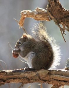
  • squirrel eating a nutThe trail continues gently back up to a matching plateau on the east side. Deer trails cross and you may find leftovers from a red squirrel’s dinner in a pile of pine cone scales or acorn tops. The forest is different here – less pine, more hardwood – belying a different history. Could this have been Luther’s woodlot?

  • Ten minutes from your car, you reach the Harris Trail, but if there’s been a recent snowfall, it’s easy to miss the junction. An orange DOC sign hangs on a red oak at R, facing the other direction. The sign reads, “To AT” and “To 3 Mile Rd & Parking,” indicating the path you just took. Across the intersection is a wooden sign reading, “<- Harris Trail ->” installed by energetic volunteers of the Hanover Conservation Commission’s Trails Committee.
  • The Fred Harris Trail, former route of the Appalachian Trail, honors the Dartmouth Outing Club’s founder (1909). It offers wonderful skiing when conditions are right. The trail once ran from Moose Mountain Lodge Road N into Lyme, but a section N of Ferson Road can no longer be traced. The AT was re-routed off this path onto the ridge of Moose Mountain in the 1980s.
  • Turn R onto the wide Harris Trail and head down to meet the brook you saw earlier. Alas, there is no bridge here, but with care and help from your hiking poles you can cross on the ice. Slow-growing hemlocks and yellow birch shelter the stream and hold its banks in place. At L, beyond the brook, a yellow blaze and white boundary sign signal the edge of the federal easement over Dartmouth land that protects the Appalachian Trail.
  • The Harris Trail continues on its gentle grade. In a few minutes, an unmarked trail joins from L. Some maps identify it as the “Ski Loop,” a difficult ski trail built well before the AT.
  • Bear R here as the Harris Trail continues its easy path downhill. Step over another rivulet.
  • From this direction, especially in winter, you might not notice the Appalachian Trail crossing unless you’re alert for a rusted metal gate standing open across the Harris Trail. At L, the famous white blaze of the AT stands out on the trunk of a fine white pine about 40 yards uphill. At R, another orange DOC sign is posted on the far side of a white birch. 20 yards ahead a wooden sign reads “Old Harris Cabin Access Road.” If you continued straight on this for 1.25 miles, you’d come to a pull-off on Moose Mountain Lodge Road.
  • Instead, turn R onto the AT to head W toward Three Mile Road (and ultimately, S to Georgia!).
  • A few paces from the Harris Trail, you get an intimate view of the underside of a large fallen tree, up close and personal! Rising and falling are all part of a tree’s life cycle, and soon the trunk will become a nursery for its successors. The root mass will slowly melt into a mound, one of many sprinkled across New England forests.
  • Eight minutes from the Harris/AT junction, the trail abruptly heads downhill across an arm of the Shumway Forest. This area was protected in 1983 with narrow easements embracing the newly re-routed trail. In 2017, the Hanover Conservancy strengthened this protection with a new easement over the entire 313-acre parcel that stretches nearly to the mountain ridge behind you.
  • The trail displays a distinctly different character from those you’ve walked earlier today – it’s narrower with more twists and turns. It soon turns R then sharply L as it attains the spine of a narrow little ridge adorned with hemlock. Small branch tips and tiny cone scales on the snow at your feet reflect the foraging of porcupines and squirrels. Listen for Mink Brook before you see it.
  • Head down a short steep section to enjoy the brook and a swig of hot tea from your thermos. Look around this tiny but dramatic little valley. Thick hemlock forest protects the watery home of wild brook trout, keeping waters shaded, cold, and full of oxygen in summer, just the way our native trout like it.
  • water flowing over ice
  • These waters and the rest of the Mink Brook watershed were part of a statewide study by Trout Unlimited and NH Fish and Game biologists in 2011. They found that “Hanover’s little Mink Brook and its tributaries showed a surprisingly healthy population of native Eastern Brook Trout. In 16 survey sites, 213 Eastern Brook Trout were counted.  The survey data also underline how important cold, clean water is for this species.  Almost 70% of all the Eastern Brook Trout were found in five survey sites (some tiny upland tributaries) that had an average water temperature of 59.8 degrees.” You are now standing at one of those sites.  If you have such a stream on your property, what can you do to help brook trout? Keep a lush buffer of trees and shrubs to shield the water from the summer sun.
  • In winter trout are tucked away, but you can enjoy the glittering play of water against ice and snow, all the more glamorous on a bright day.
  • Cross the two-log wood bridge, sending a silent thanks to the person who added the handrail. Head up a short slope, leaving Mink Brook to continue on its way to the Connecticut.
  • Here, the AT moves fitfully across 21 acres purchased by the federal government from none other than the Mascoma Beagle Association. We’d really like to know the story behind that.
  • Six minutes from the bridge, you arrive at Three Mile Road. Turn R and head back along the road 0.2 miles to your car, soon within view in the dip below.
  • Be sure to come back in the spring, when Mink Brook will have even more to say!

February  2018,  revised July 2020


Filed Under: February, Hike of the Month, Moose Mountain, Shumway Forest Tagged With: Appalachian Trail, trout

Hudson Farm & the AT

January 1, 2018

Hudson Farm Trail Guide in PDF form


Driving Directions

  • From Etna, take Trescott Road north for 0.5 miles to the junction with Partridge Road.
    Park in the new parking area on the L side of the road (if it is plowed) at the blue sign reading “Old Highway 38 Trail.”
  • If the parking area is not accessible, continue up Trescott Road for another 0.4 miles to the AT parking lot on the R, just before a fence at the Trescott Water Supply Lands boundary. Your hike will end just across the road. To begin your hike, walk down Trescott Road to the new parking area at Old Highway 38.
  • Today’s hike is a loop through the Hudson Farm’s fields and forest on an historic highway and the famed Appalachian Trail, highlighted on the map at R.

What You Should Know

  • You’re about to visit one of Hanover’s newest conservation properties! The National Park Service has purchased the Hudson Farm, owned for many years by Dartmouth College, to permanently protect it as part of the Appalachian Trail corridor. The conservation project is a partnership between the Trust for Public Land, Hanover Conservancy, and Town of Hanover, celebrated in June, 2017. In addition to major federal funding, many local contributions made the farm’s protection possible. Over the years, the property was eyed as a site for everything from a housing development to a cemetery and golf course. We like it just the way the bobolinks and deer do.
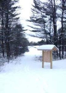
  • Hudson Farm kiosk in winterThe Appalachian Trail Conservancy manages care of the land. Trails on the property are maintained by Berrill Farm neighbors and Hanover Trails Committee volunteers. The beautiful meadows will be kept open for their spectacular views and grassland bird habitat.
  • Dogs are welcome but must be under your control; please pick up after your pet.
  • Snowmobiles, ATVs, and bicycles are not permitted.
  • In spring, wet areas make parts of this route difficult. Hunting is allowed in season.

Brief Hiking Directions

  • Follow the Old Highway 38 Trail up along the edge of the field for 0.2 mi.
  • Turn L at brown & yellow “Old Highway 38 Trail” sign for a brief detour to the nearby meadow for views.
  • Return to the sign in the first meadow and walk straight, down the hill and enter the woods.
  • Continue over boardwalks and through the woods to a junction with sign on L. Continue straight.
  • At the next junction, bear R; trail is now blazed blue.
  • Travel 0.2 mile and watch for pink flagging on trees and AT crossing (easy to miss).
  • Take sharp R onto AT; note white blaze on tree on R.  If you reach a playground you’ve gone too far.
  • Follow AT & white blazes 12 minutes to Trescott Road. Turn R.  Note orange sign at L at road.
  • Continue 0.4mi back to start.  Parking area will be at R at the base of the hill.

Full Hiking Directions

  • Begin your hike where the Old Highway 38 Trail meets Trescott Road. The Town of Hanover constructed a parking area here, opposite Partridge Road.
  • Take the path beyond the trailhead kiosk to an open field, keeping the tree line on your left. Winter is a good time to visit this expansive rolling field, which is alive with nesting bobolinks in spring and summer (when your dog should be on a leash, at least here).
  • Continue up the rise along the tree line that marks an old stone wall. You are walking through one of rural Hanover’s iconic historical farm landscapes.
  • Seven minutes’ walk up from the trailhead, you’ll reach the far corner of the field. Here you’ll notice a brown and yellow trail sign where two paths meet, directing you to the right. Instead, turn L for a brief detour through an opening in the stone wall to a second, equally beautiful meadow.
  • Stop for a moment to enjoy the expansive view. Straight ahead, the open hillside of Storrs Hill in Lebanon stands out, especially when covered in snow. At R are Rix Ledges, some of the most interesting terrain and wildlife habitat in Lebanon.
  • Approach the small group of trees in the field, 30 paces away. From this vantage point you can see Mount Ascutney rising in the distance, to the right of Rix Ledges.
  • RETURN to the first field and its brown and yellow trail sign. Until recently, you would have caught a glimpse of the late 18th century Adams Farm house. Once a lively tavern, it was likely home to the family that once owned the abandoned farmland you are exploring today.  To the R, amid a clump of trees, is a 20th century home built by later owners.  Archer Hudson, a retired architect, constructed the house as a country retreat and burned down the Adams Farm’s barn–the foundation of which remains.  Dartmouth College later purchased the property and carved off the house for resale, keeping the land.  While the College has long referred to it as the “Hudson Farm,” this is historically inaccurate as the property ceased to be a farm before the Hudsons acquired it.
  • From the trail sign, with your back to the second meadow, follow the arrow on the sign and walk straight (turning R would return you to your car) to follow the tree line down to the lowest point in the rolling field. Here the yellow-blazed Old Highway 38 Trail enters the woods. A bog bridge offers an easy way across a small wetland. On this hike you’ll encounter some huge, open-grown “pasture pines” – white pines that grew up on abandoned agricultural land, with many lower branches. Some of them are monsters!
  • Town Highway 38 has a murky history. Laid out in 1795, it originally led from Greensboro Road through this land to Trescott Road. In time it became a Class VI highway, but its exact route was so hard to trace that when planning began for the Berrill Farms neighborhood, the town agreed with the developer in 1979 on a route to be called the “Old Highway 38 Trail.” New LiDAR imagery of the Adams Farm just north shows traces
    of the old road heading toward the old tavern and then on to Trescott Road by today’s Bob Adams Road.
  • Soon you’ll ford another drainage on a crossing built in 2018 by Hanover Trails Committee volunteers. Protecting such headwater wetlands and streams from the erosion and runoff that comes with development is another reason to conserve this land – and will ultimately benefit water quality and trout habitat in Mink Brook from Etna to the Connecticut River.
  • Rising back to dry ground, you’ll encounter not one but two stone walls on the R, another reminder that this land was once open pasture. The second wall forms a corner as you approach and follows you for a distance. Fresh yellow blazes mark your path.
  • Soon, a sign at L indicates a turn in the Old Highway 38 Trail, where it will reach Greensboro Road in 0.9 miles. Instead, you continue straight toward the AT, 0.3 miles ahead.
  • As you continue, an open area is visible downhill at R; this is the forested wetland that is the source of the small drainage you crossed earlier.
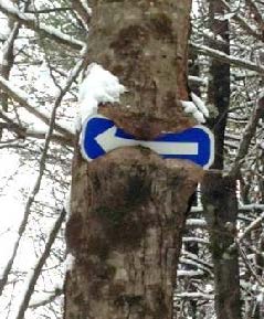
  • 25 minutes’ walk from the trailhead, you reach another junction. The trail coming in at L originates at Bblue arrow sign in a treeerrill Farms. Above to the L, a tree seems to be gnawing on a blue arrow. Ahead at R, another tree has made less progress consuming its arrow sign. Bear R here and follow the arrow and blue-blazed trail downhill past a large old wolf pine at R.
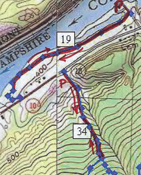
  • You’ll soon reach the yellow-blazed boundary of the original federal land embracing the Appalachian Trail corridor, before the corridor was expanded with the addition of the Hudson Farm. If there’s no snow cover today, you’ll notice the stone wall forming the old property boundary and the AT boundary pin next to the trail. Continue on the blue-blazed trail. Watch for ice underfoot as you cross a small drainage.
  • Keep an eye out for bits of “cultural debris” such as a sap bucket. This is a good time to note that hunting is permitted on the AT and federal land surrounding it, so it’s wise to wear orange if you’re out between Sept. 15 and Dec. 15.
  • A few minutes after passing the sap bucket, the famed Appalachian Trail crosses your path. While it is well marked with fresh white blazes, it can be easy to miss as the old trail continues straight. Turn R onto the AT and head for Mt. Katahdin (or maybe just your car). This is your second historic trail of the day. Benton MacKaye conceived of the regional trail in 1921, and after overcoming many obstacles including the 1938 Hurricane, World War II’s drain on trail maintainers, and the kind of political intransigence that is all too familiar, his vision became the National Scenic Appalachian Trail in 1968.
  • Hemlocks shelter the trail here; if weather conditions are right, it’s easy to see how their stiff needles and short branchlets capture and hold snow before it can fall to the ground. Deer and other wildlife take advantage of the shallower snow depths under hemlocks, where it’s easier to move around. Wildlife managers call such hemlock groves “deer yards” for this reason.
  • Soon you leave the hemlocks behind as the AT heads up a gentle knoll dominated by northern hardwoods. Continuing back down the north side, the trail enters evergreen forest again.
  • About 8 minutes after turning onto the AT, you’ll encounter another wetland. The log crossing may be buried in snow – watch your footing. In summer, this place begets very dirty dogs.Velvet Rocks trail sign
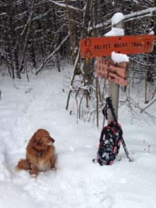
  • Four minutes later you’ll reach Trescott Road and the Dartmouth Outing Club’s orange sign for the Velvet Rocks Trail. The AT parking lot is visible to the L across the road.
  • If you left your car here, it’s time to end your hike. If not, turn R on Trescott Road and walk the 0.4 miles back down toward Etna and your car.

updated 9/1/2020


Filed Under: Hike of the Month, Hudson Farm, January Tagged With: Appalachian Trail, bobolink

Fullington Farm & Old Highway 34

December 1, 2017

Hike Directions and Trail Map – Full PDF


Fullington Farm hike mapDriving Directions

  • From Downtown Hanover, drive N on N. Park Street and turn R onto Route 10N.
  • Drive past the golf course, through a rotary, past the Richmond School, and through a smaller rotary.
  • Continue 1.5 miles past the smaller rotary on Route 10 and turn L at the entrance for Wilson’s Landing.
  • Park in the gravel-surfaced lot next to the Connecticut River. Sunset is an especially lovely time for a walk on the river path, but give yourself plenty of daylight if you plan to hike Old Highway 34.

What You Should Know

  • You can opt to explore just the gentle path along the river, the more challenging Old Highway 34, or both to get a fuller sense of the variable character of Hanover’s Connecticut River corridor.
  • You’ll be walking on lands owned by the Town of Hanover, Friends of Hanover Crew (briefly) and Dartmouth College. Conservation easements protect some but not all of this land.
  • Dogs are welcome but must be under your control; please pick up after your pet. You will need a leash.

Hiking Directions – Fullington Farm River Path

  • Begin at Wilson’s Landing. This town-owned public river access area is named for Wilson Fullington, one of a family of riverfront farmers who worked this fertile land with its ample gambrel dairy barn. That property and 2.4 acres of land are now owned by the Friends of Hanover Crew.
  • Before starting your hike, walk to the water’s edge. From here, you enjoy a splendid view up the mighty Connecticut, the largest river in New England. This area is the scene of many regional crew races on the flat water impounded by Wilder Dam, a few miles downstream. When leaves are off the trees, flat-topped Smarts Mountain in Lyme appears on the horizon to the N. The Hanover Conservation Commission recently led an extensive effort to improve the public boat landing here, adding picnic tables, comfortable benches, a dock, improved boat launch, and timber-framed information kiosk.
  • The flooding of this area by Wilder Dam in 1950 changed the shoreline, and this is a great place to look for waterfowl in the quiet backwater and for smaller birds nesting in the shrubby growth nearby. At this season the slender cattails are dispersing their seeds and look like they’re wearing shaggy fleece coats. You can admire the festive scarlet twigs of red osier dogwood – there’s a good clump next to the boat landing. This native New England shrub, which grows well in wet places, is highly valued by wildlife for its nutritious white berries. You won’t see those because they don’t last long!
  • Leave your car and walk back up the gravel drive as far as the sign at R indicating that this land is protected by the Land Conservation Investment Program and the Trust for NH Lands. This was New Hampshire’s first venture into conservation on a state-wide scale, authorized by the Legislature in 1987, which appropriated $25 million that was spent (with $3.3 million of private funds) to protect over 100,000 acres of much appreciated land before the program closed in 1993. The Huntington Hill lands nearby in Hanover were also protected through this program. The Hanover Conservancy, then known as the Hanover Conservation Council, led a fund-raising campaign for the local match. The land remains privately owned but is now protected by a permanent conservation easement held by the Town.
  • merganser in flightEnough talk, let’s walk! Turn R off the drive and onto the mown path just before the gravel path leading to the crew boathouse. Turn S along the river. For the next few minutes you’ll have a good view of the backwater, where dabbling ducks and other waterfowl shelter in this quiet area off the mainstem, especially during the fall migration. The Connecticut River is a major migration corridor for these and other birds. On the afternoon we walked this path, the lowering sun lit the white breast of a migrating common merganser, its rapid wingbeats echoing the intent of its outstretched neck as it flew south, low and fast, over the water. (R – male in flight)
  • Meadowsweet, goldenrod, and other rough herbs and shrubs grow near the bank, along with sumac, red and silver maple. This riparian buffer helps capture any sediment in the runoff from the fields that might be headed toward the river. Common among them is invasive honeysuckle, easily picked out with its scrappy bark, low arching branches, and opposite buds. This shrub is especially obvious around the gullies and cavities in the bank at the bottom of the field.
  • About 8 minutes into your walk, pass through a gap in a hedgerow marking the boundary of a larger field. You’re in a world apart – while you can hear the sounds of cars on Route 10 above and Route 5 across the river, your view is much more wholesome – all rolling fields and river. The rich soils under the sod, a gift of the river, are among the most fertile in the country. Indeed, they are among the most valuable agricultural soils in Hanover.
  • The mown path curves R around a gully; glance to the N for a nice view of Smarts Mountain and the point of wet land extending downstream from Wilson’s Landing (when leaves are off the trees).
  • Soon the big white barn of the Dartmouth Organic Farm comes into view above at L, along with the low building now housing the Hampshire Cooperative Nursery School. These are the current uses of what was the last dairy farm of any significance in Hanover – the Dartmouth Dairy, also known as the Fullington Farm. Four generations of Fullingtons worked this land, most recently with a milk processing and bottling plant run by Haslett Fullington and his brother, Wilson. Their fleet of trucks delivered milk produced by their herd of Guernseys to the college and beyond. Dartmouth bought the property in 1972.
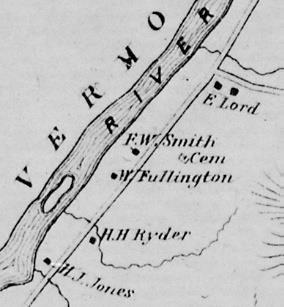
  • 1892 Fullington area map
    1892 map of the area

    The Fullingtons had been on the land since at least 1860, and lived in the c. 1820 cape house that stood near the large and handsome early barn. In 1885, the Grafton County Gazetteer listed William Fullington as farming 220 acres with 300 head of registered Merino sheep and a sugarbush of 120 maples. The College tore down the nearly 200-year-old farmhouse in the summer of 2017. (R- 1892 map of the area)

  • Today, your path passes an experimental planting area, bee hives, and a nursery of evergreen and deciduous trees on the fields where the Fullingtons once grew feed for their cows or pastured their sheep. The path approaches the south boundary where a gravel drive curves up to Route 10. You can walk back to your car along the road, but it’s more fun to retrace your steps and head north on the mown path along the river.
  • As you do, note the sole many-stemmed tree standing nearby on the riverbank, a sole representative of the grand and towering silver maple floodplain forest that once blanketed the riverbottom here – after the glacier left but before European settlers cleared the alluvial plains for farming, before the Smiths and Fullingtons, and before Wilder Dam inundated the shoreline. Silver maples tolerate flooding and are supremely adapted to such a setting.
  • As you return N, the pine-studded crest of an esker looms beyond the barn roof. This is part of a ribbon of sand left behind by melting water under the glacier as it covered this area thousands of years ago. You can explore another piece of this geological ribbon at the South Esker (Hanover Hike of the Month, August).
  • The low sun of the approaching winter plays tricks as you walk N along the river. Your shadow reaches forty feet ahead and the light reflects off the river, illuminating golden brown oak leaves still clinging to their branches. Oaks are thought to have evolved in the south and never developed the knack of dropping their leaves in fall as those of northern maples and birches do.
  • Pass through the hedgerow and enjoy a fine view of the beautiful white dairy barn.
  • It appears that both the old farms you pass on this walk have been present for centuries – no surprise given their desirable soils. Just north of the barn, a fine two-story farmhouse stood from 1771 until it was torn down in 2018. Historic maps indicate that this riverfront farm was occupied by one I. Smith in 1855 (when the Fullington Farm was owned by a B. Tisdale), and in 1892 by F. W. Smith. We’re guessing that the Fullingtons bought their neighbors’ place sometime around 1910 to make room for a son and his family, updating the old Smith farmhouse with a generous front porch.
  • Turn L toward the boat landing and back to your car. Resolve to return for a family picnic by the river!

Hiking Directions – Old Highway 34

  • If you have another half hour and energy to spare, cap off your adventure with another hike into the past. If it is hunting season, you’ll want to dress in fashion – blaze orange.
  • You can either walk or drive to the nearby trailhead. Return to Route 10, turn R and then L up a short gravel drive. This leads to an unmarked parking area N of the flat old river terrace that today sees less action from glacial Lake Hitchcock and more from soccer players. In winter, trucks deliver snow plowed from downtown streets to this spot, allowing it to melt into the ground close to the river where any contaminants mixed with the snow cannot interfere with drinking water wells or the river directly.
  • Walk around the green metal gate across the entrance to the old road. In 1794, Highway 34 ran “from Ezra Carpenter’s on the Wolfeboro Road to Elias Newton’s on the River Road” (meaning Route 10). Its S end continues as Grasse Road linking Reservoir Road to Trescott Road. In 1979, Town Meeting voted to discontinue the N part subject to gates and bars such as this one. The Town still owns the right of way.
  • You’ll soon reach signs indicating the college’s shooting range; the old road probably passed through that area. Instead, you will turn R, away from the range, and skirt the L edge of the field, hiking uphill. The college’s sugarhouse is visible at R. Does the sap from William Fullington’s 120 maples boil there?
  • When the nursery school is in session, this area becomes an outdoor classroom. It looks like fun!
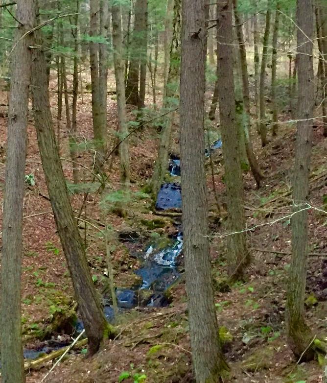
  • unnamed brook in Fullington areaNo more than 5 minutes from the gate, the narrow historic road becomes evident again, passing straight up into the woods. It climbs steadily on the R side of a narrow little valley, heavily wooded with large hemlocks and white pine. One can only imagine the strength required of a farm horse to draw a laden wagon up this hill. The remains of an old stone wall appear at R, confirming the nature of the old way. An unnamed stream tumbles down the hillside at L through a shaded and undisturbed valley. It’s the clear waters of small, cool, well-oxygenated streams like this that provide relief for fish in the Connecticut River below.
  • 10 minutes from the lower gate, you’ll reach another one. This is your turnaround point today. Pause to note a lovely small waterfall at L (photo). At R is undeniable evidence that the forest beyond was once the Fullingtons’ diligently maintained pasture – many strands of barbed wire still attached to the stump of a long-dead tree.
  • At this point, Highway 34 bears gently R and enters a maze of trails on Oak Hill before it ends at Reservoir Road, 1.8 miles from your starting point. That’s a challenge for another day.
  • Return to your car, enjoying the gentle conversation of the brook and wondering, as we do, why it never earned a proper name. We think it should be Fullington Brook.

December 2017, updated August 2020

Filed Under: December, Hike of the Month Tagged With: Class VI Road, Fullington Farm, Highway 34, merganser

  • « Previous Page
  • 1
  • …
  • 3
  • 4
  • 5
  • 6
  • 7
  • 8
  • Next Page »

71 Lyme Road
Hanover, NH 03755
(603) 643-3433

info@hanoverconservancy.org

Facebook logo   Instagram   YouTube

Get Involved

Become a Member

Volunteer

Business Sponsors

Conserve Your Land

Employment

Our Mission

Advocacy

Conservation

Education

Stewardship

Explore Hanover

Hanover Hikes

Upcoming Events

Upper Valley Hikes

Trails Challenge

Copyright © 2026 Hanover Conservancy | Design by Chase Brook Software