From downtown Hanover and the Green, follow Route 10 N for 4.2 miles to River Road and turn L.
Follow River Road for 0.5 mile.
Just past Purling Brooks Drive, cross Slade Brook near its confluence with the Connecticut River.
Turn immediately R into the small parking area.
What You Should Know
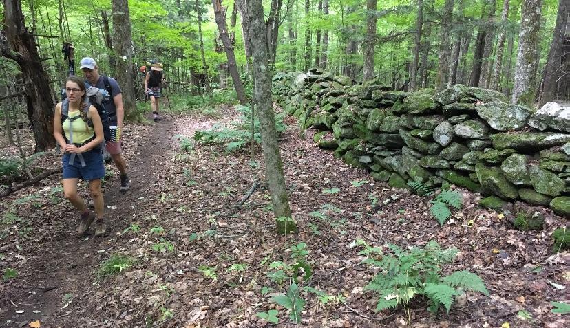
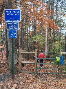
Today’s hike begins at the Hanover Conservancy’s Jim and Evalyn Hornig Natural Area at Lower Slade Brook. It continues on land owned by DHMC to Rt. 10, then follows Rt. 10 N to Pipers Lane. A short walk through this neighborhood ends at the Class VI section, a rough lane past town-owned land down to River Road, where you’ll enjoy river views on the way back to your car.
Bring binoculars and guides to both birds and wildflowers. Spring has arrived in all its diversity!
Foot travel only in the Natural Area.
Please pick up after your pet. Dogs must be under your strict control, especially while passing along Rt. 10 and through the Pipers Lane neighborhood.
The trail in the Natural Area is not blazed but is easy to follow. Wooden arrows and signs mark turns.
Brief Hiking Directions
Start on the trail that begins at the kiosk.
After the third waterfall, the trail bears L and uphill. After leaving the Natural Area, turn R at signs for Rt. 10.
Turn L on Rte. 10 and follow the shoulder 0.4 miles to Pipers Lane.
Turn L on Pipers Lane and follow to its maintained end. Continue on the unmaintained section to River Road.
Turn L on River Road and walk 0.5 miles to return to your car.
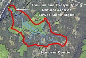
Slade Brook watershed
The Full Story
Take a moment to check the kiosk display and map before embarking on the trail beyond the rocks.
Slade Brook flows 4.0 miles from a wetland near Three Mile Road west to the Connecticut River, draining a largely forested 2.55 square mile watershed. Nearly a third of this watershed is permanently protected, including the 38-acre Lower Slade Brook Natural Area, Huntington Hill Wildlife Management Area, Moister Meadow, and several other parcels.
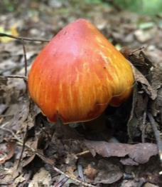
At this time of year, the dark green of stiff-stemmed horsetail, or scouring rush, is prominent. Our forebears used this primitive native plant, its tissues naturally fortified with silica, to scrub dishes.
The brook takes its name from Capt. Samuel Slade (1747-1826), a leading citizen of Hanover who came to town around 1774. He served in the Revolutionary War at Fort Ticonderoga. He, his wife Sarah, and their 13 children lived a mile north of Hanover Center (house later burned). His grandson, Samuel Thompson Slade (b. 1810) married a Huntington girl from the neighborhood. Generations of Slades are buried at Hanover Center.
Louisiana waterthrushIn May, migrating songbirds using the Connecticut River as a flyway will linger near the river in forests like this as they prepare to return to their upland breeding grounds. Listen as you walk for the Louisiana waterthrush. The male’s song is a musical, distinctive series of descending notes followed by a warble. The hilly forest surrounding Slade Brook offers prime habitat for this bird. The NH Fish & Game Department recognizes the Slade Brook corridor as among the highest quality habitat in the state.
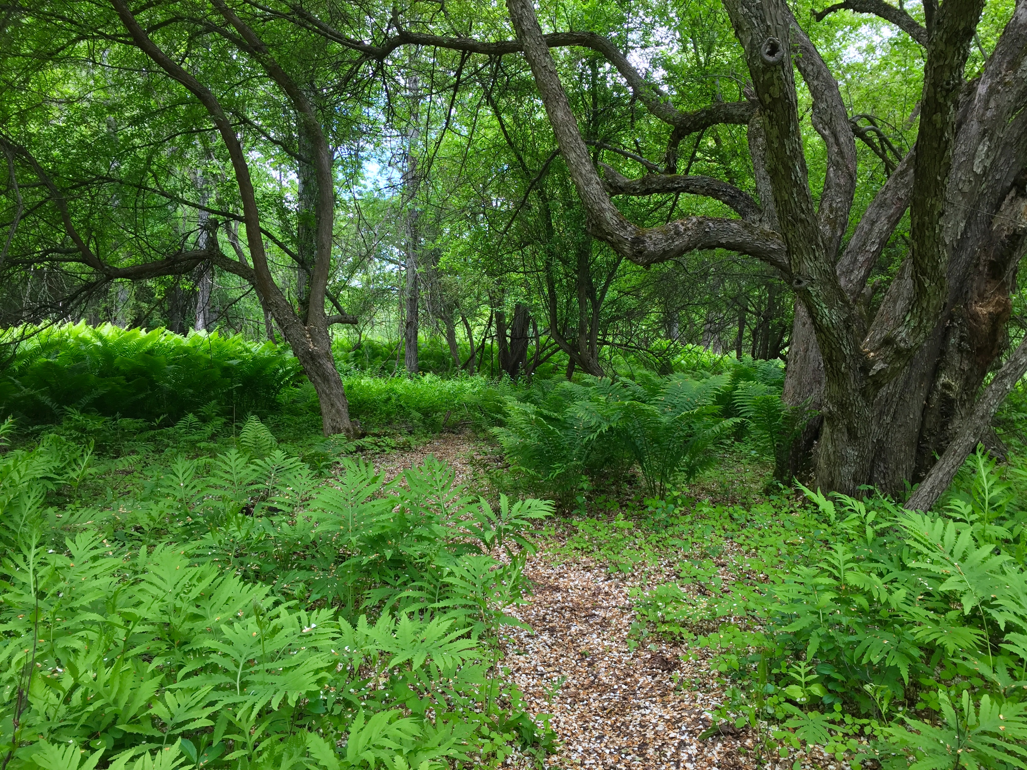
The trail follows a gently rising path on a terrace above the brook that may have been an early tote road.
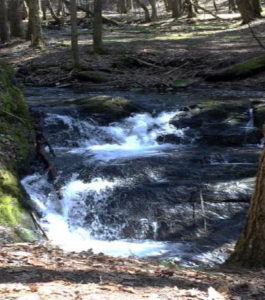
Within a few minutes’ walk from your car, the first flume comes into view and the trail heads up a short rise. A second flume appears above the first. They are at their sparkling best at this time of year.
The trail soon levels again and offers a view down onto the floodplain of the brook at R. The wet, mossy expanse hints at its value for storing water during heavy rains and snowmelt.
As you continue, the trail moves a short distance from the brook into a grove of hemlock, yellow birch, and white pine. Admire the birches’ glowing papery bark. Some, growing on the rotting remains of old fallen trees, are working on a giraffe imitation as their roots stretch down to the soil. The forest promises a cool retreat when you return on a hot summer day.
About 12 minutes’ walk from your car, you catch the sound of water again, drawing you a few feet off the trail to a log bench built by Conservancy volunteers. Here you can view the uppermost and largest waterfall. The brook tumbles down stepped ledges, hemmed in by a sheer moss-covered wall, and then sluices away to the SW through a short, narrow gorge. The entire 1,630 acre watershed drains through this slender point.
After admiring the falls, continue up the path. Stepping stones lead across the brook to a short (0.15 mile) side trail to the Purling Brooks neighborhood. The public may use this trail as far as the Natural Area boundary, but it’s not on our route today.
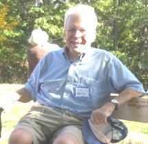
Jim HornigWhen a developer proposed 17 houses here, the Conservancy (then the Hanover Conservation Council) suggested an alternative that resulted in 10 homes clustered on 20 acres on the site of a former gravel pit S of the brook, with the rest of the property left intact. This solution protected the brook and its valley, allowing the public to enjoy the waterfalls and trails. The Conservancy also holds a conservation easement on the stream-side portions of the house lots on the far side. Jim Hornig, former president of the Council, was the inspiring force behind this idea, and in 2005 the Council named the Natural Area in honor of Jim (right) and his wife, Evalyn.
Watch for the sharp L turn as the trail heads away from the brook and somewhat steeply up to the height of land. About 5 minutes past the falls, you’ll see a remnant of barbed wire at R, marked with flagging, a reminder of the grazing history of this area.
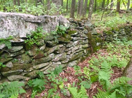
The trail continues past the Conservancy boundary to a junction with signs. Turn R onto a nearly flat logging road that leads 0.25 miles to Rt. 10. An old stone wall, a reminder of this land’s former farming history, is at L.
You’re now passing over land bequeathed to the hospital that is occasionally logged for income. This becomes clear as you arrive at a wide log landing with a recently thinned (2017) red pine plantation at R.
5 minutes later, the sound of occasional traffic announces your arrival at Rt. 10, where a chain blocks the logging road. Turn L on Rt. 10 for the 10-minute walk on the shoulder of the wide state highway, a stark contrast to the historic Class VI road you’ll soon visit.
10 minutes later, turn L onto Pipers Lane. A one-room schoolhouse, known as the County Road School, stood on this corner from at least 1855 through 1892. By 1926 it had been moved across the road.
Now a dispersed residential neighborhood, this area was once part of the Piper Farm. Today, it’s something of a showcase for solar energy installations by ReVision Energy. At #2, a 8.4kW system has 30 modules mounted on the ground in two separate arrays that will produce 10,222 kWh/year of electricity. This also helps heat and cool the home with air source heat pumps. Nearby at #3, a 11.52 kW system with 36 roof-mounted modules can produce 10,587 kWh/year of electricity. A bit further down the lane, at #9, is a 10.24kW system with 32 modules that can produce nearly that amount.
This reminds us that the Dartmouth Organic Farm you may have passed on the way to River Road has a 9.8kW solar array put up by ReVision that has been operating since 2017. The array, mounted on the S side of the newer barn’s roof, is set to produce 11,000 kWh of electricity (14% of what the farm used then).
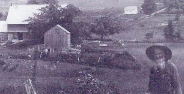
About 10 minutes’ gentle walk from Route 10, arrive at two architecturally distinct homes book-ending the last traveled portion of Pipers Lane. At L is a sleek modern home facing the beautiful Slade Brook Valley. Its open fields and forested edges are fine wildlife habitat. At R is an historic house, home in the 19th century to generations of the Smith family. Note the granite hitching post out front. (Map at R – 1892)
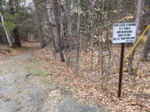
1892 mapThings are pretty quiet here now, but maybe less so 200 years ago. Laid out in 1816, this road connected River Road with “the County Road” (now Lyme Road/Route 10). In 1932, the steep, difficult-to-maintain lower (NW) end was finally discontinued and made subject to gates and bars. You’ll see why very shortly. By that time, it had been called Pipers Lane for decades, after the family owning the nearby farm. The town still owns the right of way over the old road, not the roadbed itself.
A few steps down the historic road, bear R at a Y, following an old stone wall at R topped with barbed wire, a reminder of open pastures of earlier times. Soon the road swings N as it follows the steep and winding path of a small drainage. This drainage, which you’ll be hopping over occasionally, may be not be impressive now, but at one time it had the power to gouge out the ravine you’re now descending. Indeed, this is a classic remnant of glacial Lake Hitchcock. This steep, narrow cut was carved out thousands of years ago by a wandering Slade Brook as it scoured through the soft lake-bottom sediments left behind by the retreating glacial lake. You can visit several other places in Hanover that exhibit this same dramatic effect: Trout Brook trail at the Mink Brook Nature Preserve, Kendal Riverfront Park, and the Rinker-Steele Natural Area.
Starting at the sharp bend in the old road, you’ll be passing the Beryl Piper Little Nature Preserve on the R for the next 1/3 mile. This 3.4 acre parcel was purchased by the Town of Hanover from the Piper family in 2004. Year-round, the looming slopes of the ravine are clothed with evergreen Christmas fern, but at this time of year, ephemeral spring wildflowers may pop up among them. Most are native, but you may find the cheerful, early yellow daisy-like flowers of introduced coltsfoot, especially in disturbed areas.
Near the bottom of the ravine you cross a forlorn heaved culvert, the bane of a road crew’s days. A sudden heavy storm uprooted it a few years ago as the old road washed out yet again.
This place might be a highway engineer’s nightmare, but it is also a dream for dogtooth violet, also known as trout lily. Its camouflaged leaves of green splotched with brown suddenly appear at this time of year, followed by single (sometimes two) nodding yellow down-ward facing lily flowers.
The old road eventually leads you to River Rd, near the junction of Grant Rd. The Connecticut itself appears beyond the houses perched just above its floodplain. Turn L for the easy ½-mile walk back to your car.
Just past #30 River Road, the river draws close. The Hanover Conservancy owns 900 feet of riverbank here, acquired in 2005 with the Lower Slade Brook Natural Area.
As you arrive back at your car, take a moment to view the confluence of tiny Slade Brook with the largest river in New England. From its headwaters in Hanover Center, its waters are now joining those of thousands of others on their way to Long Island Sound.
This Hanover Hike of the Month has been generously sponsored by
Although our spring trips are postponed due to the coronavirus epidemic, you can head out on the trails with your own self-guided adventure: our Hanover Hikes of the Month! Trail maps and detailed history on all our properties are available on our website, at trailheads and in the printed guides at kiosks.
People everywhere are taking advantage of opportunities to get outside, and we continue to be grateful for our founders’ foresight in protecting natural areas for all future generations to enjoy. Please stay off muddy trails to prevent erosion, keep your dog on a 6′ leash or shorter to maintain a safe distance from other hikers and dogs, and pack out all trash. Ticks are ACTIVE, so don’t forget a tick check at home!
From Downtown Hanover and the Green, drive E on East Wheelock St. and up the hill 1.7 miles to the junction of E. Wheelock, Grasse, and Trescott Roads. Continue straight on Trescott Rd. and
drive 2.4 more miles to Etna Rd. Turn L and head N on Etna Rd. 1.3 miles to Dogford Rd. Turn L; follow 1.2 miles to parking on L after sharp bend and pond.
Park at the marked trailhead parking area near the kiosk.
What you should know
Today’s hike is a loop on lands owned by the Trescott Water Company (Town/Dartmouth).
This is a great route for confident backcountry skiers.
The route follows two 18th century roads, visits two cellar holes, and returns on a new trail (2019).
As of 2019, all trails described here are blazed with yellow and marked with brown and yellow signs, thanks to the Trescott Recreation and Hanover Trails Committees.
Dogs must be leashed while on the Trescott Water Supply Lands and waste must be picked up and
carried out in order to protect drinking water.
Brief Hiking Directions
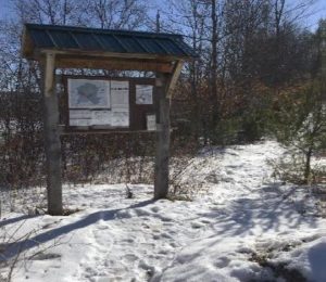
Start on the Poor Farm Trail that begins at R of the trailhead kiosk.
The trail soon reaches an historic road; turn R and continue.
Follow the Poor Farm Trail E as it turns R off the old road.
Continue to Knapp Road and turn R.
Turn R on the Child’s Farm Trail for 0.6 miles and return to your car.
The Full Story
Welcome to your water source! Drinking water for much of Hanover and Dartmouth College comes from these lands, so special rules apply for recreational use. Take a moment to check the kiosk display to acquaint yourself with these rules and pick up a trail guide.
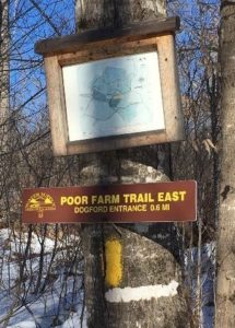
Start at the path to the R of the kiosk; a few steps in, a sign at L identifies it as the Poor Farm Trail East, 0.6 miles to Knapp Road. The easy trail parallels Dogford Road before swinging R at a distinctly raised, flat spot that is the site of the old Wright place. Snow may obscure it today; the photo below gives you an idea of what you’re missing. Wright was raising sheep on this land in 1855; by 1892, J.W. and W.D. Chandler had taken over his farm.
As the trail swings L again, note blue tubes on both sides of the trail. These protect young tree seedlings from deer browse. The foresters managing this land are working hard to re-establish native trees in a place with a dense deer population – the water supply lands had essentially been a deer sanctuary for half a century while people (and hunters) were fenced out. Deer prefer to browse the northern hardwoods like maple, birch, beech, and oak that make a healthy natural forest and therefore a pure drinking water supply. This is one reason why deer hunting is strongly encouraged on these lands.
Soon the path joins the wide old Wolfeboro Road, with its graceful stone walls and venerable sugar maples. Today, the Hanover emergency services folks insist on a different name to avoid confusion when attempting a rescue, so this section is now called Poor Farm Trail East.
Governor John Wentworth
Royal Governor John Wentworth ordered the cutting of this road in 1770 in hopes of traveling over it from his home in Wolfeborough, NH, to attend Dartmouth College’s first commencement in 1771. A committee of Hanover citizens was appointed to “…run a line from near the southwest corner of Hanover to the Great Pond, or Governor’s seat, at Wolfeborough, and view the situation of the land and convenience for a highway, and make return the first Monday in October next.” Members were paid four shillings and sixpence per day and spent ten days surveying the route. Hanover landowners were assessed a penny and a half per acre to raise the 120£ needed to complete the road. The road wasn’t finished in time, however, and the Governor had to travel by way of Haverhill to attend the first commencement, but by 1772 it was ready for the second ceremony.
Wentworth, appointed in 1766 by King George III to take over management of the colony of New Hampshire from his infamous uncle Benning, helped Eleazar Wheelock secure the charter for Dartmouth College. Here he appears as quite the dandy, but indeed he was an eager outdoorsman and leapt at any chance to go camping and rusticating in his colony’s abundant wilderness. While he was on the trail happily getting dirty and sleeping on the ground, his wife was planning her fancy ballroom at their estate in the Lakes Region.
The Wolfeboro Road was probably only the second road in Hanover to be properly laid out, mapped, and recorded. Like many early roads, over the years its location has shifted. The entire road remained in use through the 19th century until construction of the Fletcher Reservoir in 1893 interrupted its path. Today many sections, including this one and the stretch that goes bravely up and over Moose Mountain, are Class VI roads. No wonder Emergency Services gets confused.
Follow the wide old road gently down the slope. A bit over 10 minutes from your car, your route swings R as the old road plunges toward what is now the Parker Reservoir, an area now off-limits to the public. Note the map posted on a tree at R. As you near the bottom of the hollow, note the gleaming golden bark of yellow birch at R, a most handsome tree.
20 minutes from your car, cross a stream headed for the Parker Reservoir. Pause to look upstream – at this season, with leaves off the trees, you get a good view of a well-laid stone wall running along the hillside above. One of Mr. Wright’s creations?
Climb up and out of the little valley. At the top, the trail bears L and flattens out.
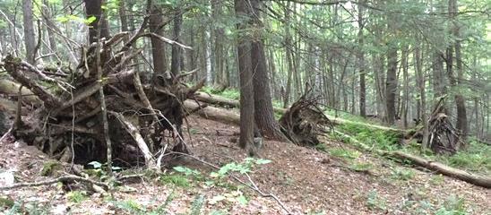
At R note a plantation of small red pines, thigh-high at this writing. The Trescott lands experienced major blowdowns during the 2007 Patriot’s Day Windstorm, and two million board feet of logs and 3,100 cords of pulp were salvaged. This storm hit heaviest in the plantations, leaving natural stands largely unaffected. While the forest management plan for the Trescott lands calls for creating more natural, uneven-aged stands rather than even-aged plantations, this area is an exception to keep the slopes from becoming overrun by invasive buckthorn and other non-natives.
Proceed along the level trail, catching glimpses of Parker Reservoir below at L through the trees.
30 minutes from your car, arrive at Knapp Road, identified by a sign just across the way and a map posted at R. Turn R and follow this historic road up the hill. Knapp Road was laid out Nov. 13, 1793, named for Lt. Peter Knapp of Hanover’s Revolutionary War-era militia. The cellar hole of his homestead is just below where this road meets another part of the Wolfeboro Road. In the late 1700s, that was a busy intersection!
A minute’s walk up the hill brings you to a sign at L interpreting the history of the Town Poor Farm, which once stood in the field beyond the road. That’s a great place to explore in spring.
Ms. Hadden’s 7th Grade group “Power of We”
Continue to the top of a small rise and look for a small cellar hole at R in a circle of pines. Here is what seems like the remains of a very small house. Actually, most early homes had cellars under only a part, as a cellar was not easy to dig and was needed just for storage of apples and other supplies, not for the many purposes to which we put basements today. This was the home of P. W. Durkee in 1855, and by the 1880 census, government workers recorded the four Hewitts here – Elbert, 36 years old, a farmer; his 34-year-old wife Augusta, keeping house; their 12-year-old daughter Mary and 10-year-old son Charles, who both attended the District #4 one-room schoolhouse at the bottom of the hill. (Thanks to Ms. Hadden’s 7th grade group at the Richmond School, who researched this site and helped clear it of brush for their “Power of We” project in 2019.) In 1903, it was owned by Newton Frost until the Water Company bought his place and demolished it along with nine other farms.
Continue up Knapp Rd another 100 paces to a sign at R for the Childs Farm Trail. From here, it’s an easy 0.5 miles back to your car. Before turning onto the trail, look back down the road, noting the pines ringing the cellar hole at the edge of your view. This must have been a beautiful place to live.
Back to the mundane – is your dog still on its leash? There are porcupines nearby. Indeed, the next trail up the hill is named the Porcupine Trail for a good reason.
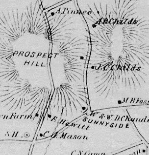
1892 map showing Childs farm
In the 1880s and 90s, the northeastern part of the Trescott lands were part of the home farm of Joseph Childs, his wife Christiane, and their children Arthur, Mabel, Myrtle, and Marcellus. Joseph was a major landowner with 500 acres, including a sugar orchard of 800 trees and an apple orchard of 200 trees, plus 10 cows, 12 horses, and 200 Merino sheep. The 1892 map at right shows Joseph’s location; he had set his son Arthur up in the next place north.
Strike out through the meadow on the Childs Farm Trail. The yellow-blazed trail is mostly flat and follows the contour, except where it dips when crossing a few small drainages. You’re now passing above the most recent plantation you saw from below, and have a better view of earlier plantings and a pine-backed ridge.
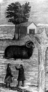
15 minutes after leaving Knapp Road, cross a second small stream and then climb gently to a small height of land. A low stone wall angles in at L; it may be barely visible in the snow. This is one of over a quarter million miles of stone walls built in New England and New York in the early-mid 19th century, largely in response to the rise of the Merino sheep industry (left). When the landscape-altering wool textile industry eventually went south, much of the human population went west, and the forest returned to cloak the hillsides where hundreds of sheep once grazed. In the mixed-age, mixed species forest surrounding you today, larger stumps are evidence of a previous harvest of trees that got their start a century ago.
5 minutes later, you emerge into an open meadow that has been partly planted with young pines. At your appearance, finches erupt from feeding on seed heads in the scrub.
As your car comes into sight, a trail joins at R – a glance over your shoulder confirms it’s the Coyote Connector, an alternative route to Knapp Road.
As you approach the parking area, enjoy the view of Muscle In Your Arm Farm on the slope across Dogford Road, another part of the former Childs Farm. Its open sheep pastures, laced with stone walls lined with sugar maples, echo the view that you would have encountered a century ago on the lands you have just explored.
This Hanover Hike of the Month
has been generously sponsored by
From Downtown Hanover, drive S on S. Main St. for 0.3 miles
Parking area is on R just before electric substation and bridge over Mink Brook.
What You Should Know
Start your hike AFTER 11AM if you’d like to do the loop and visit the garden. Bring binoculars and a bird book!
Today’s hike takes you along lower Mink Brook on a flat, ADA accessible path with benches. You can retrace your steps OR
For a more challenging hike, continue on the banks of the CT River on a narrow, sometimes steep path and climb to the neighborhood tucked behind downtown. Return on quiet streets, visiting a small meditation garden that glows in fall.
Dogs are welcome if under your control. Please pick up after your pet.
Foot travel only.
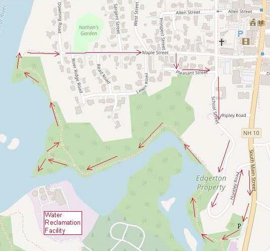
Brief Hiking Directions
Take the gravel path down through the gate and bear R along Mink Brook.
The gravel path ends across from the Water Reclamation Facility. Turn around here OR
Stay straight on a woods path; turn R at river’s edge
Follow path along river to wood steps
Climb wood steps to gate at Maple St./Downing St.
Walk down Maple St.; turn R on Pleasant St. and R on School St.
Follow School St. to sharp curve; visit Li Graben Meditation Garden
Continue on School St. (becomes Huntley Ave.)
Turn R onto S. Main St. and return to your car.
The Full Story
Walk toward the electric station, bearing R before its parking lot, and go through the gate (better ADA access is from this lower lot). Bear R onto the packed gravel path along the water. You’ll notice that the trees are alive with birds at this season, stocking up on seeds and berries before launching themselves into the great migratory stream of wings that flows south along the Connecticut River flyway in fall.
The Town of Hanover undertook an ambitious project in the summer/fall of 2019 to create a 3,700 foot fully ADA compliant, accessible path along this beautiful stream (marked in red on aerial photo). Benches beckon visitors to stop and enjoy the views, reflections, and especially the waterfowl that frequent this area.
Note the blue and white tags identifying this as Town Conservation land. Working with the Town, the Hanover Conservancy (then the Hanover Conservation Council) contributed half the purchase price for the 15.7 acre former Edgerton property on Mink
Brook and the river in 1973. With protection of the Conservancy’s Mink Brook Nature Preserve just upstream in 1999, nearly 2 miles of the stream are now protected and open to the public.
Fall is the perfect time to enjoy the foliage and feathered things here. The flame of maples may be winding down, but the oaks are golden bronze and we can (if grudgingly) enjoy the brilliant foliage of burning bush, an invasive garden escape. Note the sewer covers along the path – you and the wastewater piped under your feet are both traveling in the same direction – toward renewal! Thankfully, the Water Reclamation Facility (once known as a wastewater treatment plant) to which it is headed has restored Mink Brook and the Connecticut River from the ugly open sewers of the 1960s back to the beautiful waterways they are today.
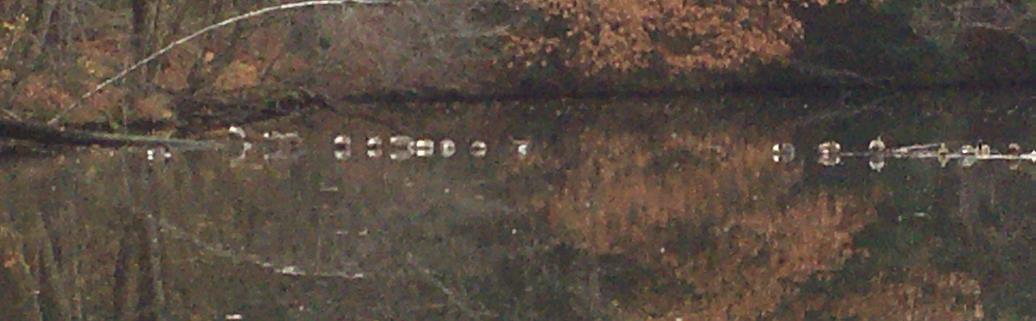
Lower Mink Brook, so close to the Connecticut River flyway, is known for its waterfowl. On the day we scouted this route (Oct. 30), two male hooded mergansers (R ) were bobbing their bright white mops of head feathers and croaking in attempts to impress the less gaudy females with them. Further downstream, a dozen Canada geese rested on a fallen log (below). Occasional broad stone slabs and more formal benches invite you to stop to watch.
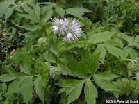
At the first bend you’ll see pink flagging marking a patch of Virginia waterleaf (L), a plant of moist woods and floodplains, considered threatened in NH. It is protected here.
As you proceed, note the steep slopes at R, decorated with evergreen Christmas fern.
Like similar slopes at the Rinker-Steele Natural Area and Kendal Riverfront Park, these are remnants of Lake Hitchcock, which flooded this area as the glacier receded.
The brook bends, its original channel filled with river water backed up behind Wilder Dam just a short distance downstream on the Connecticut. Before the dam was built in 1950, this would have been a narrow but obviously flowing stream, probably small and shallow enough to wade through at this time of year.
Soon the Water Reclamation Facility comes into view. 20 minutes’ walk from your car, and opposite the plant, the ADA path ends. Here you can choose to turn around and see what new birds might have alighted in your wake, or continue on.
To continue, proceed straight ahead on an un-blazed woods path across a wet area and up a knob. At the top, turn L for a short way to where the path ends at the mouth of Mink Brook. Take care on the hemlock-clad point – the clay soils are slippery when wet. The brook may be narrow here, but it is the largest in Hanover, draining an 18 sq.mi. watershed from the ridge of Moose Mtn. through Etna and along Greensboro Road.
Return to the intersection and stay straight down a short hill, following the river for <15 minutes to another viewpoint. The path narrows as it passes another inlet. Stay L along the water as several paths join at R. The trail is narrow and benched, and passes a small island that was part of the shore before Wilder Dam flooded the area. Sinewy stems of ironwood or musclewood trees lean toward the water. Across the river a short section of railroad bed is visible, but beyond the sounds of I-91 and yard work in the neighborhood above, you might as well be 100 miles from civilization.
The trail, unmarked but easy to follow, skirts another backwater and rises to another point of land. Watch for bald eagles – on our scouting day, an immature and an adult were perching overhead. Eagles have made a substantial comeback in the last 10 years, with dozens of nests along the Connecticut where there was only one in 1995. Some overwinter in this area, where they fish in the open water around Wilder Dam.
The view S from the point includes the pine and hemlock-clad South Esker, another natural area purchased by the Conservancy and Town in 1971. See our Hikes of the Month to visit those trails. Across the river appear benches and trails at the Montshire Museum in VT.
The trail passes over a steep-sided ridge with water on both sides. A few minutes later, take the R fork through a cut in a large log and head up a set of wooden steps. The trail swings R, edged with sections of cut log, and then curves up more steeply among the homes on the ridge above. Wood steps are your guide.
7 minutes’ hike up from the eagles’ point, arrive at the top of the ridge and a gate (walk around) at the junction of Maple and Downing Streets. A handsome new kiosk displays a useful map and signs remind that the trail is open from dawn to dusk only. Parking for this part of the trail is at the other end of Maple Street.
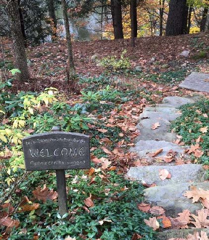
Start down Maple St.; opposite the junction with River Ridge Rd,, look for the entrance to Nathan’s Garden at L. This beautiful secluded natural area (R ) is open to the public (dawn to dusk) through the kindness of the landowner. Make a note to come back in spring and summer.
Continue on Maple St. Can you spot the bear family on a weathervane? For all the civilized look of this neighborhood, it’s prime bear territory, or at least it was until the neighbors took in their birdfeeders and covered up their compost piles, and the bears went elsewhere.
This part of the hike (<½ hour) makes you wish you’d brought a field guide to historic architecture along with your bird guide. Turrets, porches, eave decorations, fanciful shingles, and even stained glass panels evoke the 1860s-1920s when this neighborhood grew up. It’s a pleasant mix of Italianate, Second Empire, Stick, Queen Anne, Shingle, and Colonial Revival styles. Bright-leaved barberry and burning bush decorate front yards, more appropriate habitat than streambanks.
Turn R on Pleasant St. and enjoy the view out over the Mink Brook valley as it curves to the L.
Turn R on School St. If you are pressed for time, turn L on Ripley and R onto S. Main St. to return to your car.
You’ll be glad you continued on School St., passing the pretty forested section at L, and over the brook at R.
Just before the street curves L, watch for a small sign at R welcoming you to the Li Graben Meditation Garden, open noon to sunset. Follow the short stone path and turn R onto a wooden deck path that leads to a tiny covered seating area. Here, you can contemplate the brook below and a peaceful scene created by stones arranged in a gravel bed. Azaleas will be bouncing with color in spring, but at this time of year, you’re treated to the brilliant yellow feathery blossoms of witchhazel (L)! Sit for a bit to enjoy the silent company of a public-spirited landowner who provides this space. In the shelter, discover a journal of poems left by visitors, including one who declared, “the river is Byootyefl!”
Return to School St. and follow it down as it becomes Huntley Rd., marveling at this neighborhood arranged on the challenging terrain left by glacial Lake Hitchcock.
Turn R onto S. Main Street. Your car is close, but the fun is not over. Just as the small parking area comes into view, note the Greek Revival style brick cape that sits across the road on your L. This house was built in 1840 by Ruben Benton, a Hanover selectman at the time, when his earlier home burned. In 1852, Ruben’s son Charles added a massive barn (131’ x 45’, four stories high) that was a landmark in town for a century. In 1885, the Benton Farm included 150 acres of land in Hanover and 174 in abutting Lebanon, 140 Merino sheep, and a sawmill. That land included the brook side area you’ve just explored plus the Mink Brook Nature Preserve and much more.
The Benton Farm – view N to Hanover village across Mink Brook c. 1865
After Charles Benton’s death, his family sold the farm to Dartmouth College for $4,500. Five years later in 1903, the college traded this farm for Charles Stone’s farm on the Wolfeboro Road in the future Trescott Water Supply lands to make room for the new Fletcher Reservoir. Stone milked his dairy herd at the Trescott lands in the morning, herded them down Reservoir and Lyme Roads into town and down Main Street, and milked them in their new barn that evening.
The Stones later sold off pieces of their farm to the electric company (1928), to the town to re-route S. Main Street, to the hydro power company to allow Wilder Dam to flood the lower brook, and for residential development on parts of Buell St., Mourlyn, and S. Main, among other things. Finally, in 1949, the Stones sold the remaining 169 acres to three families who developed the residential area around Brook Road, and the landmark barn came down.
Time to return to your car at R.
This Hanover Hike of the Month has been generously sponsored by
From Downtown Hanover and the Green, drive E on E. Wheelock St. and up the hill 1.7 miles to Grasse Road. Turn L onto Grasse Road.
Park at the public ballfield parking area at 41 Grasse Road, outside the fence at the water treatment facility.
What You Should Know
Today’s hike takes you on a loop that tours the east and north slopes of the Balch Hill Natural
Area from neighborhood lanes and returns on the historic Wolfeboro Road, on lands owned by Dartmouth College and the Town of Hanover.
Dogs are welcome if under your control. Please pick up after your pet.
Archery season begins Sept. 15 and it is wise to wear blaze orange until Dec. 15.
Brief Hiking Directions
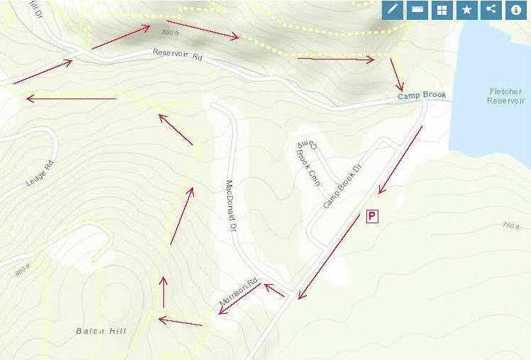
Turn L onto Grasse Rd to MacDonald Dr.
Turn R onto MacDonald Dr. and L onto Morrison Rd.
At far end of cul-de-sac, take steps up to trail
Turn R on the Garipay Trail
Take sharp R onto the Maple Trail
Turn L on Dot Strong Trail; at private drive, turn R
Turn R onto Reservoir Rd; cross to Wolfeboro Rd.
Take Wolfeboro Rd for 15 min
Turn R onto smaller path; cross brook
Turn L onto Reservoir Rd and Grasse Rd and return to your car.
The Full Story
Turn L onto Grasse Rd and walk along the shoulder past Camp Brook Dr. to MacDonald Dr. At this season, asters, goldenrod, and white-flowering turtlehead decorate the drainage ditch by the road. You might hear Canada geese announcing their flight south (let’s hope they didn’t linger on nearby Fletcher Reservoir).
Turn R at MacDonald Dr into a neighborhood developed for Dartmouth faculty and staff housing in the early 1990s. In fall, old apple trees hint at the history of this land, an orchard on the Garipay Farm.
5 minutes’ walk from your car, turn L onto Morrison Rd and walk up the short lane to the cul-de-sac and trailhead sign.
You can thank the Upper Valley Trails Alliance’s High School Trail Corps and the Hanover Conservation Commission for the friendly steps at the trail entrance. Built in 2019 on Grasse Rd Homeowners’ Assoc. land, they lend easy access to the Balch Hill Natural Area trail system.
It’s just a few paces to the junction of the Hunter East (L) and Garipay Trails. Turn R onto the blue-blazed Garipay Trail, named for the farm family that most recently owned this land. At this season, the many small drainages off Balch Hill are dry, but at wetter times of year, the wooden crossings are most welcome. The split log one was built by Hypertherm volunteers in 2019 and the lumber one by a Conservancy volunteer a few years earlier.
A low stone wall follows the trail at R; could this be a relic of the sheep days in the mid-1800s, when the entire hill was open pasture and orchard?
5 minutes’ hike from Morrison, the Garipay Trail rises to meet the Maple Trail. Turning L would bring you to the summit with its beautiful views – if you have 10 minutes to spare, it’s worth the detour. For this trip, take the sharp R turn, cross the stone wall, and follow the yellow-blazed Maple Trail. You’re now on town land, bought from the Garipays in 1978 with help from the federal Land and Water Conservation Fund.
2 minutes later, look for deer research plots at R. A small sign explains their purpose.
Watch for color underfoot, not just among the maples overhead. It’s mushroom time!
The entire E side of Balch Hill suffered blowdowns from the Patriot’s Day Windstorm in 2007. At one point on the Maple Trail, you’ll see the “undersides” of 5 downed trees in a row, with their boles all pointing W away from the source of that wind. Eventually, the root masses will melt back into the landscape, leaving the “mound and pit” (sometimes called “pillow and cradle”) micro-topography typical of wind-influenced forests.
10 minutes’ hike from the Garipay Trail, the Maple Trail enters more open coniferous forest and onto another piece of Dartmouth land, where the college kindly granted a trail license to move the trail onto a more sustainable path. By now you’ve gathered that the Hanover Conservancy, Hanover Conservation Commission, Upper Valley Trails Alliance, and Dartmouth are closely cooperating partners on Balch Hill.
A few minutes farther, look for a yellow Wildlife Safety Zone sign as the trail swings L and then out to the wide Dot Strong Trail. A glance to the R confirms this is a sewer line connecting two neighborhoods. Bicycles are allowed on the flat, comfortable path. Dot Strong was an ardent conservationist who lived nearby on Reservoir Road.
Turn L on the Dot Strong Trail and enjoy the easy 0.3 mile walk to Reservoir Rd. In 5 minutes, reach the metal gate posts at the edge of town property. Continue a few paces to the private drive at 29 Reservoir Rd (you’re allowed!), turn R down the drive, and note the trailhead sign at R – in case you’d like to try the loop counter-clockwise sometime.
Turn R onto Reservoir Rd. As you walk along the shoulder, look down into the forested ravine at L, listening for Camp Brook as it falls from the Fletcher Reservoir down to Storrs Pond. The brook has only this short distance to cool off in the shade of the hemlocks on its banks before reaching the pond. While smaller brooks run dry at this season, controlled releases from the reservoir keep water in the channel.
Cross the brook; look for the brown/yellow Wolfeboro Rd trailhead sign, just R of the Storrs Pond sign.
Take the Wolfeboro Rd trail up and around the metal gate. Five steps in, and you’re on the clearly discernable, original route of the Wolfeboro Rd. Our forebears chose a good path – it is safely out of the way of Camp Brook, which washed out Reservoir Rd a few years back.
Walk up through the hemlocks that shade the valley of this brook. You can imagine the relief of Royal Governor John Wentworth, after several days’ ride on the new road in 1772, as he made his final descent toward his destination, Dartmouth College’s second commencement. He had ordered the cutting of this road, linking his home in Wolfeborough with Hanover, two years earlier. At a public meeting on July 30, 1770, a committee of Hanover citizens was appointed to “…run a line from near the southwest corner of Hanover to the Great Pond, or Governor’s seat, at Wolfeborough, and view the situation of the land and convenience for a highway, and make return the first Monday in October next.” Members were paid four shillings and sixpence per day and spent ten days surveying the route. In October, they gained approval to lay it out from the College to the Canaan line. Hanover landowners were assessed a penny and a half per acre to raise the 120£ needed to complete the road.
The old road moves steadily up the side of the valley, past some large old pines that are still too young to have been here when the Governor passed through. Two Oak Hill trails join at L; continue straight.
At this season you can hear birds flitting in the branches overhead, preparing to join their migrating brethren following the nearby Connecticut River south.
10 minutes’ hike from Reservoir Rd, the canopy opens up and the trail is crowded by young white pines eager to fill the space. This is your cue to watch for a less worn trail at R. (The Wolfeboro Rd continues with two detours through the Trescott Water Supply Lands, over Moose Mountain, and on to the Lakes Region.)
Turn R on this smaller path and head downhill for 5 minutes among the brash and brushy white pines. As you approach Reservoir Rd., note the barbed wire and sign on a big pine at L, marking the boundary of the restricted area around the Fletcher Reservoir and its dam. Just beyond at R are two study plots helping the Hanover Biodiversity Committee measure deer browse pressure on Trillium, a native wildflower. One plot is fenced from deer and the other, marked with blue flagging, is not.
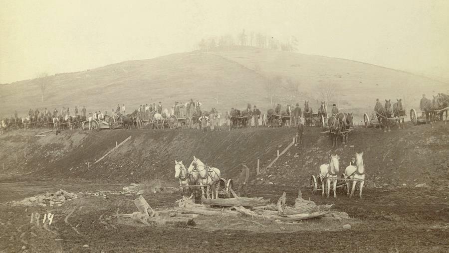
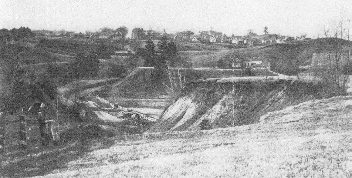
A small footbridge leads over the natural channel of Camp Brook, nearly dry at this season, and soon you pop out on Reservoir Rd just as it curves into Grasse Rd. The Fletcher Dam looms above at L. Constructed in 1893, this is the first of two dams built on Camp Brook to provide safe drinking (and fire-fighting!) water to downtown Hanover and Dartmouth College. This image shows the many teams of horses and men employed in building the dam. We aren’t certain, but we believe that the white horses in the foreground are standing on what would eventually be flooded land behind the dam, and that the hill in the background topped by the tuft of trees is Balch Hill.
Follow Grasse Rd to return to your car at the public parking area just beyond the ball field and swings.
This Hanover Hike of the Month has been generously sponsored by
From Downtown Hanover and the Green, drive E on E. Wheelock St. and up the hill 1.7 miles to the junction of E. Wheelock, Grasse, and Trescott Roads. Bear R to continue on Trescott Road and drive 1.2 more miles to the Trescott gate at a sharp bend.
From Etna village, turn W onto Trescott Road and drive 1.3 miles to the Trescott gate at a sharp bend.
Park at the marked trailhead parking area near the kiosk. Please do not block the gate.
What You Should Know
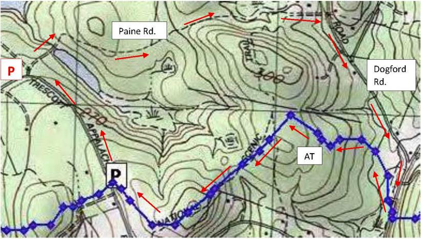
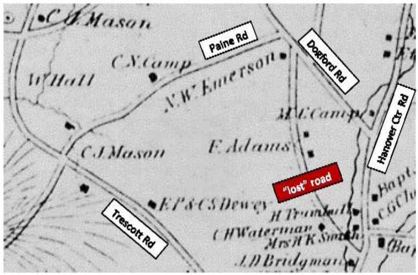
Today’s hike takes you on a loop that begins on the Trescott Water Supply Lands, follows an historic road past two cellar holes, visits a 19th century cemetery, and returns on the Appalachian Trail. The two forested legs of the hike are linked by short walks on the public portions of Paine, Dogford, and Trescott Roads.
You’re about to visit lands owned by the Trescott Water Company (Town/Dartmouth) and the permanently protected corridor of the Appalachian Trail as it skirts Etna village.
Dogs must be leashed while on the Trescott Water Supply Lands and waste must be picked up and carried out in order to protect drinking water. Elsewhere, dogs are welcome if under your control.
Archery season begins Sept. 15. Deer hunting is encouraged on the Trescott lands to improve the forest, and it is wise to wear blaze orange Sept. 15-Dec. 15. Hunting is also permitted on AT lands.
Hiking Directions
Welcome to your water source! Drinking water for much of Hanover and Dartmouth College comes from these lands, so special rules apply for recreational use. Take a moment to check the kiosk display to acquaint yourself with these rules and pick up a trail guide.
Take the short path R of the kiosk that leads around the fence to Knapp Rd., avoiding a logging road at L. At Knapp Rd., turn R back toward the gate and after 25 yards, turn L onto Paine Road. For over a century, this was a four-way intersection.
The route now called Paine Road was laid out in 1782 from Jeremiah Trescott’s place to Dogford Road, “to accommodate him for Meeting.” He’d been asking for an easier route from his house to Hanover Center since 1775. Who Paine was and why the road now bears that name remain a mystery.
Paine Road leads invitingly down a gentle hill for several minutes’ walk. Approach the dip in the old road softly; if you’re lucky, you’ll get a glimpse of a great blue heron or other wildlife in the wetland at R. This valley is not as small as it first appears – it extends over a half mile and feeds Parker Reservoir. The wetland captures sediment washing off higher ground before it can enter the drinking water reservoir.
The old road continues up out of the hollow. Just as it swings R, stop and look for the remains of an old stone wall at L. You have found the site of the Wright-Mason Farm.
Cellar hole of the Wright-Mason farmTo find the farmhouse’s cellar hole, follow the line of this wall into the woods to a pile of large, flat stones, about 35 paces from the road. From this point continue straight, another 25 paces, to a small grassy rise. The cellar hole may be invisible until you’re nearly upon it.
Here is what seems like the remains of a very small house. Actually, most early homes had cellars under only a part, as a cellar was not easy to dig and was needed just for storage of apples and other supplies, not for the many purposes to which we put basements today. Other foundations on the N side suggest the house had an ell.
In 1855, one H. Wright occupied this farm. Little is known about this family. By 1885, Charles Mason, Jr. owned the place. It was removed when the Parker Reservoir was built.
Return to the road and continue E (away from the wetland). Ahead on a rise at L is an impressive “fairy ring” where five large ash trees spring from a single place. All are sprouts from the stump of a single earlier tree.
Paine Road levels out, lined by a nice low stone wall at L and handsome sugar maples 20” in diameter. They were probably set out along the road by the Wrights and their mid-19th century neighbors, the Johnsons, when the surrounding land was open pasture or cropland. Now, the forest has returned but the maples still reign.
0.3 miles and 15 minutes from your car, look for the Mason Trail at L. Continue straight on Paine Road.
20 minutes from your car, arrive at a log landing – a sunny opening where timber pulled through the woods by a skidder is cut to length before transfer to a lumber truck.
As you proceed, stone walls follow the road and head off into the woods at right angles, separating fields and pastures of another time. They were likely built by A.D. Johnson, whose home site you will soon visit, during the “Sheep Craze” of the mid-1800s. A close look reveals small stones among larger ones, indicating the land nearby was cultivated, making it worth the trouble to move minor rocks.
About 5 minutes’ walk past the log landing is a flat spot at L, site of the Johnson-Camp Farm. This cellar hole is easily visible from the road. While it is nearly square, the farmhouse that stood over it was probably rectangular. The 1855 map shows A. D. Johnson here. By 1885, Carlton Camp lived here, of the family that gave Camp Brook its name and a veteran of the Civil War (Company B of the 18th NH Volunteers). His farm consisted of 75 acres with a sugar orchard of 150 trees and 40 more acres leased from a William Doten.
After exploring the cellar hole, continue E on Paine Rd. At a sign and barbed wire marking an old water company boundary, walk around the large pine at R to pass through a gap in the fencing.
Paine Rd. heads gently downhill and, on a sunny day, light through the trees catches your attention. You’ve reached a major wetland in the headwaters of Mink Brook where cattails and other marsh plants grow amid the standing skeletons of dead white pines. A big wetland in a bowl like this helps hold heavy rains like a sponge, protecting people downstream in Etna from sudden flooding.
A mesh cage, oddly out of place in these woods, is part of a monitoring program by the Hanover Biodiversity Committee to measure deer browsing pressure on Trillium.
Climbing up out of the bowl, Paine Rd. once again becomes a traveled way (restored to active use in 1971). Here, private land is posted in some places. Please take care to respect these neighbors.
Turtlehead1/2 hour from your car, reach Dogford Rd. Turn R and walk on its edge, following the drainage from the wetland. Just past Jones St. is a good patch of wetland wildflowers in joyous bloom at this season: orange jewelweed and white turtlehead (R). Its flowers are so sturdy that only bees are strong enough to pry them open for pollination. Walking allows you to enjoy the riot of roadside flowers blooming at this time of year – goldenrod, Queen Anne’s lace, yarrow, New England aster, and pink clover.
10 minutes’ walk brings you to Hanover Center Road. Turn R and take a few moments to wander through the nearby cemetery, established in the early 1840s. Most of the families who farmed the Trescott Water Supply Lands now rest here, along with their Etna neighbors. Some of their names are being memorialized on trails in the water supply lands.
Detail on the Mason grave marker
A tall obelisk near the gate marks the 1883 Chandler family plot, and just behind, an ornately carved obelisk (L) marks the burial place of Julius J. Mason and his successive wives Sarah Camp and Lydia Chandler. Other markers bear the names Bridgman, Childs, and Chase. William Hall (1825-1912), pictured below at his farm (site of today’s Parker Reservoir), is buried here. Heart-breaking are stones for “Little Baby” and other children.
William Hall, c. 1890After visiting the Trescott lands’ long-ago occupants, follow the roadside fence to the far opening, turn R on Hanover Center Rd. and R again onto the Appalachian Trail S at the US Forest Service sign. Trescott Rd is 1.3 miles and under an hour away.
The 2,190 mile-long Appalachian Trail threads through a national park that spans the eastern seaboard from Maine to Georgia. Conservation efforts along its route have protected valuable wildlife habitat and cool forests – and historic sites. The fern-lined, white-blazed trail heads between the cemetery and a forested wetland fed by Monahan Brook, a tributary of Mink Brook. Check tracks at wet spots – are all human and dog? We saw a bear track when scouting this route. Cross the brook on a sturdy log bridge and follow it up to an old field, where goldenrod reaches for the sky and apples ripen on trees planted 150 years ago. This is wonderful wildlife habitat.
10 minutes’ hike from the road brings you over another log crossing as the trail begins to climb gently but steadily out of the little valley. Young woods are punctuated by big bull pines.
9 minutes later, arrive at a trail junction marked by an orange Dartmouth Outing Club sign directing you to the L. A stone wall just beyond marks an old property line. A few minutes later, reach a Y junction with similar sign. You’ll bear R here; a service trail bears L.
An odd metal object leaning against the sign is your cue to explore the large cellar hole just W of the trail (at R as you face the sign). Beyond the nearly intact cellar hole are three dressed granite foundation slabs. Metal objects of mysterious purpose are scattered about. Beyond is a complex set of foundations indicating that an elaborate barn stood here. What is such a thing doing out here in the woods? The 1855 map of Hanover shows a mysterious road linking Dogford and Hanover Center Rds with a single home near the N end. The 1892 map (R) shows two more places, owned by F. Adams, midway on the road. Today’s Partridge Road once linked Hanover Center Road with Jones Street, and it is the remains of the Adams farm you’ve discovered. The Adams family once owned all the land between Dogford and the east leg of Trescott Road. When the farm was sold and subdivided to create the Trescott Ridge subdivision in the 1960s, Partridge Road was re-routed and the Adams farmhouse (R) was bulldozed.
Adams House, c. 1960Return to the trail junction and take the R fork to continue on the white-blazed Appalachian Trail. The AT follows Adams’ handsome, well-made stone wall for quite a distance. Sharp eyes will note other walls joining it to separate former pastures where tree roots now graze. The AT is busy at this time of year – the day we were out, we met 8 hikers, hailing from Florida, Chicago, Massachusetts, and Vermont.
The AT heads up around a knob and through gaps in other, older walls. 20 minutes from the cellar hole, you’re suddenly in a thick pine forest, likely a cattle pasture abandoned 80 years ago, and the trail swings R to skirt an old field. The sound of passing cars hints that Trescott Road is near.
The trail drops gently down the slope to another souvenir from Etna’s agricultural past – the circular foundation of a silo, now moss-covered. Nearby is a curious rectangular cement box and platform, possibly a milk cooling structure for a dairy farm.
Soon the trail approaches the back of a kiosk placed to inform AT hikers coming the other way. While the AT proceeds straight, turn R here to take the pine needle-strewn path that leads through the woods to a small AT parking area. Turn R onto Trescott Road and walk 10 minutes back to your car.
This Hanover Hike of the Month has been generously sponsored by


 You’re now passing over land bequeathed to the hospital that is occasionally logged for income. This becomes clear as you arrive at a wide log landing with a recently thinned (2017) red pine plantation at R.
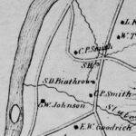
 This drainage, which you’ll be hopping over occasionally, may be not be impressive now, but at one time it had the power to gouge out the ravine you’re now descending. Indeed, this is a classic remnant of glacial Lake Hitchcock. This steep, narrow cut was carved out thousands of years ago by a wandering Slade Brook as it scoured through the soft lake-bottom sediments left behind by the retreating glacial lake. You can visit several other places in Hanover that exhibit this same dramatic effect: Trout Brook trail at the Mink Brook Nature Preserve, Kendal Riverfront Park, and the Rinker-Steele Natural Area.
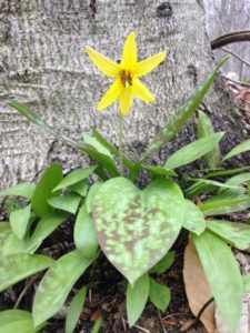 Starting at the sharp bend in the old road, you’ll be passing the Beryl Piper Little Nature Preserve on the R for the next 1/3 mile. This 3.4 acre parcel was purchased by the Town of Hanover from the Piper family in 2004. Year-round, the looming slopes of the ravine are clothed with evergreen Christmas fern, but at this time of year, ephemeral spring wildflowers may pop up among them. Most are native, but you may find the cheerful, early yellow daisy-like flowers of introduced coltsfoot, especially in disturbed areas.


 Brief Hiking Directions
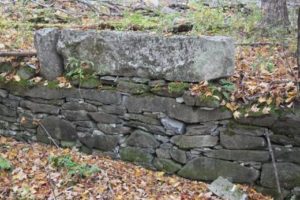 As the trail swings L again, note blue tubes on both sides of the trail. These protect young tree seedlings from deer browse. The foresters managing this land are working hard to re-establish native trees in a place with a dense deer population – the water supply lands had essentially been a deer sanctuary for half a century while people (and hunters) were fenced out. Deer prefer to browse the northern hardwoods like maple, birch, beech, and oak that make a healthy natural forest and therefore a pure drinking water supply. This is one reason why deer hunting is strongly encouraged on these lands.
 The Wolfeboro Road was probably only the second road in Hanover to be properly laid out, mapped, and recorded. Like many early roads, over the years its location has shifted. The entire road remained in use through the 19th century until construction of the Fletcher Reservoir in 1893 interrupted its path. Today many sections, including this one and the stretch that goes bravely up and over Moose Mountain, are Class VI roads. No wonder Emergency Services gets confused.
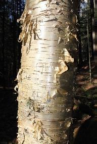 note the gleaming golden bark of yellow birch at R, a most handsome tree.
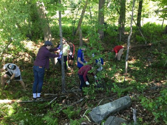
 Driving Directions
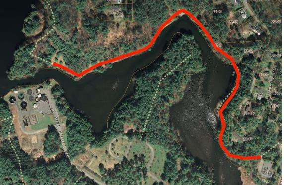

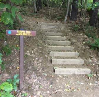 You can thank the Upper Valley Trails Alliance’s High School Trail Corps and the Hanover Conservation Commission for the friendly steps at the trail entrance. Built in 2019 on Grasse Rd Homeowners’ Assoc. land, they lend easy access to the Balch Hill Natural Area trail system.