Hanover Conservancy

Facebook logo   Instagram   YouTube          
Donate button
  • Home
  • About Us
    • Celebrating 60 Years
    • What We Do
      • Advocacy
      • Conservation
      • Education
      • Stewardship
    • Board & Staff
    • Membership Benefits
    • Contact Us
  • Get Outdoors
    • Hanover Lands
      • Balch Hill Natural Area
      • Mink Brook Nature Preserve
      • Other Properties
    • Hanover Hikes
    • Hanover Trails Challenge
    • Upper Valley Hikes
    • Exploring Nature at Home
    • Hunting
  • Events
    • Calendar
    • Spring Wildflower Scavenger Hunt
    • Private Events
  • Get Involved
    • Donate
    • Volunteer
    • Adopt a Trail
    • Corporate Conservators
    • Planned Giving
  • Education
    • School Programs
      • KAST
      • Connecticut River Studies
      • Hanover High School Scholarship
    • Request a Field Trip or Speaker
    • Research on Our Lands
    • Hanover History
    • Resources
  • News
    • Remembering Bob Norman
    • Reports & e-News
  • Conserve Your Land

Black Bear Loop

December 29, 2020

DOWNLOAD FULL DIRECTIONS -pdf

Driving directions:

  • From the Hanover Center green, head north on Hanover Center Rd.
  • Shortly before Rennie Rd, turn R (E) on Ferson Rd.
  • Turn L at T onto Three Mile Rd.
  • Turn right at T onto Ibey (sometimes spelled Iby) Rd.
  • Proceed up the hill 0.1 mile to the small parking area at the road’s maintained end opposite a cape house.

What you should know:

  • This is a mostly easy hike with a few short steeper sections.
  • The route is well marked with flagging and blue diamonds.
  • Foot travel only.
  • Dogs are welcome but must be under your control; please pick up after your pet.
  • Deer hunting is permitted in season; dress appropriately.
  • The Black Bear Loop trail was built in 2020 on the Conservancy’s Britton Forest.

 BRIEF HIKING DIRECTIONS

  • From the trailhead parking area, take the Class VI Plummer Hill Road, the continuation of Ibey Road.
  • Cross a small stream and turn R off the old road at a large old maple and a barn foundation.
  • Follow the trail over and then along a stone wall.
  • Bear L at a trail junction up and across a small stream on a log bridge.
  • The trail visits a large glacial erratic and an old maple tree, unusual survivor of an insect infestation here.
  • The trail returns to the junction; stay straight to return to the stone wall and eventually the barn foundation.
  • Bear R at the foundation and immediately L onto Plummer Hill Road to return to your car.

FULL DIRECTIONS

  • At the trailhead parking area, take a moment to look around. The house stands on the site of the former Smith farmhouse, which was standing here by 1799. By 1892, it was owned by Henry L. Barnes. The stone wall just L of the house marks a boundary of the Mayor-Niles Forest, a 92-acre mountainside property given to the Hanover Conservancy in 2013 by Michael and Lili Mayor and John Niles. This land, and the 79-acre Britton Forest just beyond, were once part of Barnes’ 220 acre family farm –by the mid-19th century, likely treeless sheep pasture! More about that as we proceed.
  • Begin your hike by heading up the Class VI Plummer Hill Road, the unmaintained continuation of Ibey Road. At R is the trailhead for the Mayor-Niles Forest, where you can pick up a trail map and guide. Today we’ll continue N for a brief time on Plummer Hill Road, crossing a small stream on logs placed at R.
  • This road dates back to the 18th century, when it apparently dead-ended farther up around Plummer Hill and did not continue on to nearby Lyme. However, the old road, discontinued in 1979, now serves as a section of the Harris Trail, offering some of the best back-country skiing in Hanover. The Harris Trail begins 3.2 miles S at Moose Mountain Lodge Road and runs nearly the entire length of Moose Mountain, following a major tributary of Mink Brook, passing Dartmouth’s Class of ’66 Lodge, and crossing the old Wolfeboro Road before arriving at Ibey Road just below where you parked. The Harris Trail continues 1.5 miles up Plummer Hill Road and has recently been re-opened all the way to Goose Pond Road thanks to cooperative landowners and a dedicated volunteer.
  • But back to today’s hike. Just past the crossing, look ahead at R for an old maple snag that marks your turn – and Farmer Barnes’ former route – to the remains of his bank barn. New Hampshire is not blessed with much level land, and any sensible hill farmer would use sloped land to his advantage, building his barn back into the hillside. This avoided taking up precious level space and provided handy access to multiple levels of the building. While a century’s leafy detritus makes it a little hard to see, a close look at the drylaid stone foundation shows how the barn was built into the hill so one could enter either from where you are standing or reach an upper level by walking up and around to the back.

    Barnes barn foundation
  • Find your trail heading NE past the lower L side of the foundation. The trail is marked with various colors of flagging being replaced with more durable blue diamond markers.
  • Cross a small drainage on stepping stones and continue as the easy path takes you through mixed woods.
  • 10 minutes’ walk from your car, cross a stone wall and immediately turn R as the path follows the wall. One is tempted to wonder why anyone would build a stone wall in the forest –to keep the trees from wandering off? Indeed, over a quarter million miles of stone walls just like this were built in New England and New York before 1870, most of them in the first 20 years of that century, and mostly to contain sheep. Imagine this space as an open grassy pasture when the wall was built, except for the upper slopes of Moose Mountain.
  • The stone wall marks the boundary between the Conservancy’s Mayor-Niles Forest and Britton Forest, the generous gift of Doug and Katharine Britton in 2017. This now wooded parcel had been in the Britton family for many years. When Doug decided to donate the property to the Conservancy, he asked that a trail be built here for the public to enjoy – and here you are. With a grant from the Quabbin to Cardigan Partnership and gifts from friends and neighbors, the Conservancy confirmed the W boundary of the parcel and engaged the Upper Valley Trails Alliance’s high school trail corps to build the trail during the summer of 2020, following a full year’s observations of soil conditions and wildlife movements to determine the best route. The trail explores the S part of the property, not far from trails on the Mayor-Niles Forest, to avoid disturbing a high-use bear area on the N side.
  • The trail follows the old wall for a short while and then turns L, winding pleasantly up the slope. The trail builders benched the path here for a more level treadway.
  • The trail bears R and up more steadily through mixed woods.
  • 10 minutes from the stone wall crossing, arrive at a fork where markings on a large hardwood straight ahead catch your eye. A cut stump at your feet bears an arrow pointing L to begin the loop.
  • The trail rises gently and, when leaves are off the trees, offers views at L into the valley below.
  • 9 minutes from the junction, cross a log bridge built by Hypertherm volunteers. Listen for the music of a small waterfall just below. This stream, like its sisters on the Mayor-Niles Forest, is part of the headwater network for Hewes Brook, which flows down off the NW slope of Moose Mountain in to Lyme, past Crossroads Academy, and on to the Connecticut River. By protecting these headwater streams, keeping them naturally forested and shaded, the Conservancy protects cool and clean water for brook trout while providing security against downstream flooding during the heavy storms that come with climate change.
  • Once across the log bridge, keep your eyes out for a tiny forest of Lycopodium, or clubmoss. There are at least 3 species here – ground pine, ground cedar, and shining club moss, miniature ancient cousins of the huge forests that once offered shade to dinosaurs.
  • As you continue, look for deer scrapes and antler rubs on smaller trees near the trail. These are message boards for deer looking to see who has been by and their breeding status. They also serve as handy scratching posts for ridding maturing antlers of their nourishing velvet.
  • Don’t miss a pretty view down at R into the valley of the stream you recently crossed.
  • 10 minutes’ hike past the bridge, arrive at curious slabs of stone that look as if a giant had just lost a game of dominoes. One of them offers the perfect seat for a snack, with a great view of one of this trail’s highlights – a grand glacial erratic.
  • This rock had some help getting here from nearby Holt’s Ledge in Lyme, but the icy conveyor belt melted and disappeared 14,000 years ago. Spend a few moments admiring the growth of rich moss on its downslope side encouraged by moisture rising from the stream below. Topping the huge rock is a toupee of rock polypody, a tiny evergreen fern that seems to like such perches.
  • The trail descends to pass on the L side of the erratic. As you go by, look up to admire the ambition of a small shrub that has claimed a foothold on top of the rock.
  • The trail continues toward a small stream, bearing R as you approach it. Nearly 10 minutes after leaving the erratic, cross the stream on a double log bridge – built by Hypertherm volunteers like the one you crossed lower down on this same brook. As you do, look upstream to see where several braided channels come together. It’s places like this that allow this little brook to play its part in capturing and holding stormwater before sending it gently downhill.
  • The trail turns L and up after crossing the stream. Note the finely corrugated bark of the ash trees here. Ash enjoys damp soils and is a good partner for the stream. A fallen ash at the far side of the brook’s little valley guides you on your way.
  • 5 minutes after crossing the stream, a big old sugar maple comes into view. It shouldn’t be much of a landmark, but indeed it is. You can’t recall seeing other maples of this size here, except near the barn foundation. Shouldn’t this mixed northern hardwoods-hemlock-red spruce forest have lots of them? Yes – but they were mostly cut in the 1980s during a salvage operation following an infestation of the saddled prominent moth. Apparently this one missed the logger’s saw, or maybe it was left as a seed source for the once and future forest.
  • The trail turns L near the maple and heads gradually down through the fallen brush of dying birches. Paper, or white birch, is an early successional tree that comes in to the sunny openings created by fires, logging, or windthrow, but doesn’t do as well once its longer-lived companions shade it out.
  • About 15 minutes’ walk from the big maple, the trail turns L twice before arriving at the end of the loop. Pause here to consider a red spruce at R. It was this species of tree that alerted the country to the scourge of acid rain in the 1980s, when scientists from the University of Vermont noticed waves of dying red spruce on the W slopes of Camel’s Hump…the slopes that caught polluted winds blowing in from industrialized parts of Ohio, Michigan, and SW Ontario. Efforts to control air-borne pollution were successful enough that acid rain is largely a thing of the past and the spruces are recovering, but they face a new threat – climate change. Barely tolerant of warm temperatures, red spruce survives on “sky islands” around the summits of the southern Appalachian Mountains, along the Maine coast, and in higher elevation parts of New England such as this. These populations will surely shrink as the climate warms. Their presence here contributes to wildlife habitat value – offering food and shelter for ruffed grouse, snowshoe hare, and small mammals in times of snow, and is among the many reasons the Conservancy was pleased to protect this land.
  • You’ve just spent an hour roaming an unbroken forest – another key reason the Britton Forest is important. The property is surrounded on three sides by other forested, protected and/or public lands: the Mayor-Niles Forest to the S, the Appalachian Trail corridor owned by the National Park Service to the E along the mountain’s spine, and the Plummer Tract to the N, owned by the Town of Hanover. Keeping all of these higher elevation forests intact means continuous, cooler room for wildlife to roam, especially as the climate warms.
  • It’s time to retrace your steps – bear L at the trail junction and down the hill.
  • Soon you arrive at the stone wall, turning R to follow it briefly before turning L to cross it and continue down to the barn foundation guarded by its ancient maple.
  • Turn L onto Plummer Hill Road, and return to your car 10 minutes after crossing the wall. Resolve to return another day to explore the trails on the nearby Mayor-Niles Forest.

This Hanover Hike of the Month is generously sponsored by JMH Wealth Management logo

Filed Under: Britton Forest, Forest Ecology, Hike of the Month, History, January, Mayor-Niles Forest, Trails

Oak Hill: Up, Down, Roundabout

November 17, 2020


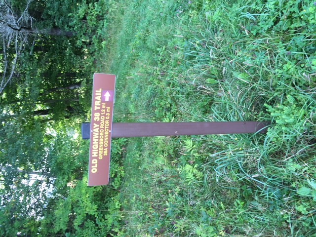
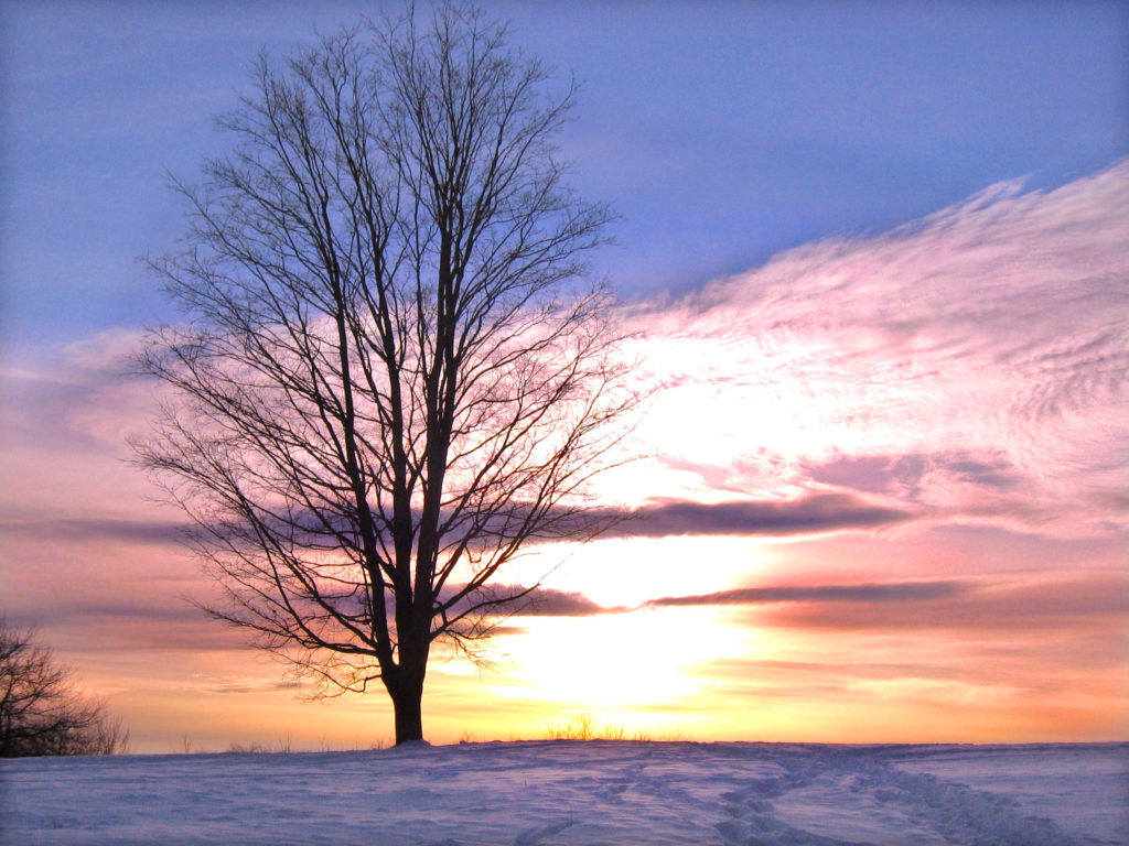
HANOVER HIKE OF THE MONTH – 11-2020 Oak Hill Up, Down, Roundabout{full directions; PDF}

Driving directions:

  • From Downtown Hanover, take Route 10/Lyme Road N past golf course, fire station, schools, and CRREL.
  • Turn R at 71 Lyme Road (opposite Rivercrest) to the Hanover Conservancy’s offices and Lyme Road Dental. Park in the area closest to Sheridan Printing.
  • Please stop in to say hello if our office is open! We are located in the lower level of the building.
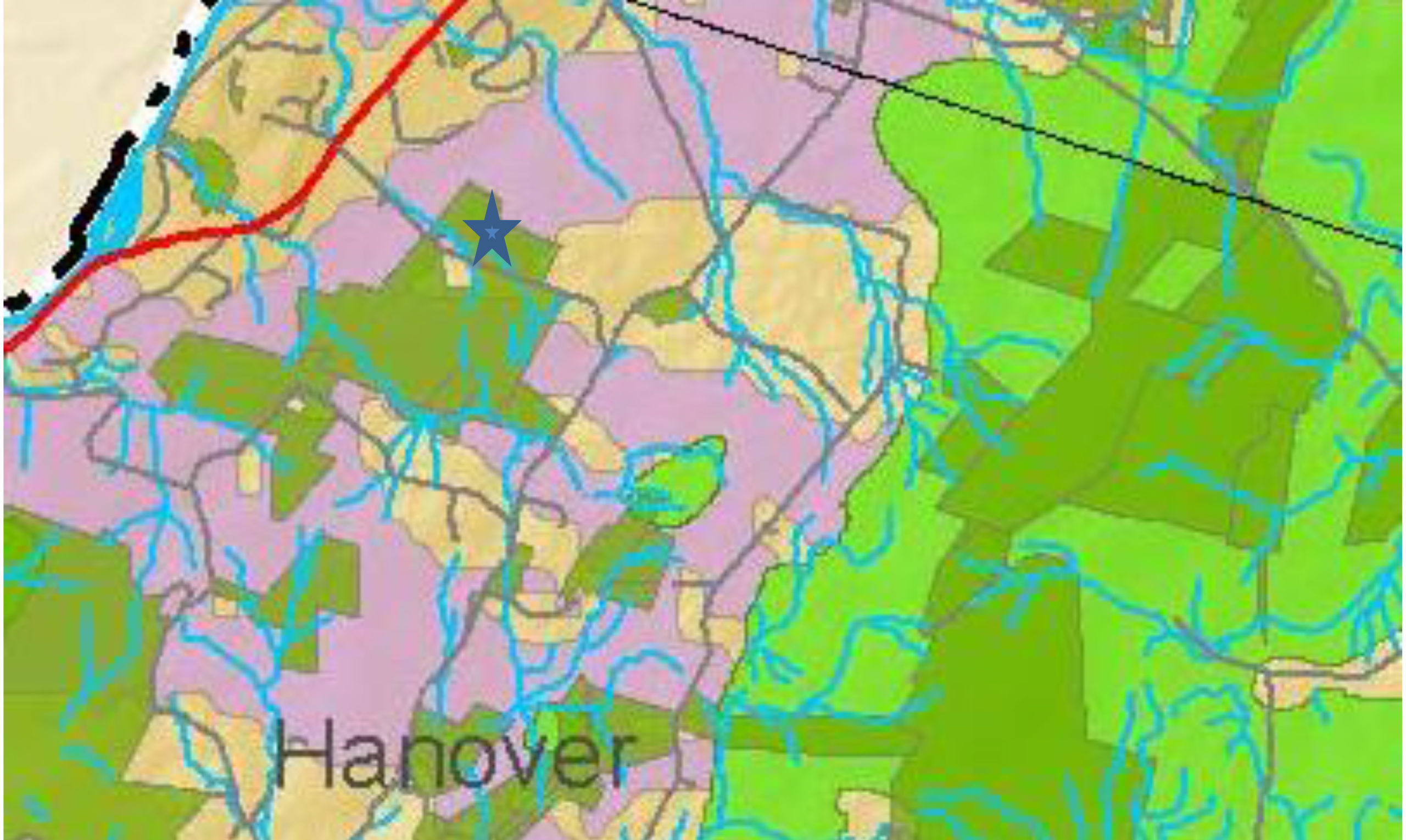
  • Today’s hike begins and ends on Storrs Pond Recreation Area trails and explores a loop on the N and W sides of Oak Hill.

What you should know:

  • This is a mostly easy hike, especially where it follows wide ski trails, but with some steep sections and occasionally tricky footing among roots or rocks. The route is partially signed.
  • Expect to share the trail with mountain bikers.
  • Dogs are welcome but must be under your control; please pick up after your pet. Dogs are not permitted within 25 of groomed ski trails during ski season.
  • Deer hunting is permitted; dress appropriately.
  • During ski season, hikers and snowshoers must stay off the groomed ski tracks.

BRIEF HIKING DIRECTIONS

  • From the Lyme Road Dental/Hanover Conservancy parking area, walk around the gate on the lane that runs downhill between this building and Sheridan Printing.
  • Turn L at the first turn onto wide ski trail and follow this down to Area 5 at Storrs Pond Recreation Area.
  • Turn L and choose the path at R up hill. Turn R onto ski trail at T near base of Ferguson Field.
  • Follow ski trail up and down across the Storrs Pond Dam.
  • Bear R at junction for Rinker-Steele trail; bear L at 3-way ski trail intersection
  • Turn sharply L onto the Game Trail. Stay R at each junction with Frankenstein’s Folly Trail.
  • Turn L onto Hunter’s Track and R onto the Fall Line Trail.
  • Turn R onto the Crystal Ridge Trail.
  • Turn R onto the Screaming Downhill Trail.
  • Turn sharp R back onto ski trail, pass the entrance to the Game Trail, and return the way you came.

FULL DIRECTIONS

  • Begin your hike by locating the gate at the top of the lane that runs between the Lyme Road Dental/Hanover Conservancy offices and Sheridan Printing. Walk around the gate and head down the hill.
  • 2 minutes later, turn L onto a wide ski trail just after the lane briefly flattens. Head up this trail; just past the top of the rise, you’ll see the Conservancy’s office windows at L. Truth be told, we love working here all year round but especially during ski season, when shouts and quavering voices catch our attention as beginner skiers get up their nerve to plunge down this trail.
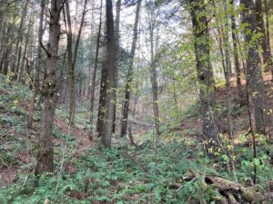
  • The wide ski trail winds down through a steep-sided valley, one of many such odd landforms characteristic of the old lakebed of glacial Lake Hitchcock. At times in such places, one feels a bit like Alice having dropped into a very corrugated alternative universe.
  • 8 minutes from your car, you arrive at a junction. At R is Area 5, a flat field with a large pavilion. This is part of the Storrs Pond Recreation Area, owned and managed by the Hanover Improvement Society.
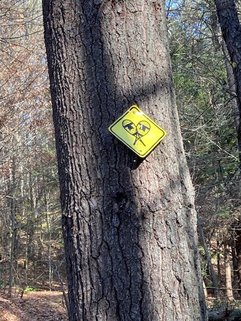
  • You bear L on the narrower path, cross the 5K loop (which leads to the open field above at L) and take the steeper footpath straight ahead, marked 
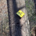
with a yellow snowshoe sign. This path is as much of a roller coaster as the rest, and traces the east edge of Ferguson Field.
  • Turn R at a T near a gate at the far end of the field. In a few minutes, Storrs Pond appears through the trees at R. At L at the crest of the next hill, the Steele Trail is marked with a sign and yellow blaze. That’s a great route for another day.
  • Continue on the ski trail up and around toward the Storrs Pond Dam, 20 minutes from your car. Rinker Pond appears below at L. Camp Brook, which begins high on the far side of the Trescott Water Supply Lands, flows downhill to fill Storrs Pond. A pipe buried in the dam delivers water to Rinker Pond below, which is partly backed up by the waters of the Connecticut River behind Wilder Dam far downstream. The water falls 3.5 miles and over 700’ from its source down to the river.
  • As you start up the hill on the far side of the dam, note the path at L to the Rinker-Steele Natural Area. This 26-acre property, owned by the Town of Hanover, is protected by a Hanover Conservancy conservation easement and offers some exciting trails that give a true flavor of the dramatic local topography.
  • Continue on the ski trail, bearing R and up to a flattened area, the remains of an old lakebed terrace formed as glacial Lake Hitchcock drained in stages. At an intersection, stay L on the higher trail, choosing the option marked 5K. Hemlocks and yellow birch populate this cool forest. In preparation for hosting the NCAA Championships in 2003, Dartmouth College made major ski trail improvements, including in this area.
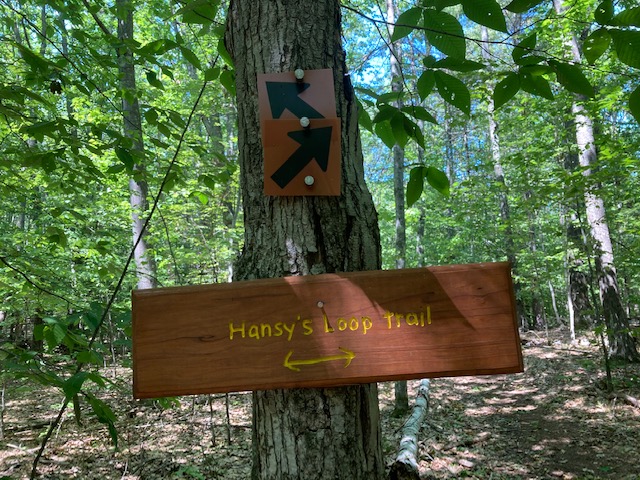
  • 5 minutes’ hike from the Rinker-Steele Trail junction, as you reach the top of a rise and before reaching a yellow snowshoe trail sign, take a hard L off the ski trail onto the narrower Game Trail. This is marked with a sign up ahead on a tree. We’re now headed up into the 254-acre Oak Hill area, owned by Dartmouth College for many years. “Game Trail” is possibly the tamest trail name you’ll encounter; we’d love to know the stories behind the others. Dartmouth’s website freely characterizes this set of trails as a maze – so we’re grateful to Tom Collier, son of former Hanover Conservancy President Nancy Collier, for his efforts to create the map we’re sharing with you here.
  • The Game Trail trends moderately up and then slabs along the contour, with the ski trail you just walked visible at L below. In 5 minutes a narrow unmarked trail joins at L; if you need to change your plans, you can take this down to the ski trail and the Storrs Pond dam. Otherwise, continue straight.
  • 3 minutes later, bear R as Frankenstein’s Folly (there’s a story there, for sure) forks off at L. That trail forms a loop that rejoins this trail in another 6 minutes. At this next junction, stay R on the upper path. You may hear the sounds of traffic on Route 10 below, but you’re headed up and away from all that.
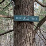
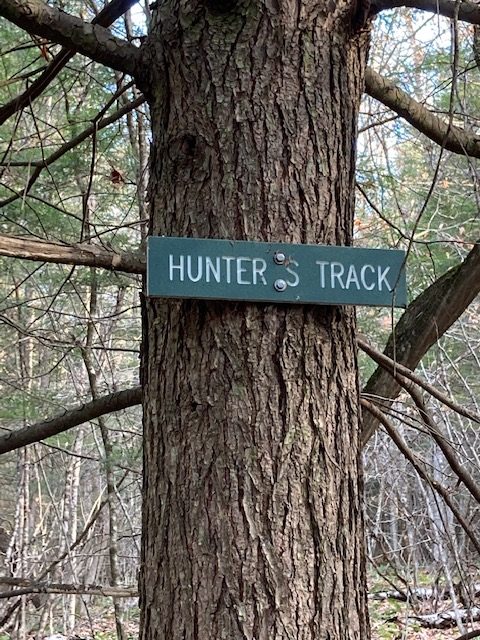
  • Shortly, the Up Through the Woods Trail comes in at R; you turn L onto the Hunter’s Track, noting the sign ahead at R.
  • 3 minutes later, the Hunter’s Track turns L; you stay straight on the Fall Line. The forest seems different here – old openings sprinkled with large, mossy stumps are signs of logging years back. The Fall Line passes through strange clumps of small gray-stemmed trees – reach out to touch their stems, which resemble a sinewy arm. Indeed, these are musclewood trees! They are also known as blue beech and American hornbeam – small, slow-growing native trees found in the understory of eastern woodlands. A tonic made from this plant was thought to relieve tiredness and its leaves were used to stop bleeding and heal wounds. This useful, very hard-wooded tree was also cultivated as a source of strong poles by coppicing – cutting the tree to promote the growth of sprouts from the roots. Farther on, a tree perforated by a pileated woodpecker indicates that humans are not the only ones at work in the woods.
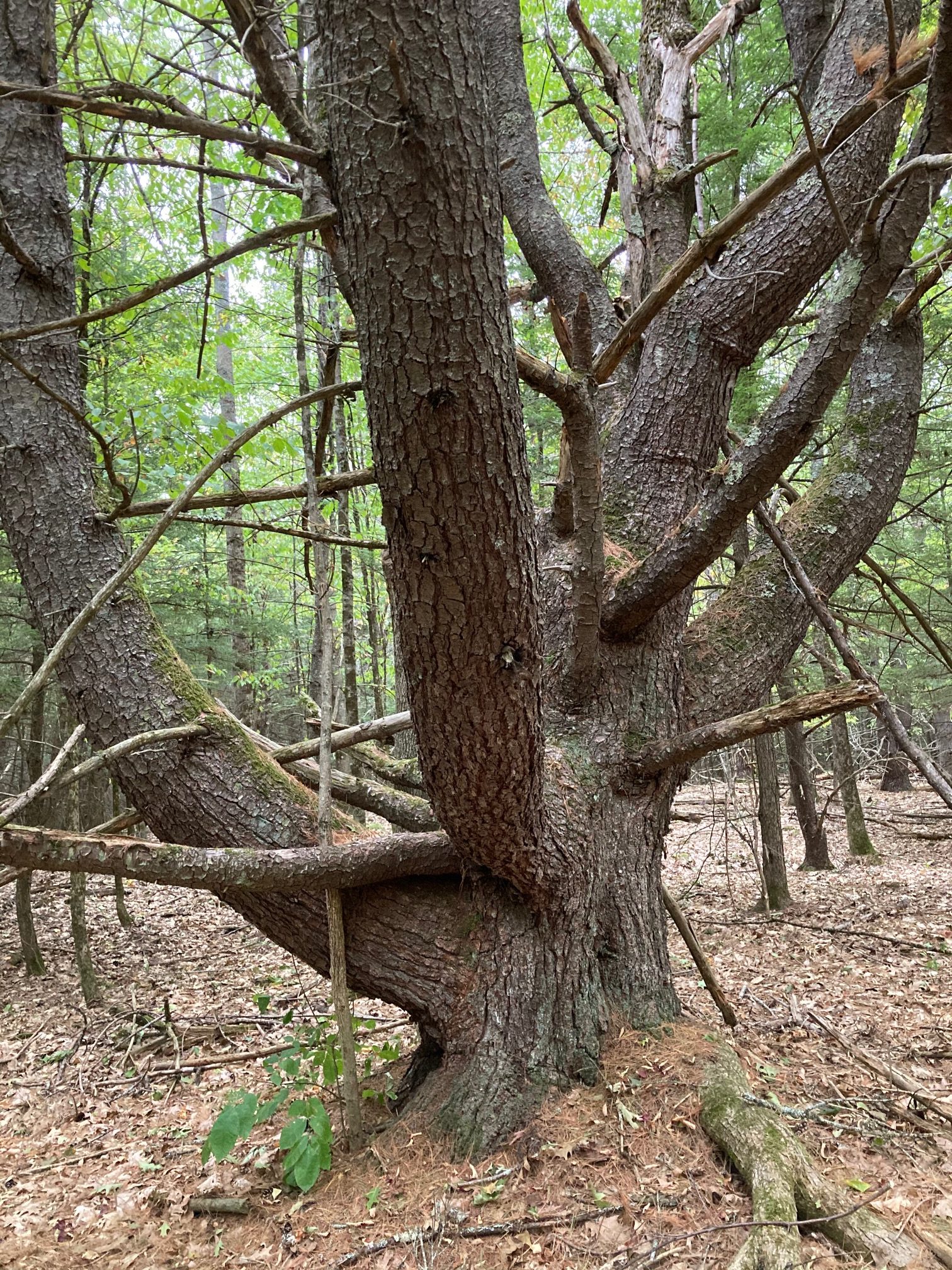
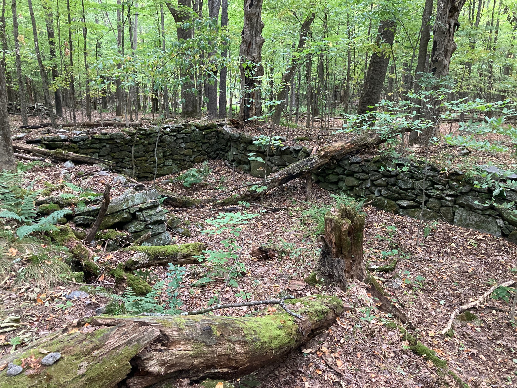
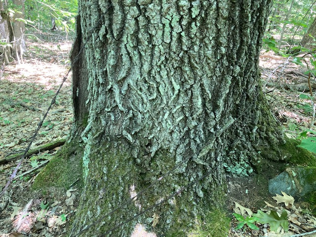
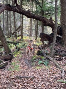
  • The Crystal Ridge Trail comes in from the L (sign ahead) and heads SSW under a fallen snag. Stop here and look closely at the trees at R; barbed wire is embedded deeply in a very old ash tree, a sign that this was once open pasture. A few paces up the trail the massive remains of an old maple appear at R. Why such huge trees amid all the smaller ones? They likely marked property boundaries, where neither landowner dared cut. The 1892 map of Hanover indicates that the nearest farmsteads in this area were those of Henry Ryder on the E side of Lyme Road near the Fullington Farm and Charles W. Stone, whose home was close to where the Fletcher Reservoir is today. Perhaps the barbed wire marks the boundary between their properties. In 1886, the Grafton County Gazetteer reported that Ryder had 26 dairy cows and leased 660 acres of sugar orchard from Adna Balch, a local leader and legislator who also owned nearby Balch Hill. No cows are to be seen here today, and it looks like many of the sugar maples fell to the axe. Except this one!
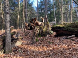
  • Soon you notice that a wide ski trail is running nearby at L. Don’t be tempted! You’d miss out on some nifty sights. A few minutes later the trail actually passes through the remains of another enormous boundary tree, this one at least 5 feet through at its base.
  • Stay on the Crystal Ridge Trail as the Up Through the Woods Trail comes in at R.
  • 5 minutes past that junction, arrive at a four-way intersection and stop. Straight ahead is a pine snag, and at R is a jumble of 2 cut mossy logs and a tipped stump. Look closely to the R to spot a blue boundary blaze and 19th century sheep fencing caught in an old hemlock. Before Ryder’s cows pastured here, it was sheep.
  • Now turn R at this intersection and down the hill onto an unsigned trail. Blue blazes appear on the hemlocks at R with fragments of sheep fencing and barbed wire. While not marked, know that the name of this trail is Screaming Downhill –prompting you to keep a sharp eye over your shoulder for approaching mountain bikes.
  • This part of the forest is distinctly different, composed of tall, straight hemlocks interspersed with white pines. They may look the same size, but the slower-growing hemlocks are likely much older.
  • 5 minutes from the intersection, the trail forks at a dip; you bear R among the hemlocks. The downhill end of that same trail rejoins the Screaming Downhill trail 7 minutes later (hiking speed, not biking speed!). Continue straight as the trail moves steadily downhill.
  • 6 minutes from the last junction, arrive at the bottom of Screaming Downhill and its junction with a wide ski trail. A sign intended for skiers reads “one way” with the arrow pointing L; you turn R, soon passing the entrance to the Game Trail and closing your loop.
  • Stay straight on the wide ski trail, passing the “do not enter” sign for skiers, and in 5 minutes arrive at the junction for the Rinker-Steele trail system.
  • From here, you’ll continue to retrace your steps across the Storrs Pond Dam and up and around to the bottom of Ferguson Field. Let’s take a breather from the woods and instead of turning L before the gate, walk around it out to the base of the open field.
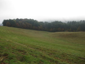
  • Ferguson Field is owned by the Hanover Improvement Society, and is permanently protected. It is a strange-looking meadow until you recall that the farm family that once owned it must have labored hard to create a hayfield out of the kind of corrugated terrain you’ve been walking through. The early farmhouse that was the Ferguson Farm’s home base still stands across the road – the white cape now owned by Kendal.
  • You have one more choice to make – you can take the path across the bottom of the field, re-enter the woods, and turn R onto the ski trail that will bring you up through the woods, past the Conservancy office, and to the lane leading up to your car, OR you can stay in the sunshine and head up the lovely field to the sidewalk along Route 10. Skirt the rotary carefully and use the sidewalk to return to your car.
  • 11/17/2020

Filed Under: Hike of the Month, November, Trails Tagged With: Mountain bikes, Oak Hill, Storrs Pond, Trescott

Old & New Etna Loop

September 29, 2020

HIKE DIRECTIONS & MAP – Full PDF

Driving Directions

  • From Etna, take Trescott Rd northwest for 0.5 miles to the junction with Partridge Rd.
  • Park in the parking area on the L (W) side of the road at the blue sign reading “Old Highway 38 Trail.” If the area is not accessible, continue up Trescott Rd 0.4 miles to the AT parking lot at R, just before a fence at the Trescott Water Supply Lands.
  • Today’s hike is a loop through the Hudson Farm’s fields and forest on an historic highway, behind Etna village on the famed Appalachian Trail, and down Hanover Center Rd. to the Etna Library, the Audrey McCollum Trail, and Partridge Rd.

What you should know

  • This is a mostly easy hike with a few short steeper sections and some with tricky footing among roots or rocks. The route is well-blazed and signed.
  • The route follows an early road on one of Hanover’s newest conservation lands. In 2017, the Hudson Farm (brown-shaded area on map) was permanently protected as part of the Appalachian Trail corridor.
  • The Audrey McCollum Trail, built by the Hanover Trails Committee from Hayes Farm Park to Woodcock Lane in 2017, was extended in Summer 2020 to Partridge Lane to provide improved access to the central conservation area owned by the Town of Hanover.
  • Trails are maintained by Trails Committee volunteers.
  • Dogs are welcome but must be under your control and must be leashed on the McCollum Trail; please pick up after your pet.
  • Deer hunting is permitted (except at Hayes Farm Park) by archery Sept. 15-Dec. 15
  • Foot travel only; snowmobiles, ATVs, and bicycles are not permitted.
  • Please respect nearby private property.

BRIEF HIKING DIRECTIONS

  • From the Hudson Farm parking area, take Old Highway 38 south to the rise in the meadow.
  • Turn R at sign for Old Highway 38 Trail and 38A Connector.
  • Stay straight at next trail junction; turn R at T toward Appalachian Trail.
  • Turn R (N) on AT, cross Trescott Road, and continue on AT to Hanover Center Road.
  • Turn R (S) on Hanover Center Road; follow to Etna Library.
  • Turn R into parking lot and take trail into meadow to junction with Audrey McCollum Trail.
  • Bear L onto Audrey McCollum Trail; follow this to Woodcock Lane.
  • Turn R onto Woodcock Lane and then L to new section of McCollum Trail.
  • Follow this to Partridge Road.
  • Turn L and walk along Partridge Road to Trescott Road; cross to reach your car.

FULL DIRECTIONS

  • Begin your hike by passing the kiosk and taking Old Highway 38 along the treeline up to the rise that is visible from the trailhead. At this season, the old field is filled with nodding goldenrod, small white asters, and periwinkle New England asters. Start “collecting” stone walls! Among the leaves cloaking the hedgerow at L is the first, a low stone wall separating two former pastures of the historic Adams Farm.
  • 5 minutes’ walk brings you to the top of the rise and a brown/yellow trail sign where two mown paths meet. Look back at R – easily visible is a white 20th century home built as a country retreat by retired architect Archer Hudson. Beyond another hedgerow stood the Adams Farm house from 1790 until 2024, a former tavern and home of the family that once owned the former farmland you are exploring now. Hudson purchased land that included the Adams barn – and then burned it down. Dartmouth College later bought the property and carved off his house for resale.  While the College referred to it as the “Hudson Farm,” the land ceased to be farmed when Hudson arrived.
  • In June, 2017, this was the site of a grand celebration. A partnership between the Trust for Public Land and the Town of Hanover, assisted by the Hanover Conservancy, resulted in the purchase of 175 acres by the National Park Service to permanently protect them as part of the Appalachian Trail corridor. In addition to major federal funding, many local contributions made this possible.  Owned for many years by Dartmouth, the property had been eyed as a site for everything from a cemetery and golf course to a housing development. Today, the AT Conservancy manages the land with help from the staff of the White Mountain National Forest.  The beautiful meadows are kept open by carefully prescribed burns, for their spectacular views and valuable grassland bird habitat.
  • Turn R at the sign to follow the Old Highway 38 Trail and pick up the 38A Connector. The trail heads down to the woods; crabapples at the edge, a remnant of farming days, bear colorful fruit at this time of year. Yellow blazes mark the trail.
  • Two sets of boardwalks offer dry footing across a wetland, built by Hanover Trails Committee volunteers (thank you!). Protecting such headwater wetlands and streams from heavy foot traffic benefits water quality and trout habitat in Mink Brook below. The wetlands act as sponges during heavy downpours, holding water to prevent flooding and erosion in downstream neighborhoods. While they may seem dry at this time of year, the coarse fronds of sensitive fern are a clue to wetter times. Keep an eye out for the intriguing white flowers of turtlehead. Their bee pollinators must muscle their way inside to gather their nectar.
  • Rising up and away from the wetland, you’ll soon see a pair of stone walls at R, reminders that this was once grazing land before the forest returned. The second turns a corner and follows the trail.
  • 7 minutes’ hike from the first trail sign, note another at L where Highway 38 turns L. You continue straight on the 38A Connector for 0.3 miles to the Appalachian Trail.
  • Head over stepping stones on what may be a dry crossing at this season. The trail is now blazed blue, indicating a, AT connection trail. The rolling trail moves through mixed woods in former pastures.
  • 5 minutes from the last junction, arrive at a T. Blue and white arrow signs in nearby trees (which seem eager to devour them) mark your R turn down the hill, following blue blazes. Mark the time – you’ll see why.
  • As you approach the clearly marked boundary of the old AT corridor – an 1800s stone wall, 1980s yellow blazes, and a 2017 boundary pin – you note that the forest understory is more open here. This land has a different history.
  • 10 minutes from your last turn, reach the pine-needle strewn crossing of the Appalachian Trail. It is easy to miss! The connector trail continues beyond the AT, bending around a yellow birch about 50’ ahead. Stop and look for the white blaze on a pine at R.
  • Turn R onto the famed – but here quite humble – Appalachian Trail, heading gently up for 7 minutes to the top of a low ridge. Stop here and note the big old “wolf pine” at L, a pretty impressive character. The growing tip of such a white pine was damaged early in its career, which let side branches develop into competing leaders. No longer valuable for timber, such pines were often left to provide shade for grazing animals – and to spook hikers.
  • 4 minutes later, cross another small wetland decorated with asters and turtlehead.
  • On the far side, the forest understory is suddenly crowded with young buckthorn, an invasive tree. At this season, when most proper New England trees are beginning to shed their leaves or at least turn color, the non-native buckthorn reveals the secret to its grim success – it retains its green leaves and keeps on photosynthesizing well after the natives have checked out for the winter, giving it a competitive edge.
  • 4 minutes past the wetland crossing, arrive at Trescott Road. On the day we were out, during a drought, a thoughtful “trail angel” had left a cooler and big water bottle for thirsty hikers.
  • To continue on the AT, spot the trail across the road at one o’clock. A few steps in, a kiosk appears ahead. A path from the AT parking lot comes in at L, strewn with needles from the pine plantation it crosses.
  • Continue past the kiosk through thickly planted rows of pines, another part of the old farm that is now owned by the National Park Service.
  • After a small opening, watch for an odd rectangular structure of moss-covered concrete at R – was this the farm’s spring house? A few steps further is a spectacular round drylaid stone structure – possibly the foundation of a silo. Etna’s farming history is deep and rich – and its footprints are everywhere.
  • 5 minutes from Trescott Rd, emerge into an opening where the trail skirts the upper edge of the recently reclaimed meadow. A stone wall (the fifth or sixth so far?) appears at R as the trail re-enters the woods. As you leave the Trescott Rd corridor behind, invasive buckthorn in the understory is replaced by native cherry, ash, and striped maple.
  • The AT crosses a low stone wall as you note many blowdowns. These may date from the 2007 Patriot’s Day windstorm that leveled much timber here and on the east slope of Balch Hill, among other places.
  • Cross another stone wall, this one remarkable for its long, angular slabs. Who knew stone walls had different personalities? We’ve only just begun!
  • Continue north on the AT as it rolls along, skirting the W edge of Etna village. Cross yet another stone wall.
  • The trail bears L, arriving at an interesting intersection of stone walls that once must have divided pastures. The AT follows one on your L – note some venerable sugar maples lining it. As the trail rises, this wall becomes even more impressive, nearly reaching chest height. We can’t resist sharing here that in 1870, a government agency estimated that over a quarter million miles of drylaid stone wall had been built in New England and New York, most during a few decades in the early 19th century during the Sheep Craze. Recently, NH’s State Geologist has worked with area volunteers and UNH to create a citizen-based, on-line stone wall mapping tool using LiDAR maps. You can visit this site to see the stone walls you’re “collecting” on this hike (shown in pink on the image), and visit your own home area to see what other walls might exist nearby.
  • 5 minutes after crossing the last wall, you reach a height of land. A trail joins at R from the nearby neighborhood, and low wooden signs – along with a mystery object made of iron – invite you to stop and look around. Off just a few paces at L is a large and impressive cellar hole. It is the remains of another Adams farmhouse you’ve discovered. The Adams family once owned all the land between Dogford Rd and the E leg of Trescott Rd, over which you have been walking. When the farm was sold and subdivided to create the Trescott Ridge subdivision in the 1960s, Partridge Rd was re-routed and the Adams farmhouse (R) was removed – another piece of Etna history lost.
  • Continue straight on the AT, following white blazes to avoid a few cross-trails here. Within sight of the cellar hole, another wooden trail marker tells you to turn R; a brush pile blocks the incorrect path ahead. Add to your stone wall collection as you encounter more, many marked with old maples. Did these walls border a garden, a pasture, a cart path, a sheep pen, a lane, or were they just convenient places to store the stones?
  • 10 minutes past the cellar hole, descend toward a plush green wetland, startlingly green at this time of year. The spicy fragrance of drying hay-scented ferns is pleasing.
  • A plank crossing brings you over an often-dry streambed and the path twists toward an open field. On a summer morning, hawks may be hunting mice and other wee things from the perches above.
  • Just inside the meadow, the trodden path forks; bear R and skirt the old field through eye-high goldenrod before reentering the woods. The same dry streambed appears at L and you’ll soon cross it on a log bridge.
  • The trail passes behind the Etna cemetery, where many of those who built the walls and farms of Etna rest.
  • 7 minutes after entering the field, arrive at Hanover Center Road and turn R. A short, more civilized walk along the road gives a fresh view of the forested wetland you just passed.
  • Some of Etna’s most historic buildings – Trumbull Hall and the brick First Baptist Church of Hanover at L, and the former parsonage in the red cape at R – announce your arrival at what was once known as Mill Village, for the many mills that made busy use of the power of Mink Brook.
  • At Ruddsboro Road, a beautiful stone wall (the 13th or 15th?) creates a centuries-old hypotenuse between the roads. This scenic triangle has been protected by the Town of Hanover. It is part of nearby Mink Meadow Farm, home to a long-time Etna farm family. On one side of the historic Yankee-style barn is the foundation of an old silo – on the other, a tiny former milkhouse that now boasts refrigerated eggs and farm-grown vegetables.
  • At R is the white 1767 Bridgeman House; the earliest part of this home is likely the middle section with the chimney. Take a moment to read the plaque mounted on the nearby stone. A tributary of Mink Brook passes behind the home and under the road.
  • Across the way, electric fencing excludes grazing cattle from the mainstem of Mink Brook, protecting water quality by allowing a lush buffer of native plants to grow along the stream to filter runoff. The farm family worked with the Connecticut River Conservancy to establish the fence and plant stream-side shrubs to keep the stream clean. For well over a century, waste from the entire village – including mill waste – was piped directly into the brook.
  • Don’t look now, but stone walls are everywhere in Etna village – among the most beautiful in town.
  • Pass the new fire station at R, and note the historic one ahead at L, a small gray clapboard building.
  • 10 minutes from the farmstand, arrive at Etna Library, one of only three structures in Hanover listed on the National Register of Historic Places. Turn into the parking lot and pick up the trail at the far end.
  • You’re entering Hayes Farm Park, acquired by the Town of Hanover in 2010 from the Hayes family whose farmstead and barn stand nearby at L.
  • Walk up through the meadow toward the kiosk. Glance beyond it at the impressive glacial erratic with early 19th century graffiti done by H. L. Huntington (for whom Huntington Hill takes its name). Take the R fork and continue straight through the meadow, up and around the corner, and through a gap in yet another stone wall. Here, the trail turns R and follows an early farm lane lined with beautiful high stone walls adorned by black, grey, and white lichens. How many tons of stone were moved to create the walls that stitch this rural landscape together? And all without machinery, just with man and animal muscle, patience, a good understanding of physics and gravity, and maybe not much else to do at certain times of year.
  • The path heads uphill to a fork marked by a sign indicating the King Sanctuary ahead and the path to Woodcock Lane to the L. Bear L as you gain the knoll – the wall makes the corner with you.
  • At L is a low cage protecting Trillium from deer browse. This is part of a deer monitoring project being of the Conservation Commission’s Biodiversity Committee. A few feet further stands a sign for the Audrey McCollum Trail. Stay L as the trodden path forks and follow Audrey’s Trail down into the woods, following yellow blazes. Bear immediately R on the needle-strewn path.
  • An ardent and well-known local conservationist, Audrey McCollum lived nearby on Trescott Road. Gifts in her memory allowed the creation of this trail in 2017.
  • Be sure to leash your dog here – porcupines den nearby!
  • Cross another stone wall and skirt the Trescott Wetlands on the somewhat rooty and rocky trail at the base of a dark hemlock and pine-covered slope. Contrast the stony hillside with the lush green ferny wetland at L. Audrey’s Trail goes over a few log crossings as you make your way around the wetland. Take care to stay on the trail and avoid nearby yards.
  • 10 minutes from the start of Audrey’s Trail, arrive at Woodcock Lane. Turn R toward the lane’s end and L at a sign just before the driveways. Be sure to keep your dog leashed, and please pick up after it.
  • This new section of trail was completed in September 2020 after much planning and effort by the Hanover Trails Committee. It provides a welcome path for “bird road” and other Etna residents to explore the natural parts of their neighborhood and to visit friends.
  • The pleasant yellow-blazed trail soon crosses a stone wall (watch your footing for wobblers) and enters the woods. Five minutes later the trail uses a log crossing near a small wetland that is likely a pool earlier in the year. This is a good place to look for animal tracks.
  • Turn L onto Partridge Road and enjoy the 8-minute stroll along this pretty lane. “Collect” your final stone wall at #3 Partridge, where a handsome historic wall has become a valued landscape feature for a later home.
  • Your car appears ahead, across Trescott Road.

This Hanover Hike of the Month has been generously sponsored by…

Filed Under: Hike of the Month, History, Hudson Farm, Invasive Species, King Bird Preserve/Hayes Farm Park, October, Trails Tagged With: stone walls

Huntington Hill North Loop

August 25, 2020

Driving Directions

  • From downtown Hanover, head N on Lyme Road (Route 10)
  • 6 miles after passing Kendal, turn R on Goodfellow Road
  • Head uphill for 0.7 mile; pavement ends near historic white farmhouse on R
  • Park in pull-off on L (north) side of road near gate. A sign reads “foot travel welcome.”huntington hill north map

What You Should Know

  • Today’s hike is a pair of loops on permanently protected, privately owned land. Please respect the generosity of landowners who provide public access, and pack out your trash.
  • Much of this route travels over wide and less-used trails – old farm lanes and mowed meadow paths – allowing for ample physical distancing while enjoying the outdoors.
  • Dogs must be under your close control. Please pick up after your pet.

Brief Hiking Directions

  • Walk around the gate and follow the mowed path to Sam’s Pond.
  • Beyond the pond, bear L at a fork
  • Bear L at another fork labeled “Hansy’s Loop”
  • Bear L at another fork with arrows pointing both ways and sign reading “Hansy’s Loop”
  • Returning to this point, return on the trail traveled earlier but turn L just past a large fallen tree on R
  • Turn L at T at a stone wall to follow Allegra’s Field Trail
  • Cross a second stone wall and bear R
  • After reaching a second meadow, bear R and down to the pond
  • Turn L to cross the pond’s dam and return to your car.Pond on Huntington Hill

The Full Story

  • Begin by walking around the gate and following the mowed path as it winds through a pleasant meadow.
  • An expanse of water appears ahead – you’ve found Sam’s Pond.
  • Pause by the small dock for a moment to contemplate the major conservation success that allows you to visit today. You’re walking through 83 beautiful acres that are part of the permanently protected Huntington Hill property. Dr. Sam Doyle purchased this land in 1991 and conveyed a conservation easement on six parcels, including this one, to the NH Fish and Game Department. On the S side of Goodfellow Road, the property spans another 417 acres. Other adjacent conservation lands, including the Moister Meadow (20 acres, easement held by the Hanover Conservancy), the Mudge land (8 acres, easement held by Fish & Game) and the Nutt Farm (207 acres, easements held by Society for Protection of NH Forests) bring the total of protected, connected wildlife habitat to a stunning 735 acres. (See map on next page, where these areas appear in dark green). Today, Huntington Hill continues under a new family, with the original protections intact (see p.4).
  • Continue across the earthen dam to the far side, and bear L through another meadow. The coarse fronds of sensitive fern at L tell you that area is damp without the need to feel the soil. Drier parts of the upland meadow are studded at this season with the nodding white flowers of Queen Anne’s Lace. Continue straight as a second mown path comes in at L. Your trail soon swings to the R and up into the woods, returning to the N edge of the meadow, where the pond comes back into view. At the far edge, look L for a yellow-highlighted sign reading “Hansy’s Loop.”
  • Bear L here, walking up and away from the pond. After a few minutes, an orange arrow guides you to bear L.
  • A large blowdown at L gives an intimate view of the fallen tree’s root system and the light soil in which it grew.
  • 5 minutes from the last junction, arrive at another fork with arrows pointing both ways, and bear L.
  • Travel gently down through a mixed age forest of pine, northern red oak, and other hardwoods. These are taking the place of an earlier stand of white birch, whose fallen members litter the forest floor, returning nutrients to the soil. Look for a variety of club mosses thriving here – ground cedar, shining clubmoss, and others. The strange and ghostly white stems and flowers are Indian Pipe, a wildflower – not a fungus – that takes food from tree roots rather than making its own with green chlorophyll.
  • As the trail swings R and to the SE, you’ll encounter some much larger trees. Sharp eyes will spot fragments of old barbed wire caught in their trunks and realize these are boundary trees – allowed to grow to such size because neither neighbor dared cut them, and they were serving as useful fence posts at a time when the landscape was more open. One oak looks to be at least 30” in diameter at breast height. 7 minutes from the last fork, the trail swings R again at a huge double-stemmed red oak marked with a red boundary blaze.
  • 3 minutes later, you’re back at the start of Hansy’s Loop. Retrace your steps back down the hill for about 45 paces; just past the fallen tree at R seen earlier, turn L onto a less distinct, unmarked trail.
  • This trail soon reaches a low stone wall, where you turn L and walk gently uphill for a short distance past the end of the wall. This is the first reminder that this wooded land – and most of Hanover – was once open sheep pasture. After all, nobody builds stone walls in the woods! In 1840, Hanover had 2,613 human residents and a startling 11,024 sheep.
  • The trail narrows and rises more steeply to another impressive oak, then flattens out. Soon, arrive at a larger stone wall. Just beyond, a sign announces “Allegra’s Field Trail.”
  • 3 minutes’ hike from the last stone wall, reach another sunny meadow. In your view at about 2 o’clock is Huntington Hill, at 1247’ a perfect twin of the hill you just hiked around.
  • The meadow’s mown path forms a T: turn R, noting the lowbush blueberries carpeting the area. This must be a very happy place for bush-surfing bears in July.
  • Head down through the field amid the sunny heads of goldenrod. There are many species of this yellow aster-type flower in northern New England, but did you know that there is also one called silverrod? Its white flowers are reminiscent of moonbeams.
  • Huntington Hill’s variety of habitats – shady diverse forest, sunny meadows, open water, and the edges where they meet – are more important than you might think in keeping Hanover’s landscape resilient to the effects of climate change. Why? Connectivity. Strategically located between the migratory pathway that is the Connecticut River and the uplands of Moose Mountain, Huntington Hill connects these areas. It provides an important travel corridor for birds and other wildlife that need to move around, either seasonally to summer breeding grounds, or more long-term as the climate changes. If wildlife can move freely, their genes can too, meaning that their populations don’t become isolated, inbred, and therefore less healthy. In this map, dark green shows conserved and public lands; light green shows core areas for conservation focus, and purple indicates important connectivity corridors stretching from the river to the core (the star indicates today’s hike location.)
  • As you re-enter the cool woods at the foot of the same stone wall you recently crossed, note the heap of many small stones. These tell you that the land nearby was once tilled, and the farmer went to the effort to pick the stones and transport them here to spare his plow and give his root crops a fighting chance.
  • Walk along the contour on a wide old farm lane. Watch for acorns on the trail – they make wonderful food for wildlife but can act like ball bearings underfoot!
  • 15 minutes from the top of the last meadow, arrive at the lower end of the first wall you crossed, and Sam’s Pond appears through the trees ahead at L. As you close your second trail loop of the day, note a large rhododendron, oddly out of place near the trail junction. It must have been planted – but by whom, and why?
  • Watch the area carefully before stepping out of the woods. On the day we visited, a male Northern Harrier (formerly called a marsh hawk) sailed out over the meadow from the pond.
  • At the lower field’s edge, turn L to the pond. Pause a moment to watch for wildlife – maybe the darting gymnasts of the air, dragonflies on the hunt above the water’s surface or resting on a blade of grass. Check the sediments at the water’s edge for tracks. Goldfinches chatter in the trees.
  • Continue to the far side of the pond. At this season, your reward may include ripe blackberries on the briars that frame parts of the trail. This is one of many kinds of mast on which wildlife thrives here – blueberries, acorns, naturalized crabapples, and more.
  • Follow the mown path to your car on Goodfellow Road.

Historical Notes

Goodfellow Road, linking Lyme Road with Hanover Center Road since at least 1855, takes its name from the Goodfellow family, from whom Dr. Doyle purchased the land in 1991. The Goodfellows arrived between 1893 and 1925.

In the 1850s-80s several generations of the Runnels family lived on and farmed on the land you visited today. By 1885, John Runnels was listed as a “wool grower” with 125 sheep on 196 acres. He had served three years in the Civil War with the 9th New Hampshire Volunteers.

In the 1880s-90s the Ingalls brothers, A.H. and Charles, occupied the big white farmhouse, barn, and 250 acres across the road. Also sheep farmers, they had an apple orchard of 100 trees, a maple sugar orchard of 200 trees, and 130 head of sheep. Back in 1855, the family of Andrew Huntington – he who gave his name to the property –farmed that land. Andrew, who probably built the 1780 farmhouse, served in the Revolutionary War with his brothers Christopher and Samuel.

Today’s owners feel viscerally attached to their property on Goodfellow Road and were excited to purchase conserved land from Sam Doyle with the promise to Sam that they would continue his focus and dedication to the land – maintaining and expanding the network of trails, promoting the property as a wildlife habitat, keeping fields mowed, and sustainably harvesting timber according to the Forest Management plan maintained by Jeff Smith of Butternut Hollow Forestry.

September, 2020

This Hanover Hike of the Month has been generously sponsored by

Filed Under: Hike of the Month, History, Huntington Hill, September, Trails Tagged With: farming, Goodfellow Road, history, huntington hill, Sotheby's

Behemoths of Balch Hill

August 12, 2020

Hike Directions & Map – Full PDF

Driving directions:

  • From Downtown Hanover, drive east for 1.6Route map on Balch Hill
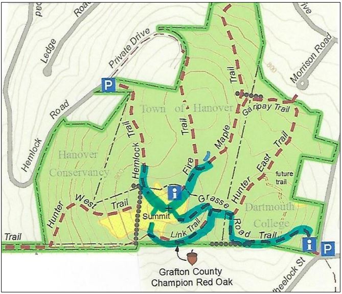
miles on East Wheelock Street, up a long hill to the junction of Grasse and Trescott Roads.
  • Park in the unpaved informal parking area on the northeast side of this intersection.

What you should know:

  • This loop hike takes you through the Balch Hill Natural Area to the summit with its beautiful views. Along the way you’ll visit grandfather trees that may have witnessed our town’s founding – including the Grafton County Champion Northern Red Oak.
  • You’ll be walking on lands owned by Dartmouth College, the Hanover Conservancy, and the Town of Hanover. Conservation easements and other restrictions protect some but not all of this land.
  • Trails have occasional short up-and-down grades but are easy for the entire family.
  • Foot travel only; no bicycles please.
  • Archery hunting for deer is permitted Sept 15 through Dec. 15; blaze orange is a good wardrobe choice.
  • Dogs are welcome but must be under your control; please pick up after your pet.

BRIEF HIKING DIRECTIONS

  • Take the red-blazed Grasse Road Trail from the trailhead kiosk to the summit, crossing a small footbridge.
  • From the summit kiosk, take the Fire Trail down to the junction with the Maple Trail.
  • Return to the summit and take the Hemlock Trail down to a large fallen tree.
  • Return to the summit and head for a group of apple trees and a stone bench. Look for the Piane Trail sign and turn L onto the red-blazed Grasse Road Loop.
  • Take this trail to the Champion Red Oak; continue to the small footbridge and turn R to return to your car.

FULL DIRECTIONS

  • Begin your hike at the trailhead kiosk, across Grasse Road from the parking area. The Hanover Lions Club generously donated this timber frame kiosk in 2011. Here, you can read a bit about the history of this land and pick up a trail guide if you wish.
  • The Grasse Road Trail heads across the slope on Dartmouth College land. This section was re-routed in 2015 by an Upper Valley Trails crew to follow a gentler, more sustainable path than the original.
  • The path soon turns to avoid a series of downed trees. What happened here? A short but violent windstorm on Patriot’s Day in April, 2007 blew down many trees on this part of the hill, and it will be years before they degrade back into the earth.
  • For several years near this spot stood a deer “exclosure” where Dartmouth ecology students conducted a study  to determine the effect of deer browse on the vegetation. Two identical plots, one fenced against deer and the other unfenced, were compared each year. Here are the results for the plot in this area. The blue bars indicate total number of plants in the fenced plots where deer cannot enter to browse, while red bars indicate the number of plants in the unfenced plots. In 2012, before the fencing went up, both plots had nearly the same number of plants. Contrast that to 2015! The largest change is in the number of wildflowers, especially Canada mayflower.
  • You’ve reached the low stone wall marking the southern boundary. Look for fragments of sheep fencing (large rectangles of wire fence) that date from the pre-Civil War “sheep craze” in the Upper Valley. In 1840, Hanover had over 10,000 sheep grazing on its hillsides, including this one, while the human population was around 2,000.
  • Follow the Grasse Road Trail as it makes a right turn away from the wall and heads north among tall, cool hemlocks.
  • At the junction with the Hunter East Trail (route to the Morrison Road neighborhood), turn left and cross a small log bridge over a wet area and onto Hanover Conservancy land.

Balch Hill sunset in winter. Photo by Rob Chapman

  • The trail bears right then immediately left and heads up the slope past some dramatic pine snags. In ten minutes’ walk from your car, you’ll reach the 920’ summit.
  • Enjoy the sweeping views from this, the only open summit in town where the public is welcome. Twenty-one miles to the south is grand Mount Ascutney. The spire of Baker Tower marks downtown Hanover in the near view to the west, while on the western horizon, 29 miles across Vermont, the sharp peak of Killington appears. To the northwest, our volunteers have been restoring the view toward Gile Mountain in Norwich.
  • Historically, the summit of Balch Hill was used as a pasture for grazing sheep and cattle. Records indicate that it was cleared of most trees for more than a century. In our experience, those trees badly want to return! We’ve been working to restore the orchard on the hill and keep the views open by mowing the meadow.
View of Hanover from Balch Hill in winter; undated photo
  • Once known as Corey Hill after an early owner, Balch Hill takes its name from former owner Adna P. Balch (1817-1889). Balch, a prominent citizen who served in the legislature in 1876-1877, promoted the development of the railroad in the Connecticut River Valley and was a director of the Hanover Gas Company. In the early to mid-twentieth century, the summit was known as Dewey Hill Pasture, after owners in those later days.
  • You can imagine what demand there might be to develop this hillside with its astounding views, so close to town. That’s why the Hanover Conservancy, then known as the Hanover Conservation Council, set out to purchase the summit when a New York developer proposed first 126 condominiums and then 49 luxury homes for this place. The community came together to protect the land, with the Council and Town later adding to it with a second purchase from the Garipay family. Make a note to come back for the annual Balch Hill Kite Day in May or the Hawk Watch in September, to see how much the community enjoys this natural area today. It was worth the effort!
  • After visiting the summit kiosk, erected by the Council in memory of Alice Jackson in 2009, begin your tour of Balch Hill’s biggest trees. Take the wide Fire Trail behind the kiosk for a short distance to its junction with the Maple Trail.
  • Take this right turn and in just a few steps you meet some venerable old sugar maples that may once have marked the path of an early road. These ancients stand out against their much younger brethren.
  • A person stands underneath a huge oak tree with one fallen limb
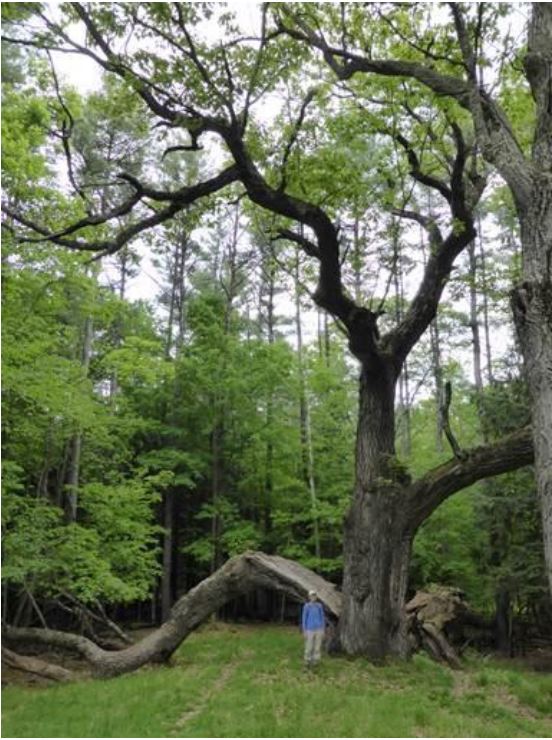
Head back up the Maple and Fire Trails to the summit. Pass the kiosk and nearby bench, and head down to the right toward the Hemlock Trail sign. You’ll soon come to the remains of an enormous old oak tree, its split trunk and massive limbs now draped across the landscape, having lost their battle with gravity and time. The trail actually passes under the fallen trunk. Here’s what it looked like in 2014 (right).
  • Return to the summit for your last view before visiting the largest resident of Balch Hill. From the low bench near the summit maple, walk west and downhill toward the view of downtown, to another stone bench near a group of crabapple trees. Just beyond, you’ll see a sign for the Piane and Grasse Rd Loop Trails on the left, nailed to a white birch. Head down this trail only a few steps and make a sharp left onto the red-blazed Grasse Rd Loop.
  • The Grasse Rd Loop trail follows the contour, leading you in a couple of minutes to the County Champion Northern Red Oak, marked with a small sign. Despite its size, it can be easy to miss as its bulk is so far overhead. Look for it opposite the cut trunk of a tree.
  • Neighbors are sometimes reluctant to cut trees along boundaries, and we think it was this instinct that protected this massive tree, the largest survivor of its kind in Grafton County. When measured by the state’s Big Tree Steward in 2014, it had a circumference of 196 inches, a height of 114 feet, and an average crown spread of 80 feet. Had its cousin on the Hemlock Trail not lost its limbs, that tree would have been even larger.
  • After admiring this giant and imagining the history it must have witnessed, continue on the trail that soon bears left to head up a small valley to the small footbridge you crossed earlier. You’re now five minutes from your car.
  • Cross the bridge, bear right at the junction with the Hunter East Trail, and return down the hill to your car.

The volunteer Balch Hill Stewardship Committee cares for thisVolunteers tend a fire to remove cut brush on the summit of Balch Hill in winter. 
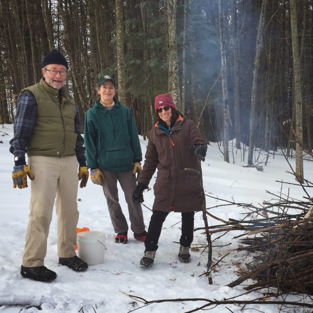
place and always welcomes help. Contact us if you’d like to get involved! We welcome contributions to the Balch Hill Stewardship Fund to help with the costs of annual mowing, vegetation management, and trail improvements.

December 2016, updated September 2020

Filed Under: Balch Hill, December, Forest Ecology, Hike of the Month Tagged With: Dartmouth College, history, maple, oak, summit, Town of Hanover, view

General’s Trail

July 15, 2020

HIKE DIRECTIONS & MAP – Full PDF


General's Trail route mapDriving Directions

  • From Etna village, turn R onto Ruddsboro Road
  • Follow Mink Brook as the road curves up its narrow valley for 1.5 mi.
  • Turn L onto Three Mile Road
  • After 1.2 miles, arrive at the AT parking area on L, opposite telephone pole 31-50

What You Should Know

  • Foot travel only.
  • Dogs are welcome but must be under close control.
  • Wear blaze orange Sept. 15-Dec. 15 (your four-legged hiking buddy, too!)
  • Hunting is permitted on the AT and other lands you cross at the beginning and end of this hike, but not on the private land crossed by the southern half of the General’s Trail loop.
  • You’ll visit lands owned by the federal government, Dartmouth College, and private owners including the Shumway Forest, protected by the Hanover Conservancy (outlined in yellow above).
  • As of 2021, some trail names are being updated.

Brief Directions

  • Take the AT east from Three Mile Road
  • Turn R onto the Fred Harris Trail
  • Bear L onto the General’s Trail, following uphill
  • Bear L where Northwest Passage comes in at R
  • Turn L onto AT going west
  • Continue straight back to your car at Three Mile Road

Full Hiking Directions

  • tree with white blazeBegin your hike on the Appalachian Trail on the E side of Three Mile Road.  The federal government bought this 21-acre parcel from the Mascoma Beagle Association in the 1980s. It must have been a lively place with the beagles in charge.
  • The white-blazed AT passes over a rise and then gently down into the valley of Mink Brook.
  • Seven minutes into your hike, cross the brook on a log bridge. Nearby, deep purple infuses the fall foliage of a hobblebush, decorating the scene at this time of year.
  • Cross the brook and follow the AT as it climbs back out of the stream valley.
  • Six minutes’ walk from the brook, step over a rotting log and cross onto Dartmouth College land. On this part, the federal government holds a permanent easement to protect the AT.
  • Just after a log crossing at a small wetland, arrive at a 4-way junction. The Harris Trail, former route of the AT, honors the Dartmouth Outing Club’s founder (1909). It offers wonderful skiing when conditions are right. The AT was re-routed off this path onto the ridge of Moose Mountain in the 1980s.
  • At this junction, the AT continues straight ahead – you’ll return down that path to this point. At L, the Harris Trail looks well-traveled. Today, you’re up for the path less taken – turn R. A few yards ahead, a wooden sign reads, “Old Harris Cabin Access.” [new trail name: North Cabin Trail]
  • The wide and grassy trail soon begins to descend gently through northern hardwoods. For the next 5 minutes, you’re traveling through a part of the 313-acre Shumway Forest that was protected by an AT trail easement in the 1980s and in 2017 by the Hanover Conservancy’s more comprehensive conservation easement. Both easements guarantee public access to the trails.
  • Soon a wood sign with arrow directs you L. You have arrived at another parcel of private property. Say a silent thanks to this generous landowner who gamely goes along with the network of hiking trails on Moose Mountain, and take care to leave no trace of your visit.
  • General's Trail sign
  • red berries by walking poleShortly after the arrow sign, an orange sign at L marks the W end of the orange-blazed General’s Trail, a pine-needle-strewn path that makes a wide loop back to the AT.
  • In autumn, it seems the whole trail is decked out in orange – from the trail signs and blazes to the brightly colored red eft salamander you might spot at your feet, to the brilliant mushrooms that spangle the forest floor and the fallen leaves of red and sugar maples.
  • red leaf
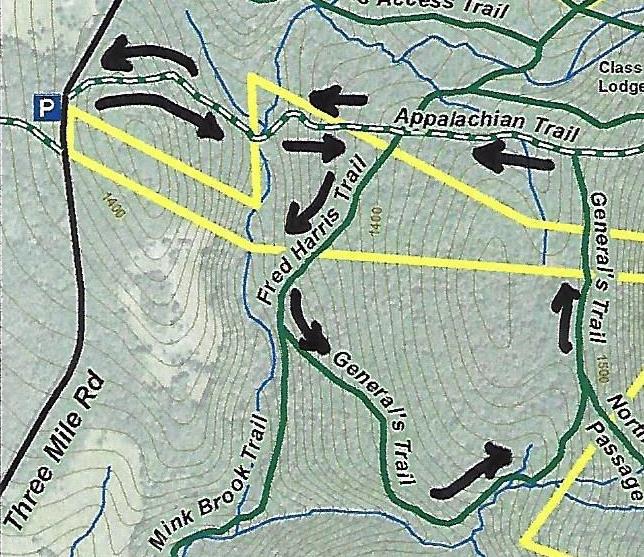
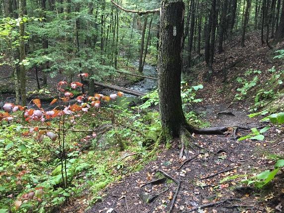
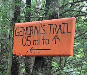
The trail initially has the look of an old woods road but soon narrows, offering gentle and comfortable hiking, unlike the often rooty and rocky AT. This trail was built in the early 1990s by a former owner of this property with the help of his boy scout troop. Why the “General’s Trail?” For a quarter century, it’s been the favorite daily hike of a neighbor who retired from the Air Force Reserve as a two-star general. When his friends and neighbors Peter and Kay Shumway met him often on the trail, they decided to name it for him on their Moose Mountain Lodge trail map. Recently, his daughter asked the Dartmouth Outing Club to make the orange signs as a special birthday gift.
  • Ten minutes from the orange sign, you arrive at an open grove of hemlocks – a good place for a snack. The trail swings L here to follow the rim of a steep valley, but before taking that turn, look over the escarpment to the brook far below.
  • "elbow" birchThe trail turns L past an “elbow tree” at R, a leaning yellow birch that lost its top and headed for the sun.
  • white fungi on log
  • Climbing gently up along the stream, the trail soon brings you to an up close and personal look at the tiny Mink Brook tributary. Cross it on impossibly green, luxuriantly mossy logs. You’ll soon encounter a few more “corduroy” log crossings. These places don’t look like much, but they are ecologically valuable. Headwater seeps, kept shaded and forested, serve as an important “sponge” in a downpour and start a stream off on its downhill tumble in the right fashion, cool and clean. Abundant moisture in the forest floor and a rich layer of duff support a fun and fantastic array of fungi.yellow fungi
  • white mushroom
  • The trail reaches the head of the little stream valley and follows the land’s contour as it heads north toward its junction with the AT. As the trail is less distinct here, it’s important to keep an eye out for the orange blazes; stay left at a fork. It’s hard to miss a jumble of pure white boulders of quartz.
  • yellow fungi by leaves20 minutes from the hemlock grove, a vertical white “US AT Boundary” sign appears on a white birch at L, and you know you’re getting close.
  • Three minutes later, arrive at the AT; note the orange “General’s Trail” sign.
  • Turn L and follow the famous path as it heads gently and pleasantly downhill.
  • What a difference thousands of feet per year can make! The AT treadway is well-worn but also well-loved, evidenced by some clever bits of trail work that carry the path over small drainages.
  • Five minutes after bidding the General goodbye, you return to the familiar four-way intersection with the Harris Trail. Cross it and continue straight on the AT.
  • Seven minutes from the intersection, the brook and bridge come into view. If you didn’t stop for a picnic at the hemlock grove, this is a great picnic spot too.
  • These waters and the rest of the Mink Brook watershed were part of a statewide study by Trout Unlimited and NH Fish and Game biologists in 2011. They found that “Hanover’s little Mink Brook and its tributaries showed a surprisingly healthy population of native Eastern Brook Trout.” They counted 213 brookies in 16 study sites and noted how important cold clean water is for this species. Almost 70% of the trout were found in five sites (including this one) with an average water temperature of 59.8 degrees. If you have such a stream on your property, what can you do to help brook trout? Keep a lush buffer of trees and shrubs to shield it from the summer sun.
  • Cross the bridge with its handrail and head back up and out the seven minutes’ hike to your car.

Please respect the generosity of these landowners by leaving no trace of your visit and enjoy the memories and photographs you take home.

9/2018, revised 1/2021


Filed Under: Hike of the Month, Moose Mountain, October, Shumway Forest Tagged With: Appalachian Trail

  • « Previous Page
  • 1
  • 2
  • 3
  • 4
  • …
  • 8
  • Next Page »

71 Lyme Road
Hanover, NH 03755
(603) 643-3433

info@hanoverconservancy.org

Facebook logo   Instagram   YouTube

Get Involved

Become a Member

Volunteer

Business Sponsors

Conserve Your Land

Employment

Our Mission

Advocacy

Conservation

Education

Stewardship

Explore Hanover

Hanover Hikes

Upcoming Events

Upper Valley Hikes

Trails Challenge

Copyright © 2025 Hanover Conservancy | Design by Chase Brook Software