Hanover Conservancy

Facebook logo   Instagram   YouTube          
Donate button
  • Home
  • About Us
    • Employment
    • What We Do
      • Advocacy
      • Conservation
      • Education
      • Stewardship
    • Celebrating 60 Years
    • Board & Staff
    • Membership Benefits
    • Contact Us
  • Get Outdoors
    • Hanover Lands
      • Balch Hill Natural Area
      • Mink Brook Nature Preserve
      • Other Properties
    • Hanover Hikes
    • Hanover Trails Challenge
    • Upper Valley Hikes
    • Exploring Nature at Home
    • Hunting
  • Events
    • Calendar
    • Spring Wildflower Scavenger Hunt
    • Private Events
  • Get Involved
    • Donate
    • Volunteer
    • Adopt a Trail
    • Corporate Conservators
    • Planned Giving
  • Education
    • School Programs
      • KAST
      • Connecticut River Studies
      • Hanover High School Scholarship
    • Request a Field Trip or Speaker
    • Research on Our Lands
    • Hanover History
    • Resources
  • News
    • Remembering Bob Norman
    • Reports & e-News
  • Conserve Your Land

Old Highway 38 & Hudson Farm

September 1, 2018

Trail Directions and Map – Full Hike
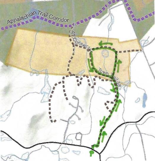
 

Hudson Farm hike mapDriving Directions

  • From the traffic light at Route 120 and Greensboro Road, take Greensboro Road east for 1.8 miles to its junction with Etna and Great Hollow Roads.
  • Park at the roadside pull-off. If you prefer off-road parking, turn in at David Farr Memorial Park and bear R and downhill to a shaded gravel parking area.
  • Today’s hike on an historic highway includes a loop through the now-protected Hudson Farm’s fields and forest.

What You Should Know

  • This is a fun and easy hike with a few sections of tricky footing among roots or rocks. The route is well-blazed.
  • The route follows an early road and then travels a loop on one of Hanover’s newest conservation lands. In 2017, the National Park Service purchased the Hudson Farm (brown-shaded area on map) to permanently protect it as part of the Appalachian Trail corridor.
  • Trails are maintained by Hanover Trails Committee volunteers and Berrill Farm neighbors.
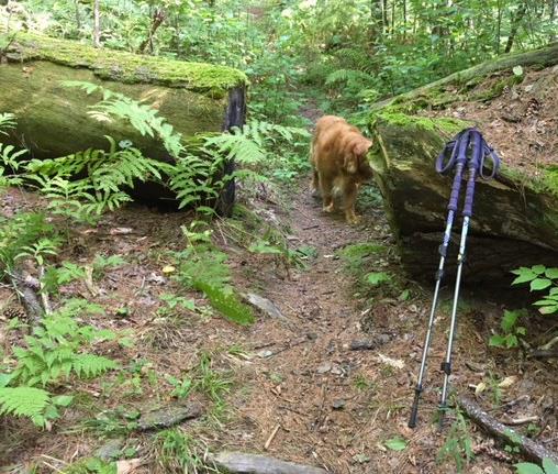
  • Dogs are welcome but must be under your control; please pick up after your pet.
  • Snowmobiles, ATVs, and bicycles are not permitted.

Hiking Directions

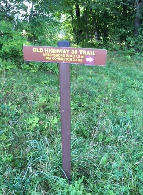
  • Begin your hike on Greensboro Road at the blue town sign marking the Old Highway 38 Trail, directly opposite the town’s Farr Memorial Park.
  • The old road leads between two contemporary houses and shortly turns R (marked with arrow), immediately diving back into time at a pair of old stone walls – the first of many you will encounter today.
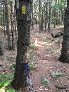
  • tree with yellow blazeDon’t be dismayed by the steep path that suddenly appears– the rest of the hike is gentle and rolling. Follow the yellow blazes into the woods.
  • Town Highway 38 has a murky history. Laid out in 1795, it connected Greensboro and Trescott Roads. It was later discontinued, but its exact route was so hard to trace that when planning began for Berrill Farms in 1979, the town agreed with the developer on a route to be called the “Old Highway 38 Trail.”
  • The trail passes through a knobby landscape covered with ferns and a young forest of white pine. The stubs of lower branches encircling each tree are clues that these pines grew up together in an abandoned field, self-pruning those branches as the canopy closed in and blocked out the sun. A few venerable, much older maples survive.
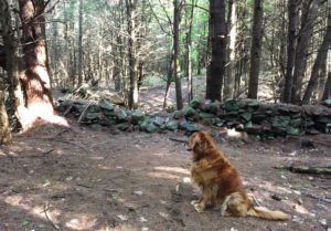
  • old stone wall
  • Eight minutes from the trailhead you cross a fine stone wall. Follow it with your eyes to another at R, running parallel to the trail.
  • A few minutes later, take care crossing a wet spot, where “tree cookies” placed as pavers can be slippery. A small wooden bridge takes the trail over a space that is wetter in other seasons.
  • Six minutes from the first wall crossing, a trail comes in at L at the top of a small rise. This trail is closed to all but Berrill Farms residents. Continue straight, toward a blaze on a large, triple-trunk white pine. The nature of the forest has shifted, with more deciduous hardwoods, belying a different history.
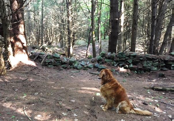
  • You soon encounter another stone wall, this one built with much smaller stones – a clue that it once bordered cultivated land. The builder wished to spare his plow and give his carrot seedlings a chance by stooping to move and stack smaller stones. Had he been grazing sheep here, he wouldn’t have bothered. Take a moment to peel the years off this scene in your imagination, to a time nearly 200 years ago when the only trees were a few young maples left as shade for sheep, when sunlight flooded the ground you’re walking, and the view stretched E to nearby Mill Village, now called Etna. Time, and the end of the sheep craze, brought back the trees.
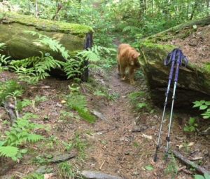
  • path in fallen pineSeven minutes’ walk from the trail junction, you pass through a slot in the fallen bole of a big pine, nearly 3 feet through. That’s big – but trace it back to where it fell – it was once part of a massive ring of three trunks! These softwoods grow more quickly than hardwoods like maples and oaks, so despite its imposing size, it’s likely younger than most of the hardwoods.
  • The trail swings up and L and follows a stone wall that retains barbed wire from when cattle, not sheep grazed here. At R, a field appears.
  • Bear R at a fork in the trail, up onto a mown path into the E meadow of the former Hudson Farm, to begin a steady climb to a line of trees at the top. Monarchs and other butterflies join you at this time of year, alighting on milkweed, clover, and goldenrod among the grasses, and cicadas and grasshoppers contribute the music.
  • Five minutes from the woods trail, you arrive at the tree line, where a second field comes into view beyond. You are walking through one of Hanover’s iconic historical farm landscapes.
  • Stop for a moment to enjoy the expansive view. Straight ahead, the open slopes of Lebanon’s Storrs Hill stand out, even more so in winter when covered in snow. At R are the Rix Ledges, some of the most interesting terrain and wildlife habitat in Lebanon.
  • Approach the small white pine growing by itself in the field, 20 paces away. From this vantage point you can see Mount Ascutney rising in the distance, to the right of Rix Ledges. You won’t be the first to have “The Sound of Music” pop into your head – nobody’s watching, so twirl around and sing!

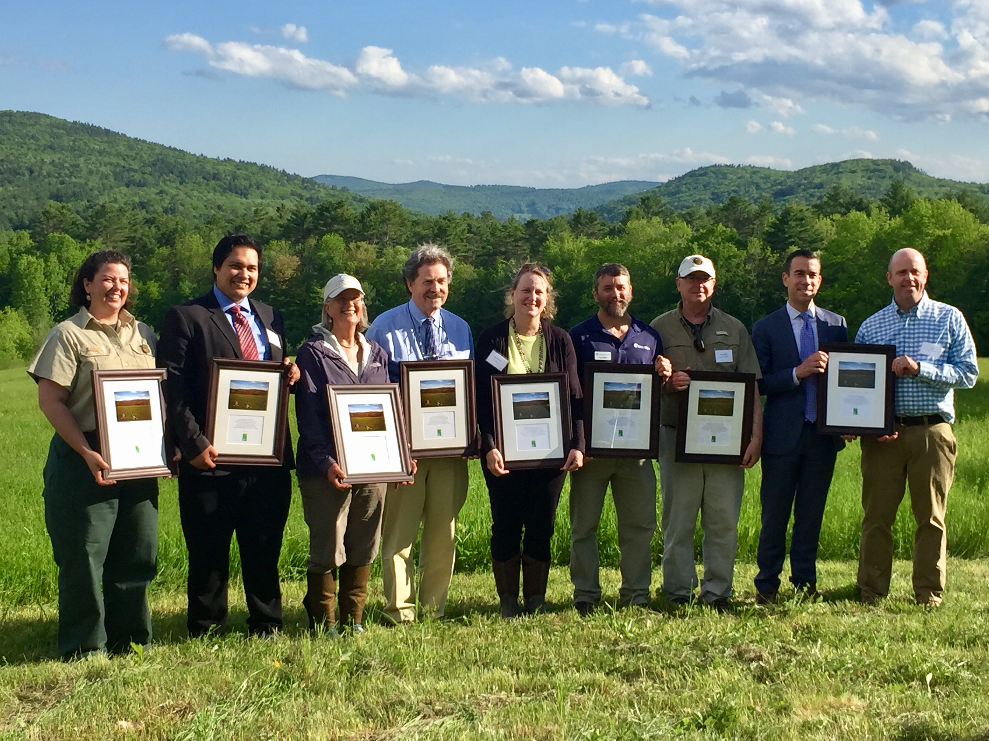
  • A group stands with honorary plaques during the June 2017Hudson Farm conservation celebrationIn June, 2017, this was the site of a grand celebration. A partnership between the Trust for Public Land and the Town of Hanover, assisted by the Hanover Conservancy, resulted in purchase of the 175-acre Hudson Farm by the National Park Service to permanently protect it as part of the Appalachian Trail corridor. In addition to major federal funding, many local contributions made this possible, including a major contribution from the Hanover Conservancy to help with caring for the land into the future.
  • Owned for many years by Dartmouth College, the property had been eyed as a site for everything from a cemetery and golf course to a housing development. Today, the AT Conservancy manages the land with help from the White Mountain National Forest (WMNF) and, for trails, the Hanover Conservation Commission’s Trails Committee.
  • The beautiful meadows are kept open by periodic controlled burning for their spectacular views, to keep invasives under control, and to rejuvenate valuable grassland bird habitat. Without such treatment, grassy thatch would build up to prevent ground nesting of bobolinks. WMNF crews conduct such burns every 3-4 years, after careful advance planning. Burns take place during the brief window of time in late April just before the fields burst into lush green and before birds arrive to begin nesting. Coordinating with local officials and consulting weather forecasts, trained crews stage fire-fighting equipment nearby before conducting a small test burn to confirm that conditions are right. If they are, the burn continues.
  • Returning to the tree line, cross a low stone wall to the other field and a brown and yellow trail sign where two mown paths meet. From here, you can see a 20th century home built as a country retreat by Archer Hudson, a retired architect. Dartmouth College later purchased the property and carved off the house for resale, keeping the land. While the College referred to it as the “Hudson Farm,” the property ceased to be a farm when Hudson arrived. In fact, he burned down the large barn that once stood here!Old Highway 38 sign
  • [NOTE: To return along Etna Road, bear R here and take the mown path down through the meadow to Trescott Road and the Hudson Farm trailhead. Turn R on Trescott Road and R on Etna Road to your car.]
  • To continue today’s hike, bear L toward the woods to the lowest point in the rolling field.
  • Two sets of boardwalks offer dry footing across drainages. The second, larger one was built in 2018 by Hanover Trails Committee volunteers (thank you!). Protecting such headwater wetlands and streams from heavy foot traffic benefits water quality and trout habitat in Mink Brook.
  • Soon you’ll see a stone wall at R, reminder that this was once grazing land. Continue as the trail heads gently downhill, with the slabby stone wall on your R until the wall neatly turns a corner of the old pasture.
  • Shortly after, a blue sign at R indicates you are heading toward the Appalachian Trail.
  • [NOTE: For a much longer adventure, continue straight here, turn L (southbound) on the AT to the Conservancy’s Greensboro Ridge Natural Area, L at Oli’s Trail, L at the Greensboro Highlands Trail, L at the Silent Brook Trail, and then L onto Greensboro Road and walk 1.6 miles back to your car.]
  • To continue today’s hike, turn L at the blue sign and follow the yellow blazes past impressive white pines. The trail slabs along the contour. It is discouraging to note the invasion of non-native barberry (a prickly shrub) and glossy buckthorn (find its black berries underfoot among the pine needles). Consider volunteering for organized work parties to remove these pests from conservation land. Or, volunteer to remove them from your own property, to help keep them from spreading. Learn more about these invasives from the Hanover Conservation Commission’s Biodiversity Committee.
  • Continue down the hill to a small drainage that may be nearly dry at this season. The trail crosses it in two places and bears R. About 15 minutes from the top of the fields, you return to the path you took into the first meadow. Continue on the woods path and stay L to avoid a R fork leading over a stone wall. It’s another 15 minutes back to your car from here.
  • The trail soon swings R and down toward Greensboro Road. Listen for the two-part whistle of a broad-wing hawk and keep an eye out for mushrooms. These fungi decorate the forest floor at this time of year, in colors ranging from purest white to bloody red.
  • The sound of traffic is a clue that you are nearing Greensboro Road. A pair of granite boulders serve as your gateway back from Hanover’s past to its present.
8/30/2018
Filed Under: Hike of the Month, Hudson Farm, September Tagged With: Appalachian Trail

Deer season begins in NH Sept. 15

August 27, 2018

Although hunting for various species occurs throughout the year, deer season is by far the most popular. In New Hampshire, the full season runs from September 15 – December 15 each year.

IMG_5856

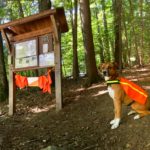
Remember to wear your blaze orange or hi-vis yellow and take precautions with dogs and kids: bells and bright colors are always a good choice!

Loaner safety vests and bandanas are available at many of our trailheads. Please return them after your hike!

Filed Under: Balch Hill, Deer, Hunting, Lands, Stewardship, Wildlife Tagged With: archery, Balch Hill, deer, hunter, hunting

Hanover receives special deer hunting permits from NH Fish & Game

August 23, 2018

New webpage on local hunting coming soon…

View a 2018 map of areas where these permits can be used, and read more about the data behind Hanover’s multi-year application process from the Town’s Biodiversity Committee.

Filed Under: Balch Hill, Deer, Forest Ecology, Hunting, Lands, Partnerships, Research, Wildlife Tagged With: deer, Fish & Game, hunter, hunting, permits

Slade Brook and Huntington Hill

August 1, 2018

Hike information and map – full PDF


Slade Brook trail mapDriving Directions

  • From downtown, head N on Rt. 10 past Hanover Conservancy offices
  • Continue on Route 10, 3.3 miles past the N rotary
  • Turn R on Old Lyme Rd. and drive 0.2 miles to a sharp bend.
  • Park on R on gravel shoulder at sign for Upper Slade Brook.

What You Should Know

  • Foot travel only, except for Old Spencer Road.
  • Dogs are welcome but must be under close control.
  • This loop hike passes through the Barnes Estate, owned and managed by Dartmouth Hitchcock Medical Center, before reaching the Huntington Hill Wildlife Management Area, a major privately owned parcel protected by a conservation easement held by the NH Fish and Game Department.
  • Trails are marked in some places; plans are being developed for a new trail map.

Hiking Directions

  • A sign bearing a white arrow with yellow lettering directs you to Upper Slade Brook on a path leading in to the woods. Begin your hike here.
  • In a few yards you’ll pass over a narrow wooden footbridge, built by the Hanover Conservation Council (now Conservancy) and town volunteers in 2000. This crossing replaces an earlier one – below at L is the old stone abutment for the bridge that once carried Old Spencer Road over this stream. This road, built in 1816 to link Old Lyme Road with Dogford Road, was discontinued subject to gates and bars in 1932.
  • Follow Old Spencer Road through the woods and up the hill. This is part of the former Barnes Estate, now owned by DHMC. In 2017 this area was logged significantly.
  • About 7-8 minutes from the bridge, you’ll reach a junction marked with a yellow-lettered sign. Old Spencer Road continues straight uphill. Bear L onto the Bridle Path. It has been used recently as a skid trail, but quickly narrows and you’ll soon hear the music of Slade Brook at L.
  • After 5 minutes’ walk from Old Spencer Road, a sturdy wooden bridge comes into view as you cross onto the Huntington Hill Wildlife Management Area.
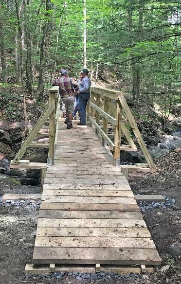
  • Slade Brook bridgePause on the bridge to admire both the workmanship and the partnership that built it in May-July, 2017. A determined team of 20 volunteers, led by Hugh Mellert and the Hanover Conservation Commission’s Trails Committee, built the bridge with permission of the private landowners and help from the Upper Valley Trails Alliance, Hanover Public Works, Hanover Conservancy, Cardigan Mountain Highlanders, DHMC, neighbors, and hikers who happened by and jumped in. Funds for materials were donated and the 250 person hours of labor were free. This new bridge replaces one that’s been gone for 50 years, and provides a safe and valuable connection to the network of trails on Huntington Hill.
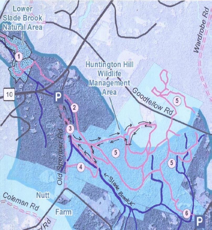
  • Huntington Hill map
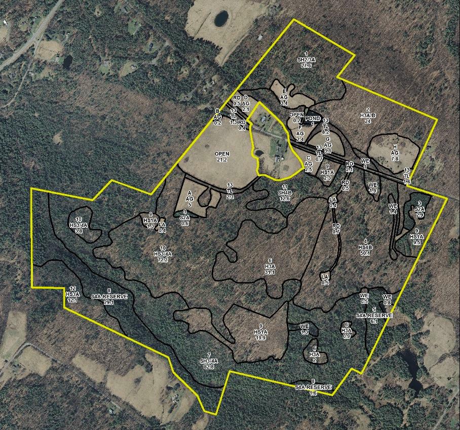
  • Huntington Hill Wildlife Management Area (outlined in yellow on this forest stand map) is managed for recreation, timber, and wildlife habitat. The NH Fish and Game Department holds a permanent conservation easement on 464 acres of privately owned land here, and also on a 31-acre piece connecting it to Hanover Center Road, where the Hanover Conservancy holds a secondary easement. Forests and vegetation cover are highly variable, with deciduous, mixed, and coniferous forest types. Hemlocks dominate the brook valley (lower L). Much timber stand improvement has been done over the last 40 years under the guidance of professional foresters.
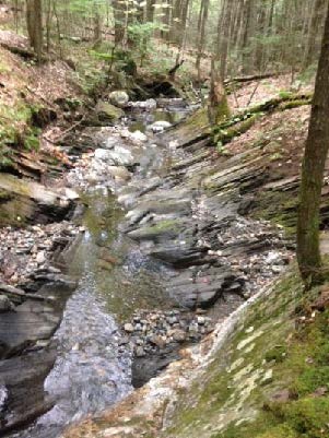
  • Now turn your attention to the brook itself, and the fascinating variety of rocks composing its bed. Water-worn granite alternates with leaves of uplifted, slanted sedimentary rock that speak volumes about the deep geological history of this place.
  • Two trails meet at the far end of the bridge. Bear L onto the wider of the two (you’ll come back on the other one) and head steadily uphill through a pine/hemlock forest. Faded pink flagging marks the route.
  • About 10 minutes’ walk from the bridge, you reach the top of a rise where the Barnes Trail comes in at L by two large white pines. Another wooden sign with yellow lettering confirms your location. Continue straight for Goodfellow Meadows. Just ahead, another trail junction is visible. You’ll take that path on your way back.
  • 15 minutes’ gentle steady walk uphill from the bridge, a trail comes in at R. Continue straight toward the opening that appears ahead. An orange diamond with arrow is posted at L, guiding your way forward.
  • Pass briefly into a brushy wildlife opening of berry bushes and popple. Think like a bear and keep an eye out for ripe fruit before reentering the woods. Places like this are also excellent habitat for hares.
  • In 6 more minutes’ walk, arrive at an open meadow bounded on the far side by a stately line of trees. A minor trail comes in at R – you’ll be returning on that trail to this point later.
  • song sparrow
  • Walk straight through the meadow, a stark contrast to the piney woods below. The meadow is filled at this season with golden black-eyed Susans and goldenrod, white yarrow and Queen Anne’s lace, and deep blue cow vetch among the grasses. Wildlife appreciate openings like this, vestiges of the much more open agricultural landscape that once existed here in New Hampshire. Listen for the conversational trill of the song sparrow.
  • Nearing a small red maple at L, note the barely perceptible shift in the tilt of the land beneath your feet. You are crossing the watershed boundary from Slade Brook behind you to the watershed of Pingree Brook, ahead.
  • horse drawn tedderAs you approach the wall of tall trees at the far end of the meadow, a break in the trees appears and you arrive at an opening in the stone wall. Beyond stretch a grand, wide, rolling hayfield and wonderful views to the west and northwest. On the day we visited, newly mown hay was being turned to dry and the air was full of its sweet scent. While a woman driving a tractor was managing this task today, we could easily imagine a horse drawn tedder (R) doing the job a century ago.
  • While it’s hard to keep your eyes off the distant horizon, wrest them away to the stone wall close by. Among the larger stones are many smaller fist-sized ones, clues that the land growing grass today was once cultivated, prompting the farmer to remove and dump here any small stones that might damage his equipment or discourage seedlings.
  • Turn R and head up along the edge of the hayfield close to the tree line.
  • You’ll pass another break in the stone wall, but continue until the 19th century barn comes into view and you reach a sturdy post carrying a bluebird house and the familiar orange diamond with arrow. Views are even broader here. Imagine a time when these hills were 85% open sheep pasture and cropland, rather than 85% forested. In 1840, when Hanover’s human population was about 2,600, its sheep population was 11,024!
  • A low yellow-painted iron post by the stone wall marks your turn back into the woods here. Turn R again onto a well-worn path that follows the wall back in the direction you just came. From this vantage, it’s easy to read the former farming use in the strands of barbed wire laying over wider sheep fencing. A line of fine old maples punctuates the wall, testifying to the passage of time on this farm.
  • As the trail swings gently up to the L, sharp eyes will find the hood of a 1930s-era truck, another remnant of farm days past. The trail moves away from the field and wall and back into the Slade Brook watershed. Continue straight and head WSW and eventually S, gently up. Occasional flagging appears at R.
  • 15 minutes from the field, an opening appears through the trees; just before reaching it, turn R onto a narrower trail just past a handsome straight-boled red oak at R.
  • A few yards later, this link ends at a T; turn R.
  • 3 minutes later, you arrive back at the first open meadow. Look for the small red maple dead ahead. Stop and admire the views you couldn’t see when you first traversed a lower part of this field.
  • Paths diverge here following the forest edges; you bear L, noting blueberry bushes at your feet, and pass along the edge of the meadow before quickly regaining the shelter of the woods.
  • 5 minutes later, rejoin the trail at the end of the meadow. Turn L and retrace your steps downhill, bringing you in 10 minutes back to the yellow painted sign for the Barnes Trail. If you’re in a very big hurry, you can take this trail to return directly to your car (about 12 minutes), but you’ll miss a nice treat (20 minutes, not including time lingering by the brook).
  • To continue your hike, turn to face uphill and after 15-20 paces, turn R onto a new trail that largely follows the contour after a short log crossing of a small drainage. The trail soon takes on the look of a very old woods road, with a sunken bed just wide enough for a cart. The old road starts down into Slade Brook’s hemlock-shaded valley.
  • Slade Brook5 minutes from the last junction, you reach the brook at a footbridge constructed in September, 2018 by Hanover Trails Committee volunteers and the public-spirited landowner. Today, our route keeps us on this side of the brook.
  • Turn R and follow the brook down through its steep-sided valley, noting how tree roots hold the streambank in place. In some places, you can see where the brook makes several channels during high water, and then recedes to the lowest of them as waters subside, rearranging its bed every time. A thrush’s song plays a duet with the water’s music.
  • Watch closely for a shift in the trail up to the R under a tipped hemlock as the trail leaves the brookside to avoid a section of uplifted ledges. Occasional orange arrow signs point the way, but you need only to keep the brook on your L. It seems a privilege to be accompanying this little brook on its trip to the Connecticut River, spilling over tiny waterfalls and enlivening occasional pools as it tumbles on its wood-strewn way. If you brought a snack with you, find a likely looking rock perch to enjoy it now.
  • 6 minutes from the old crossing, return to the new bridge. The trail you took on the way out comes in at R.
  • Past the bridge, you’ll know when you’ve returned to DHMC land when logging slash appears by the trail. Limbs and branches are left behind to return nutrients to the soil and feed the next generation of trees.
  • 3 minutes from the bridge, arrive again at Old Spencer Road. Turn R and head down 4 minutes to the lower bridge and your car.

Please respect the generosity of these landowners by leaving no trace of your visit and enjoy the memories and photographs you take home.

In 2004, Northern Woodlands magazine carried this feature story about Huntington Hill.


Filed Under: August, Hike of the Month, Slade Brook Tagged With: Queen Anne’s lace, white yarrow

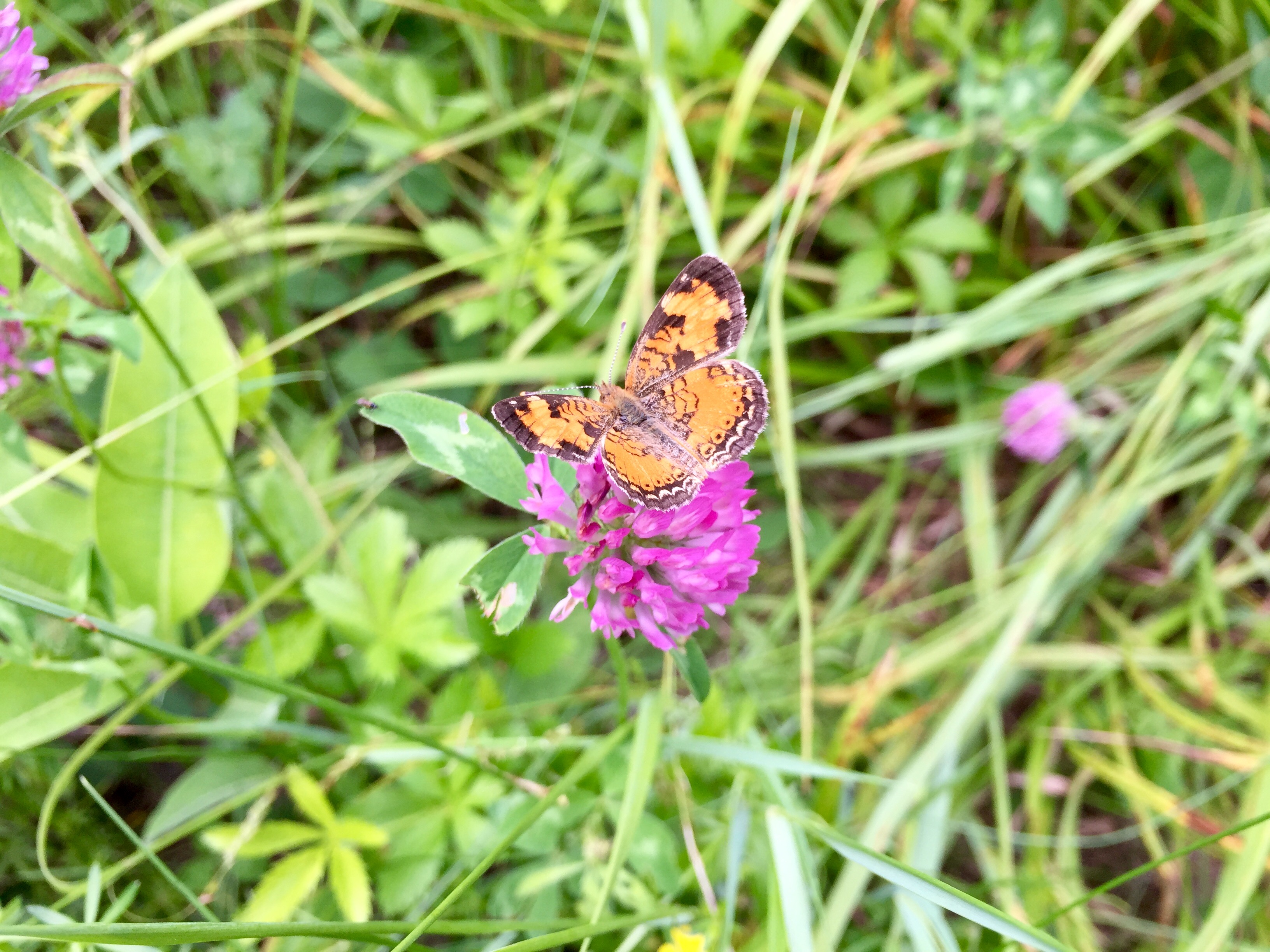
Butterflies For All

July 23, 2018

Come explore the lovely world of some of our local butterflies with Bill Shepard at the Etna Library on Monday, August 13th at 3:00.

Look at specimens and learn about moth & butterfly resources before heading outside to the Hayes Farm Park & Nan and Allen King Bird Sanctuary to try your hand at catching a few!

Crescent sp.

This fun & informative event is recommended for ages 8+, but all are welcome. Event includes a short, easy walk behind the library.

Filed Under: Events, Indoor Programs, King Bird Preserve/Hayes Farm Park, Outdoor Trips, Partnerships, Wildlife Tagged With: butterflies, Etna Library, family friendly, Hayes Farm Park, wildlife

Baum Conservation Area and Moose Mountain

July 1, 2018

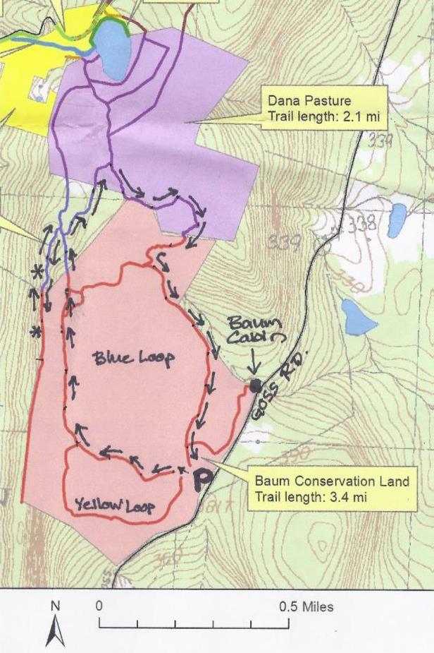
Baum Conservation Area – Full PDF


Baum area trail mapDriving Directions

  • From Etna Village, head N on Hanover Center Road
  • Turn R on Ruddsboro Road and continue to end on Route 4
  • Turn L on Route 4, drive 1.6 miles to Enfield Village
  • Turn L onto Maple Street; bear L at junction with May Street.
  • Drive 3.1 miles to the well-marked Baum Conservation Area entrance (1.7 mi. past Hanover-Enfield line).

What You Should Know

  • This is a hike for confident hikers with good trail skills. The trails are not the well-beaten paths you find at Balch Hill or the Appalachian Trail, which is part of the adventure. Bring a compass.
  • Some of the route follows grassy former skid trails; anticipate insect hitchhikers and do a tick check.
  • Foot travel only. Dogs welcome if under close control. You’ll pass prime porcupine habitat – we know from experience.
  • The route visits the Baum Conservation Area and the Dana Forest and Pasture Natural Area, parts of a 3,800-acre block of protected high-elevation wildlife habitat on Moose Mountain.

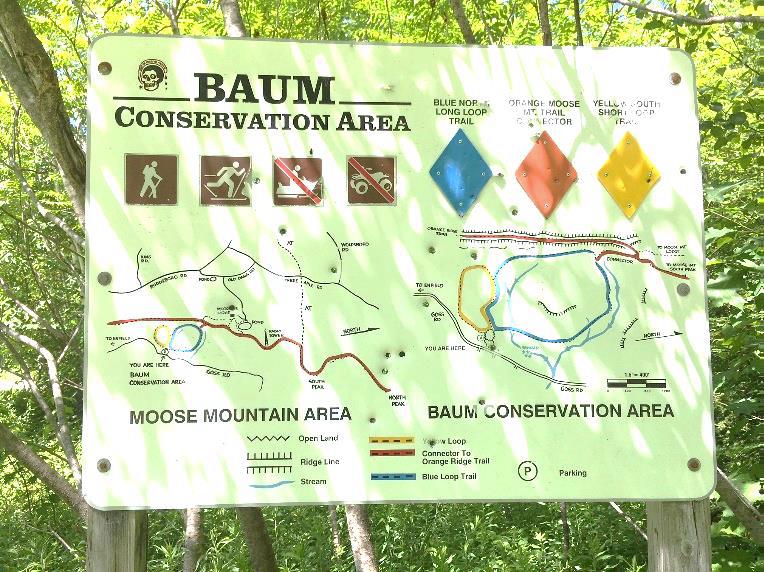
Baum area signHiking Directions

  • Begin your hike at the large triangular flat rock at the SW edge of the dirt parking area, after familiarizing yourself with the trails depicted on the posted entrance sign. You’ll be touring most of the 1.6 mile Blue Loop today, with a couple of additions.
  • To protect mountain wildlife habitat next to the Dana Forest and Pasture Natural Area and to offer public access to the trails you’ll be exploring, Dartmouth alumnus and outdoorsman Jim Baum and his wife Carol purchased this 239-acre area and gave the Town a conservation easement on the land. Jim worked with the Upper Valley Trails Alliance to improve the trails.
  • Start up through the trackless meadow, aiming for a point at 10 o’clock on the surrounding tree line. Soon a bare bit of smooth ledge appears with a small cairn to reassure you. Look for a yellow diamond sign with an arrow at the edge of the woods. Here, you bear R (not L) onto a mowed path.
  • An old skid trail turned hiking trail, the path soon begins to ascend gently but steadily, with mosses and herbaceous plants underfoot. Continue past a wide trail leading back down to the meadow. Shrubs such as a native honeysuckle and spiraea line the way. You can tell the soils here are moist, receiving subsurface water from upslope, as the path is carpeted with water-loving sedges. The curious fruiting body of the most common one looks like a pudgy green porcupine or blowfish. It looks prickly, but it’s not.
  • bracken fernAbout 18 minutes from your car, the trail bears R and levels out. A blue arrow confirms you’re on the Blue Loop. Waist-high bracken fern grows exuberantly. If a deerfly has discovered you, thwart it by joining the Order of the Bracken – pick a frond and wear it upside down on top of your head! Deerflies are programmed to swarm around the highest point of their prey – and will hover at the top of the fern stem.
  • 4 minutes from the blue diamond, look for yellow and blue diamonds on a tree at L. The trail swings L and moves through a thick young forest of pole-sized trees 1-3” in diameter. Grouse enjoy this habitat and you may suddenly flush one, startling both of you. Listen for the liquid notes of a wood thrush.
  • Another 4 minutes’ walk brings you to a clearing where a yellow arrow points L. You bear straight toward an opening filled with sun-loving, fragrant, hay-scented fern. Foresters don’t like this fern (or bracken) because it tends to quickly colonize forest openings, shading out any tree regeneration they encourage.
  • The trail moves gently up and curves L and R, ducking in and out of fern openings. As you ascend, now heading N, note the change in the woods. Here, older yellow birch and beech dominate the bony land. A few dips in the trail remind you that it was built as a logging trail with water bars to prevent erosion.
  • In 10 minutes, pass a pool teeming with tiny life. Just past it, the trail heads downhill.
  • Watch for a blue arrow on a small gnarled maple at L, directing you R as the trail gently curves.
  • The trail becomes narrower, with a few twists and turns, but if you trust your feet, it’s easy to follow.
  • 5 minutes past the pool, look for a junction with blue arrows pointing L and R. The Blue Loop heads R, straight downhill and back to the meadow and your car. We have more to discover, so look ahead for two orange diamonds at 11 o’clock. Head this way and cross a tiny drainage. This is a good place to look for wildlife tracks. Moose, bear, fisher, bobcat, fox, coyote, deer, porcupine, and squirrel are possibilities!
  • The trail has now transitioned to a more familiar woodland path. Follow the irregularly spaced orange diamonds, interspersed with blue flagging. In some places, blue diamonds are posted for viewing from the other direction. The trail moves gently and steadily up through mature northern hardwood forest.
  • 9 minutes from the last junction, a large bark-less, sun-bleached tree trunk has fallen across the trail. Pause to cross it and note an orange diamond on the L and just ahead, a constellation of signs. You have arrived at the Dana Forest and Pasture Natural Area, a 132-acre parcel owned by both the Town of Hanover and a member of the Dana family.
  • At this major junction, you have a choice –a 20-minute detour to check out two ledges (10 minutes if you just bag the first one) and soak in some views, or continue in the woods.

Optional Visit to Moose Mountain Ledges (1/3 mile each way)

  • view from the ledge just off the ridgeTurn L at the wooden sign and up a short steep section to a mossy ledge. This is part of the Orange Diamond Ridge Trail, built by a daring snowmobile club in the 1970s. The trail runs along the spine of Moose Mountain from Enfield to the South Peak, where it meets the AT. The Hanover Trails Committee has decided to rename it the Tom Linell Ridge Trail, after a dedicated long-time trail maintainer. The snowmobiles never returned.
  • Arrive at the first of two open ledges where views open up to the E. At 1 o’clock is the bony knob of Mt. Cardigan. Keep an eye on kids and dogs. A small cairn on the far side marks the trail’s return to the woods. Pass a nice colony of the small but stoic rock polypody fern.
  • Here, the Ridge Trail follows the boundary of two privately owned parcels – to the E is the Baum Conservation Area – you’re now following a trail that is parallel to but high above the one you just walked.
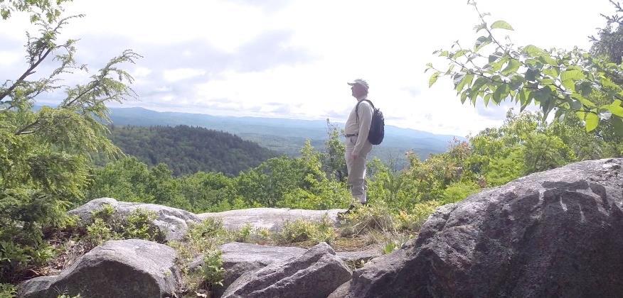
  • 5 minutes from the first ledge, arrive at the second, larger ledge, with even broader views. From the highest part of the open rock, you can see distant Mount Washington at 11 o’clock. At 10 o’clock, the ridge of Moose Mountain stretches N beyond the communications tower.
  • To return, look for pink tape on a tree to locate the trail back. It becomes clear you’re hiking the very spine of this mountain, a watershed divide, with the Mascoma River valley off at R and Mink Brook valley at L.
  • Return to the first ledge and follow a blue arrow to return to the trail junction.

Hike Continued

  • Back at the trail junction, retrace your steps to the fallen bare tree across the trail. Continue another 10 paces to a yellow sign at R for the Baum Conservation Area. At L, an orange sign with an arrow directs you to turn L onto the Ridge Trail, which appears as a smaller side trail.
  • Soon the Ridge Trail swings L and slabs along the contour before heading gently downhill. Note the bristly white pine at R that has received the attentions of pileated woodpeckers. The forest floor undulates with
  • the mounds and pits that betray long-ago blowdowns.
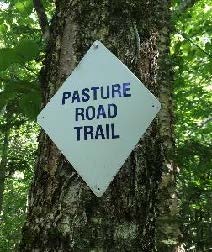
  • Pasture Road sign5 minutes after turning onto this trail, arrive at a junction. Bear R to follow orange flags, about 20 yards to a small hollow. Here an orange sign at L reads “Orange Ridge Trail” and at R, a white sign indicates “Pasture Road Trail.” Note the town’s blue and white trail blazes on a birch at L. This doesn’t look much like a road, but it follows, more or less, the route of a long-abandoned early “highway.”
  • Turn R to take the Pasture Road Trail, which is marked with blue-white blazes and occasional blue flagging. Here, the trail is uneven and narrow but well-marked.
  • stone wall corner
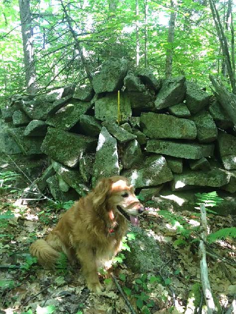
  • 6 minutes from the junction, you come upon a startling sight – the imposing corner of a stone wall with a yellow pin protruding from its base – boundary markers from the 19th and 21st centuries colliding. The wall is big and blocky and encrusted with lichen. It marks the northernmost corner of the Baum Conservation Area. After the terrain you’ve just been over, it’s hard to imagine building a wall to keep sheep here – especially a wall like this!
  • The trail continues L of the wall’s corner. Keep the wall on your R and a sharp eye out for painted blazes and blue flagging. The wall oddly ends, then after the trail twists near an outcrop, a section of wall appears again. There’s a nice growth of bunchberry and lowbush blueberry on the forest floor.
  • 8 minutes from the pinned wall corner, the trail parts company with the wall, which heads downslope. You continue straight, following blazes carefully. A short section of wall shows up again (what was the wall builder thinking?). Keep following the blue flagging and trust your feet.
  • 3 minutes later, bear R downhill onto a clearer path, down to a flat in a hemlock grove. Here, the trail bears R and is marked with simple blue painted blazes. Arrive at an opening with a dramatic view up to the ridge you may have just visited.
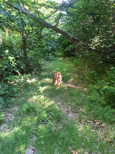
  • dog on trailThe trail continues on a narrow, rocky path for another 5-7 minutes arriving abruptly back at the Baum Conservation Area’s Blue Loop Trail, the now-familiar wide grassy path.
  • Turn L onto the easily followed trail and soon cross a streambed. Depending on recent weather, it may be dry, but it still has a watershed address! It’s an unnamed tributary of Lovejoy Brook, a tributary of the Mascoma River. We think it should be Baum Brook.
  • 10 minutes after joining the Blue Loop, cross another tiny stream. A path comes in at L – this leads to the Baum Cabin. Continue straight, head slightly uphill, and 2 minutes later you’re back at the meadow with your car in sight. As you head down to it, don’t forget to look for wild strawberries in the grass!

Note – Baum Cabin, 1/3 mile north of the parking area, is open to all by reservation with the Dartmouth Outing Club. Jim and Carol Baum gave the cabin to the DOC in 2008, thoughtfully including funds for its upkeep. The two-room cabin sleeps 6.

Learn More

  • Shumway Forest on Moose Mountain
  • Hanover Trails Committee maps
  • Baum Cabin


Filed Under: Hike of the Month, July, Moose Mountain Tagged With: bracken fern, polypody fern, sedge, views

  • « Previous Page
  • 1
  • …
  • 9
  • 10
  • 11
  • 12
  • 13
  • …
  • 29
  • Next Page »

71 Lyme Road
Hanover, NH 03755
(603) 643-3433

info@hanoverconservancy.org

Facebook logo   Instagram   YouTube

Get Involved

Become a Member

Volunteer

Business Sponsors

Conserve Your Land

Employment

Our Mission

Advocacy

Conservation

Education

Stewardship

Explore Hanover

Hanover Hikes

Upcoming Events

Upper Valley Hikes

Trails Challenge

Copyright © 2026 Hanover Conservancy | Design by Chase Brook Software