Hanover Conservancy

Facebook logo   Instagram   YouTube          
Donate button
  • Home
  • About Us
    • Employment
    • What We Do
      • Advocacy
      • Conservation
      • Education
      • Stewardship
    • Celebrating 60 Years
    • Board & Staff
    • Membership Benefits
    • Contact Us
  • Get Outdoors
    • Hanover Lands
      • Balch Hill Natural Area
      • Mink Brook Nature Preserve
      • Other Properties
    • Hanover Hikes
    • Hanover Trails Challenge
    • Upper Valley Hikes
    • Exploring Nature at Home
    • Hunting
  • Events
    • Calendar
    • Spring Wildflower Scavenger Hunt
    • Private Events
  • Get Involved
    • Donate
    • Volunteer
    • Adopt a Trail
    • Corporate Conservators
    • Planned Giving
  • Education
    • School Programs
      • KAST
      • Connecticut River Studies
      • Hanover High School Scholarship
    • Request a Field Trip or Speaker
    • Research on Our Lands
    • Hanover History
    • Resources
  • News
    • Remembering Bob Norman
    • Reports & e-News
  • Conserve Your Land

Camp Brook Valley Loop

October 1, 2019

Trail Information and Hike Map – Full PDF
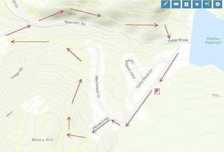
 

Camp Brook loop mapDriving Directions

  • From Downtown Hanover and the Green, drive E on E. Wheelock St. and up the hill 1.7 miles to Grasse Road. Turn L onto Grasse Road.
  • Park at the public ballfield parking area at 41 Grasse Road, outside the fence at the water treatment facility.

What You Should Know

  • Today’s hike takes you on a loop that tours the east and north slopes of the Balch Hill Natural
  • Area from neighborhood lanes and returns on the historic Wolfeboro Road, on lands owned by Dartmouth College and the Town of Hanover.
  • Dogs are welcome if under your control. Please pick up after your pet.
  • Archery season begins Sept. 15 and it is wise to wear blaze orange until Dec. 15.

Brief Hiking Directions

  • Turn L onto Grasse Rd to MacDonald Dr.
  • Turn R onto MacDonald Dr. and L onto Morrison Rd.
  • At far end of cul-de-sac, take steps up to trail
  • Turn R on the Garipay Trail
  • Take sharp R onto the Maple Trail
  • Turn L on Dot Strong Trail; at private drive, turn R
  • Turn R onto Reservoir Rd; cross to Wolfeboro Rd.
  • Take Wolfeboro Rd for 15 min
  • Turn R onto smaller path; cross brook
  • Turn L onto Reservoir Rd and Grasse Rd and return to your car.

The Full Story

  • Turn L onto Grasse Rd and walk along the shoulder past Camp Brook Dr. to MacDonald Dr. At this season, asters, goldenrod, and white-flowering turtlehead decorate the drainage ditch by the road. You might hear Canada geese announcing their flight south (let’s hope they didn’t linger on nearby Fletcher Reservoir).
  • Turn R at MacDonald Dr into a neighborhood developed for Dartmouth faculty and staff housing in the early 1990s. In fall, old apple trees hint at the history of this land, an orchard on the Garipay Farm.
  • 5 minutes’ walk from your car, turn L onto Morrison Rd and walk up the short lane to the cul-de-sac and trailhead sign.
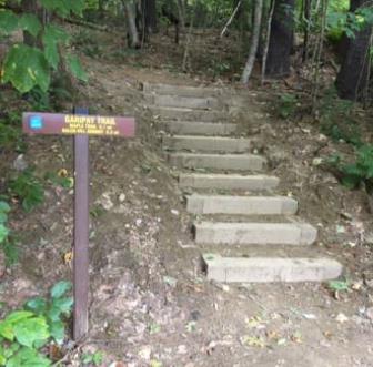
  • Garipay Trail stepsYou can thank the Upper Valley Trails Alliance’s High School Trail Corps and the Hanover Conservation Commission for the friendly steps at the trail entrance. Built in 2019 on Grasse Rd Homeowners’ Assoc. land, they lend easy access to the Balch Hill Natural Area trail system.
  • It’s just a few paces to the junction of the Hunter East (L) and Garipay Trails. Turn R onto the blue-blazed Garipay Trail, named for the farm family that most recently owned this land. At this season, the many small drainages off Balch Hill are dry, but at wetter times of year, the wooden crossings are most welcome. The split log one was built by Hypertherm volunteers in 2019 and the lumber one by a Conservancy volunteer a few years earlier.
  • A low stone wall follows the trail at R; could this be a relic of the sheep days in the mid-1800s, when the entire hill was open pasture and orchard?
  • 5 minutes’ hike from Morrison, the Garipay Trail rises to meet the Maple Trail. Turning L would bring you to the summit with its beautiful views – if you have 10 minutes to spare, it’s worth the detour. For this trip, take the sharp R turn, cross the stone wall, and follow the yellow-blazed Maple Trail. You’re now on town land, bought from the Garipays in 1978 with help from the federal Land and Water Conservation Fund.
  • 2 minutes later, look for deer research plots at R. A small sign explains their purpose.
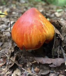
  • colored mushroom
  • Watch for color underfoot, not just among the maples overhead. It’s mushroom time!
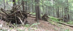
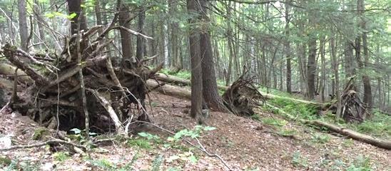
  • 5 downed treesThe entire E side of Balch Hill suffered blowdowns from the Patriot’s Day Windstorm in 2007. At one point on the Maple Trail, you’ll see the “undersides” of 5 downed trees in a row, with their boles all pointing W away from the source of that wind. Eventually, the root masses will melt back into the landscape, leaving the “mound and pit” (sometimes called “pillow and cradle”) micro-topography typical of wind-influenced forests.
  • 10 minutes’ hike from the Garipay Trail, the Maple Trail enters more open coniferous forest and onto another piece of Dartmouth land, where the college kindly granted a trail license to move the trail onto a more sustainable path. By now you’ve gathered that the Hanover Conservancy, Hanover Conservation Commission, Upper Valley Trails Alliance, and Dartmouth are closely cooperating partners on Balch Hill.
  • A few minutes farther, look for a yellow Wildlife Safety Zone sign as the trail swings L and then out to the wide Dot Strong Trail. A glance to the R confirms this is a sewer line connecting two neighborhoods. Bicycles are allowed on the flat, comfortable path. Dot Strong was an ardent conservationist who lived nearby on Reservoir Road.
  • Turn L on the Dot Strong Trail and enjoy the easy 0.3 mile walk to Reservoir Rd. In 5 minutes, reach the metal gate posts at the edge of town property. Continue a few paces to the private drive at 29 Reservoir Rd (you’re allowed!), turn R down the drive, and note the trailhead sign at R – in case you’d like to try the loop counter-clockwise sometime.
  • Turn R onto Reservoir Rd. As you walk along the shoulder, look down into the forested ravine at L, listening for Camp Brook as it falls from the Fletcher Reservoir down to Storrs Pond. The brook has only this short distance to cool off in the shade of the hemlocks on its banks before reaching the pond. While smaller brooks run dry at this season, controlled releases from the reservoir keep water in the channel.
  • Cross the brook; look for the brown/yellow Wolfeboro Rd trailhead sign, just R of the Storrs Pond sign.
  • Take the Wolfeboro Rd trail up and around the metal gate. Five steps in, and you’re on the clearly discernable, original route of the Wolfeboro Rd. Our forebears chose a good path – it is safely out of the way of Camp Brook, which washed out Reservoir Rd a few years back.
  • Walk up through the hemlocks that shade the valley of this brook. You can imagine the relief of Royal Governor John Wentworth, after several days’ ride on the new road in 1772, as he made his final descent toward his destination, Dartmouth College’s second commencement. He had ordered the cutting of this road, linking his home in Wolfeborough with Hanover, two years earlier. At a public meeting on July 30, 1770, a committee of Hanover citizens was appointed to “…run a line from near the southwest corner of Hanover to the Great Pond, or Governor’s seat, at Wolfeborough, and view the situation of the land and convenience for a highway, and make return the first Monday in October next.” Members were paid four shillings and sixpence per day and spent ten days surveying the route. In October, they gained approval to lay it out from the College to the Canaan line. Hanover landowners were assessed a penny and a half per acre to raise the 120£ needed to complete the road.
  • The old road moves steadily up the side of the valley, past some large old pines that are still too young to have been here when the Governor passed through. Two Oak Hill trails join at L; continue straight.
  • At this season you can hear birds flitting in the branches overhead, preparing to join their migrating brethren following the nearby Connecticut River south.
  • 10 minutes’ hike from Reservoir Rd, the canopy opens up and the trail is crowded by young white pines eager to fill the space. This is your cue to watch for a less worn trail at R. (The Wolfeboro Rd continues with two detours through the Trescott Water Supply Lands, over Moose Mountain, and on to the Lakes Region.)
  • Turn R on this smaller path and head downhill for 5 minutes among the brash and brushy white pines. As you approach Reservoir Rd., note the barbed wire and sign on a big pine at L, marking the boundary of the restricted area around the Fletcher Reservoir and its dam. Just beyond at R are two study plots helping the Hanover Biodiversity Committee measure deer browse pressure on Trillium, a native wildflower. One plot is fenced from deer and the other, marked with blue flagging, is not.
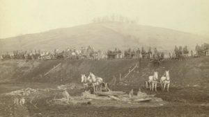
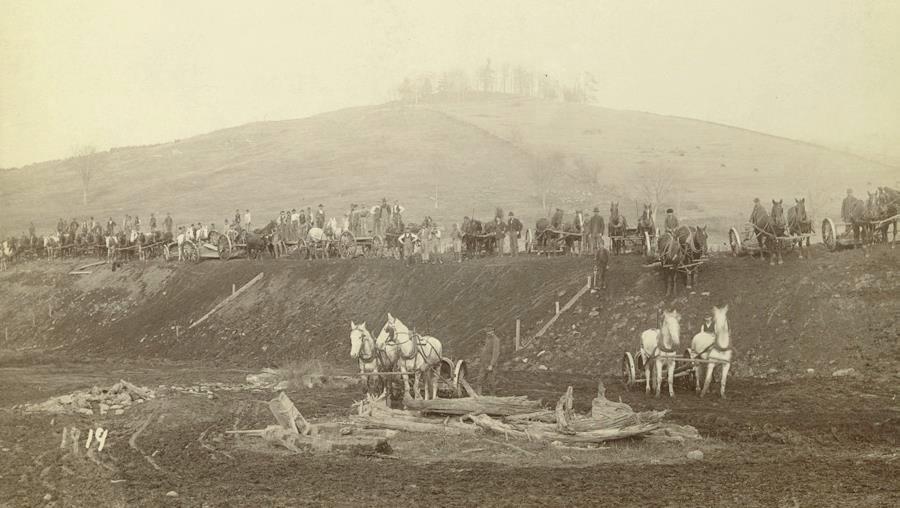
  • Fletcher Dam construction in 1893A small footbridge leads over the natural channel of Camp Brook, nearly dry at this season, and soon you pop out on Reservoir Rd just as it curves into Grasse Rd. The Fletcher Dam looms above at L. Constructed in 1893, this is the first of two dams built on Camp Brook to provide safe drinking (and fire-fighting!) water to downtown Hanover and Dartmouth College. This image shows the many teams of horses and men employed in building the dam. We aren’t certain, but we believe that the white horses in the foreground are standing on what would eventually be flooded land behind the dam, and that the hill in the background topped by the tuft of trees is Balch Hill.
  • Follow Grasse Rd to return to your car at the public parking area just beyond the ball field and swings.
This Hanover Hike of the Month has been generously sponsored byJMH Wealth Management logo

October 2019 


Filed Under: Balch Hill, Hike of the Month, October Tagged With: aster, Oak Hill, turtlehead, Wentworth, Wolfeboro Road

Norman Overlook at Mink Brook

September 25, 2019

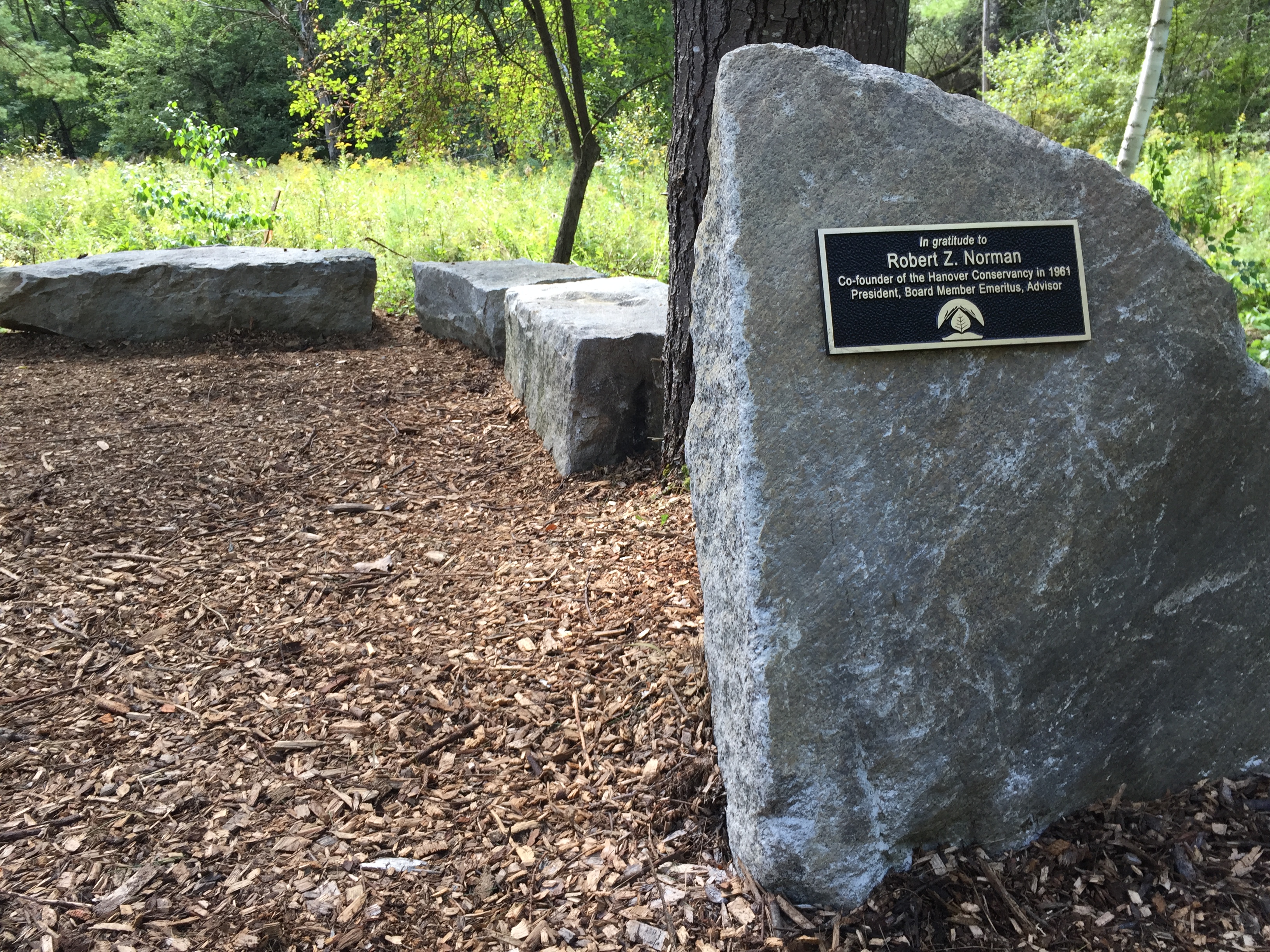
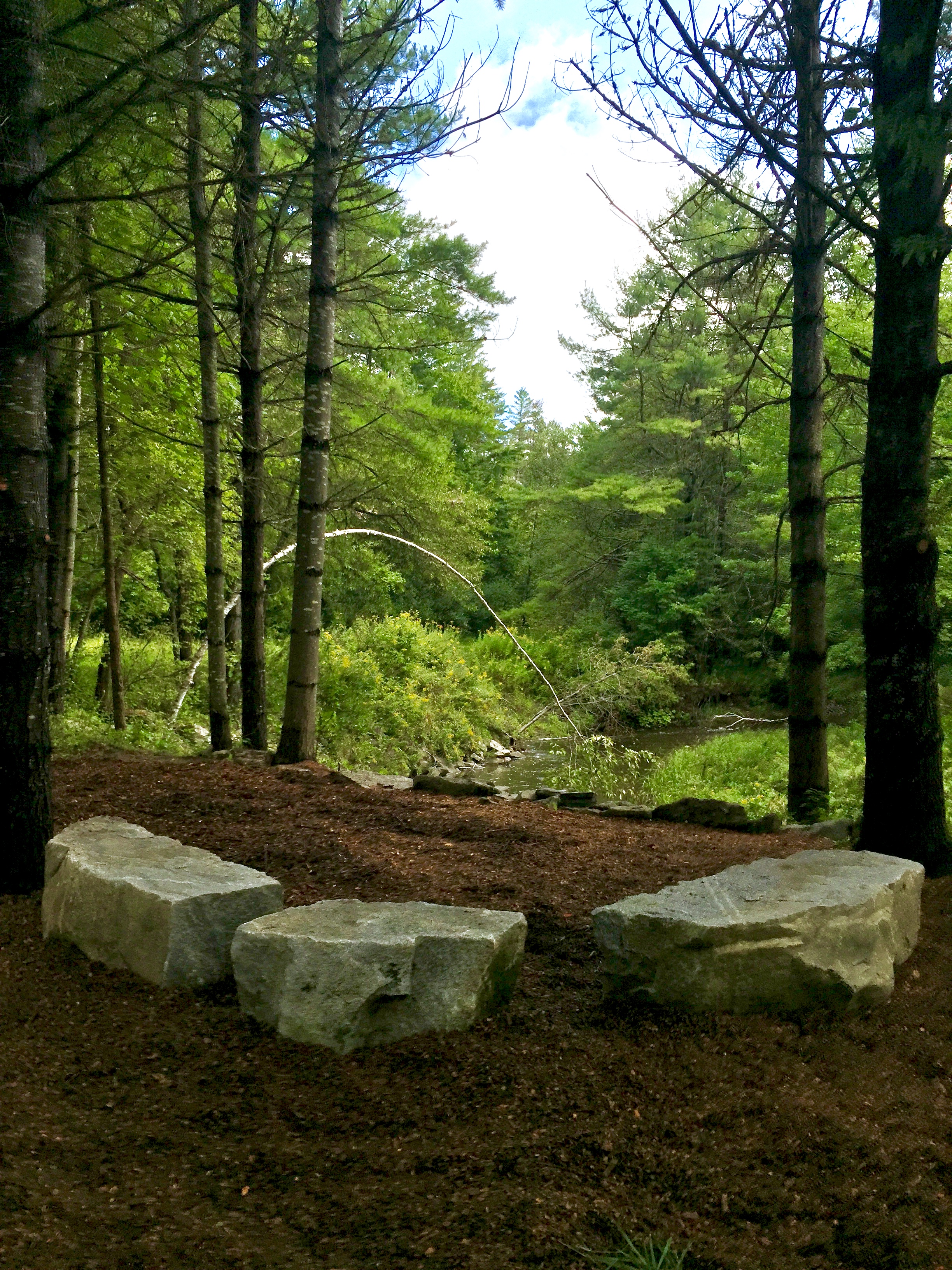
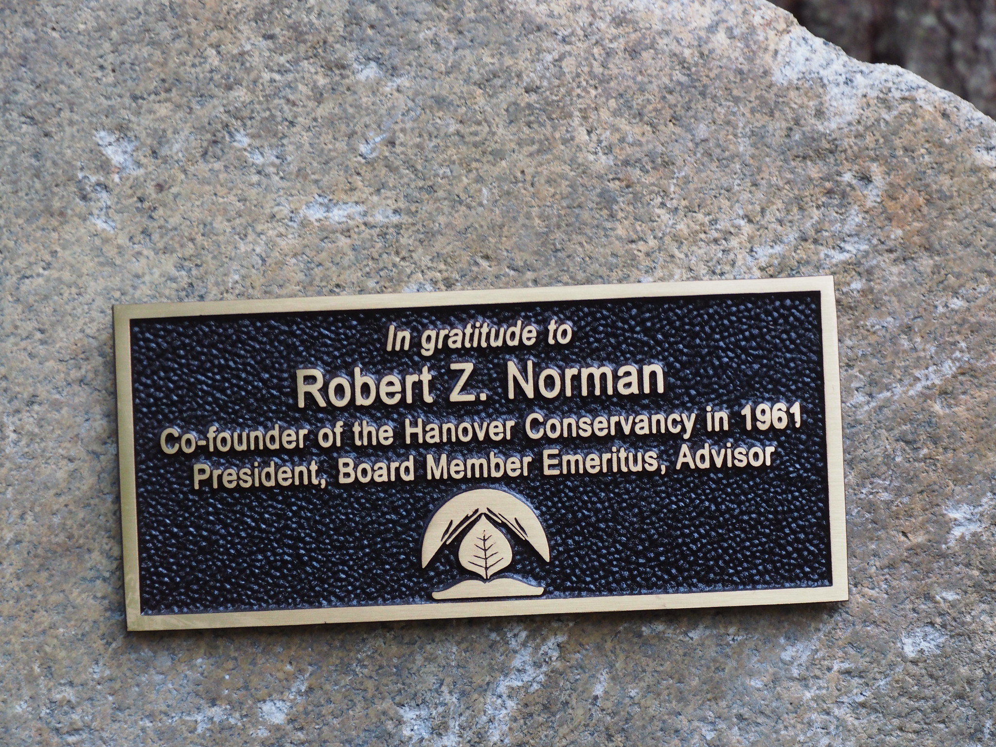
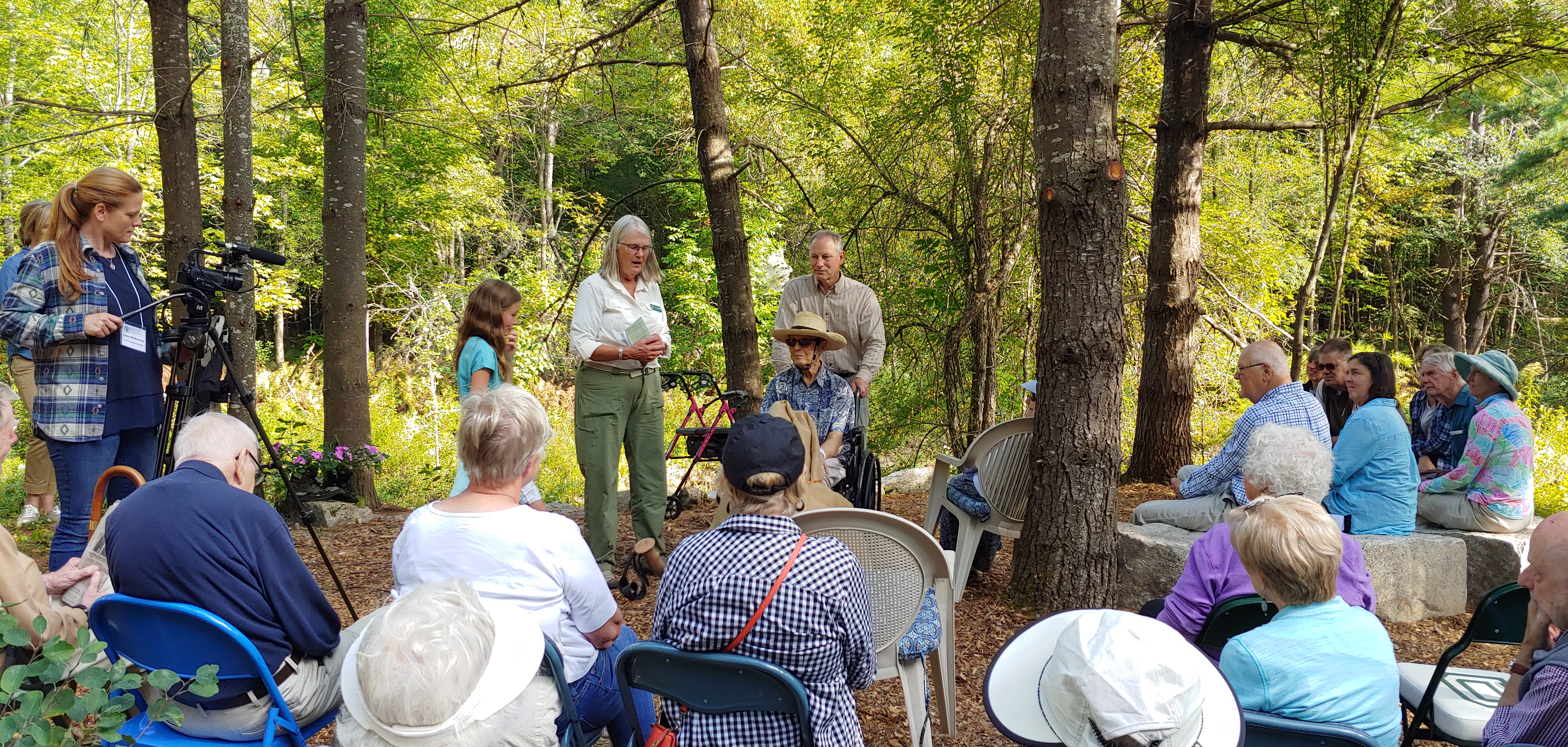
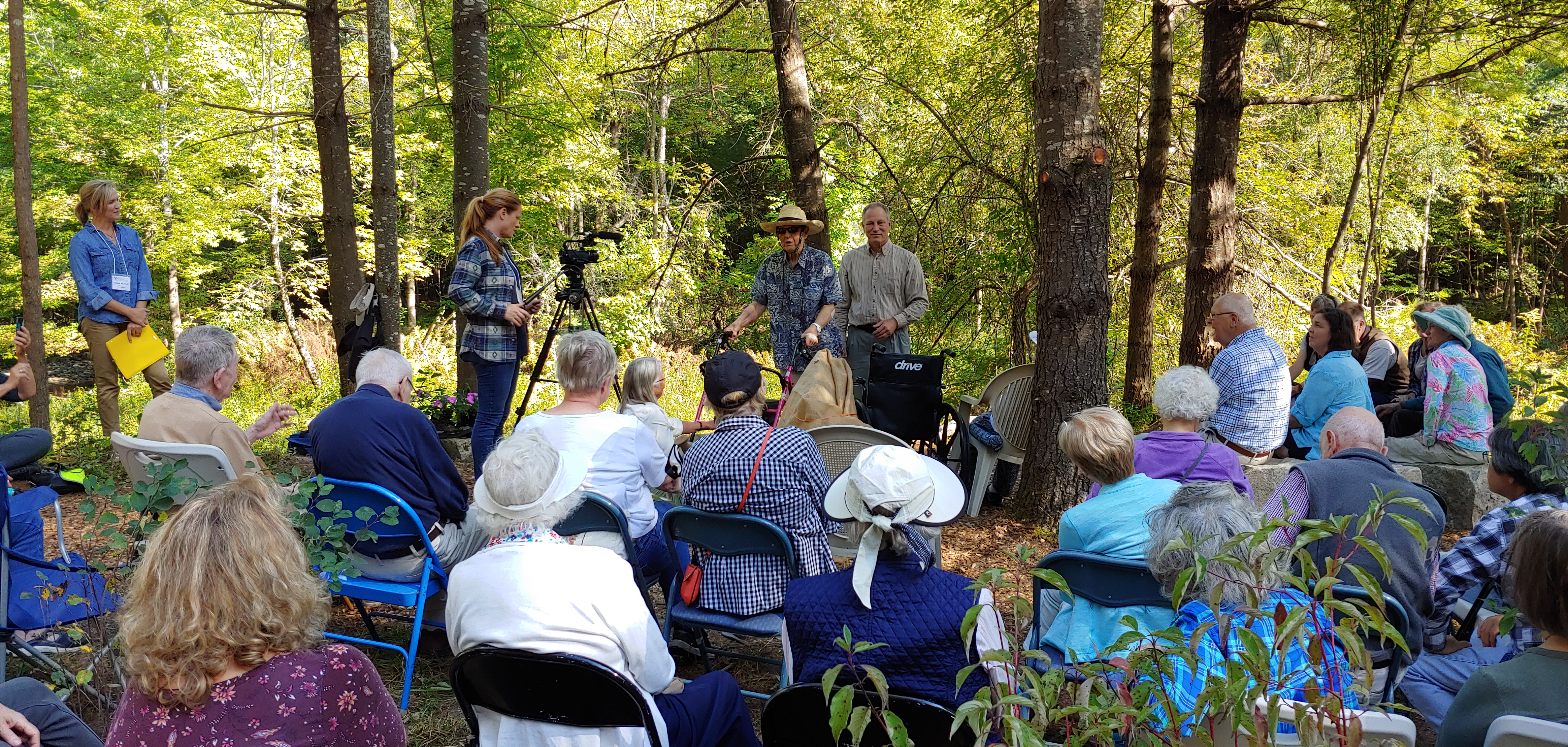
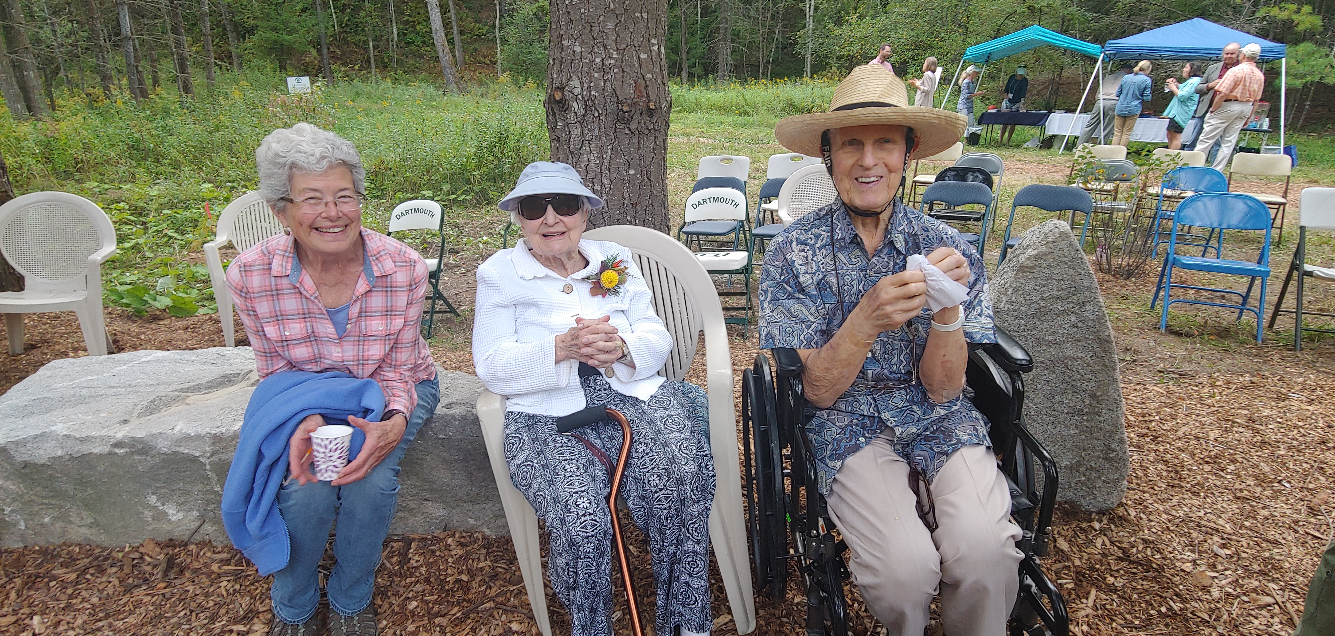
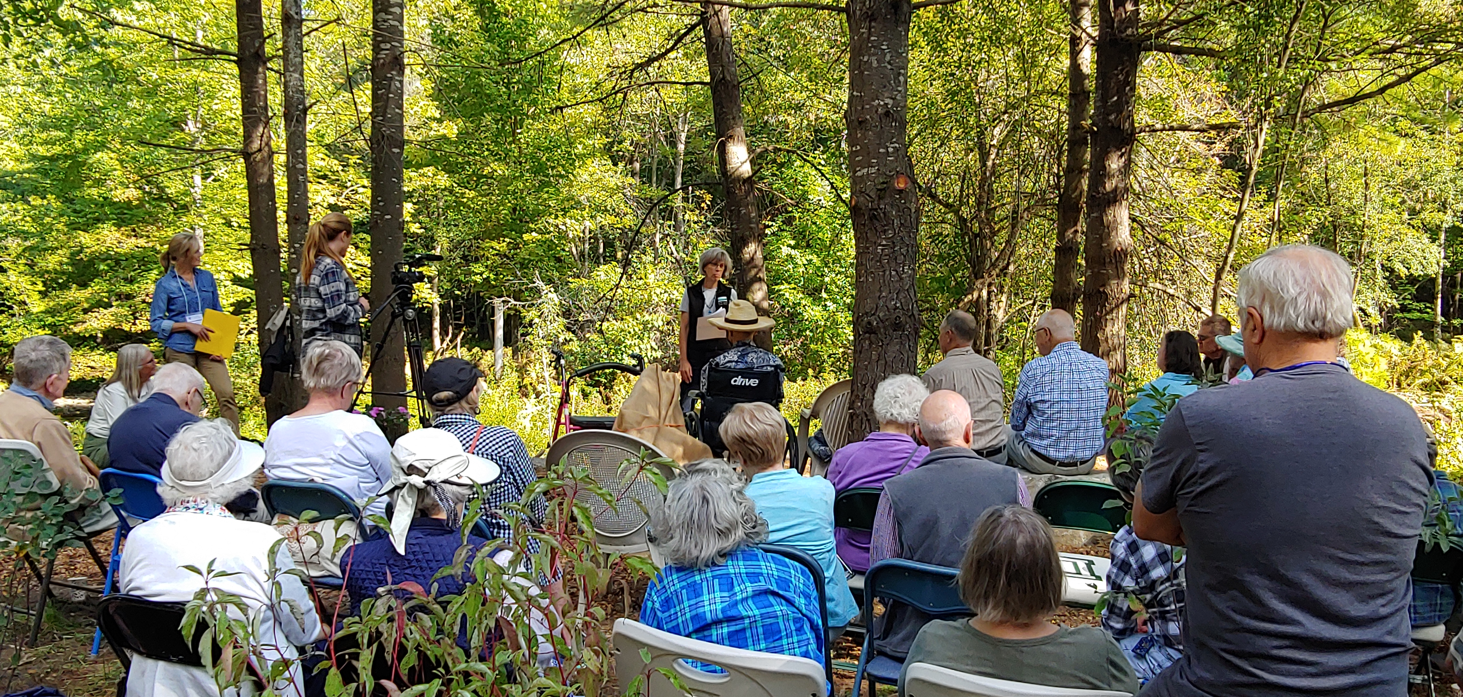
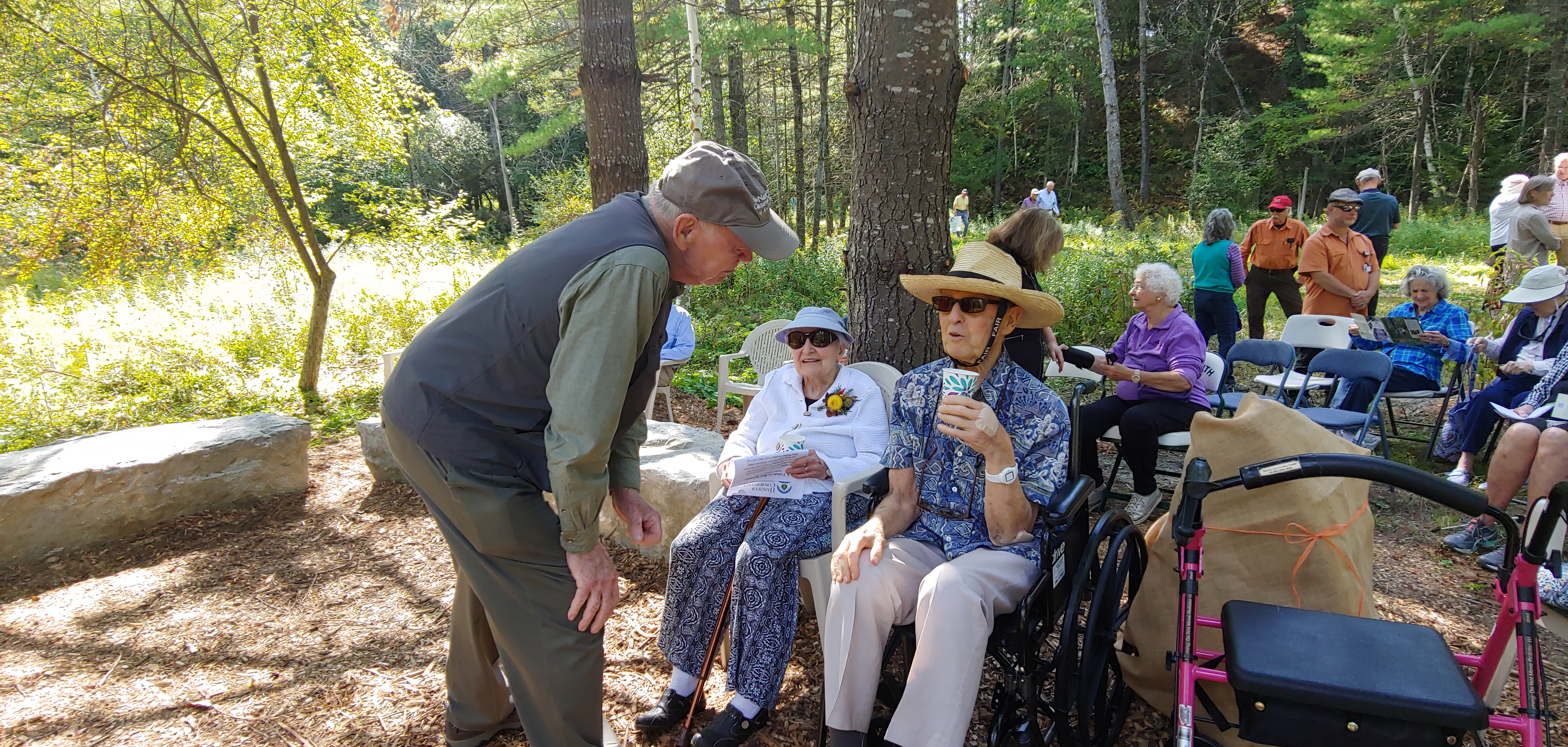
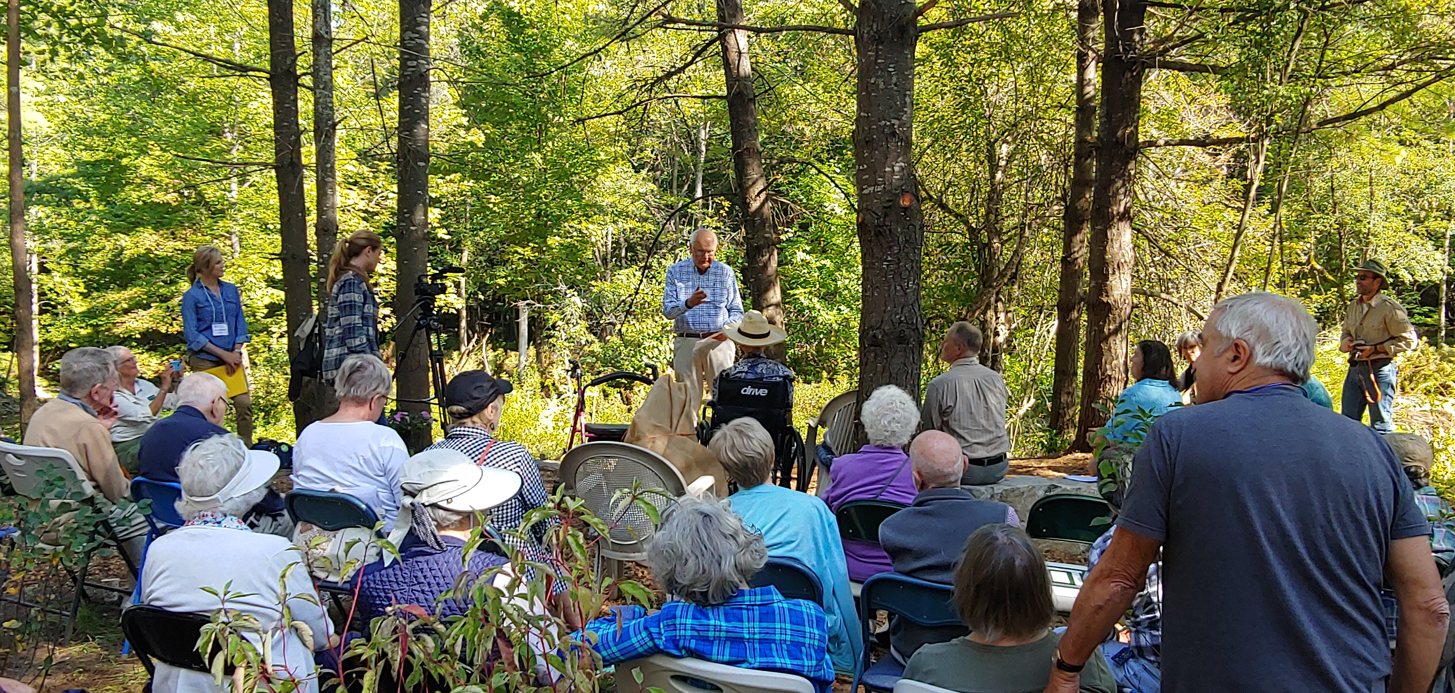
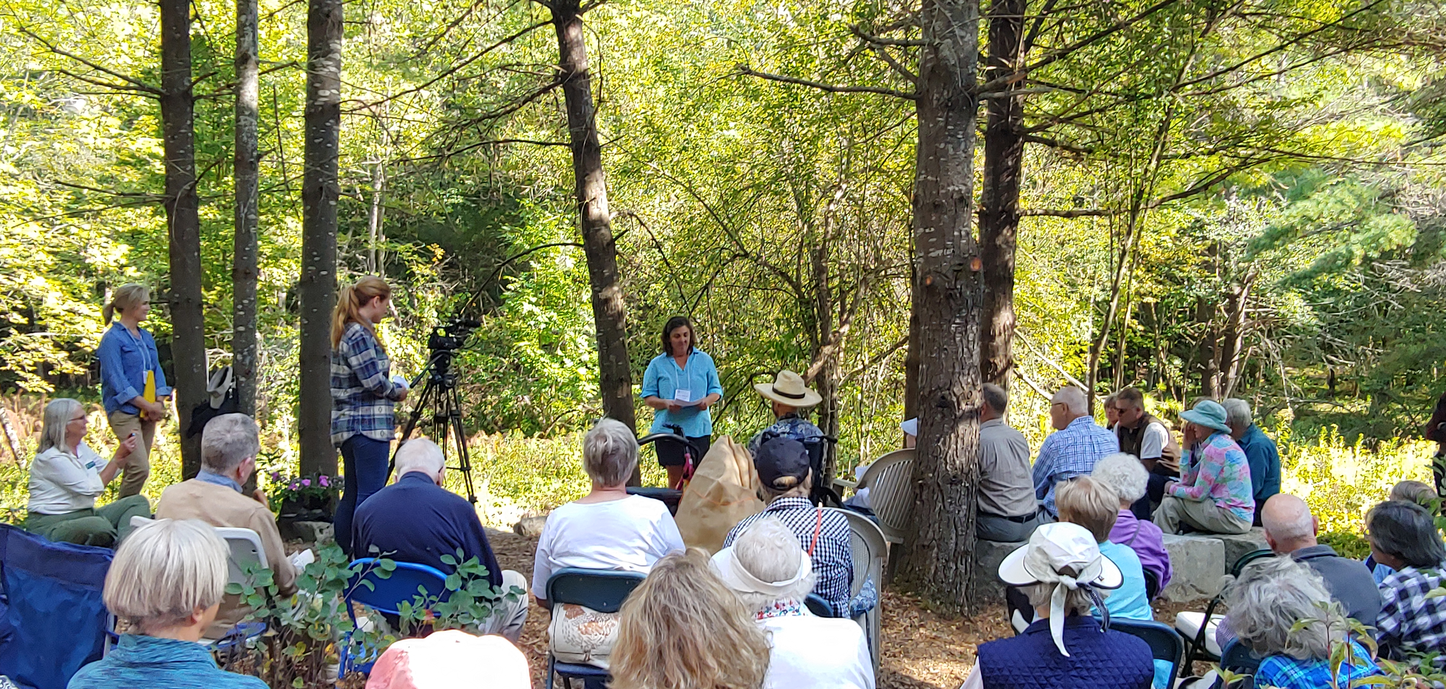
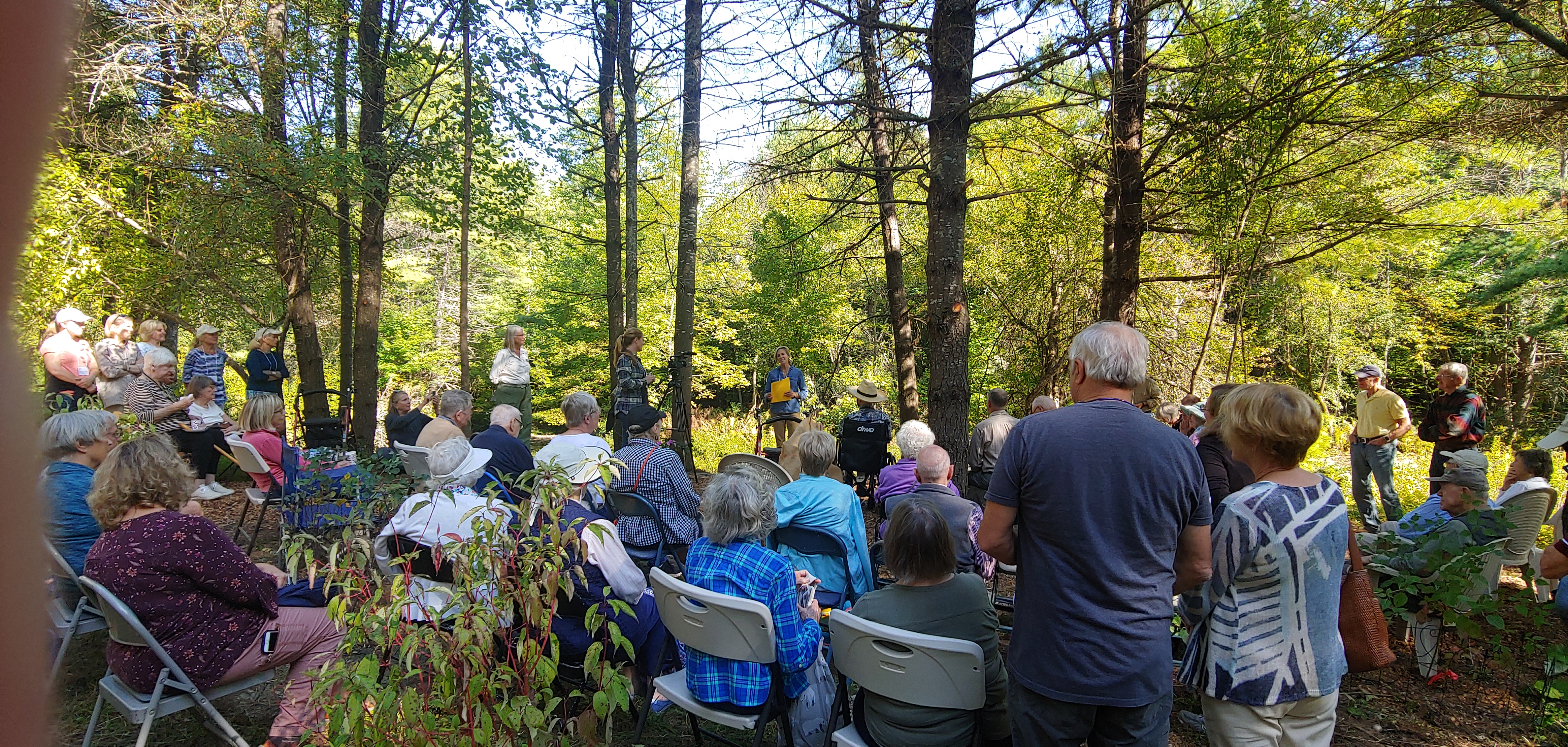
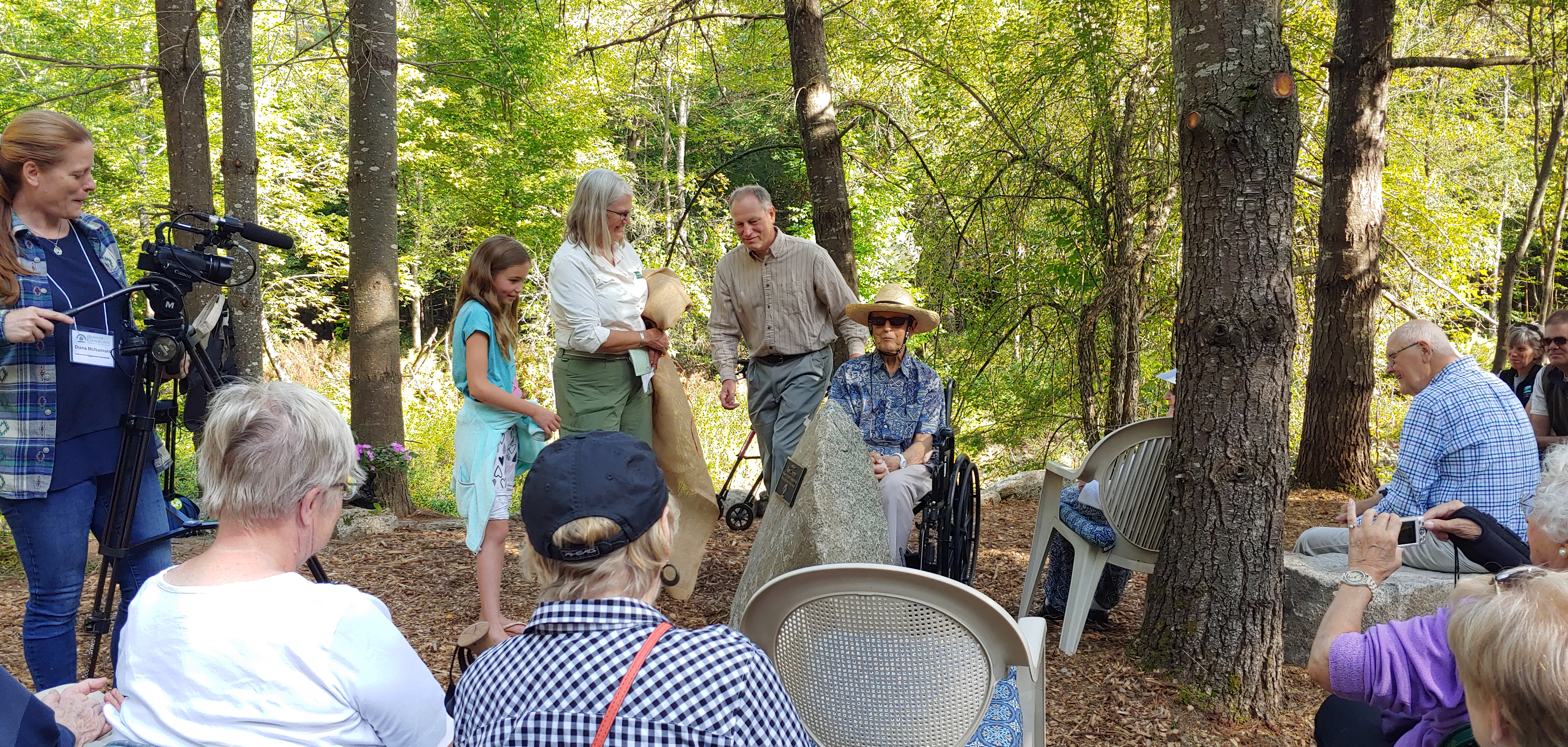
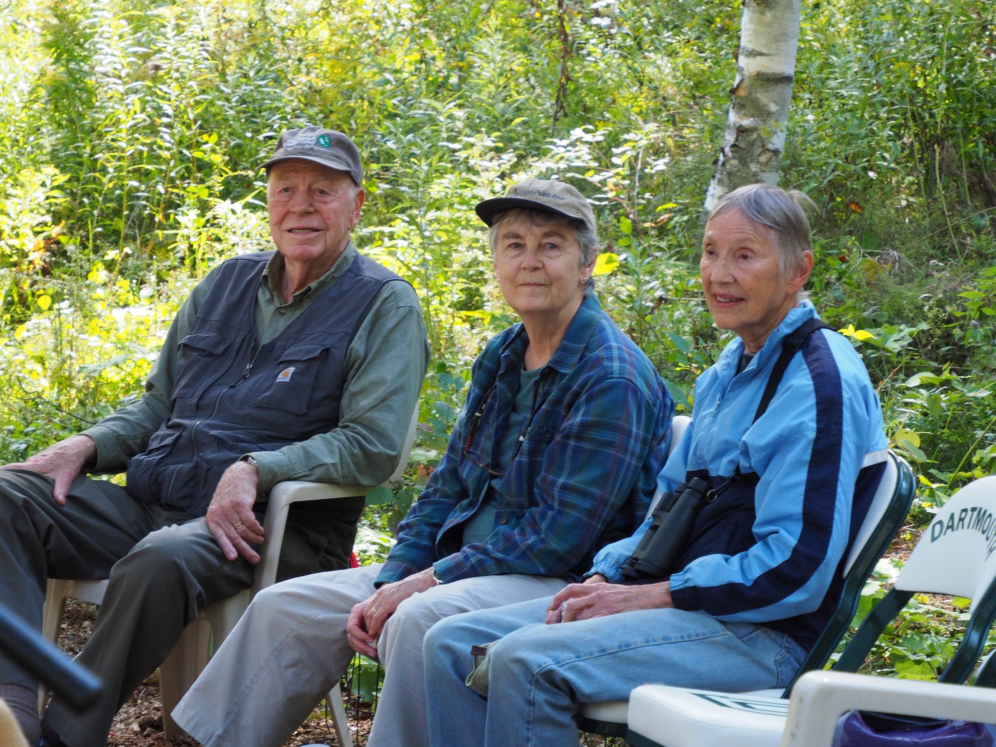
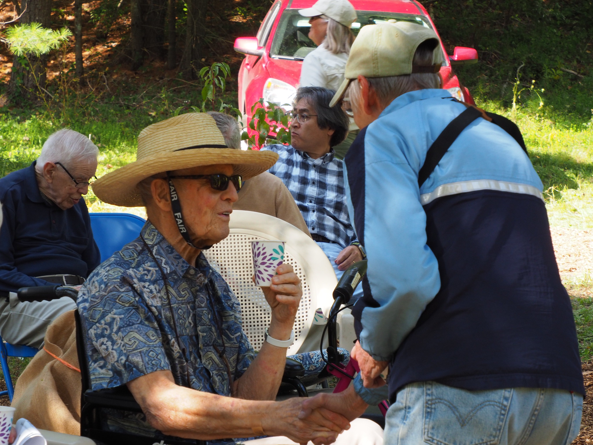
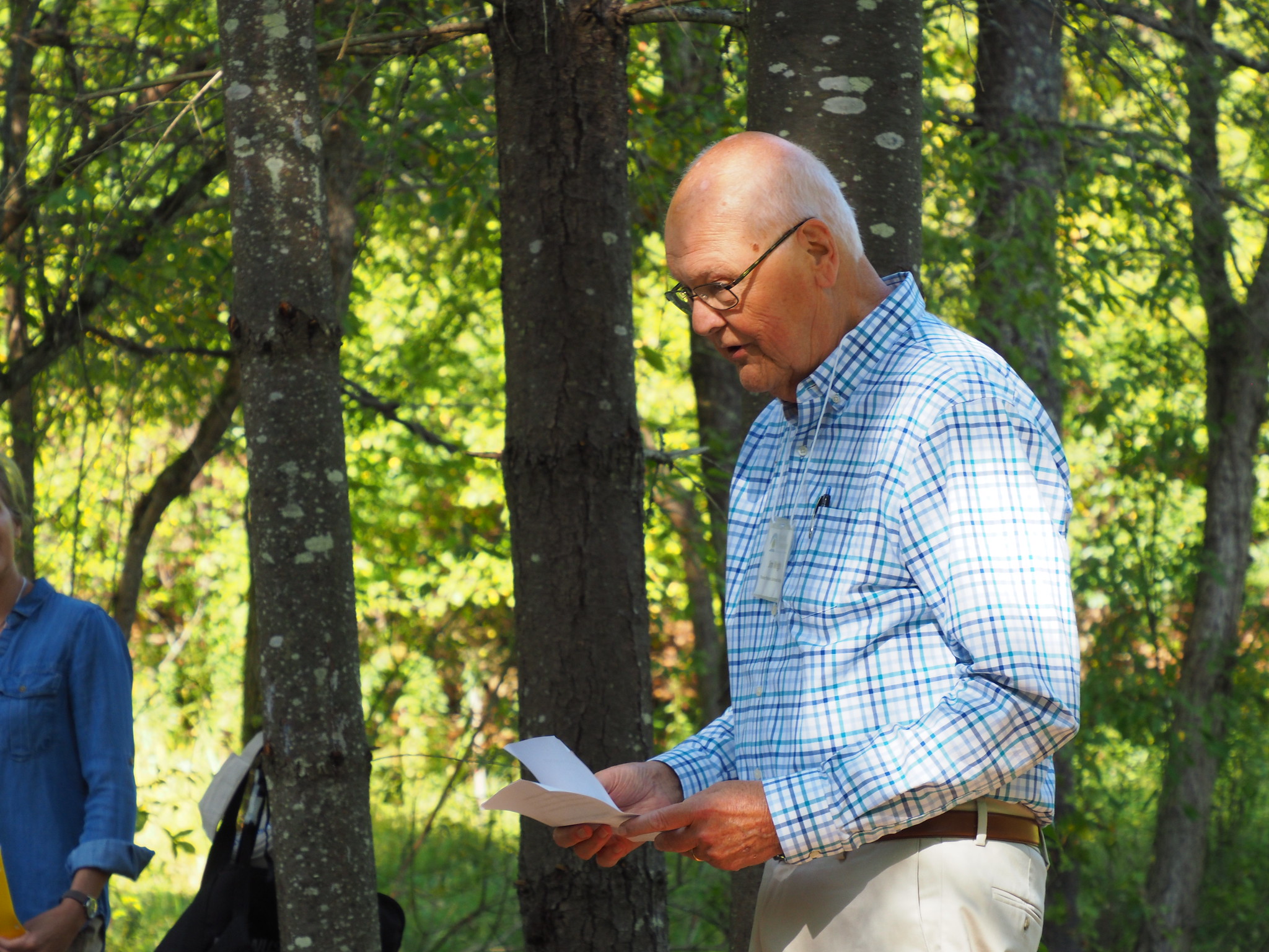
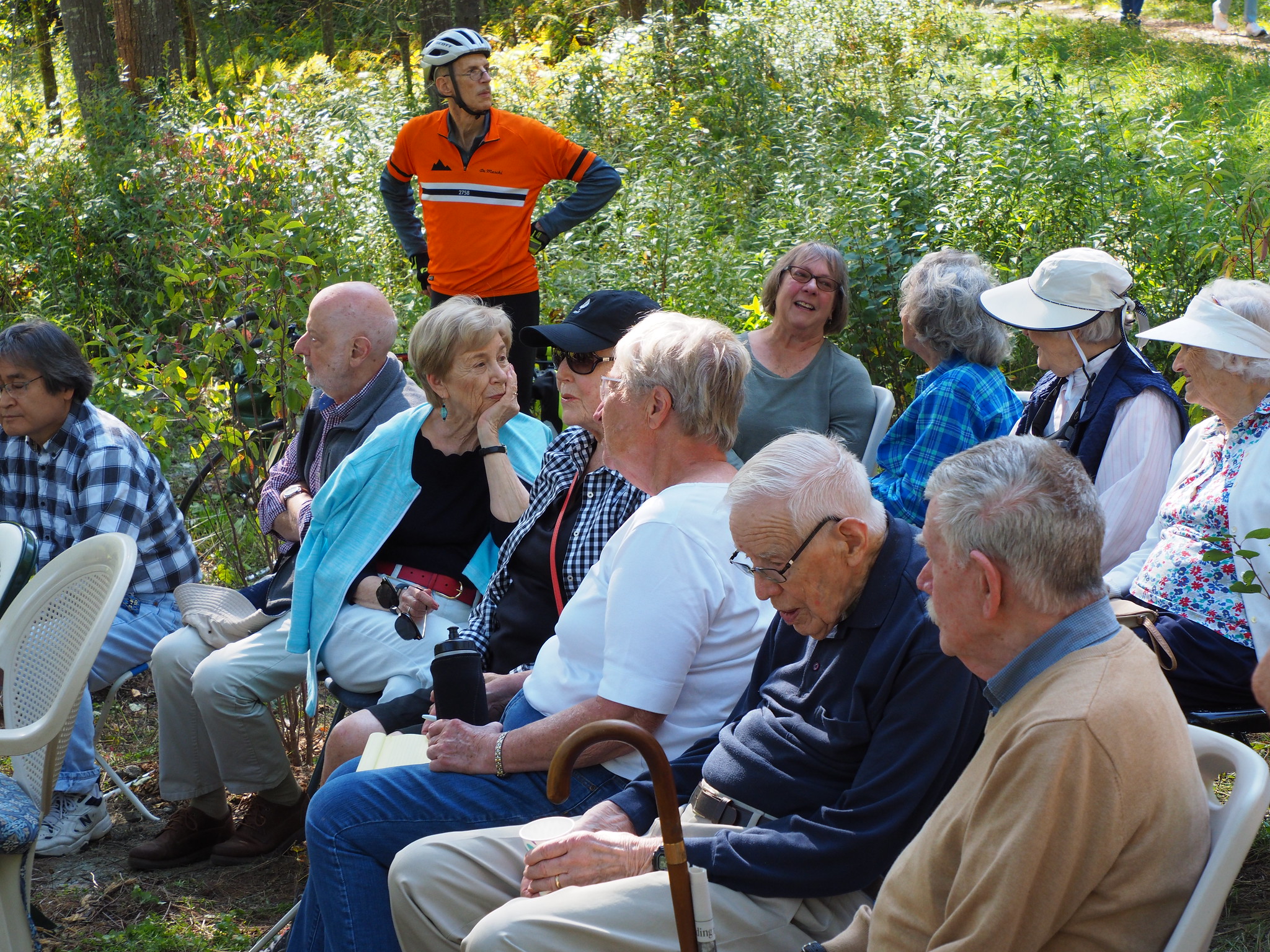
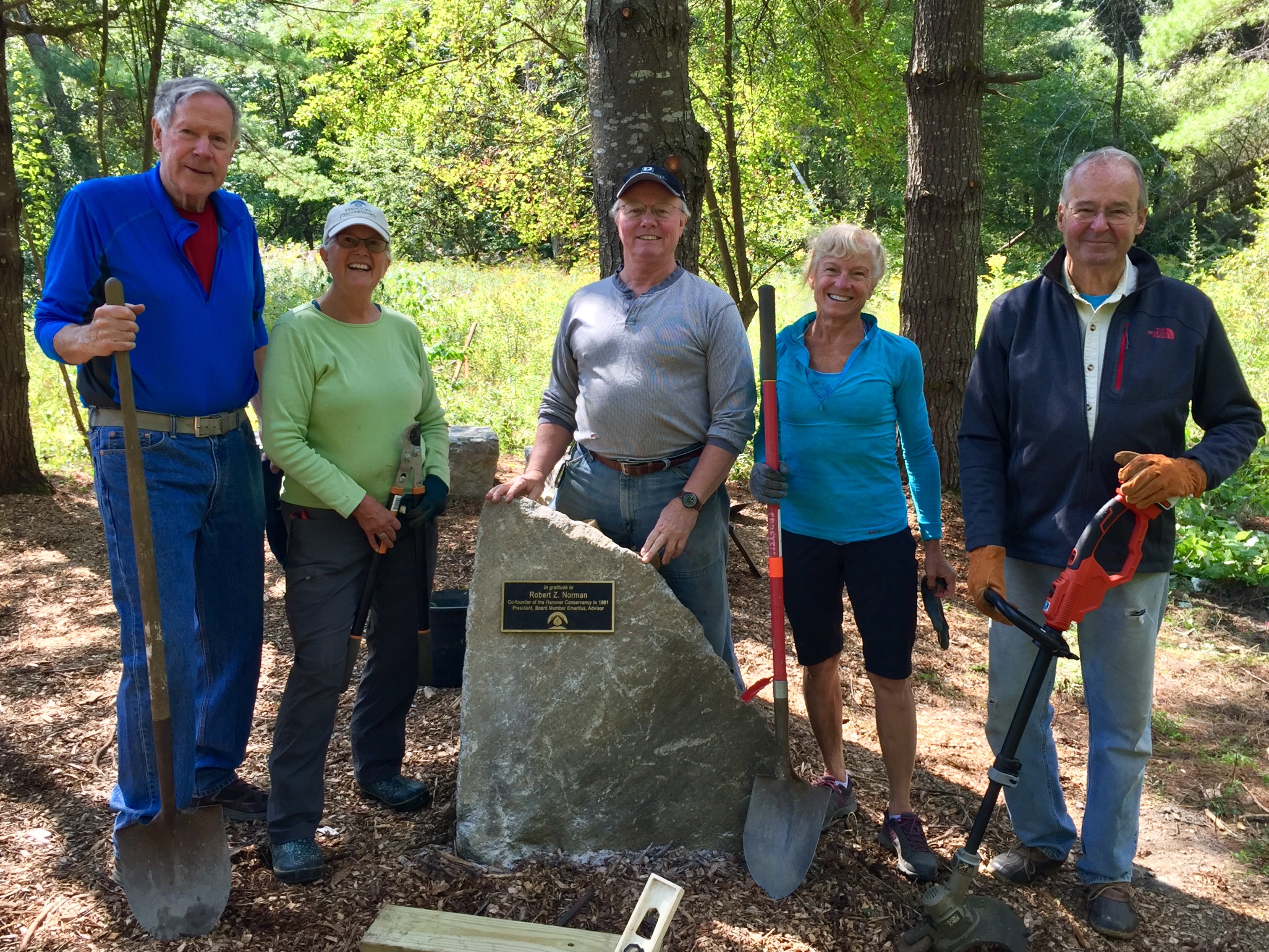
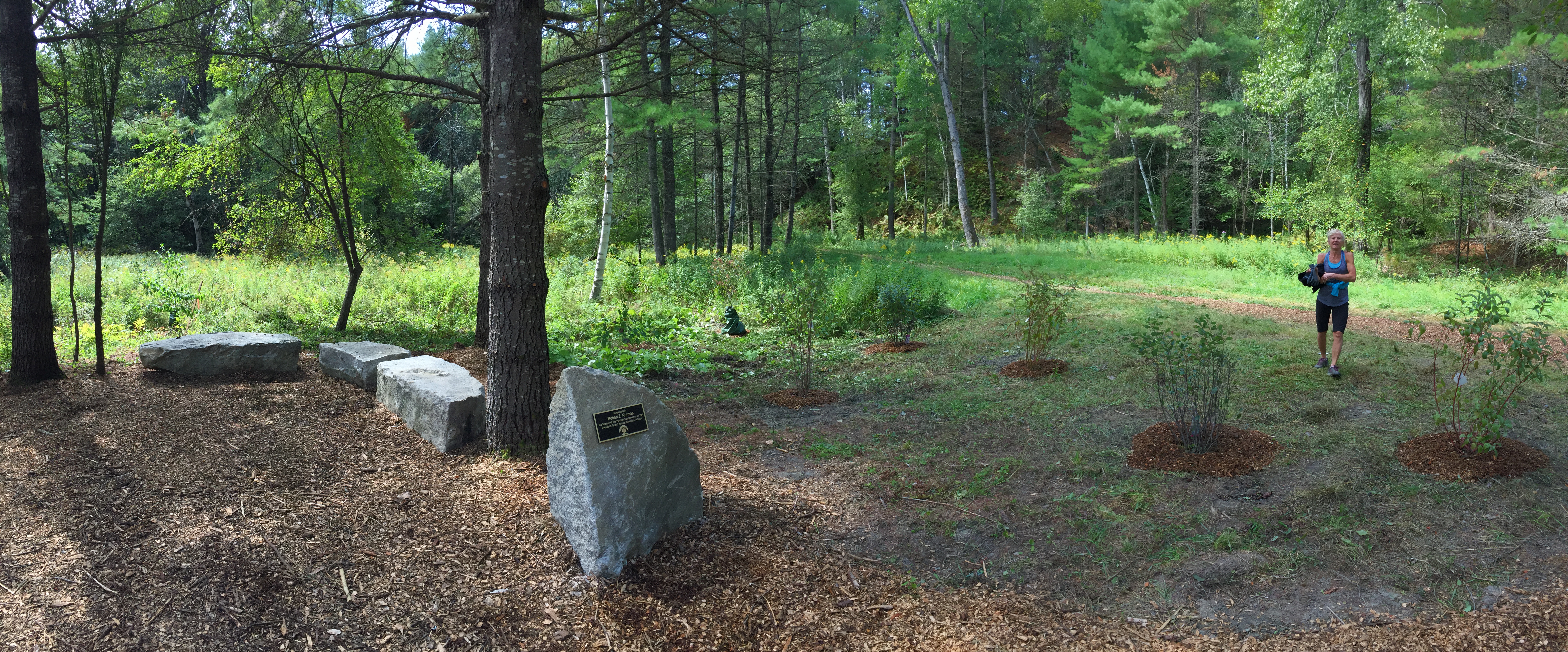
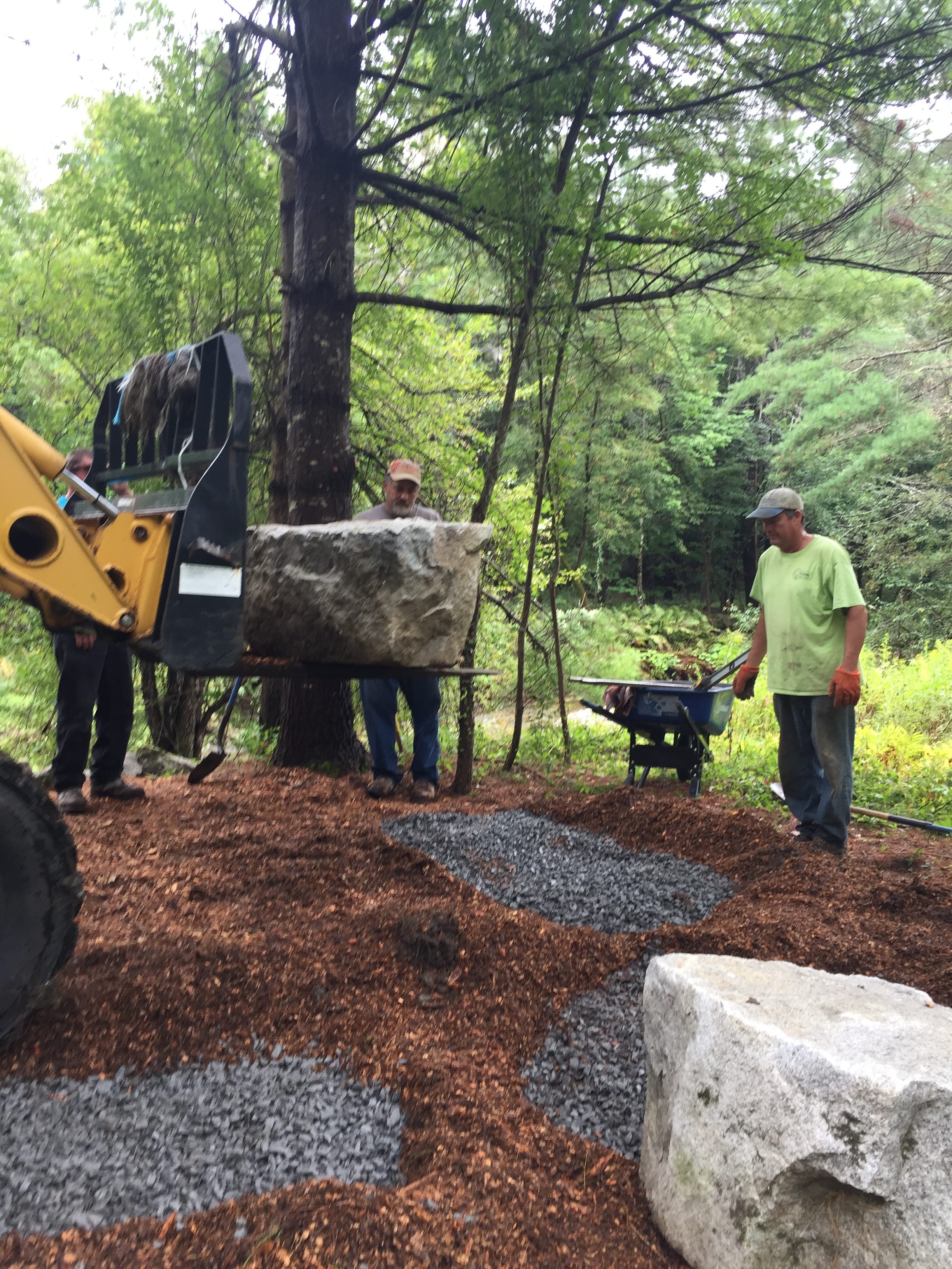
In 1999, Bob led the Council’s effort to protect the 112-acre Mink Brook Nature Preserve, then slated to become a 32-lot subdivision. In 2019, the 20th anniversary of that daunting and ultimately successful project, the Conservancy dedicated the Norman Overlook to Bob and his vision for our community.

The Bob Norman Overlook
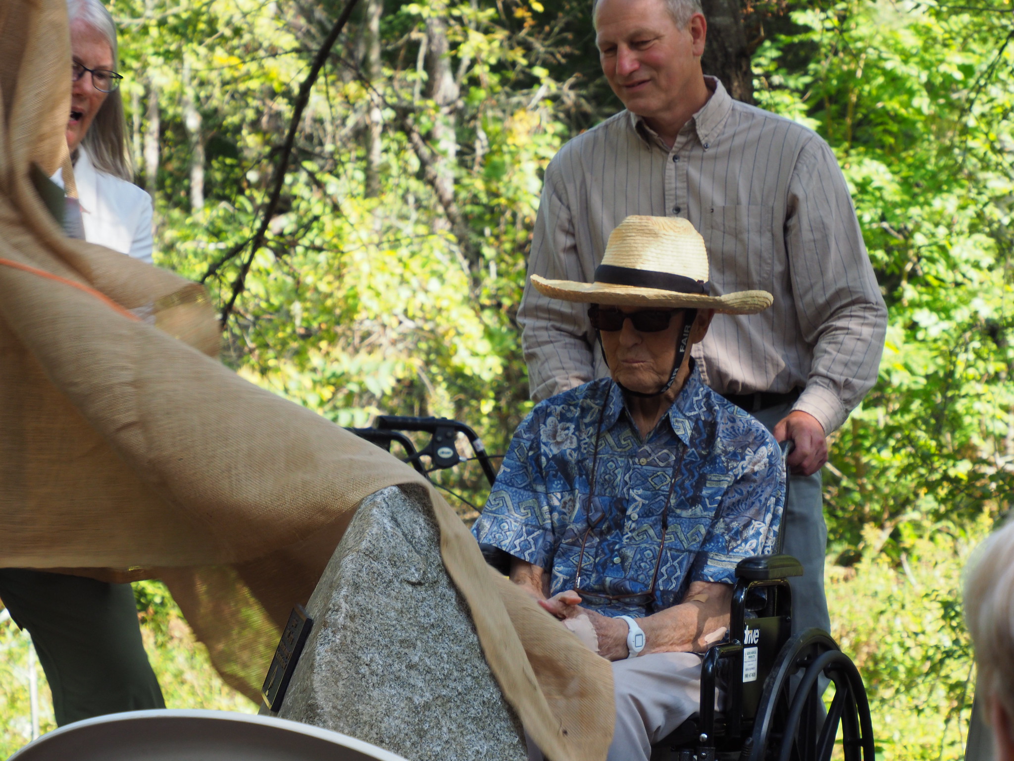
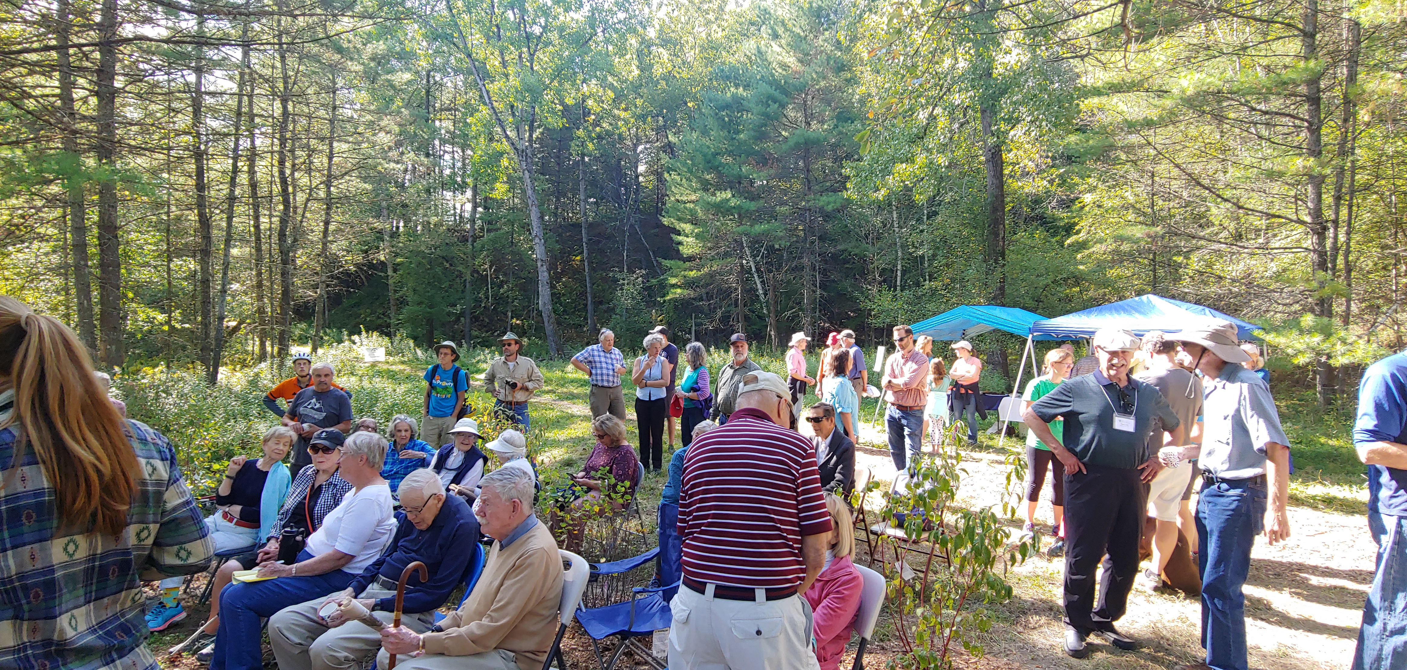
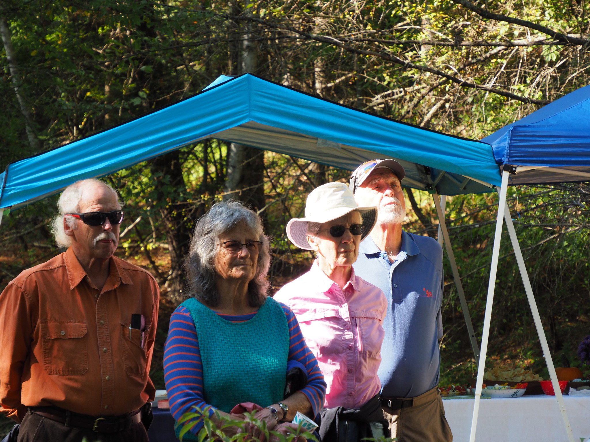
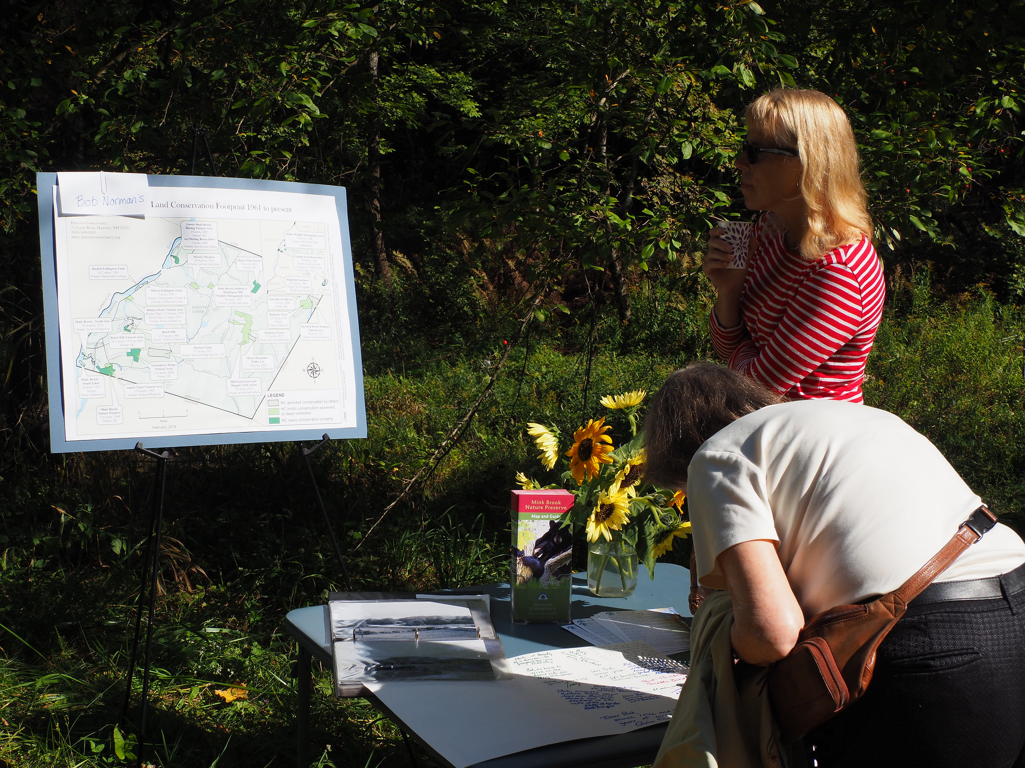
Celebrating the Norman Overlook’s dedication
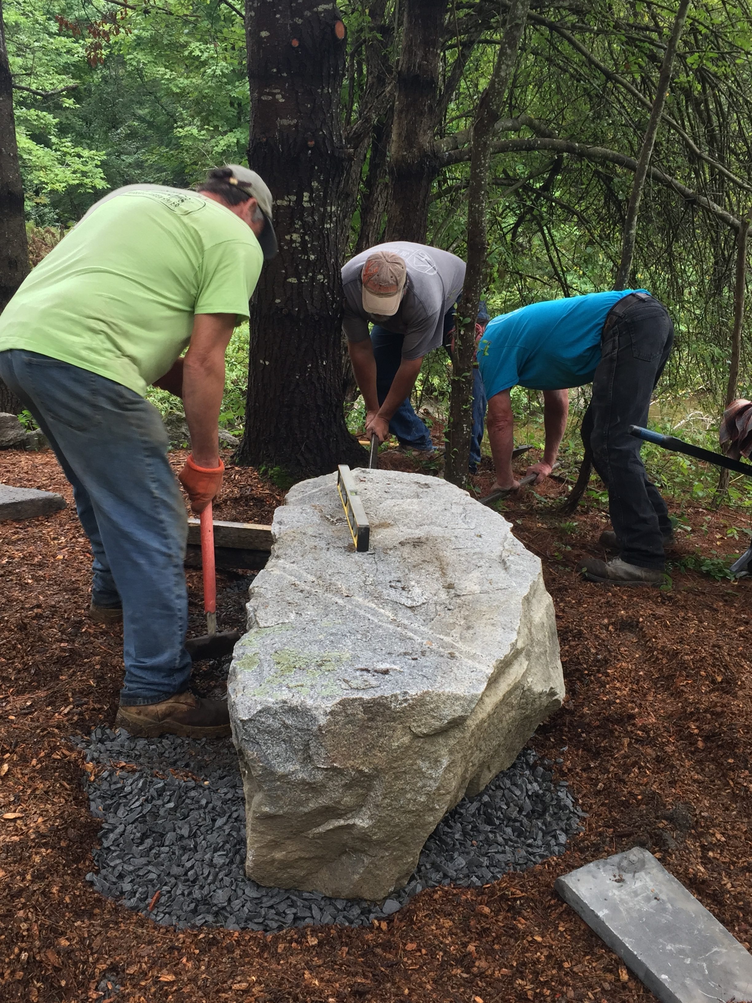
Unveiling the “sentry stone”
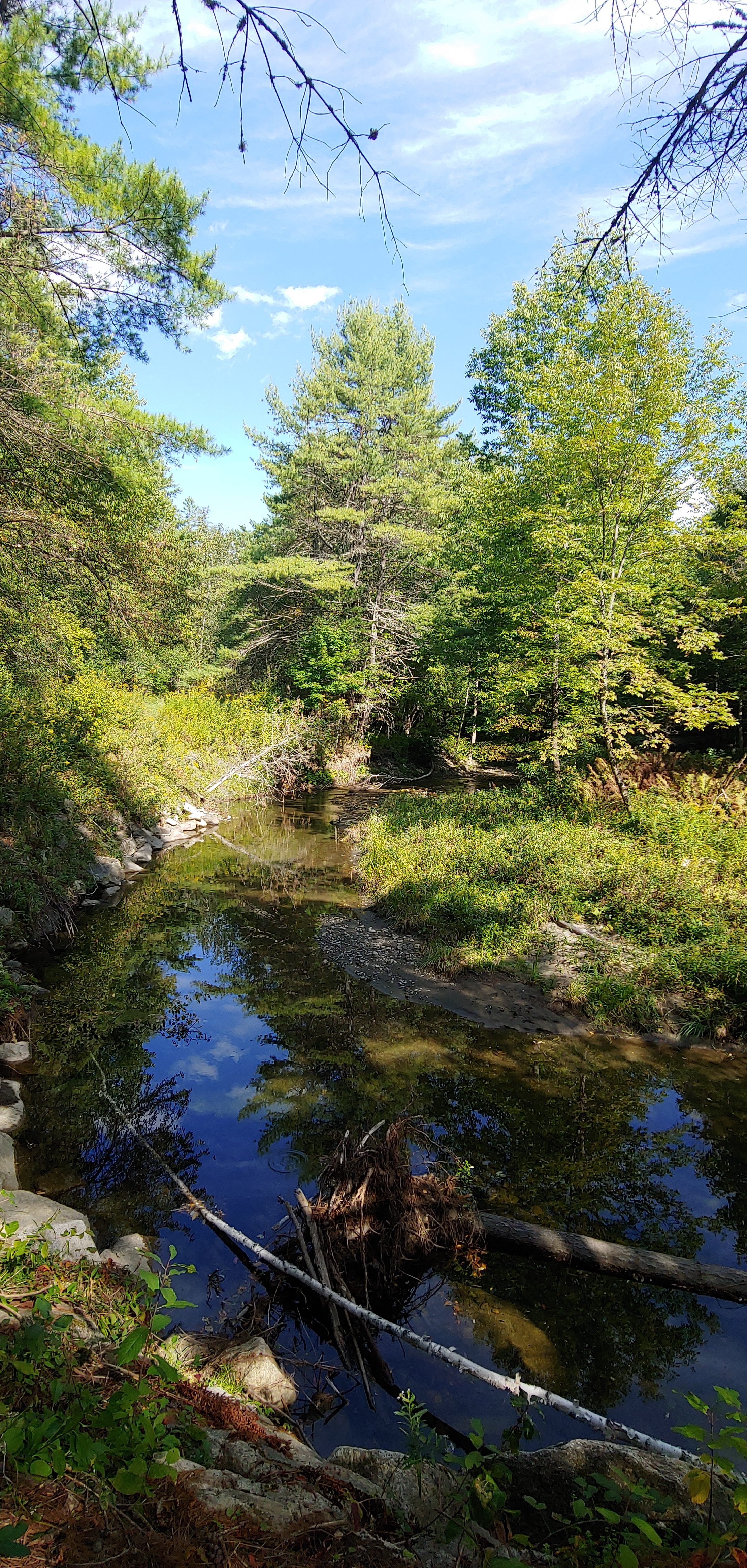
The view from the Norman Overlook
Bob greets a guest
Former Dartmouth President Jim Wright
Signing a card for Bob
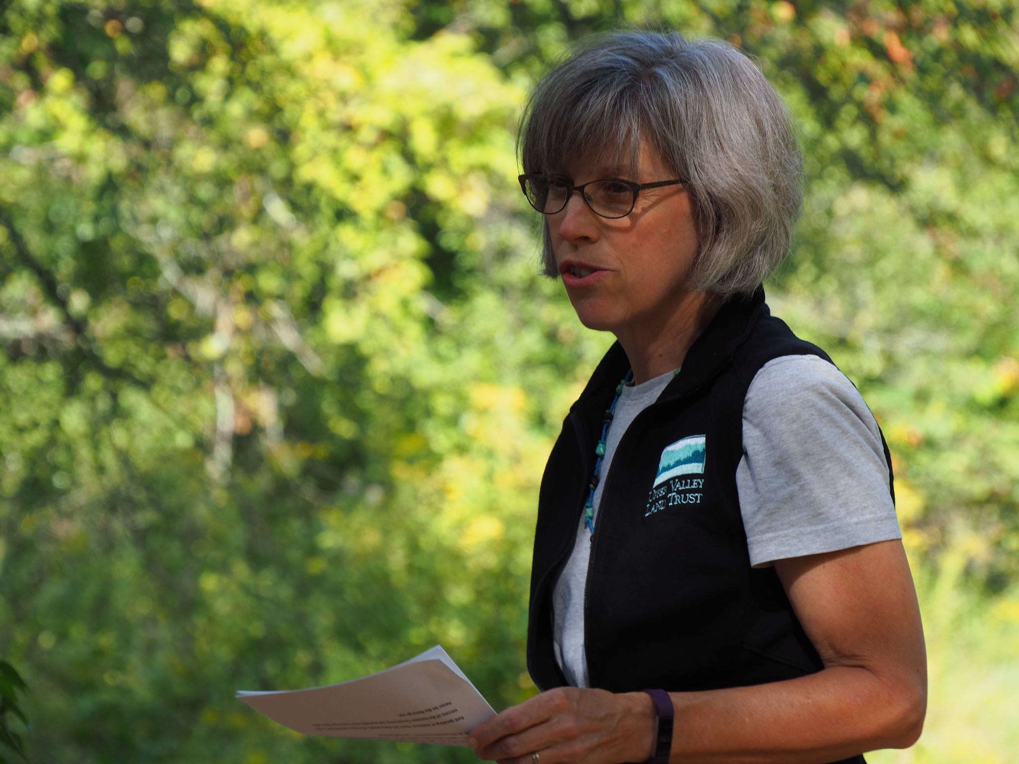
Jeanie McIntyre, President of UVLT
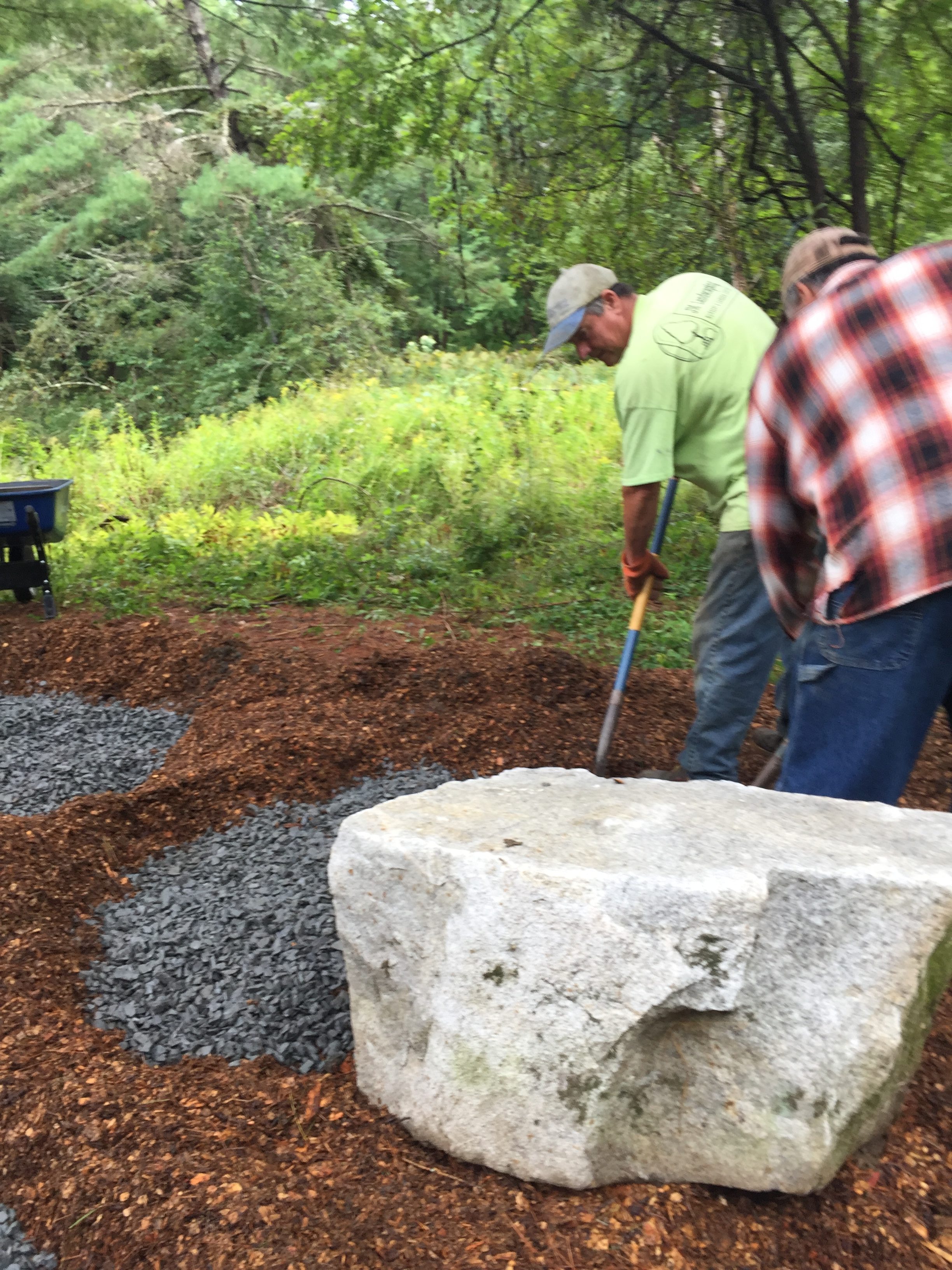
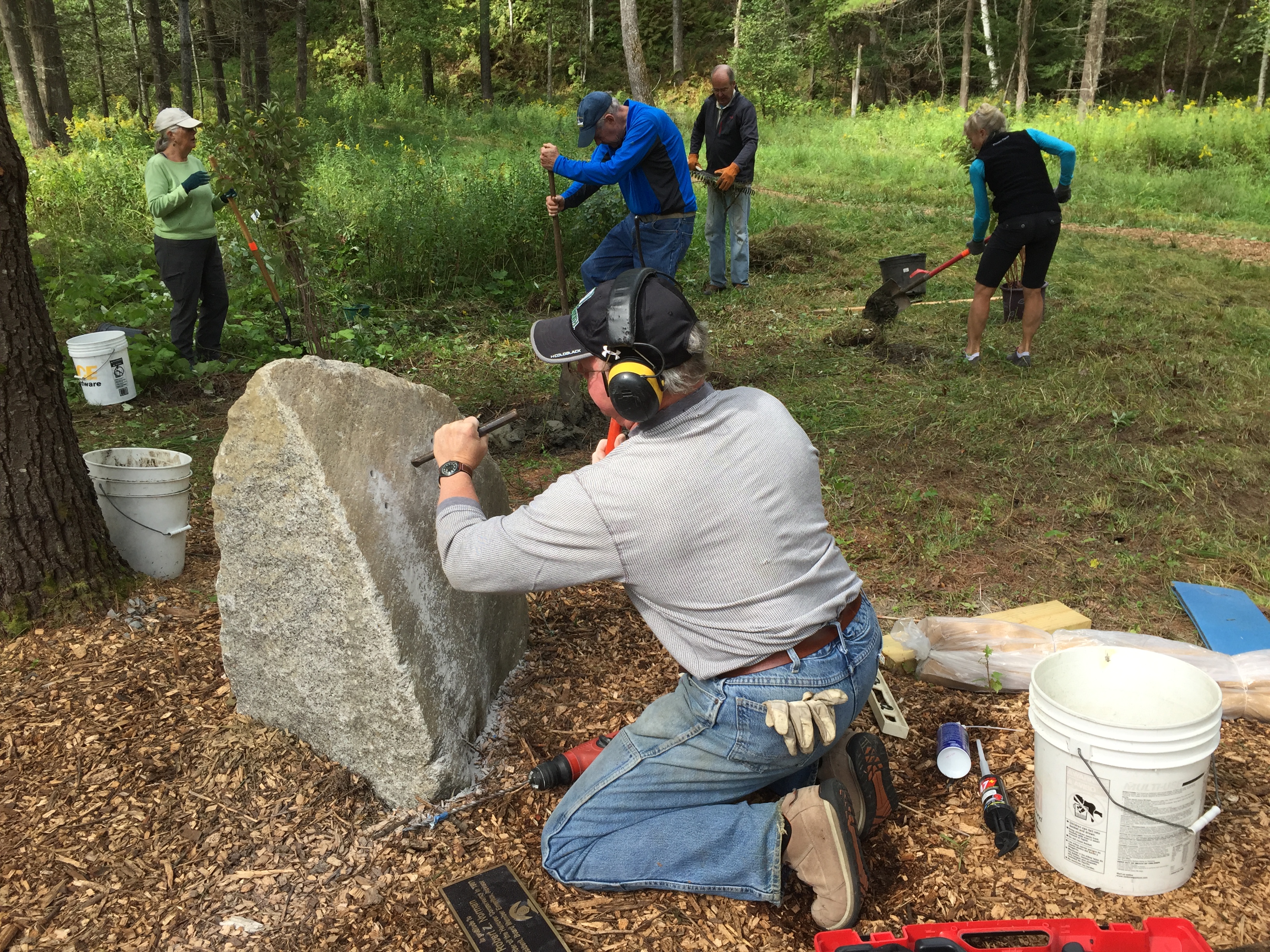
Preparing the site with JM Landscaping
HC Board members finish final prep on the Overlook site
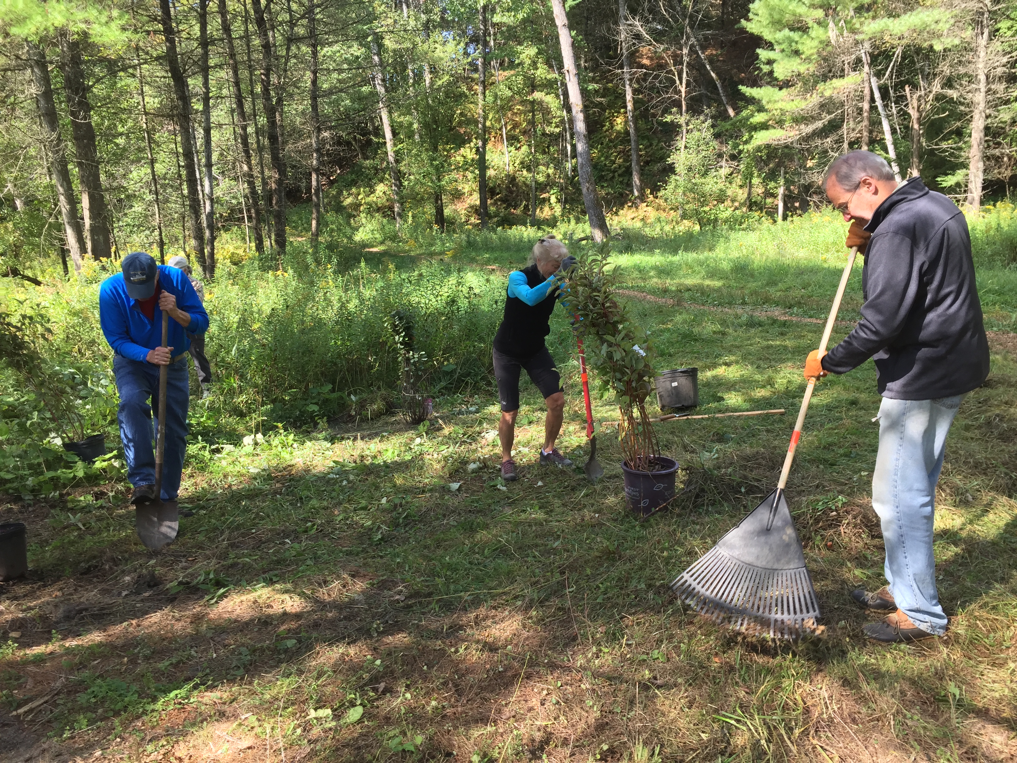
Native dogwoods, serviceberry and other shrubs were planted to restore the floodplain.
Hugh Mellert works to place the dedication plaque on a granite boulder
The final step was planting native shrubs and preparing the site for the dedication ceremony

Filed Under: Events, History, Lands, Mink Brook, Outdoor Trips, Trails, Volunteers Tagged With: accessible, benches, Bob Norman, founder, history, Mink Brook, Norman Overlook, seating, trails, volunteers

Trescott/Paine/AT Loop

September 1, 2019

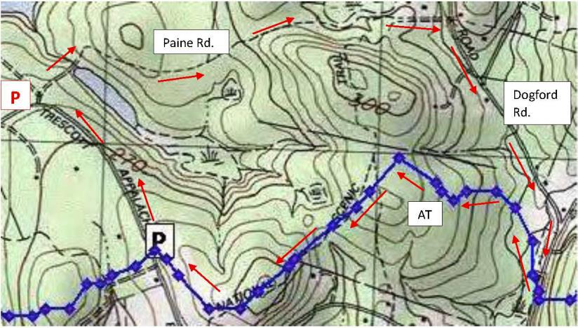
Hike map and directions – full PDF


Paine Road trail mapDriving Directions

  • From Downtown Hanover and the Green, drive E on E. Wheelock St. and up the hill 1.7 miles to the junction of E. Wheelock, Grasse, and Trescott Roads. Bear R to continue on Trescott Road and drive 1.2 more miles to the Trescott gate at a sharp bend.
  • From Etna village, turn W onto Trescott Road and drive 1.3 miles to the Trescott gate at a sharp bend.
  • Park at the marked trailhead parking area near the kiosk. Please do not block the gate.

What You Should Know

  • Today’s hike takes you on a loop that begins on the Trescott Water Supply Lands, follows an historic road past two cellar holes, visits a 19th century cemetery, and returns on the Appalachian Trail. The two forested legs of the hike are linked by short walks on the public portions of Paine, Dogford, and Trescott Roads.
  • You’re about to visit lands owned by the Trescott Water Company (Town/Dartmouth) and the permanently protected corridor of the Appalachian Trail as it skirts Etna village.
  • Dogs must be leashed while on the Trescott Water Supply Lands and waste must be picked up and carried out in order to protect drinking water. Elsewhere, dogs are welcome if under your control.
  • Archery season begins Sept. 15. Deer hunting is encouraged on the Trescott lands to improve the forest, and it is wise to wear blaze orange Sept. 15-Dec. 15. Hunting is also permitted on AT lands.

Hiking Directions

  • Trescott Water Supply Lands logoWelcome to your water source! Drinking water for much of Hanover and Dartmouth College comes from these lands, so special rules apply for recreational use. Take a moment to check the kiosk display to acquaint yourself with these rules and pick up a trail guide.
  • Take the short path R of the kiosk that leads around the fence to Knapp Rd., avoiding a logging road at L. At Knapp Rd., turn R back toward the gate and after 25 yards, turn L onto Paine Road. For over a century, this was a four-way intersection.
  • The route now called Paine Road was laid out in 1782 from Jeremiah Trescott’s place to Dogford Road, “to accommodate him for Meeting.” He’d been asking for an easier route from his house to Hanover Center since 1775. Who Paine was and why the road now bears that name remain a mystery.
  • Paine Road leads invitingly down a gentle hill for several minutes’ walk. Approach the dip in the old road softly; if you’re lucky, you’ll get a glimpse of a great blue heron or other wildlife in the wetland at R. This valley is not as small as it first appears – it extends over a half mile and feeds Parker Reservoir. The wetland captures sediment washing off higher ground before it can enter the drinking water reservoir.
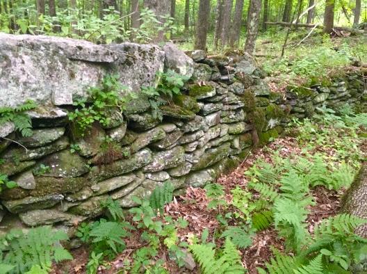
  • The old road continues up out of the hollow. Just as it swings R, stop and look for the remains of an old stone wall at L. You have found the site of the Wright-Mason Farm.
  • old cellar hole wall
    Cellar hole of the Wright-Mason farm
    To find the farmhouse’s cellar hole, follow the line of this wall into the woods to a pile of large, flat stones, about 35 paces from the road. From this point continue straight, another 25 paces, to a small grassy rise. The cellar hole may be invisible until you’re nearly upon it.
  • Here is what seems like the remains of a very small house. Actually, most early homes had cellars under only a part, as a cellar was not easy to dig and was needed just for storage of apples and other supplies, not for the many purposes to which we put basements today. Other foundations on the N side suggest the house had an ell.
  • In 1855, one H. Wright occupied this farm. Little is known about this family. By 1885, Charles Mason, Jr. owned the place. It was removed when the Parker Reservoir was built.
  • 5 ash trees
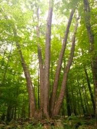
  • Return to the road and continue E (away from the wetland). Ahead on a rise at L is an impressive “fairy ring” where five large ash trees spring from a single place. All are sprouts from the stump of a single earlier tree.
  • Paine Road levels out, lined by a nice low stone wall at L and handsome sugar maples 20” in diameter. They were probably set out along the road by the Wrights and their mid-19th century neighbors, the Johnsons, when the surrounding land was open pasture or cropland. Now, the forest has returned but the maples still reign.
  • 0.3 miles and 15 minutes from your car, look for the Mason Trail at L. Continue straight on Paine Road.
  • 20 minutes from your car, arrive at a log landing – a sunny opening where timber pulled through the woods by a skidder is cut to length before transfer to a lumber truck.
  • As you proceed, stone walls follow the road and head off into the woods at right angles, separating fields and pastures of another time. They were likely built by A.D. Johnson, whose home site you will soon visit, during the “Sheep Craze” of the mid-1800s. A close look reveals small stones among larger ones, indicating the land nearby was cultivated, making it worth the trouble to move minor rocks.
  • About 5 minutes’ walk past the log landing is a flat spot at L, site of the Johnson-Camp Farm. This cellar hole is easily visible from the road. While it is nearly square, the farmhouse that stood over it was probably rectangular. The 1855 map shows A. D. Johnson here. By 1885, Carlton Camp lived here, of the family that gave Camp Brook its name and a veteran of the Civil War (Company B of the 18th NH Volunteers). His farm consisted of 75 acres with a sugar orchard of 150 trees and 40 more acres leased from a William Doten.
  • After exploring the cellar hole, continue E on Paine Rd. At a sign and barbed wire marking an old water company boundary, walk around the large pine at R to pass through a gap in the fencing.
  • Paine Rd. heads gently downhill and, on a sunny day, light through the trees catches your attention. You’ve reached a major wetland in the headwaters of Mink Brook where cattails and other marsh plants grow amid the standing skeletons of dead white pines. A big wetland in a bowl like this helps hold heavy rains like a sponge, protecting people downstream in Etna from sudden flooding.
  • A mesh cage, oddly out of place in these woods, is part of a monitoring program by the Hanover Biodiversity Committee to measure deer browsing pressure on Trillium.
  • Climbing up out of the bowl, Paine Rd. once again becomes a traveled way (restored to active use in 1971). Here, private land is posted in some places. Please take care to respect these neighbors.
  • turtlehead
    Turtlehead
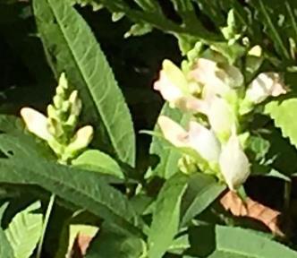
    1/2 hour from your car, reach Dogford Rd. Turn R and walk on its edge, following the drainage from the wetland. Just past Jones St. is a good patch of wetland wildflowers in joyous bloom at this season: orange jewelweed and white turtlehead (R). Its flowers are so sturdy that only bees are strong enough to pry them open for pollination. Walking allows you to enjoy the riot of roadside flowers blooming at this time of year – goldenrod, Queen Anne’s lace, yarrow, New England aster, and pink clover.
  • 10 minutes’ walk brings you to Hanover Center Road. Turn R and take a few moments to wander through the nearby cemetery, established in the early 1840s. Most of the families who farmed the Trescott Water Supply Lands now rest here, along with their Etna neighbors. Some of their names are being memorialized on trails in the water supply lands.
  • close-up of headstone
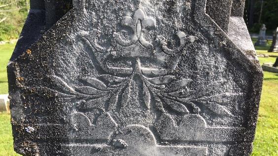
    Detail on the Mason grave marker
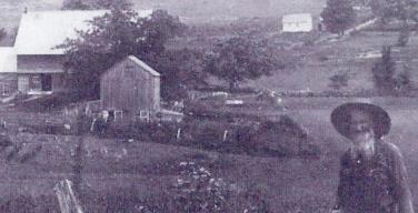
  • A tall obelisk near the gate marks the 1883 Chandler family plot, and just behind, an ornately carved obelisk (L) marks the burial place of Julius J. Mason and his successive wives Sarah Camp and Lydia Chandler. Other markers bear the names Bridgman, Childs, and Chase. William Hall (1825-1912), pictured below at his farm (site of today’s Parker Reservoir), is buried here. Heart-breaking are stones for “Little Baby” and other children.
  • farmer in field by farm houses
    William Hall, c. 1890
    After visiting the Trescott lands’ long-ago occupants, follow the roadside fence to the far opening, turn R on Hanover Center Rd. and R again onto the Appalachian Trail S at the US Forest Service sign. Trescott Rd is 1.3 miles and under an hour away.
  • The 2,190 mile-long Appalachian Trail threads through a national park that spans the eastern seaboard from Maine to Georgia. Conservation efforts along its route have protected valuable wildlife habitat and cool forests – and historic sites. The fern-lined, white-blazed trail heads between the cemetery and a forested wetland fed by Monahan Brook, a tributary of Mink Brook. Check tracks at wet spots – are all human and dog? We saw a bear track when scouting this route. Cross the brook on a sturdy log bridge and follow it up to an old field, where goldenrod reaches for the sky and apples ripen on trees planted 150 years ago. This is wonderful wildlife habitat.
  • 10 minutes’ hike from the road brings you over another log crossing as the trail begins to climb gently but steadily out of the little valley. Young woods are punctuated by big bull pines.
  • 9 minutes later, arrive at a trail junction marked by an orange Dartmouth Outing Club sign directing you to the L. A stone wall just beyond marks an old property line. A few minutes later, reach a Y junction with similar sign. You’ll bear R here; a service trail bears L.
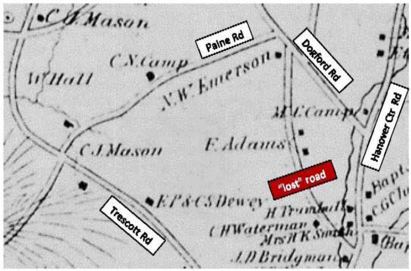
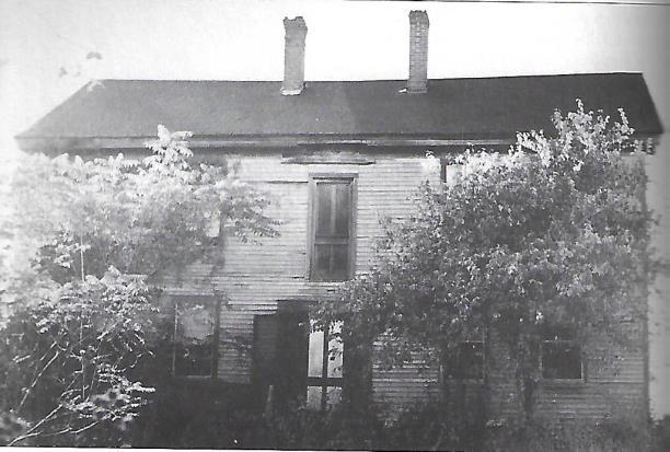
  • 1855 map showing roadsAn odd metal object leaning against the sign is your cue to explore the large cellar hole just W of the trail (at R as you face the sign). Beyond the nearly intact cellar hole are three dressed granite foundation slabs. Metal objects of mysterious purpose are scattered about. Beyond is a complex set of foundations indicating that an elaborate barn stood here. What is such a thing doing out here in the woods? The 1855 map of Hanover shows a mysterious road linking Dogford and Hanover Center Rds with a single home near the N end. The 1892 map (R) shows two more places, owned by F. Adams, midway on the road. Today’s Partridge Road once linked Hanover Center Road with Jones Street, and it is the remains of the Adams farm you’ve discovered. The Adams family once owned all the land between Dogford and the east leg of Trescott Road. When the farm was sold and subdivided to create the Trescott Ridge subdivision in the 1960s, Partridge Road was re-routed and the Adams farmhouse (R) was bulldozed.
  • 2-story house with trees in front
    Adams House, c. 1960
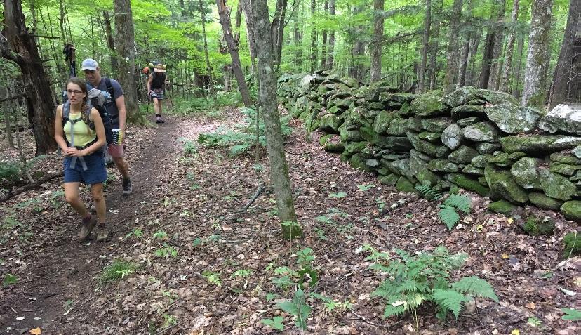
    Return to the trail junction and take the R fork to continue on the white-blazed Appalachian Trail. The AT follows Adams’ handsome, well-made stone wall for quite a distance. Sharp eyes will note other walls joining it to separate former pastures where tree roots now graze. The AT is busy at this time of year – the day we were out, we met 8 hikers, hailing from Florida, Chicago, Massachusetts, and Vermont.
  • hikers by stone wall
  • The AT heads up around a knob and through gaps in other, older walls. 20 minutes from the cellar hole, you’re suddenly in a thick pine forest, likely a cattle pasture abandoned 80 years ago, and the trail swings R to skirt an old field. The sound of passing cars hints that Trescott Road is near.
  • The trail drops gently down the slope to another souvenir from Etna’s agricultural past – the circular foundation of a silo, now moss-covered. Nearby is a curious rectangular cement box and platform, possibly a milk cooling structure for a dairy farm.
  • Soon the trail approaches the back of a kiosk placed to inform AT hikers coming the other way. While the AT proceeds straight, turn R here to take the pine needle-strewn path that leads through the woods to a small AT parking area. Turn R onto Trescott Road and walk 10 minutes back to your car.

This Hanover Hike of the Month has been generously sponsored by
Chase Brook Software logo


Filed Under: Hike of the Month, September, Trescott Tagged With: Appalachian Trail, cellar hole, jewelweed, turtlehead

Moose Mountain Ridge Loop

August 1, 2019

Complete PDF


Moose Mountain loop mapDriving Directions

  • From Etna village, turn R onto Ruddsboro Rd
  • Follow Mink Brook as the road curves up its narrow valley for 1.5 miles
  • Turn L onto Three Mile Rd
  • After 1.4 miles, arrive at a big dip in the road with parking on both sides.

What You Should Know

  • Today’s hike, shown on the map above, takes you on a loop that visits the South Peak on a lesser known trail, cruises the mountain ridge on the Appalachian Trail (with optional 15-minute, 0.2 mi. visit to the Moose Mtn. Shelter) and returns on the historic Wolfeboro Road and the old route of the AT, the Harris Trail.
  • You’re about to visit lands owned by the federal government (permanently protected) and Dartmouth College (partially protected for the AT corridor) and the privately owned Shumway Forest, protected by the Hanover Conservancy in 2017.
  • Dogs are welcome if under your control; please pick up after your pet.

Hiking Directions

  • Begin your hike on Dartmouth land at the orange Dartmouth Outing Club sign that reads, “Parking/No Camping.”
  • Known as the New Fred Harris Cabin Access Trail, this blue-blazed, ½ mile trail was built by the DOC as a direct route to the college’s Class of ’66 Lodge (built on the site of the Fred Harris Cabin).
  • The trail is easy and rises gently to a plateau, passing through a long-abandoned sheep pasture. Here, saplings are creeping into the understory sheltered by towering pines above. Years ago, all these lands between the road and the mountain ridge were owned by Luther Brown.
  • Seven minutes’ walk from your car, the sound of water signals the approach to a main tributary of Mink Brook. At L, a rough stone wall marks the plateau’s edge and boundary of the old pasture.
  • The trail drops to a bridge over the brook. Look L upstream; the brook drains a rich beaver-influenced wetland just out of sight on the Shumway Forest.
  • The trail continues gently back up to a matching plateau on the E side. The forest is different here – less pine, more hardwood – belying a different history. Was this Luther’s woodlot?
  • 10 minutes’ hike from your car, reach the Harris Trail. An orange DOC sign hangs on a tree at R, facing the other direction and reading “To AT” and “To 3 Mile Rd & Parking,” indicating the path you just took. Across the trail junction is a wooden sign reading, “<- Harris Trail ->” placed by the Hanover Conservation Commission’s Trails Committee.
  • The Fred Harris Trail, former route of the Appalachian Trail, honors the Dartmouth Outing Club’s founder (1909). It offers wonderful skiing when conditions are right. The trail once ran from Moose Mountain Lodge Road N into Lyme, and can still be followed by an alert hiker. The AT was re-routed onto the Moose Mountain ridge in the 1980s.
  • Turn R onto the wide Harris Trail and head down to another brook. While there is no bridge, it’s easy to cross on stepping stones. Slow-growing hemlocks and yellow birch shelter the stream and hold the banks in place. At L, beyond the brook, a yellow blaze and white boundary sign signal the edge of the federal easement over Dartmouth land that protects the Appalachian Trail.
  • The Harris Trail continues on its gentle grade and an unmarked trail soon joins at L. This is the Ski Loop, a challenging ski trail built before the AT. Turn L here and head uphill for about 15 minutes. The trail is not blazed and because it is not used as heavily as the AT that parallels it nearby to the S, it is not as worn, but is not hard to follow.
  • The Ski Loop takes you gently but steadily up on an old cart path. Shortly past a fallen beech, the trail levels out and slabs L along the hillside.
  • 15 minutes from the Harris Trail, the sounds of falling water accompany your arrival at another trail junction. Signs on trees at L indicate the trail down to Dartmouth’s Class of ’66 Lodge. The stream you hear, which is the one you recently crossed below, provides the lodge’s water supply. At this point, you cross onto the Shumway Forest. More about that later.
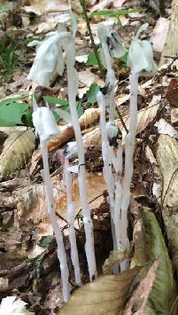
  • Indian Pipe flowersContinue straight onto the Nat Thompson Trail which leads 1.1 miles from this junction up to the AT on the ridge. This begins as a wide, pleasant trail, re-opened a few years ago by the Dartmouth Outing Club. In midsummer, look for the ghostly white stems and downturned flowers of Indian Pipe (R), a saprophyte that relies on decomposing plants for its food as it has no chlorophyll. Shining clubmoss blankets the hillside at R.
  • 8 minutes from the Ski Loop junction, the Nat Thompson Trail approaches the stream at L; be sure to stay straight without crossing the stream and continue gradually uphill. The trail is irregularly blazed but easy to follow. Six minutes later, a log crossing carries the trail over a small drainage as you leave the Shumway Forest for federal land surrounding the AT. The trail swings NNE to make a wide easy sweep up to the ridge.
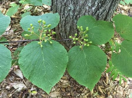
  • Hobblebush
  • Spring wildflowers have long since gone by, but sharp eyes will find the deep blue berries of blue-bead lily and the seed clusters setting on hobblebush viburnum. Some paired hobblebush leaves achieve lunch plate size; they will turn deep purple in autumn. The three-lobed leaves of goosefoot or striped maple, a small understory tree, can get even bigger.
  • 10 minutes from the log crossing, the trail swings R and becomes steeper as it climbs toward the South Peak. 5 minutes later, reach a fork and a sign directing you R toward the South Peak. 5 more minutes’ climb brings you out onto the open ledges of the 2293’ South Peak of Moose Mountain.
  • Time for a break! Enjoy the view out over Goose Pond below and, if it’s not hazy, across Canaan and far beyond. At this time of year, the rosy flower clusters of shrubby meadowsweet attract pollinators and dragonflies patrol the skies.
  • Beyond the summit sign, the path S of the clearing is the AT southbound, which would take you straight back to Three Mile Road about ¼ mile S of your car (and downtown Hanover, if you keep going). If a thunderstorm threatens, this is your best bet. But we’ve got much more to see today, so retrace your steps and strike N (path at L of ledges). In a few yards bear R on the AT northbound at a pair of orange signs, past the Nat Thompson Trail.
  • The white-blazed AT soon heads down into the saddle between the N and S peaks. The wind rising up both the E and W slopes plays in the trees overhead, keeping the bugs too entertained to bother you.
  • 13 minutes from the S Peak, a sign announces you’ve reached the Moose Mountain Shelter “FPA” (government-speak for Forest Protection Area). 5 minutes further, an orange sign indicates the shelter is 0.1 miles beyond Wolfeboro Rd. Just beyond is the historic road itself, rising up from the Tunis District to the E and quickly disappearing down toward Hanover to the W.
  • SHELTER STOP – You can visit this shelter with an easy out-and-back 0.2 mile, 15 minute hike, or if time is short, simply turn L and head down Wolfeboro Rd. To find the shelter, cross the Wolfeboro Rd and follow the AT northbound as it winds gently uphill for 5 minutes to a cheerfully illustrated orange sign at the shelter access path. Turn R here and within moments, the shelter comes into view at L. A bench of Aldo Leopold’s design rests on a nearby ledge, and must offer great views when leaves are off. Be sure to sign the ledger tucked by the shelter’s N wall. A lot of work by volunteers goes into maintaining places like this. Return to the Wolfeboro Rd the way you came.
  • Stand for a moment at the four-way junction of two of the most historic routes in New Hampshire. The 2,190 mile-long Appalachian Trail, proposed nearly a century ago, threads through a national park that spans the eastern seaboard from Maine to Georgia. Conservation efforts along its route have also protected valuable wildlife habitat and cool forests. The Wolfeboro Road, built 250 years ago when New Hampshire was still a colony of Great Britain, reached from the colonial governor’s home in Wolfeborough up and over this mountain to Hanover, a distance of 55 miles as the crow flies. Governor John Wentworth ordered its construction so that he could attend commencement at Dartmouth College, having assisted its founder, Rev. Eleazar Wheelock, in securing its charter from the King. Wentworth was an eager outdoorsman, relishing camping out with his road survey crew in the NH woods and leaving his wife at home to worry about decorating her new ballroom in the governor’s mansion.
  • This spot also marks an important watershed divide. All rain and snow falling E of where you stand on the AT flows into Tunis Brook, Pressey Brook, Goose Pond, and then to the Mascoma River. All that falls on the W side ends up in Mink Brook. Waters from each reach the Connecticut River, but by much different paths.
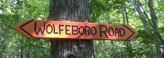
  • Wolfeboro road signIt’s time to head down. Take the Wolfeboro Rd W and down the mountainside for about 15 minutes. Adventure-seeking jeep drivers have created ruts in places, and the footing is wet for the first 5 minutes until you encounter rough gravel laid down by the Hanover Dept. of Public Works so emergency vehicles could reach the AT to assist injured hikers.
  • Along the way, imagine Governor Wentworth riding this rugged route to the Dartmouth Green. For more hiking on this historic road, see our Hike of the Month for June, Wolfeboro Road West.
  • 15 minutes from the AT, an old stone wall appears at L and you reach an open area at the bottom of the slope. You’re back in former sheep country! Continue straight, passing a chained-off drive at R. A few paces further, a metal gate comes into view at L and an orange sign just beyond indicates the Harris Trail. Walk around the gate and back onto Dartmouth land, following a woods road past a log landing and bearing R to re-enter the woods.
  • Here, the Harris Trail follows a gravel-surfaced woods road used to deliver supplies to the college’s Class of ’66 Lodge. After crossing a new wooden bridge, there’s a more natural surface underfoot.
  • Peter and Kay Shumway at table
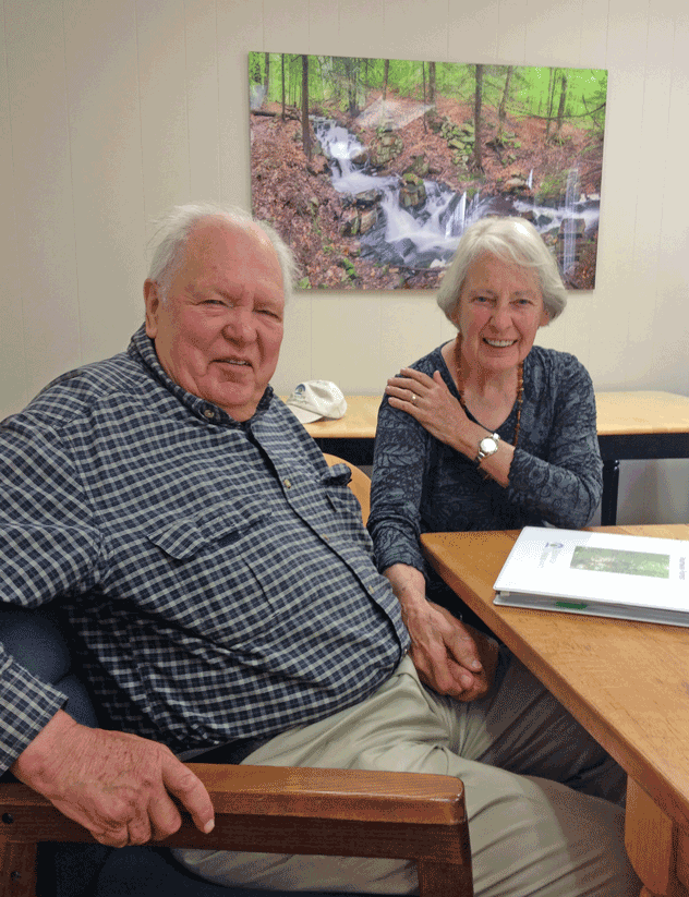
    Peter and Kay Shumway after signing the Shumway Forest conservation easement, June 2017
  • Shumway Forest sign10 minutes from the gate, spot the green Shumway Forest sign at R. Peter and Kay Shumway (L), owners of the historic Moose Mountain Lodge from 1975 to 2018, purchased 313 acres on the mountain from a lumber company in 1986 to keep the land from being developed. In 2017, to permanently protect public access to its foot trails, they conveyed a conservation easement to the Hanover Conservancy.
  • A short distance past the sign, follow the Harris Trail as it bears R off the woods road. While the red and black DOC blazes have long since faded, the former route of the AT is easy to see. The forest is younger here than on the mountain ridge, punctuated with occasional massive white pines.
  • 5 minutes past the fork arrive at a junction where a trail at L heads over a footbridge to the Class of ’66 Lodge. Continue straight and soon the orange sign appears at R directing you back to Three Mile Road. You’ve now closed today’s loop. Bear R for the 10-minute return on the now-familiar path, over the wooden bridge, and back to your car.


Filed Under: August, Hike of the Month, Moose Mountain Tagged With: Appalachian Trail, goosefoot, hobblebush, Indian Pipe, meadowsweet, Wentworth, Wolfeboro Road

Mink Brook and Gile Hill

July 1, 2019

Complete PDF


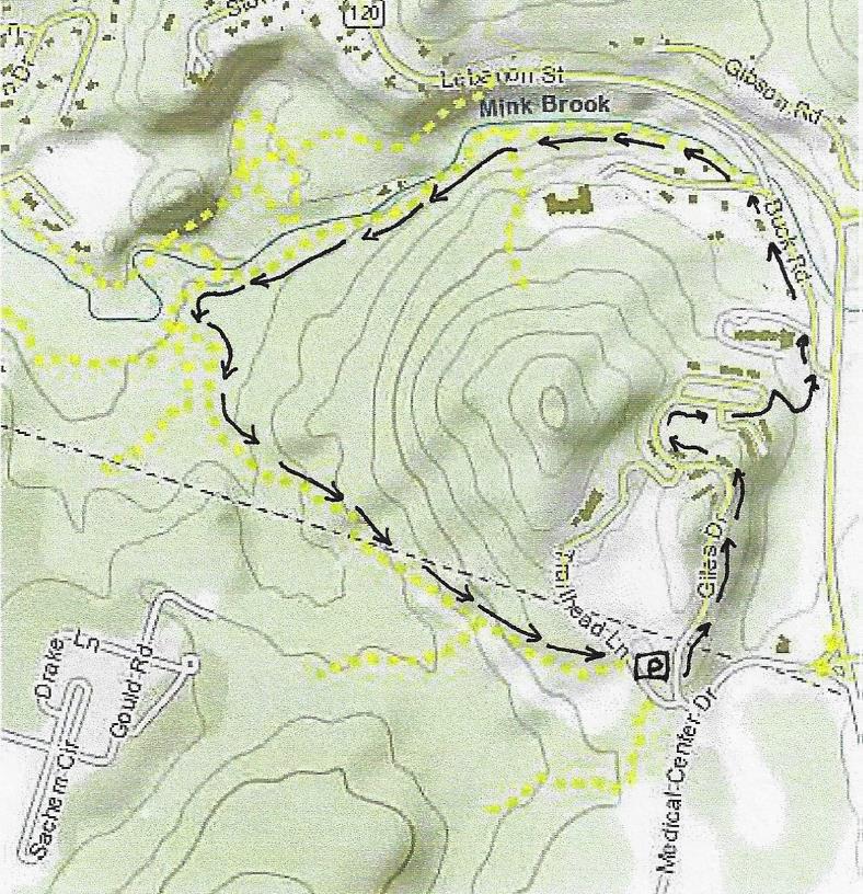
Gile Hill mapDriving Directions

  • You can drive to the take-off point at Gile Hill OR walk from DHMC on medical center campus trails.
  • From downtown Hanover, take Lebanon St./Route 120 south to the first light after Greensboro Road, at Medical Center Drive. Turn R at the light, pass the gas station, cross the bridge, and take the first R to Gile Drive.
  • Turn immediately L into the gravel parking area encircled by large stones, and park. This is your starting point.
  • Today’s hike is a loop through the Mink Brook Nature Preserve and adjoining Gile Hill area, encircling the 800’ rocky knob highlighted on the map at R.

What You Should Know

  • This is a moderately challenging hike, if only because it uses every sort of path you can imagine – from wide and paved to narrow and rocky, flat to steep – and everything in between. Wear sturdy shoes!
  • You’ll pass through surroundings that vary from a deep hemlock forest to sculpted grassy slopes between apartment buildings. It’s good to know such wild places are so close at hand.
  • Dogs are welcome but must be leashed while walking through Gile Hill and must always be under your close control. Please pick up after your pet.
  • Bicycles are not permitted in the Mink Brook Nature Preserve.

Hiking Directions

  • To begin your hike, walk to the paved road to the Gile Hill development and turn L onto the paved sidewalk just beyond. Follow the sidewalk as it crosses the access road several times and continues down past the apartment buildings. When the sidewalk ends, continue a short distance to White Pine Oval. Take the nearer end of the oval – your destination is a crosswalk at the far end that leads you to a paved path. Along the way, notice a “wall” of stones inside a gabion cage, a stark contrast to the native boulders visible just beyond and the early stone walls you’ll observe later on this trip.
  • Walk past the wooden rail fence to a crosswalk where you’ll take the wide paved path to Buck Road. Just as it curves L, note a steep sided trench at R, built to capture stormwater runoff from the paved areas and roofs. Before 2006, when the Gile Hill development was built, this entire hillside was a steep, forested jumble of boulders. It presented such an engineering challenge that it was the field site focus of a regional conference on stormwater management techniques.
  • The paved path ends at Buck Road near Route 120. Turn L and head down the hill on Buck Road, which was once the main road linking Lebanon and Hanover before 120 was built. In a few minutes, Buck Road swings L just before the narrow bridge that once carried it over Mink Brook.
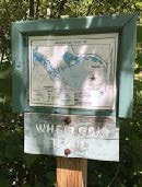
  • Wheelock trail signA few paces beyond the turn, look for the Wheelock Trail just before a fire hydrant.
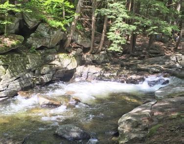
  • Named for Eleazar Wheelock, founder of Dartmouth College (more about him in a minute), the blue-blazed trail begins as a narrow, rocky path threading among rocks and roots close to Mink Brook. You’re greeted by the sound of the tumbling brook and the cool sweet air of the protective forest, a stark change from Buck Road and Gile Hill. The Upper Valley Land Trust owns this land on the south side of the brook; you’ll pass beneath UVLT’s office perched at the top of the bank. UVLT was instrumental in protecting this parcel and the larger Mink Brook Nature Preserve in 1999, working hand in hand with the Hanover Conservancy (then known as the Hanover Conservation Council).
  • Five minutes from Buck Road, look for a rocky ledge on the far side of the brook where the water spills over a small falls. Amid the foliage above, you can make out the stone wall of an old mill structure. Watch your step among the tangle of roots across the trail. There’s a better view of the falls from below. You’re looking at the reason why Dartmouth College is in Hanover and not somewhere else!
  • 1778 map
    1778 map of SW Hanover showing Mink Brook and college and Wheelock holdings
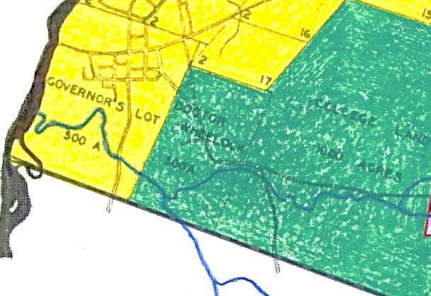
    In the late 1760s, when Rev. Wheelock was searching for a town to locate his college, colonial governor John Wentworth and the proprietors of newly-founded Hanover and Lebanon joined together to offer him 2,000 acres surrounding this brook. This, the largest stream in Hanover, has an 18 square mile watershed, thus guaranteeing a good flow, and this falls offered a promising spot for a grist mill. This was essential gear for grinding grain to make flour to bake bread to feed hungry young men. The deal was sealed, and in 2019, Dartmouth celebrated its 250th anniversary, all thanks to Mink Brook. (After a first mill failed, Israel Woodward built this mill for Wheelock in 1771-1772).
  • But we digress. The Wheelock Trail continues into a cool glen shaded by hemlocks and becomes a wider path. Soon it heads up to a break in the canopy and bears R across land owned by Wheelock Terrace. Here, the sewer line passes under your feet on its way to the wastewater treatment plant at the mouth of Mink Brook.
  • Enter the woods once again at a small sign (TRAIL ->). In a few moments you’ll encounter a low stone wall marking an early boundary; today it announces that you have arrived at the Hanover Conservancy’s Mink Brook Nature Preserve. A remnant of barbed wire clings to a tree at L, and HC’s even more contemporary boundary marker, a 4’ plastic square, hangs on a tree at R. This stone wall marks the ancient property line between the 300 acre Wheelock parcel and the 1000 acre Dartmouth College parcel of land. That easterly property line makes a series of erratic westerly jogs as it runs north over the top of the hill and descends the northerly side. This reflects the fact that in 1771, after Wheelock had established his first mill on Mink Brook, it was found to be located not on Dartmouth property as the College Trustees had intended, but rather on Wheelock’s private property. Therefore, to appease the Trustees, the original property line was adjusted westerly, giving more land to the College.
  • Continue as the path becomes level and wide among the hemlocks. The brook’s floodplain may be flat, but you’re aware of steep, high slopes both across the brook and to your L. Soon they begin to crowd the path as steep ravines appear at L. What’s going on here? You are actually hiking along what was once the bottom of glacial Lake Hitchcock. This frigid lake covered the Connecticut River valley from Middletown, CT to Littleton, NH after the river’s waters were trapped by a dam of debris dropped by the glacier as it melted. Thousands of years later that dam broke, leaving us with the beautiful winding Connecticut River of today. While the lake was in place, however, soil washing in from the uplands settled on the lake bottom. In still water, such as that quieted by a veneer of ice, the finest particles of clay sink to the bottom. When the lake drained, Mink Brook’s braided waters flowed down through the newly exposed sediments, slicing deep channels through them on their way to meet the river. These old channels are now the steep ravines that surround you.
  • rocky gorgeAbout 15 minutes’ walk from Buck Road, you reach a beautiful rocky gorge. The trail briefly becomes indistinct on the slope but picks up later. Take a moment to visit the water’s edge and discover a lovely pool behind a low dam. This dam was built in the 1920s to create a swimming hole for a seasonal cottage once owned by the Tanzi family. The cottage is now gone, but a nearby private residence remains on the opposite bank. Continue west on the Wheelock Trail.
  • Four minutes’ walk past the gorge a flat terrace appears at L; this is part of the old glacial lake bed, formed when the lake had partially dropped.
  • Two minutes later, you arrive at a dramatic spot where an enormous boulder guards the brook. The footing is tricky here. Climb below the boulder to admire its sheer face, but please resist the temptation to climb it. A look toward the brook may reveal woody debris tossed here by high water. A nearby tree shows the scars of two strands of barbed wire, two and three feet off the ground, presumably set 150 years ago to protect grazing sheep from falling into the water.
  • Just beyond the huge boulder is a very old stone wall with hemlocks growing from it. Scan the hillside at L to marvel at another partial wall of larger boulders. This land has clearly been used for many, many years.
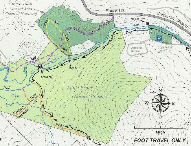
  • Mink Brook area mapFive minutes’ walk past the boulder brings you to a recently abandoned stream channel. Before Tropical Storm Irene, Mink Brook ran through this now nearly dry sandy area, but the August 2011 surge tore a new channel slightly north, where it now flows except in times of very high water. The trail heads toward the log crossing built in 2009. Just before the bridge are signs of erosion that began with Irene and continues today – a hemlock hangs out over the water, its roots exposed, and on the far side, the brook is scouring the north bank. Nearby at L, ferns occupy the swale of yet an earlier abandoned channel. This is a pretty busy place!
  • At the log crossing, you have a choice of exploring trails on the north side of the brook. If you do, please cross the log one at a time. A sign at L indicates that you have come from Buck Road and are headed toward Lebanon. Continue straight on the Wheelock Trail; it soon begins to swing away from the brook.
  • Just past a dead tree at R, look L for bright pink “whiskers” marking a study plot of Trillium. This study, conducted by the Biodiversity Committee of the Hanover Conservation Commission, is following survival of this native wildflower under heavy deer browse pressure.
  • A few steps further, a trail comes in at R. Take this for a few yards back to the streambank. Plans for a 32-lot housing development on this land included a road and bridge across the brook at this point. In 1999, to save this land as a refuge for the community – both human and wild – the Hanover Conservancy and Upper Valley Land Trust worked together to purchase the property. Over 500 households contributed, with Dartmouth College providing the major gift that ultimately made it possible to protect this land. Today, the 112-acre preserve is owned and managed by the Hanover Conservancy with help from volunteers. Conservation restrictions held by UVLT guide the preserve’s management.
  • Return to the Wheelock Trail, trying to visualize this place as a residential subdivision and yourself standing on a paved road leading to driveways, garages, mailboxes, landscaped yards, and houses with dogs and cats.
  • A few steps bring you to another junction, where the Wheelock Trail turns R and crosses a drainage over stones placed to allow both feet and water to pass. Here, you stay straight and continue on the orange-blazed Trout Brook Trail, a flat and gently winding pine-needle strewn path.
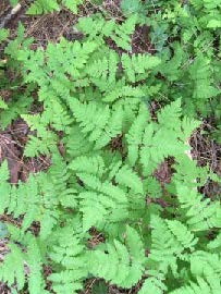
  • fernsAt R, pockets of ferny wetlands adorn the forest floor. It is easy to imagine how useful they are as sponges during heavy rains, holding back stormwater and protecting the brook from flooding and erosion.
  • Five minutes’ walk from the would-be subdivision bridge, arrive at another junction where a trail at R leads to Sachem Village. A small sign reminds that bicycles are not permitted at the Mink Brook Nature Preserve due to a condition placed on the College’s major gift that protected the land. The trail begins to climb as the mild music of falling water is heard.
  • Two minutes further, arrive at a small but picturesque waterfall on Trout Brook. At its foot are twin boulders, each wearing a rakish wig of moss and ferns. During a study of wild brook trout habitat by the NH Fish and Game Department and Trout Unlimited in 2012, biologists agreed that the protected forest in this area provides extremely high quality habitat for wild brook trout. (The trout are small, and deserve to live and grow another day.)
  • Keep the brook company for a short while, but watch for orange blazes as the trail swings L and heads up and away. Through the trees at L above is a flattish area where millet was grown by the Stone family when this land was part of their farm in the 1960s.
  • The Trout Brook Trail now heads steadily up, with Trout Brook singing away below to the R.
  • Seven minutes’ walk from the waterfall, you reach the height of land on the trail and emerge, blinking in the sudden change of light, into the clearing for a huge powerline. Needless to say, you’ve found the southern boundary of the nature preserve, which is also the boundary between Hanover and Lebanon.
  • Take a moment to adjust to the sharp contrast and then continue on the path, which bears L and down toward the power line. Coarse rock and gravel mark the route, which soon plunges up again, sometimes quite steeply, through clover, daisies, briars, coltsfoot, and 5’ white pines. It’s difficult to imagine that this area once looked exactly like what you just hiked. Replacing towering hemlocks with towering metal poles makes a big difference to everything beneath them!
  • About 10 minutes from the woodland’s edge, you arrive at another height of land affording a view of an electric transformer station below at R. Continue on the path, heading slightly L toward a gap in the trees and a yellow gate. Just beyond the gate is Trailhead Lane; turn R to reach the parking area where you left your car. If you walked from DHMC, turn R again at Medical Center Drive.

Filed Under: Hike of the Month, July, Mink Brook Tagged With: coltsfoot, trout

NEW website for Pine Park

June 3, 2019

The Pine Park Association has a new website!

Stay up to date and learn more about this beloved area at PinePark.org.


0669c171016Pine Park is a treasure in so many ways…
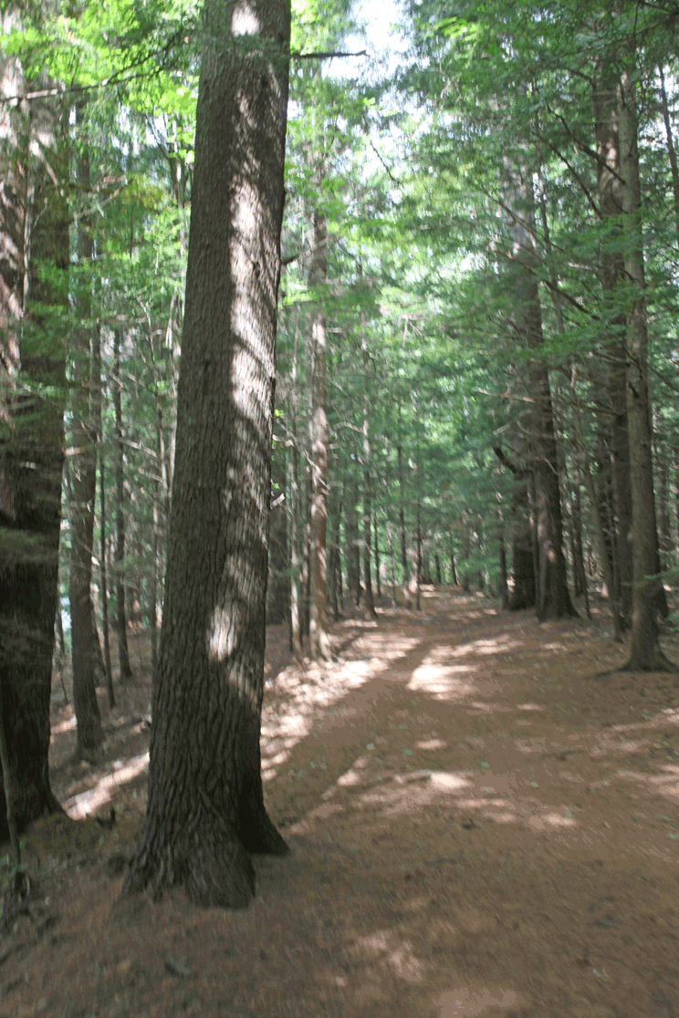

— scenic, forested Connecticut River shoreline – near downtown!

— beautiful trails, linking the campus and nearby neighborhoods

— protected corridor & shaded fish habitat for Girl Brook, one of Hanover’s most vulnerable streams

— stopover habitat for spring migrating birds

— shelter for wildlife

Here’s more from our friends at the Pine Park Association:

Pine Park is Hanover’s first natural area permanently preserved as a park and today functions as the town’s “central park” for the enjoyment of walkers, joggers, skiers and many others.  TRAILS MAP

The Park’s 95 acres, acquired between 1900 and 1912, represent an important ecological resource, where riparian and forest ecosystems intersect. Accessed through the Hanover Country Club, off Rope Ferry and Occom Ridge roads north of the Dartmouth College campus, the park features a significant stand of old white pine, hemlock and hardwoods. The land is home to deer and black bear, among many other woodland animals, as well as to some unusual and endangered plant species.

IMG_8651Historically, the town of Hanover and Dartmouth College have shared responsibility for the management of the park, and both periodically offer labor and expertise in connection with its preservation. However, neither contributes funding directly for park maintenance or capital improvement. The park is owned by the Pine Park Association, a voluntary nonprofit that dates back to 1900, when a group of 17 local residents sought to prevent the Diamond Match Company from harvesting trees along the riverbank just north of the Ledyard Bridge.

Conditions in the park have deteriorated in recent years, in part because of an aging canopy affected by a disease known as needle cast, and because of development that has contributed to notable erosion along Girl Brook. Frequent foot traffic along the brook, which crosses the park’s main path, has also contributed to the degradation of the bank and adjacent trail, which has been temporarily re-routed.  A  pedestrian bridge has been built to protect the bank from further damage.  (Watch the bridge being built!)

To learn more about Pine Park contact the Pine Park Association.  Read an essay about the park (Valley News, September, 2014).  (Thanks to Kathryn Stearns for this article)

Filed Under: Lands, Media, Partnerships, Pine Park

  • « Previous Page
  • 1
  • …
  • 7
  • 8
  • 9
  • 10
  • 11
  • …
  • 29
  • Next Page »

71 Lyme Road
Hanover, NH 03755
(603) 643-3433

info@hanoverconservancy.org

Facebook logo   Instagram   YouTube

Get Involved

Become a Member

Volunteer

Business Sponsors

Conserve Your Land

Employment

Our Mission

Advocacy

Conservation

Education

Stewardship

Explore Hanover

Hanover Hikes

Upcoming Events

Upper Valley Hikes

Trails Challenge

Copyright © 2026 Hanover Conservancy | Design by Chase Brook Software