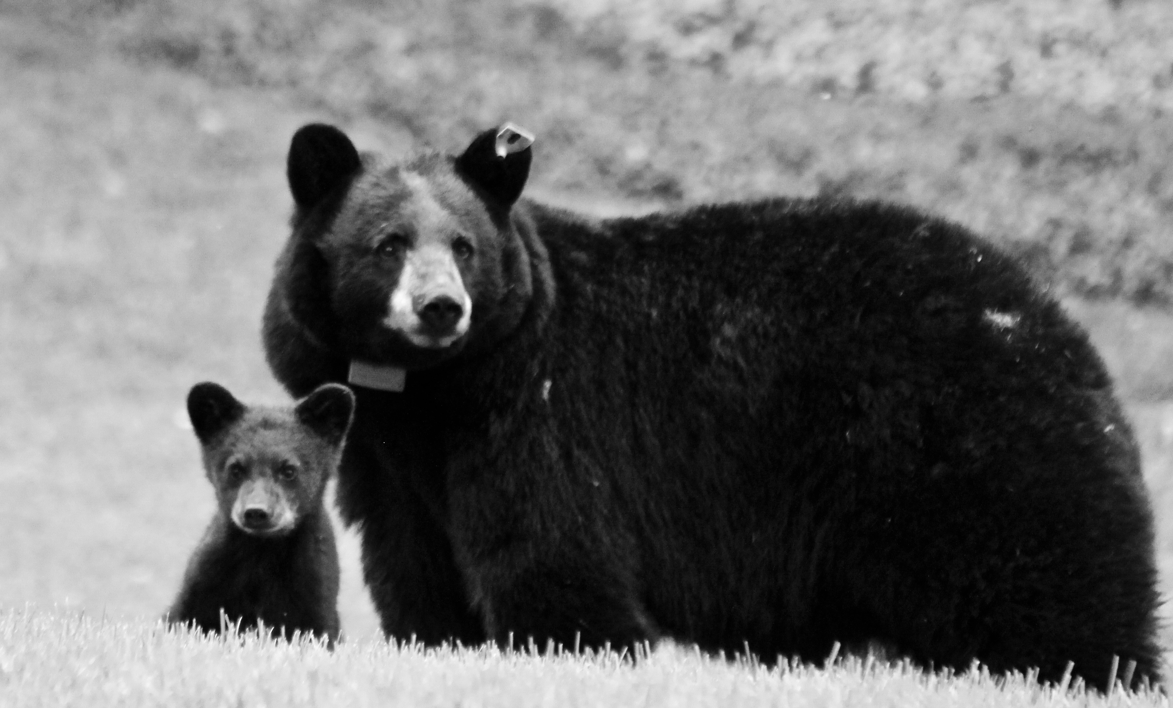
We’re sad to report that the family of black bears at the Mink Brook NP have been trapped and relocated after more than a year of concentrated efforts by town and state officials to educate our human residents. With another large bear family only a few miles away, our efforts to become better neighbors to these beautiful, typically shy animals will certainly continue! Read more here…
POP-UP THIS SUNDAY! Mindfulness at Tunis Brook
This Sunday, June 17th from 10:30-noon, join Lee Steppacher for this peaceful walking meditation at one of our less-visited properties, the Tunis Brook Mill Lot. Directions here.

Take a moment to pause in the midst of a busy summer weekend to enjoy an easy, mostly silent mindfulness in nature experience. The trail is a very gentle ~0.5 mi. each way, with time to sit individually by the shaded brook. First-timers and daily practitioners alike are welcome!
Bring whatever you need to sit comfortably for 20 minutes; bug spray, towels and a few camp chairs will be provided for your convenience. Long pants and sleeves are recommended to ward off insects. Sunday morning will be very warm, but we’ll be shaded and near water much of the time. Questions? Call Courtney at (904) 536-9682.
NHPR Features Wilder Dam Relicensing Project
For Residents On The Connecticut River, Hydro Dams’ Relicensing Is A Rare Opportunity
Moose Mountain Lodge and Ledges
Hike information & map – full PDF
Driving Directions
- From Etna Village, head N on Hanover Center Road
- Turn R on Ruddsboro Road and drive 1.8 miles
- Turn L on Old Dana Road
- Turn R just past large red barn on R, onto Moose Mountain Lodge Road (not marked)
- Drive 0.8 miles to top of road. Park at the marked trailhead parking area just past the beaver dam.
What You Should Know
- Foot travel only. Dogs welcome if under close control.
- Bring binoculars and bird book for viewing waterfowl on Mill Pond and exploring distant views.
- This hike celebrates the history of Moose Mountain Lodge and explores the wild ridge of the mountain. We will view the former Lodge site from an overlook; please note that the site is privately owned.
- The route visits part of a 3,800-acre block of protected higher-elevation wildlife habitat on Moose Mountain.
- The hike ends with an optional visit to protected 18th century mill ruins on the steep mountainside.
BRIEF DIRECTIONS
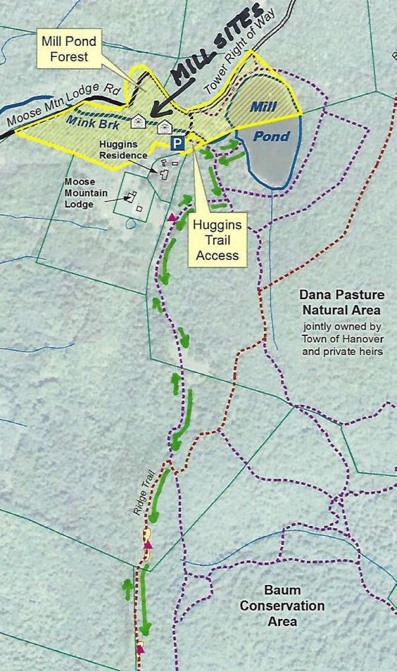
- Begin at the sign reading “Mill Pond Forest & Huggins Trail Access.”
- Bear L at first trail junction to visit Mill Pond
- Return to trail junction and turn L onto Pasture Road
- Turn R onto Baboon Bypass, cross drainage, and reach first views
- Continue on trail to second pasture and third pastures and cross stone wall
- Bear R at arrow, head downhill, and shortly after, turn L at arrow
- Bear R at sign parallel to the trail indicating the Orange Diamond Ridge Trail. Head up a short steep section to a mossy ledge.
- Continue to second open ledge.
- Retrace your steps to return to your car.
Hiking Directions
- Begin your hike at the sign reading, “Mill Pond Forest & Huggins Trail Access.” To forever ensure public access to the network of trails you’ll be exploring, the Shumway and Huggins families donated conservation easements on this area to the Hanover Conservancy in 2016.
- Cross a small drainage and note the series of small beaver ponds at L. By late 2017, the beavers left after many years of entertaining their neighbors with sightings of cruising kits and evening tail slaps on the water, as well as plugged culverts and “free-range forestry.”
- The thread of infant Mink Brook has reappeared with the lack of diligent management by these aquatic engineers.
- Arrive at the first trail junction and bear L. Within 15 paces look for a cellar hole at L. This was the high-elevation c. 1800 home of miller David Woodward, who built the dam on Mill Pond and an impressive sawmill and gristmill on the steep falls of Mink Brook below where you left your car (optional visit at end of this hike). Woodward’s house was probably larger than the modest cellar hole, which, in the days of hand digging, must have presented a challenge to build.
-

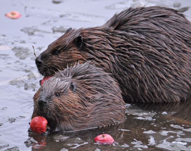
Mill Pond beavers; photo by Kay Shumway Continue on the path a few minutes further to a bench at the pond shore. It’s time for a picnic, or at least to pull out the binoculars! Ten-acre Mill Pond is the highest water body in Hanover and the primary source of Mink Brook, the town’s largest stream. Set in a saddle on the mountain ridge, it may have originally been a small pond or perhaps a marsh. Around 1800, Woodward built a drylaid stone dam (just out of view at L, beyond the spruces) to raise the water level some 6-8 feet (it has since partly silted in). Beavers later took over and have been managing the pond off and on, ever since. Today, the entire shoreline remains undisturbed: Hanover Conservancy easements protect the N side with the Dana Pasture Natural Area on the S (co-owned by the Town of Hanover and a Dana heir).
- Directly across the water is an impressive beaver lodge. Scan the pond’s surface for waterfowl and other birds. On the day we visited, three male mallards were holding a bachelor party at the pond.
- Retrace your steps to the cellar hole and trail junction. At this time of year, violets are in bloom on the forest floor and you may spot the cheerful red of partridgeberries.
- A sign for Pasture Road and a green moose mark the trail junction. Turn L; soon you’ll see the old stone wall marking this Class VI road. Where Pasture Road once met Moose Mountain Lodge Road is anybody’s guess – our bet is the area under the beaver dam.
- Pass by the first gap in the wall, which leads to a private home, and look for a second gap marked with a sign for “Baboon Bypass” a few yards beyond the wall. Turn R here. This short and somewhat indistinct trail leads W toward your next destination, across a small drainage. Blue sky appears ahead and an arrow on a barbed-wire-garbed tree directs you to swing L into an opening.
- Arriving in an old pasture (first of three), leave the path and head through low brambles and blueberry bushes toward a big pine and two old fence posts. It seems all of central and southern Vermont is spread before you, with sharp-peaked Killington presiding.
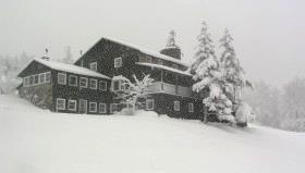
- It seems all of central and southern Vermont is spread before you, with sharp-peaked Killington presiding. For 80 years, just below the brow of this field, stood Moose Mountain Lodge, an icon in the Upper Valley and legend in the ski world. The Lodge is now history, having been removed in the last few years, but we’re going to tell you all about it!
-

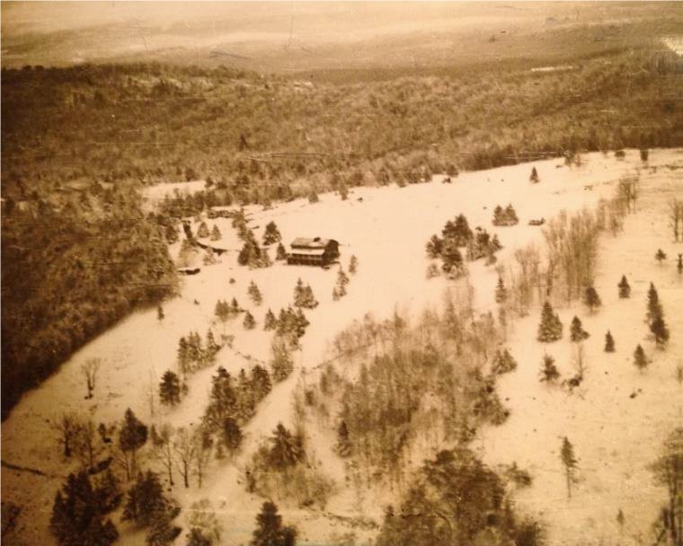
Lodge, pastures, and ski slopes, 1949 Let’s start with long-time owner Kay Shumway’s recollections: “The Lodge is a big old comfortable log building perched high on the western side of Moose Mountain. It has survived 80 years of snow, sleet, ice, wind, and lightning. The weather comes across the Connecticut River Valley and sweeps up the mountain, wearing away at the log surfaces like sandpaper. Sometimes the wind gets unbearable with its relentless buffeting. We often remark that it’s almost like living on a ship at sea.”
- The Leslie brothers built the lodge in 1937-38. They were identical, inseparable twins – when one came to Dartmouth, the other had to come too! Bill Robes was teaching skiing then and the boys were hooked. Robes, who married into the Dana family, he said he knew of a place where they could build a ski lodge, and the rest is history.
- The Lodge opened in 1938 for downhill skiing complete with rope tows and skiing on cleared slopes below. There was even night skiing on a lighted slope, which according to Kay was not too successful. The Lodge primarily served Dartmouth, housing college guests and students’ dates. Back then skiers careened down the mountain’s sunny west slopes on wooden skis. The road up to the Lodge was part of the adventure. Most who arrived by car parked at the base of the mountain and used a crank telephone to summon the Lodge’s Ford woody station wagon for a ride up the hill.
- From 1943-45, the Lodge closed as gas rationing during WWII curtailed driving for pleasure and cut off fuel for the tows. It reopened from 1946-49 but was soon empty and vandalized. In 1955, Bob Jones bought the abandoned Lodge and nearby cottage as a boys’ summer camp. Camp Moose Hi ran for three years until Agnar and Anah Pytte bought the Lodge and Elisha and Anne Huggins the nearby cottage. John and Mary Clarke acquired the Lodge in 1972, turning it back into an inn for cross-country skiers and cutting some of trails we still enjoy today.
-

The Lodge in 1975 Three years later, Peter and Kay Shumway visited in a snowstorm. At the time, Peter was in the lumber business in New York and Kay taught in a Head Start program. Peter’s father had been a ski jumper at Dartmouth (Class of 1913) and when he and some friends skied the 25 miles to Mt. Moosilauke, people would stop them and ask what they had on their feet. The Shumways happily bought the Lodge and it continued to host in the back country skiing tradition.
- The Shumways welcomed guests for the next 35 years, retiring in 2011. Kay recalls, “Inn-keeping on our beautiful mountain allowed us to live in this peaceful place in isolation while still meeting interesting people.”
- In 1985, the Shumways purchased a 313-acre mountain tract just N of the Lodge to keep it from being developed. Their forester, John O’Brien, helped them return its forest to health after prior heavy logging, always with an eye to ski trail potential. In 2017, these public-spirited landowners conveyed a permanent conservation easement on the Shumway Forest to the Hanover Conservancy, protecting public trail access and high elevation wildlife habitat forever. We celebrated with the entire Moose Mountain Lodge family and many friends on a sunny Saturday in July.
-

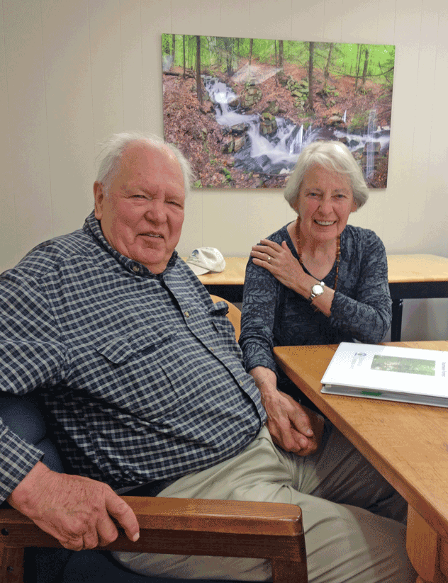
Peter and Kay Shumway after signing the Shumway Forest conservation easement, June 2017 The lodge interior was even more wonderful than you imagine. Log ceiling beams, a sunny comfortable living room filled with rustic handmade log furniture, Kay’s baby grand piano, and drifts of hand-dyed wool for her spinning projects surrounded a huge cobblestone fireplace that featured a granite millstone above the hearth (more on that later). The dining room spanned the NW side, with another fireplace and a handmade dining table so long you can just imagine hungry guests gathering around it after a great day on skis. Behind was an efficient yet delightfully old-fashioned kitchen with everything close at hand, including Kay’s own Moose Mountain Lodge recipe book. On the N side was the ski shop with rows of skis hanging from a rack, ready for waxing. A welcoming porch spanned the entire W side, with log settees beckoning you to relax and take in the breathtaking view and spectacular sunsets.
- Up the stairs under the watchful eyes of a mounted moose head you’d find a warren of cozy guest rooms with log beds, some made by Kay and Peter themselves. Down the hill were a large fenced vegetable garden, goat shed (Kay kept Angora goats for their fleece), and small sugarhouse.
- Now it’s time to enjoy some of the trails the Shumways and their former neighbor, Elisha Huggins, long maintained. Return to the path and continue uphill to a second, smaller clearing adorned by white birches. Follow the path back into the woods, guided by small wooden arrows. Soon you’ll arrive at a third pasture, the largest of all. Head uphill toward a moose sign with orange highlights posted on a birch.
- These pastures, occasional clumps of juniper, and the fragments of barbed wire on fence posts recall the land’s history as the Dana Farm’s summering grazing grounds. The Dana family farmed this area since the late 1800s. Today, the red barn still stands on the E side of Old Dana Road and the early white farmhouse migrated from its original site across the way to the hilltop above. Into the 1960s, the family drove their cattle up the mountainside to graze here during the summer. After grazing stopped, Elisha Huggins kept the pastures open for skiing and views, using a hand scythe!
- A low stone wall among the birches marks the boundary with private land. Continue S toward a large ash bearing an arrow pointing R. After a short downhill, another arrow + moose sign directs you to turn L. Take the path through the woods a short distance to a trail junction.
- A sign at R, parallel to the trail, indicates the Orange Diamond Ridge Trail. Bear R and up a short steep section to a mossy ledge.
- Ten minutes’ walk from the last pasture, you arrive at the first of two open ledges and views open up to the E. Keep an eye on kids and dogs. A small cairn on the far side marks the trail’s return to the woods.
- Here, the Ridge Trail follows the boundary of two privately owned parcels – to the E is the Baum Conservation Area, owned by a local Dartmouth alumnus with a keen interest in trails and conservation. Pass a nice colony of the small but stoic rock polypody fern.
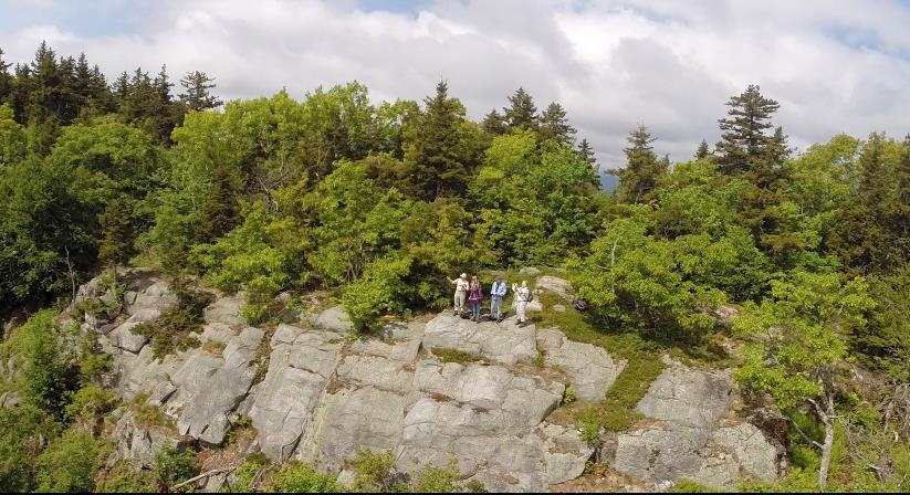
Five minutes from the first ledge, arrive at the second, larger ledge, today’s turn-around point. Time to corral kids and dogs and pull up a stony seat among the lowbush blueberries to drink in the view (and some water). At 1 o’clock is the bony knob of Mt. Cardigan. If you stand on the highest part of the ledge, you can see distant Mount Washington at 11 o’clock.- At 10 o’clock, the ridge of Moose Mountain stretches N beyond the communications tower. From here, you get a fine view of the mountain’s E profile and realize that, like Holt’s Ledge and so many others in New England, it is a roche moutonnee or sheepback, shaped by the passing of the glacier. The glacier abraded the NW side and plucked rocks from the opposite slope as it ground its way from NW to SE. In this view, dark patches of evergreens to the R of the tower mark the steep SE side.
- To return, pink tape on a tree helps you locate the trail back. It becomes clear you’re hiking the very spine of this mountain, with the Mascoma River valley off at R and Mink Brook valley at L.
- Returning to the first ledge, admire the view of Cardigan before continuing on, following a blue arrow.
- At the trail junction, yellow signs point R to the Baum Conservation Area (to explore another day). You turn L to retrace your steps toward the pastures.
- At a bent yellow birch, a sign at L directs you to turn R; shortly after you’ll turn L at another arrow. Soon you’re back to the birches and the upper Dana pasture. In June, white five-petaled strawberry flowers decorate the ground under your feet.
- Continue gently downhill to the last pasture, above the site of the Lodge. See if you can spot the white hamlet of Hanover Center in the distance, to the R. You can see why this village never fulfilled its intended destiny as the hub of Hanover – it’s on a hilltop and there’s no running water!
- Take the path back into the woods – avoid the trail that comes in at L from a private home – and return to Pasture Road. Turn L past the stone wall and then L again at the junction by the cellar hole. Ten minutes from the last overlook, you’re back at your car.
Optional Mill Site Visit (10 minutes)
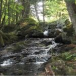
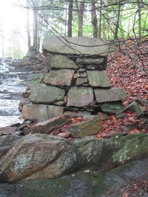
Hidden in the woods are remains of a late 1700s saw and grist mill. They are very close by but invisible unless you make the short scramble through the woods to see them.- Walk back down Moose Mountain Lodge Road to a telephone pole opposite the gated entrance to the tower right of way. Turn L and bushwhack back the short way to the stream. You’ll soon pick up an old cart path on the near side. Take this down along the brook, admiring the cascades, to a series of angular piles of rock. Towers rise on either side of the brook. More can be seen farther downstream.
- We marvel at how David Woodward managed to build these structures in such a steep ravine around 1800, his only tools likely being a pair of sturdy oxen, ropes, a chisel, and a native understanding of physics. In his 1982 anthropology paper, Dartmouth student Tom Slocum suggests that Woodward used the cubic
- blocks of native schist to build an undershot-type mill that most likely functioned to saw wood and grind grain. Water stored in the pond above could be released to provide enough flow to operate the mill. At some point in its history, the mill operated only during the spring freshet and only as a sawmill.
- The 1930s builders of Moose Mountain Lodge found their fireplace ornament here amid the ruins of Woodward’s mills. These historic sites are now specifically protected from further disturbance by the Hanover Conservancy’s Mill Pond Forest conservation easement.
- Continue down the brook-side cart path to the last set of ruins. The path appears to end here; retrace your steps to return to your car.
Revised 10/2020
Hayes Farm Park & Audrey McCollum Trail
Hayes Farm Hike – Full PDF
Driving Directions
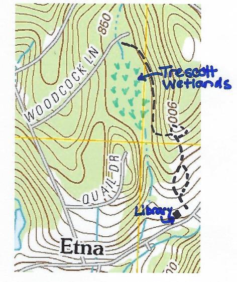
- This hike begins at the Etna Library at 130 Etna Road.
- From downtown Hanover, follow East Wheelock Street up to Grasse Road, where it becomes Trescott Road. Continue straight on Trescott Road to Etna Road.
- Turn L onto Etna Road and head N
- Opposite King Road, turn L into the Etna Library parking area.
What You Should Know
- Foot travel only. Dogs are welcome but must be under close control; please pick up after your pet.
- While this hike is not long, there are some short steep sections and some tricky footing.
- We suggest bringing a picnic and binoculars, and allowing extra time to enjoy this spot.
- You are exploring land acquired by the Town of Hanover in two phases – the 12.9 acre Trescott Ridge Wetlands, set aside when the “bird roads” (Woodcock, Partridge, and Quail Lanes) were laid out, and Hayes Farm Park, 9.4 acres acquired from the estate of Ethel Hayes in 2010. On the way, you’ll visit the King Bird Sanctuary, established in 2011 by the Hanover Conservancy and the Audrey McCollum Trail, built in 2017.
Hiking Directions
- Begin your hike at the sign reading, “0.5 miles to Woodcock Lane/0.2 miles to King Bird Sanctuary.” Head up the mown path toward the trailhead kiosk visible above the meadow.
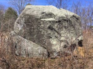
A massive boulder, looking quite out of place, looms ahead. This is a glacial erratic, plucked by the glacier from someplace northwest of here and unceremoniously dropped when the glacier receded, melting around it and leaving it behind. If you look closely, you can see that one H. L. Huntington spent quite a bit of time here on Sept. 14, 1872, carving the erratic’s first (and hopefully only) graffiti.
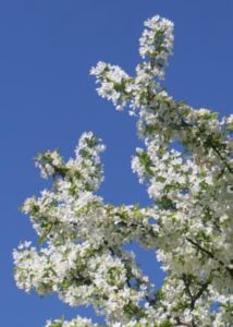
- Pass L of the boulder and up into a small orchard of crabapples (L) that promise to be lovely at some point in May. Resolve right now to return to catch the show.
- The trail is short and sometimes steep. Five minutes’ walk from your car, reach the top of a rise with the next of many fascinating features before you – a stone wall comes in at R. Close inspection reveals wide-mesh sheep fencing topped with a strand of barbed wire, clues that you are standing in what was sheep pasture (1820s-70s) and later pasture for cattle (to mid 20th century).
- Continue down into the broad sheep lane with its fine stone walls on both sides. Halfway along, there’s a gap in the wall at R – your return route.
- For a former sheep lane, this is a pretty interesting place ecologically. Here and there blue flags, set by the town’s Biodiversity Committee, indicate native plants to be tracked. Woodcock frequent the area, as do flocks of turkeys.
- Follow the lane up the next knoll. A sign directs you R to the King Bird Sanctuary. The distinctive boulder seat, your next destination, appears up at L. It’s time for a picnic, or at least to pull out the binoculars!
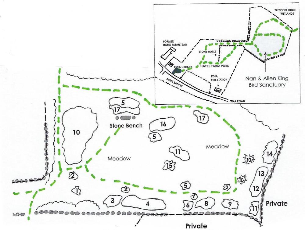
The Hanover Conservancy and Hanover Conservation Commission partnered to create this sanctuary to honor Nan and Allen King, prominent Hanover conservationists, and to benefit Etna Village. On the Upper Meadow of Hayes Farm Park, the sanctuary features a naturalized planting of hardy native trees and shrubs to benefit wildlife. It was dedicated on June 30, 2011, the Kings’ wedding anniversary. In addition to the Conservancy’s King Memorial Fund, many volunteers and donors helped make the project possible.
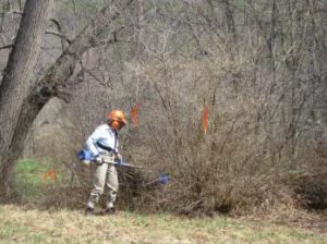
- From your seat on the boulder, imagine this knoll as open pasture. A few such meadows can still be seen across the Mink Brook valley, but most have since grown up to pine. This piece was grazed longer and allowed to grow up more recently, with unforeseen and dire effects – what came in was not only white pine, but thick tangles of invasive non-native plants, including bristly Japanese barberry, honeysuckle, and glossy buckthorn. It took brave volunteers to cut the invaders and heavy equipment to pull them out by the roots.
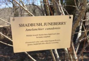
- Replacing them are plantings of native northern New England trees and shrubs that are more reliable and less demanding than exotic varieties, and provide better food, cover, and nesting habitats for native birds and other creatures. All of the plants displayed here are excellent alternatives for the home landscape. Look for tags identifying the plants, their value to wildlife, and ornamental qualities. You’ll want to visit the Sanctuary throughout the seasons to see the changing palette of flowers, fruits, and foliage, and to enjoy a quiet view of the birds and mammals who make this their seasonal or permanent home.
First up in spring are the delicate, fragrant white flowers of shadbush, also called serviceberry and Juneberry. Old-timers associated the blooming of this plant with the spring migration of American shad and also the time for burial services for those who died in winter when the ground was frozen. You’ll find three specimens of this small tree at the King Sanctuary. In June, brightly colored berries follow the flowers, attracting birds. In fall, it sports brilliant foliage.- Take a few minutes to explore the King Sanctuary and its plantings. Follow the mown path a few yards back down to an adjoining path, and at the first of three shadbush, turn L to follow the path along a stone wall. These beautiful walls, built 200 years ago to enclose the sheep pasture, are still enjoyed by animals. At this time of year they hold the spring sun’s welcome heat through the chilly night. You might find chipmunks, garter snakes, and other creatures taking advantage of their warmth.

- After one wall opening (private property beyond) and a group of witchhazel, the wall takes a curious jog. Past a second, smaller gate, a clump of bushy young pines are all that’s left of the many that had invaded the abandoned pasture.
- Bear L and take the path over the saddle of the hill, keeping the stone seat at L. The path bends down and L past the remains of a huge brush pile left from the culling of invasives and dead trees. Now it’s a handy home for small mammals.
- You’ve encircled the small hill and, with another stone wall ahead, arrive at a sign for the Audrey McCollum Trail. An ardent conservationist, Audrey (R) lived nearby for many years. Gifts to the Hanover Conservancy in her memory allowed the creation of this trail linking the library to the Woodcock Lane neighborhood.
- Turn R and head downhill, following sunflower yellow blazes and entering a cool hemlock forest. At this time of year you can find such fleeting evidence of micro-climate as lingering patches of snow and ice in the hemlocks’ dense shade, when the sunny Sanctuary had long since given up such wintry garb.
- Nearing the forested Trescott Ridge Wetlands, the trail bears R and a dramatic stone wall angles down the hill at R. Step over the wall and turn R. This is good porcupine habitat – keep an eye on your dog.
- The yellow-blazed trail skirts the E edge of the wooded wetland. Note the spongy green sphagnum moss and erect beaded fertile fronds of sensitive fern. Indeed, this place IS one huge sponge – it collects and stores meltwater and rainwater, releasing it slowly into a tributary of Mink Brook. Those living as far away as Greensboro Road benefit from the flood-moderating work of this wetland.

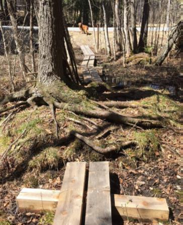
- Approaching the north end of the wetland, you encounter a bog bridge of split logs to help you over a wet spot. A few yards further, cross an impressive string of carefully fitted planks bridging more wet areas and protecting wetland plants.
- This is the work of the Upper Valley Trails Alliance with town and Conservancy volunteers who completed the Audrey McCollum Trail in 2017.
- Follow the yellow blazes to avoid nearby private land. A final pair of bridges leads to the north end of Woodcock Lane. If you want to pick up the pace and cover more distance, you could walk down the lane, turn L onto Trescott Road (beware narrow shoulder), turn L onto Etna Road, and return to your car. We think it’s more fun to retrace your steps and see what you might have missed on the way out.
- Turn around and follow the small stream feeding the wetland. It’s running well now, but slows to a trickle in summer. Signs of squirrel picnics might decorate a granite slab. Keep an eye on the blazes as you go.
This is a very untidy environment! Mossy stumps, lumps, shrubs, standing and fallen trees create visual havoc but are part of what makes this such a valuable wetland. Note the silence of this place.- Keep the wetland immediately on your R until you reach the stone wall. Here, wildlife like mink use such places as billboards, placing scat where it can’t be missed.
- Past the wall, the trail swings up and away from the wetland and, 15 minutes from Woodcock Lane, you ascend from the woods. Stay on the path and round the corner of the stone wall (unless the King Sanctuary’s stone seat requires another visit). Head down the broad sheep lane, past an impressive quartz boulder at R.
- Turn L through the break in the wall and enter the field. Ahead, the old farm well-head gives the impression that a giant has pounded a tiny house into the ground. A cluster of flagging and fence posts indicates a population of plants being tracked and protected.
- Pass the end of the tree line and follow the path as it turns R to bring you to the library and your car. Enjoy a fine view of the historic Hayes Farm barn. This farm was owned by the Ingalls family as early as 1855; by 1892, the Stetsons farmed here. Hayes family members still live nearby.
- Before leaving, pay a quick visit to the lilac garden behind the Etna Library. This outdoor reading garden is encircled by lilac varieties brought by the Conservancy from the famed Highland Park in Rochester, New York, where Nan and Allen King met.
The Conservancy has prepared a map and guide to the King Bird Sanctuary plantings to help visitors learn more about the wildlife benefits and year-round ornamental values of these native plants. Copies are available at the Etna Library and Hanover Town Office.
Mink Brook & the Harris Trail
Harris Trail Loop full PDF
Driving directions
- From Etna village, turn R onto Ruddsboro Road
- Follow Mink Brook as the road curves up its narrow valley for 1.5 miles
- Turn L onto Three Mile Road
- After 1.4 miles, arrive at a big dip in the road with space for parking on both sides. (The AT parking area just S of it is not plowed in winter).
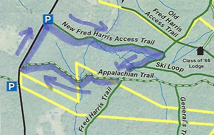
- Today’s hike, shown on the map at R, takes you on a loop that crosses Mink Brook twice.
What you should know
- In winter, we suggest hiking poles and micro-spikes or snowshoes for traction, especially for the brook crossings. The first part of this hike and the Harris Trail offer fine skiing, but the last part of the loop, on the AT, is narrow and often too steep for all but the bravest skiers.
- You’re about to visit lands owned by the federal government (permanently protected) and Dartmouth College (partially protected for AT corridor). The route also crosses a small portion of the Shumway Forest, protected in 2017 by the Hanover Conservancy (outlined in yellow above).
- Dogs are welcome if under your control; please pick up after your pet.
Brief Hiking Directions
- Begin at the orange Dartmouth Outing Club sign that reads “Parking/No Camping”
- Follow the gentle trail 7 minutes to the first crossing of Mink Brook
- Cross the brook and continue another 3 minutes to the Harris Trail
- Turn R on the Harris Trail
- Cross a stream (no bridge)
- Turn R on the Appalachian Trail and hike 10 minutes to second crossing of Mink Brook
- Continue on the AT for 6 minutes to Three Mile Road.
- Turn R and walk 0.2 miles along the road to your car.
Full Hiking Directions
- Begin your hike at the orange Dartmouth Outing Club sign that reads, “Parking/No Camping.”
- Known as the New Fred Harris Cabin Access Trail, this blue-blazed, half-mile-long trail was built by the Dartmouth Outing Club as a direct route to the college’s Class of ’66 Lodge (built on the site of the Fred Harris Cabin). We won’t visit the Lodge today, but you’ll find it on the map above.
- The trail is easy and rises gently to a plateau, passing through a long-abandoned sheep pasture. Here, small saplings are creeping into the understory sheltered by towering pines above. Years ago, all these lands between the road and the mountain ridge were owned by Luther Brown.
- Here and there, last year’s fragile leaves seem to shiver on beech trees. It’s believed that beeches evolved in the south and migrated to this area in the wake of the glacier, but never quite got the hang of dropping their leaves in fall like their northern brethren, the maples and birches. Admire the delicacy of their slender, cigar-shaped leaf buds.
- Seven minutes’ walk from your car, the appearance of a rivulet and its small steep valley at R signals the approach to Mink Brook. At L, a rough stone wall marks the plateau’s edge and the boundary of the old pasture.
- The trail takes you down a short, moderately steep section to a fine bridge installed a few years ago over Mink Brook. Look L upstream; the brook drains a rich and complex beaver-influenced wetland just out of sight on the Shumway Forest. Downstream, the brook may be covered in ice but still can be heard murmuring beneath. At R a small brook joins. You’ll cross this one soon; it is the same stream that pools near the Class of ’66 Lodge.
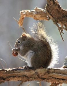
The trail continues gently back up to a matching plateau on the east side. Deer trails cross and you may find leftovers from a red squirrel’s dinner in a pile of pine cone scales or acorn tops. The forest is different here – less pine, more hardwood – belying a different history. Could this have been Luther’s woodlot?- Ten minutes from your car, you reach the Harris Trail, but if there’s been a recent snowfall, it’s easy to miss the junction. An orange DOC sign hangs on a red oak at R, facing the other direction. The sign reads, “To AT” and “To 3 Mile Rd & Parking,” indicating the path you just took. Across the intersection is a wooden sign reading, “<- Harris Trail ->” installed by energetic volunteers of the Hanover Conservation Commission’s Trails Committee.
- The Fred Harris Trail, former route of the Appalachian Trail, honors the Dartmouth Outing Club’s founder (1909). It offers wonderful skiing when conditions are right. The trail once ran from Moose Mountain Lodge Road N into Lyme, but a section N of Ferson Road can no longer be traced. The AT was re-routed off this path onto the ridge of Moose Mountain in the 1980s.
- Turn R onto the wide Harris Trail and head down to meet the brook you saw earlier. Alas, there is no bridge here, but with care and help from your hiking poles you can cross on the ice. Slow-growing hemlocks and yellow birch shelter the stream and hold its banks in place. At L, beyond the brook, a yellow blaze and white boundary sign signal the edge of the federal easement over Dartmouth land that protects the Appalachian Trail.
- The Harris Trail continues on its gentle grade. In a few minutes, an unmarked trail joins from L. Some maps identify it as the “Ski Loop,” a difficult ski trail built well before the AT.
- Bear R here as the Harris Trail continues its easy path downhill. Step over another rivulet.
- From this direction, especially in winter, you might not notice the Appalachian Trail crossing unless you’re alert for a rusted metal gate standing open across the Harris Trail. At L, the famous white blaze of the AT stands out on the trunk of a fine white pine about 40 yards uphill. At R, another orange DOC sign is posted on the far side of a white birch. 20 yards ahead a wooden sign reads “Old Harris Cabin Access Road.” If you continued straight on this for 1.25 miles, you’d come to a pull-off on Moose Mountain Lodge Road.
- Instead, turn R onto the AT to head W toward Three Mile Road (and ultimately, S to Georgia!).
- A few paces from the Harris Trail, you get an intimate view of the underside of a large fallen tree, up close and personal! Rising and falling are all part of a tree’s life cycle, and soon the trunk will become a nursery for its successors. The root mass will slowly melt into a mound, one of many sprinkled across New England forests.
- Eight minutes from the Harris/AT junction, the trail abruptly heads downhill across an arm of the Shumway Forest. This area was protected in 1983 with narrow easements embracing the newly re-routed trail. In 2017, the Hanover Conservancy strengthened this protection with a new easement over the entire 313-acre parcel that stretches nearly to the mountain ridge behind you.
- The trail displays a distinctly different character from those you’ve walked earlier today – it’s narrower with more twists and turns. It soon turns R then sharply L as it attains the spine of a narrow little ridge adorned with hemlock. Small branch tips and tiny cone scales on the snow at your feet reflect the foraging of porcupines and squirrels. Listen for Mink Brook before you see it.
- Head down a short steep section to enjoy the brook and a swig of hot tea from your thermos. Look around this tiny but dramatic little valley. Thick hemlock forest protects the watery home of wild brook trout, keeping waters shaded, cold, and full of oxygen in summer, just the way our native trout like it.

- These waters and the rest of the Mink Brook watershed were part of a statewide study by Trout Unlimited and NH Fish and Game biologists in 2011. They found that “Hanover’s little Mink Brook and its tributaries showed a surprisingly healthy population of native Eastern Brook Trout. In 16 survey sites, 213 Eastern Brook Trout were counted. The survey data also underline how important cold, clean water is for this species. Almost 70% of all the Eastern Brook Trout were found in five survey sites (some tiny upland tributaries) that had an average water temperature of 59.8 degrees.” You are now standing at one of those sites. If you have such a stream on your property, what can you do to help brook trout? Keep a lush buffer of trees and shrubs to shield the water from the summer sun.
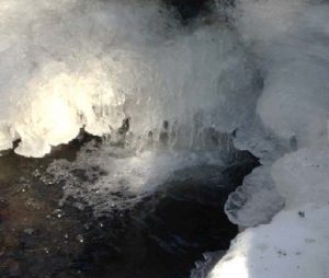
- In winter trout are tucked away, but you can enjoy the glittering play of water against ice and snow, all the more glamorous on a bright day.
- Cross the two-log wood bridge, sending a silent thanks to the person who added the handrail. Head up a short slope, leaving Mink Brook to continue on its way to the Connecticut.
- Here, the AT moves fitfully across 21 acres purchased by the federal government from none other than the Mascoma Beagle Association. We’d really like to know the story behind that.
- Six minutes from the bridge, you arrive at Three Mile Road. Turn R and head back along the road 0.2 miles to your car, soon within view in the dip below.
- Be sure to come back in the spring, when Mink Brook will have even more to say!
February 2018, revised July 2020
- « Previous Page
- 1
- …
- 10
- 11
- 12
- 13
- 14
- …
- 29
- Next Page »