Hanover Conservancy

Facebook logo   Instagram   YouTube          
Donate button
  • Home
  • About Us
    • Employment
    • What We Do
      • Advocacy
      • Conservation
      • Education
      • Stewardship
    • Celebrating 60 Years
    • Board & Staff
    • Membership Benefits
    • Contact Us
  • Get Outdoors
    • Hanover Lands
      • Balch Hill Natural Area
      • Mink Brook Nature Preserve
      • Other Properties
    • Hanover Hikes
    • Hanover Trails Challenge
    • Upper Valley Hikes
    • Exploring Nature at Home
    • Hunting
  • Events
    • Calendar
    • Spring Wildflower Scavenger Hunt
    • Private Events
  • Get Involved
    • Donate
    • Volunteer
    • Adopt a Trail
    • Corporate Conservators
    • Planned Giving
  • Education
    • School Programs
      • KAST
      • Connecticut River Studies
      • Hanover High School Scholarship
    • Request a Field Trip or Speaker
    • Research on Our Lands
    • Hanover History
    • Resources
  • News
    • Remembering Bob Norman
    • Reports & e-News
  • Conserve Your Land

Hudson Farm & the AT

January 1, 2018

Hudson Farm Trail Guide in PDF form


Driving Directions

  • From Etna, take Trescott Road north for 0.5 miles to the junction with Partridge Road.
    Park in the new parking area on the L side of the road (if it is plowed) at the blue sign reading “Old Highway 38 Trail.”
  • If the parking area is not accessible, continue up Trescott Road for another 0.4 miles to the AT parking lot on the R, just before a fence at the Trescott Water Supply Lands boundary. Your hike will end just across the road. To begin your hike, walk down Trescott Road to the new parking area at Old Highway 38.
  • Today’s hike is a loop through the Hudson Farm’s fields and forest on an historic highway and the famed Appalachian Trail, highlighted on the map at R.

What You Should Know

  • You’re about to visit one of Hanover’s newest conservation properties! The National Park Service has purchased the Hudson Farm, owned for many years by Dartmouth College, to permanently protect it as part of the Appalachian Trail corridor. The conservation project is a partnership between the Trust for Public Land, Hanover Conservancy, and Town of Hanover, celebrated in June, 2017. In addition to major federal funding, many local contributions made the farm’s protection possible. Over the years, the property was eyed as a site for everything from a housing development to a cemetery and golf course. We like it just the way the bobolinks and deer do.
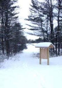
  • Hudson Farm kiosk in winterThe Appalachian Trail Conservancy manages care of the land. Trails on the property are maintained by Berrill Farm neighbors and Hanover Trails Committee volunteers. The beautiful meadows will be kept open for their spectacular views and grassland bird habitat.
  • Dogs are welcome but must be under your control; please pick up after your pet.
  • Snowmobiles, ATVs, and bicycles are not permitted.
  • In spring, wet areas make parts of this route difficult. Hunting is allowed in season.

Brief Hiking Directions

  • Follow the Old Highway 38 Trail up along the edge of the field for 0.2 mi.
  • Turn L at brown & yellow “Old Highway 38 Trail” sign for a brief detour to the nearby meadow for views.
  • Return to the sign in the first meadow and walk straight, down the hill and enter the woods.
  • Continue over boardwalks and through the woods to a junction with sign on L. Continue straight.
  • At the next junction, bear R; trail is now blazed blue.
  • Travel 0.2 mile and watch for pink flagging on trees and AT crossing (easy to miss).
  • Take sharp R onto AT; note white blaze on tree on R.  If you reach a playground you’ve gone too far.
  • Follow AT & white blazes 12 minutes to Trescott Road. Turn R.  Note orange sign at L at road.
  • Continue 0.4mi back to start.  Parking area will be at R at the base of the hill.

Full Hiking Directions

  • Begin your hike where the Old Highway 38 Trail meets Trescott Road. The Town of Hanover constructed a parking area here, opposite Partridge Road.
  • Take the path beyond the trailhead kiosk to an open field, keeping the tree line on your left. Winter is a good time to visit this expansive rolling field, which is alive with nesting bobolinks in spring and summer (when your dog should be on a leash, at least here).
  • Continue up the rise along the tree line that marks an old stone wall. You are walking through one of rural Hanover’s iconic historical farm landscapes.
  • Seven minutes’ walk up from the trailhead, you’ll reach the far corner of the field. Here you’ll notice a brown and yellow trail sign where two paths meet, directing you to the right. Instead, turn L for a brief detour through an opening in the stone wall to a second, equally beautiful meadow.
  • Stop for a moment to enjoy the expansive view. Straight ahead, the open hillside of Storrs Hill in Lebanon stands out, especially when covered in snow. At R are Rix Ledges, some of the most interesting terrain and wildlife habitat in Lebanon.
  • Approach the small group of trees in the field, 30 paces away. From this vantage point you can see Mount Ascutney rising in the distance, to the right of Rix Ledges.
  • RETURN to the first field and its brown and yellow trail sign. Until recently, you would have caught a glimpse of the late 18th century Adams Farm house. Once a lively tavern, it was likely home to the family that once owned the abandoned farmland you are exploring today.  To the R, amid a clump of trees, is a 20th century home built by later owners.  Archer Hudson, a retired architect, constructed the house as a country retreat and burned down the Adams Farm’s barn–the foundation of which remains.  Dartmouth College later purchased the property and carved off the house for resale, keeping the land.  While the College has long referred to it as the “Hudson Farm,” this is historically inaccurate as the property ceased to be a farm before the Hudsons acquired it.
  • From the trail sign, with your back to the second meadow, follow the arrow on the sign and walk straight (turning R would return you to your car) to follow the tree line down to the lowest point in the rolling field. Here the yellow-blazed Old Highway 38 Trail enters the woods. A bog bridge offers an easy way across a small wetland. On this hike you’ll encounter some huge, open-grown “pasture pines” – white pines that grew up on abandoned agricultural land, with many lower branches. Some of them are monsters!
  • Town Highway 38 has a murky history. Laid out in 1795, it originally led from Greensboro Road through this land to Trescott Road. In time it became a Class VI highway, but its exact route was so hard to trace that when planning began for the Berrill Farms neighborhood, the town agreed with the developer in 1979 on a route to be called the “Old Highway 38 Trail.” New LiDAR imagery of the Adams Farm just north shows traces
    of the old road heading toward the old tavern and then on to Trescott Road by today’s Bob Adams Road.
  • Soon you’ll ford another drainage on a crossing built in 2018 by Hanover Trails Committee volunteers. Protecting such headwater wetlands and streams from the erosion and runoff that comes with development is another reason to conserve this land – and will ultimately benefit water quality and trout habitat in Mink Brook from Etna to the Connecticut River.
  • Rising back to dry ground, you’ll encounter not one but two stone walls on the R, another reminder that this land was once open pasture. The second wall forms a corner as you approach and follows you for a distance. Fresh yellow blazes mark your path.
  • Soon, a sign at L indicates a turn in the Old Highway 38 Trail, where it will reach Greensboro Road in 0.9 miles. Instead, you continue straight toward the AT, 0.3 miles ahead.
  • As you continue, an open area is visible downhill at R; this is the forested wetland that is the source of the small drainage you crossed earlier.
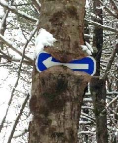
  • 25 minutes’ walk from the trailhead, you reach another junction. The trail coming in at L originates at Bblue arrow sign in a treeerrill Farms. Above to the L, a tree seems to be gnawing on a blue arrow. Ahead at R, another tree has made less progress consuming its arrow sign. Bear R here and follow the arrow and blue-blazed trail downhill past a large old wolf pine at R.
  • You’ll soon reach the yellow-blazed boundary of the original federal land embracing the Appalachian Trail corridor, before the corridor was expanded with the addition of the Hudson Farm. If there’s no snow cover today, you’ll notice the stone wall forming the old property boundary and the AT boundary pin next to the trail. Continue on the blue-blazed trail. Watch for ice underfoot as you cross a small drainage.
  • Keep an eye out for bits of “cultural debris” such as a sap bucket. This is a good time to note that hunting is permitted on the AT and federal land surrounding it, so it’s wise to wear orange if you’re out between Sept. 15 and Dec. 15.
  • A few minutes after passing the sap bucket, the famed Appalachian Trail crosses your path. While it is well marked with fresh white blazes, it can be easy to miss as the old trail continues straight. Turn R onto the AT and head for Mt. Katahdin (or maybe just your car). This is your second historic trail of the day. Benton MacKaye conceived of the regional trail in 1921, and after overcoming many obstacles including the 1938 Hurricane, World War II’s drain on trail maintainers, and the kind of political intransigence that is all too familiar, his vision became the National Scenic Appalachian Trail in 1968.
  • Hemlocks shelter the trail here; if weather conditions are right, it’s easy to see how their stiff needles and short branchlets capture and hold snow before it can fall to the ground. Deer and other wildlife take advantage of the shallower snow depths under hemlocks, where it’s easier to move around. Wildlife managers call such hemlock groves “deer yards” for this reason.
  • Soon you leave the hemlocks behind as the AT heads up a gentle knoll dominated by northern hardwoods. Continuing back down the north side, the trail enters evergreen forest again.
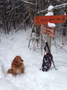
  • About 8 minutes after turning onto the AT, you’ll encounter another wetland. The log crossing may be buried in snow – watch your footing. In summer, this place begets very dirty dogs.Velvet Rocks trail sign
  • Four minutes later you’ll reach Trescott Road and the Dartmouth Outing Club’s orange sign for the Velvet Rocks Trail. The AT parking lot is visible to the L across the road.
  • If you left your car here, it’s time to end your hike. If not, turn R on Trescott Road and walk the 0.4 miles back down toward Etna and your car.

updated 9/1/2020


Filed Under: Hike of the Month, Hudson Farm, January Tagged With: Appalachian Trail, bobolink

Kendal Riverfront Park and Rinker-Steele Natural Area

November 1, 2017

Kendal and Rinker-Steele – Full PDF


Kendal and Rinker hike mapDriving Directions

  • From Downtown Hanover, drive N on N. Park Street and turn R onto Route 10N. Drive past the golf course, through a rotary, past the Richmond School, through a smaller rotary, and past Kendal.
  • Turn L at the entrance for Kendal Riverfront Park (drive for the former Chieftain Motel).
  • Park in the gravel-surfaced lot. This area is open from dawn to dusk.

What You Should Know

  • Today’s loop hike visits the Connecticut River shore at Kendal Riverfront Park and then makes a loop through the Rinker-Steele Natural Area to Ferguson Field, and back along a short section of Route 10.
  • You’ll be walking on lands owned by Kendal at Hanover, the Town of Hanover, and the Hanover Improvement Society. Conservation easements protect some but not all of this land.
  • Trails have many short but steep up-and-down grades – you’ll get a good workout! Clay soils can make for slippery footing on a wet day.
  • Dogs are welcome but must be under your control; please pick up after your pet. You will need a leash.
  • In winter, some of these trails are groomed for skiing – and should not be used by hikers.

Hiking Directions

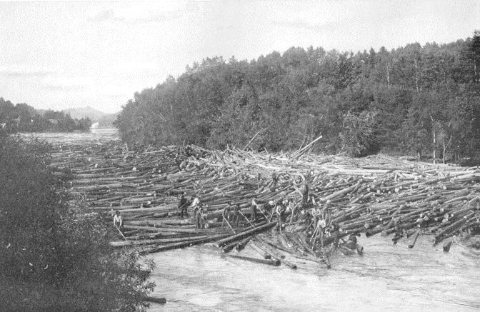
  • log drive on the riverBefore starting your hike, walk to the fence at the west end of the flat, high terrace above the river. From here, you enjoy a splendid view up the mighty Connecticut, the largest river in New England. First-person accounts of the river log drives of the 1890s-1930s mention that word quickly got around when the log drives were approaching the area. Townspeople would flock to viewpoints above the river to watch the grand spectacle. We can just picture families arriving at this very viewpoint with their picnic baskets and parasols, hoping for a glimpse of the “river rats” (daredevil log drivers) hopping from giant log to giant log with their spiked boots.
  • Give three cheers for Kendal Riverfront Park! In a fine example of public-private partnership, the Town of Hanover and Kendal found a way to welcome the public at this prime riverfront property. The land (former site of the Chieftain Motel) is owned by Kendal, and the Town manages the details of public access.
  • Walk past the gate and down the gravel drive toward the river through a steep ravine. Clearly not designed for two-way traffic, this drive is open only to authorized vehicles – think trailers stacked with rowing shells.
  • A trail at L leads to a nice network of private trails on the main Kendal property. Stay R and head for the shore. Arrive at a wide, grassy floodplain area, the lowest terrace. In season, colorful crew boats, stacked on trailers on a higher terrace, await their chance at glory on the river. This area is the scene of many regional crew races on the flat water impounded by Wilder Dam, a few miles downstream.
  • Head to the water’s edge; if the large floating dock is in the water, you’ll have an even better view upriver to flat-topped Smarts Mountain in Lyme. Across the river among the pines is Patchen’s Point, a pleasant picnic spot accessed by trail from Route 5 in Norwich.
  • After enjoying the river and sending silent thanks to Kendal and the Town of Hanover for opening this area for you, walk back up the short but steep drive and then 4 minutes’ walk down Chieftain Hill along Route 10’s bike lane. At the bottom is Camp Brook’s confluence with the Connecticut River.
  • Cross Route 10 (carefully) where the guard rail ends on the opposite side of the road. A sign marks the path into the Rinker-Steele Natural Area and along the N shore of Rinker Pond.
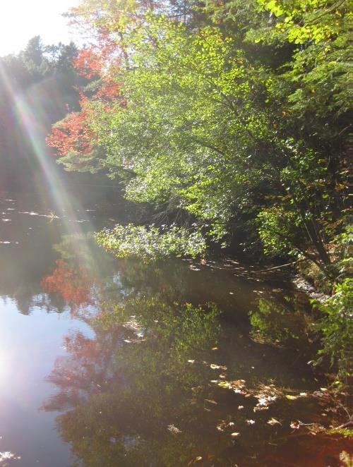
  • Rinker PondThe pond takes its name from the family who once owned the riverfront parcel you passed on your way from Kendal Park. The Hanover Conservancy purchased the 17.62 acre Rinker Tract in 1973 from Mr. and Mrs. Jack Rinker, holding it until the town’s Conservation Commission could buy it with a grant from the federal Land and Water Conservation Fund.
  • The path skirts the water’s edge and, depending on whether Wilder Dam is generating power or storing water, may be wet in places.
  • Stop here at the steep hillside at L – you’re at the old quarry, said to be the source of stone for the White Church in Hanover.
  • The trail leaves the pond shore and swings steeply up through the hemlocks and pines on a well-benched path. The Conservation Commission’s blue & white blazes mark the route.
  • This narrower path threads its way through a wild, dramatic landscape, following the heights of knolls between steep ravines.
  • Five minutes’ walk from Route 10 brings you to a pretty overlook, high over the pond below. Sunlight filtering through the foliage and glinting off the water below makes a stirring sight at odds with the sounds of traffic on the road behind you.
  • Tiptoe around the root mass of a large downed hemlock. The small pit left when the tree fell makes you wonder what held it up for so many years.
  • Follow the N arm of the pond to its end.
  • 8 minutes from Route 10, a green sign directs you R toward Storrs Pond, and the landscape drama intensifies – knobs, knolls, ferny glades. What’s going on here? You are actually hiking on what was once the bottom of glacial Lake Hitchcock. This frigid lake covered the Connecticut River valley from Middletown, CT to Littleton, NH after the river’s waters were trapped by a dam of debris dropped by the glacier as it melted. Thousands of years later, of course, that dam broke, leaving us with the beautiful winding river we see today. While the lake was in place, however, soil washing in from the uplands settled on the lake bottom. In still water, such as that quieted by a glaze of ice, the finest particles of clay sink to the bottom. When the lake drained, Camp Brook flowed down through the newly exposed sediments, slicing deep channels through them on its way to meet the river. These old channels are now the steep ravines that surround you.
  • The trail crosses a small wooden bridge and the Rinker Bike Loop comes in at L. Bicycles are permitted only on this part of the Rinker-Steele Natural Area. Continue straight.
  • It seems incredible, but part of this land was once grazed by sheep, or at least they were contained here. A fragment of wide-grid sheep fencing remains next to the trail, nailed to a dead yellow birch. Most of this land was just too steep for farming, and some trees here are therefore quite old.
  • Cross onto land of the Storrs Pond Recreation Area (not conserved) and, 15 minutes from Route 10, arrive at a wide ski trail. A sign at R confirms this junction. Turn R onto the wide trail and down a gentle slope to the sunny area by the dam at the end of Storrs Pond.
  • Storrs Pond is part of what must be Hanover’s hardest working watershed – Camp Brook. This brook begins on lands owned in the 1800s by the Camp family that are now held by the Trescott Company (50% Town of Hanover, 50% Dartmouth College). The Hanover Water Works bought those lands in 1893-1912 to create the public water supply. Camp Brook was dammed in 1893 to form the Fletcher Reservoir (where Grasse and Reservoir Roads meet) and upstream in 1924 to form the Parker Reservoir. After filtering, much of its water ends up on downtown restaurant tables, in college dorms, and domestic faucets. What’s left continues downhill along upper Reservoir Road and into another artificial pond created by a third earthen dam. This is Storrs Pond, and thanks to the Hanover Improvement Society, there’s a lot of fun to be had here!
  • Cross the dam and note the pond’s outlet below at R, leading to Rinker Pond. Continue as the ski trail swings up and L among white pines that invaded old farmland about 75 years ago. The route is easy to follow.
  • The view into steep, wooded ravines changes constantly as the path turns this way and that. From the first dip after leaving the dam, spot Rinker Pond on the R. Four minutes’ walk from the dam, as you head down to the second dip, note the steep hill at R on the Steele Tract – you’ll soon be up at the top looking down.
  • At the bottom of the second dip the trail to the Scout Area comes in at L. Stay straight. An arm of Storrs Pond appears through the trees at L. Head up the next rise.
  • 8 minutes’ walk from the dam, the entrance to Ferguson Field comes into view. Look for a brown/yellow sign at R marking the entrance to the Steele Trail.
  • Turn R up the hill onto this new yellow-blazed trail, completed in Fall, 2017. The trail follows an old woods road for a short time and swings R on a gradual slope. A double blaze soon indicates a sharp L turn onto a narrower trail. Head up this path and reach the height of land after 2 more minutes.
  • Ferguson FieldLook for a yellow blaze about 15’ to the R. This is a spur trail to the Steele overlook. Take this path through the gap in a large fallen log and in 2 minutes reach the top of the knoll you passed earlier. The grove of solemn pines and hemlocks confers a special silence upon this place, despite its proximity to Route 10. A chipmunk scolds the traffic for disrupting the peace. Plans for this area include some view clearing and a bench. The Town of Hanover and the Kendal community led a successful drive to purchase the Steele Tract in 2010, with help from the Hanover Conservancy, extinguishing what could have been a house lot with a driveway across Ferguson Field. Today the property is managed by the Conservation Commission and protected, with the Rinker Tract, by a Conservancy conservation easement.
  • Retrace your steps to the junction of the trail you took from below, and continue straight on this gentle path. In 2 more minutes it meets Ferguson Field at a “wolf” pine, a large, many-limbed white pine that has overseen many mowings of this field, from hayfield days to ski race times. Ferguson Field, a softened version of the steep hills below, was once part of the Ferguson Farm. The historic white farmhouse, a cape, remains near the Kendal entrance. The field is owned by the Hanover Improvement Society and protected by a conservation easement. The Hanover Conservancy acquired the field from Mrs. Ferguson in 1989, holding it until it could be conveyed to H.I.S.
  • wood fence at Kendal parkA mown path slabs across the meadow to a point opposite the Kendal entrance on Route 10, along with other mown trails that are a pleasure to wander. Today, you can traverse the field or return more directly to your car (6 minutes) by heading R uphill to Route 10. Follow the bike lane on the R side of the road down to the best crossing place, a point opposite the Kendal Park sign.
  • Return to your car at Kendal Riverfront Park and resolve to return for your own family picnic by the river!

Learn more about the Rinker-Steele Natural Area and Kendal Riverfront Park.

Filed Under: Hike of the Month, November, Rinker-Steele Tagged With: Hanover Improvement Society

Watch for blowdowns

November 1, 2017

The windstorm of Oct. 29-30 visited our trails and it will take time to clear all the paths. Our volunteers made much progress at Balch Hill on 10/31 and at Lower Slade Brook on 11/4. Please get in touch to report other obstructions. New volunteers always welcome!

Filed Under: Balch Hill, Slade Brook, Trails

New Trails and Old Names at Balch Hill

October 1, 2017

Balch Hill ~New Trails-full PDF

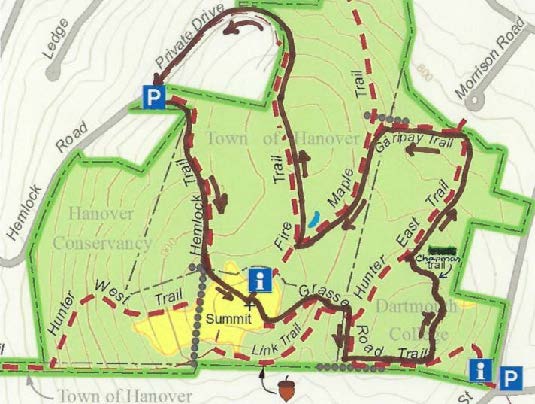
Balch Hill trail loop mapDriving Directions

  • From Downtown Hanover, take E. Wheelock St to Park St, turn L at light and R at next light onto Rte 10/Lyme Rd
  • At first rotary, bear R onto Reservoir Rd
  • Just past Ray School, turn R onto Hemlock Rd, pass Rip Rd, bear R at Y for Ledge Rd.
  • Continue ½ mile up Hemlock Rd, around hairpin turn to its end at a private drive.
  • Park in the circle here, being careful not to block the drive.

What You Should Know

  • This loop hike explores new and rebuilt trails on the Balch Hill Natural Area, with a stop at the summit to enjoy its beautiful views.
  • You’ll be walking on lands owned by the Town of Hanover, Hanover Conservancy, and Dartmouth College. Some but not all of this land is permanently protected.
  • Trails have occasional short up-and-down grades but are easy for the entire family.
  • Archery hunting for deer is permitted Sept. 15-Dec. 15, when blaze orange is a good wardrobe choice.
  • Dogs are welcome but must be under your control; please pick up after your pet.

Brief Directions

  • Take the Hemlock Trail up over stone steps, across a stone wall, and up to the summit.
  • Take the Grasse Road Trail down the E side, turning L at a stone wall.
  • Bear L onto the Chapman Trail to a bench and eastern view.
  • Continue to the Hunter East Trail and turn R.
  • Bear L onto the Garipay Trail and L again onto the Maple Trail.
  • Turn R onto the Fire Trail and follow it down to a driveway.
  • Turn R and follow the drive back to your car.

Full Hiking Directions

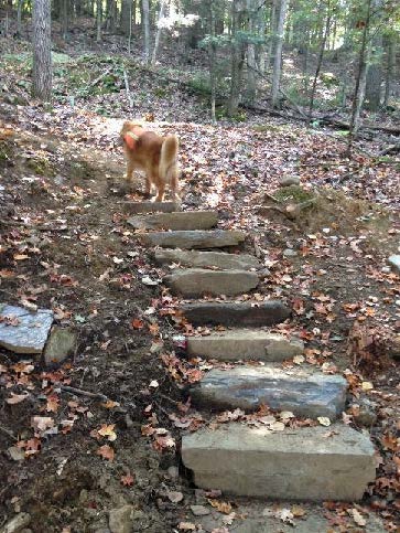
  • dog on stone stepsBegin your hike on the orange-blazed Hemlock Trail, marked by a brown sign with yellow lettering. A series of stone steps (R), terracing, and switchbacks help you navigate the steep (and in winter, icy!) beginning of the trail. In a fine example of partnership, the Upper Valley Trails Alliance’s high school trail crew built these steps in 2017, on land owned by the Town of Hanover with funds contributed to the Hanover Conservancy by the Chapman Family.
  • Soon the trail straightens and passes through pleasant hemlock and pine woods.
  • 7 minutes from your car, cross a fragment of an old stone wall. Look for the shells of 2 ancient maples at R. We’ll meet more of their fellows later.
  • old oak on Balch
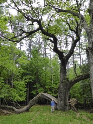
  • You’ll soon come to the remains of an enormous old oak, its split trunk and massive limbs now draped across the landscape like an opened lily, having lost their battle with gravity and time. The trail passes under a fallen limb. Here’s what it looked like in 2014 (R).
  • The trail continues up and L into an opening framed by old crabapple trees, and the summit bench comes into view.
  • 12 minutes from your car, arrive at the summit kiosk, dedicated to neighbor and Hanover Conservancy volunteer educator Alice Jackson. Here, you can read about views and pick up a trail guide.
  • skiers on Balch Hill The bench honors one of Balch Hill’s most important benefactors, Ralph Hunter. Ralph, who took this photo of a young family skiing here in 1965, lived nearby and developed 7 building lots on Hemlock Rd. In 1970 he was instrumental in helping the Hanover Conservancy (then known as the Hanover Conservation Council) acquire 6.26 acres at the summit, donating some of his own land to bring it to 10.3 acres. Then in 2001, Ralph and his wife Betty (below) donated another 10 acres to the Council, protecting the W side of the hill.
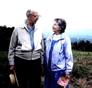
  • Ralph and Betty Hunter on Balch Hill
    Ralph and Betty Hunter

    Pay your respects to the fine summit maple, standing 920 feet above sea level – can you find the heart shaped pattern in its bark? From here, you can enjoy views as close as a monarch butterfly on milkweed at your feet or as far as Killington, 29 miles away. The stone bench was given in memory of Betty Latham.

  • Continue your perambulation of Balch Hill by heading toward the balancing rock reminding that no fires are permitted here.
  • The views of Mount Ascutney, four ridges to the southwest, are inspiring and hard-won. For over a century, the open, breezy summit of Balch Hill served as pasture first for sheep and later for cattle, but once the grazing stopped, Nature had other ideas and began to clothe the hill once again. By the 1990s, a threat lurked amid the puckerbrush – non-native invasive buckthorn, barberry, burning bush, and honeysuckle. Major grants to the Hanover Conservancy from USDA’s Natural Resources Conservation Service, plus private donations, paid to push back the invasives, improving wildlife habitat and restoring views. Resulting brush piles were tucked into the woods to provide cover for small mammals.
  • Follow the red-blazed Grasse Road Trail down from the summit. The woods are quite different here on the S side of the hill – young hardwoods with some pine. As the trail bends L, look for a big maple snag at R. Its size compared to its companions is a clue that it once stood alone on an open slope.
  • A few minutes’ walk from the summit, pass the “candelabra tree” at L – a dismembered pine with marvelous grain where its whorl of branches once met the trunk.
  • The trail turns sharply R into a hollow at the Link Trail junction. Bear L on the Grasse Road Trail over the double log crossing, built by volunteers from Hypertherm.
  • Soon the Hunter East Trail – named for Ralph Hunter – comes in at L. Bear R as the Grasse Road Trail follows a series of mossy ledges. Here on the SW side of the hill, the glacier plucked stones away from the ledge as it ground its way over. But where did they go?
  • stone wall on Balch HillThe answer appears in a few more paces – the settlers plucked them for stone walls! Straight ahead is the S boundary line, marked with an old wall topped with wide wire sheep fencing (R), relics of the mid-1800s. In 1840, over 10,000 sheep grazed on Hanover hillsides, including this one, while the human population stood at around 2,000.
  • The trail swings L along the stone wall. Soon, at the top of a small rise, arrive at a Y with the Chapman Trail, marked with a sign at L. The Upper Valley Trails Alliance’s high school trail crew built this trail in 2017, again with a gift to the Conservancy from the Chapman family. The trail crosses Dartmouth land with the College’s permission.
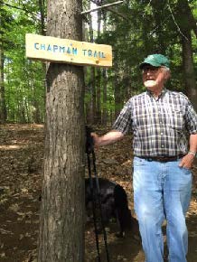
  • Rob Chapman by trail signTurn L onto the purple-blazed Chapman Trail, which rises gently. In this area, Dartmouth ecology students conducted a study to determine the effect of deer browse on the vegetation. Two identical plots, one fenced against deer and the other unfenced, were compared each year. Results show that deer browse reduced the number of wildflowers, especially Canada mayflower.
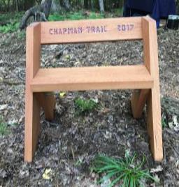
  • bench on the Chapman TrailSoon you arrive at an Aldo Leopold bench, designed by the legendary conservationist himself and built of black locust by a Conservancy volunteer. The trail and bench are recent additions to Balch Hill, named for long-time Balch Hill neighbors. Rob Chapman (L), early chairman of the Balch Hill Stewardship Committee and former member of the Conservancy’s board of directors, had long envisioned a trail to this knoll, where views E to Moose Mountain are being opened up.
  • Take a moment to relax on the bench and consider the many families that have been touched by Balch Hill – and those who have given back in return. Some might spend a morning helping to clear a trail, and others, like the Chapmans, Hunters, Stapleses, and Jacksons, have given deeply over many years in this and many other ways.
  • Continue on the Chapman Trail as it curves L and re-enters the hemlock forest, winding gently down off the knoll. In 3 minutes, reach the blue-blazed Hunter East Trail, marked by a large downed hemlock.
  • Check your watch – if you’re in a hurry to get back to your car, turn L here, take the Grasse Road Trail to the summit, and return on the Hemlock Trail the way you came (about 20 minutes).
  • To continue exploring (30 minutes), turn R on the Hunter East Trail, through the gap in the fallen hemlock and down into a ferny glen. In 5 minutes, Morrison Circle appears between the trees and the trail swings L at a large red oak.
  • Soon you’ll arrive at a sign for the Garipay Trail. The Garipay family farmed this area in the 1940s-70s, with land holdings that extended from Lyme Road to Grasse Road. Earle Garipay’s 185-cow dairy farm was based on Reservoir Road. Young stock were kept on Balch Hill.
  • Head up the blue-blazed Garipay Trail, crossing a small wooden bridge built by another Conservancy volunteer over a little drainage that Is dry in fall. The trail continues along a fragment of stone wall and bears L uphill past rosettes of evergreen Christmas fern.
  • 5 minutes’ walk from the Hunter East Trail, the Garipay Trail ends at the yellow-blazed Maple Trail. Bear L to continue uphill. Openings at R are tangles of raspberry canes thriving in the sunlight as several pines gave way. Soon you’ll pass among blowdowns from a sudden windstorm on Patriot’s Day, 2007. All the trees are laid to the SW, indicating that the wind came from the NE. Root systems, still clinging to rocks and soil, are tipped up and will melt into mounds next to the pits where they once grasped the earth. This “mound and pit” micro-topography is a common feature in New England woods, where it tells stories of forests past.
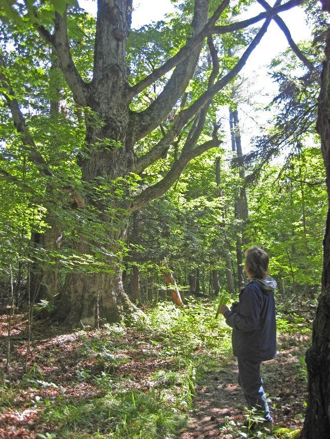
  • old maple on Balch5 minutes’ hike up the Maple Trail brings you within sight of the summit through the trees – and what magnificent trees they are! Now you know the story behind this trail’s name. Four enormous sugar maples, three still living, march in a line, the ancients standing out among their much younger brethren. A few more appear just ahead. How many people would it take to encircle one of these giants?
  • These venerable maples, possibly 250 years old, may have marked one of Hanover’s earliest roads. Laid out in 1764, Half Mile Road passed just E of the summit of Balch Hill and ran parallel to and ½ mile E of the Connecticut River.
  • A double blaze marks a turn to the R; ahead is the most marvelously gnarled maple of all.
  • In a few more yards, reach the unmarked Fire Trail, a wide old farm lane. The summit is visible up the hill at L; across the way is the shell of yet another ancient maple.
  • Turn R onto the Fire Trail – this time it’s a practical name – the Fire Department can use this old road to reach the summit in an emergency.
  • At R is a curious depression that may be dry in fall but is full of water in spring. Earle Garipay dug this pit to provide water for his cattle; these days it serves as a vernal pool!
  • Head down the Fire Trail; in 5 minutes, approach an opening that gives a broad view into Vermont. A blue arrow directs you R to skirt this privately owned former (and possibly future) house site. Soon the Fire Trail meets the drive. Turn R down the drive. A formal arrangement with the landowner provides for public foot access here. The dark hemlock forest at R reminds you what the N side of Balch Hill once looked like.
  • The drive swings L and your car comes into view. Be careful to heed the cable across the end of the drive.

The volunteer Balch Hill Stewardship Committee cares for this place and always welcomes help.
Contact us if you’d like to get involved!
We welcome contributions to the Balch Hill Stewardship Fund
to help with the costs of annual mowing, vegetation management, and trail improvements.

October 2017; updated July 2020

Filed Under: Balch Hill, Hike of the Month, October Tagged With: Canada mayflower, deer

Slade Brook Watershed Trails

September 1, 2017

Trail Description and Map – Full Hike


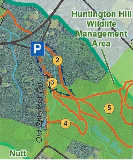
Slade Brook trail mapDriving Directions

  • From downtown, head N on Rt. 10 past Hanover Conservancy offices
  • Continue on Route 10, 3.3 miles past the N rotary
  • Turn R on Old Lyme Rd. and drive 0.2 miles to a sharp bend.
  • Park on R on gravel shoulder.

What You Should Know

  • Foot travel only, except for Old Spencer Road.
  • Dogs are welcome but must be under close control.
  • This loop hike passes through the Barnes Estate, owned and managed by Dartmouth Hitchcock Medical Center, before reaching the Huntington Hill Wildlife Management Area, a major privately owned parcel protected by a conservation easement held by the NH Fish and Game Department.

Hiking Directions

  • There’s a secret waiting for you right here, before you start into the woods. Walk a few dozen yards back down Old Lyme Road to the guard rail marking Slade Brook’s passage below. Look carefully on the left beyond the far end of the rail for a dramatic drylaid stone bridge abutment. This once carried the original road linking Hanover to Lyme and points north. Today, we whiz by this area at 50+mph on a much straightened, widened, and otherwise altered route. Imagine journeying to Lyme on the poky narrow road that existed before Dartmouth urged the state to “improve” travel to its new Skiway in Lyme Center.
  • Back at your car, look for two routes into the woods. At L, a woods road heads uphill, blocked with a cable. This is where you’ll return. At R, a clear, narrower level path leads in to the woods. Begin your hike here.
  • In a few yards you’ll pass over a narrow wooden footbridge, built by volunteers shortly before the Hanover Conservancy protected the Jim and Evalyn Hornig Natural Area at Lower Slade Brook, just downstream from Route 10. (2007) This crossing replaces an earlier one – look down to the left to see remains of the old stone abutment for the bridge that once carried Old Spencer Road over this stream.
  • Follow Old Spencer Road through the woods and up the hill to an upper river terrace that was once the shore of glacial Lake Hitchcock. This land is part of the former Barnes Estate, now owned by DHMC.
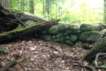
  • old stone wallOld Spencer Road links Old Lyme Road with Dogford Road, built in 1816 “from Benjamin Thatcher’s to the County Road.” Thatcher’s place (known today as the Nutt Farm on Dogford Road) was later owned by Captain Uel Spencer. Town Meeting voted to discontinue the road subject to gates and bars in Hanover is criss-crossed with dozens of early roads like this one, providing fine hiking, snowshoeing, horseback riding, biking, and skiing now that they are retired and no longer maintained for more intensive use.
  • About 7-8 minutes from the bridge, you’ll reach a tree down across the old road (which may be gone by the time you read this) and a junction. Old Spencer Road continues straight uphill. A logging skid trail is visible nearby at R. What appears to be another skid trail bears off Old Spencer Road at L. This is the Bridle Path, and your turn. Before taking it, continue another minute or two up the old road as it fully reveals its historic character. Partly buried stone walls mark each side and the roadbed appears sunken between them. Barbed wire follows the wall on the S side, a reminder that cattle once pastured here before the forest returned.
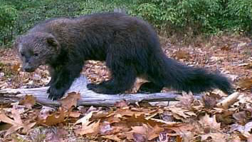
  • fisherWatch for wildlife – on the day we visited, a fisher paused here on the wall to observe us. The largest member of the weasel family, the fisher is a lithe and talented predator that makes a specialty of dining on porcupine.
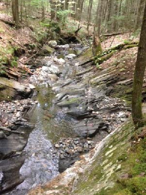
  • Return to the junction and take the Bridle Path that veers NE. It too has been used recently as a skid trail, but it quickly narrows and you’ll soon hear the music of Slade Brook at L.
  • After five minutes’ walk from Old Spencer Road, a new wooden bridge comes into view as you cross onto the Huntington Hill Wildlife Management Area.
  • Pause on the bridge to admire both the workmanship and the partnership that built it in May-July, 2017. A determined team of 20 volunteers, led by Hugh Mellert and the Hanover Conservation Commission’s Trails Committee, built the bridge with permission of the private landowners and help from the Upper Valley Trails Alliance, Hanover Public Works, Hanover Conservancy, Cardigan Mountain Highlanders, DHMC, neighbors, and hikers who happened by and jumped in. Funds for materials were donated and the 250 person hours of labor were free. This new bridge replaces one that’s been gone for 50 years, and provides a safe and valuable connection to the network of trails on Huntington Hill.
  • Slade BrookNow turn your attention to the brook itself, and the fascinating variety of rocks composing its bed. Water-worn granite alternates with leaves of uplifted, slanted sedimentary rock that speak volumes about the deep geological history of this place.
  • Two trails meet at the far end of the bridge. Bear L onto the wider of the two and head steadily uphill through a pine/hemlock forest. Faded pink flagging marks the route.
  • About 10 minutes’ walk from the bridge, you reach the top of a rise where the Barnes Trail comes in at L by two large white pines. Just ahead, another trail junction is visible.
  • Turn L onto the Barnes Trail and head down the narrower, pine needle- strewn path. The Barnes Trail is easy to follow as it meanders pleasantly down the slope. There’s a nice patch of foamflower (Tiarella cordifolia) on the R just before you cross a small drainage. Resolve to come back in May to see this native wildflower in bloom. The Barnes Trail begins to feel like an old woods road.
  • Cross another, larger drainage. Ten minutes’ walk from the last junction, reach a sunny opening filled with native wildflowers like Queen Anne’s Lace and various kinds of goldenrods, but with an ominous patch of Japanese knotweed. This log landing provides a valuable bit of open habitat nevertheless.
  • Continue across the clearing and re-enter the woods.
  • The trail, now an obvious logging road, passes through another small opening and then swings L and heads down to where your car awaits.

Please respect the generosity of these landowners by leaving no trace of your visit and enjoy the memories and photographs you take home.

8/30/2017

Filed Under: Hike of the Month, September, Slade Brook Tagged With: Class VI Road, fisher, foamflower

Shumway Forest and Tom Linnell Ridge Trail

August 1, 2017

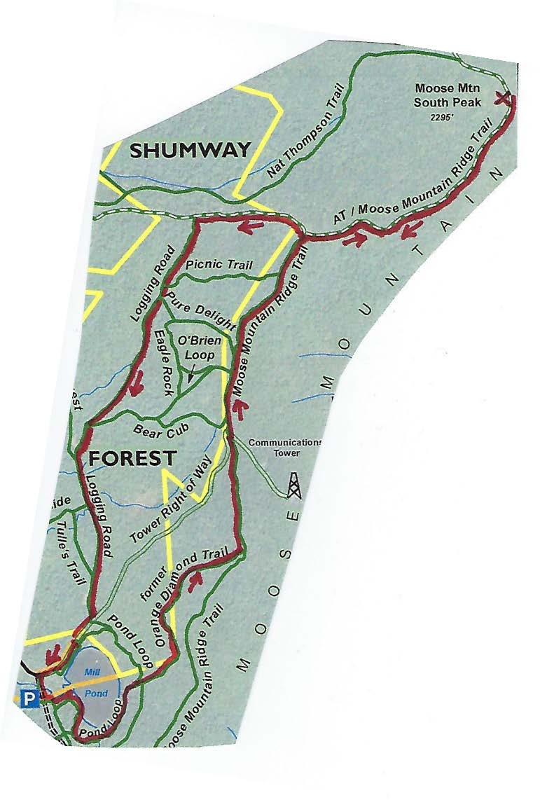
Hike Information and map – full PDF


Moose Mountain trail mapDriving Directions

  • From Etna Village, head N on Hanover Center Road
  • Turn R on Ruddsboro Road and drive 1.8 miles
  • Turn L on Old Dana Road
  • Turn R just past large red barn on R, onto Moose Mountain Lodge Road (not marked)
  • Drive 0.8 miles to top of road. Park in marked trailhead parking area just past the beaver dam.

What You Should Know

  • Foot travel only. Dogs are welcome but must be under close control.
  • Consider bringing binoculars and a bird book for viewing waterfowl on Mill Pond.
  • This hike passes through six major conservation parcels on Moose Mountain that are part of a 3,800-acre block of protected, un-fragmented wildlife habitat. The newest and largest is the 313-acre Shumway Forest, conserved by the Hanover Conservancy in June 2017.

Hiking Directions

  • Begin your hike at the green Mill Pond Forest/Huggins Trail Access sign. The Huggins and Shumway families donated a conservation easement on this area in 2015 to ensure that the public would always be welcome on their trails and have a dedicated place to park.
  • The trail heads E along a beaver-managed section of Mink Brook – look for evidence of beaver chews, slides, and an impressive series of dams.
  • You’ll soon reach a fork; a big pine at R bears a sign for Pasture Road. Bear L on the other trail. You have arrived at the 130-acre Dana Pasture Natural Area, a wonderful piece of land that holds an important place in the Dana Family history. Today, the Town of Hanover and a Dana heir own undivided half shares.
  • 15 paces from the fork, look for a cellar hole at L. This was the home of miller David Woodward, who built the dam on Mill Pond and an impressive sawmill and gristmill on the steep falls of Mink Brook below where you left your car (a visit for another day).
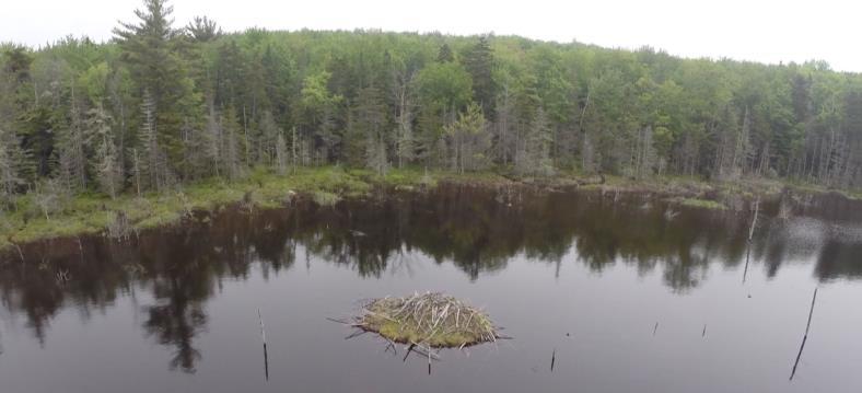
  • Continue 75 yards to the pond’s edge and a bench that beckons you to admire the view across the 10-acre pond. This is the highest water body in the town of Hanover and the primary source of Mink Brook, the town’s largest stream. Set in a saddle on the mountain ridge, it may have originally been a small pond or perhaps a marsh. In the late 1700s, Woodward built a drylaid stone dam (just out of view at L, beyond the spruces) to raise the water level some 6-8 feet (it has since partly silted in). Then beavers took over and have been managing the pond ever since. Today, the entire shoreline remains undisturbed: Hanover Conservancy easements protect the N side with the Dana Pasture Natural Area on the S.
  • beavers in pondDirectly across from the bench is an impressive beaver lodge. Scan the pond’s surface for waterfowl and other birds. You might be welcomed by the slap of a beaver’s tail.
  • Retrace your steps for a short distance to the Pond Loop (unmarked) at L, and begin your trip around the pond. In 3 minutes, come to a Y with the Baboon Bypass at R and an arrow pointing L.
  • Turn L here, keeping the pond at L. You’ll encounter some wet places, an old corduroy (log) crossing, and lush growths of sphagnum moss, goldthread, and club moss.
  • About 10 minutes’ walk from the bench, you meet a massive old white birch and side trails to the water. Continue straight to another big birch and a large maple snag, an apartment house for a variety of creatures. The trail continues around them.
  • Just a few minutes later you’ll arrive at a trail junction, and you have a decision to make.
  • The arrow points L to the tower road. If you just remembered you left something on the stove, this is the first of two bail-out points. To return to your car, bear L on the Pond Loop, heading N. The trail is easy to follow if you keep the pond in view at L and bear R at an arrow. You’ll leave the Dana Pasture Natural Area for the Shumway Forest before you reach the tower road 10 minutes from your decision point. Turn L to return to your car in another 4 minutes.

  • If you’re game for more adventure, bear R toward the sign reading “To the O.D. Ridge Trail.” The Orange Diamond Trail was built by a local snowmobile club in the 1970s but hasn’t been used that way for years. The trail, deemed by the club as unsuitable for today’s snow machines, is now restricted to foot travel.
  • Thank the Hanover Conservation Commission’s Trails Committee for restoring this and the Tom Linnell Ridge Trail, which it joins in 4/10 mile. The trail sees heavier use in winter than summer, so follow it with care.
  • Continue on the Orange Diamond Trail as it heads northeast through mixed northern hardwoods for 20-25 minutes. Bear L at forks in the path. Soon you leave the Dana Pasture Natural Area, briefly visit the Shumway Forest, and enter two lots fully owned by the Town of Hanover. The Conservancy helped the Town acquire the N one in 2002. Didn’t notice a break in the forest, did you? Wildlife doesn’t either! That’s the point of keeping habitat un-fragmented here on the mountain.
  • This is prime habitat for the kinds of wildlife that need large blocks of cold mountain habitat, including the snowshoe hare. We’ve seen not only the tracks but the creature itself, a white blur whizzing across a whitened winter landscape, with a bobcat in pursuit. Sheltered rocky crevices provide fine bobcat dens.
  • As the Orange Diamond Trail joins the Tom Linnell Ridge Trail, bear L to head due N. The Hanover Conservancy is assisting the Upper Valley Trails Alliance and Hanover Trails Committee with their project to formalize and protect public access to the Ridge Trail for its entire route from Enfield to the South Peak, under a grant from the Quabbin to Cardigan Partnership.
  • 20-25 minutes from the Pond Loop, arrive at the tower “road,” which was visible at L for the last few minutes. Here’s your second bail-out point: you can walk down the road to the gate and turn L to your car.
  • The tower road was built in the 1960s for construction and maintenance of the nearby communications tower. Despite what a surprising number of maps say, it is NOT a public Class VI road that goes over the ridge to Goss Road, nor is it part of Moose Mountain Lodge Road. A private right of way, it is blocked by a locked gate just above the entry from the Lodge Road. Hanover Conservancy easements on its lower half prevent use by vehicles except for forestry, wildlife habitat management, and of course, by the tower folk.

  • We hope you’re up for more adventure – if so, cross the road at its hairpin turn and re-enter the woods at the sign of the moose. The Orange Diamond / Tom Linnell Ridge Trail is wide and easy to follow here.
  • In 3 minutes, the O’Brien Trail (named for the Shumways’ forester, John O’Brien) leaves at L. John has an endearing habit of arranging skid trails so they make good hiking and XC ski trails.
  • Stay straight; you’ll soon encounter evidence of federal boundary blazes as the trail begins to snake the line between the Shumway Forest and federal land acquired in the 1980s for the Appalachian Trail.
  • In 2 minutes, bear R at a fork and sign reading “To the A.T.” The trail becomes a narrow footpath again, easy to follow as it begins to climb along the boundary. Look for some old sugar maples whose nearness to the line may have spared them the woodman’s axe.
  • Soon you’ll get hints of views to the E (R) as the trail swings L and continues up, not blazed but easy to see.
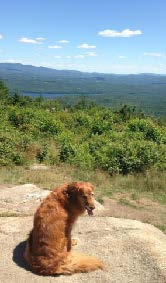
  • dog at Moose Mountain view20 minutes from the tower road, arrive at the Appalachian Trail. An orange Dartmouth Outing Club sign rests on the ground by a tree, pointing the way to the South Peak. Here, you can turn R to head to Mt. Katahdin in Maine. Turn left for Velvet Rocks, downtown Hanover, and if you’re really ambitious, Springer Mountain in Georgia. Today, we’ll turn R and take the AT for about 15 minutes to the S summit along the well-worn, gently but steadily climbing path.

  • Relish your reward at the South Peak: glorious views E, with Goose Pond at your feet and Mt. Cardigan, Sunapee, Kearsarge, and more visible on the SE horizon. At one point, the Presidentials are visible in the distance to the NE. Bedrock ledges offer comfortable seating. Search the raspberry thicket for ripe berries. You can bet the bears do.
  • steeplebush
  • At this season, native steeplebush is in full bloom (L), its rosy spires of tiny flowers alive with native pollinators. Dragonflies cruise the peaceful scene today, but in 1968, Northeast Airlines flight 946 crashed near this area. The rescue effort required bulldozers to clear a path to the wreckage.
  • The orange DOC sign indicates that the South Peak’s elevation is 2222’ above sea level. More refined measurements indicate it’s actually 73’ higher.
  • When you’re done drinking in the view, head back down the AT the way you came. The junction for the O.D. Ridge Trail appears just after a raised log/stone section of trail. Enter the Shumway Forest once again and continue down the AT past this trail. Volunteer AT trail maintainers have been here – step over rock water bars that keep water from sluicing down the trail and creating gullies.
  • About 8 minutes from the O.D. Ridge Trail junction, the trail flattens out – your cue to look for the Logging Road entering at L. Find the trail sign mounted on a large paper birch a short way in.
  • Turn L here, off the AT (if you continued, you’d arrive at Three Mile Road). You’re passing through a “sandwich” of easements placed by the National Park Service in 1983. A 200’ Trail Right of Way Easement follows the AT itself with a pair of protective easements 200-461’ wide, one on each side of the Trail ROW.
  • The Logging Road heads briefly uphill and then follows the contour S. You will follow it for half an hour through the Shumway Forest. This is your best chance at seeing moose that use this trail as a highway. Watch for their dinner plate-sized tracks in a few wet areas that appear here and there.
  • About 9 minutes from the AT, the Picnic Trail comes in at L. Ferny openings indicate the Logging Road’s path SSW. A few minutes further at a small opening, bear L and the trail, now more clearly a former skid trail, leads on.
  • Note the carefully constructed water bars on the route, built for past years’ logging operations to control water flow. Brush piles were laid to help return nutrients to the soil and provide small mammal habitat. The Shumway Forest has been under the supervision of a professional forester ever since the current owners, Kay and Peter Shumway, purchased what was then a heavily logged property in 1986 from a timber company to prevent construction of a mountaintop vacation home by another would-be buyer.
  • The Shumways manage the land primarily for public recreation and also to steer the forest back to a healthy and ecologically intact system with a variety of habitats for wildlife while protecting streams and wetlands. The new conservation easement ensures that this management will continue, adding a 100’ protective buffer for those waters.
  • About 20 minutes from the AT, the Bear Cub Trail comes in at L and soon you arrive at a grassy log landing. Bear L, away from the large open area, and continue up into the woods. Wildlife feed in such openings surrounded by forest cover. The Logging Road becomes stony here, hardened to take the weight of forestry vehicles. You’re starting to think this might be a wonderful ski route in winter, and you’re right!
  • In 4 minutes the Middle Mountain Trail and Mountainside Trail leave at R, and in a few more, you arrive at a second log landing. Just beyond is the tower road. Signs on a tree at L include a trail map. Turn R on the tower road.
  • Now it’s time to explore the north shore of Mill Pond. Two minutes from the Logging Road, the pond comes into view as you leave the Shumway Forest and enter the Mill Pond Forest, where the Shumways and Hugginses donated a conservation easement to the Hanover Conservancy in 2015.
  • Mill Pond with beaver lodgeTurn L opposite a telephone pole and take the short trail to the water’s edge. The beaver lodge is close by, and the bench you visited earlier is visible on the far shore at 2 o’clock. Lush northern shoreline vegetation is underfoot: sphagnum moss, ferns, and lichens. This thick carpet captures sediment running off the mountainside and helps keep Mink Brook crystal clear.
  • Turn R to follow the path along the shore, crossing a few beaver slides, noting the reeds with their tousled “bad hair day” seedheads. At a fork in the path, stay L on the pine-needle carpeted trail to where a small cove indicates the old dam overflow. The dam is just beyond, obscured by beaver engineering and shrubs.
  • Bear R and head for the green gate at the entrance to the tower road. Turn downhill past the gate and L to return to your car.

The Hanover Conservancy holds permanent conservation easements on the Shumway Forest, Mill Pond Forest, and Huggins Trail Access, which remain privately owned. Please respect the generosity of these landowners by leaving no trace of your visit and enjoy the memories and photographs you take home.

Filed Under: August, Hike of the Month, Moose Mountain, Shumway Forest Tagged With: Appalachian Trail, beaver, snowshoe hare, steeplebush

  • « Previous Page
  • 1
  • …
  • 11
  • 12
  • 13
  • 14
  • 15
  • …
  • 29
  • Next Page »

71 Lyme Road
Hanover, NH 03755
(603) 643-3433

info@hanoverconservancy.org

Facebook logo   Instagram   YouTube

Get Involved

Become a Member

Volunteer

Business Sponsors

Conserve Your Land

Employment

Our Mission

Advocacy

Conservation

Education

Stewardship

Explore Hanover

Hanover Hikes

Upcoming Events

Upper Valley Hikes

Trails Challenge

Copyright © 2026 Hanover Conservancy | Design by Chase Brook Software