Hanover Conservancy

Facebook logo   Instagram   YouTube          
Donate button
  • Home
  • About Us
    • Employment
    • What We Do
      • Advocacy
      • Conservation
      • Education
      • Stewardship
    • Celebrating 60 Years
    • Board & Staff
    • Membership Benefits
    • Contact Us
  • Get Outdoors
    • Hanover Lands
      • Balch Hill Natural Area
      • Mink Brook Nature Preserve
      • Other Properties
    • Hanover Hikes
    • Hanover Trails Challenge
    • Upper Valley Hikes
    • Exploring Nature at Home
    • Hunting
  • Events
    • Calendar
    • Spring Wildflower Scavenger Hunt
    • Private Events
  • Get Involved
    • Donate
    • Volunteer
    • Adopt a Trail
    • Corporate Conservators
    • Planned Giving
  • Education
    • School Programs
      • KAST
      • Connecticut River Studies
      • Hanover High School Scholarship
    • Request a Field Trip or Speaker
    • Research on Our Lands
    • Hanover History
    • Resources
  • News
    • Remembering Bob Norman
    • Reports & e-News
  • Conserve Your Land

Shumway Forest on Moose Mountain Conserved!

July 12, 2017

Download a newly updated trail map HERE.

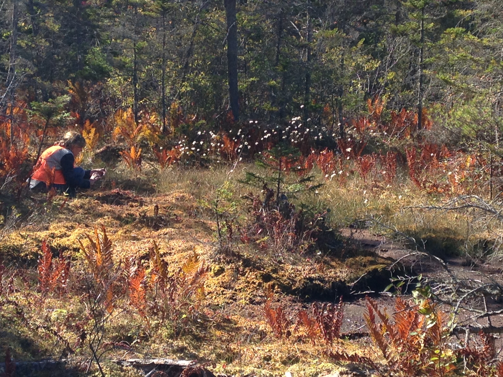
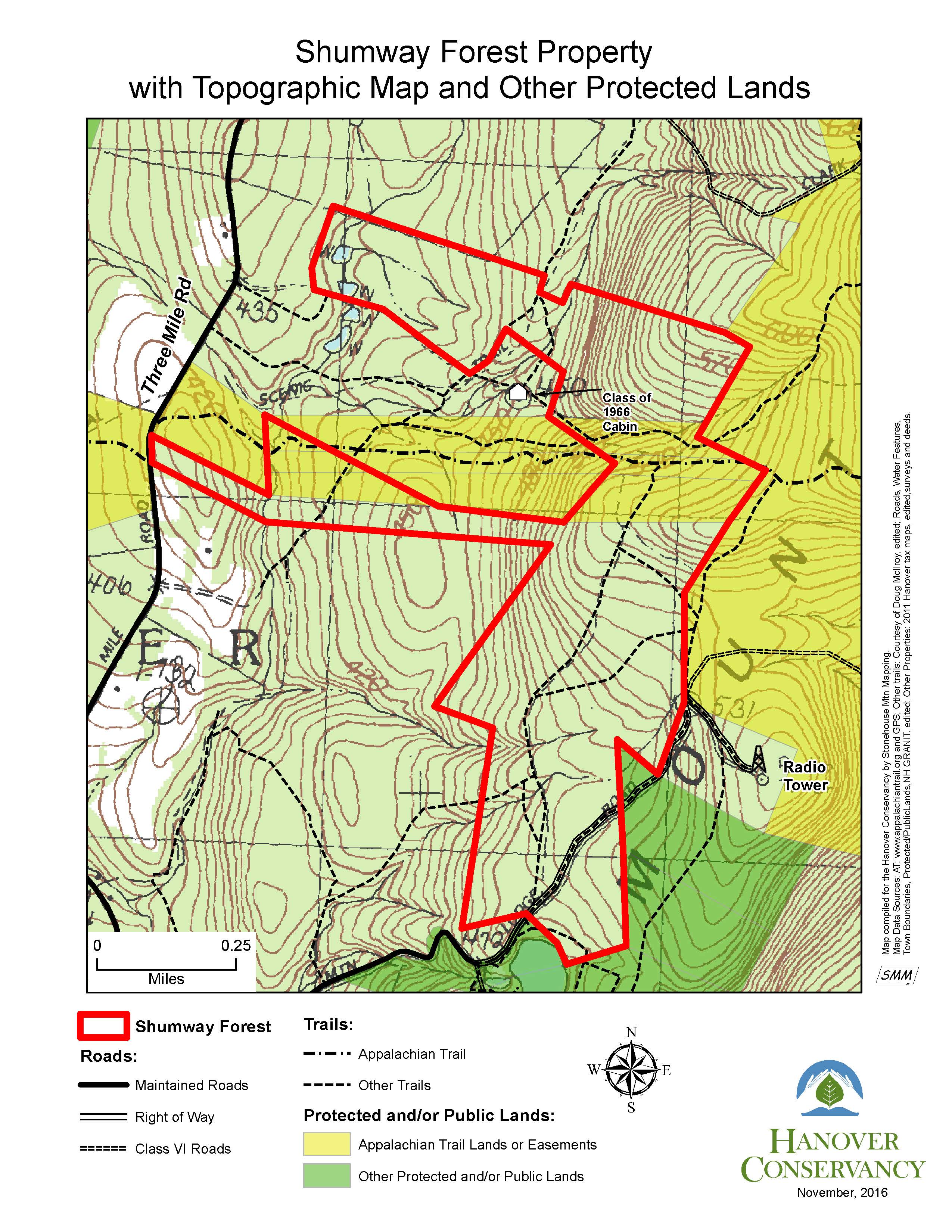
Our conservation work continues on Hanover’s highest ridge with the permanent protection of the 313-acre Shumway Forest – the largest project in our half-century history!  The parcel stretches from Three Mile Road to the crest of Moose Mountain and creates a link both to other conservation lands – federal Appalachian Trail lands, town-owned parcels, and the Mill Pond Forest – and to a vast network of foot trails including the AT.  This connected high elevation habitat assures room for wildlife – and hikers – to roam.  The parcel includes headwater tributaries of Mink img_2207Brook and a variety of other types of wetlands, including a fen (left), vernal pool, and black ash and red spruce swamps.
The Shumway Forest is the center of a mountainside trail network that includes not only the Appalachian Trail as it travels from Three Mile Road to the South Peak of Moose Mountain, but a dozen other foot trails totaling 3.4 miles, linking the AT with others on the mountain and beyond. Many are trails that Kay and Peter built and/or maintained for skiing as the owners of Moose Mountain Lodge.  Coincidentally, they signed the conservation easement on the 40th anniversary of their acquisition of the Lodge.

The Shumways and their neighbors, Elisha and Anne Huggins, previously donated a conservation easement on the abutting Mill Pond Forest and Huggins Trail Access, protecting a key public access point as well as the primary headwaters of  Mink Brook.

Two grants allowed us to purchase a permanent conservation easshumway-forest-topo-for-app-2016-11-21ement on this prominent property.  New Hampshire’s Aquatic Resource Mitigation Fund provided a major contribution, the largest single grant in the Conservancy’s history.  A second grant from the Quabbin to Cardigan Partnership helps with transaction costs. Owners Kay and Peter Shumway have generously made a bargain sale of this easement, far below market value.  Learning of the awards, the Shumways replied, “We are thrilled with your news and the idea that our land will be forever open for people to enjoy and not covered with no trespassing signs (and houses…)!”  We  look forward to a mountain-side celebration on July 17.
 

Filed Under: Conservation, Easements, Moose Mountain, Shumway Forest

Post-Storm Trail Conditions

July 5, 2017

On July 1, Mother Nature reminded us who’s in charge. Most of our trails are in good condition except for a few spots at the Mink Brook Nature Preserve – two blow-downs on the Trout Brook Trail and a small missing bridge on the Sachem Connector Trail. At Slade Brook, trails are clear and the flood actually improved the lower falls by scouring the ledge. Reports are not yet in for the Mayor-Niles Forest or Tunis Brook Mill Lot. If you’d like to help with trail restoration, please get in touch.

Filed Under: Mink Brook, Trails, Volunteers

Historic Wolfeboro Road West

June 1, 2017

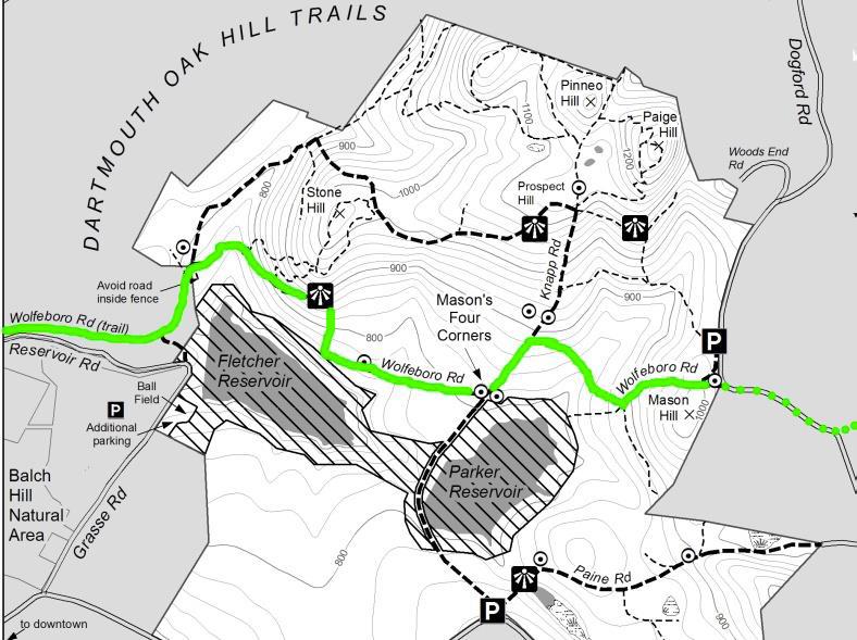
Wolfeboro Road West – Full Hike PDF


Wolfeboro Road trail map
Route is outlined in green

Driving Directions

  • Arrange with a friend to leave a car at the hike’s end OR give yourself time to hike back to your car.
  • Car drop: from downtown Hanover and the Green, take E. Wheelock Street east up the hill; continue as it becomes Trescott Road. Turn L onto Etna Road. Drive through Etna village, pass a cemetery on L, and turn L onto Dogford Road. Follow as it turns sharply R past a farm pond; turn L into the Trescott parking area. To reach the start point, return to Trescott Road and turn R onto Grasse Road. Follow as it turns L and heads down the hill. Stay R for Storrs Pond and Oak Hill. Park at the Oak Hill parking area at R.
  • Starting point for a round trip hike: from downtown Hanover and the Green, take the Wolfeboro Road (known today as College Street) north through campus past the medical school. At the Dewey Field light, stay straight to join Lyme Road. Drive past the golf course to the rotary and bear R onto Reservoir Road (still on the old Wolfeboro Road route). Turn sharply L toward Storrs Pond and Oak Hill as the road enters the woods. Park at the Oak Hill parking area at R.

What You Should Know

  • Trescott Water Supply Lands logoWelcome to your water source! Most of this hike crosses the Trescott Water Supply Lands. Drinking water for much of Hanover and for Dartmouth College comes from this area, so special rules apply for visitors.

  • Dogs are welcome but must always be leashed; please pick up after your pet.
  • You may encounter forestry vehicles; they have the right of way.
  • Hiking times are approximate. Plan on 2 hours; longer if you plan to spend time enjoying the views.

Hiking Directions

  • Begin your hike by walking back up the lane to a path entrance between the white Storrs Pond sign and the green street sign for Reservoir Road. Five steps in, and you’re on the clearly discernable, original route of the Wolfeboro Road. Our forebears chose a good path – it is safely out of the way of Camp Brook, which washed out Reservoir Road a few years back.
  • Walk up through the hemlocks that shade the valley of this brook. You can imagine the relief of Royal Governor Wentworth, after several days’ ride on the new road, making his final descent toward his destination, Dartmouth College’s second commencement in 1772. In hopes of making it to the first one, Governor Wentworth ordered the cutting of the Wolfeboro Road, from his home in Wolfeborough across to Hanover, in 1770. At a public meeting on July 30 of that year, a committee of Hanover citizens was appointed to “…run a line from near the southwest corner of Hanover to the Great Pond, or Governor’s seat, at Wolfeborough, and view the situation of the land and convenience for a highway, and make return the first Monday in October next.” Members were paid four shillings and sixpence per day (Hanover Center’s Jonathan Freeman earned six shillings and sixpence/day as surveyor) and spent ten days surveying the route. In October, they gained approval to lay it out from the College to the Canaan line. Hanover landowners were assessed a penny and a half per acre to raise the 120£ needed to complete the road.
  • portrait of John Wentworth
    John Wentworth
    Royal Governor John Wentworth, appointed in 1766 by King George III to take over management of the colony of New Hampshire from his infamous uncle Benning, helped Eleazar Wheelock secure the charter for Dartmouth College. Here he appears as quite the dandy, but indeed he was an eager outdoorsman and leapt at any chance to go camping and rusticating in his colony’s abundant wilderness. While he was on the trail happily getting dirty and sleeping on the ground, his wife was fixated on having a fancy ballroom at their country estate in Wolfeborough.
  • In about a half mile, just as the road starts gently downhill, look R for a trail coming in from Reservoir Road where it joins Grasse Road. If you want to return to this side of the Trescott lands, you can park at the ball field near the water filtration plant and take this path over a foot bridge.
  • You are near the foot of Fletcher Reservoir, first of two impoundments built on Camp Brook to provide water to downtown Hanover and Dartmouth College. This reservoir flooded a section of the Wolfeboro Road, so we will bear L and head uphill to avoid this section and the protected area around it. Because the public is not permitted within 250 feet of the waters, we’ll have to take a few side trails, but these are not without their delights!
  • After six minutes’ walk from the trail junction, a mowed ski trail comes in from the L. A few yards further, look closely for the turn to the R as the ski trail veers off to the L – your goal is a sign, posted a short way into the woods at the Trescott Lands boundary. Time to leash your dog, if your pup is along for the hike.
  • This trail takes you over an old woods road and soon, a newly built bridge over an intermittent stream. The trail is marked in most places with flagging and is well trodden, following the contour of Stone Hill (more about Stone – a person, not a geological feature – in a moment). Side trails built by mountain bikers come in at L in several places; avoid these and stay on the generally straight path.
  • Soon, you’ll see a stone wall ahead. Head for the break in the wall and emerge from the forest to a vantage point. This unusual view of Velvet Rocks, with the waters of Fletcher Reservoir at R, is your reward for the detour off the old road.
  • Head downhill, following stakes in the open field, to rejoin the Wolfeboro Road at a well-marked opening in the trees. Look R to see where the old road went west, and turn L to resume your pilgrimage. Red boundary signs on the R and orange blazes on trees indicate the reservoir buffer, not open to the public (or dogs hoping for a swim).
  • Walking on the old road is easy and grades are gentle. Keep your eyes out for the cellar hole at L of the old Stone Farm, on a small rise (double circle on the map). Plans to dam Camp Brook meant that farmers in its watershed would be displaced. In 1893, Dartmouth College simply swapped farms with Charles Stone. It’s said that he milked his cows here in the morning of the move, then herded his cows down the Wolfeboro Road and through downtown Hanover, and installed them in their new barn near Mink Brook just south of town, where he milked them that evening.
  • Continue east on the Wolfeboro Road to Mason’s Four Corners. Now a log landing, the Four Corners was once a major intersection where the Wolfeboro Road crosses the more recent Knapp Road. Look for a sign posted on a tree opposite, confirming your location.
  • Knapp Road was laid out Nov. 13, 1793, named for Lt. Peter Knapp of Hanover’s Revolutionary War-era militia. The cellar hole of his homestead is on the northeast corner of this intersection. By 1855, J. J. Mason lived here, followed by Charles Mason by 1892. The 160-acre Mason Farm had a 100-tree apple orchard and 200-tree sugarbush. Mason also kept 12 dairy cows and 70 Merino sheep. In the days before the Civil War, Hanover was one of the four top sheep towns in New Hampshire (after Walpole, Lyme, and Lebanon). The water company purchased Mason’s farm by 1903 for $4000.
  • At the NW corner of this intersection stood the one-room District #4 schoolhouse (1807). Look for an interpretive sign here for more about these historic sites.
  • The Wolfeboro Road was probably only the second road in Hanover not only to be properly laid out but also to be mapped and recorded. Like many early roads, over the years its location has shifted, with and without the benefit of surveys and deeds. The entire road remained in use through the 19th century until construction of Fletcher Reservoir in 1893 interrupted its path.
  • As a member of Dartmouth’s new Board of Trustees, Wentworth hoped to cross it for the first commencement of four students in 1771, but not all the communities in its path felt obliged to cooperate in its construction (except Hanover, of course!). It wasn’t ready for another year, and was still just a rough trace, not a “road” as we imagine it. In 1771 the governor ended up going by way of Haverhill.
  • The Wolfeboro Road continues E, still marked by old sugar maples but obscured by brush. Here again, we must take a detour to avoid the reservoir buffer, this time for the Parker Reservoir. After imagining the busy neighborhood that once existed here, continue up Knapp Road, itself lined with stately old maples and stone walls. In a few minutes you’ll notice another sign at R for the trail to Dogford Road. Turn R here.
  • The hillsides beyond are partly open and are being replanted. These lands experienced major blowdowns during the 2007 Patriot’s Day Windstorm. Two million board feet of logs and 3,100 cords of pulp were salvaged. This storm hit heaviest in the plantations, leaving natural stands largely unaffected. The forest management plan calls for creating more natural, uneven-aged stands rather than even-aged plantations.
  • Catch glimpses of Parker Reservoir as the trail turns SE to rejoin the old Wolfeboro Road after a short dip.
  • Back to Royal Governor John Wentworth – he visited Hanover for the third and last time in 1773, once again for the College’s commencement exercises, presumably traveling over his new highway. He was not able to attend in 1774, and by the summer of 1775 he had fled New Hampshire after war broke out with Great Britain.
  • Back to the mundane – is your dog still on its leash? Give yourself a gold star and know that there are porcupines nearby.
  • stone wall in fieldTurn L, uphill, returning to the old road. It climbs gently but steadily, and stone walls become more impressive. You’re seeing the handiwork of one Wright, who owned the farm at the final cellar hole we will visit today. He was there in 1855; by 1892, J.W. and W.D. Chandler had taken over his farm. As the gate and Dogford Road come into view, look for the cellar hole at L – it’s the largest yet. Find the threshold stone and admire the drylaid stonework, all done without benefit of power machinery.
  • From here, you have a choice. If you dropped your car at the Dogford Road parking lot, head N on the light trail that leads from the cellar hole and parallels the road for the short distance to the lot. You can also continue by foot, or in your car, along the route of the Wolfeboro Road by following Dogford Road straight E to where it turns just past an historic farmhouse at L.
  • If you are feeling adventurous, have 15 minutes, and seek the very best Wolfeboro Road experience of all, park on the shoulder of Dogford Road at the turn (there is room for one carefully parked car) and proceed on foot up the old road as it continues as a Class VI road through a pasture.
  • Note the cattle fence, which is electrified. Grasp the gray plastic handle to cross the fence – carefully – and immediately replace the handle behind you. This is the home of Scottish Highlander cattle, but the public is still allowed on the old road, which is easily distinguished by the early stone walls and towering maples that line it. You’ll pass pieces of antique farming equipment and sap buckets along the way. Step carefully (for obvious reasons) and do not approach the long-horned cattle if you encounter them.
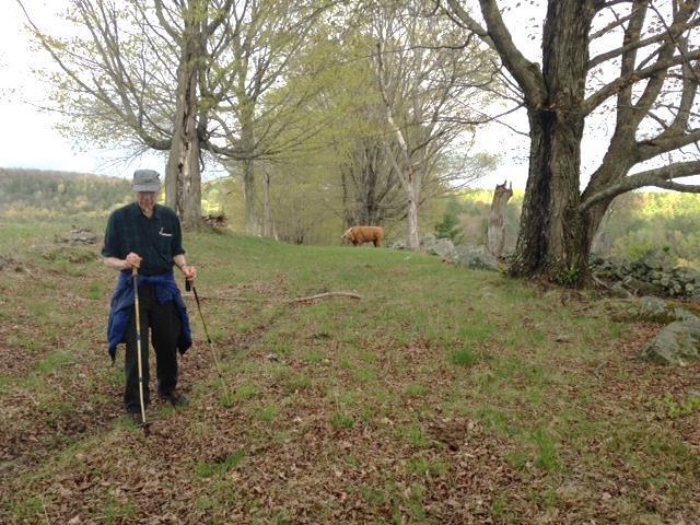
  • Wolfeboro Road with walker and cattle in backgroundProceed, if cattle and other conditions allow, to the crest of the hill. From here, you can see the path of the old Wolfeboro Road as it continues down into a little valley and then up the other side.
  • Stop here – this is the one section of the Wolfeboro Road that is no longer a public way, due to town meeting action in the 1980s, when a single vote sealed the road’s fate. The road is closed from a small bridge at the end of Elm Road until it joins Hanover Center Road. Yet the Wolfeboro Road, a beautiful scenic and recreational asset for Hanover, remains an important historical reminder of the early regional vision and political leadership that was to benefit the entire region.
  • Turn back toward Dogford Road and enjoy the most beautiful view of all – Velvet Rocks and the lush farm landscapes that seem not to have changed since the early 19th century.

Learn more about the Trescott Water Company Lands.

Filed Under: Hike of the Month, June, Trescott Tagged With: cellar hole, Wentworth, Wolfeboro Road

About those bears…

May 25, 2017

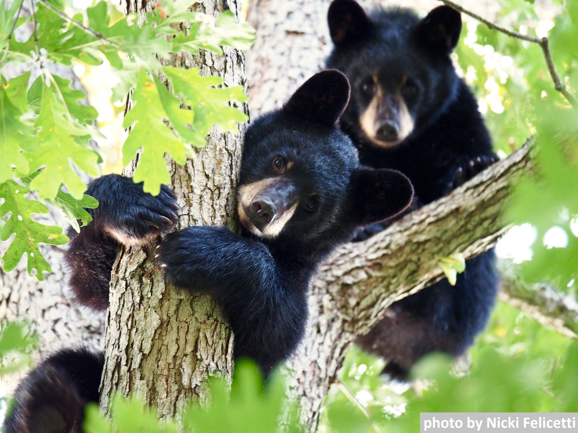
photo by Nicki Felicetti

The Hanover Conservancy has worked hard for many, many years to educate the Hanover community about how to co-exist with native wildlife, including the bears that, for generations, have occupied a home range near downtown and Mink Brook. We’ve sponsored programs by a variety of bear experts, blanketed inboxes with repeated pleas to take in birdfeeders, stuffed flyers in doors, posted signs, and sought help from the town and state. We organized a meeting with these experts and, most recently, sought volunteers to help with “bear hazing” to try to deter the bears from approaching homes in a last-ditch effort to stave off the inevitable.

Despite these efforts and those of many concerned neighbors, a bounty of birdfeeders, unsecured trash, and other inappropriate food sources remained available, leading the mother bear to teach her cubs to seek these rather than wild foods. The result is cubs that are twice the size they should be for their age, with no fear of humans or concept of bear/human boundaries. Much as we’d like to imagine that a different future could await bears that think it’s okay to help themselves to brownies on a kitchen counter, there is, unfortunately, no “Bear-Anon” to rehabilitate a bear that has strayed from its wild roots. And it is not the bears’ fault.

The bears will ultimately pay the price for human mistakes that are forcing state biologists to trap and euthanize the mother and her cubs. Nobody wants that fate for them, but with such unnatural habits, the bears cannot be released elsewhere. They would either continue their dangerous ways in their new home or would find their way back to Hanover after being driven out by bears already living there.  There is no other place a bear gone bad can go.

When one Hanover neighborhood decided to clean up its bear attractants and got serious about it, the bears stopped visiting, according to deputy fire chief Mike Hinsley, who has diligently scouted the situation. Bear-proof trash containers, taking in birdfeeders when bears emerge in spring, and confining access to compost are all sensible solutions.  We strongly support a town-wide ordinance requiring responsible management of trash and other bear attractants.

In the meantime, we recognize that there is excellent bear habitat in our area – Indian Ridge, Velvet Rocks, and stream corridors – and that it’s only a matter of time before a new bear discovers the recently-vacated territory in Hanover. We hope this time the bear receives a different welcome, from a community that has united to help it remain wild and free.

Filed Under: Bears, Mink Brook

Deer Hunting Update for 2017 Season

May 14, 2017

About the deer…

We’ve been watching both the deer and their snacking habits at Balch Hill for some time, and when the Town of Hanover approached us in the fall of 2013 about opening Balch Hill for a trial archery season to help thin an increasingly unhealthy herd, we gave the idea serious consideration. A survey of our Balch Hill neighbors in 2011 had indicated strong support for hunting to control the deer population. Many Balch Hill deer are noticeably smaller these days, likely due to competition.

deer exclosure 1yr results
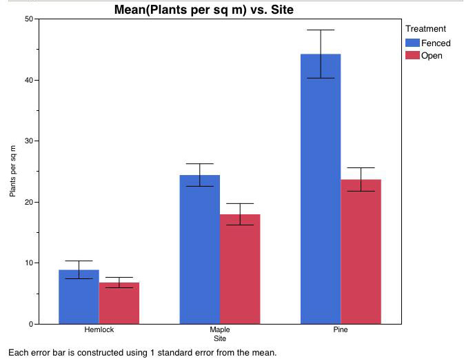
Deer exclosure results after 1 year – blue shows # of plants/meter in areas fenced off from deer browse, compared to unfenced areas (red)

After only one year, Dartmouth forest ecology studies showed deer browse is having an impact on the Natural Area. Other studies have found that over-browsing by deer favors invasive plants, reduces cover for other wildlife, and reduces nesting bird habitat and abundance.

In 2017, Balch Hill will be again be open for specially permitted deer hunting during the full archery season, which runs from Sept. 15th through Dec. 15th. In previous years, the hill has been closed for the first four days of the season to all users except permitted hunters; due to hunter and neighbor feedback, the preserve will not be closed at any point in 2017. We work diligently with neighbors, the Town of Hanover, and Dartmouth College to ensure the guidelines are clearly posted, and send out a Balch Hill e-newsletter with the current year’s hunting information. Signs will be posted on the kiosks and at trailheads as a reminder to use caution, and blaze orange safety vests will be available at the Grasse Road kiosk for hikers to borrow while on Balch Hill. A survey sent to neighboring residents in 2015 showed strong support for continued hunting on Balch Hill.

During hunting season, please wear blaze orange, make sure your children are similarly attired, and put bright vests or collars on your pets! Be aware that the nearby Oak Hill, Trescott Company lands, and Velvet Rocks areas are also open to hunting. We apologize for any inconvenience,  but want to offer a better chance to the select hunters who are helping us responsibly manage Balch Hill.  We view hunting as a useful way to manage the Natural Area in the absence of natural predators. Overall, hunting in Hanover has been increasingly successful, as recorded by New Hampshire Fish & Game. For more information on our 2015 neighbor survey results, or questions about our hunting management, please contact Program Coordinator Courtney Dragiff at cdragiff@hanoverconservancy.org.

For 2015 and 2016, Balch Hill was open to specially permitted hunters for the full archery season, Sept. 15 – Dec. 15.  A limited number of hunters were allowed at any one time,  again required to hunt only from tree stands by bow only (no firearms allowed).  Tree stands must be at least 50 feet from trails and a hunter cannot shoot within 300 feet of a permanently occupied home without the landowner’s permission. To facilitate a more concentrated and successful hunt at the start of the season, we closed Balch Hill to all other recreational users for the first four days of the archery season.  The Balch Hill Stewardship Committee put up hard-to-miss signs for trail users, and we had a successful season- a total of 8 deer were taken on the Preserve.

For 2014, we listened to the larger community at a well-attended forum and again at an open meeting of the Balch Hill Stewardship Committee in September. We opened Balch Hill at the very end of the season to bow hunting from tree stands by permit only.  It turned out that most hunters had already taken their deer before we allowed hunting to begin, so results were disappointing. Only three deer were taken, despite many hours of effort. In March, 2015, we presented testimony to the NH Fish and Game Department for its draft game management plan, prompting Fish and Game to send a delegation of its top officials to meet with us in June.

In 2013, the Natural Area was opened to a  limited number of archers carrying a special Town permit for the last half of deer season. No firearms were allowed. The trails and summit remained open and signs at each trailhead alerted trail users.

Filed Under: Balch Hill, Deer, Hunting

Tunis Brook Mill Lot

February 1, 2017

Hike Directions & Map – Full PDF

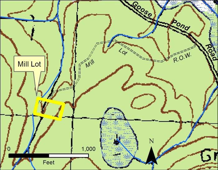
Mill Lot mapDriving Directions

  • From Route 10 north of town, turn R onto Goose Pond Road and set your odometer.
  • Drive E on Goose Pond Rd. 5.4 miles (1.6 miles from where pavement ends for the second time).
  • Find the trailhead on the south side of Goose Pond Road, marked with a green Conservancy sign and red flagging. It is nearly opposite a gate bearing a yellow sign reading “Private Road – Bear Hill Reservation.” If you reach a large roadside pulloff on the R, you’ve gone too far.
  • Please park as far off Goose Pond Road as possible, and do not block the gate.
  • Today’s hike, shown on the map above, is an out-and-back trip to an historic site in the woods.

What You Should Know

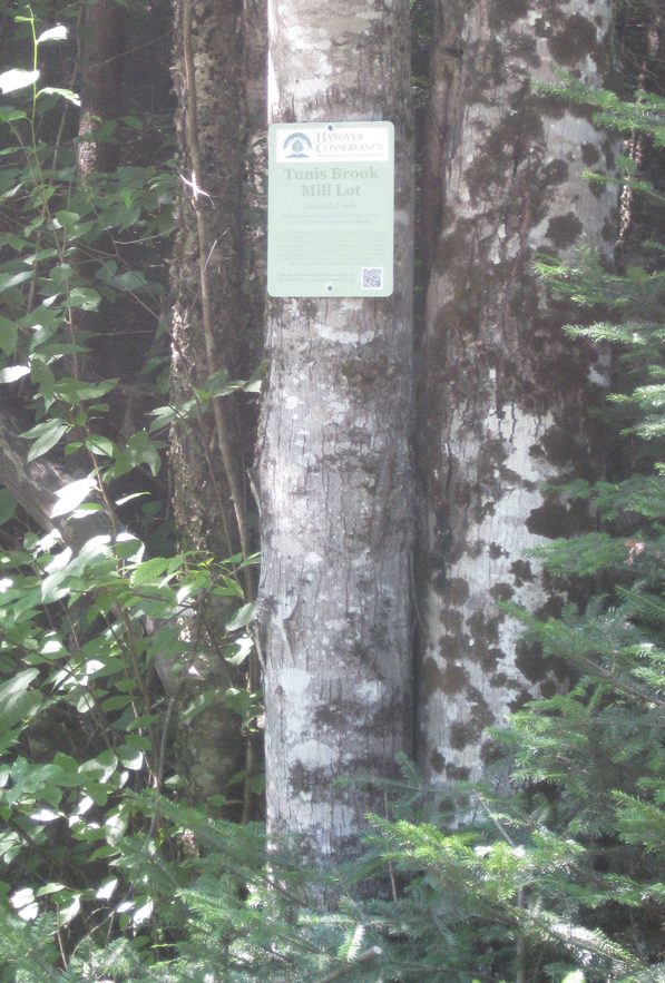
  • Tunis Brook trailheadYou’re about to visit the Conservancy’s smallest property, a 1.5 acre gem with a mysterious history. Hidden deep in the wild forests of Hanover’s northeast corner, at the foot of Moose Mountain, is the site of a 19th century sawmill on tiny Tunis Brook.
  • In winter, we suggest snowshoes rather than skis because of uneven ground at the mill lot. The trail, however, is fine for experienced backcountry skiers.
  • The half-mile trail is marked with flagging and passes over private land on a right-of-way to the mill site. Conservancy volunteers maintain this trail.
  • Dogs are welcome if under your control; please pick up after your pet.
  • Snowmobiles, ATVs, and bicycles are not permitted.

Brief Hiking Directions

  • Begin on the trail at R of the Conservancy sign.
  • Follow the flagged half-mile-long right of way path for about 25 minutes to the Conservancy property, which is marked with a wooden sign.
  • Explore the mill site and return by the same route to Goose Pond Road.

Full Hiking Directions

  • Begin your hike on the trail that leaves to the R of the Conservancy sign, and note the time.
  • The trail is mostly flat and follows an old tote road that can be traced to the mid-1800s. Here and there, saplings grow in the route; we leave them to discourage vehicles.
  • The Mill Lot is part of a large block of contiguous forested wildlife habitat, much of it already conserved or owned by people with conservation intent. The Hanover Conservancy acquired the tiny parcel in 1994 with a gift of $5,000, to protect it from becoming the site of a vacation home deep in the forest. Close to Hanover’s Goodwin Forest, Town Forest, and also its McKinley Tract and Marshall Brook Wetlands (which the Conservancy helped the Town acquire in 1993 and 1977, respectively), the Mill Lot is a piece of the conservation puzzle in this wild corner of town.
  • A few minutes’ walk from your car, cross a small drainage on a pair of logs. In snow, you might see only a slender birch handrail, placed by our volunteer. Another crossing comes up soon after.
  • You’re passing through cool northern forest dominated by hemlock, spruce, and northern hardwoods such as yellow birch. Ruffed grouse live here year-round; look for their arrow-shaped tracks.
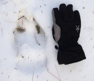
  • Look for moose tracks too – this trail seems to be a moose right-of-way! We see moose sign every timtrack beside a glovee we visit. Bobcat, bear, snowshoe hare, and coyote also frequent the area. Deer use a nearby wintering yard of dense softwoods. Small mammals include red squirrels, voles, moles, shrews, and mice.
  • About 12 minutes’ walk from your car, the trail heads gently uphill and narrows, turning L through an intimate alley of young pines and hemlocks growing in the right-of-way. Their foliage muffles sound and you feel deliciously a part of the forest, privy to its secrets.
  • The trail soon leads down into a little valley. Look for tracks of bounding snowshoe hare. Scattered on the snow might be spruce and fir tips, nibbled off by porcupine or red squirrels.
  • At an opening, look for a big boulder at R and a flagged, striped maple just beyond. The maple bears wounds from moose and deer rubbing their antlers against its bark.
  • About 20 minutes from your car, cross another small drainage.
  • Five minutes later, bear R past another large boulder, at a tree marked with double red flagging. A wooden sign ahead signals your arrival at the Tunis Brook Mill Lot. The brook may be covered with snow, but you will hear its music beneath.
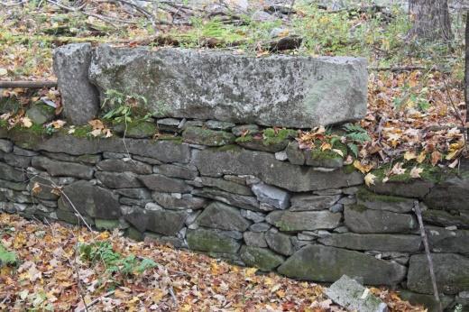
  • To your R, the intriguing drylaid stone foundations of a sawmill are visible on the banks of Tunis Brook. Amos Kinne likely built the mill around 1849. Tax records suggest that the mill was active at least from 1850-1861. If snow obscures the mill ruins, resolve to return in spring to inspect them more fully!
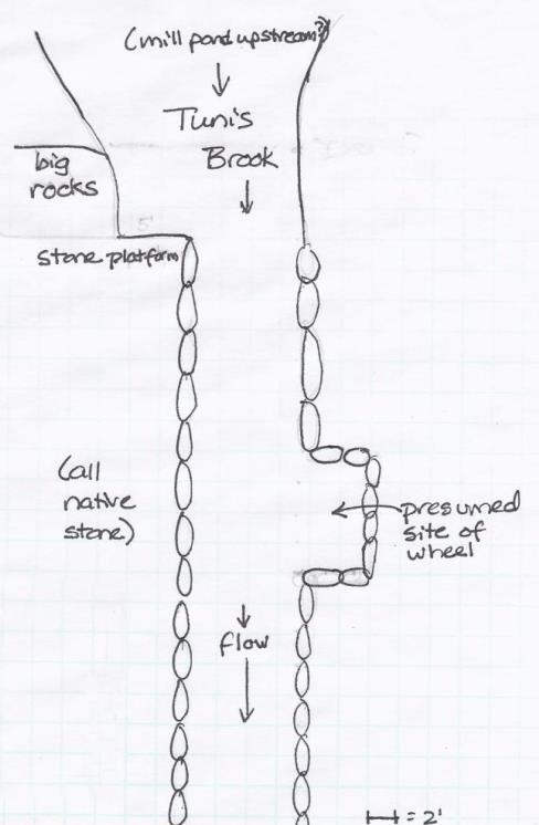
  • mill site mapThe foundation’s configuration suggests that this was an up-and-down sawmill, built over the stream and using waterpower to run a vertical, straight steel saw with coarse teeth – about six feet tall attached to a wooden frame that moved between two vertical fender posts. Because tiny Tunis Brook does not have much pitch here, water to push an overshot wheel and drive the saw was probably delivered via a millrace (trough or pipe of wood or iron) from a mill pond upstream, perhaps where a wetland is now.
  • No records exist of the mill’s abandonment, but we presume that flooding destroyed the mill in 1862 since it was not assessed in that year. Floods were recorded in the Upper Valley on April 19, 1862, also February 10, 1867, and for four days in October, 1869 (the “Great Freshet”). Clearing of forests for pasturage and farming by the mid-1800s affected many streams, causing the “flashy” flows capable of washing out mills and their dams.
  • Our 1.5 acre parcel, a grandfathered, non-conforming lot, has carried the name “mill lot” since at least 1860. The mystery surrounding its history grew as the chain of title came to a dead end in the late 1800s. We think it was lost in the estate of Kinne’s partner, Moses Colby, who lived on the Wolfeboro Road. The Town of Hanover auctioned it off a century later.
  • The lot may be tiny, but observers have recorded 32 species of birds here, including hawks, three species of woodpeckers, and a variety of warblers. Here, you might find tracks of two members of the weasel family, the fisher and American mink.
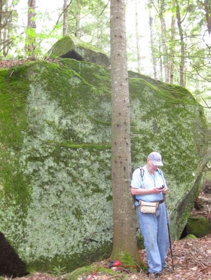
  • Now let’s visit another landmark – one of the largest glacial erratics in Hanover (a huge boulder deposited by the glacier as it melted). It’s nearby but out of sight of the mill.
  • Follow the brook upstream, counting your paces. Within 75 paces, you’ll see the boulder looming ahead, and you’ll reach it in 75 more.

    Dick Birnie by erratic
    Geologist and Conservancy Board member Dick Birnie on a trip to evaluate the erratic
  • The erratic is composed of quartz, potassium feldspar, and black mica, with stripes of quartz. This boulder dropped out of glacial ice; its angular appearance indicates it did not roll along the ground. A smaller angular boulder on top is further evidence that it fell out of the ice. It came from nearby, possibly plucked off Winslow Ledge in Lyme. Its east side displays a flute, a classic glacial sculpture that was in place before it was plucked off the side of the cliff. Remains of a wooden ladder beneath hint that this once served as a hunting stand. (R: Geologist and former Conservancy Board member Dick Birnie on a trip to evaluate the erratic).
  • Now follow the stream back down toward the Conservancy’s wooden sign. Halfway, you’ll see our small green boundary markers.
  • Tunis Brook flows north to join Pressey Brook and eventually feeds Goose Pond and the Mascoma River. These waters are protected and purified by the healthy, mature forest sheltering Tunis Brook. This is a good thing – these waters ultimately become part of the City of Lebanon’s drinking water supply.
  • The Conservancy’s studies of borings of trees on the mill lot show that its forest is composed of three age classes (about 140 years, 110 years, and 75 years). This suggests that the forest started to grow when the mill was abandoned, with two later disturbances that created openings for new trees. While the ’38 Hurricane might explain the youngest age class, what prompted the middle one is unclear.
  • To find your way back, start at the wooden sign and follow the flagging. This time, keep an eye out for concentrations of tracks that indicate wildlife trails.
  • Be sure to come back in the spring (before black fly season), when Tunis Brook will have much more to say!

February 2017, updated July 2020

Filed Under: February, Hike of the Month, Tunis Mill Lot Tagged With: erratic, mill, moose

  • « Previous Page
  • 1
  • …
  • 12
  • 13
  • 14
  • 15
  • 16
  • …
  • 29
  • Next Page »

71 Lyme Road
Hanover, NH 03755
(603) 643-3433

info@hanoverconservancy.org

Facebook logo   Instagram   YouTube

Get Involved

Become a Member

Volunteer

Business Sponsors

Conserve Your Land

Employment

Our Mission

Advocacy

Conservation

Education

Stewardship

Explore Hanover

Hanover Hikes

Upcoming Events

Upper Valley Hikes

Trails Challenge

Copyright © 2026 Hanover Conservancy | Design by Chase Brook Software