Hanover Conservancy

Facebook logo   Instagram   YouTube          
Donate button
  • Home
  • About Us
    • Employment
    • What We Do
      • Advocacy
      • Conservation
      • Education
      • Stewardship
    • Celebrating 60 Years
    • Board & Staff
    • Membership Benefits
    • Contact Us
  • Get Outdoors
    • Hanover Lands
      • Balch Hill Natural Area
      • Mink Brook Nature Preserve
      • Other Properties
    • Hanover Hikes
    • Hanover Trails Challenge
    • Upper Valley Hikes
    • Exploring Nature at Home
    • Hunting
  • Events
    • Calendar
    • Spring Wildflower Scavenger Hunt
    • Private Events
  • Get Involved
    • Donate
    • Volunteer
    • Adopt a Trail
    • Corporate Conservators
    • Planned Giving
  • Education
    • School Programs
      • KAST
      • Connecticut River Studies
      • Hanover High School Scholarship
    • Request a Field Trip or Speaker
    • Research on Our Lands
    • Hanover History
    • Resources
  • News
    • Remembering Bob Norman
    • Reports & e-News
  • Conserve Your Land

The Velvet Ledges of Greensboro Ridge

June 1, 2016

Greensboro Ridge Hike – Full PDF
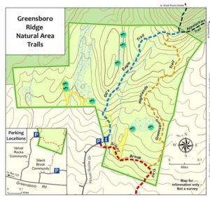
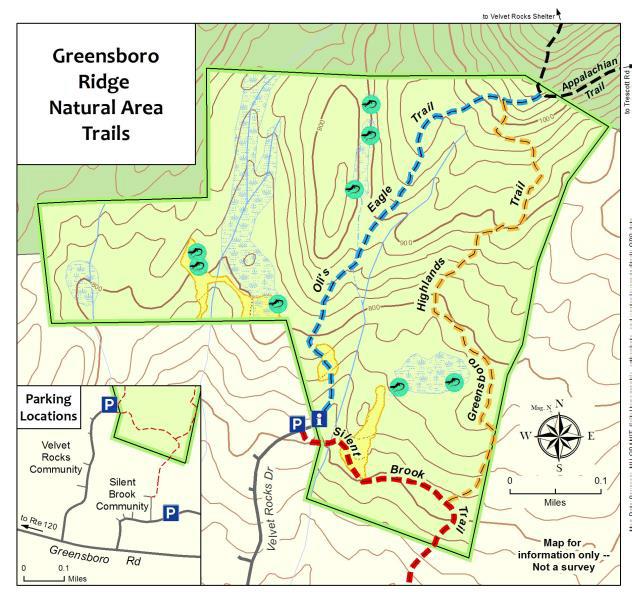
Map of Greensboro Ridge trailsDriving Directions

  • From the traffic light at Route 120 and Greensboro Road, turn east on Greensboro Road.
  • After 0.4 miles, turn left onto Velvet Rocks Drive.
  • Proceed up the hill to the parking area at the road’s end.

What You Should Know

  • Foot travel only, except on the Silent Brook Trail where bikes are allowed. Dogs are welcome but must be under close control; please pick up after your pet. Be aware that this Natural Area is prime porcupine habitat!
  • The trails are blazed in colors matching the trail map: blue for Oli’s Eagle Trail, white for the Appalachian Trail, and light orange for the Greensboro Highlands Trail. The wider Silent Brook Trail is not blazed but is easy to follow.
  • The Hanover Conservancy owns and manages the Greensboro Ridge Natural Area. The Town of Hanover holds a conservation easement on the land. After a housing development was proposed for this entire forested hillside, the Hanover Conservancy and Town worked with the developer to cluster homes close to the road and conserve the remaining acreage. The Conservancy acquired the land in 2008, protecting valuable wildlife habitat, a scenic backdrop, and a wonderful natural area with trails for the new Velvet Rocks and Silent Brook neighborhoods and the greater community to enjoy.

Brief Directions

  • Take Oli’s Eagle Trail north from the trailhead kiosk to the junction with the Appalachian Trail.
  • Retrace your steps a short distance to turn L onto the Greensboro Highlands Trail.
  • Follow this down to a T with the Silent Brook Trail.
  • Turn R to return to your car.

Full Hiking Directions

  • Take a moment to check the trailhead kiosk display and map. We are grateful to Trumbull-Nelson for the gift of this beautifully hand-crafted kiosk.
  • Oli’s Eagle Trail begins just to the L of the kiosk, heading up through a narrow rocky cleft. The contrast between this rough terrain and that tamed for the Velvet Rocks development is dramatic.
  • This trail was built in 2008 by Oliver Simpson for his Eagle Scout project with help from the Hanover Conservation Commission’s Trails Committee.
  • In early June, the foliage of purple trillium is still apparent near the trail entrance, although here at the warmer, lower end of the trail, the wildflowers may have gone by.
  • You’ll soon reach an open expanse of unfurling ferns, primarily the sweetly fragrant Hay-Scented Fern. Watch your footing here. This opening was cleared from the forest as a demonstration house site before the land was protected. It will be kept open to provide habitat variety for wildlife.
  • Heading back into the woods, you can hear the gurgle of a small stream as the trail curves gently to the right. Fisher and mink inhabit this area. The Natural Area is located in the Mink Brook watershed; protecting this land helps keep the waters of Mink Brook cool, clear, and comfortable for wild brook trout.
  • Eight minutes from your car, you’ll begin climbing the ridge. Follow the blazed trail as it crosses a tiny drainage and winds up through a narrow cleft in the rocky ledges.
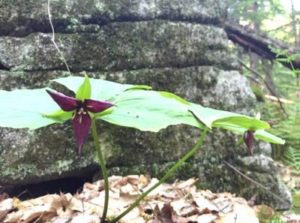
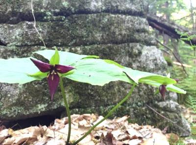
  • trillium
  • By 18 minutes’ hike from your car, you’ll notice the rise in elevation and cooler forest conditions. The trillium has noticed it too, and may be still in bloom along the trail (photo L).
  • A few minutes later, you might notice the work of pileated woodpeckers on an old tree on the L side of the trail.
  • At 22 minutes from your car, you’ll reach the junction with the Greensboro Highlands Trail, marked with a wooden sign. You’ll soon return to this junction but now continue straight on Oli’s Trail for a minute or two to reach the white-blazed Appalachian Trail. The AT actually dips off federal land and onto Hanover Conservancy property for a short distance. At that junction, you could turn R to head to Etna or Mt. Katahdin in Maine or L for Velvet Rocks, downtown Hanover, or if you’re really ambitious, Springer Mountain in Georgia.
  • Instead, turn around and retrace your steps for a short distance on Oli’s Trail, turning L onto the Greensboro Highlands Trail to continue your hike. The Hanover Conservancy, with help from the Upper Valley Trails Alliance and a team from Hypertherm, built the Greensboro Highlands Trail in 2012 to create this loop.
  • 25 minutes from your car, you’ll note a fragment of stone wall at L, a reminder that this heavily forested land was once an open sheep pasture.
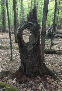
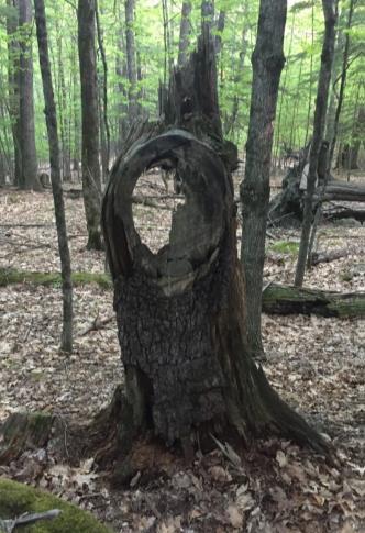
  • old branch collar in treeIn 2 more minutes, a fun photo opportunity appears on the right, where an old branch collar on a dead snag forms the perfect frame (R). Friends can take a photo of faces looking through it to post on our Facebook page!
  • Black bear make their home here, and it’s easy to find bear claw marks on the smooth bark of beech trees, evidence of a bear seeking tasty beechnuts.
  • 32 minutes into your hike, the trail winds to the R around a ledge featuring a huge and handsome vein of white quartz.
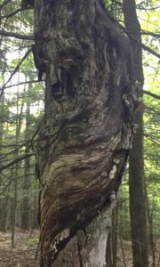
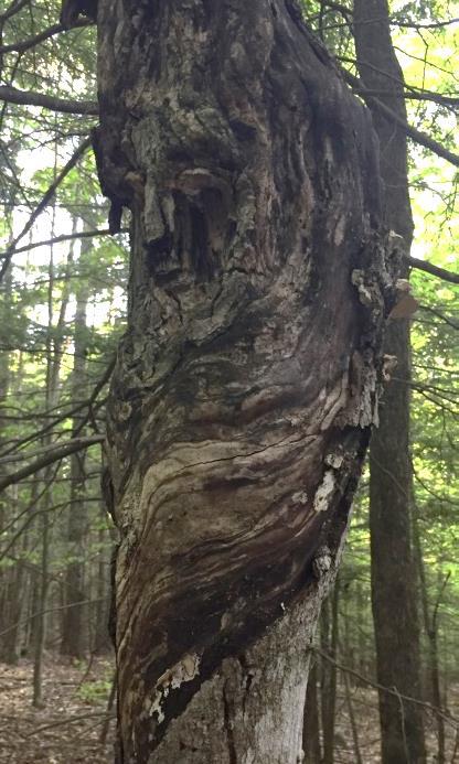
  • "face" in old tree
  • In another 2 minutes, see if you can spot the guardian of this forest. This “face” on a tree (photo L) appears on the L side of the trail.
  • 38 minutes into your hike, the trail splits around a large boulder, then a few yards later turns somewhat sharply L. There are a lot of well- worn game trails here and it would be easy to follow one if you were looking at the ground- be sure to look for the orange blazes!
  • Look carefully for signs of one of the Natural Area’s hidden gems –its 8 vernal pools. These usually ephemeral wetlands are essential breeding habitat for salamanders and frogs, as they are free of fishy predators. (Please keep your dog from cooling off here.)
  • At 45 minutes, another stone wall appears at L, marking the HC boundary. A wetland is visible just behind it as you near the trail junction for Silent Brook.
  • 48 minutes into your hike, you’ll reach the Silent Brook Trail. This trail, designed to link the Silent Brook and Velvet Rocks neighborhoods, is open to bicycles. If you turn L, you’ll reach the Silent Brook neighborhood in less than 5 minutes. To return to your car in just a few more, turn R onto the Silent Brook Trail.
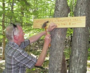
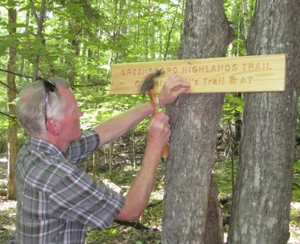
  • volunteer mounting a trail signCross a small drainage on a footbridge and enter another ferny opening. Here, white pines are doing what they do naturally – reclaiming old openings – and volunteers are working to keep this area, another demonstration house site, open for wildlife.
  • The trail drops steeply and crosses another small wooden bridge before returning to your car and the parking lot at the end of Velvet Rocks Drive.
Note: The Hanover Conservancy is seeking volunteers to advise us on managing the Natural Area, monitor trails, and help out with very occasional work parties. We also warmly welcome donations to our Land Stewardship Fund to help maintain the Natural Area. More info about the Natural Area can be found here.

June 2016, revised September 2020
Filed Under: Greensboro Ridge, Hike of the Month, June Tagged With: Appalachian Trail, hay-scented fern, porcupine, purple trillium

Waterfalls of Slade Brook

May 1, 2016

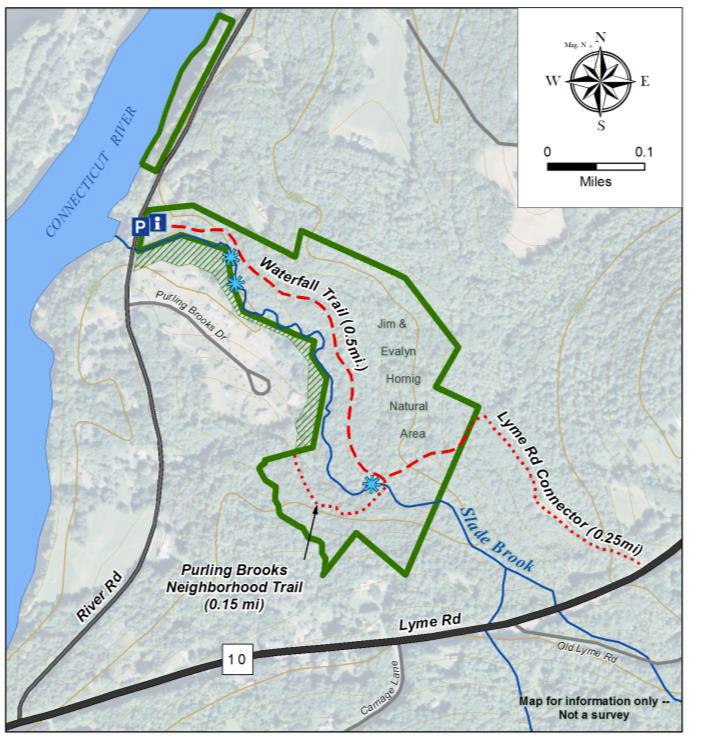
Slade Brook Hike – full PDF


Slade Brook hike mapDriving Directions

  • From downtown Hanover and the Green, follow Route 10 north for 4.2 miles to River Road and turn left.
  • Follow River Road for 0.5 mile.
  • Just past Purling Brooks Drive, cross Slade Brook near its confluence with the Connecticut River.
  • Turn immediately right into the small parking area.

What You Should Know

  • Foot travel only. Dogs are welcome but must be under close control; please pick up after your pet.
  • The trail is not blazed but is easy to follow. Wooden arrows mark important turns.

Hiking Directions

  • Take a moment to check the kiosk display and map before embarking on the trail beyond the rocks.
  • Slade Brook flows 4.0 miles from a wetland near Three Mile Road west to the Connecticut River, draining a largely forested 2.55 square mile watershed. Nearly a third of this watershed is permanently protected, including the 38-acre Lower Slade Brook Natural Area, Huntington Hill Wildlife Management Area, Moister Meadow, and several other parcels.
  • At this time of year, the dark green of stiff-stemmed horsetail, or scouring rush, is prominent. Our forebears used this primitive native plant, its tissues naturally fortified with silica, to scrub dishes.
  • The brook takes its name from Capt. Samuel Slade (1747-1826), described as a “leading citizen” of Hanover who came to town around 1774 and eventually served as tithing man, selectman, and representative. A Revolutionary War soldier, Slade was part of a committee to raise soldiers for the Continental Army and was stationed at Fort Ticonderoga. He, his wife Sarah, and their 13 children lived one mile north of Hanover Center (house later burned) and were prominent members of the Hanover Center church. His grandson, Samuel Thompson Slade (b. 1810) married a Huntington girl, so the family was clearly frequenting the neighborhood. Generations of Slades are buried at Hanover Center.
  • Shortly after leaving your car, note a dramatic ravine on the left. This steep, narrow cut was carved out thousands of years ago by Slade Brook as it scoured through lake-bottom sediments left behind by glacial Lake Hitchcock.
  • Louisiana waterthrushListen as you walk for the Louisiana waterthrush. The male’s song is a musical, distinctive series of descending notes followed by a warble. One of the earlier neotropical migrants to return to its breeding grounds in the spring, this bird often arrives a month or more before other warblers. The hilly forest surrounding Slade Brook offers prime habitat for the waterthrush, as its name indicates.
  • On a terrace above the brook, the trail follows a very gently rising path that may once have been an old tote road. Evergreen Christmas fern decorates the banks at left.
  • As the trail bears to the right, the first flume comes into view and the trail heads up a short rise. A second flume appears above the first.
  • The trail soon levels again and offers a view down onto the floodplain of the brook. The wet, mossy expanse hints at its important function of storing water during heavy rains and snowmelt.
  • As you continue, the trail moves a short distance from the brook into a grove of hemlock, yellow birch, and white pine. Admire the birches’ glowing papery bark. Some, growing on the rotting remains of old fallen trees, are working on a giraffe imitation as their roots stretch down to the soil. The forest promises a cool retreat when you return on a hot summer day.
  • About 12 minutes’ walk from your car, you catch the sound of water again, drawing you off the trail a few feet to the right to view the uppermost waterfall. Here, the brook takes two paths down mossy stepped ledges, and then sluices away to the southwest through a short, narrow gorge. The entire flow from the brook’s 1,630 acre watershed passes through this point.
  • After admiring the falls, continue up the path.
  • Just beyond the falls, stepping stones lead across the brook to a short (0.15 mile) side trail to the Purling Brooks neighborhood. The public is welcome to use this trail as far as the Natural Area boundary, but may not continue across private land.
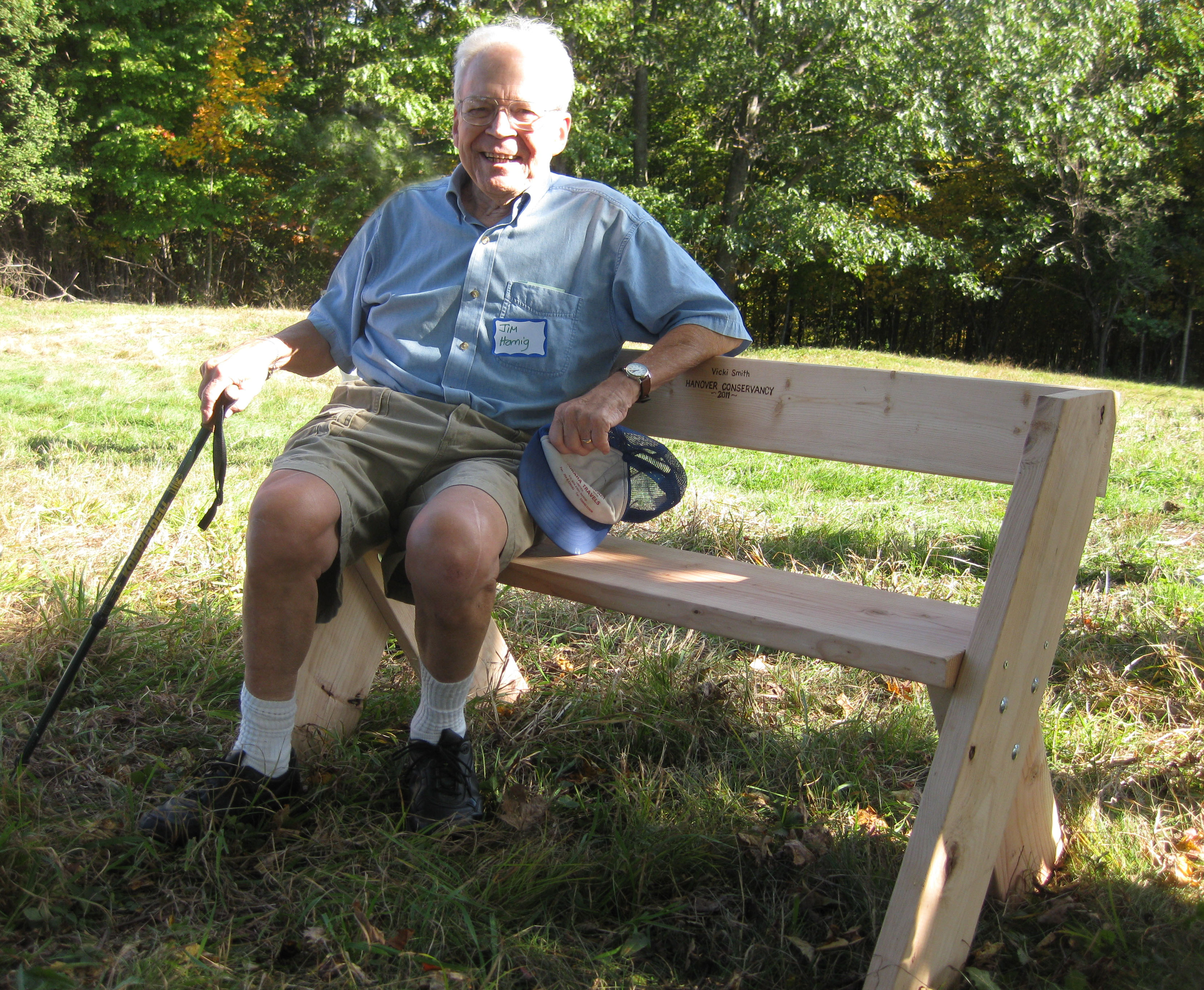
  • Board Member Emeritus member Jim Hornig sits on a bench in 2011That brings us to the story behind the Natural Area’s protection in 2005. When a developer presented a plan for 17 houses in this area, the Conservancy (then the Hanover Conservation Council) proposed an alternative that resulted in 10 homes clustered on 20 acres on the south side of the brook, on the site of a former gravel pit, with the rest of the property left intact. This solution protected the brook and its undisturbed valley, while providing recreational trails for homeowners in the Purling Brooks neighborhood and the wider community. Jim Hornig, former president of the Council, was the inspiring force behind this idea, and the Council gratefully named the Natural Area in honor of Jim (right) and his wife, Evalyn.
  • Watch for the sharp left turn as the trail heads away from the brook and somewhat steeply up to a plateau. About 5 minutes past the falls, you’ll come to a remnant of barbed wire on the right, marked with flagging, a reminder of the grazing history of this area. This land was once part of the Piper Farm.
  • The trail continues past the Conservancy boundary to a trail junction. To the right, an old logging road heads 0.25 miles to Route 10. To the left, it leads to private land.
  • Turn around and head back toward Slade Brook, enjoying the chance to see what’s growing at the top of the steep knolls you saw earlier from below.
  • Turn right at the arrow and head toward the waterfall. In the afternoon, the sun filters through the hemlocks, illuminating the falls. If you hear voices off to the left, it’s probably children playing near the houses across the brook. Consider how lucky they are to grow up with such a beautiful brook in their back yard, thanks to the foresight of those who protected it.
  • Slade Brook follows you down to your car before it joins the Connecticut River on its journey to Long Island Sound, hundreds of miles away.

The Hanover Conservancy owns and manages the Jim and Evalyn Natural Area at Lower Slade Brook. The Upper Valley Land Trust holds a conservation easement on the land. To protect the south bank of Slade Brook, the Conservancy holds a conservation easement on parts of eight properties at Purling Brooks Drive.

Note: The Hanover Conservancy is seeking volunteers to advise us on managing the Natural Area, monitor trails, and help out with very occasional work parties. We also warmly welcome donations to our Land Stewardship Fund to help maintain the Natural Area. Learn more about the Lower Slade Brook Natural Area.


Filed Under: Hike of the Month, May, Slade Brook Tagged With: Hornig, horsetail, Louisiana waterthrush

Trescott Trails: Knapp Road & Ascutney View

March 1, 2016

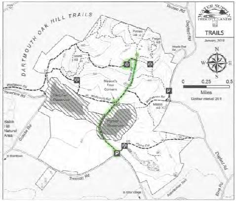
HIKE DIRECTIONS – full PDF

Driving Directions

  • From Downtown Hanover and the Green, drive east onto East Wheelock St. and up the hill 1.7 miles to the junction of E. Wheelock, Grasse, and Trescott Rds. The Balch Hill trailhead will be at L.   Bear R to continue on Trescott Rd and drive 1.2 more miles to a sharp bend and the Trescott gate.
  • From Etna village, turn W onto Trescott Rd and drive 1.3 miles to the Trescott gate at bend in road.
  • Park at the marked trailhead parking area. Please do not block the gate.

What You Should Know

  • Trescott Water Supply Lands logoThis is the perfect hike for Mud Season, when most trails can be too soft and vulnerable as frost leaves the ground.
  • Welcome to your water source! Drinking water for much of Hanover and for Dartmouth College comes from these lands, so special rules apply for recreational use.
  • Check the kiosk display to acquaint yourself with these rules and pick up a trail guide.
  • Dogs are welcome but must be leashed at all times; please pick up after your pet.
  • You may encounter forestry vehicles; they have the right of way.
  • Plan on 1 ¼- 1 ½ hours; longer if you spend time enjoying the views.
  • Many hiking routes in the Trescott lands make use of historic and/or logging roads.

Knapp Road map

Brief Hiking Directions

  • Take the short path at R of the kiosk to reach Knapp Road
  • Turn L on Knapp Rd and walk past Parker Reservoir, the Four Corners, and up hill to a junction where the road flattens out.
  • Turn L and soon L again on a path through a pine plantation to the viewpoint.
  • Return the way you came.

Full Hiking Directions

  • After visiting the kiosk, take the short path to the R that leads around the fence. This takes you to Knapp Road, where you turn L to begin your walk. Laid out on Nov. 13, 1793, the road named for Lt. Peter Knapp of Hanover’s Revolutionary War-era militia. You will pass the site of his homestead.
  • After 5 minutes’ gentle downhill walk, Parker Reservoir comes into view. A sign at the road’s edge asks you to remain on the road as you walk through the reservoir’s 250’ protective buffer zone. To safeguard the water supply, the public (dogs included) is not permitted within 250’ of the water (or ice) except on Knapp Road. State law protects these waters.
  • Built in 1924 by damming Camp Brook, Parker Reservoir is the second in a string of three reservoirs that collect water to send to Hanover homes. The oldest and lowest is Fletcher Reservoir, near Reservoir and Grasse Roads. Together, they hold 425 million gallons of water. The third is the Hanover Center Reservoir, in the Mink Brook watershed. Its water is diverted to flow into the Parker Reservoir.
  • From this point, look ahead for an open area on the hillside above. This is your destination.
  • Continue on Knapp Rd below the earthen dam and cross Camp Brook. Note the semi-circular stone structure on the R, part of the early earthworks. An interpretive sign nearby illustrates the dam’s construction and explains forest management to protect water quality.
  • Camp Brook flows out of a concrete spillway in the earthen dam near some venerable maples. One wonders if these might once have been dooryard trees for a farmhouse that once stood nearby. All structures of the ten farms that once existed on this land were removed by 1912.
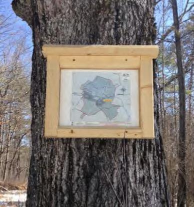
  • Continue on Knapp Rd; 15-20 minutes from your car, you’ll reach Mason’s Four Corners. Look for a sign posted on a tree at R indicating your location (photo at R)
  • Occasionally serving as a log landing, the Four Corners was once a major intersection. Here, the historic Wolfeboro Road crosses Knapp Road. Colonial Governor John Wentworth proposed this road in 1770 so he could attend commencement exercises at Dartmouth College. He and his party supposedly traveled it from his home in Wolfeboro in 1772. The historic road is easily viewed looking W; to the E, it is obscured by brush.
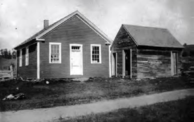
  • #4 Schoolhouse building
    #4 Schoolhouse; Knapp Road in foreground

    At the NW corner of this intersection stood the one-room District #4 schoolhouse (1807). Lt. Knapp’s home (c. 1793) stood across the way on the NE corner. Knapp was one of three school district commissioners for District 4. You can find the remains of his house’s cellar hole by looking (carefully!) through the brush.  By 1855, J. J. Mason lived here, followed by Charles Mason by 1892. The 160-acre Mason Farm had a 100-tree apple orchard and 200-tree sugarbush. Mason also kept 12 dairy cows and 70 Merino sheep. The water company purchased his farm by 1903 for $4000.

  • After imagining the busy neighborhood that once existed here, continue up Knapp Rd. In a few minutes another sign at R marks the Poor Farm East Trail to Dogford Rd.
  • Continue up Knapp Rd and reach the top of a small rise. Look for a cellar hole at R among a clump of trees near a large maple. Views are beginning to open up.
  • The Town Poor Farm stood not far from this spot, on the W side of Knapp Road. Several large foundations, a well, and a curious piece of farm equipment can still be seen. In 1840, the Town of Hanover purchased the James Tisdale Farm for $4250 to provide a place where the community’s orphans and other unfortunates could live and work to help support themselves. Unlike other towns, Hanover did not send its poor to the Grafton County farm when it opened in 1864, keeping this farm operating until 1903, when it was sold to the water company for $4000. Interpretive signage provides more insights into the farm.
  • Is your dog still on its leash? Give yourself a gold star and know that there are porcupines nearby.
  • Having caught your breath, continue your march up Knapp Rd. The road is lined with stately old maples, but the hillsides beyond are partly open and are being replanted. These lands experienced major blowdowns during the 2007 Patriot’s Day Windstorm. Two million board feet of logs and 3,100 cords of pulp were salvaged. This storm hit heaviest in the plantations, leaving natural stands largely unaffected.  The forest management plan calls for moving toward more natural, uneven-aged stands rather than even-aged plantations, although some spruce plantations have recently been planted nearby on the hillside.
  • Knapp Rd now climbs more steeply. Pass over two sets of grates covering water diversion channels to protect the steep road from erosion and protect the reservoirs below from sediment. The grates were paid for with a grant from the USDA Natural Resources Conservation Service.
  • Note the stone walls that follow the road in this area. The small size of the stones used to build them is a clue that the nearby land was cultivated at one time. One imagines the Poor Farm’s residents picking stones from among their potatoes and adding them to the walls.
  • At a little over half an hour from your car, Knapp Rd levels out. Look for a sign on a tree at 11 o’clock. Before heading to the hike’s big reward (the view!) take a moment to visit another historic site.
  • Continue straight on Knapp Rd for 90-100 paces toward a log landing. About 20 paces off the road at R in the woods is another cellar hole. This one is L-shaped.
  • Return to the intersection and turn R (west), taking care to stay on the road, not the skid trail at R.
  • After about 100 paces, turn L toward a gap in the pines.
  • Walk a short distance through a pine plantation, being thinned. The path brings you to an open hillside with dramatic views. We suggest taking a few steps to the left into the field for the best view, taking care not to trample young red pines.
  • The panorama before you is among the most beautiful in Hanover. Far below is Parker Reservoir; you can pick out Knapp Rd curving around on the SW side (your route back to your car).
  • Mt. Ascutney dominates the scene, of course.  At R in the near distance is Velvet Rocks. Ski areas in Vermont are also visible farther west.
  • Resolve right now to return in mid-October! The many sugar and red maples in this scene put on their own spectacular show at that time of year.
  • After you’ve inhaled the view, return the way you came.
  • Walk back up through the plantation and turn R on the far side of the pines
  • Turn R again onto Knapp Rd. As you walk down the hill, enjoy views of some of Etna’s surviving high fields and pastures, visible at L. These are remnants of the much more open landscape of the 19th and early 20th centuries, when the native northern hardwood/white pine forests had been cleared for agriculture and thousands of sheep, later cattle, grazed on these hills. In the days before the Civil War, Hanover was one of the four top sheep towns in NH (with Walpole, Lyme, and Lebanon).
  • Knapp Road takes you past Parker Reservoir and back to your car.

Learn more about the Trescott Water Company Lands  and download the most up to date trail map.

March 2016, revised July 2020


Filed Under: Hike of the Month, March, Trescott Tagged With: cellar hole, Wolfeboro Road

Mill Pond Forest & Dana Pastures

February 1, 2016

HIKE DESCRIPTION & MAP – Full PDF


Driving Directions

  •  From Etna village, turn R onto Ruddsboro Road
  •  Follow Mink Brook as the road curves up its narrow valley
  •  Pass Three Mile Road
  •  At 2.0 miles from Etna, turn L onto Old Dana Road
  •  At 2.4 miles from Etna, turn R onto Moose Mountain Lodge Road just past the historic Dana Barn
  •  Head up Moose Mtn. Lodge Road 0.9 miles to its end
  •  Bear R at a fork and park at the marked trailhead parking area. Please do not block driveways to the two neighboring homes.

Two Options

  •  ½ hour easy visit to the pond, pastures, and views, retracing your steps
  •  1-hour relatively easy loop, with visit to the three Dana pastures, exceptional views, and tour around the pond

What You Should Know

  • Hiking times are approximate.
  • Foot travel only. If there are ski tracks in the path, please walk beside rather than in them.
  • Dogs are welcome if under your close control; please pick up after your pet and do not allow it to chase wildlife. Porcupines are active.
  • Hunting is permitted in season.
  • You will visit both the 18-acre Mill Pond Forest and 313-acre Shumway Forest, privately owned and protected with conservation easements held by the Hanover Conservancy, and the 66-acre Dana Forest and Pasture Natural Area, owned jointly by the Town of Hanover and a private citizen and managed for conservation purposes.

Hiking Directions

For both options: Begin at the trailhead sign for Mill Pond Forest and Huggins Trail Access. You are standing on privately owned property that was conserved in November, 2015 with the Hanover Conservancy.

  • In 2015, the Shumway and Huggins families generously donated a conservation easement on this area to the Hanover Conservancy, to ensure that the public would always have access to the trails you are about to visit and to protect water quality and an early mill site on Mink Brook.
  • The trail moves past a series of pools in Mink Brook. Depending on whether beavers are active, this area can be some of the best evidence in town of a beaver’s construction skills. Cross a small drainage to reach the Dana Pasture Natural Area, jointly owned by the Town of Hanover and a private heir of the Dana family.
  • After two minutes’ walk, you’ll arrive at a fork. Bear L for a quick visit to the pond shore.
  • Just past the fork, you’ll see the c. 1800 cellar hole of the Woodward home at L. David Woodward was a miller who built a stone dam at Mill Pond and a saw and gristmill on Mink Brook as it tumbles down the mountainside beyond where you parked.
  • Continue on this short path to the shore, where you’ll find a bench at the water’s edge. At this season, little seems to move, but it’s a great place to look for waterfowl when the pond is clear of ice. Woodward’s stone
    Kay Shumway visits Mill Pond

    dam is just out of sight at L. Across the pond, a low mound indicates a large beaver lodge that was occupied until 2018.

  • Return to the cellar hole and trail junction, turning L onto Pasture Road, a very old Class VI road, marked with  a wooden sign posted on a pine, with another green moose sign nailed below.
  • Follow Pasture Road for about 2 minutes, following a handsome stone wall.
  • Two minutes from the trail junction, look for a break in the wall and trail at R, marked just beyond the break with wooden signs reading “Baboon Bypass” and a green moose. Watch for real moose sign as you venture out today –there’s a reason for Moose Mountain’s name! You may also see tracks of wild turkey, grouse, bobcat, porcupine, fisher, fox, coyote, and of course, deer.
  • Turn R, head up the path; cross a small drainage, and bear L as the trail swings toward an opening. Here, the promise of views lures you off the path. Walk about 35 paces to the edge of a drop-off and an old fence post silhouetted against the sky.

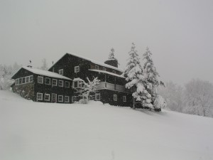
    Moose Mountain Lodge
  • Suddenly the world opens up to a stunning vista that stretches to the spine of the Green Mountains of Vermont. Killington and Pico peaks dominate the horizon. At your feet once stood Moose Mountain Lodge. Built in 1937-8 for skiers, the Lodge had a long and colorful history until it was demolished in 2019 by new owners. Learn more at hanoverconservancy.org/lands/easements/mill-pond-forest/ 
  • Please do not go beyond the fence posts and remnants of barbed wire on the property boundary; they remind you that this was one of the Dana family’s summer pastures for young cattle.
  • After you’ve inhaled the view, return to the trail and continue gently up the hill along the tree line toward a second pasture, following occasional orange flagging.
  • Continue uphill toward the third and highest pasture.
  • Note barbed wire fencing and clumps of juniper on L, more signs of the land’s grazing history.
  • Elisha Huggins leads a Conservancy snowshoe trip down through the third pasture

    Head up the gentle slope to a line of white birches that marks the southern boundary of the Dana Pasture Natural Area. After cattle were no longer pastured here, these meadows were kept open for years by neighbor Elisha Huggins, who mowed them with a hand scythe. Today, these openings offer fine wildlife habitat, especially in early summer when lowbush blueberries offer food for bears and many kinds of birds.

  • At the top of this pasture, you can extend your hike by continuing south on the orange-blazed Ridge Trail to ledges that offer remarkable eastern views. Today, we’ll return to Mill Pond.
  • Retrace your steps for 10 minutes through the three pastures and back to Pasture Road, all the way to the stone wall. (A path to the L after the last pasture, well before you reach the wall lining the road, leads to a private home).
  • At Pasture Road, turn L to return to your car (5 minutes) or take the ½ hour loop around Mill Pond.

For the pond loop:

  • Turn R on Pasture Road and immediately L.
  • Follow this path as it meanders among the spruce a short distance from the pond, keeping the pond on your left. You’ll cross small drainages that feed the pond; step carefully.
  • In about 10 minutes, a short spur to the left leads to the shore; bear R up the hill to a junction marked “Orange Diamond Trail” just visible ahead. A short distance above the pond, northern hardwoods take over for the red spruce and hemlock that cling to the water’s edge where cold air settles.
  • Turn L to continue on the Pond Loop. In a few yards you’ll step off the Dana Pasture Natural Area and onto the privately-owned Shumway Forest.  In 2017, the Shumway family conveyed a conservation easement to the Hanover Conservancy on 313 acres to protect wildlife habitat and public access to the network of trails on Moose Mountain, many of which they maintained for the public and for guests at their Moose Mountain Lodge. The Forest is now under new ownership, but the conservation protections will remain in place forever.

    snow-covered beaver lodge
  • Follow the Pond Loop Trail N for about 7 minutes to the gravel road that serves a nearby communications tower. The trail is not frequently blazed in this area. Keep the pond on your left.
  • Turn L on the tower road and walk down it along the north shore of the pond. Other than vehicles servicing the tower or those involved in forestry, no vehicles are permitted on this road.
  • After 5 minutes, reach a gate and turn L onto Moose Mtn. Lodge Road to return to your car.
  • Peter Shumway pauses by the pond

    Send a silent message of thanks to the generous landowners who made your visit possible!

February 2016, revised January 2021

Filed Under: Dana Pasture Lot, February, Hike of the Month, Moose Mountain Tagged With: cellar hole, mill, pond, views

Snowshoe Trek Through the Trescott Lands

December 29, 2015

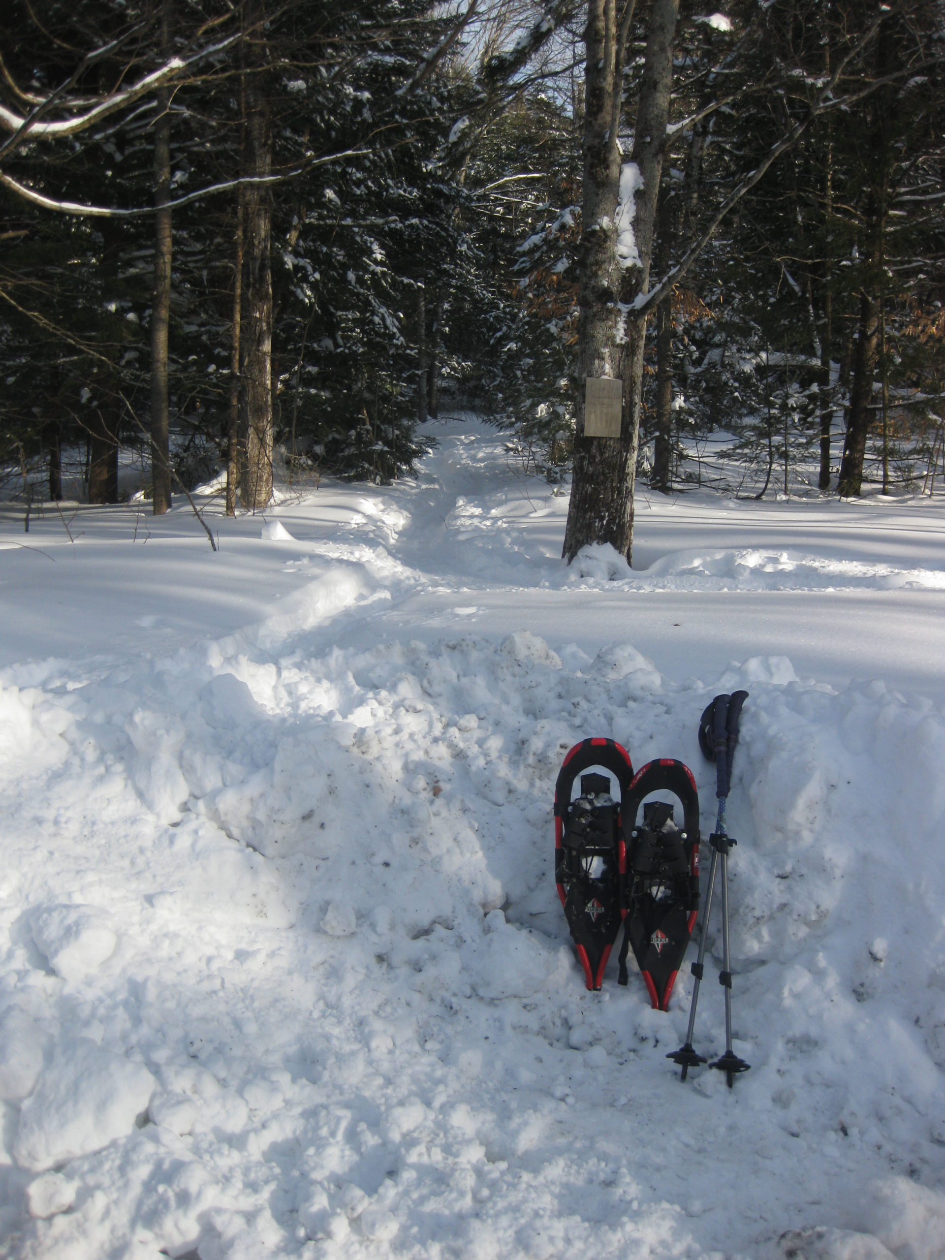
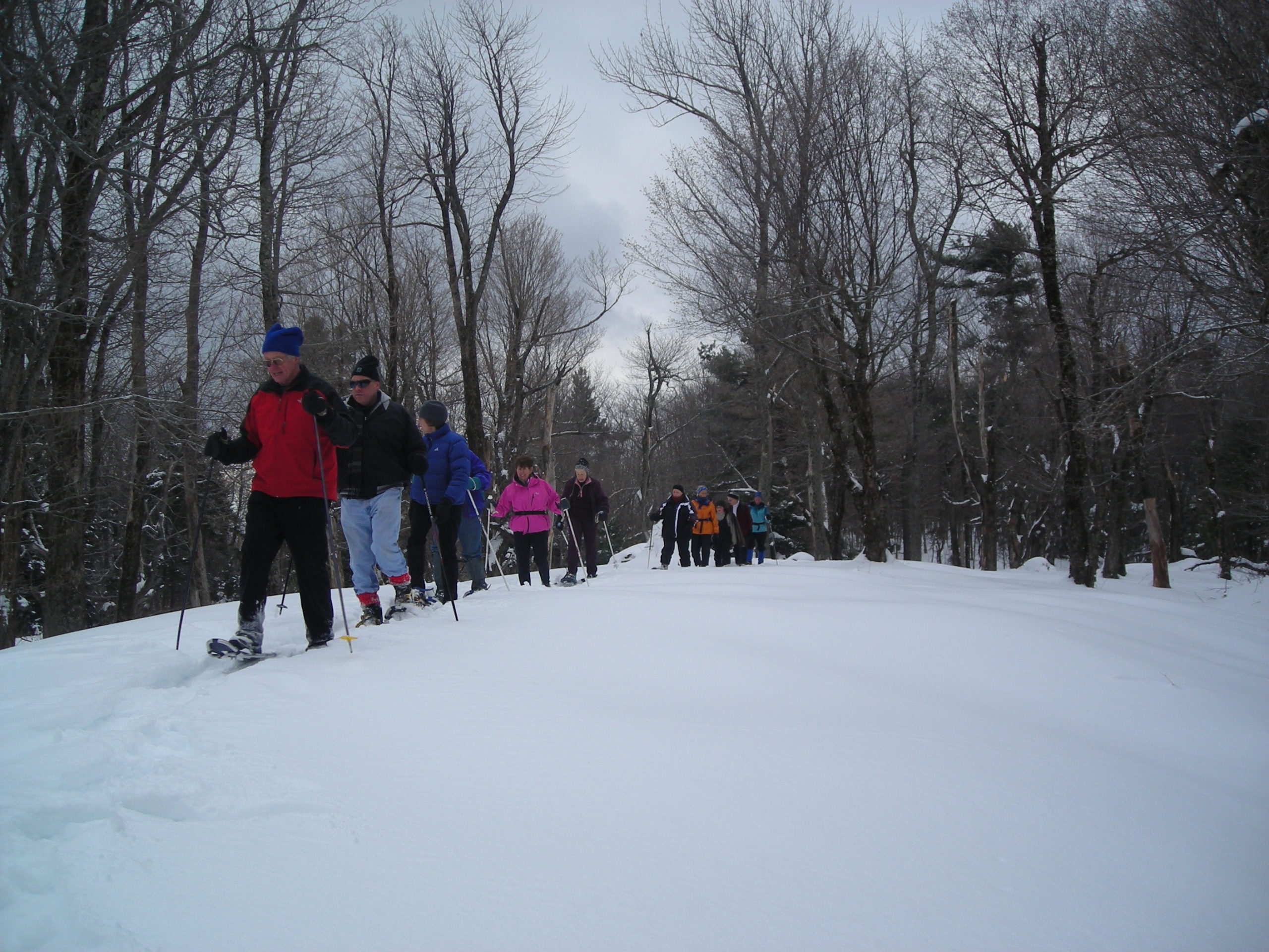
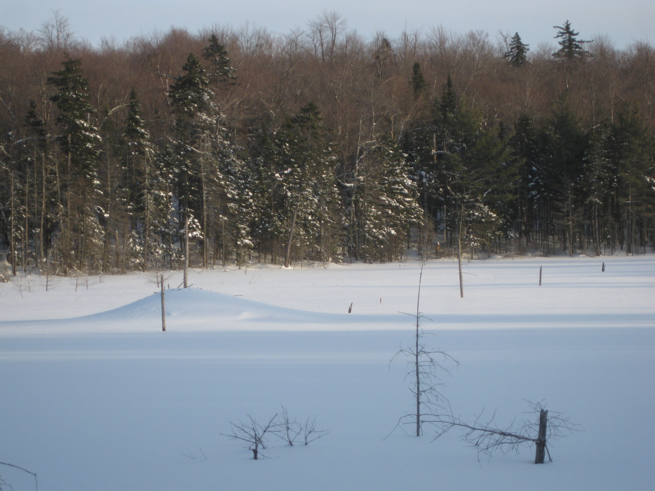
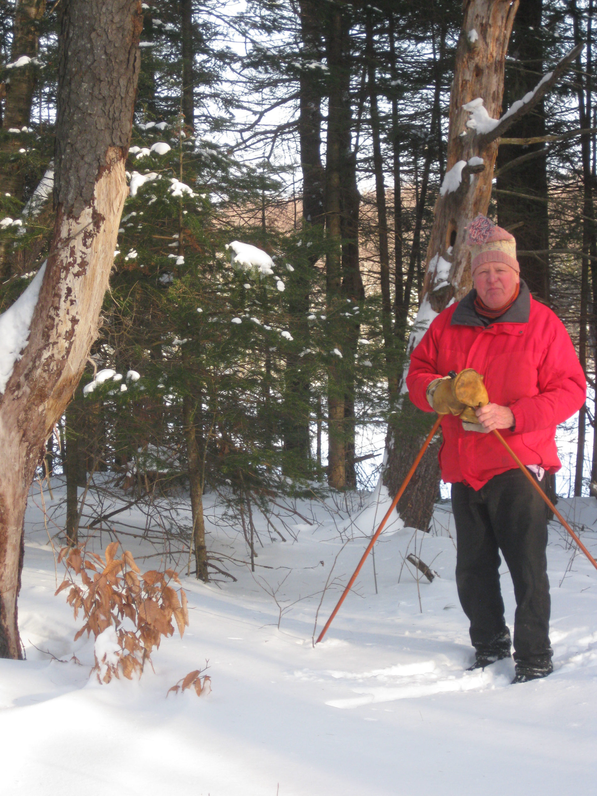
Sunday 1/24 – join us to explore the Trescott Water Supply Lands with those who are working to open these long-closed 1,165 acres to public recreation. MORE.

Thanks to KLG Financial Solutions for sponsoring this season’s schedule of free Conservancy adventures.

Filed Under: Forest Ecology, King Bird Preserve/Hayes Farm Park, Outdoor Trips, Slade Brook, Trails, Trescott, Wildlife

Moister Meadow protected

October 3, 2015

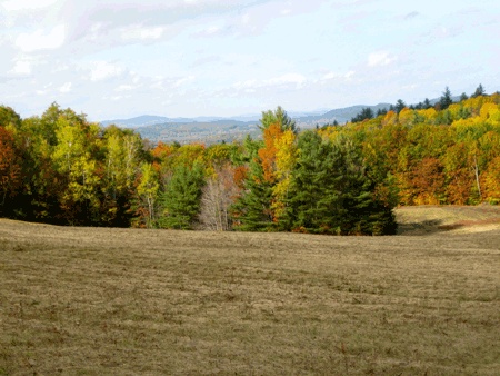
The Hanover Conservancy is pleased to announce a new addition to its portfolio of protected lands, the Moister Meadow.  The conservation easement on the 21-acre property, set in the rolling hills of Hanover Center, is the gift of F. Corbin Moister, Jr., whose family has owned the land for over 40 years.

Views into Vermont from the Moister Meadow off Dogford Road

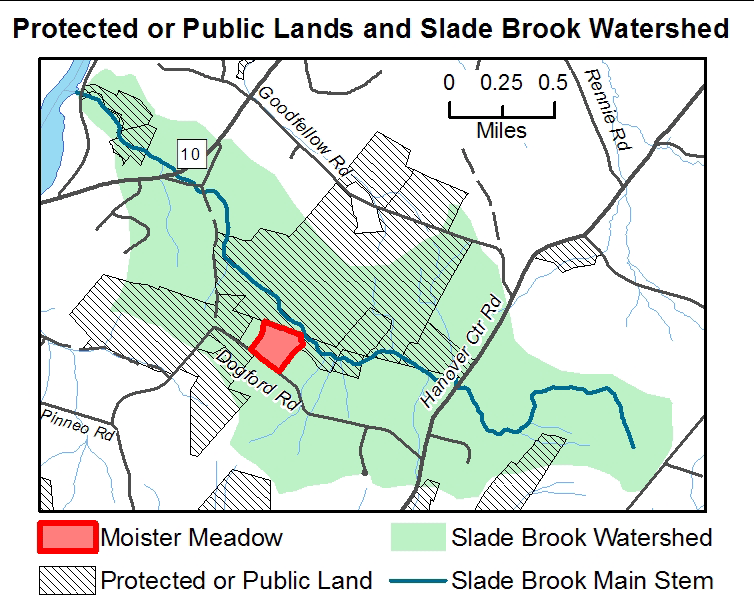
The open meadow, fringed by forest, represents an iconic historic farming landscape, ringed with stone walls dating from the early 19th century. The property is located in the headwaters of the Slade Brook watershed and abuts over 700 acres of other protected land, including the Huntington Hill Wildlife Management Area and the historic Nutt Farm.

“Protecting this property accomplishes a number of the Conservancy’s strategic conservation goals,” observes Adair Mulligan, Executive Director. “The meadow provides an increasingly uncommon type of habitat for woodcock, bobolink, and other grassland birds and wildlife, and also has valuable agricultural soils.  As the forest reclaims many old fields like this, such habitat is becoming scarcer. The open views and rolling landscape are moving reminders of Hanover’s past.”

Just as important, the wetlands and rivulets on the property protect the waters of Slade Brook and supports flood security for neighborhoods below. Such headwaters help control stream flow and are the first line of defense against microbursts and washouts. The Conservancy’s Jim and Evalyn Hornig Natural Area at Lower Slade Brook, just off River Road, guards another 35 acres around this stream.  The Moister Meadow provides a link in the wildlife corridor that connects the Connecticut with Hanover’s uplands and Moose Mountain.

“My father and step mother chose to build their home in this meadow at least in part to allow their English Setter dogs a safe place to run,” Corb Moister says. “I am very pleased to be able to preserve a portion of this property exactly as they found it 50 years ago. I hope that future owners and neighbors will enjoy tMoister-2014-12-27-locushis beautiful place as my family has.”

Donor Corb Moister with Exec. Director Adair Mulligan (L) and President Nancy Collier

The land will continue in private ownership and is currently listed for sale. Public access will be a decision of the future landowner. One need not step onto the property to enjoy it – beautiful views across the meadow from stone wall-lined Upper Dogford Road make for an enjoyable walk or drive.

Filed Under: Conservation, Easements, Moister Meadow

  • « Previous Page
  • 1
  • …
  • 14
  • 15
  • 16
  • 17
  • 18
  • …
  • 29
  • Next Page »

71 Lyme Road
Hanover, NH 03755
(603) 643-3433

info@hanoverconservancy.org

Facebook logo   Instagram   YouTube

Get Involved

Become a Member

Volunteer

Business Sponsors

Conserve Your Land

Employment

Our Mission

Advocacy

Conservation

Education

Stewardship

Explore Hanover

Hanover Hikes

Upcoming Events

Upper Valley Hikes

Trails Challenge

Copyright © 2026 Hanover Conservancy | Design by Chase Brook Software